Joshua Tree National Park straddles the boundary of the higher-altitude Mojave Desert and the lower-altitude Colorado Desert. We’d spent the previous day in the Mojave Desert portion and on our second day drove south into the Colorado Desert to a less-visited area of the park at Cottonwood. The plant life there is quite different, with scrub brush replacing the Joshua Trees and cactus we saw so much of the day before.
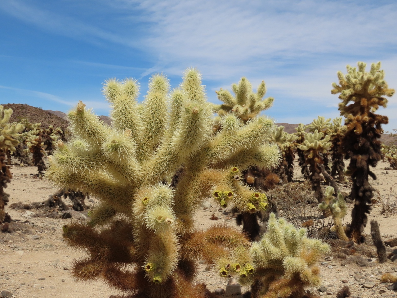
Near the transition zone between the two deserts, the higher levels of water allow for a greater density of cactus than elsewhere in the Sonoran Desert sections of the park. Here grows the Cholla Cactus Garden, pictured above. These cactus are dubbed “teddy-bear” cholla because they appear soft and furry. But those are sharp spines. The cactus also is known as “jumping” cholla because of their tendency to break off and attach themselves to people and animals as a means of reproducing.
After a great hike from Cottonwood through an oasis to enjoy the sweeping views from Mastodon Peak, we returned back to the central area of the park in the Sonoran Desert. There we visited some of the more popular rock formations of Heart, Arch and Skull rocks, and finished the day with an off-road trip along Geology Tour road. This lightly-visited 18-mile (29km) unpaved road provides another view to the park’s diverse geography, and is a fun drive as well.
Below are highlights from May 28th, 2022. Click any image for a larger view, or click the position to view the location on a map. And a map with our most recent log entries always is available at mvdirona.com/maps.
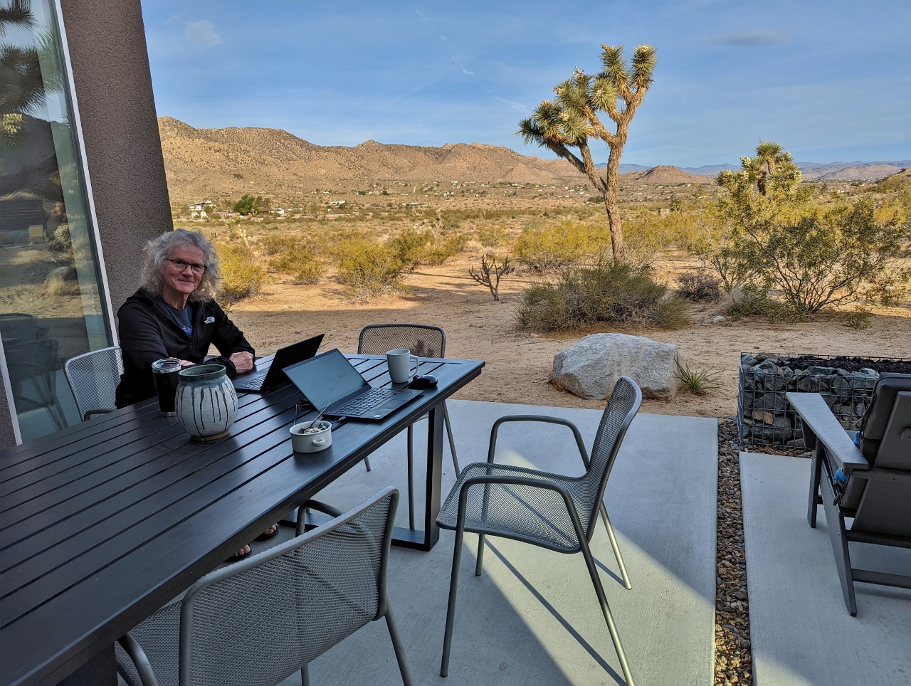 |
The Office
Position: 34°5.67’N, -116°17.30’W
Getting some work done in the morning on the patio at Shelter: One before a second day at nearby Joshua Tree National Park.
|
 |
Pinto Basin Road
Position: 33°56.24’N, -115°57.97’W
Great view to the Eagle Mountains as we drive south along Pinto Basin Road across Joshua Tree National Park towards Cottonwood.
|
 |
Transition Zone
Position: 33°54.68’N, -115°52.06’W
Joshua Tree National Park straddles the boundary of the higher-altitude Mojave Desert and the lower-altitude Colorado Desert. We spent yesterday in the Mojave Desert portion and now are in the transition zone between the two as we head south towards Cottonwood in the Colorado Desert. The plant life here is quite different, with scrub brush replacing the Joshua Trees and cactus we saw so much of yesterday.
|
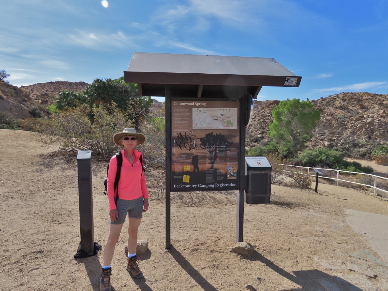 |
Cottonwood Spring
Position: 33°44.27’N, -115°48.68’W
At Cottonwood Spring to hike to Mastodon Peak.
|
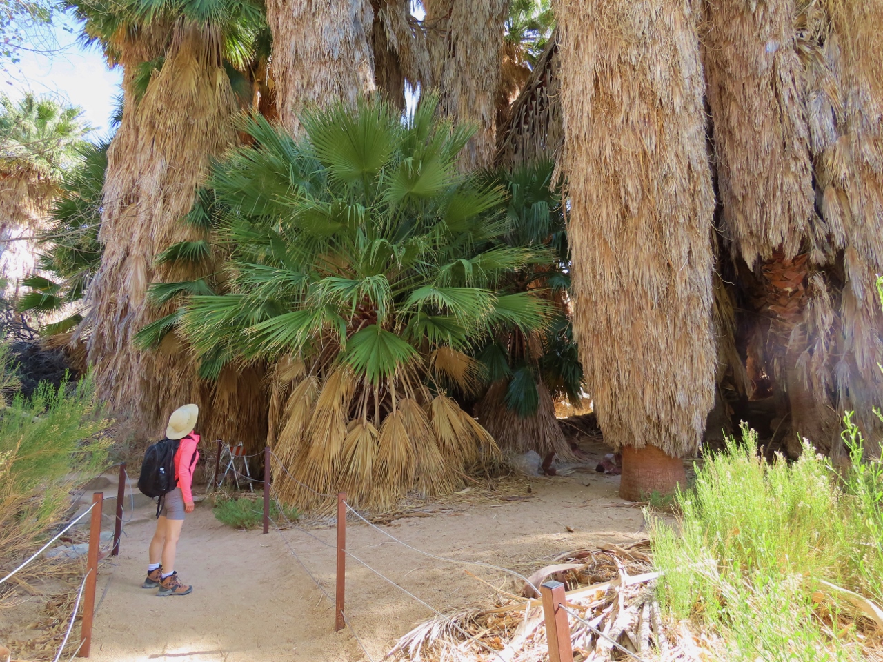 |
Fan Palm
Position: 33°44.22’N, -115°48.64’W
Huge California Fan Palm in a small oasis along near the trialhead to Mastodon Peak. Of the 158 fan palm oases in North America, 5 are in Joshua Tree National Park.
|
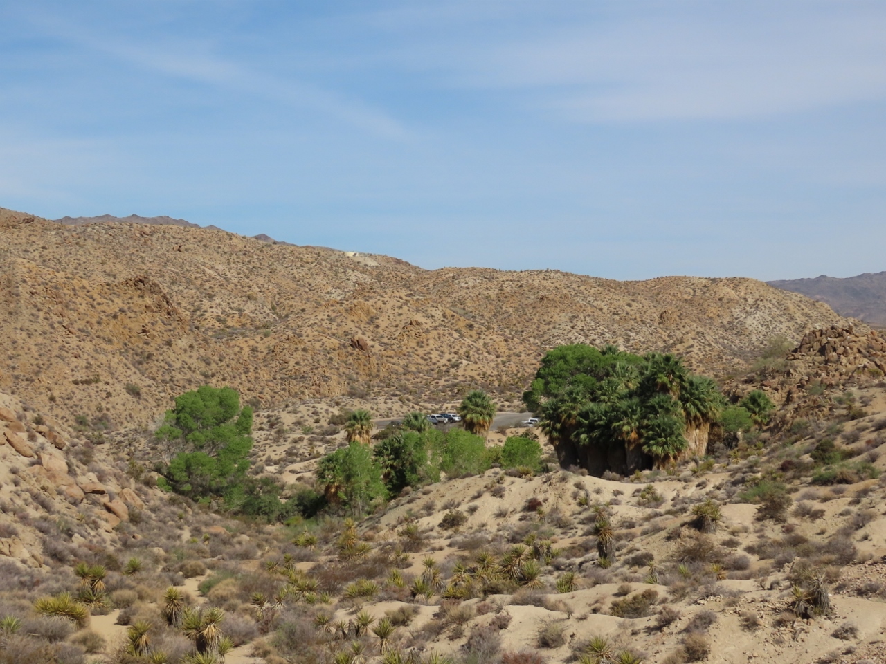 |
Oasis View
Position: 33°44.15’N, -115°48.53’W
Looking back to the fan palm oasis surrounded by desert. The palms need a constant supply of water, so oases tend to form along fault lines where groundwater is forced to the surface.
|
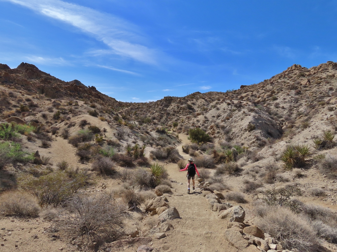 |
On the Trail
Position: 33°44.09’N, -115°48.37’W
Continuing on the trail to Mastodon Peak. The temperature is a little cooler today, and nicer for hiking.
|
 |
Steps
Position: 33°43.94’N, -115°48.00’W
Climbing steps as we ascend gradually towards the base of Mastodon Peak, visible in the background.
|
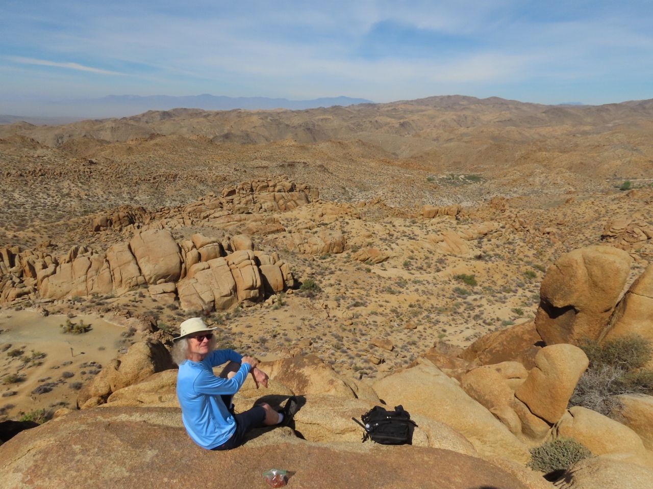 |
Mastodon Peak
Position: 33°44.05’N, -115°47.95’W
Taking a break to enjoy the wonderful 360-degree view from the top of Mastodon Peak.
|
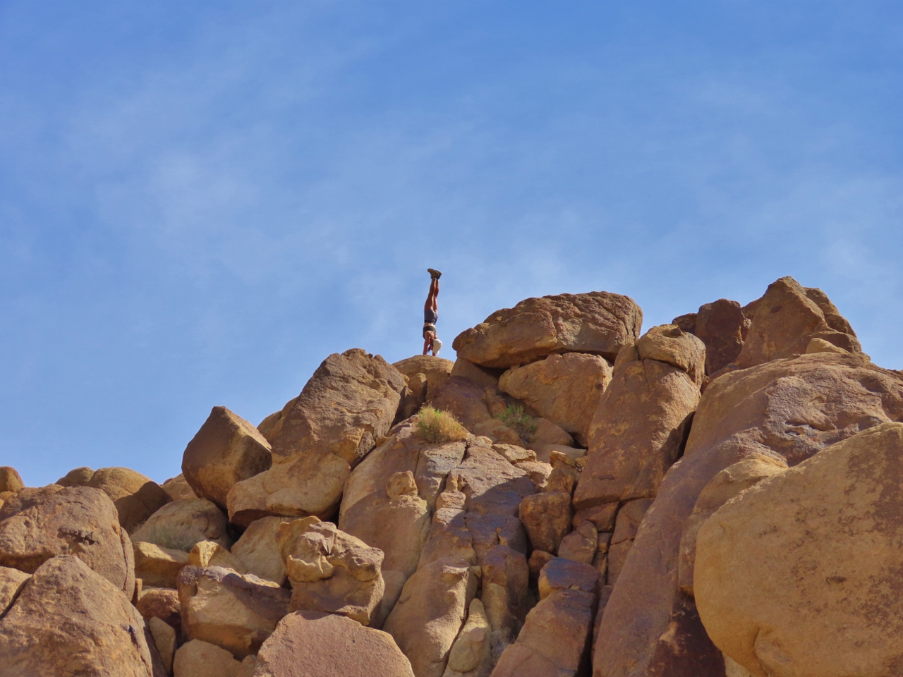 |
Handstand
Position: 33°44.01’N, -115°47.93’W
A hiker performing a handstand on the top of Mastodon Peak. She held the pose for quite some time.
|
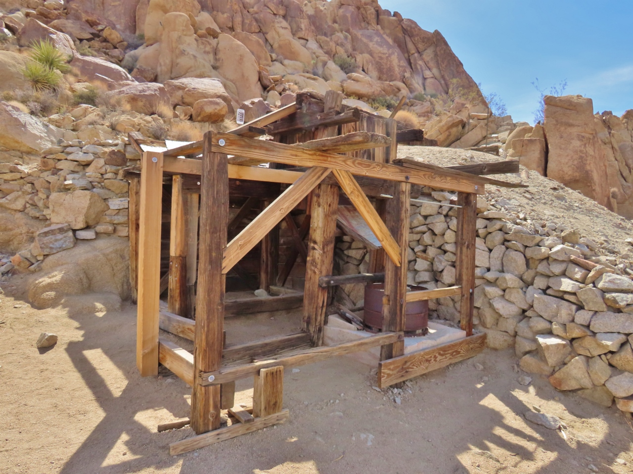 |
Mastodon Mine
Position: 33°44.06’N, -115°47.99’W
Mostodon Mine was worked for decades starting in the 1930 and is one of about 300 mines within the bounds of what is now Joshua Tree National Park. The heat, scarce water and lack of wood for building made mining difficult in the area, but the lure of gold drew many to try.
|
 |
Wash
Position: 33°44.22’N, -115°48.05’W
Walking through a dry wash on a loop trail back to Cottonwood.
|
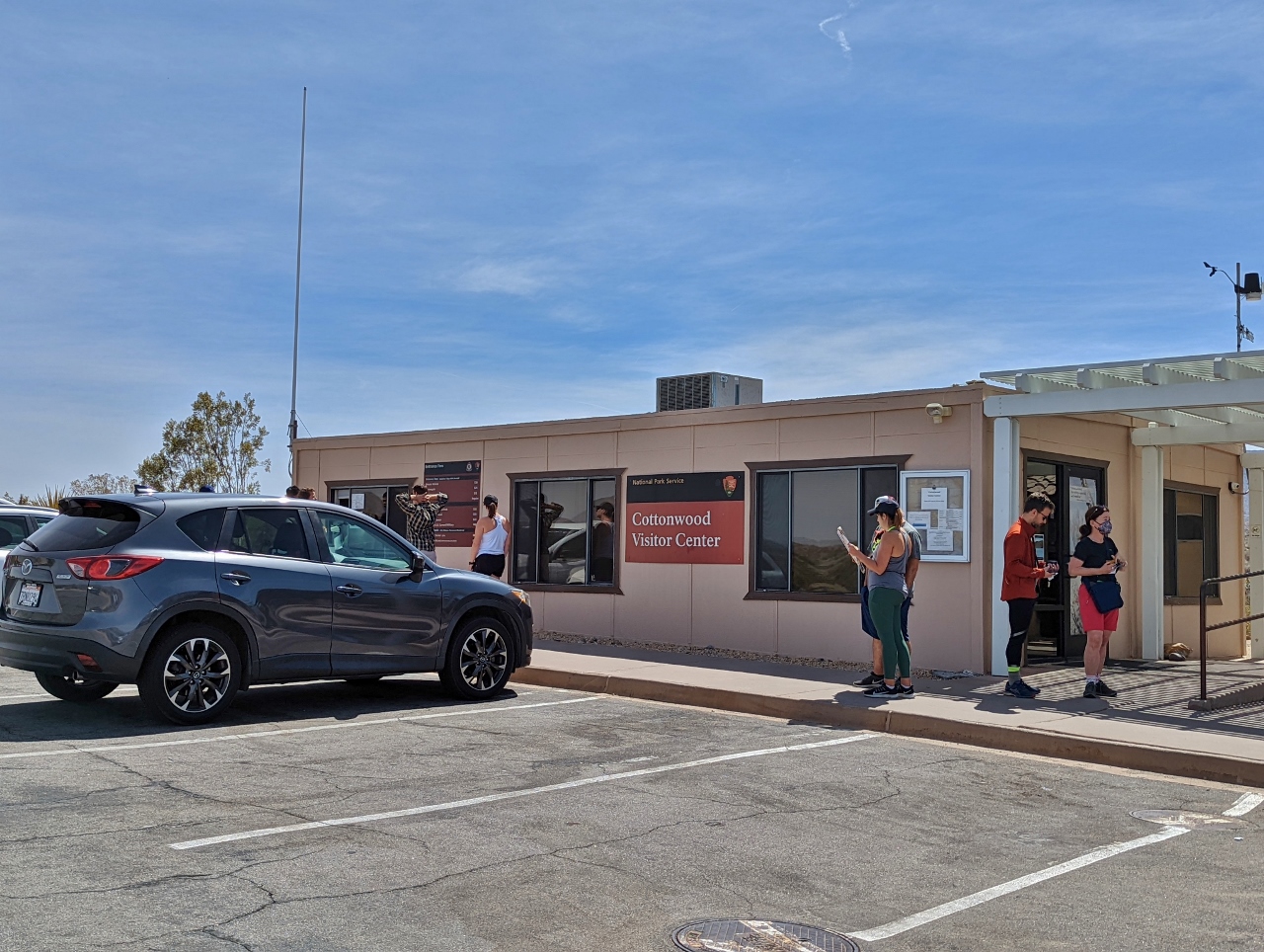 |
Cottonwood Visitor Center
Position: 33°44.89’N, -115°49.47’W
The visitor center Cottonwood was fairly busy on a Saturday morning around 10am. At the southeast corner of Joshua Tree National Park, Cottonwood is one of three paved road entrances to the park. But it doesn’t have an entrance station, so visitors needing to pay the entrance fee or pickup maps need to go to the visitor center here.
|
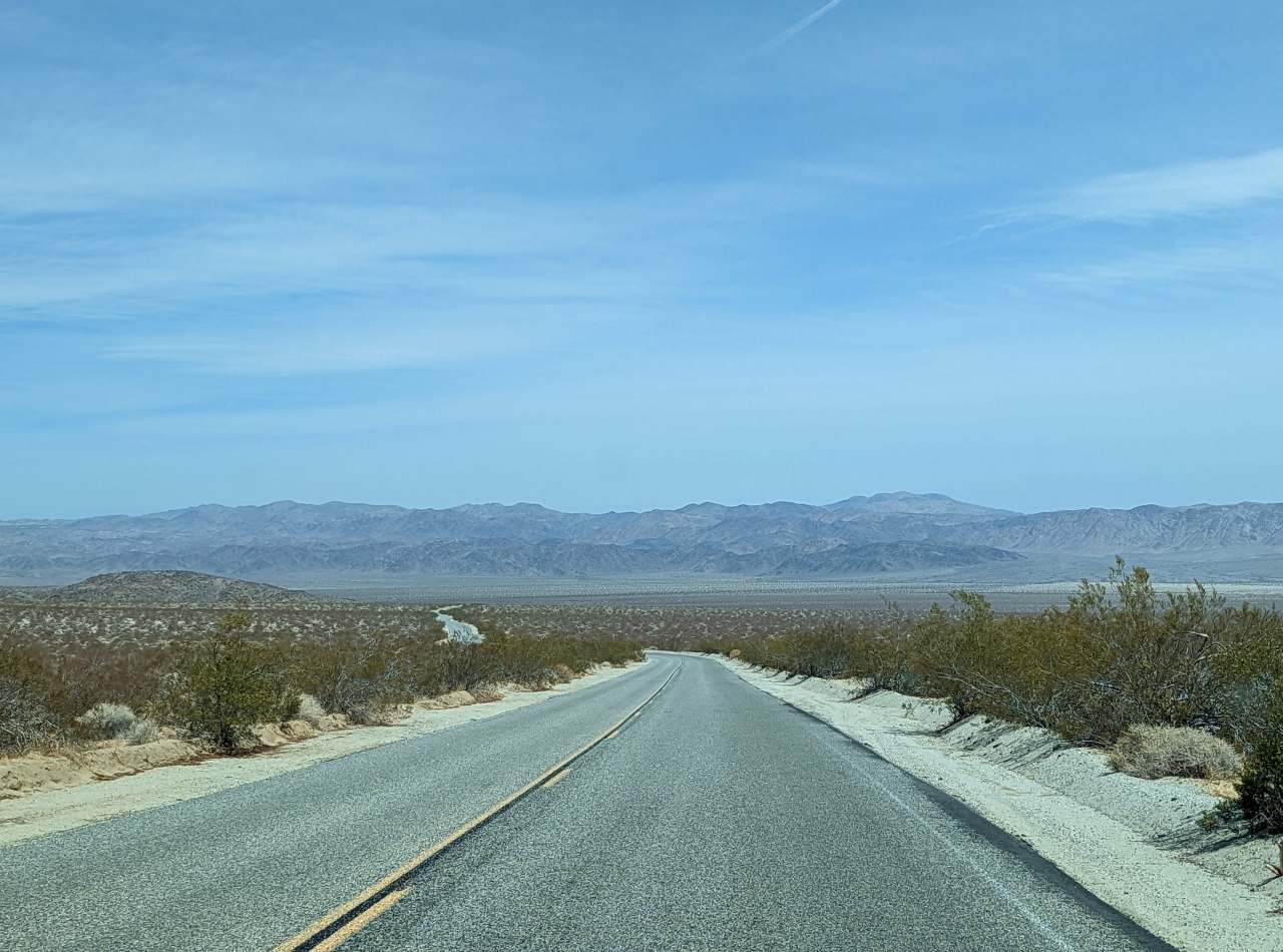 |
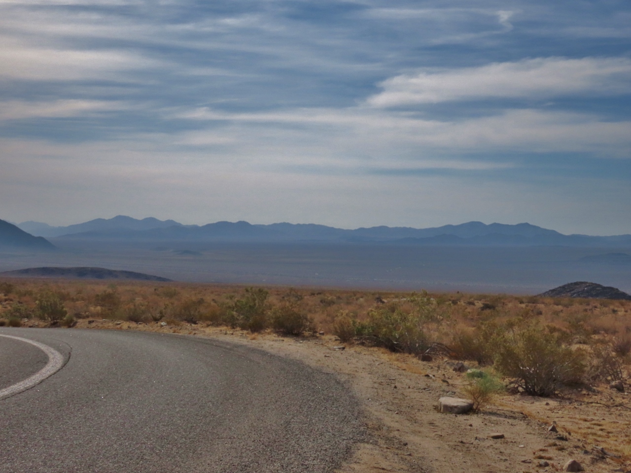
Loneliest Road
Position: 33°51.58’N, -115°47.60’W
Heading back north on Pinto Basin Road reminded us of our drive along Highway 50 across Nevada, known as “The Loneliest Road in America“.
|
|
|
Cholla Cactus Garden
Position: 33°55.46’N, -115°55.80’W
The Cholla Cactus Garden, near the transition zone between the Mojave and Colorado deserts. The higher levels of water here allow for a greater density of cactus than elsewhere in the park. These cactus are dubbed “teddy-bear” cholla because they appear soft and furry. But those are sharp spines. The cactus also is known as “jumping” cholla because of their tendency to break off and attach themselves to people and animals as a means of reproducing.
|
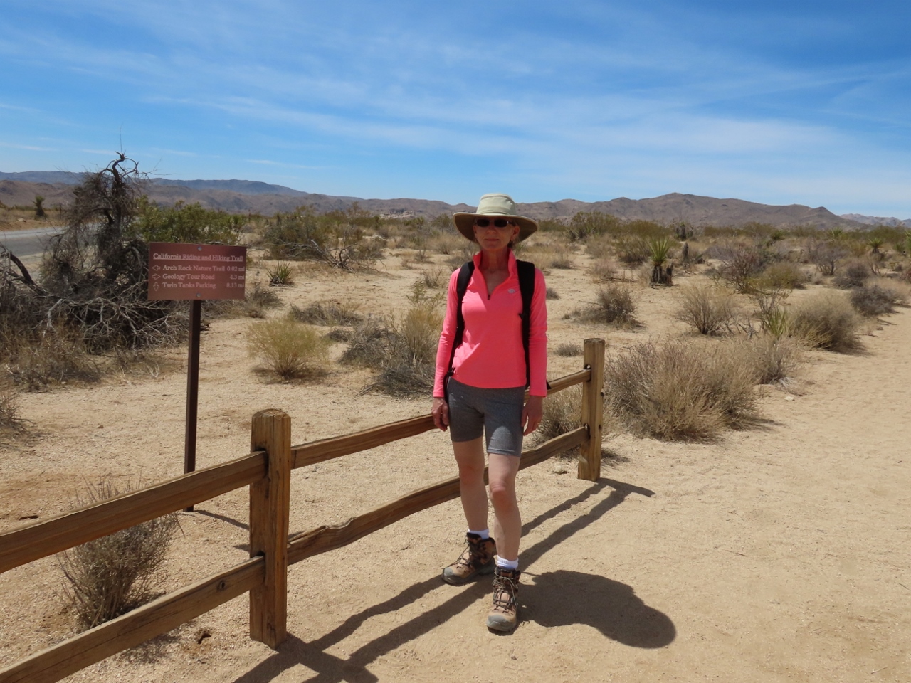 |
Trailhead
Position: 33°59.33’N, -116°1.37’W
At the trailhead for Heart Rock and Arch Rock. Compared to Cottonwood, where we hiked earlier this morning, this section of the park is much busier.
|
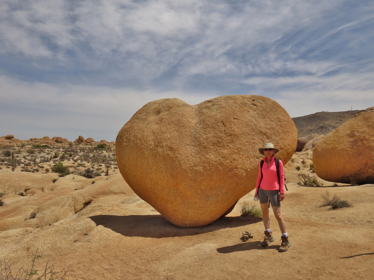 |
Heart Rock
Position: 33°59.26’N, -116°0.87’W
A short trail through the desert leads to aptly-named Heart Rock.
|
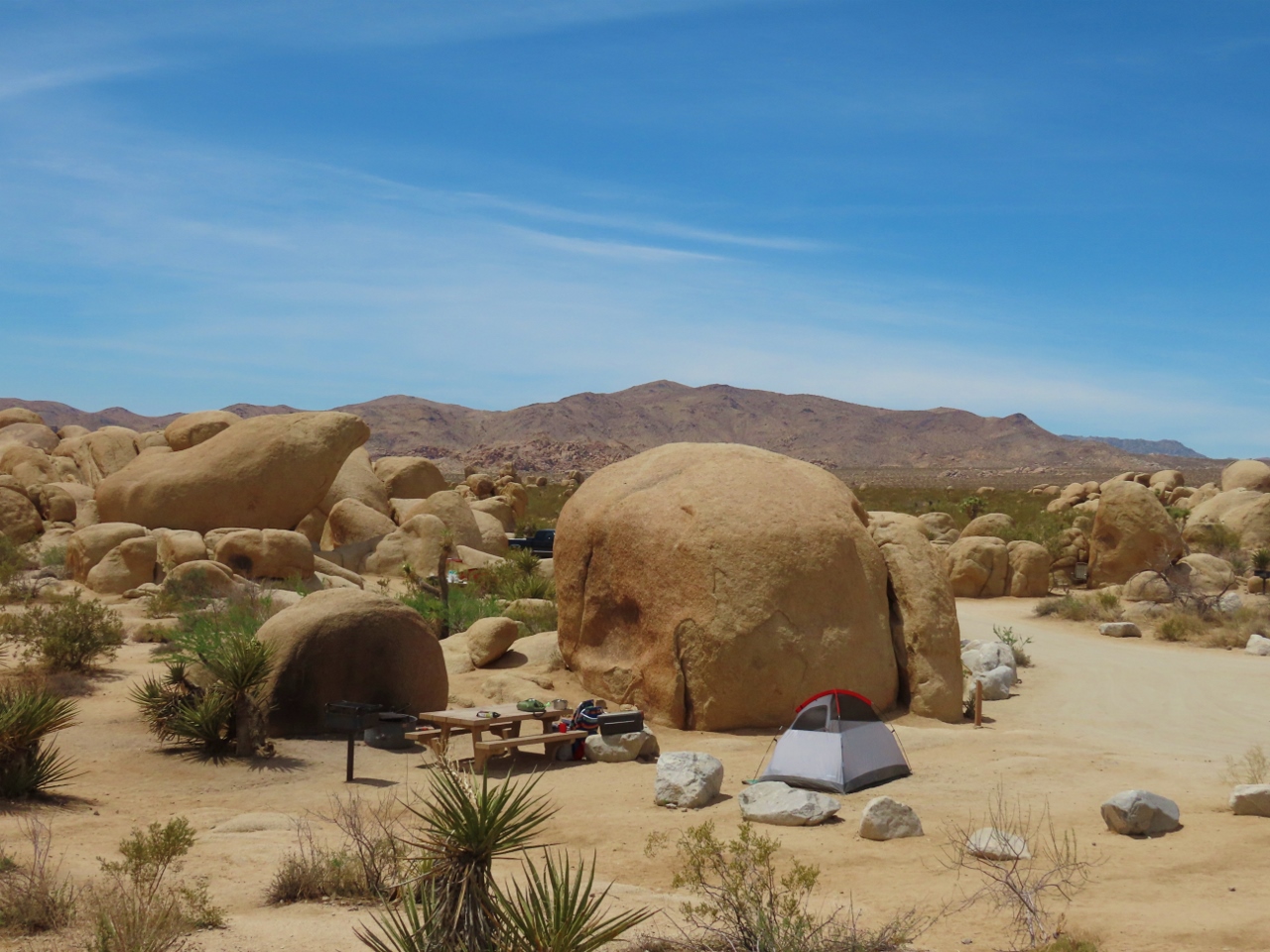 |
Campsite
Position: 33°59.22’N, -116°0.97’W
One of the over 300 camp sites in Joshua Tree National Park. It looks like a pretty nice spot, tucked away from the other sites.
|
 |
Arch Rock
Position: 33°59.19’N, -116°0.96’W
Arch Rock is one of the more popular attractions in Joshua Tree National Park. Dozens of people were out walking the short trail and posing with the formation.
|
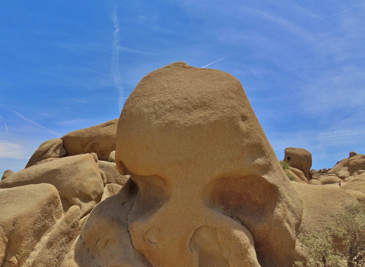 |
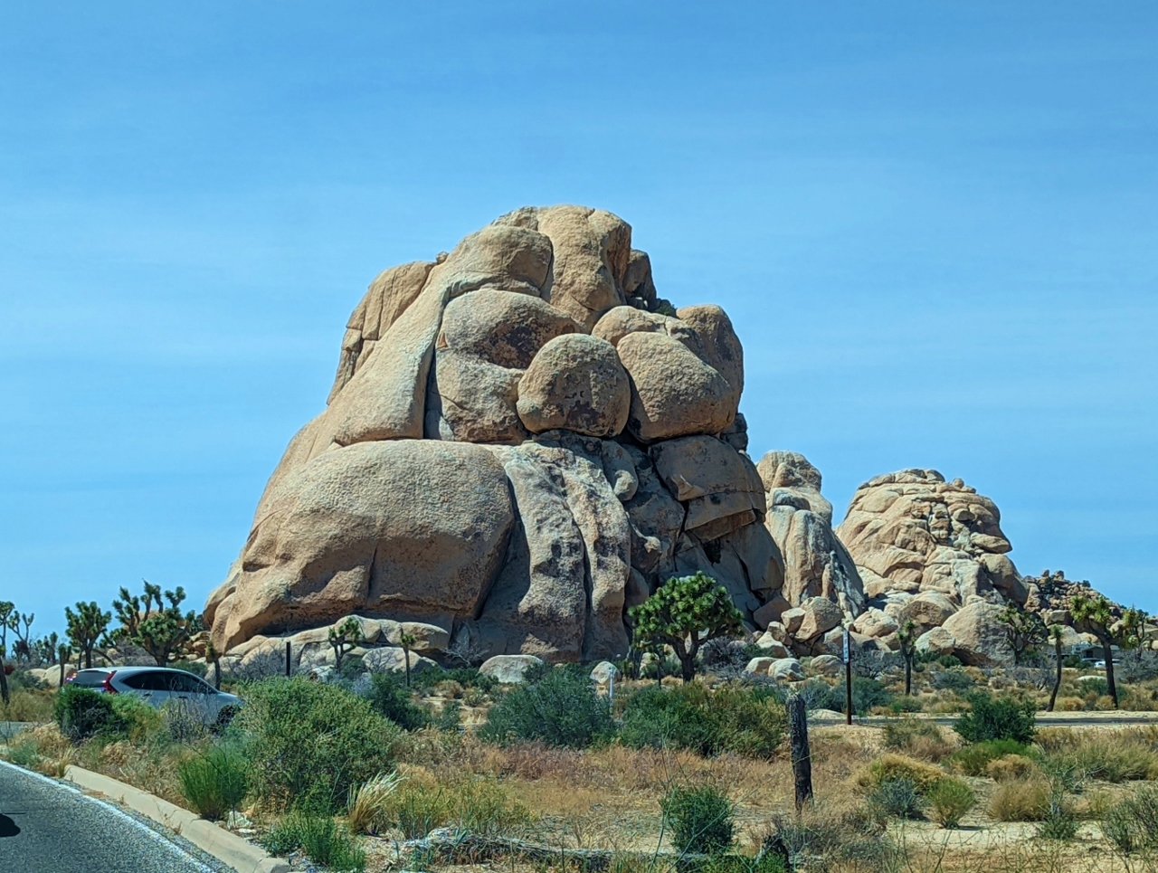
Skull Rock
Position: 33°59.88’N, -116°3.59’W
Skull Rock is another very popular formation in Joshua Tree National Park. It’s right off the side of the road, so easily accessible without much of a walk.
|
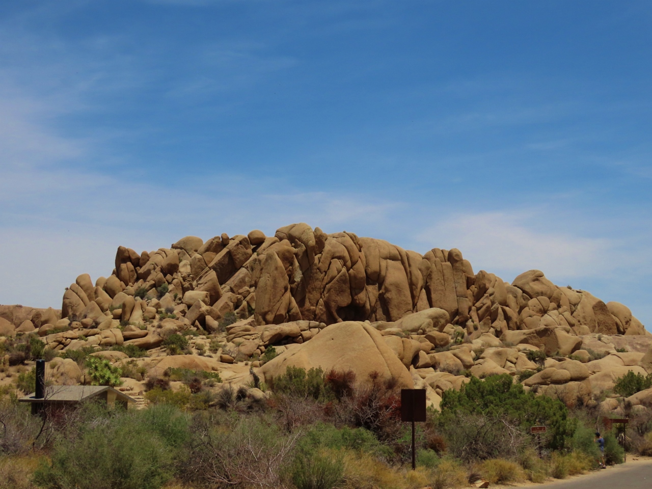 |
Jumbo Rocks
Position: 33°59.57’N, -116°3.72’W
From Skull Rock, we walked a short and enjoyable loop trail past the popular Jumbo Rocks Campground. These are some of the big rock formations the campground is named for.
|
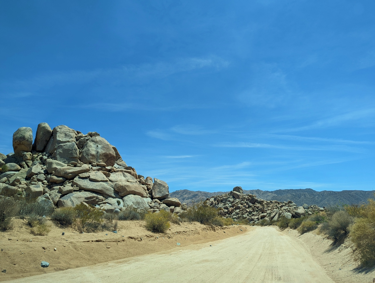 |
Geology Tour Road
Position: 33°56.88’N, -116°4.64’W
We ended the day at Joshua Tree National Park with a drive along Geology Tour Road. This lightly-visited 18-mile (29km) unpaved road provides another view to the park’s diverse geography, and is a fun drive as well. Here we are nearing the point where the road changes from two-way traffic to a one-way loop where a 4-wheel-drive vehicle is recommended.
|
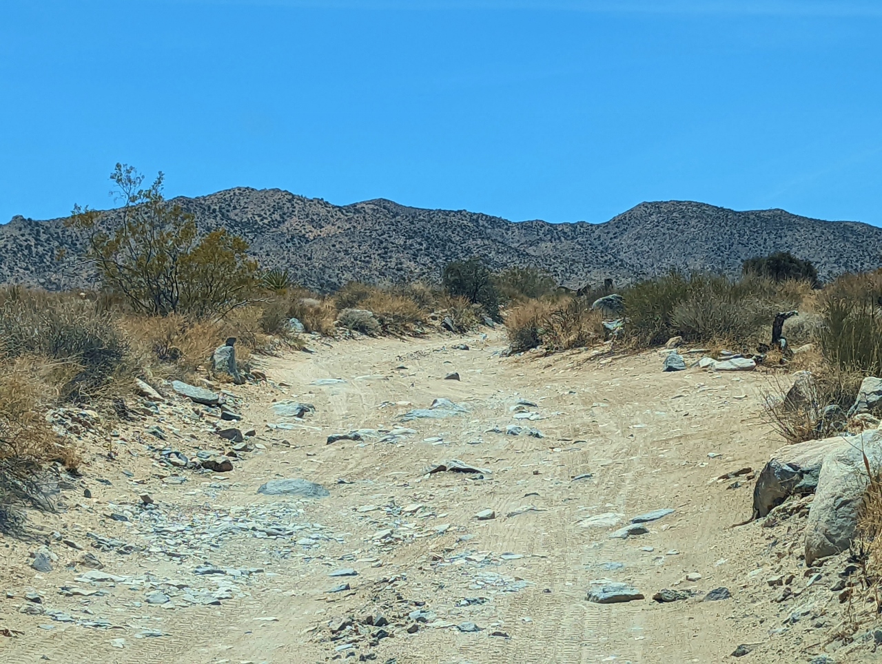 |
Rough Road
Position: 33°54.43’N, -116°4.14’W
We rented an AWD Buick Enclave to allow us to do the Geology Tour Road. There were a few rough sections like this, and places with deep sand or ruts, but the road was generally in better condition than we were expecting and we had no difficulty driving it.
|
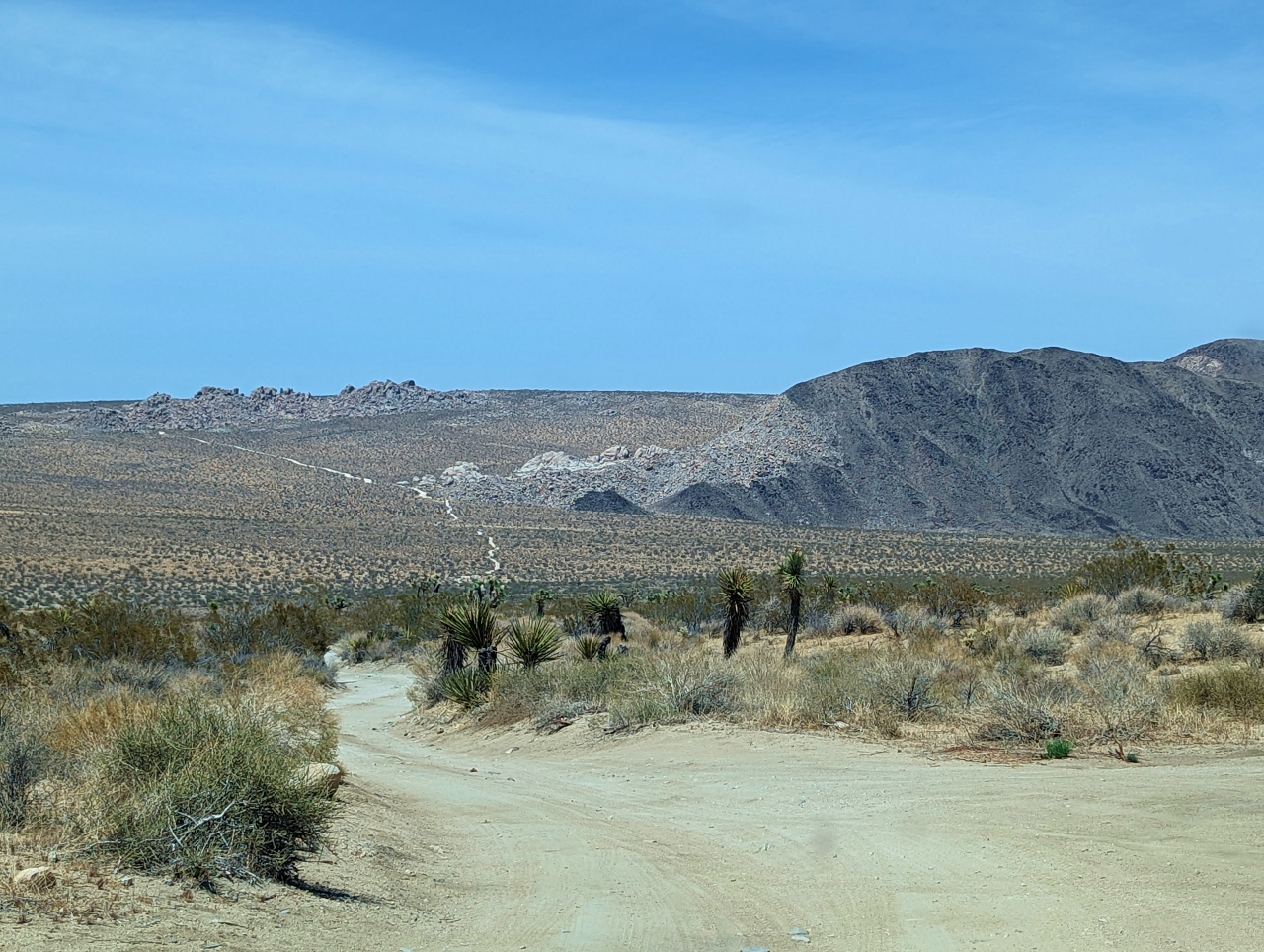 |
Pleasant Valley
Position: 33°54.06’N, -116°5.16’W
Sweeping view north from Pleasant Valley along the Geology Tour Road, just over halfway along the one-way loop. The road we drove down on is visible snaking up the hill in the distance.
|
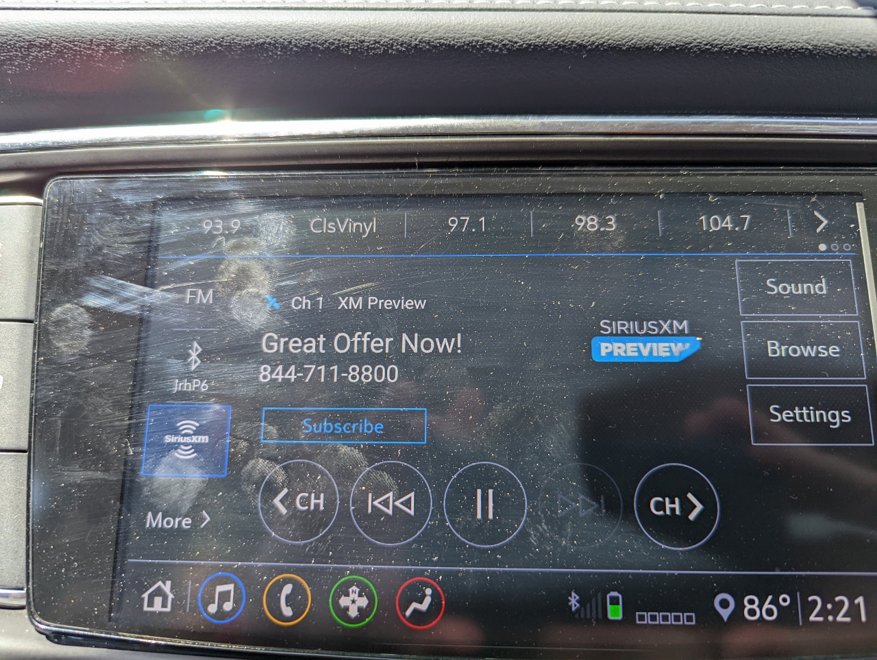 |
Advertising
Position: 33°56.33’N, -116°4.66’W
While we were driving Geology Tour Road, the radio in our rental car suddenly sprung to life with an advertisement for Sirius XM.
|
 |
Intersection Rock
Position: 34°0.79’N, -116°9.71’W
Passing 150-ft (45m) Intersection Rock as we exit the park. The iconic rock is one of the more popular climbing rocks in area with nearly 30 climbing routes ranging from easy to quite difficult.
|
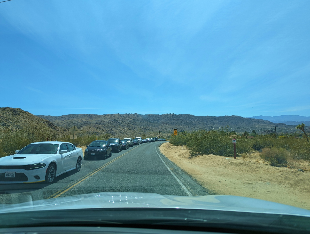 |
Queue
Position: 34°5.63’N, -116°15.97’W
Queue of cars waiting to enter the park through the west entrance as we exit. Joshua Tree is the closest national park to Los Angeles and San Diego, and is very popular. On a busy Saturday the line of cars can extend over a mile, with wait times of nearly an hour.
|
 |
Laundry
Position: 34°5.67’N, -116°17.30’W
Doing a little laundry at Shelter: One. To avoid checking bags, we only brought carry-on luggage and being able to do laundry locally minimizes the clothes we need to have.
|
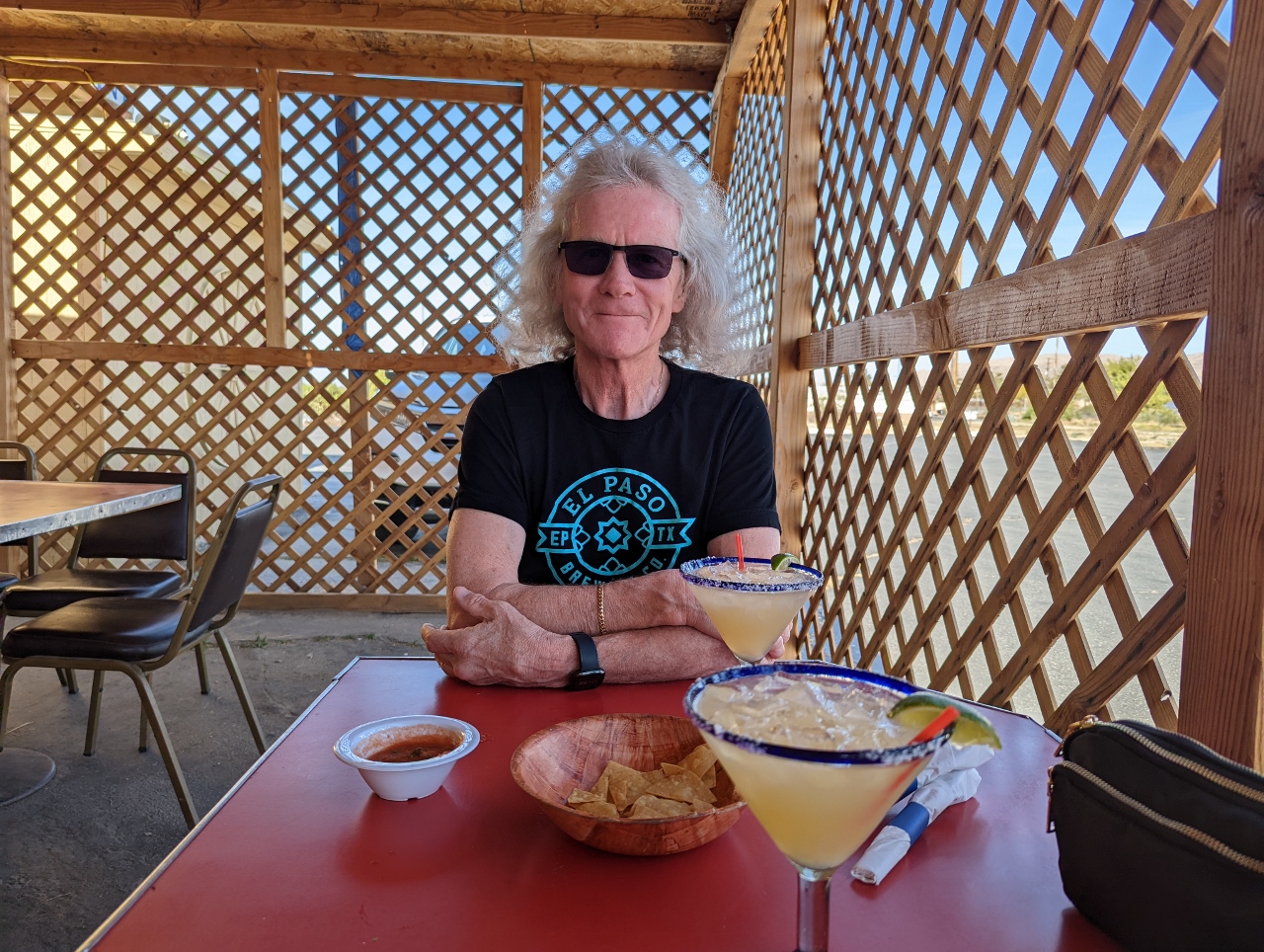 |
La Palapa
Position: 34°7.65’N, -116°24.97’W
A delicious meal on the patio at La Palapa Mexican restaurant in the town of Yucca Valley.
|
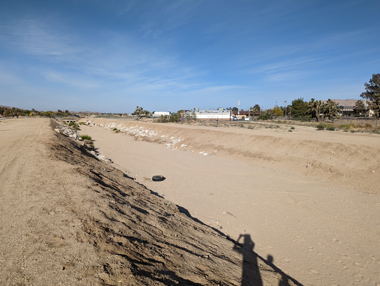 |
Flood Runoff
Position: 34°7.63’N, -116°24.97’W
Flash floods are common here in the late summer and early fall. The size of this flood runoff gives an idea of how much water can be in motion.
|
 |
Patio
Position: 34°5.67’N, -116°17.30’W
We’re really enjoying our stay at Shelter: One. The house is bright and modern, with a wide variety of places to relax outside, including a hot tub and a cowboy pool. Here we are trying out the chaise settees.
|
 |
Firepit
Position: 34°5.67’N, -116°17.30’W
Taking in the desert sunset by the firepit at Shelter: One near Joshua Tree National Park.
|
 |
Click the travel log icon on the left to see these locations on a map. And a map of our most recent log entries always is available at mvdirona.com/maps. |
Looks like a great place to visit. Wonderful photographs. How hot was it?
It was toasty, at least for us, at 90F (32C). We just fell into our usual hot weather routine of going out in the morning, having fun, and getting sweaty and mostly just ignoring the heat. Then, as things cool down later in the day, showering before dinner and enjoying dinner and the rest of the evening in comfortable but not unreasonably hot weather.