Joshua Tree National Park, near Palm Springs in southern California, is known for its surreal rock formations and the twisted, spiky trees that are the park’s namesake. Straddling the Mojave and Colorado deserts, the 795,156-acre (1,242 sq mi; 3,217 sq km) park has a unique ecosystem that supports a wide variety of plant and animal life. Visitors can experience the park through several scenic drives, many walking, hiking and backpacking trails, several hundred camp sites, and thousands of rock-climbing routes.
On the first day of a three-day visit to Joshua Tree National Park, we spent our time in the central road-accessible section of the park. We started with a hike up Ryan Mountain for sweeping views of the park, then squeezed our way through slot canyons in the Hall of Horrors, had lunch at Cap Rock and walked the trail there with its hundreds of Joshua Trees, and finally drove up Keys Vista for another great view across the park.
We also spent a wonderful two evenings at Shelter: One. The modern and light-filled small house is right near the entrance to Joshua Tree National Park and has a private back deck with evening sunset views across the desert.
Below are highlights from May 26th and 27th, 2022. Click any image for a larger view, or click the position to view the location on a map. And a map with our most recent log entries always is available at mvdirona.com/maps.
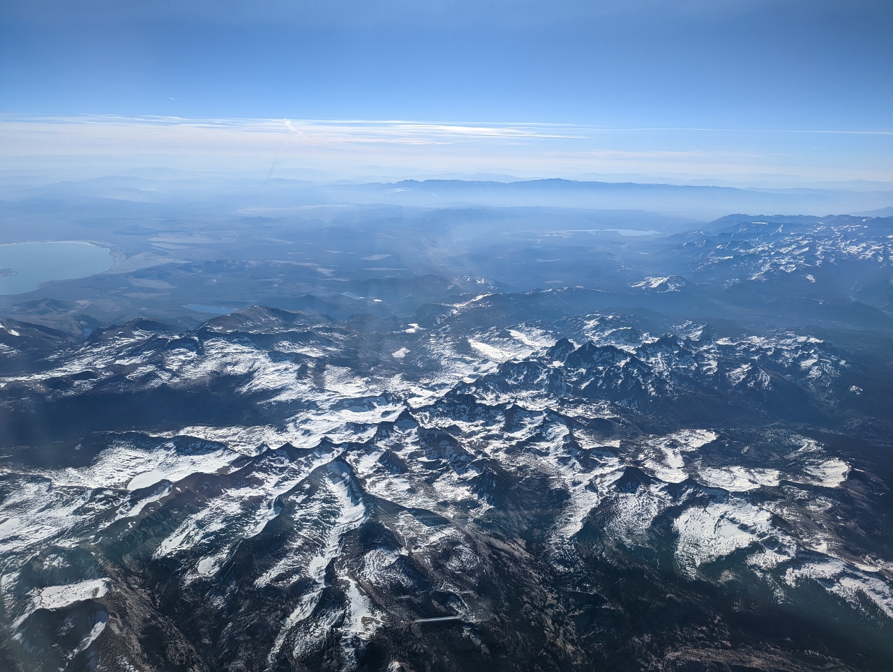 |
Sierra Nevada
Position: 39°2.81’N, -119°10.82’W
View to the Sierra Nevada mountain range as we fly south to Palm Springs.
|
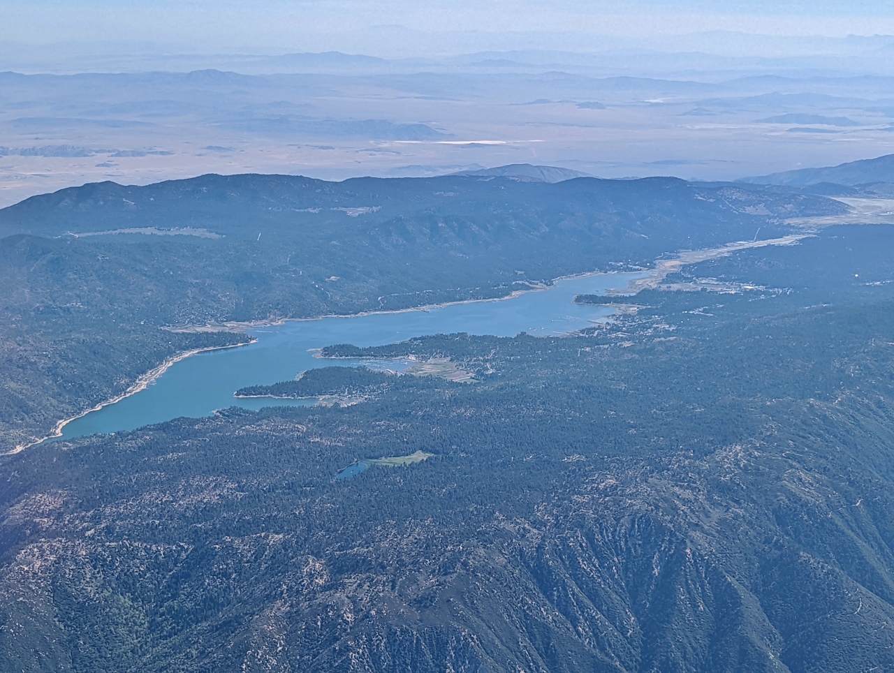 |
Lake Arrowhead
Position: 34°13.38’N, -117°10.68’W
The distinctive shape of Lake Arrowhead in the San Bernardino Mountains. Construction of a dam at the artificial lake began in 1904, with the intention of providing irrigation water to the San Bernardino Valley. But construction was halted due to conflicts over water supplies. In 1922, the Arrowhead Lake Company completed the dam with the intention to develop the area. The lake is privately controlled and access to the lake is allowed only to residents with lake rights.
|
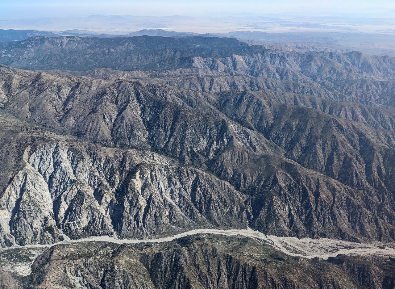 |
Whitewater River
Position: 34°2.40’N, -116°47.13’W
The Whitewater River flowing through the San Gorgonio Wilderness in the eastern San Bernardino Mountains east of Los Angeles. The river is part of the Salton Sea drainage system.
|
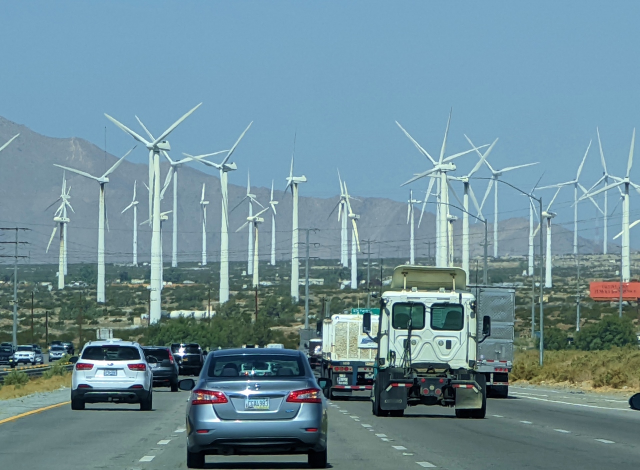 |
San Gorgonio Pass Wind Farm
Position: 33°54.14’N, -116°32.17’W
Driving towards the San Gorgonio Pass wind farm en route to Joshua Tree, CA. One of the three major wind farms in California, San Gorgonio Pass contains 1,224 wind turbines with a total rated capacity of 652 MW.
|
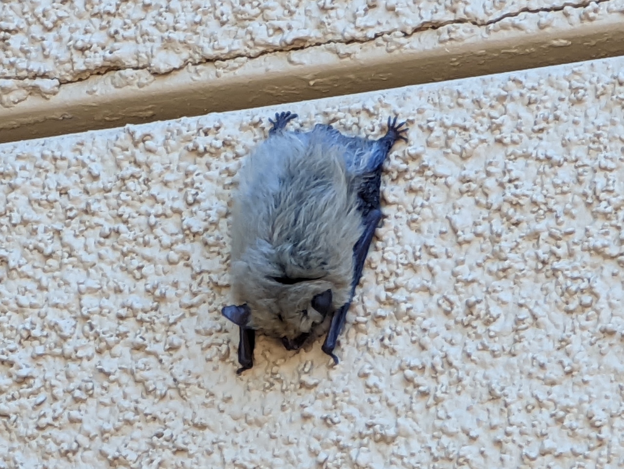 |
Canyon Bat
Position: 34°8.09’N, -116°3.41’W
We stopped off at the Joshua Tree Cultural Center in the town of Twentynine Palms to pickup a park map and talk to the rangers, who pointed out this Canyon Bat sleeping on the side of building. The bats prefer roosting in rock crevices, but this one found a shady spot high on an outside wall in the middle of the town.
|
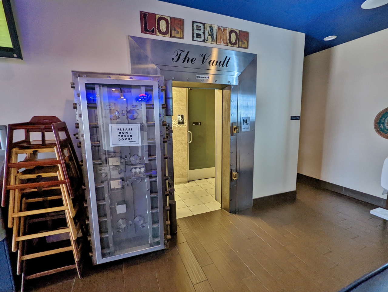 |
Edchada’s
Position: 34°8.16’N, -116°3.52’W
Edchada’s Mexican restaurant is in a building that used to be a bank, and their restrooms are in the old safe. We’d come for lunch, but they weren’t yet serving food.
|
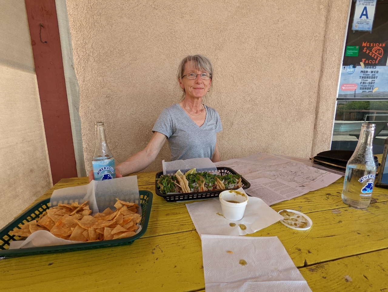 |
Mexican Street Tacos
Position: 34°8.36’N, -116°3.16’W
A delicious lunch outside in the shade at Mexican Street Tacos in Twentynine Palms.
|
 |
Say Yes to Tacos
Position: 34°8.37’N, -116°3.16’W
We got a giggle out of the “Say yes to tacos” sign at Mexican Street Tacos.
|
 |
Shelter: One
Position: 34°5.67’N, -116°17.30’W
A first look at Shelter: One, our home for the next three nights. The modern and light-filled small house is right near the entrance to Joshua Tree National Park.
|
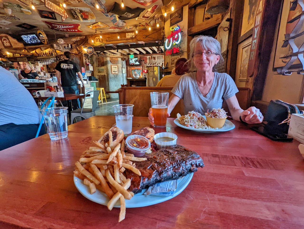 |
Joshua Tree Saloon
Position: 34°8.09’N, -116°18.87’W
Dinner at Joshua Tree Saloon. The food was good, but the portions were gigantic.
|
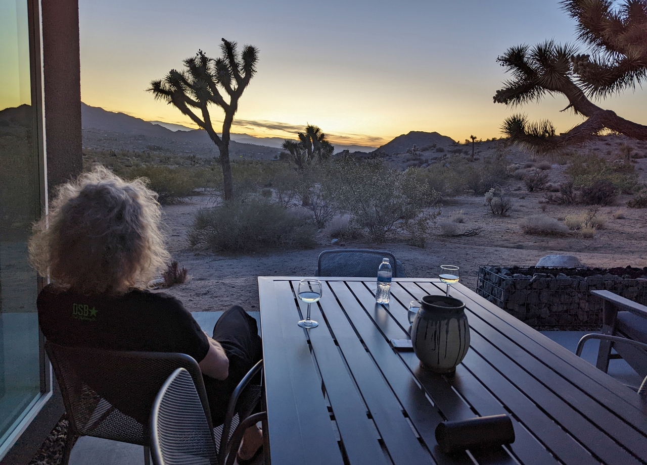 |
Sunset
Position: 34°5.67’N, -116°17.30’W
Enjoying the sunset from the wonderfully private back deck of Shelter: One through the silhouette of several Joshua Trees. The house is really fabulous.
|
 |
Park Entrance
Position: 34°5.62’N, -116°15.92’W
Entering Joshua Tree National Park for a day of hiking. A few cars are ahead of us at 9am, but it only took a few minutes to pass the gate.
|
|
|
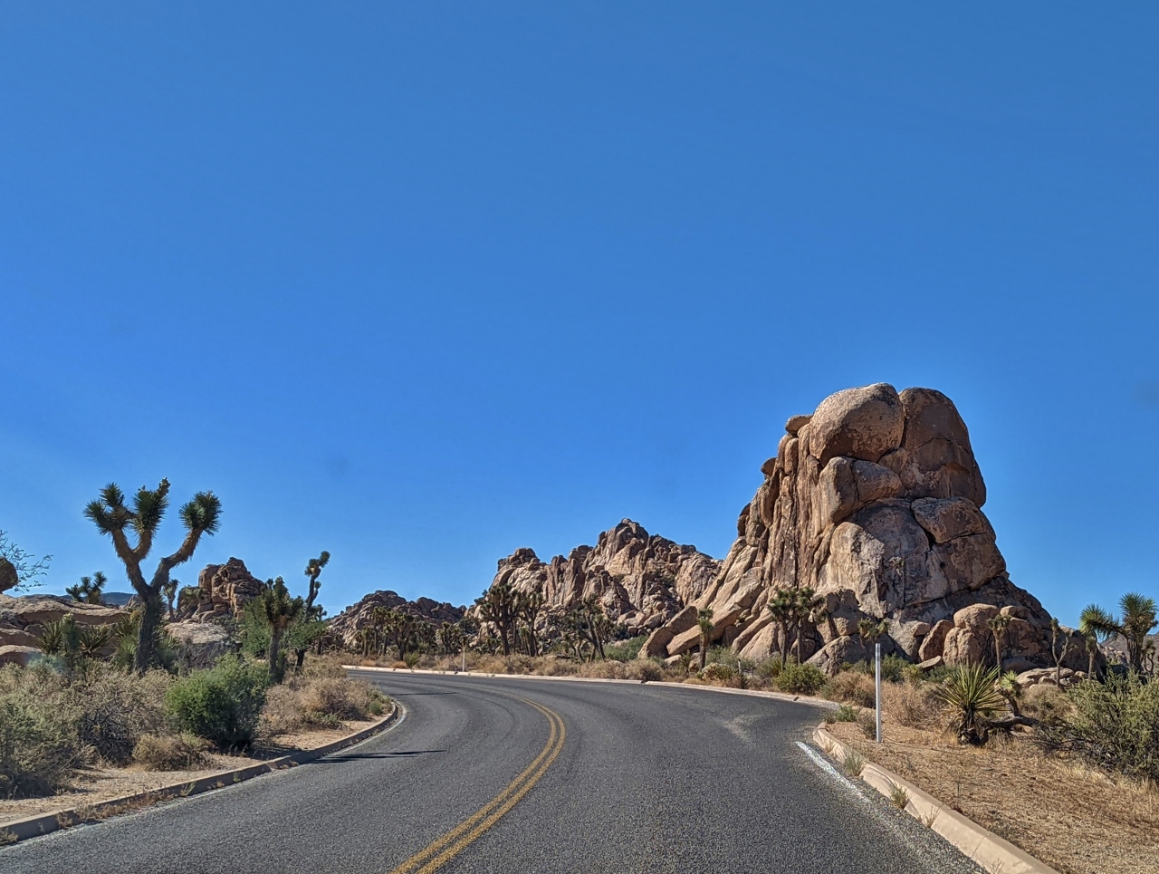
First View
Position: 34°2.04’N, -116°10.93’W
A first few to the fantastic rock formations and Joshua Trees that the park is famous for.
|
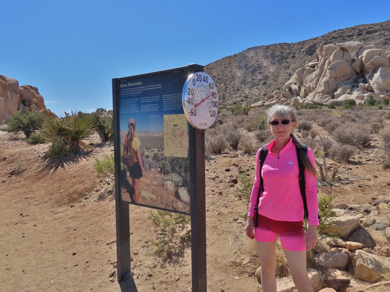 |
Ryan Mountain Trailhead
Position: 34°0.10’N, -116°8.49’W
At the Ryan Mountain trailhead for our first hike of the day in Joshua Tree National Park. At 9:30 am the temperature already is 80°F (27°C);
|
 |
Ryan Mountain Trail
Position: 34°0.12’N, -116°8.15’W
These rock formations along the Ryan Mountain trail look a bit like upturned feet and toes.
|
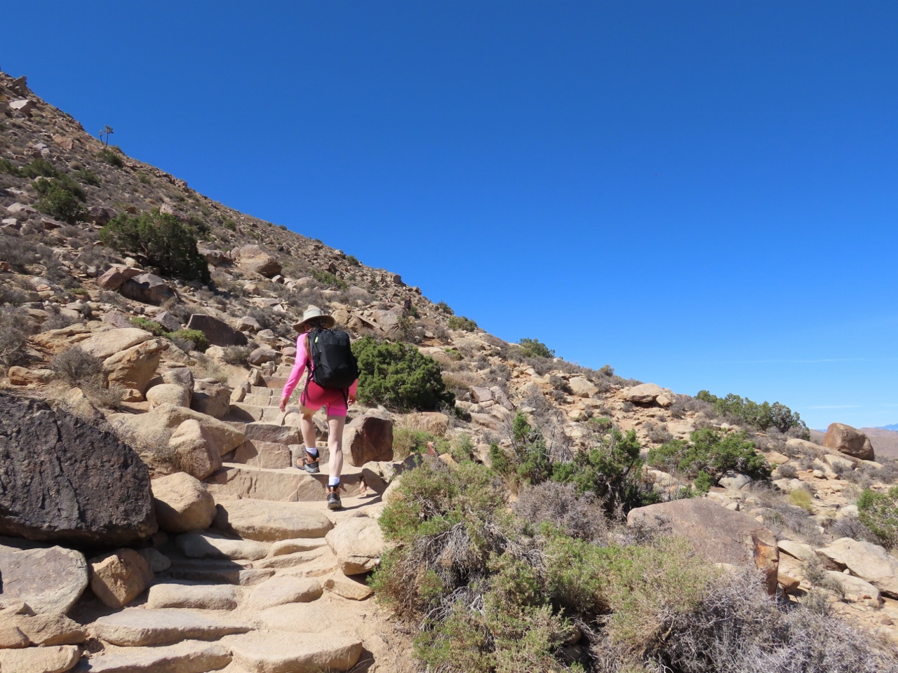 |
Steps
Position: 34°0.03’N, -116°8.12’W
The Ryan Mountain trail has an elevation gain of 1,062 ft in 2.9 miles (324 m in 4.6km). But the path is well-maintained, with steps along the steeper sections.
|
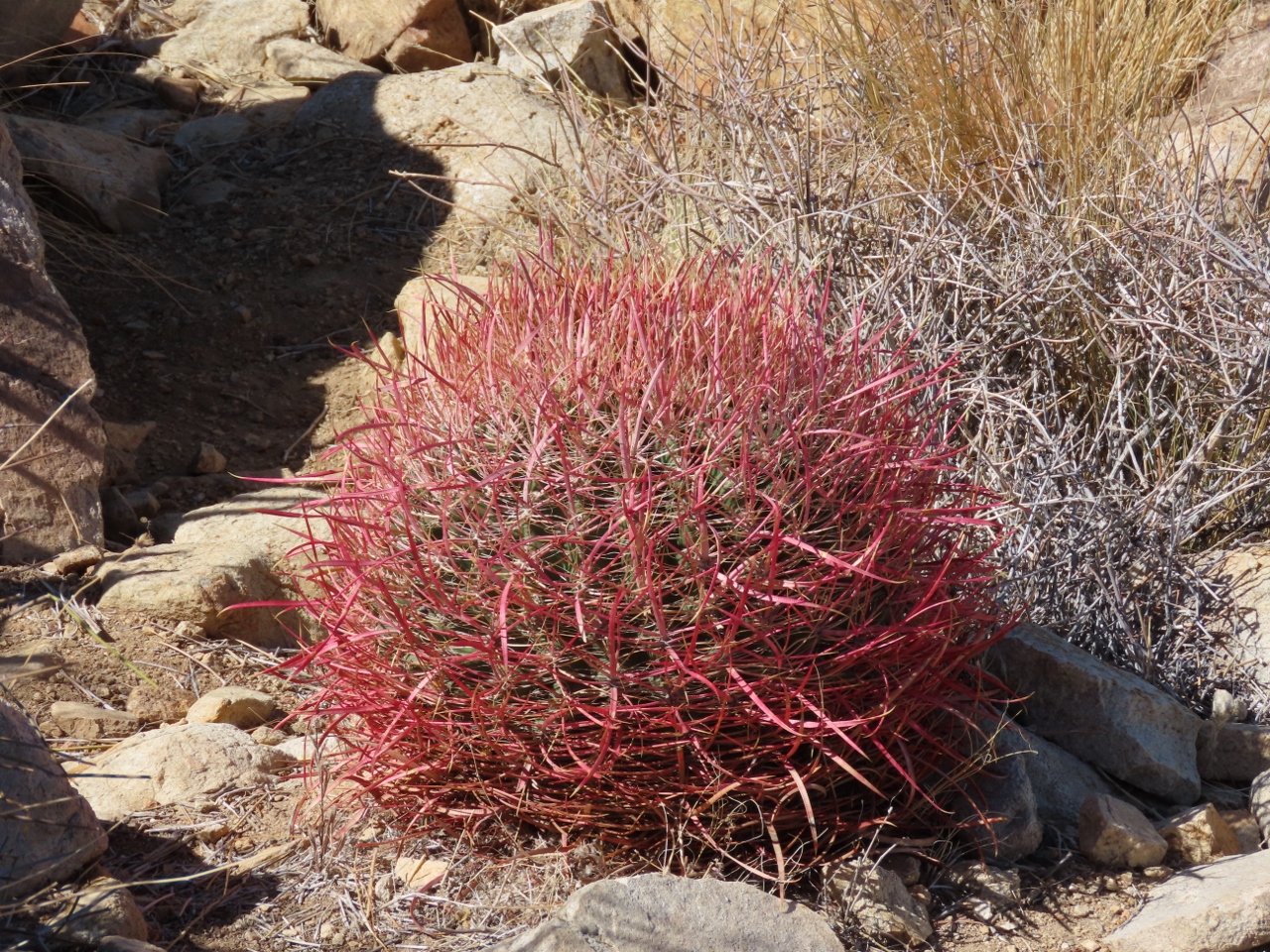 |
California Barrel Cactus
Position: 33°59.87’N, -116°8.22’W
Striking red California Barrel Cactus along the Ryan Mountain Trail.
|
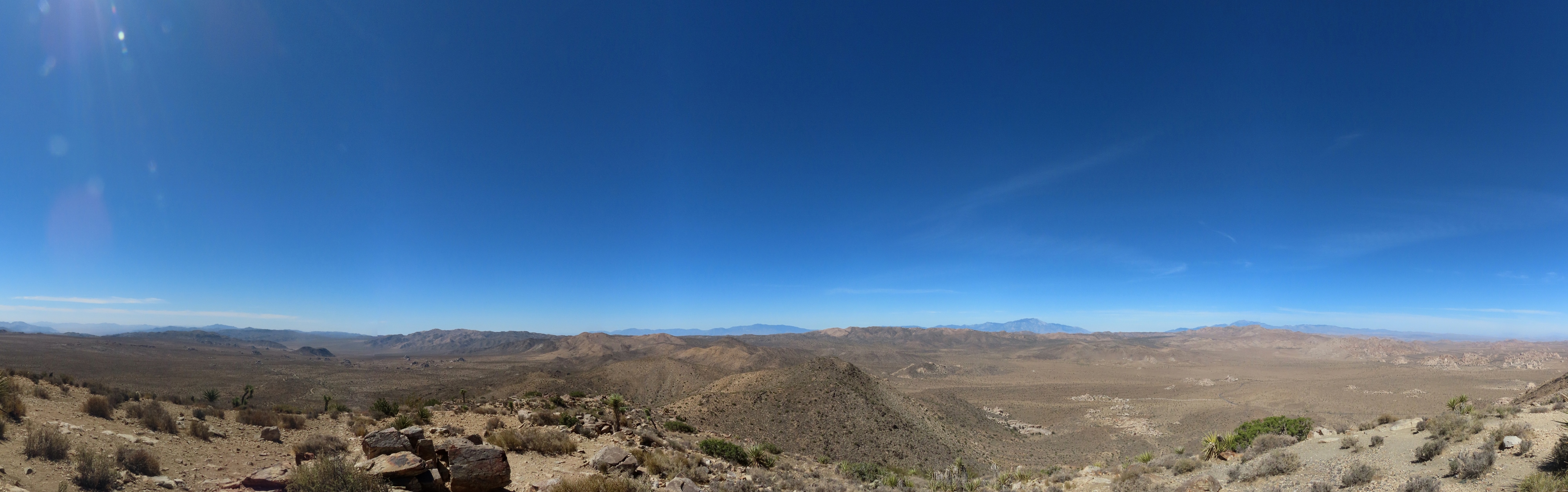 |
Ryan Mountain Vista Point
Position: 33°59.18’N, -116°8.07’W
The fabulous view looking north across Joshua Tree National Park from the Ryan Mountain Vista Point at altitude 5,359 ft (1,634 m).
|
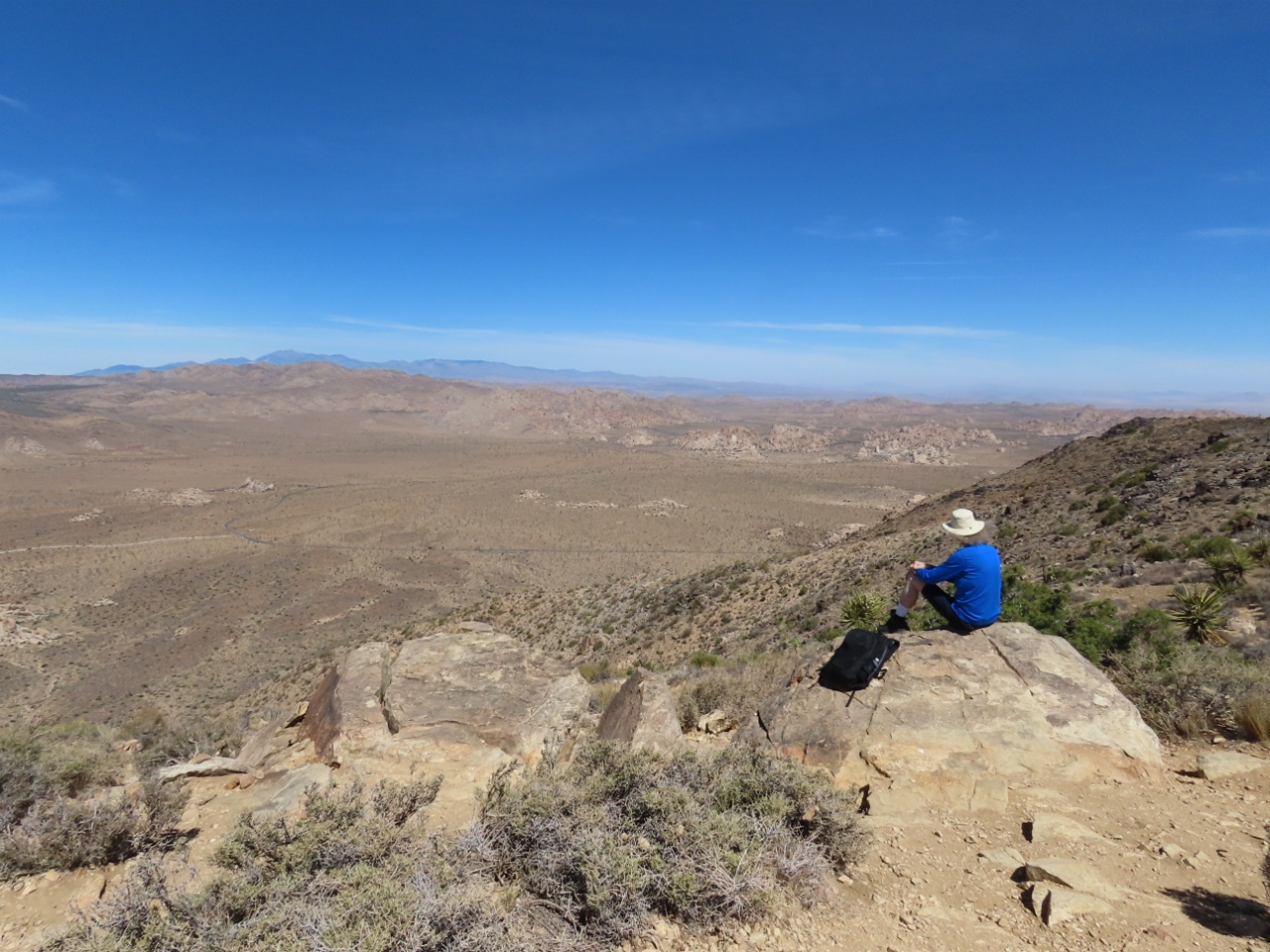 |
Snack
Position: 33°59.19’N, -116°8.09’W
Enjoying a snack with a view on Ryan Mountain before returning back down.
|
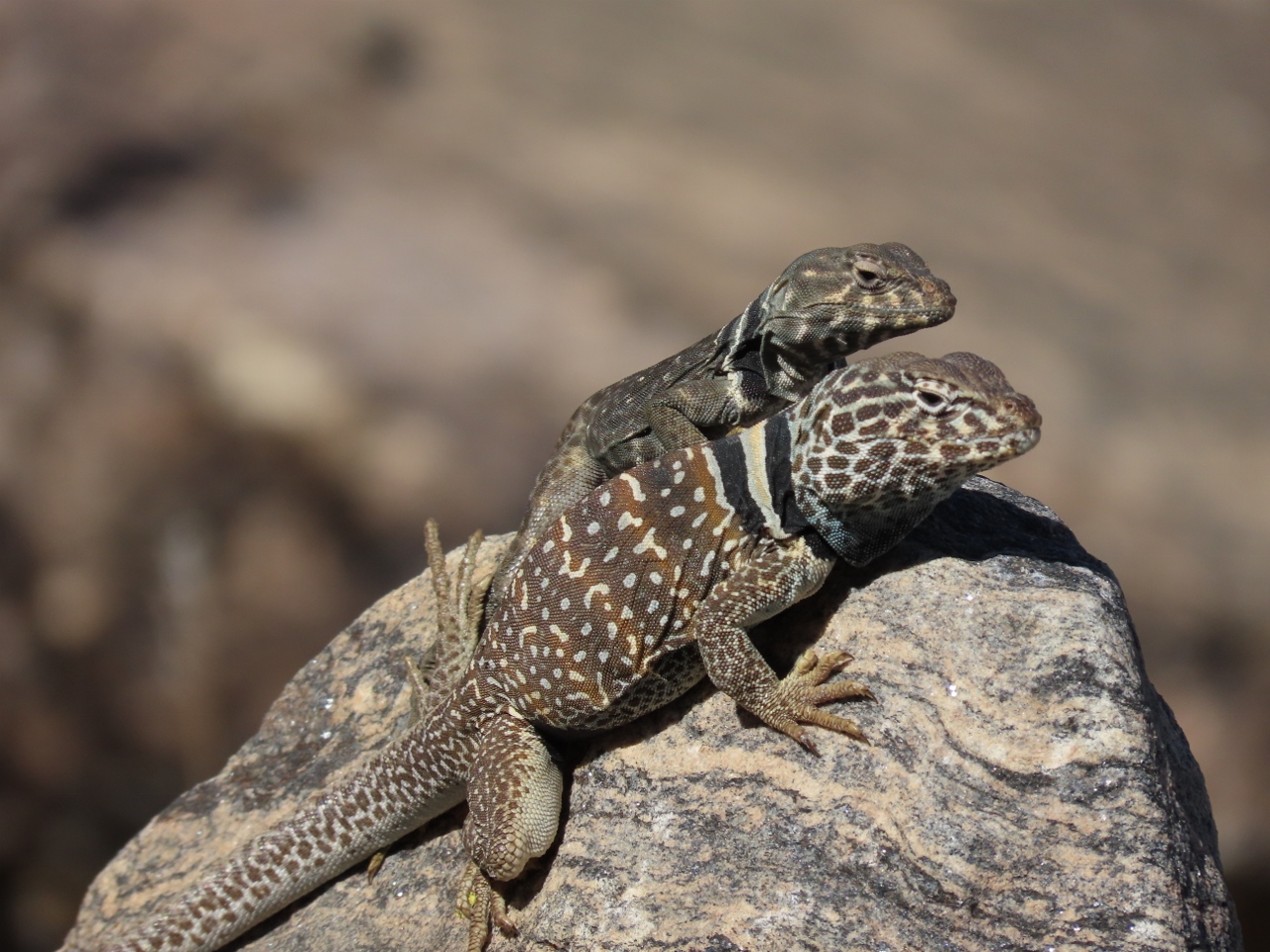 |
Great Basin Collared Lizard
Position: 33°59.60’N, -116°8.11’W
A pair of Great Basin collared lizards sunning on the rocks as we descend from Ryan Mountain.
|
 |
Hall of Horrors
Position: 33°59.93’N, -116°8.71’W
Inspecting the big piles of rock at our next destination for the day, Hall of Horrors. It’s not clear why the area is named that, possibly because of the narrow slot canyons nearby.
|
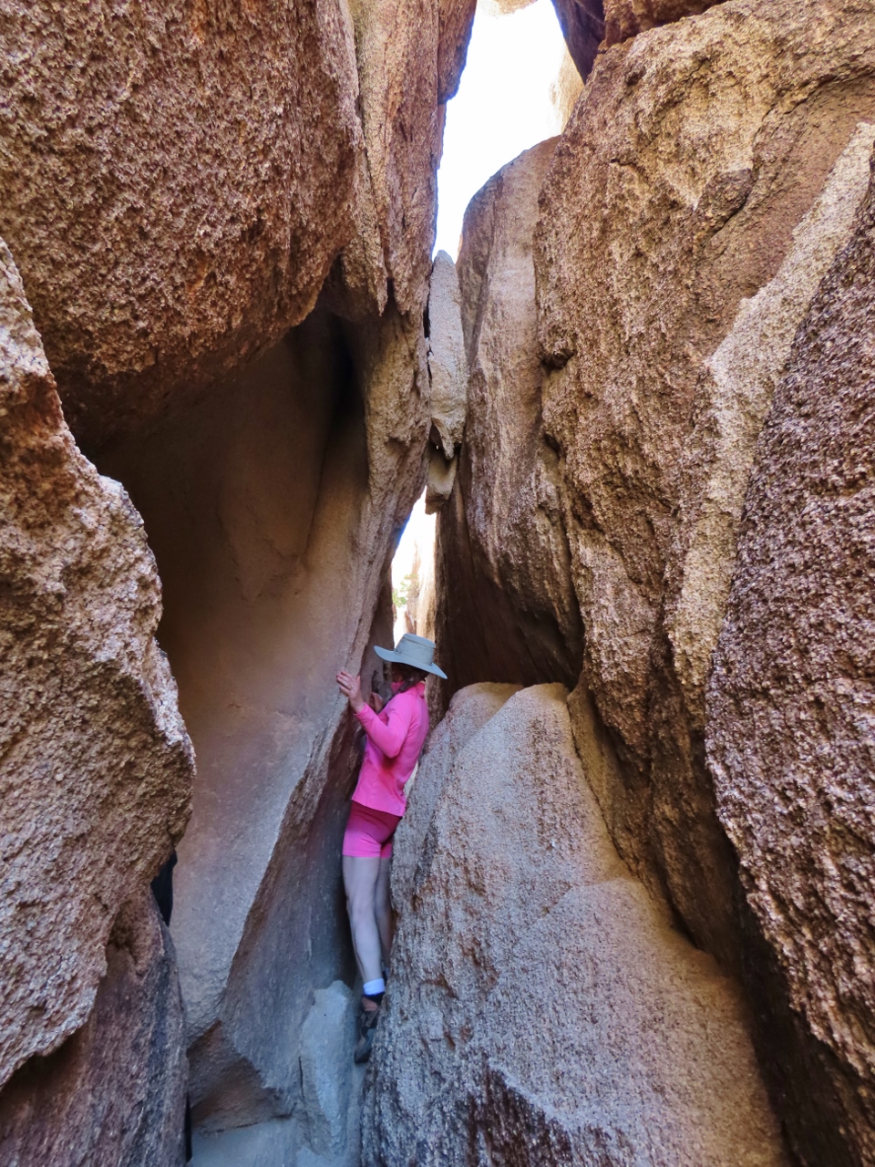 |
Slot Canyon 1
Position: 34°0.05’N, -116°8.82’W
We could just barely squeeze through this slot canyon in Hall of Horrors.
|
 |
Slot Canyon 2
Position: 34°0.06’N, -116°8.83’W
A second slot canyon in Hall of Horrors. It was really fun to work through the narrow passageways.
|
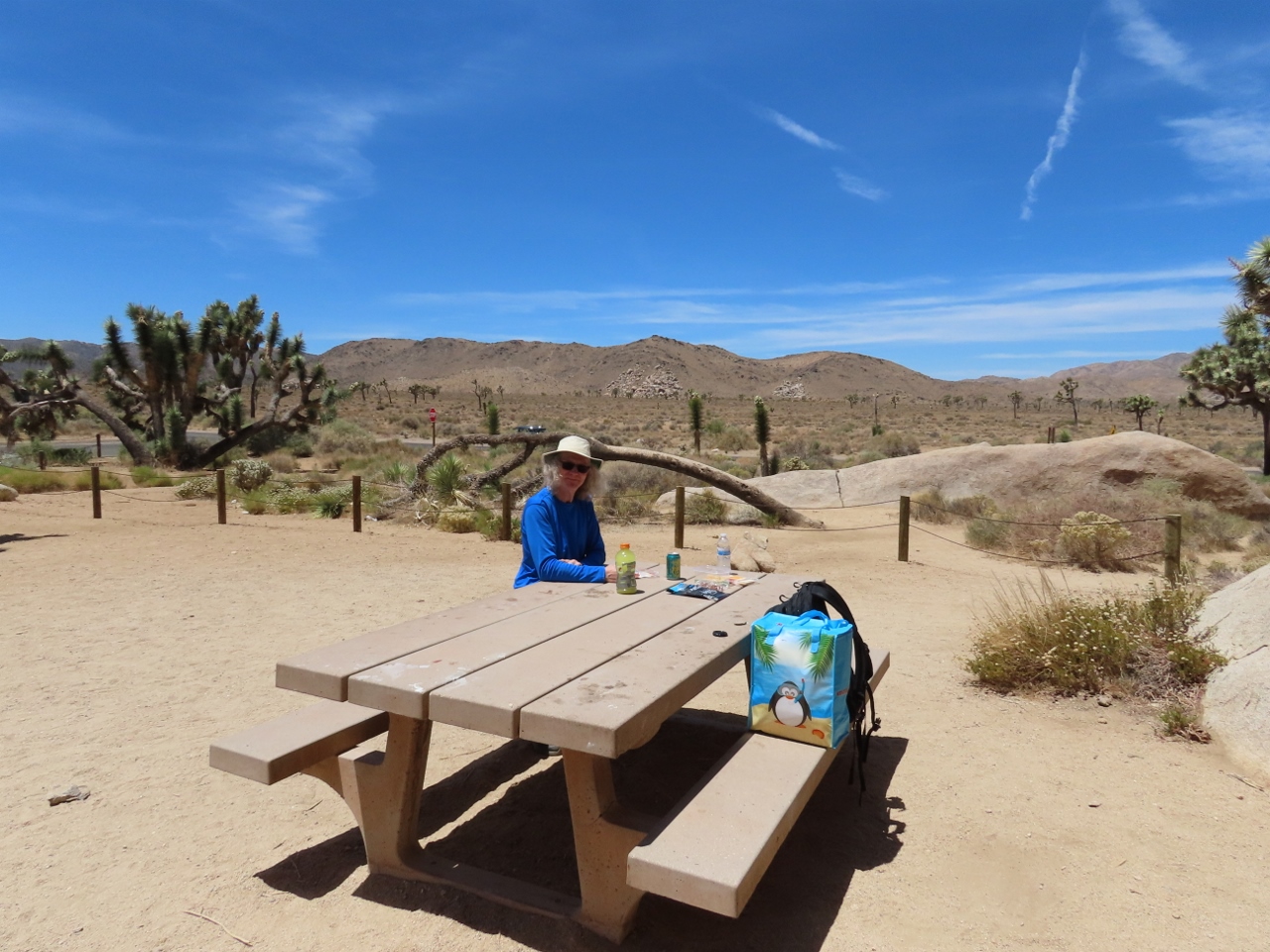 |
Lunch
Position: 33°59.38’N, -116°9.83’W
Stopping at Cap Rock for lunch before walking the trail there. There’s not much shade here, but we enjoyed the spot and the view.
|
 |
Cooler Bag
Position: 33°59.35’N, -116°9.83’W
The car gets very hot while we’re out hiking. We kept our lunch cool with nested cooler bags and large ice packs made by freezing water-filled food-storage containers.
|
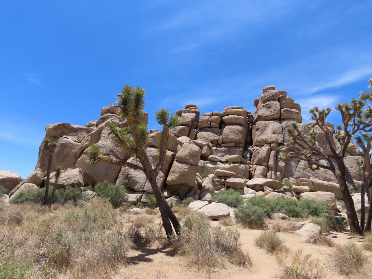 |
Cap Rock Trail
Position: 33°59.31’N, -116°9.78’W
Jumbled rocks piled high along the Cap Rock trail.
|
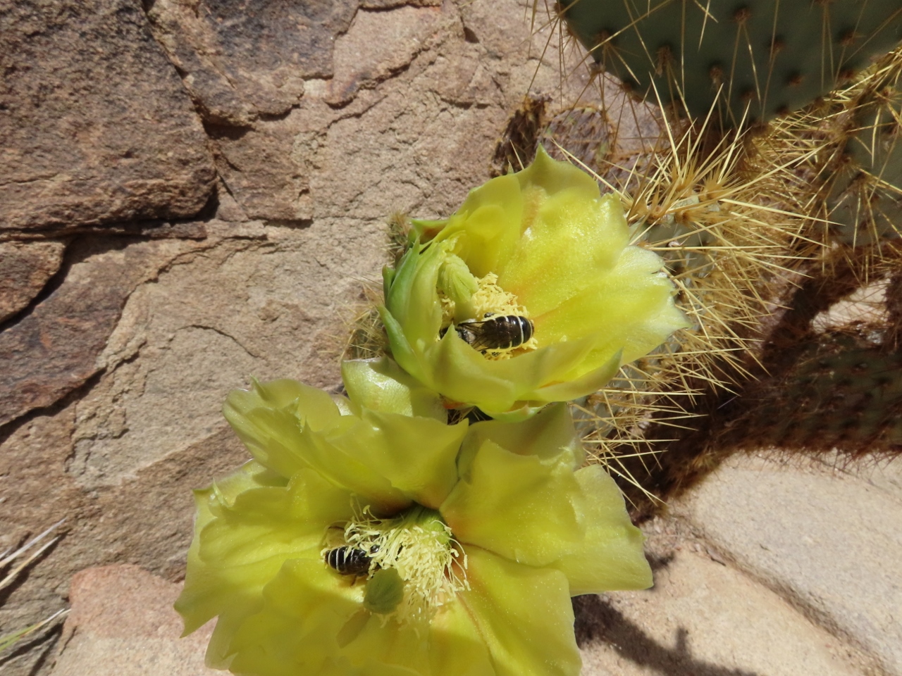 |
Prickly Pear Cactus
Position: 34°0.92’N, -116°10.20’W
Bees pollinating the yellow blooms of a Prickly Pear cactus on the Cap Rock trail in Joshua Tree National Park.
|
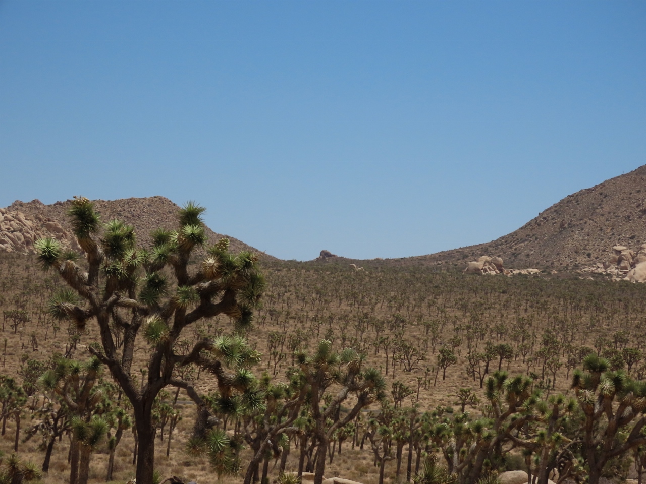 |
Joshua Trees
Position: 34°0.77’N, -116°10.13’W
A forest of Joshua Trees extending to the horizon, viewed from the Cap Rock trail.
|
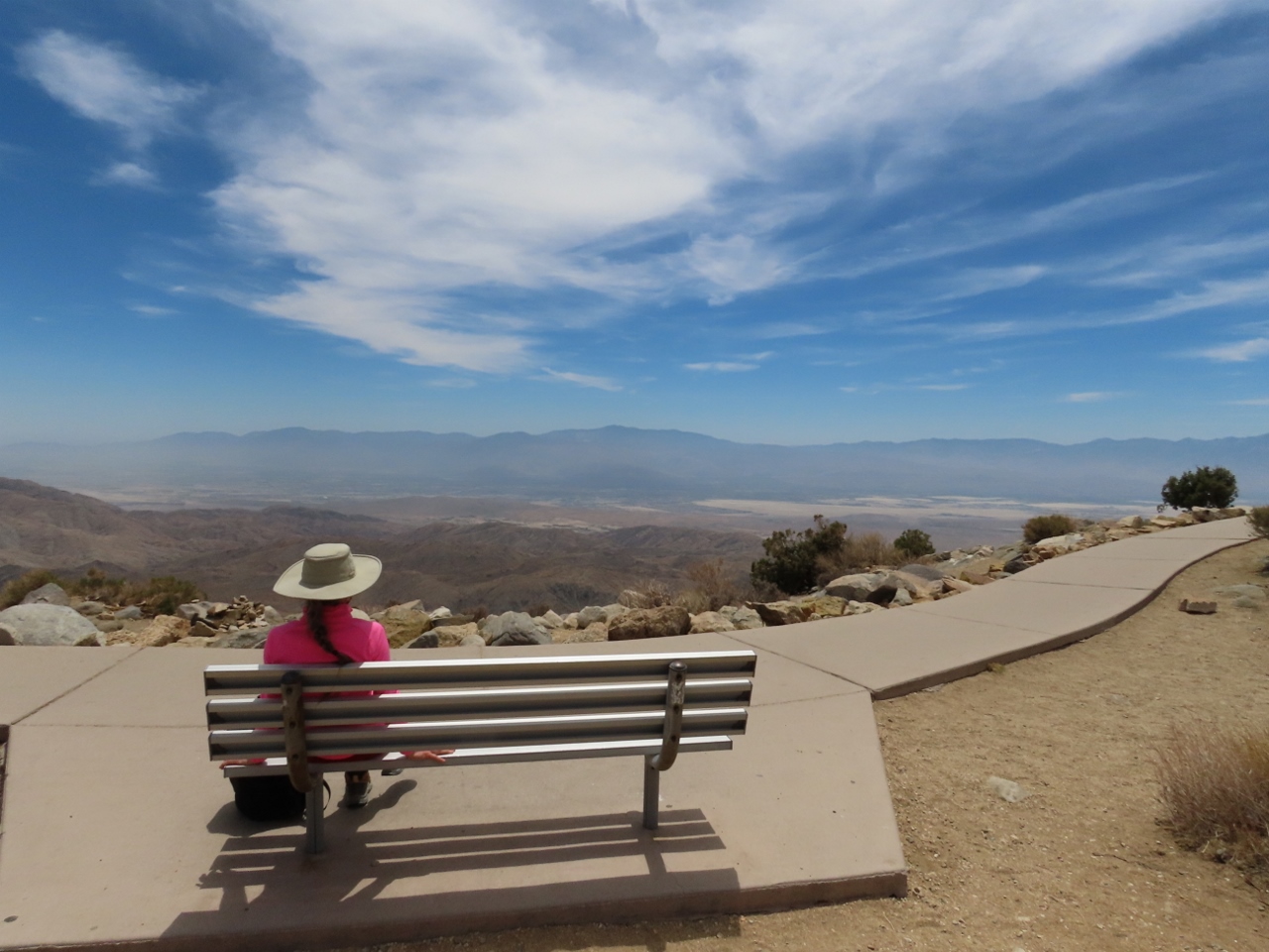 |
Keys View
Position: 33°55.59’N, -116°11.25’W
After walking the Cap Rock trail, our next stop at Joshua Tree National Park was the Keys Vista. This is the view looking south across the park.
|
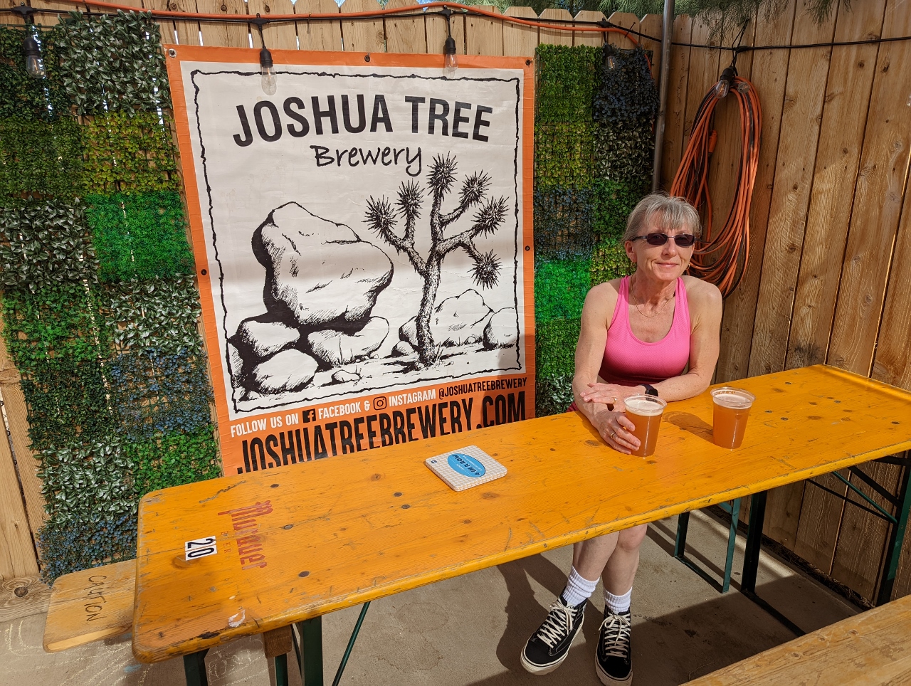 |
Joshua Tree Brewery
Position: 34°8.13’N, -116°19.05’W
A refreshing pint at Joshua Tree Brewery after a great day hiking in Joshua Tree National Park.
|
 |
Dinner
Position: 34°5.67’N, -116°17.30’W
Take-out Thai on the deck at Shelter: One.
|
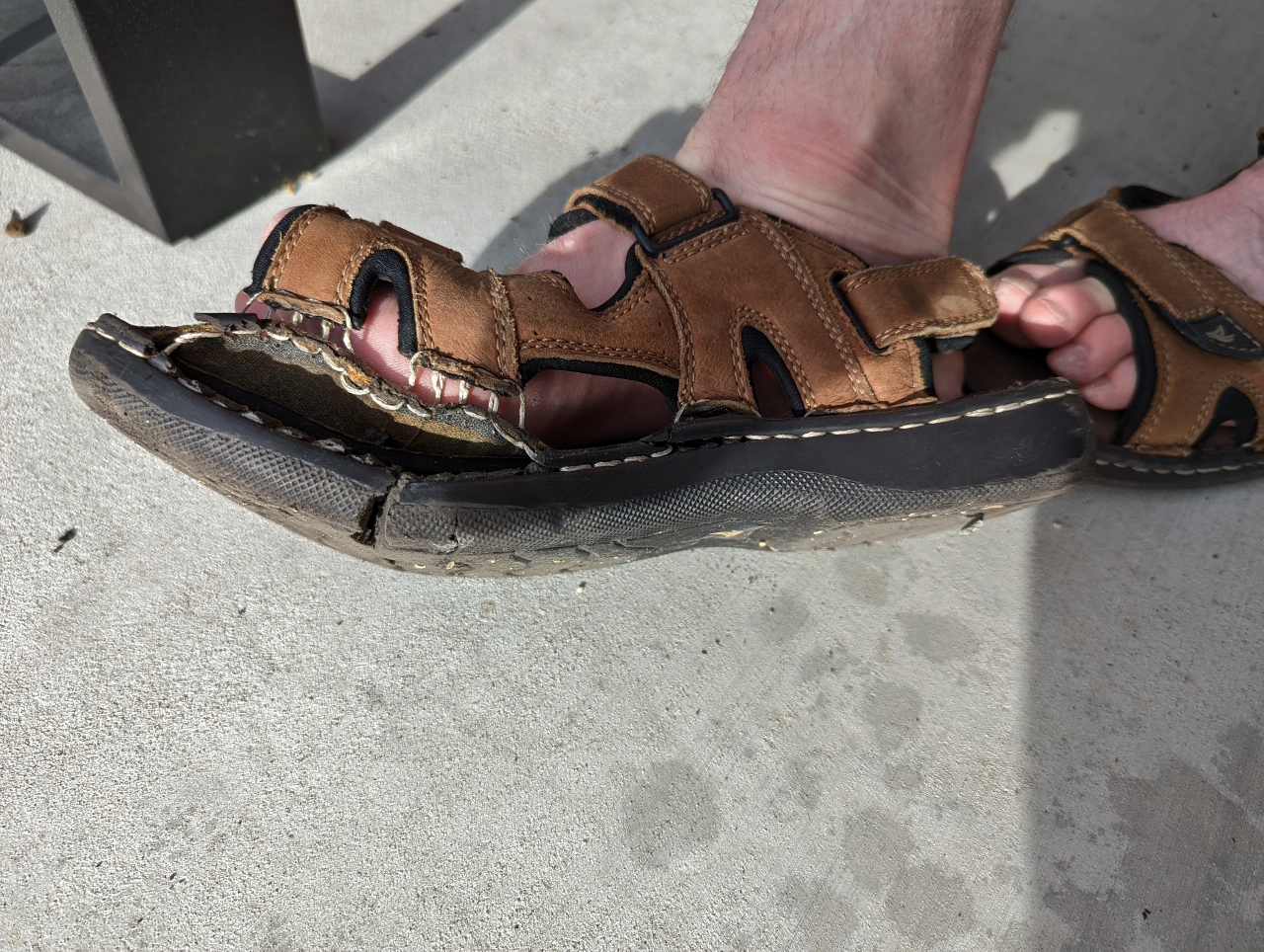 |
Sandal Blowout
Position: 34°5.68’N, -116°17.30’W
James’ sandal suffered a blowout, so we have some shopping to do.
|
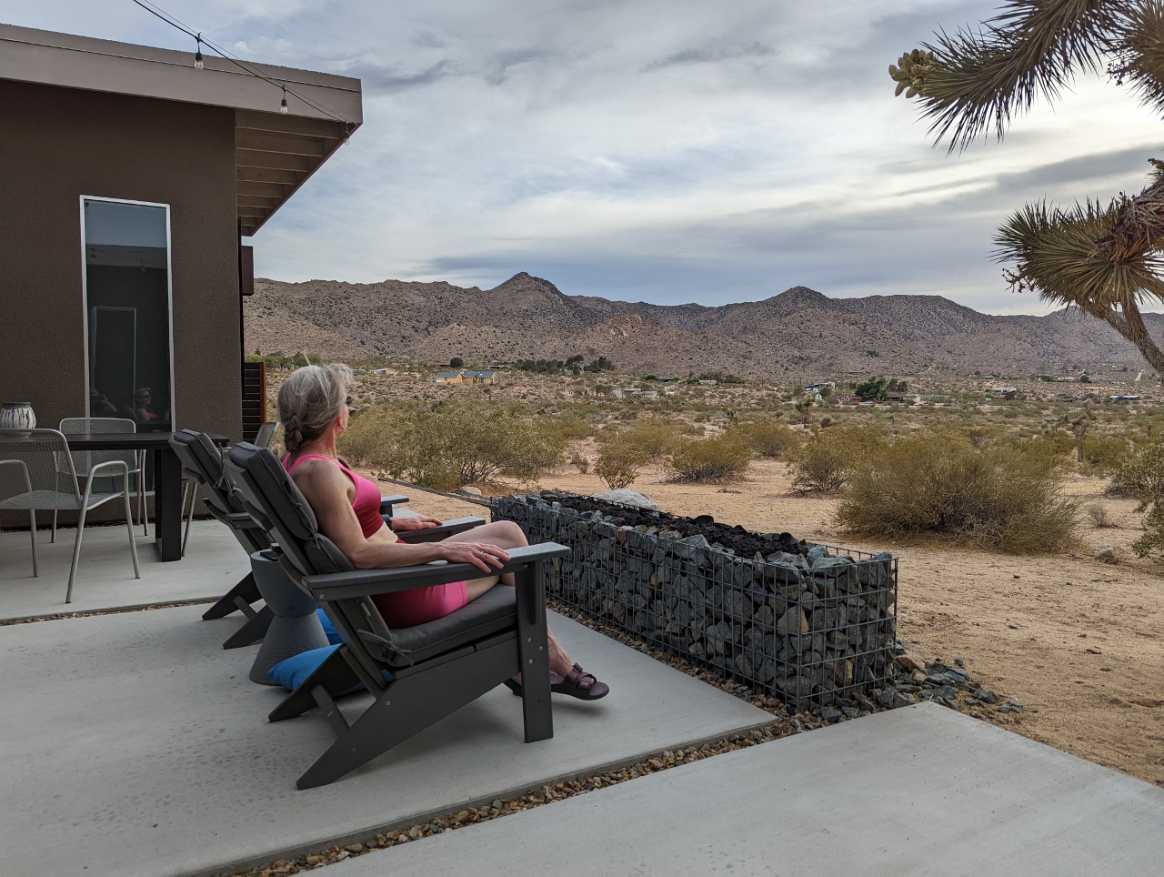 |
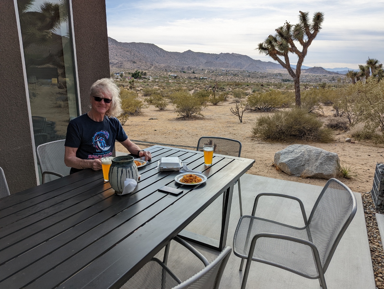
Evening
Position: 34°5.67’N, -116°17.30’W
Enjoying the evening desert view from the patio at Shelter: One near Joshua Tree National Park.
|
 |
Click the travel log icon on the left to see these locations on a map. And a map of our most recent log entries always is available at mvdirona.com/maps. |
If your comment doesn't show up right away, send us email and we'll dredge it out of the spam filter.