The 408-mile (656 km) stretch of Highway 50 across Nevada is dubbed “The Loneliest Road in America,” with only a few small towns along the way and not much else. The route was the main overland route across Nevada until the first trans-continental railway was completed in 1869, and was part of the Pony Express mail service route between Missouri and California in 1860-1861.
From Cedar City, we crossed into Nevada and drove the Loneliest Road to Reno. We enjoyed the scenery en route, and in the few settlements we passed through. The day’s 522-mile (840-km) run brought our total trip mileage to 3,787 miles (6,094 km) across 11 states (South Carolina, Georgia, Florida, Alabama, Mississippi, Louisiana, Texas, New Mexico, Arizona, Utah, and Nevada).
Below are highlights from June 27th, 2021. Click any image for a larger view, or click the position to view the location on a map. And a live map of our current route and most recent log entries always is available at mvdirona.com/maps.
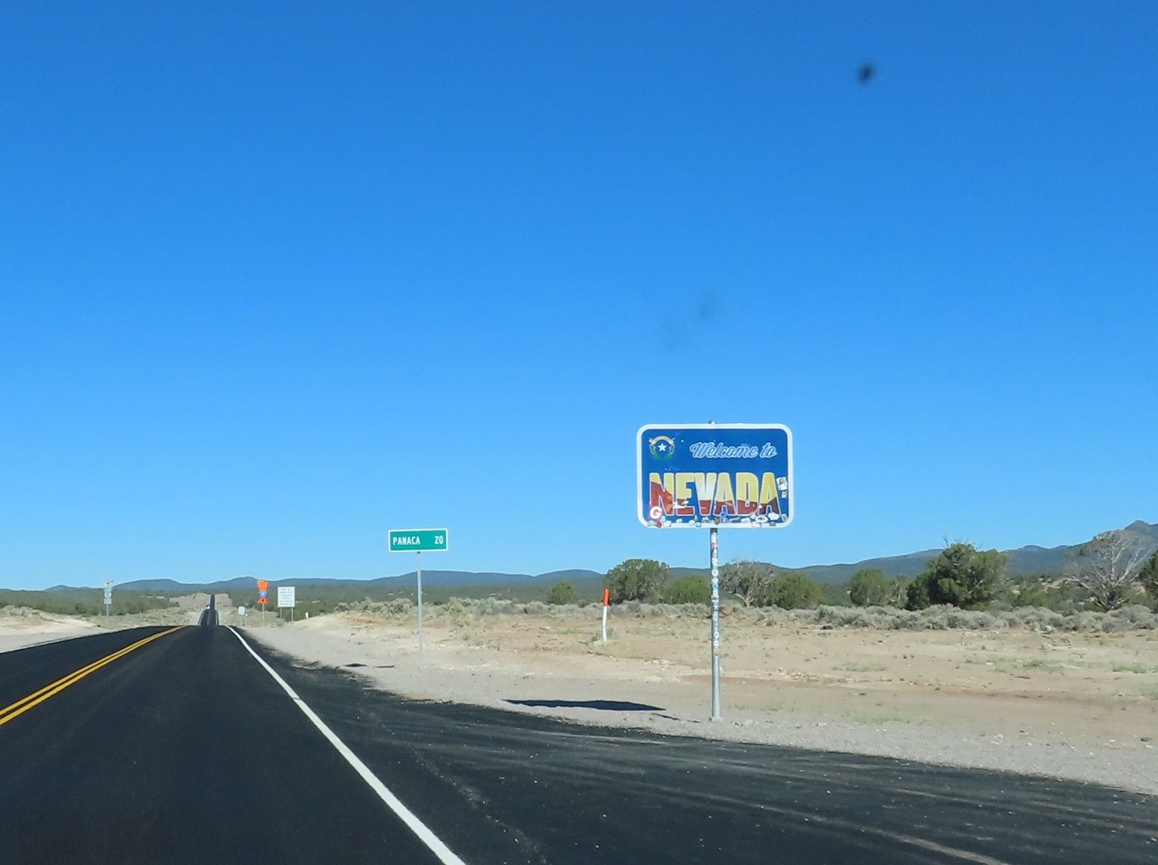 |
Nevada
Position: 37°44.33’N, -114°1.00’W
Crossing the border from Utah to Nevada en route from Cedar City to Reno.
|
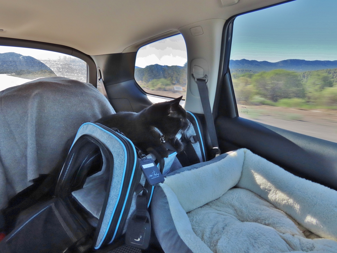 |
Spitfire
Position: 37°46.00’N, -114°11.49’W
Spitfire enjoying the drive while resting on top of his carrier. He seems able to find an endless number of different places to sleep and perch.
|
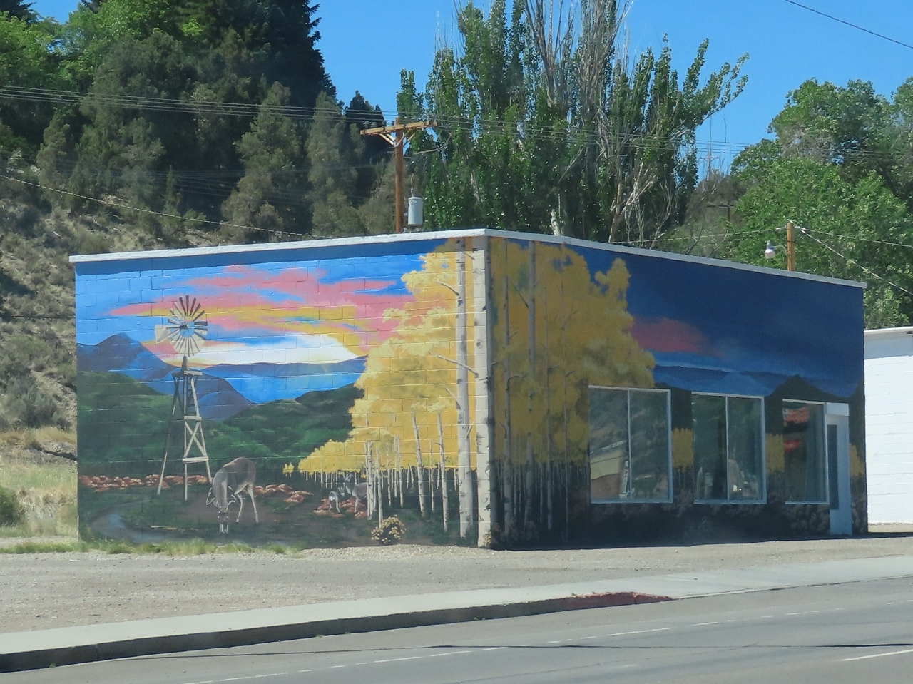 |
Ely
Position: 39°15.05’N, -114°52.37’W
Ely, Nevada is full of murals depicting the history and culture of the area.
|
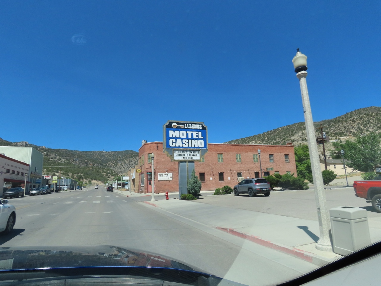 |
Casino
Position: 39°15.16’N, -114°52.70’W
We’re in Nevada now, so even the smallest towns have several casinos. This is one of four in tiny Ely (population 4,035) with nearly 500 slot machines between them.
|
|
|
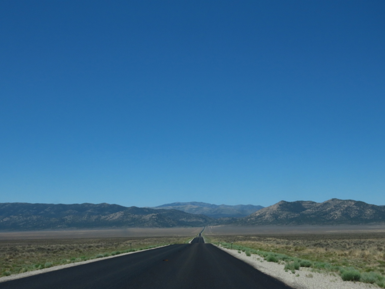
Loneliest Road
Position: 39°25.74’N, -115°10.79’W
The 408-mile (656 km) stretch of Highway 50 across Nevada is dubbed “The Loneliest Road in America,” with only a few small towns along the way and not much else. The route was the main overland route across Nevada until the first trans-continental railway was completed in 1869, and was part of the Pony Express mail service route between Missouri and California in 1860-1861.
|
 |
Eureka, NV
Position: 39°28.72’N, -115°56.61’W
Eureka, Nevada is one of the few towns along “The Loneliest Road in America,” and claims to be the friendliest.
|
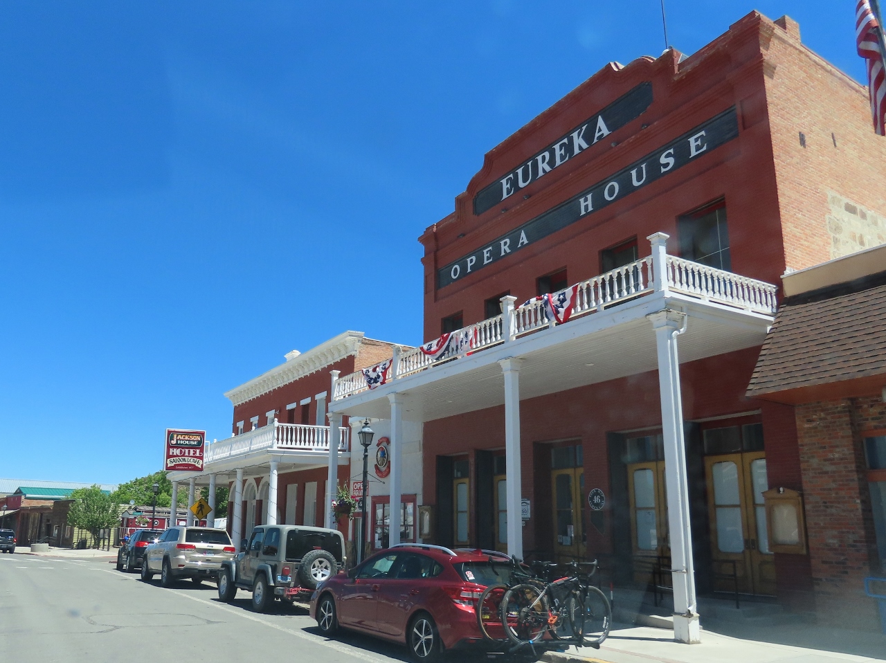 |
Opera House
Position: 39°29.59’N, -115°57.27’W
Century-old buildings along the four-block main street in Eureka, Nevada. The town is faring well compared to most others on the Loneliest Road due to still-active gold mining operations. The Goldstrike Mine here is the largest in North America.
|
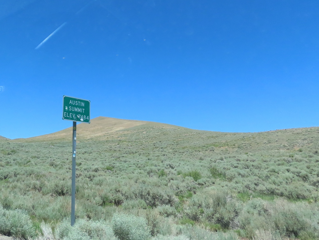 |
Austin Summit
Position: 39°28.86’N, -117°0.91’W
The Austin Summit mountain pass at elevation 7,484 ft (12,044 km).
|
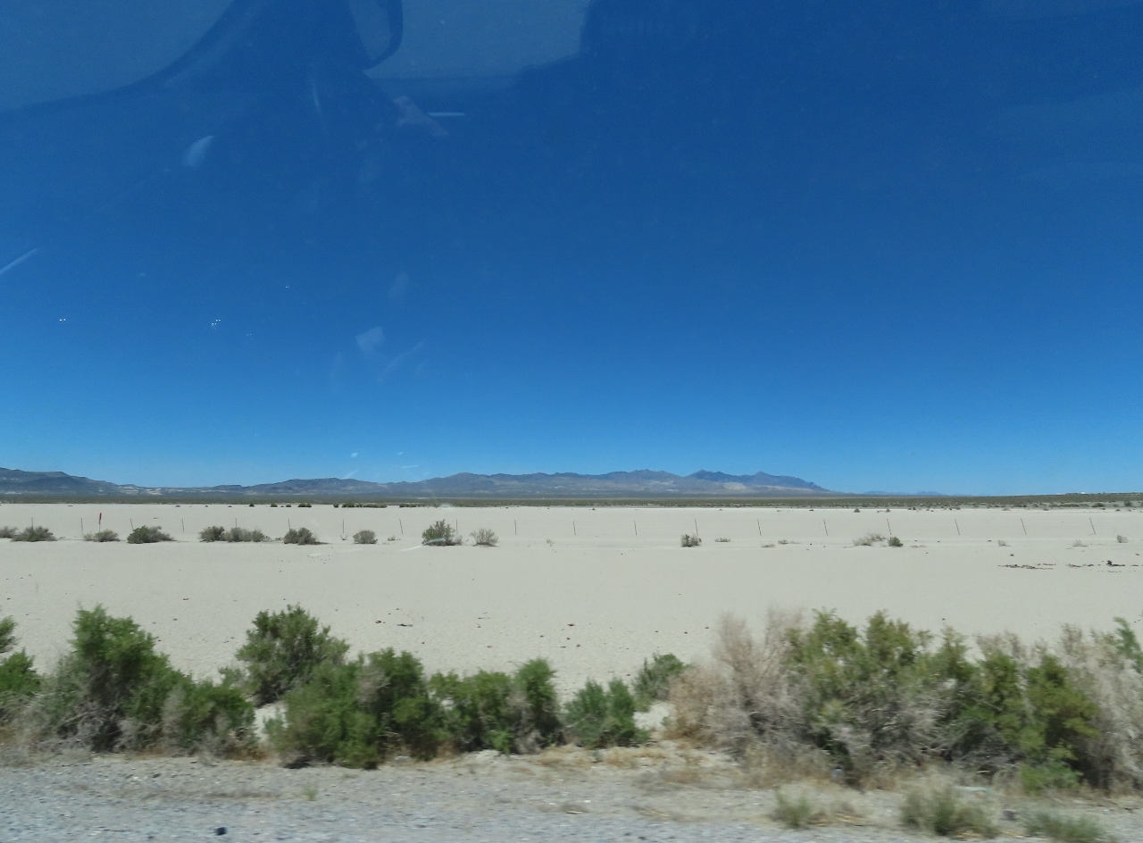 |
Sand Flats
Position: 39°17.09’N, -118°11.58’W
Extensive salt flats east of Fallon, Nevada. A third-generation family operation mines the flats, bringing out 25,000 tons in a good year. Nearby is Fallon Naval Air Station, home to Naval Fighter Weapons School (TOPGUN) since it was transferred from Miramar, CA in 1996.
|
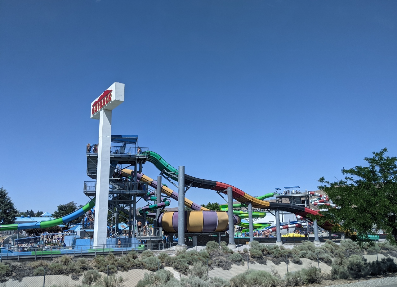 |
Water Park
Position: 39°31.63’N, -119°42.26’W
Water park outside Reno, Nevada. In today’s hot weather, the park is very popular.
|
 |
Travel Router
Position: 39°32.02’N, -119°43.43’W
Another useful piece of equipment in our travel kit is a TP-Link Portable Nano travel router. We hook the router up to the hotel wifi, and all of our devices, including the Fire TV, automatically get connectivity without having to authenticate on each one separately.
|
 |
Flushing Water Maker
Position: 39°32.02’N, -119°43.43’W
Performing a remote flush of Dirona‘s water maker from our hotel room in Reno.
|
 |
97 Degrees
Position: 39°31.89’N, -119°43.29’W
It’s a hot 97°F (tk C) in Reno, Nevada. It’s an improvement over the 113 F (45 C) we saw in Tucson, but still pretty hot.
|
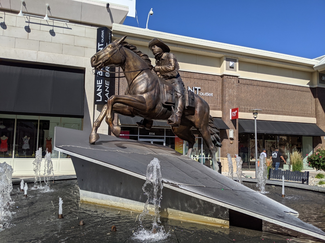 |
Pony Express
Position: 39°31.91’N, -119°43.23’W
A statue commemorating the Pony Express mail service that operated between Missouri and California for 18 months starting in 1860. The service used a relay system of horse-mounted riders who roared into town, changed mounts, and roared out, eventually passing their cargo off to another rider. The service halved the previous 20-day mail delivery time, but was not a financial success and went bankrupt with the introduction of a trans-continental telegraph service.
|
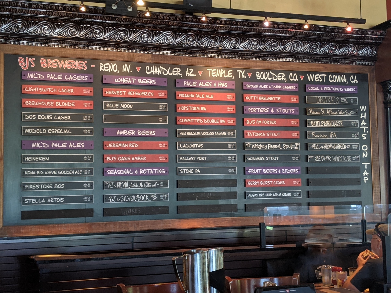 |
BJs Breweries
Position: 39°32.05’N, -119°42.98’W
An excellent selection of beer to choose from with our dinner at BJs Brewery in Reno, Nevada.
|
 |
Click the travel log icon on the left to see these locations on a map, with the complete log of our cruise.
On the map page, clicking on a camera or text icon will display a picture and/or log entry for that location, and clicking on the smaller icons along the route will display latitude, longitude and other navigation data for that location. And a live map of our current route and most recent log entries always is available at mvdirona.com/maps. |
Is it called the loneliest road just because of the amount of road with nothing along it? Either way, looks like a beautiful drive!!
It was called that in a 1986 Life Magazine article along with a recommendation not to go there because there is nothing to see. The name was meant to be negative, but the area kind of adopted it and used it for marketing. The state of Nevada created a “survival passport” that you could get stamped along the way, and a certificate if you completed the drive.
There’s not a lot there, but it isn’t quite as empty as Life Magazine described it, and the scenery is quite striking. We really enjoyed the drive.
Jennifer