Hell’s Backbone Bridge in Utah was a major engineering feet when the Civilian Conservation Corps (CCC) built it in the 1930s. The bridge spans Hell’s Backbone, a narrow spine of rock with canyons dropping of steeply on either side. Completion of this bridge gave the first automobile connection between the towns of Boulder and Escalante. Before that, reaching Boulder from Escalante entailed a difficult, three-day wagon ride through the canyon.
From Torrey, Utah we began traveling west again, towards the Pacific Coast. We followed scenic Highway 12 west back towards Bryce Canyon, taking a detour on the old highway through Hell’s Backbone, and continued on to Cedar City, Utah for the night. The 215-mile (346-km) day brought our total trip mileage to 3,265 miles (5,254 km) across 10 states (South Carolina, Georgia, Florida, Alabama, Mississippi, Louisiana, Texas, New Mexico, Arizona and Utah).
Below are highlights from June 25th, 2021. Click any image for a larger view, or click the position to view the location on a map. And a live map of our current route and most recent log entries always is available at mvdirona.com/maps.
 |
Homestead Overlook
Position: 38°2.01’N, -111°20.15’W
Sweeping view across Capitol Reef from Homestead Lookout, heading south from Torrey on Scenic Byway 12 as we turn west to head towards the Pacific Coast.
|
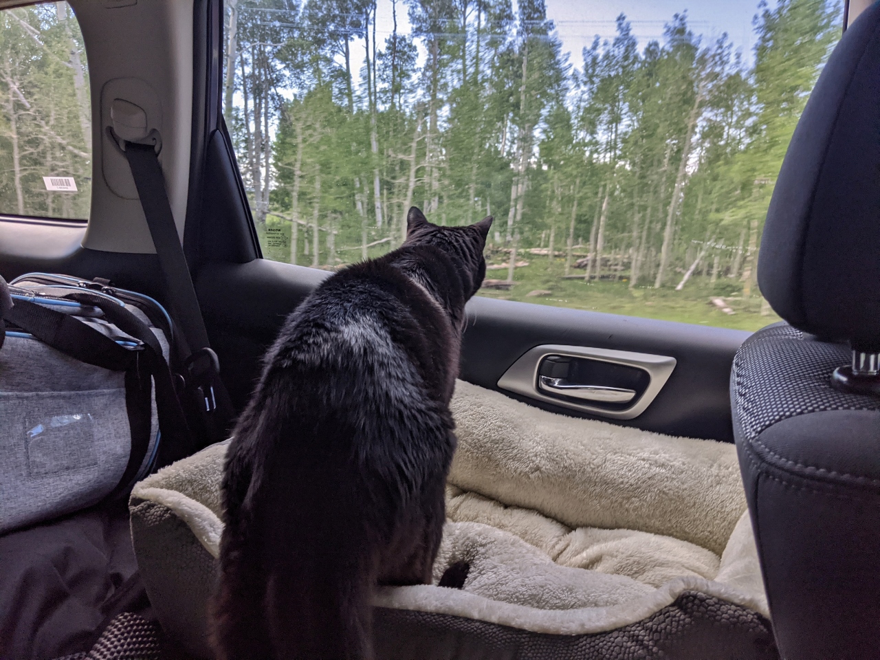 |
Too Close
Position: 38°1.63’N, -111°20.61’W
Spitfire never liked anything too close to the boat and seems to feel the same way in the car. He was quite concerned when we passed through a forest with trees crowding the road.
|
 |
Boulder
Position: 37°53.88’N, -111°26.44’W
From the late 1800s, when the first settlers arrived in isolated Boulder UT, until the 1980s, almost every local family made a living through ranching. The view from here during this period would have featured their bright green irrigated hayfields, and likely cattle. For a variety of reasons, many in the area gave up ranching and their fields now have returned to the drought-tolerant plants visible today.
|
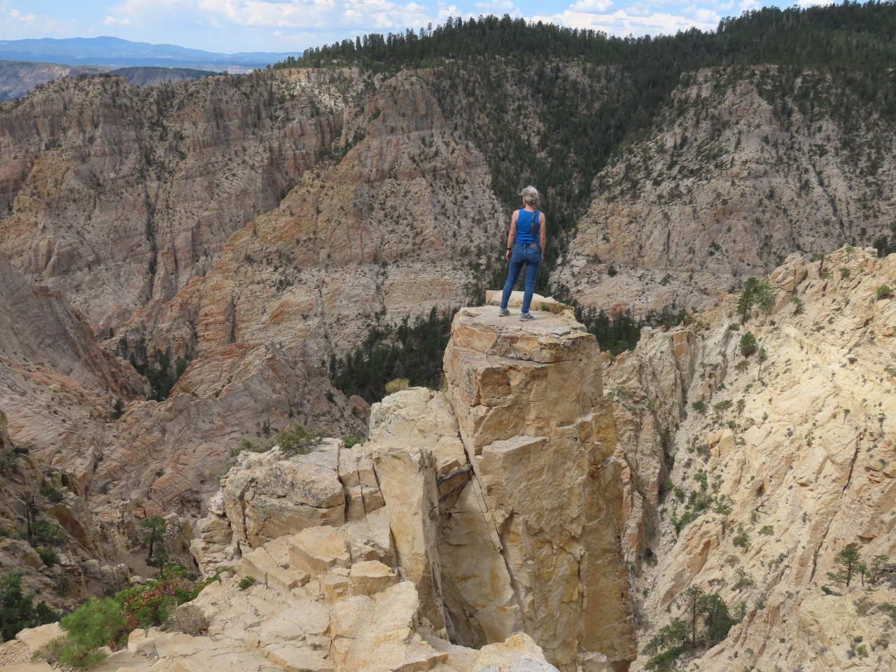 |
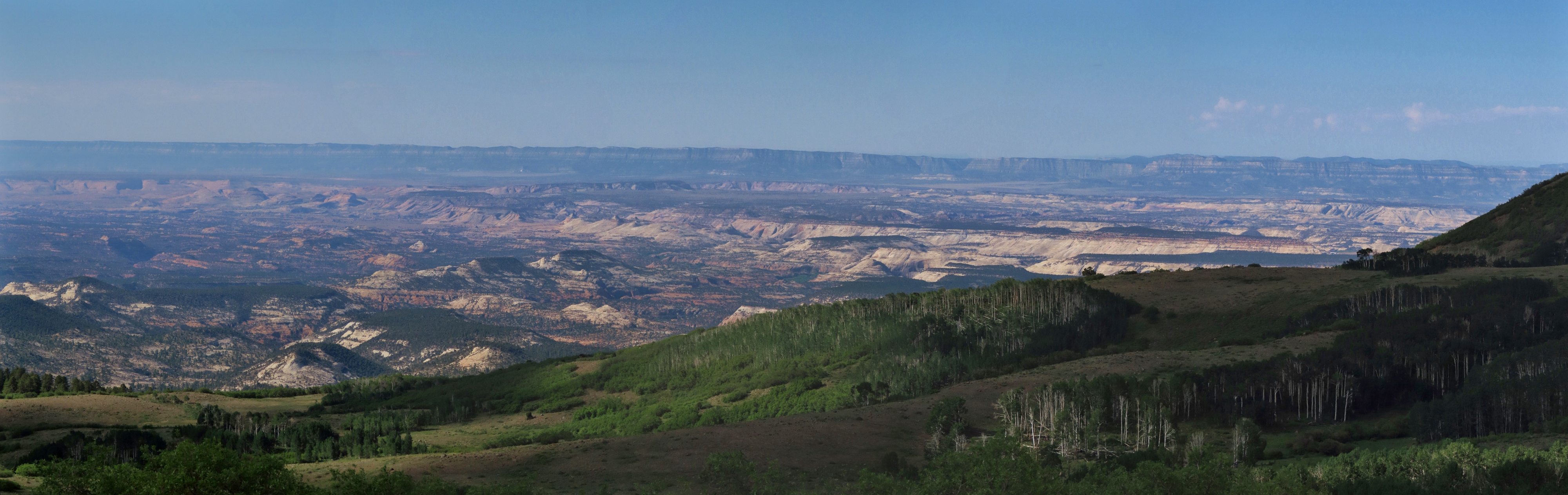
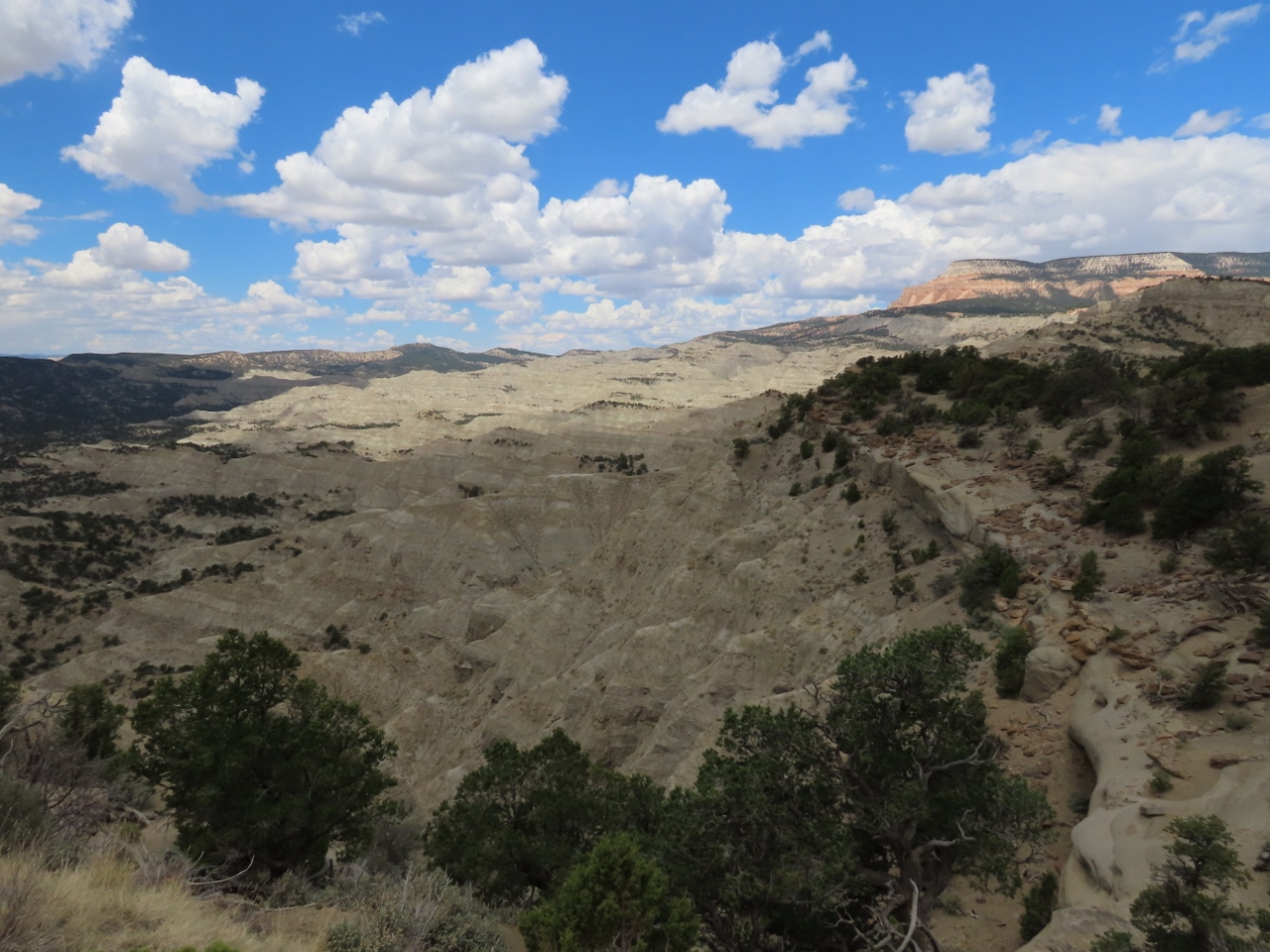
Box-Death Hollow Wilderness
Position: 37°58.22’N, -111°35.95’W
Jennifer taking in the spectacular view to Box-Death Hollow Wilderness along the Hell’s Backbone Scenic Drive. The canyon name derives from the livestock that fell to their death trying to cross.
|
|
|
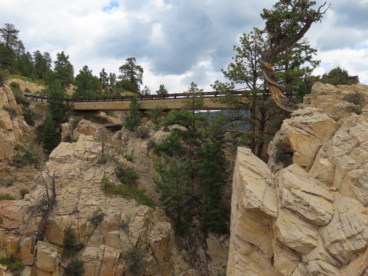
Hell’s Backbone Bridge
Position: 37°58.22’N, -111°35.95’W
Hell’s Backbone Bridge was a major engineering feet when the Civilian Conservation Corps (CCC) built it in the 1930s. The bridge spans Hell’s Backbone, a narrow spine of rock with canyons dropping of steeply on either side. Completion of this bridge gave the first automobile connection between the towns of Boulder and Escalante. Before that, reaching Boulder from Escalante entailed a difficult, three-day wagon ride through the canyon.
|
 |
Georgie’s Mexican Cafe
Position: 37°46.23’N, -111°36.58’W
We picked up exceptional take-out tacos at Georgie’s Mexican Cafe in Escalante.
|
 |
Powell Point Vista
Position: 37°39.33’N, -111°50.29’W
The region pictured here was part of the last uncharted territory in the continental United States when John Wesley Powell launched a mapping expedition in 1871, completing the task 4 years later. Powell also surveyed the Grand Canyon, where a large memorial to him stands.
|
 |
Kodachrome Basin
Position: 37°33.75’N, -111°59.77’W
View to Bryce Canyon National Park along Utah Scenic Byway 12 near Cannonville. We’re looping back towards the park en route to the Pacific Coast.
|
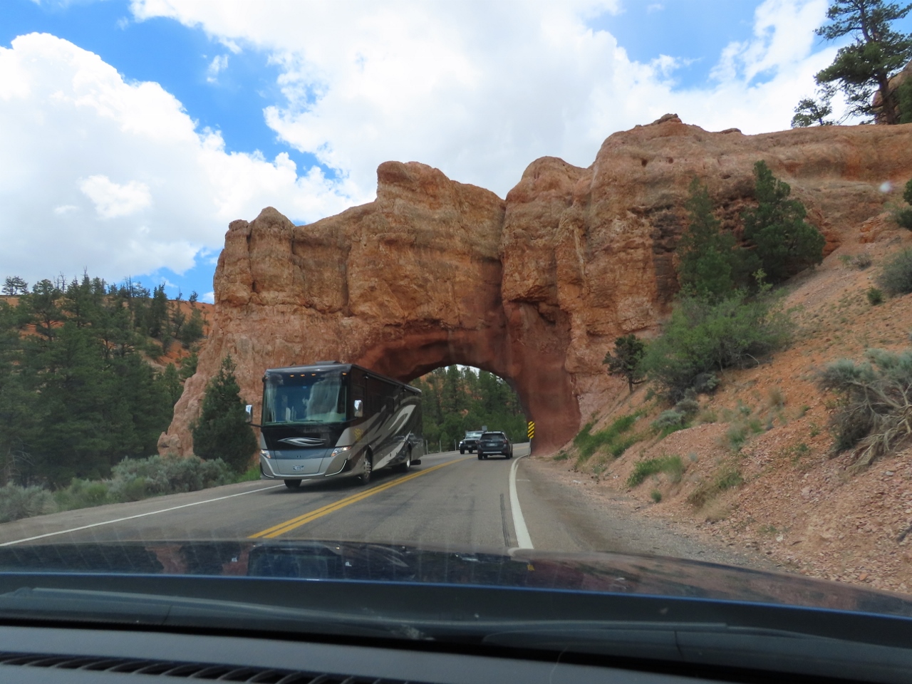 |
Red Canyon Arch
Position: 37°43.78’N, -112°16.44’W
Passing back under Red Canyon Arch as we briefly retrace our route past Bryce Canyon National Park en route to Cedar City UT.
|
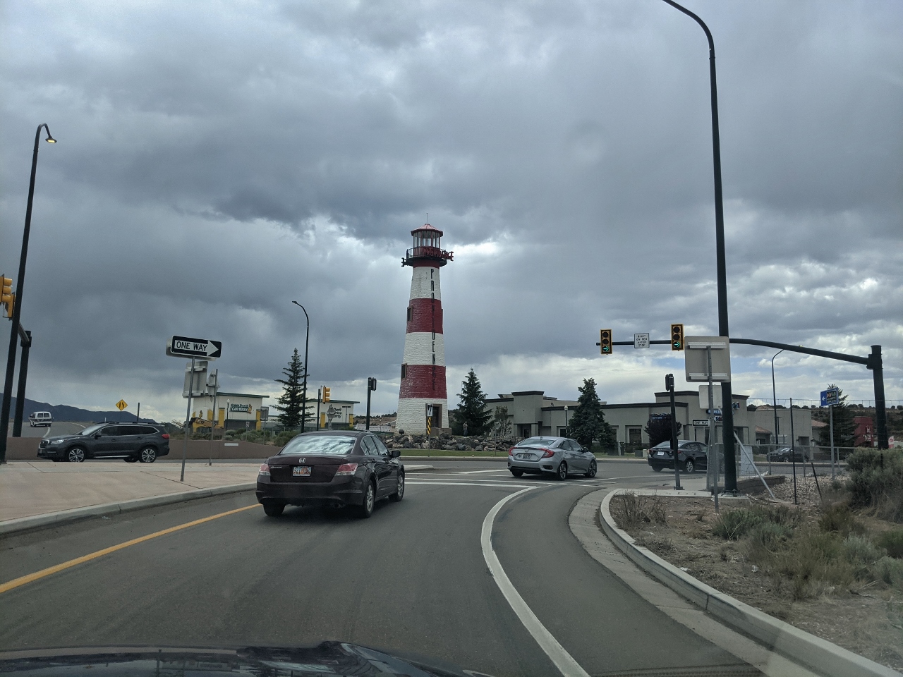 |
Cedar City Lighthouse
Position: 37°39.48’N, -113°4.88’W
The 88-ft (27m) Cedar City Lighthouse, built in 2000, is said to be the tallest inland lighthouse in the US. Cedar City is miles from any water, and was built as a distinctive feature for a property development.
|
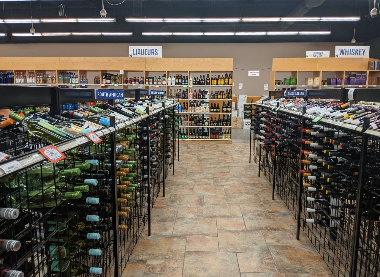 |
Liquor Store
Position: 37°38.95’N, -113°5.25’W
We’re in Utah, where you can only buy products with less than 4% alcohol in a grocery store. So we stopped in at a liquor store in Cedar City to pickup a couple of bottles of wine and a case of IPA.
|
 |
Window Ledge
Position: 37°39.25’N, -113°4.58’W
Spitfire checking out the view from the window ledge at our hotel in Cedar City. He’s doing remarkably well with all the travel and new environments.
|
 |
Click the travel log icon on the left to see these locations on a map, with the complete log of our cruise.
On the map page, clicking on a camera or text icon will display a picture and/or log entry for that location, and clicking on the smaller icons along the route will display latitude, longitude and other navigation data for that location. And a live map of our current route and most recent log entries always is available at mvdirona.com/maps. |
If your comment doesn't show up right away, send us email and we'll dredge it out of the spam filter.