Bryce Canyon National Park in southern Utah is packed with spectacular, spire-shaped formations. Known as “hoodoos”, these red-rock pillars form over time as holes in the canyon walls form when frost enlarges cracks. The holes eventually collapse, leaving the hoodoos.
From Springdale UT, near Zion National Park, we drove 232 miles northeast to Bryce Canyon, and on to Torrey, UT for the night. This brought out total trip mileage to 3,050 miles (4,908 km) across 10 states (South Carolina, Georgia, Florida, Alabama, Mississippi, Louisiana, Texas, New Mexico, Arizona and Utah).
We started the day taking in the amazing scenery along the Zion-Mt. Carmel Scenic Drive, where we transited the historic Zion tunnel. That afternoon we passed through Red Canyon and made the scenic drive through Bryce Canyon National Park, with excellent views to the hoodoos, arches and other formations. Bryce Canyon isn’t very far from Zion, but the formations are surprisingly different, and equally dramatic.
Below are highlights from June 23, 2021. Click any image for a larger view, or click the position to view the location on a map. And a live map of our current route and most recent log entries always is available at mvdirona.com/maps.
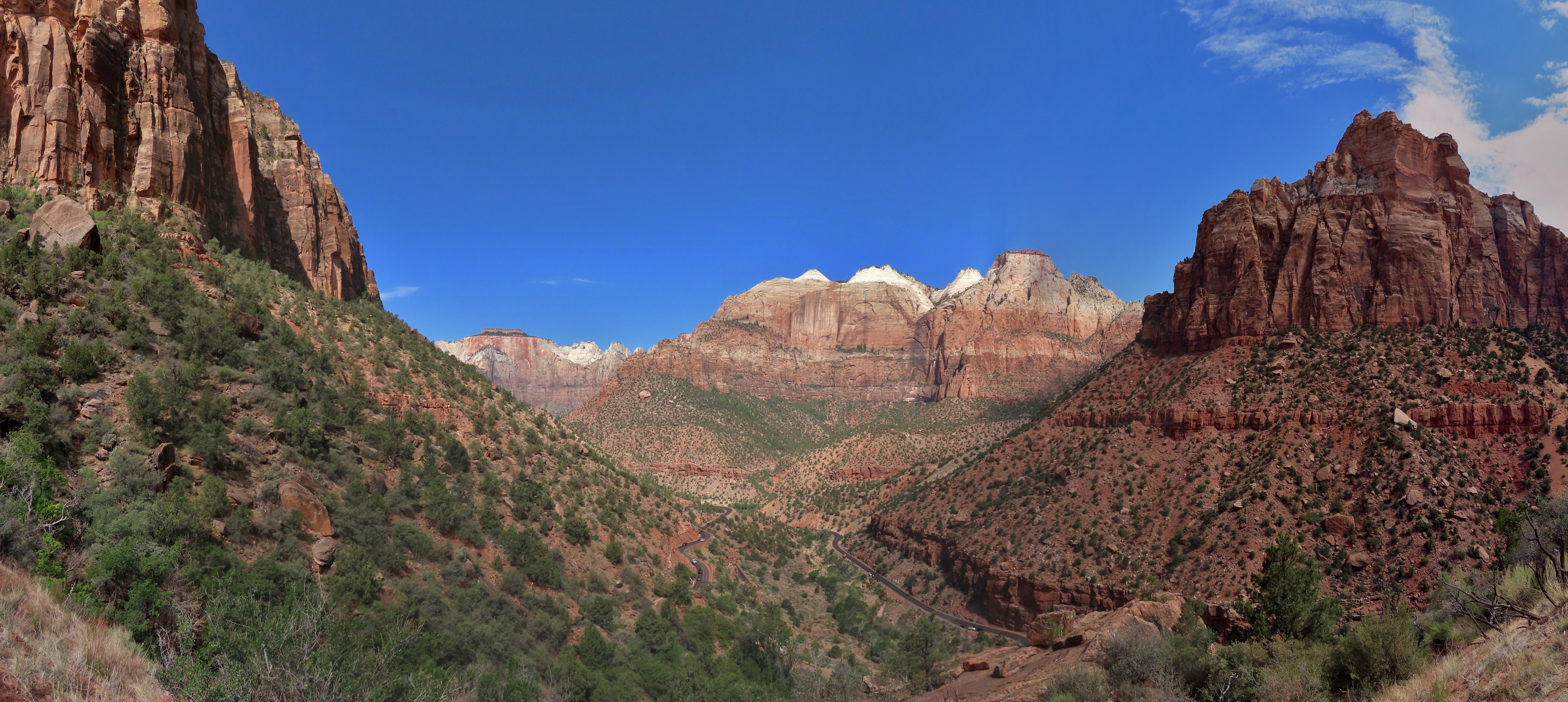 |
Zion Scenic Drive
Position: 37°12.88’N, -112°57.49’W
Amazing view into Zion Canyon from the switchbacks as we follow the Zion-Mt. Carmel Scenic Drive east from Springdale.
|
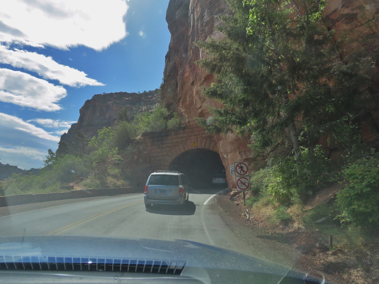 |
Zion Tunnel
Position: 37°12.75’N, -112°57.77’W
Entering the historic Zion Tunnel. The 5,000-ft tunnel was completed in the 1920s and is too small to fit larger trucks and RVs, so during the day traffic is one-way only to allow higher vehicles to run in the center.
|
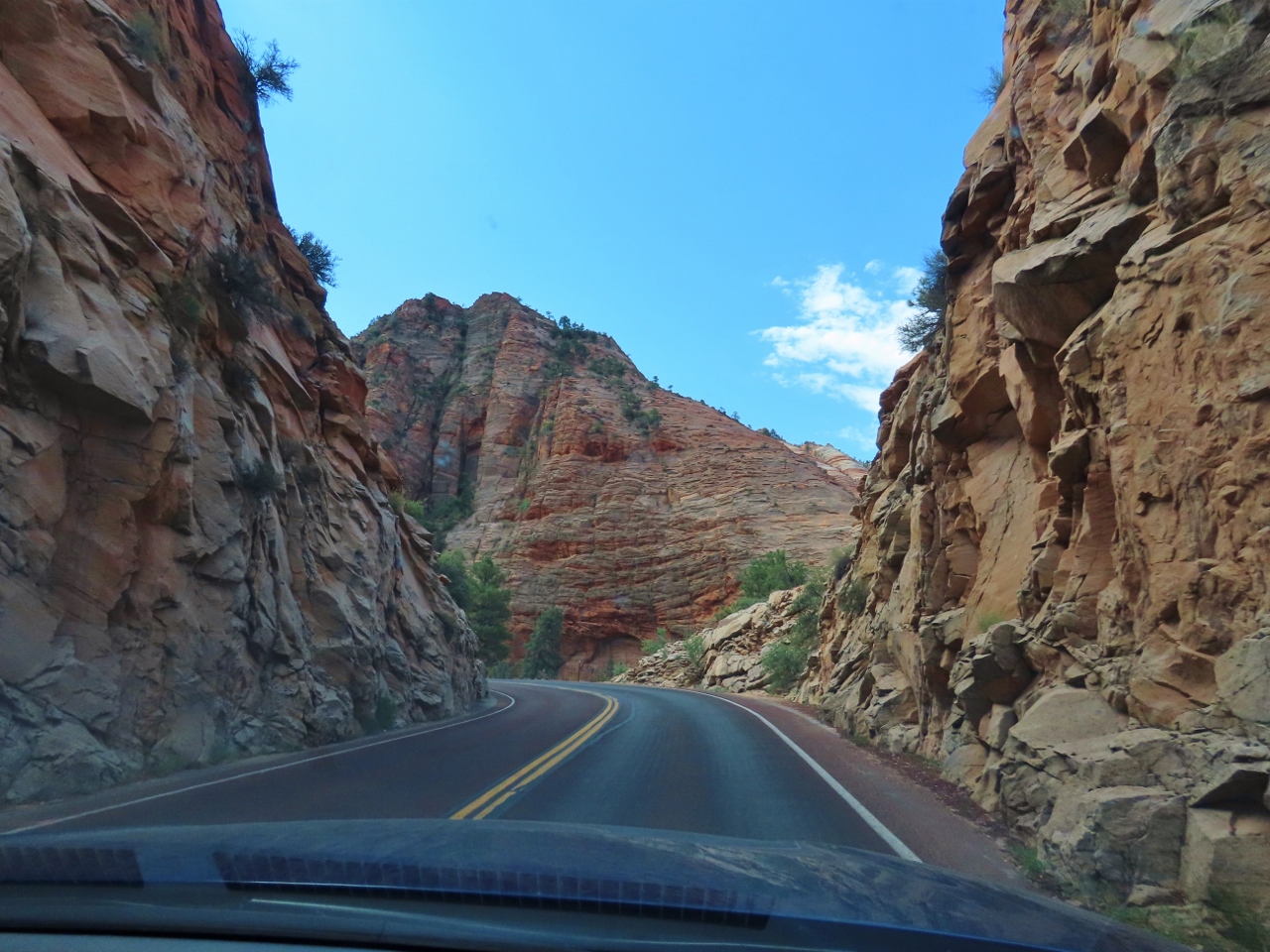 |
Tunnel Exit
Position: 37°12.68’N, -112°57.49’W
Steep walls and beautiful scenery as we exit the Zion Tunnel.
|
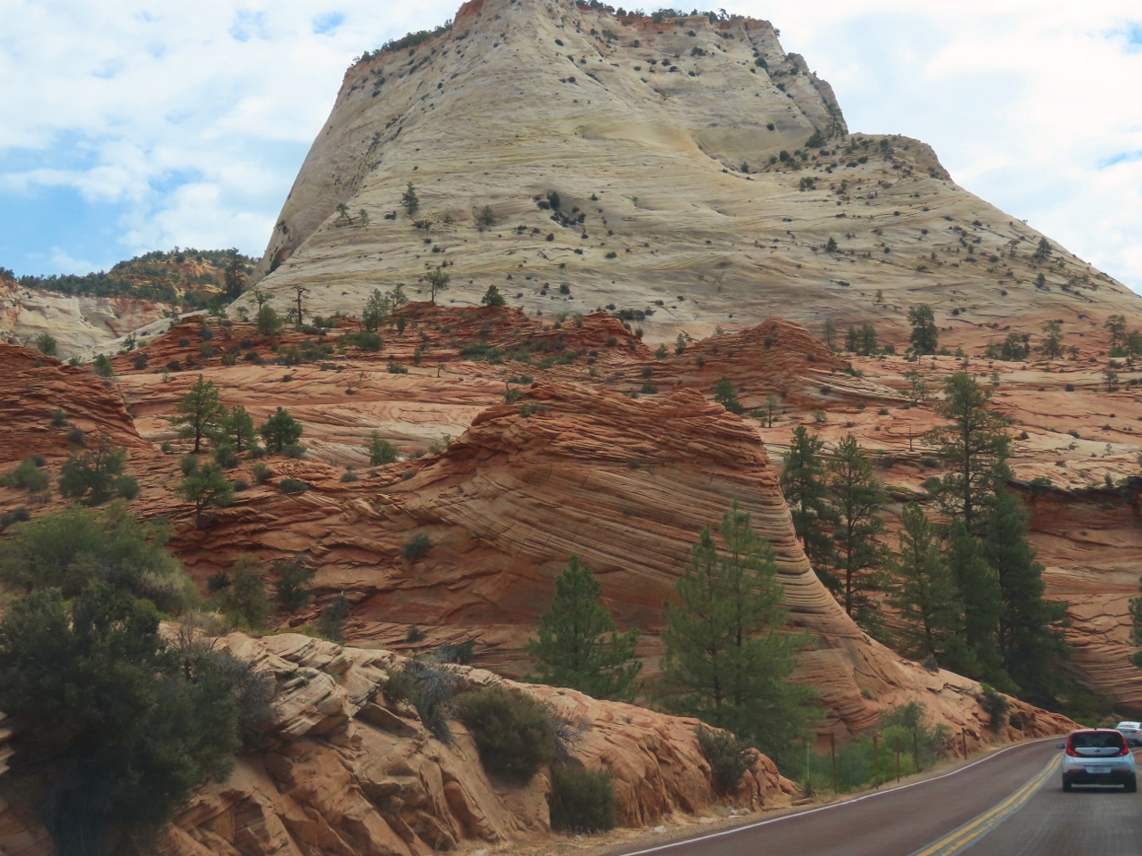 |
Swirls
Position: 37°13.41’N, -112°54.76’W
Striking swirling patterns in the red sandstone along the Zion-Mt. Carmel Scenic Drive.
|
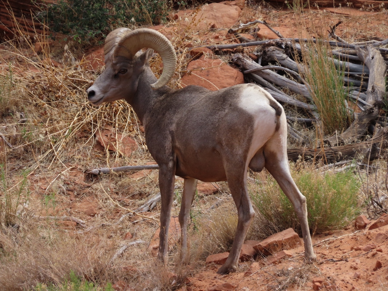 |
Bighorn
Position: 37°13.46’N, -112°54.07’W
Bighorn sheep near the east entrance to Zion National Park. The sheep are adept climbers and prefer steep-cliffed areas where they can more easily escape predators such as mountain lions.
|
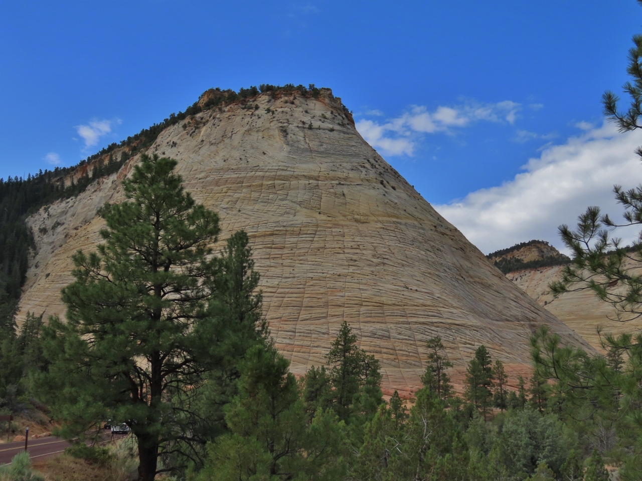 |
Checkerboard Mesa
Position: 37°13.83’N, -112°52.72’W
The unusual crack patterns on this formation resemble a checkerboard.
|
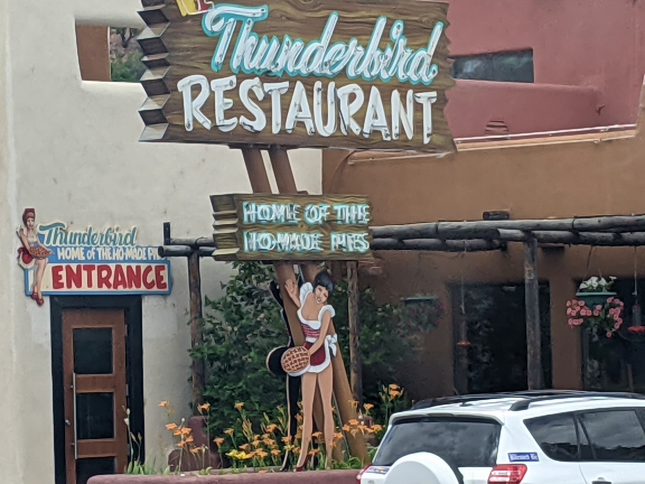 |
Ho-Made Pies
Position: 37°13.39’N, -112°40.87’W
The famous sign outside the Thunderbird roadside restaurant in Mt Carmel, Utah. In 1931, the owner used the spelling “Ho-Made” instead of “Home Made” simply to fit on the sign.
|
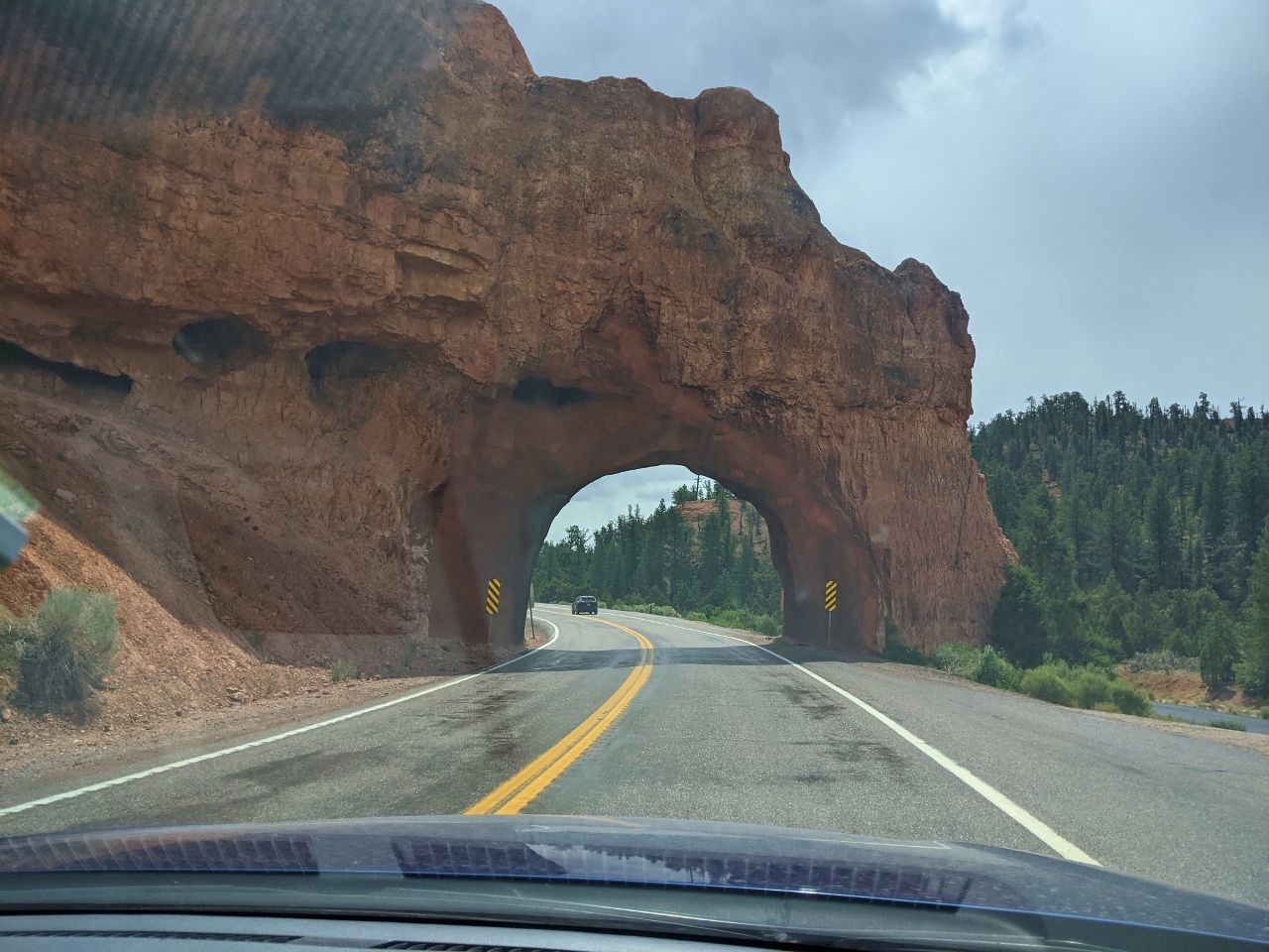 |
Red Canyon Arch
Position: 37°44.43’N, -112°17.86’W
Passing through Red Canyon Arch, one of two tunnels that for 90 years have marked the unnofficial entry to Bryce Canyon National Park.
|
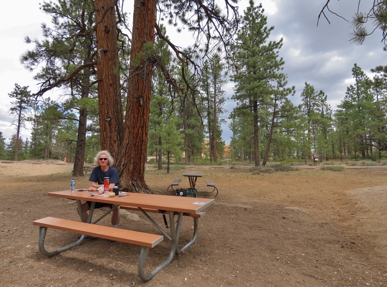 |
Picnic Lunch
Position: 37°38.10’N, -112°9.94’W
Lunch in a picnic area just inside Bryce Canyon National Park before we make the scenic drive through the canyon.
|
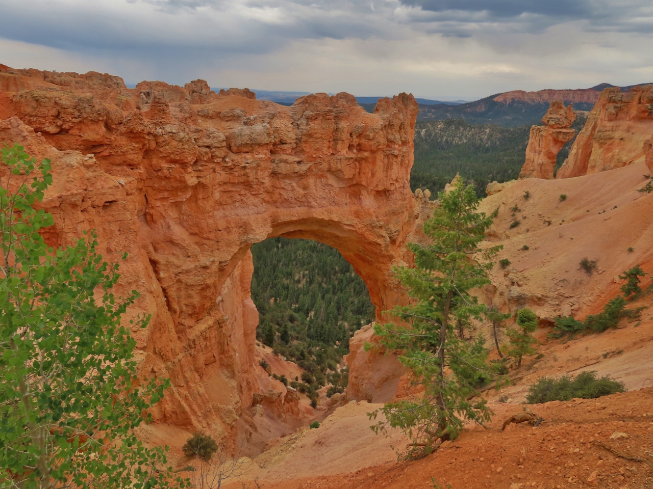 |
Natural Bridge
Position: 37°31.92’N, -112°15.65’W
The fantastic Natural Bridge arch, along the scenic drive through Bryce Canyon National Park.
|
 |
Agua Canyon
Position: 37°31.00’N, -112°15.89’W
The view from the Agua Canyon lookout at Bryce Canyon National Park. The bulbous spire on the left is called a ‘hoodoo’. Holes in the canyon walls form when frost enlarges cracks. These holes, or windows, eventually collapse, leaving the hoodoos.
|
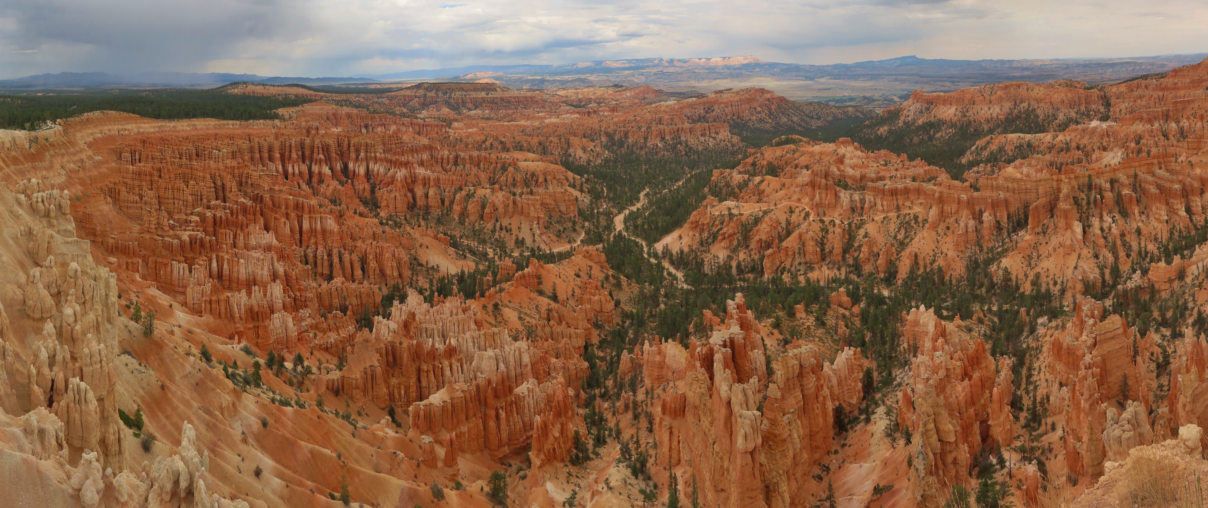 |
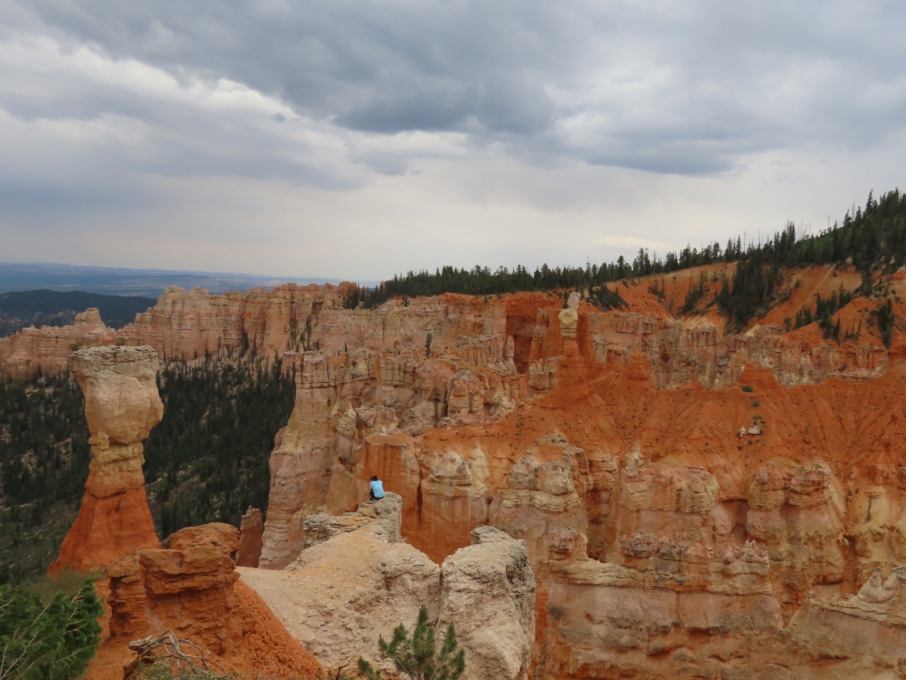
Inspiration Point
Position: 37°36.82’N, -112°10.13’W
View from popular Inspiration Point in Bryce Canyon National Park across the spectacular hoodoo formations. When we arrived into the park earlier, the parking lot here was full so we couldn’t enter, but luckily there was space when we finished the scenic drive. The view really is amazing. Bryce Canyon isn’t very far from Zion, but the formations are surprisingly different, and equally dramatic.
|
|
|
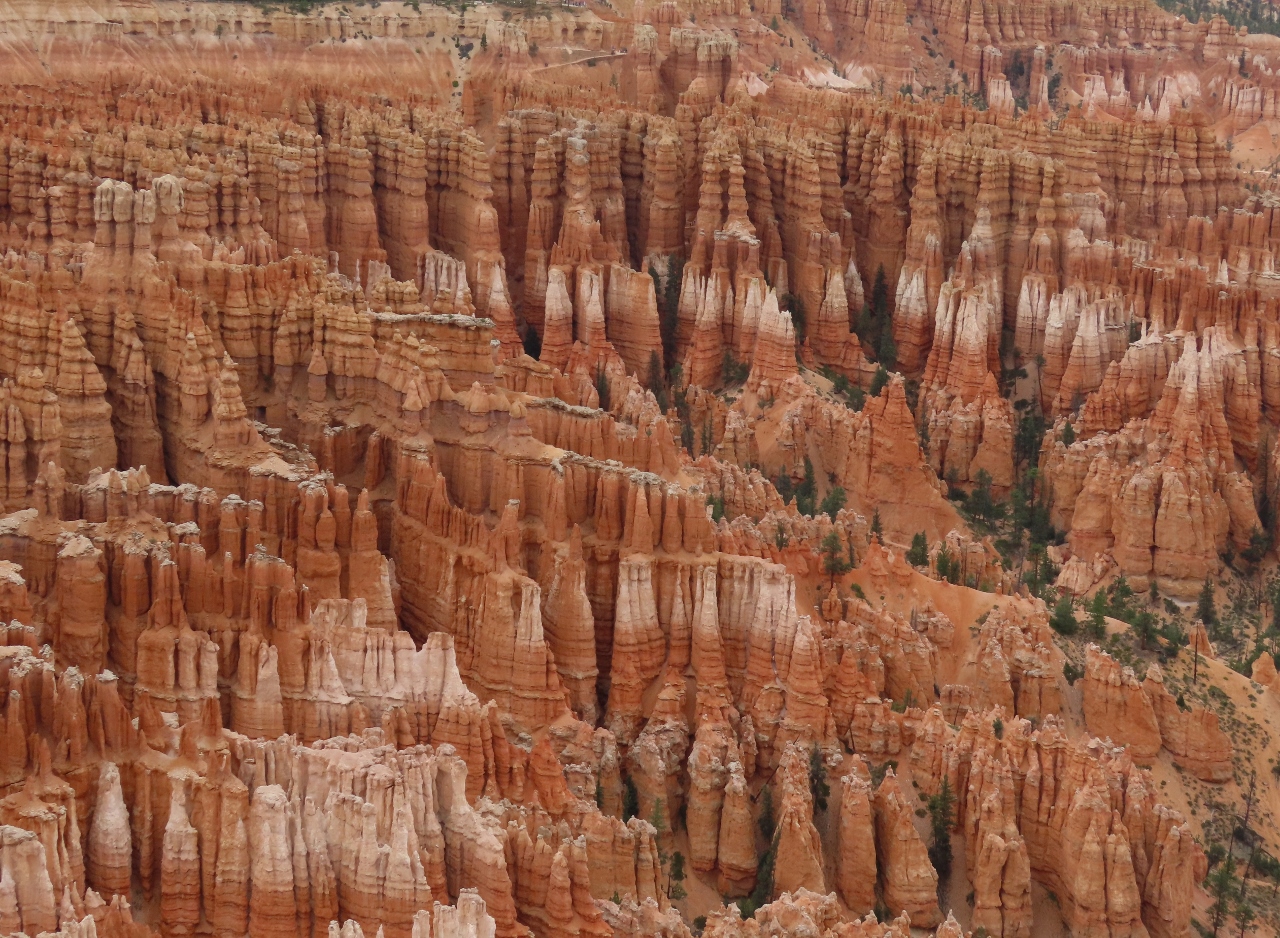
Hoodoos
Position: 37°36.80’N, -112°10.16’W
Close-up view to the hoodoo formations visible from Inspiration Point. Just amazing.
|
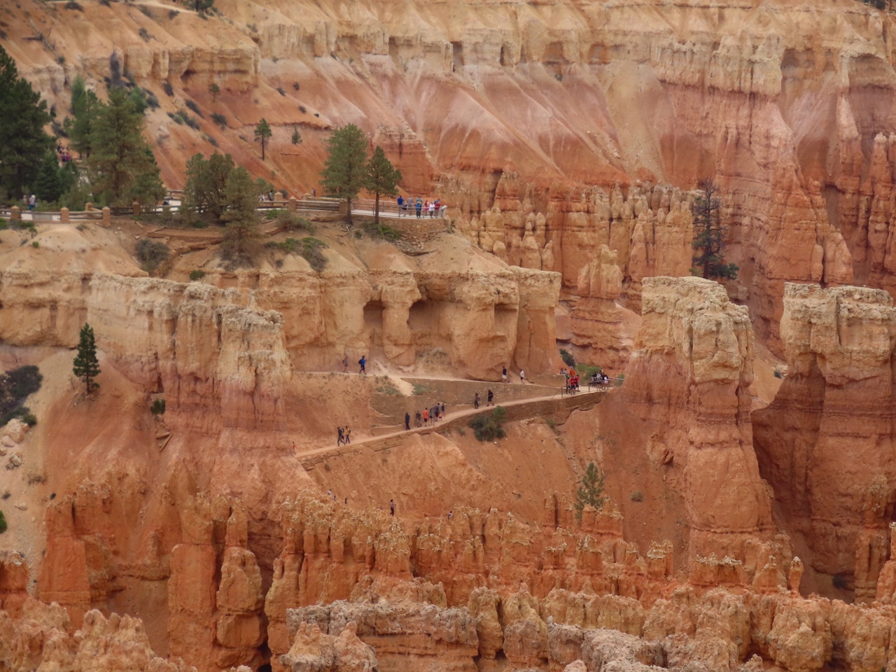 |
Hikers
Position: 37°36.85’N, -112°10.17’W
Hikers at the trailhead for one of the trails that descend into Bryce Canyon. We’ll definitely have to return to explore those trails and get close-up to the formations.
|
 |
Cows
Position: 38°28.56’N, -111°49.94’W
Cows wandering across the road as we drive Utah State Route 24 to Torrey.
|
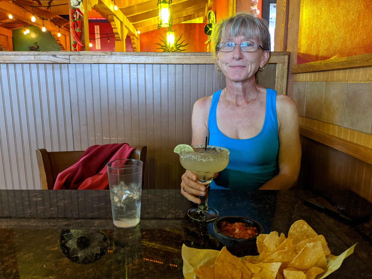 |
La Cueva
Position: 38°18.84’N, -111°23.23’W
A great meal, with delicious margaritas, at La Cueva Restaurante Mexicano right next to our hotel in Torrey, UT.
|
 |
Click the travel log icon on the left to see these locations on a map, with the complete log of our cruise.
On the map page, clicking on a camera or text icon will display a picture and/or log entry for that location, and clicking on the smaller icons along the route will display latitude, longitude and other navigation data for that location. And a live map of our current route and most recent log entries always is available at mvdirona.com/maps. |
If your comment doesn't show up right away, send us email and we'll dredge it out of the spam filter.