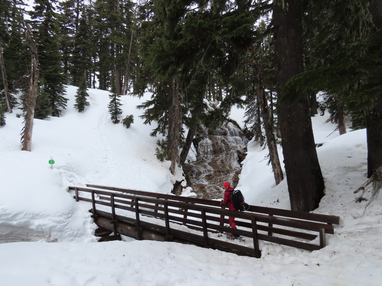
Umbrella Falls spills 59 ft (18m) down a sloping wall near the headwaters of the East Fork of Oregon’s Hood River. The trail to the falls is a popular summer hike, and in the winter is part of a system of marked snowshoe trails at the Mt. Hood Meadows ski area.
We hiked to Umbrella Falls for our final snowshoe at Mt. Hood, and our last of the 2021/2022 winter season. Mt Hood Meadows, nearing the end of their own season, was quiet when we arrived at 10am on a Saturday morning, but the parking lot had filled in quite a bit by noon. A light snow was falling as we drove up, and we had the trail all to ourselves as we made tracks in the fresh snow. The falls were beautiful, we enjoyed the hike, and after had another great evening in Government Camp and Tom Creek Haus before driving back to Seattle the following day.
Below are highlights from April 30 and May 1, 2022. Click any image for a larger view, or click the position to view the location on a map. And a map with our most recent log entries always is available at mvdirona.com/maps.
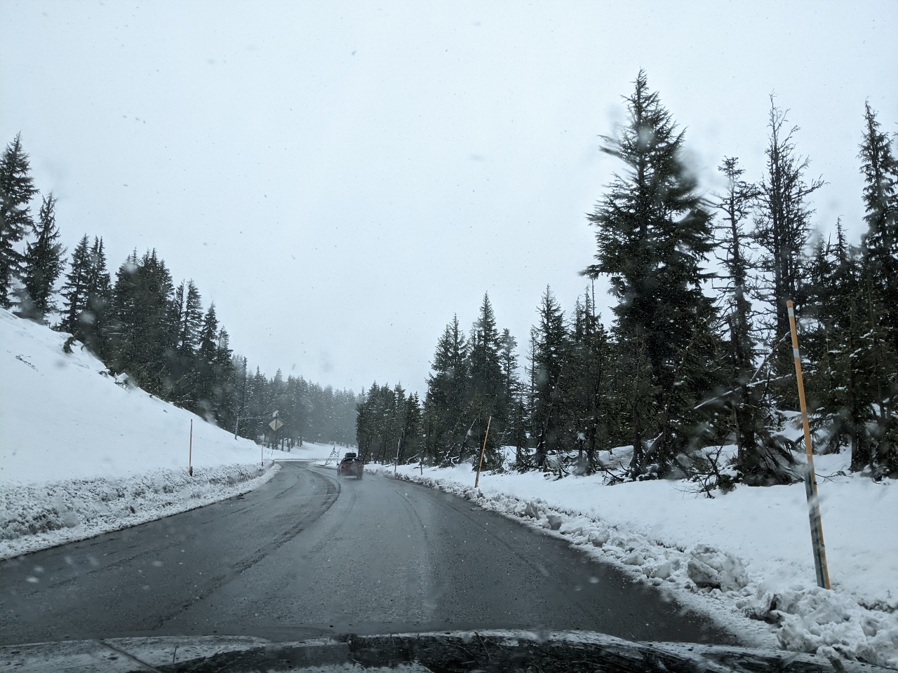 |
Snowing
Position: 45°19.50’N, -121°39.49’W
Fresh snow falling at elevation 5,170 ft (1,576 m) as we near Mt Hood Meadows to snowshoe.
|
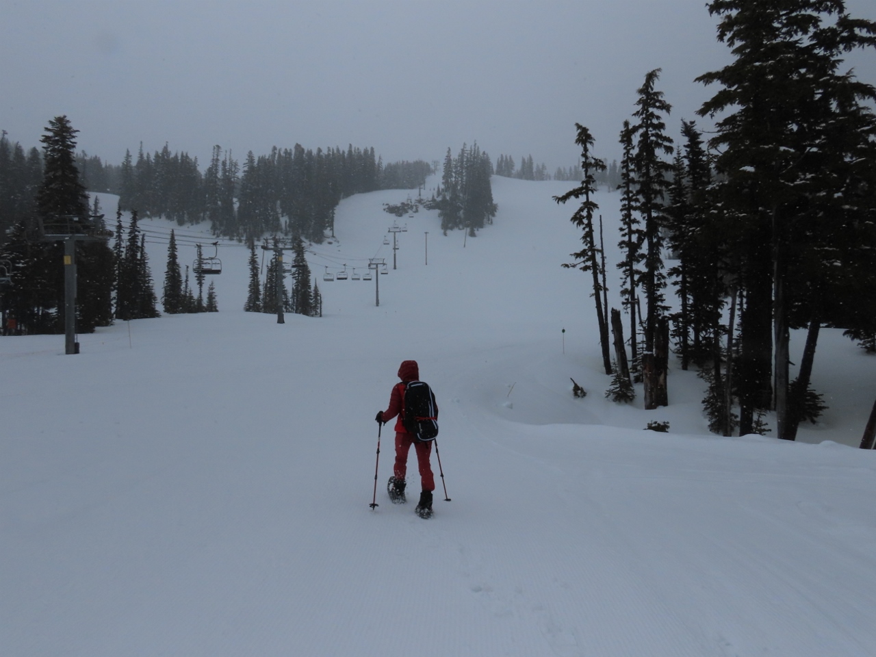 |
Mt Hood Meadows
Position: 45°19.93’N, -121°39.87’W
It’s 10 am, but things are pretty quiet at Mt Hood Meadows as we head out on their snowshoe trail to visit Umbrella Falls.
|
 |
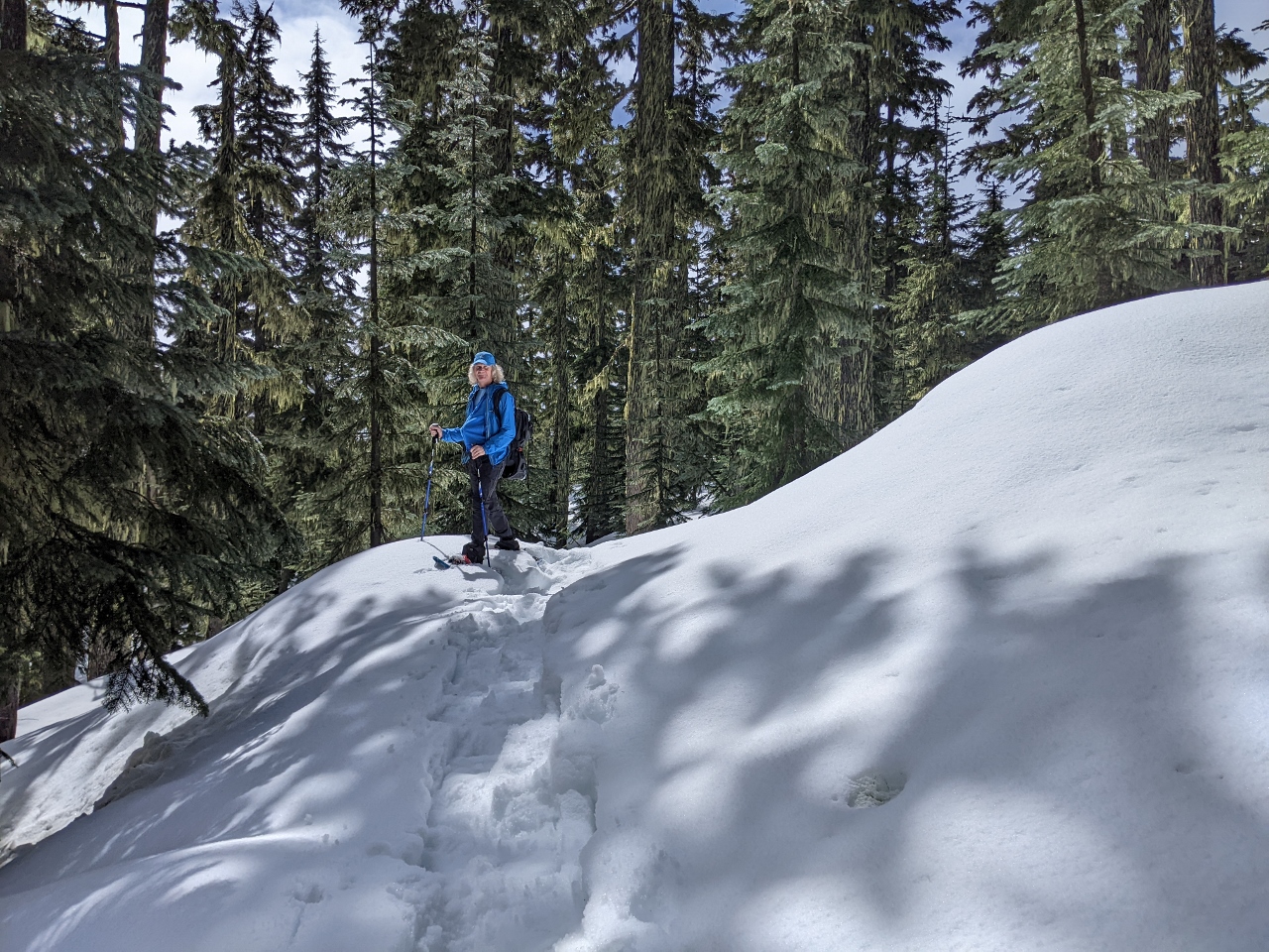
Forest
Position: 45°19.97’N, -121°39.69’W
The earlier overcast conditions are lifting and the days is starting to get a little brighter as we head through the forest.
|
 |
Big Umbrella Loop
Position: 45°19.98’N, -121°39.69’W
We don’t often walk marked snowshoe trails, and here are at the intersection of the Big Umbrella Loop towards Umbrella Falls, and an extended route, also to the falls. We took the longer route.
|
 |
Sunshine
Position: 45°19.29’N, -121°38.98’W
The sun broke through the clouds as we hiked the snowshoe trail at Mt Hood Meadows.
|
|
|
Umbrella Falls
Position: 45°19.72’N, -121°39.61’W
Umbrella Falls veil 59 ft (18m) down a sloping wall near the headwaters of the East Fork of the Hood River. The hike to the falls is popular in summer too.
|
 |
Parking
Position: 45°19.82’N, -121°39.65’W
The parking lot at Mt. Hood Meadows filled in a lot in the two hours we were out hiking.
|
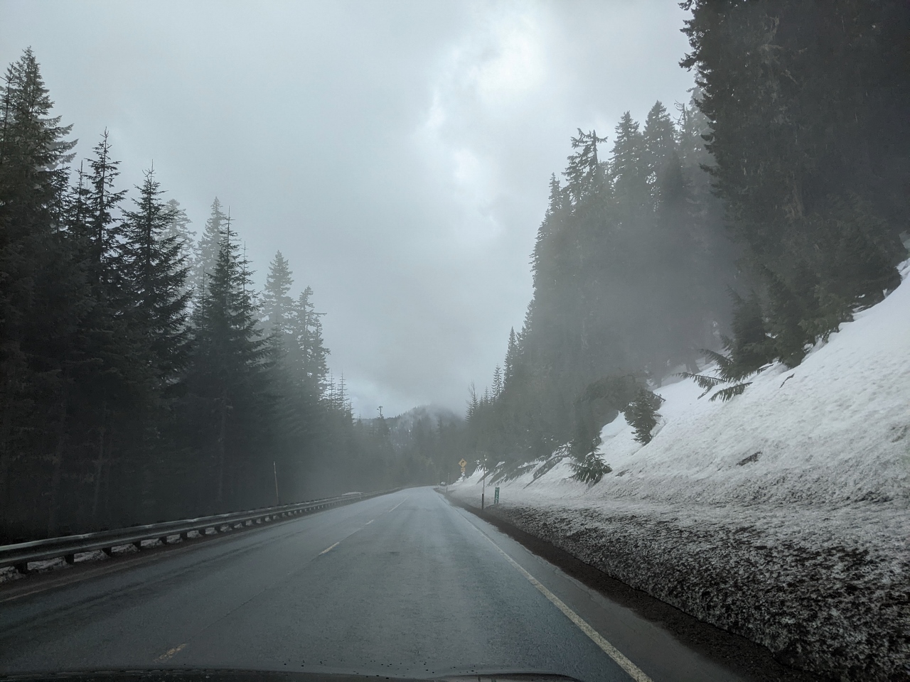 |
Steam Fog
Position: 45°18.67’N, -121°39.71’W
Heading into steam fog on our way back to Government Camp. As cold air drifts across the warmer road, the sudden cooling causes water vapor in the air above the road to condense.
|
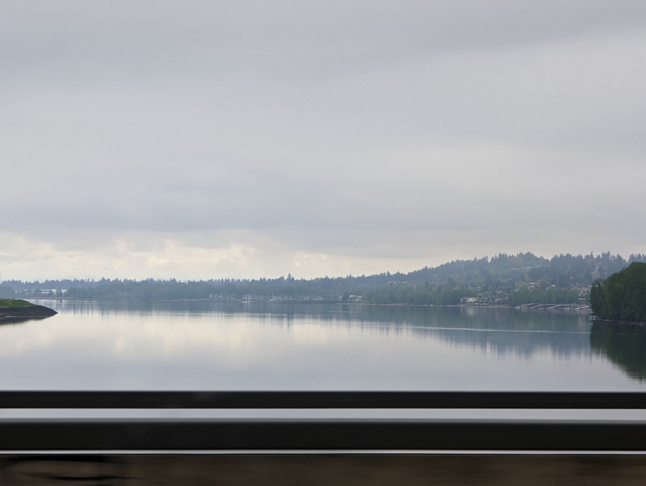 |
Columbia River
Position: 45°34.54’N, -122°32.73’W
Crossing the Columbia River on the return trip to Seattle from Government Camp.
|
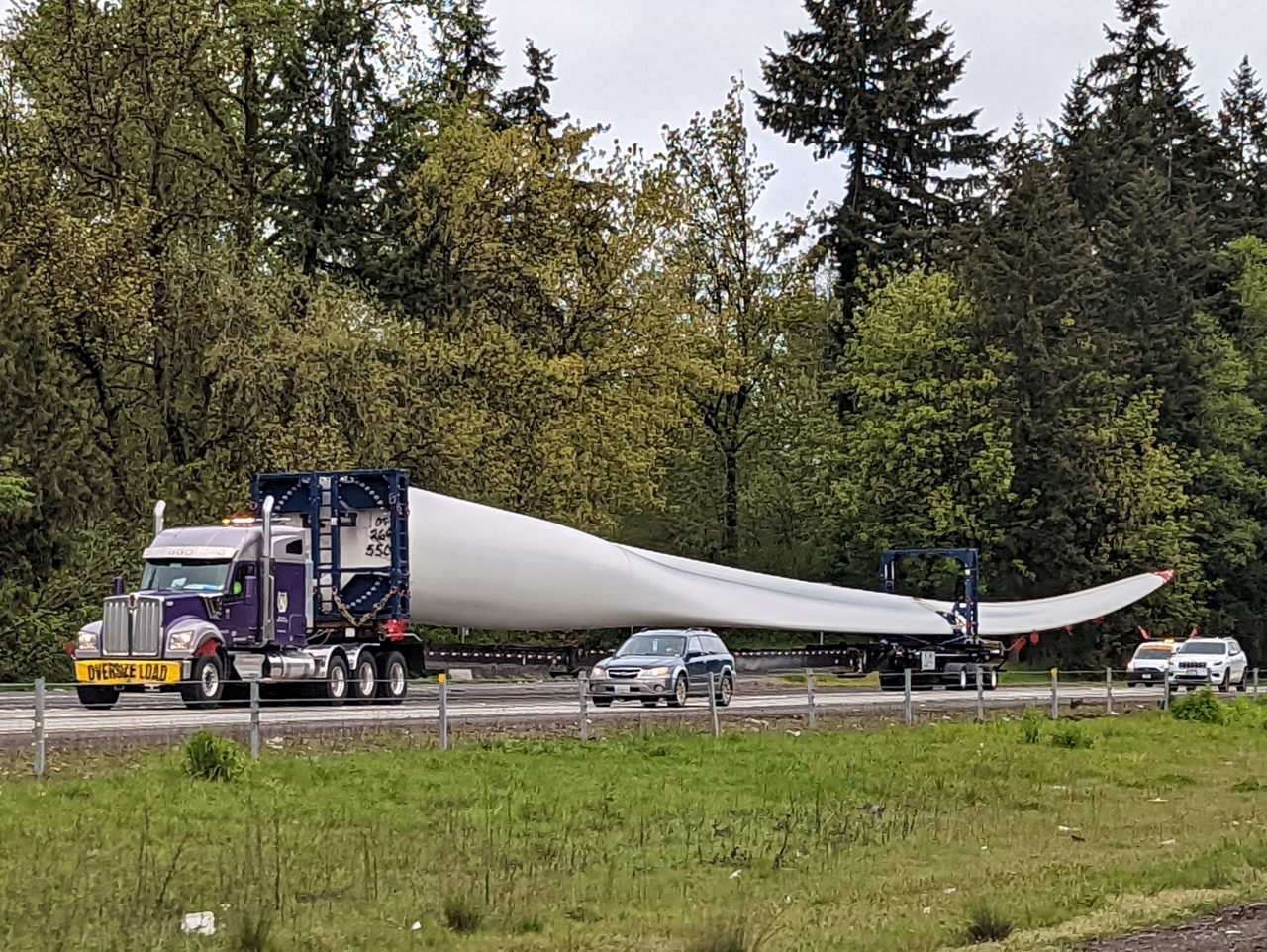 |
Blade
Position: 45°47.25’N, -122°40.44’W
One of several massive wind turbine blades being transported south along I-5.
|
 |
Gospodor Monument Park
Position: 46°27.23’N, -122°53.18’W
Statues in the now-defunct Gospodor Monument Park near Toledo, WA. Dominic Gospodor commissioned the controversial artworks on his land in 2002, but allocated no funds in his estate to maintain them when he died in 2010. Local residents and country officials did not support the monuments because they caused major traffic backups as people slowed down to look and take pictures.
|
 |
Click the travel log icon on the left to see these locations on a map. And a map of our most recent log entries always is available at mvdirona.com/maps. |
As you’ve probably read, yesterday (3rd July) a big chunk (“serac”) of an Italian Alps glacier collapsed killing several hikers downstream. Fingers are pointing towards the abnormal temperatures, 10C/50F on the peak of 3,300 mt/11,000 ft. Aren’t you afraid of that risk hiking within “warmer” temperatures and what metrics do you check ?
There is risk of avalanche in places we go in the Washington State area so we get avalanche reports early in the day and increase the care and being more selective in where we go as avalanche risk goes up. We generally don’t hike below glaciers so don’t see the risk that struck the Italian hikers very frequently. But, when we are under a potential glacier calving area, we understand the risk and try to move through quickly if we can’t avoid the area entirely.
A similar risk that we see frequently is rock slide prone areas. These are especially dangerous during or just after hard rain storms and they can be impossible to avoid when we are wilderness camping in some very steep areas. We avoid stopping in these areas and try to pass through them quickly but, when on these steep mountain roads, we are accepting some elevated risk.