The Timberline ski area at 11,249 ft (3,429 m) Mt. Hood has the longest ski season in North America, operating from October through August in ideal years. From a maximum altitude of 8,540 ft (2,602 m), the winter vertical drop is 4,540 ft (1,383 m) and in the summer it’s 2,616 ft (797 m). The topmost section, Palmer Snowfield, is accessible via the summer-only Palmer Express chairlift, or the Palmer Snowcat in other seasons. The winters are so harsh here, with winds over 100 mph (160 kph), that the lift cannot feasibly be de-iced and operated in the long winter season. So people instead take the snowcat to the top. And in the summer, as other ski resorts are closing down, Timberline is just opening their lift up.
At the base of the Palmer Snowfield, at altitude 6,799 ft (2,073 m), is the Silcox Hut. Built in 1939, Silcox Hut is one of many thousand public works project completed under the New Deal Agency that supplied paid jobs to the unemployed after the Great Depression. The hut initially was the upper terminal of the original Magic Mile chairlift and a warming hut for climbers. Today it can be rented out to groups for overnight lodging and is a popular wedding venue.
From altitude 5,807 ft (1,770 m) at the Timberline parking lot, we walked a mile (1.6km) in about an hour to reach Silcox Hut. We got some great views to Mt Hood along the way and afterwards stopped off at the historic Timberline Lodge for a drink. The Timberline Lodge was another New Deal project, built and furnished by local artisans between 1936 and 1938. The lodge is in the National Register of Historic places and served as the exterior of the Overlook Hotel in Stanley Kubrick’s film adaptation of the Stephen King’s horror novel The Shining.
Below are highlights from April 28th, 2022. Click any image for a larger view, or click the position to view the location on a map. And a map with our most recent log entries always is available at mvdirona.com/maps.
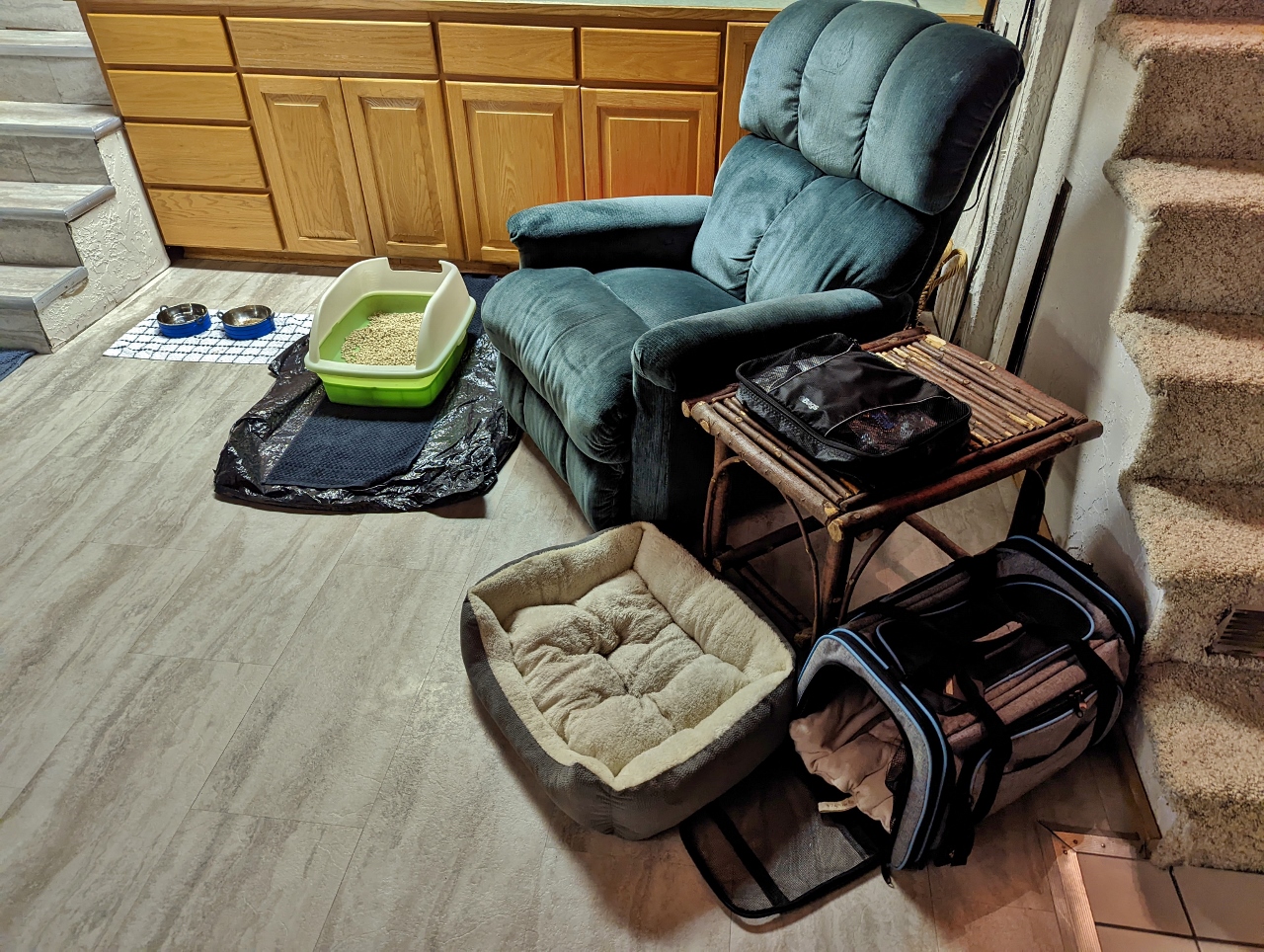 |
Kitty Central
Position: 45°18.34’N, -121°45.32’W
“Kitty Central” setup in the dining room of our cabin at Government Camp. Spitfire has been spending most of his time either underneath the master bed or tucked in his carry case while he gets used to the new digs.
|
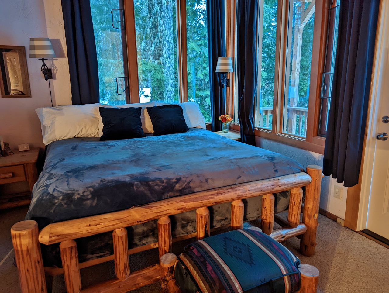 |
Master Bedroom
Position: 45°18.34’N, -121°45.32’W
We loved the light-filled master suite in our cabin at Government camp. The second-floor addition has views over Tom Creek and a small balcony at right.
|
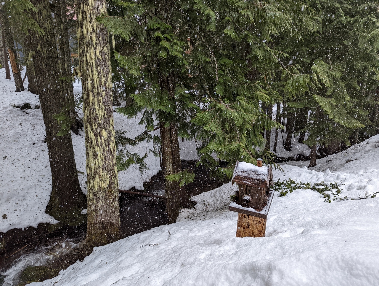 |
Tom Creek
Position: 45°18.34’N, -121°45.32’W
Tom Creek, the namesake for our cabin at Government House, viewed from the balcony off the master.
|
 |
Overcast
Position: 45°18.36’N, -121°42.21’W
Overcast conditions as we ascend Timberline Highway up to the Timberline Ski Area at Mt. Hood. We’re not holding much hope for good mountain views today.
|
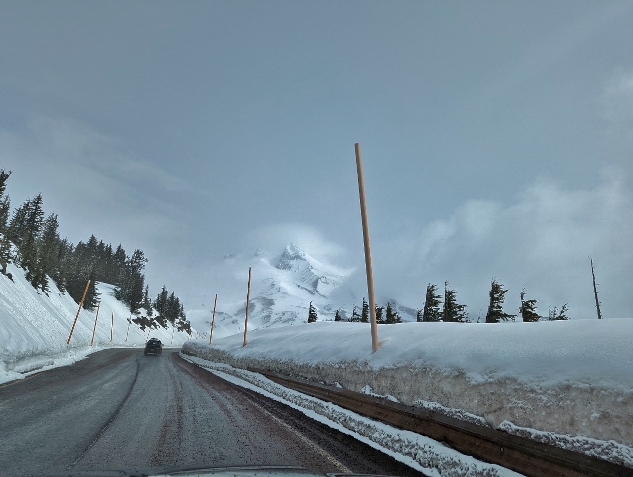 |
Mt Hood View
Position: 45°19.51’N, -121°42.49’W
As we rounded a bend near the Timberline Ski Area, 11,249 ft (3,429 m) Mt. Hood suddenly appeared dead ahead. We were pretty excited to see it.
|
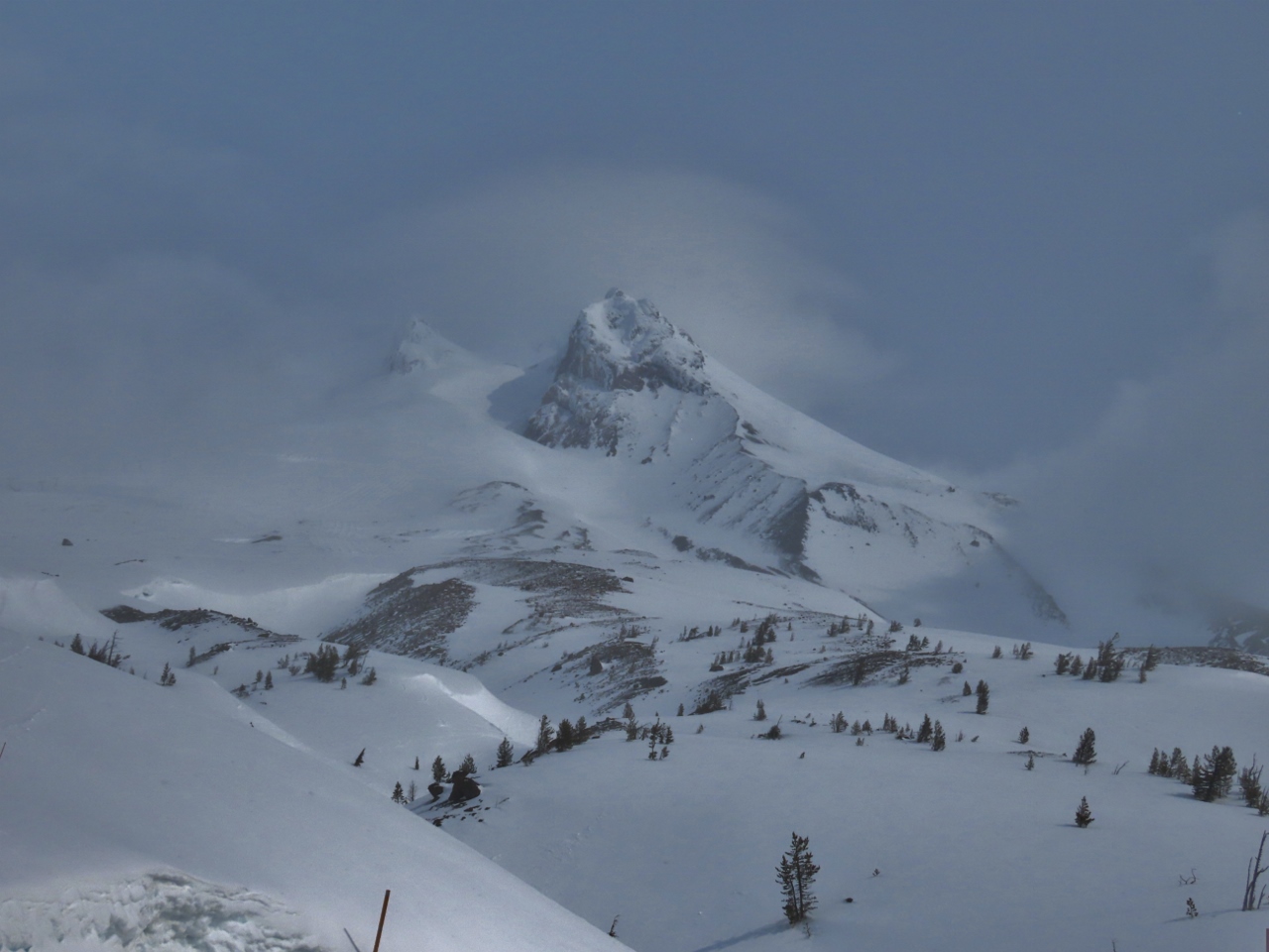 |
Mt Hood
Position: 45°19.89’N, -121°42.44’W
Another great view to 11,249 ft (3,429 m) Mt. Hood, this one from the parking lot before our hike. We feel super-lucky to get a mountain view given how overcast conditions are today.
|
|
|
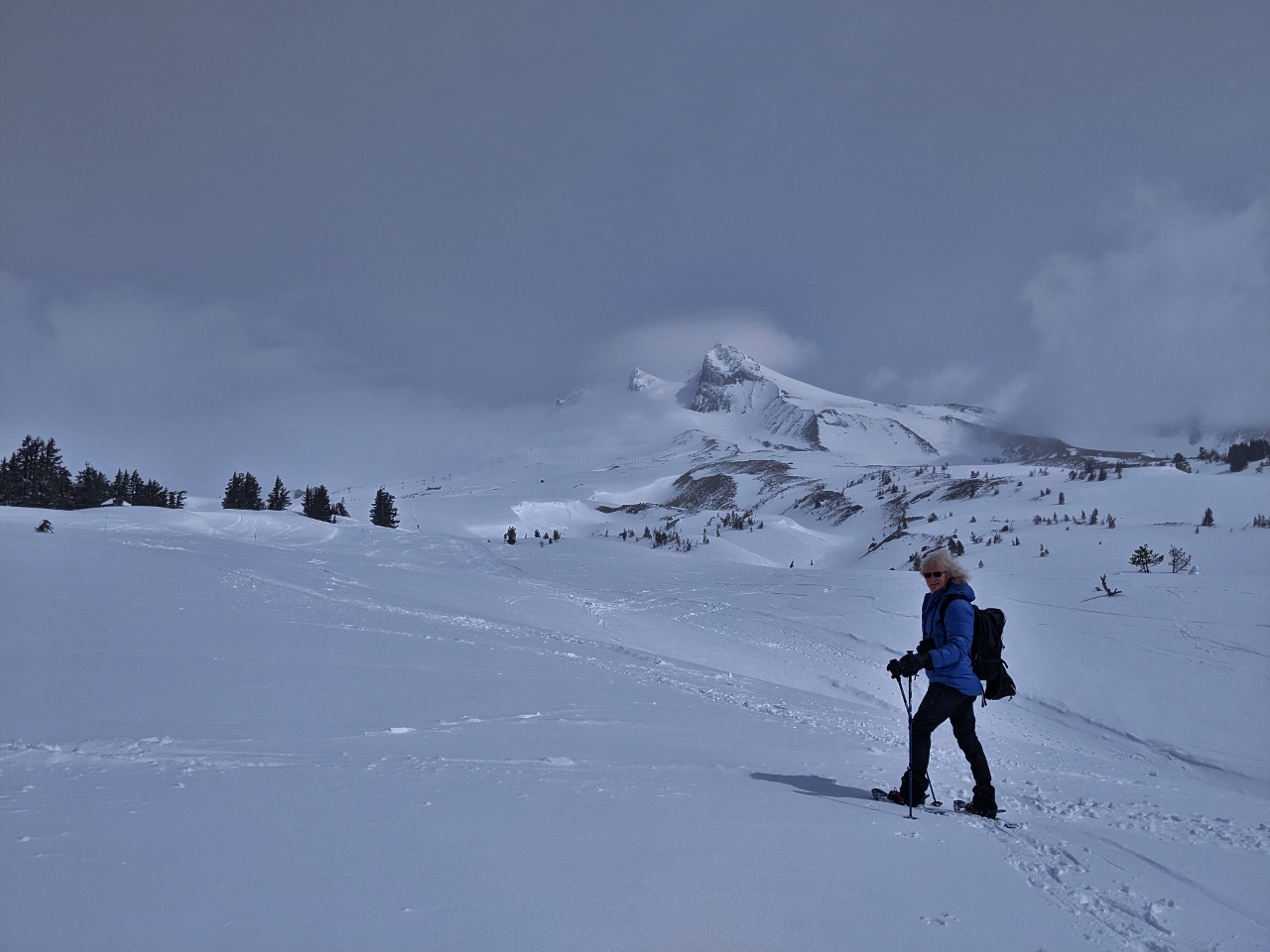
En Route
Position: 45°19.91’N, -121°42.49’W
Geared up and heading up to Slicox Hut, the small speck in the distance at roughly center of the picture above the snow cliffs.
|
 |
Climbers Trail
Position: 45°20.62’N, -121°42.51’W
The Timberline Ski area has a designated climbers trail for backcountry skiers and snowshoers, separating them from the downhill runs.
|
 |
Silcox Hut
Position: 45°20.64’N, -121°42.52’W
From altitude 5,807 ft (1,770 m) at the parking lot, we walked a mile (1.6km) in about an hour to reach Silcox Hut at 6,799 ft (2,073 m). Parked outside is one of Timberline’s many Snowcats. Silcox Hut was built in 1939, one of many thousand public works project completed under the New Deal Agency that supplied paid jobs to the unemployed after the Great Depression. The hut initially was the upper terminal of the original Magic Mile chairlift and a warming hut for climbers. Today it can be rented out to groups for overnight lodging and is a popular wedding venue.
|
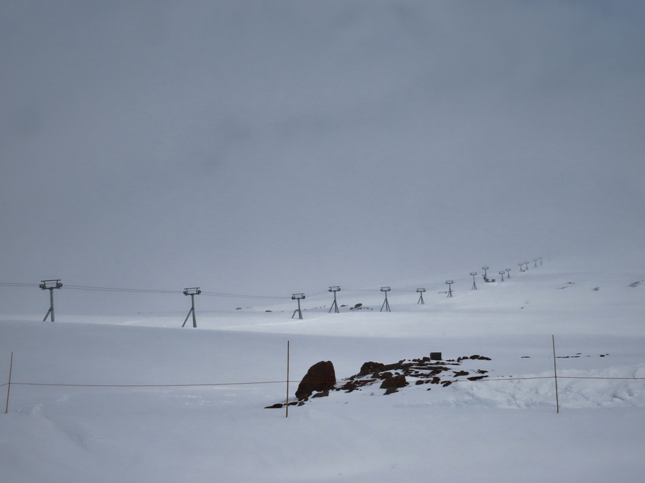 |
Palmer Express
Position: 45°20.66’N, -121°42.57’W
The Palmer Express chairlift, leading to the topmost section of the Timberline ski area at Mt. Hood at elevation 8,540ft (2,602m). Timberline has the longest ski season in North America, operating from October through August in ideal years. The winter vertical drop is 4,540 feet (1,383m) from top of Palmer to bottom of Summit Pass, and in the summer it’s 2,616 feet (797m) from top of Palmer to the bottom of the Magic Mile where the Silcox hut is.
The Palmer Express chairlift operates only in the summer. The winters are so harsh here, with winds over 100 mph (160 kph), that the lift cannot feasibly be de-iced and operated. So in the winter, people instead take the Palmer Snowcat to the top. |
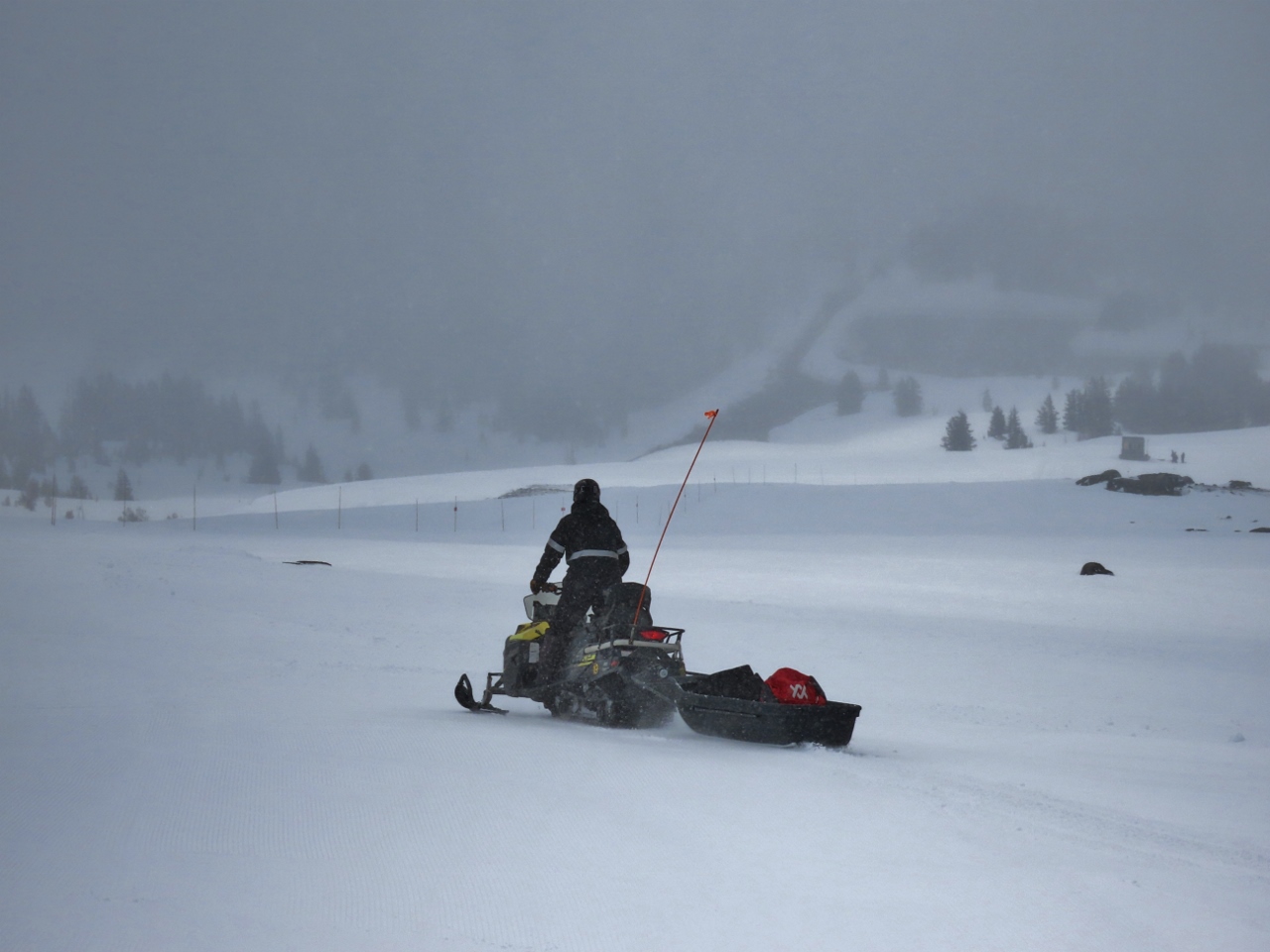 |
Snowmobile
Position: 45°20.66’N, -121°42.55’W
Snowmobile transporting gear from Silcox Hut.
|
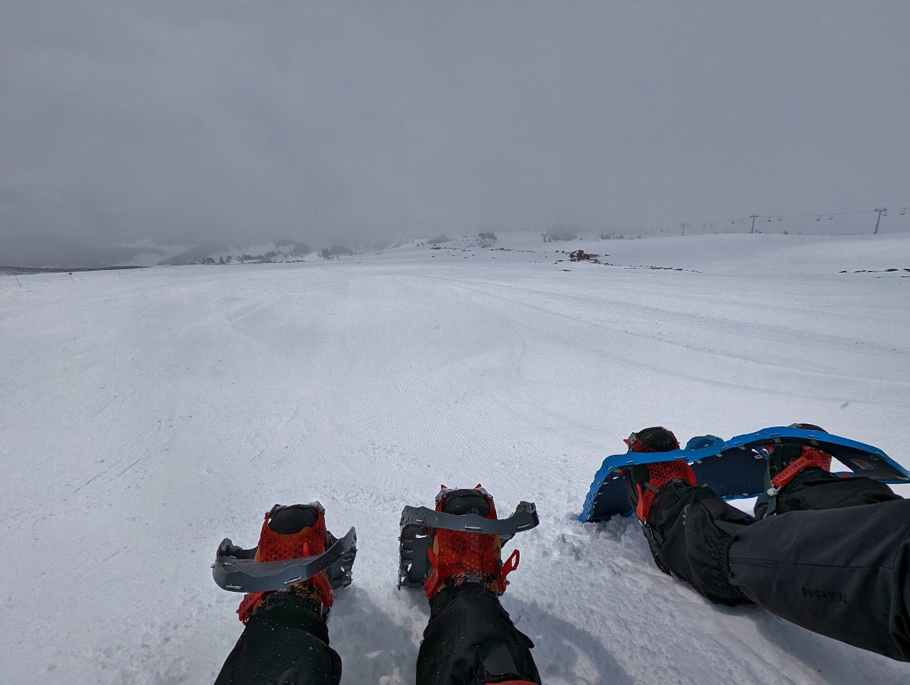 |
Snack
Position: 45°20.66’N, -121°42.55’W
Enjoying a snack and a hot drink in front of Silcox Hut on Mt. Hood.
|
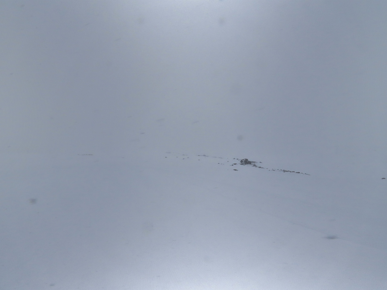 |
Visibility
Position: 45°20.66’N, -121°42.55’W
We’re lucky we got any view of Mt. Hood today. While we were having our snack, visibility went to near zero. This is the same view as the picture before with our snowshoes.
|
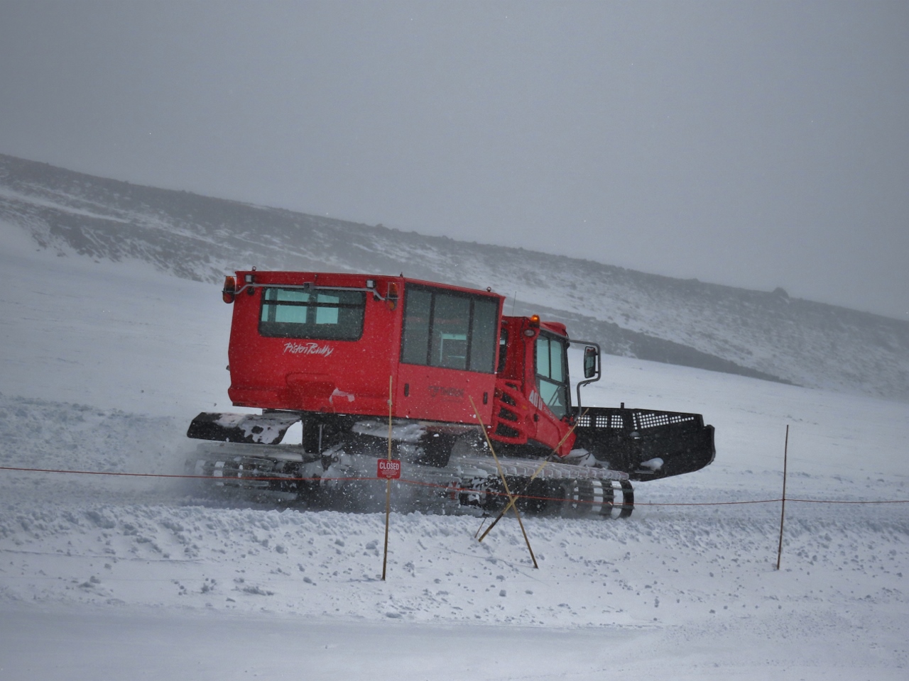 |
Snowcat
Position: 45°20.66’N, -121°42.55’W
The snowcat at Silcox Hut heading back down to the lodge. This is how guests at the hut are transported back and forth.
|
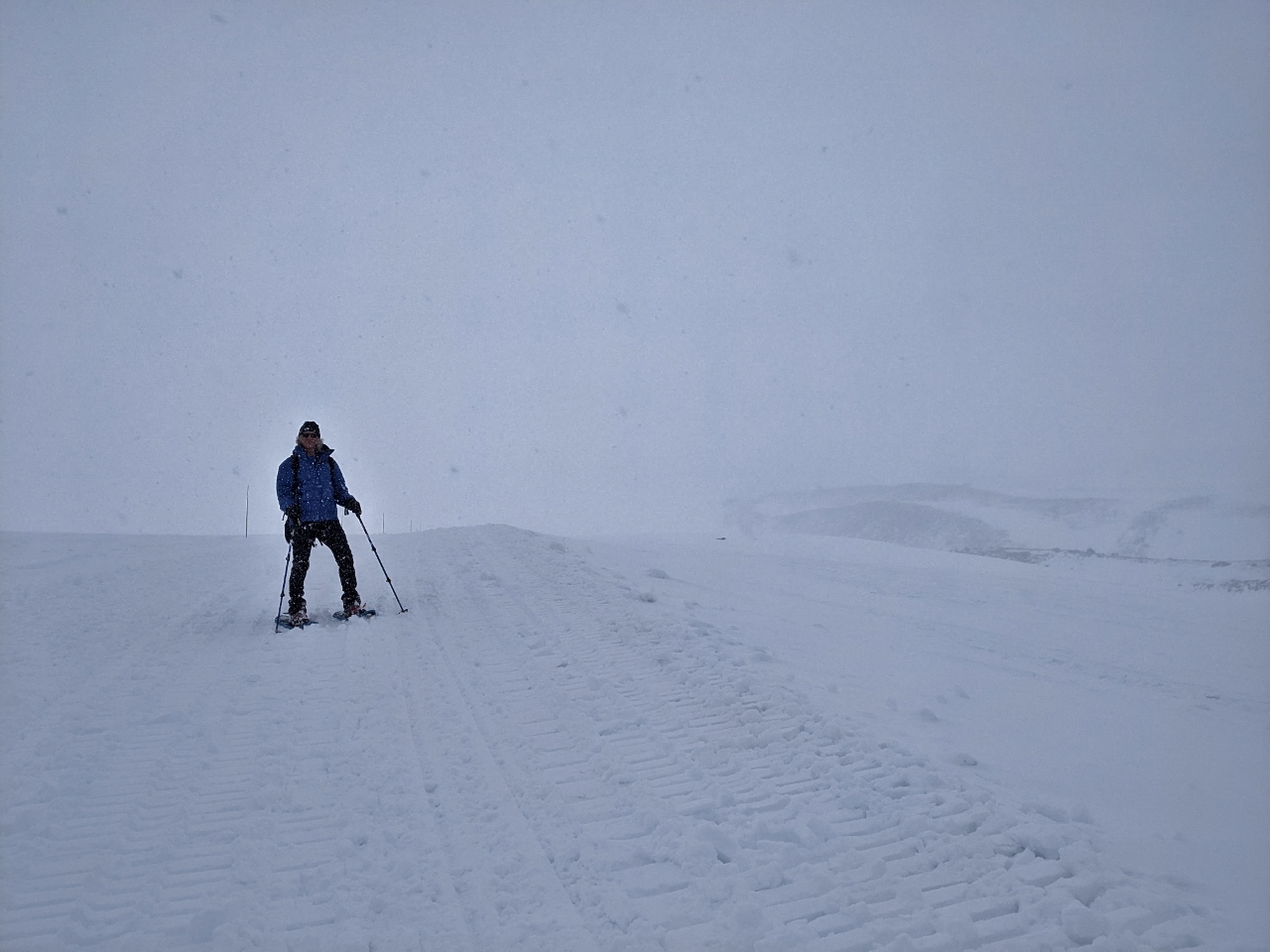 |
Descending
Position: 45°20.15’N, -121°42.56’W
Descending from Silcox Hut. It’s snowing, which is fun, but not great for visibility.
|
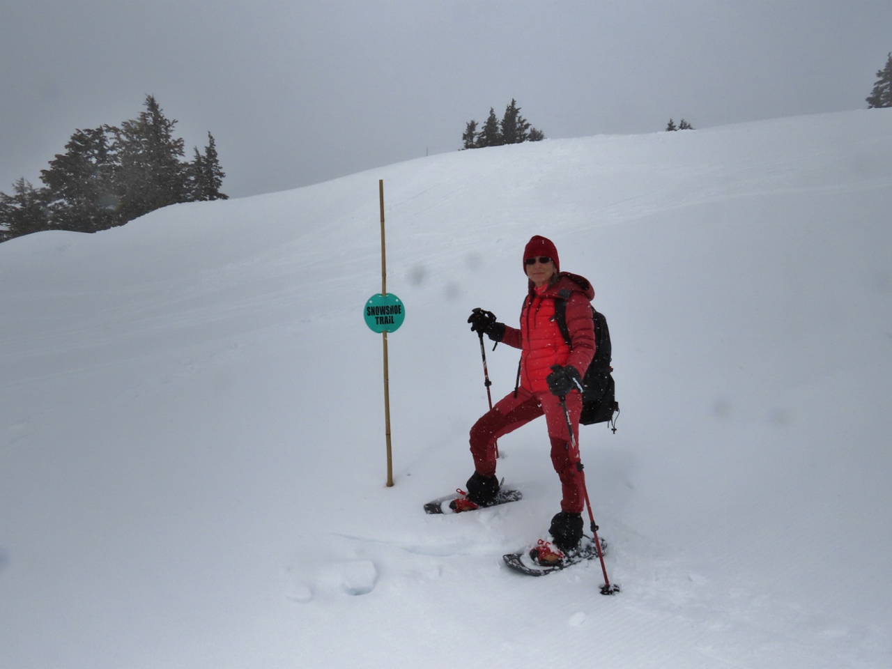 |
Snowshoe Trail
Position: 45°20.07’N, -121°42.53’W
Timberline has a small marked showshoe trail near the lodge that we’ve just reached as we return back down from Silcox Hut.
|
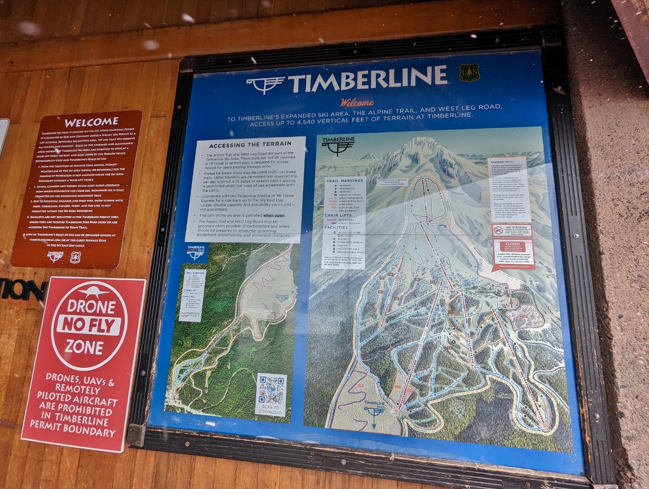 |
Timberline Ski Runs
Position: 45°19.82’N, -121°42.56’W
A diagram of the Timberline ski runs. We hiked from the parking lot at right, directly below the closed area, to the Silcox Hut, below the topmost loop. The red line running through the topmost loop is the Palmer Express chairlift route (click image for a larger view).
|
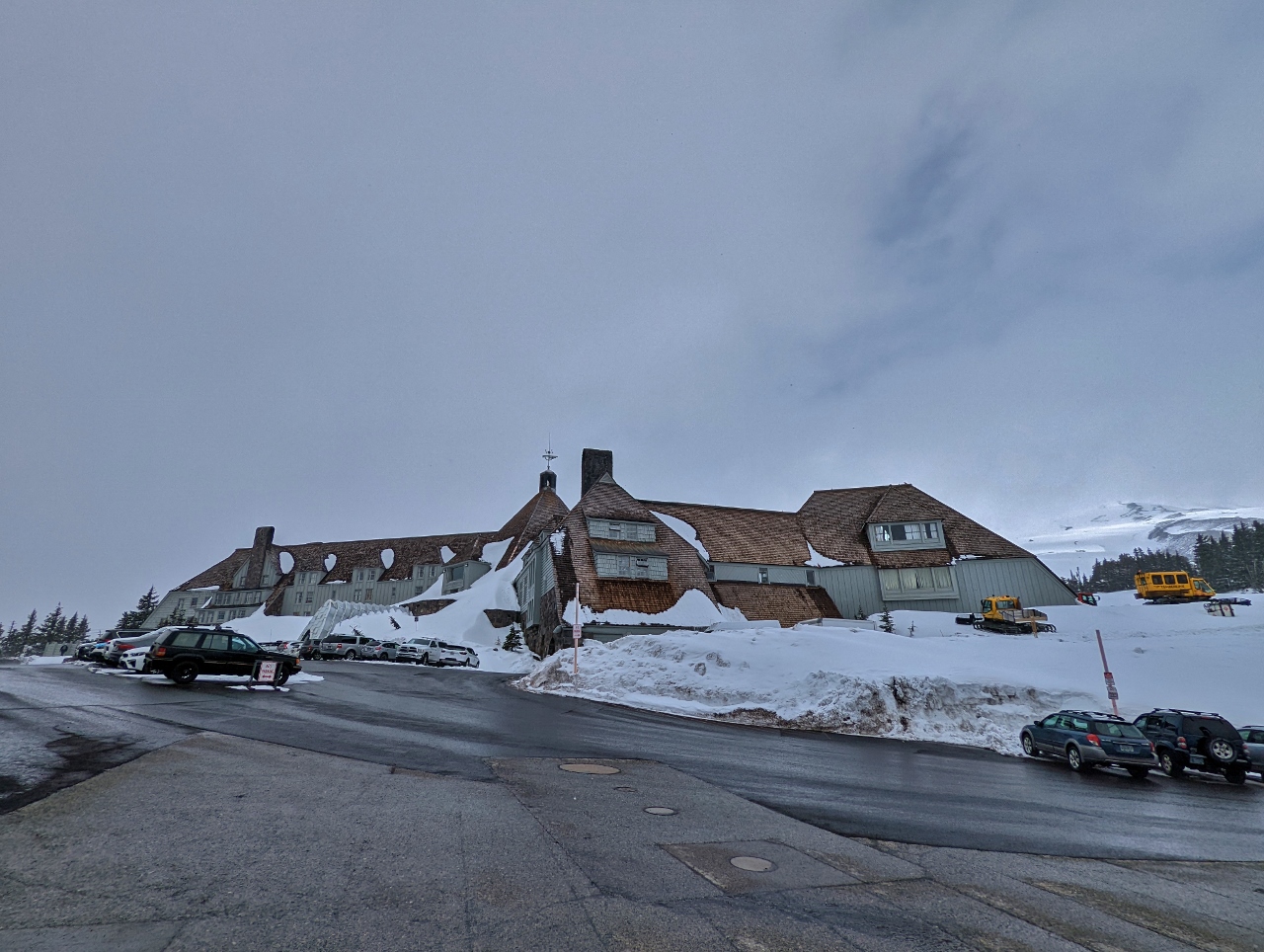 |
Timberline Lodge
Position: 45°19.83’N, -121°42.63’W
The Timberline Lodge was another New Deal project, built and furnished by local artisans between 1936 and 1938. The lodge is in the National Register of Historic places and served as the exterior of the Overlook Hotel in Stanley Kubrick’s film adaptation of the Stephen King’s horror novel The Shining. In the book, room 217 was considered the most haunted. The hotel owners, concerned that nobody would want to stay in that room once it was featured in a horror movie, requested that Kubrick instead use the fictional room number 237. Kubrick complied, but ironically, room 217 is the most requested room in the hotel.
|
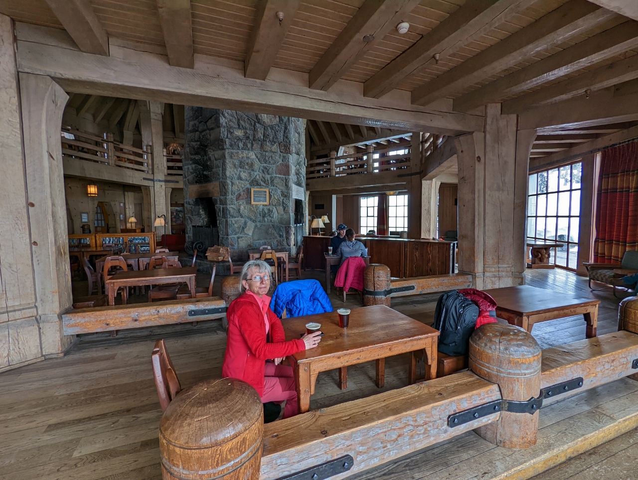 |
Head House
Position: 45°19.87’N, -121°42.67’W
Enjoying a pint of Mt. Hood Brewing company beer amid the beautiful interior of the Head House at Timberline Lodge, with the lodge’s massive chimney in the background at center.
|
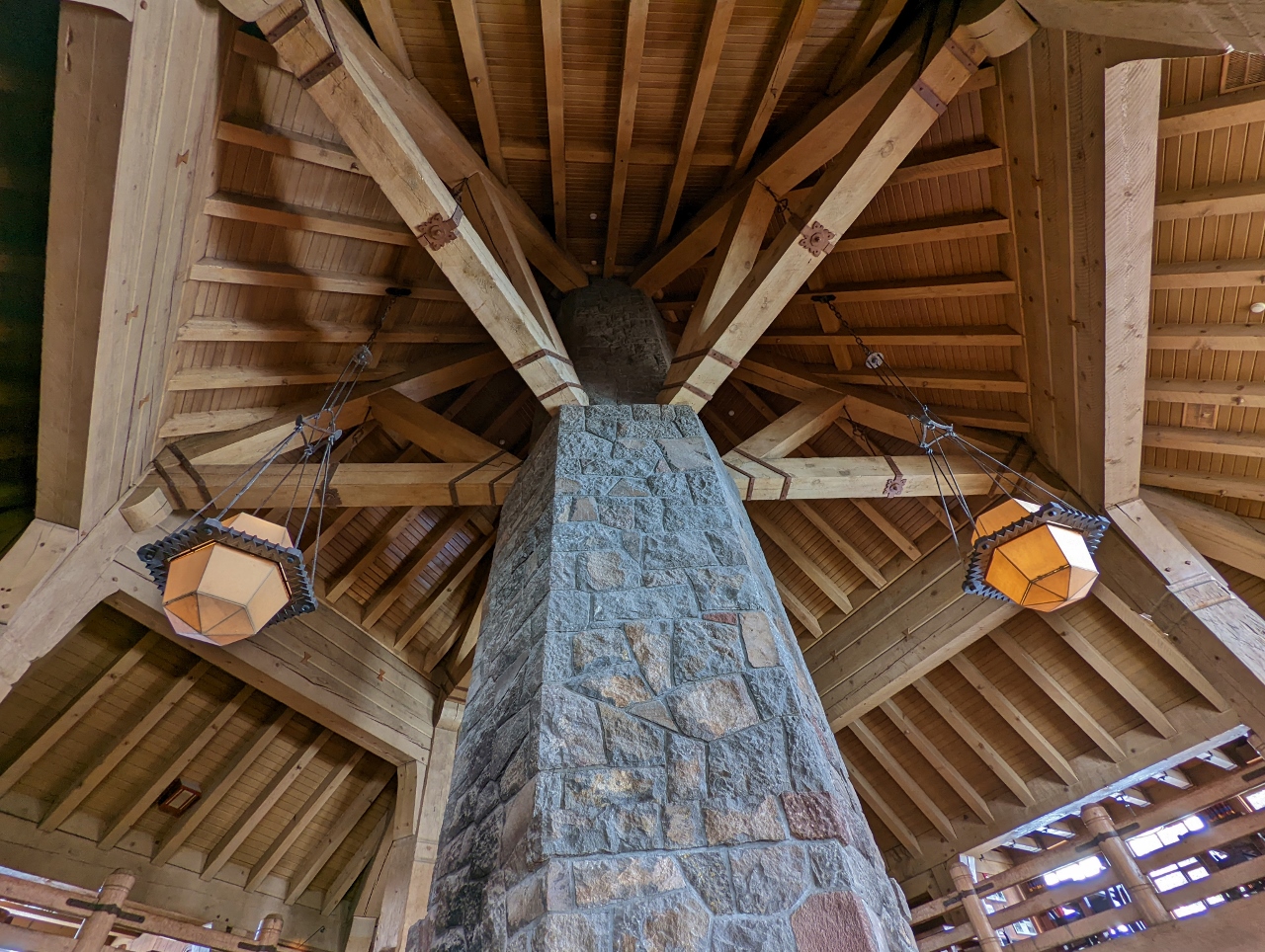 |
Chimney
Position: 45°19.86’N, -121°42.66’W
Looking up along the chimney in the Head House at Timberline Lodge to the striking wood-beamed ceiling. The chimney stands 90 ft (27 m) tall and is 14 ft (4 m) in diameter.
|
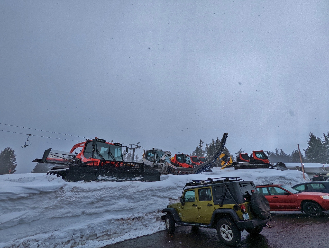 |
Snow Equipment
Position: 45°19.67’N, -121°42.66’W
A wide variety of snow grooming equipment just outside Timberline Lodge. The chair lift visible in the background, Molly’s, is one of seven in the ski area.
|
 |
Glacier Public House
Position: 45°18.24’N, -121°45.21’W
Government Camp has several good casual restaurants. We stopped for lunch here at Glacier Public House.
|
 |
Lunch
Position: 45°18.28’N, -121°45.20’W
Sharing a yummy salad at Glacier Public House. When we were boating, we always liked to see the boat from a restaurant. Now we enjoy seeing our Honda :-).
|
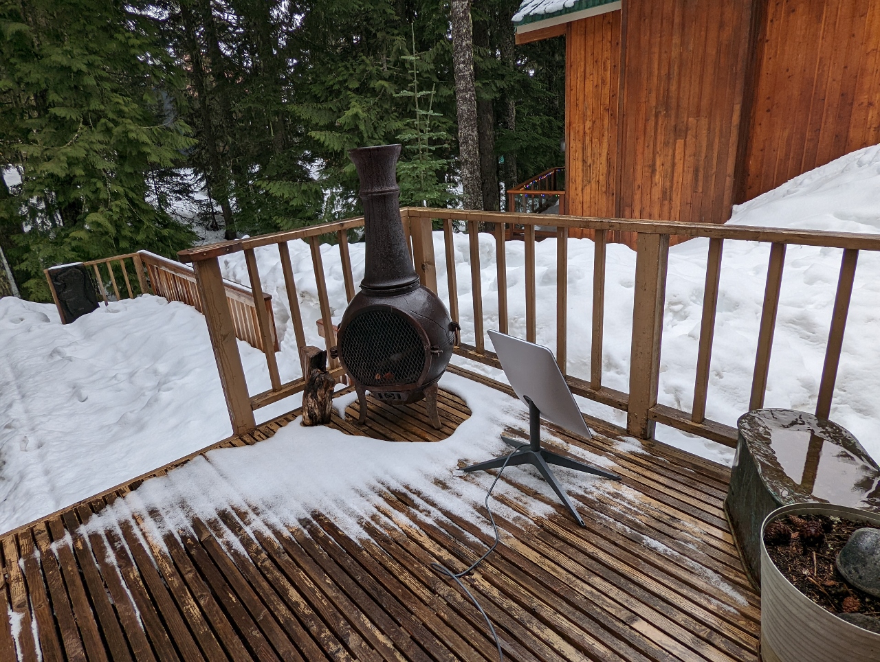 |
Starlink
Position: 45°18.34’N, -121°45.32’W
Testing our Starlink satellite dish on the deck of our cabin in Government Camp. It was unable to reliably connect with so many trees blocking the view to the satellites.
|
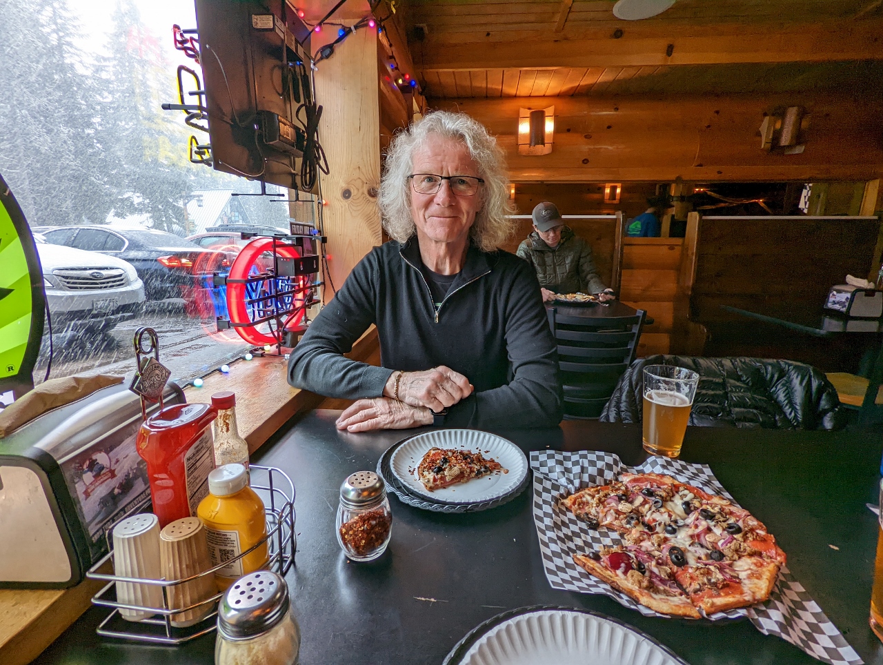 |
The Ratskeller
Position: 45°18.25’N, -121°45.37’W
A delicious pizza for dinner at The Ratskeller Alpine Bar and Pizzeria in Government Camp.
|
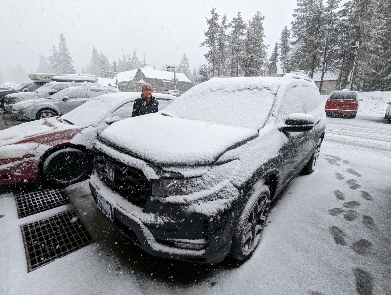 |
Snow
Position: 45°18.25’N, -121°45.38’W
Snow started falling partway through our dinner and our car was covered in snow when we returned to it.
|
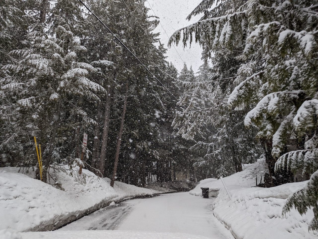 |
E Wyeast Trail
Position: 45°18.25’N, -121°45.41’W
Heading along E Wyeast Trail back to our cabin at Government Camp. In the height of winter, chains are required for vehicles to drive this road.
|
 |
Click the travel log icon on the left to see these locations on a map. And a map of our most recent log entries always is available at mvdirona.com/maps. |
If your comment doesn't show up right away, send us email and we'll dredge it out of the spam filter.