On returning from our snowshoe trip to Olympic National Park, we decided to drive south through Tacoma for the first time rather than take a ferry across the Puget Sound as we’d done on previous trips. Surprisingly, driving the whole way only takes an extra 15 minutes over the ferry. But that’s assuming you just drive onto the ferry with no delays, a rare occurrence.
From Tacoma we exited I-5 for a more scenic route north along SE Lake Holm Road near Auburn, crossing the infamous Green River along the way. American serial killer Gary Leon Ridgway was known as the Green River Killer because his first five victims were found there. His arrest and trial were international news when we lived in Seattle in the early 2000s.
We continued north through small towns we’d never heard of, such as Ravensdale, with its century-old grocery store. We eventually reached more familiar territory in the Eastside, the suburbs of Seattle east of Lake Washington, including Issaquah, Redmond and Bellevue. Issaquah is very close to the main Microsoft campus in Redmond, where we worked in the 1990s, and many of our co-workers lived there. And we owned a house in Bellevue for over a decade before moving aboard Dirona. Bellevue also is where we board Spitfire, at Wagly Pet Campus, when we travel.
Below are highlights from March 7th, 2022. Click any image for a larger view, or click the position to view the location on a map. And a map with our most recent log entries always is available at mvdirona.com/maps.
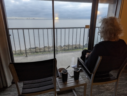 |
Breakfast
Position: 48°7.13’N, -123°25.68’W
Breakfast in our hotel room at the Red Lion Inn in Port Angeles with a view to the harbour.
|
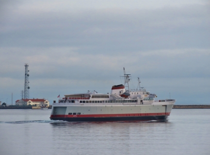 |
Coho
Position: 48°7.13’N, -123°25.68’W
The Coho departing at 8:20am on the first run of the day to Victoria.
|
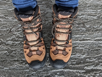 |
New Boots
Position: 48°7.13’N, -123°25.67’W
Jennifer’s new hiking boots, Salomon Quests, arrived last week and this was our first chance to try them out. We’re both now on our third pair each of Salomon hiking boots. They are super-comfortable, very light, and have excellent grip.
|
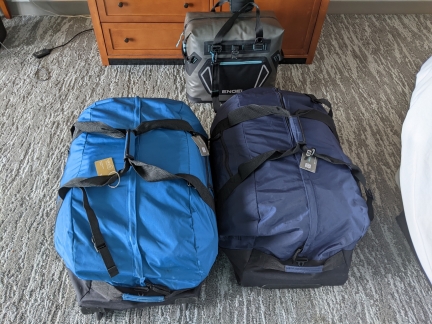 |
Packed
Position: 48°7.13’N, -123°25.67’W
Our gear all packed up and ready to go in two LL Bean Rolling Duffles plus our Engel soft-sided cooler. We’re finding the duffles very useful for road trips, allowing us to easily transport a huge amount of gear between our car and our apartment or hotel room. And even on quick day trips, we use one to carry all our snowshoe gear and packs.
|
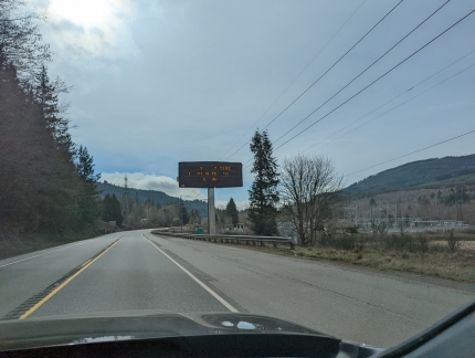 |
Hour Wait
Position: 47°58.98’N, -122°53.13’W
We were debating whether to take a ferry back to Seattle, or to drive around through Tacoma. Surprisingly, driving the whole way only takes an extra 15 minutes over the ferry, but that’s assuming you just drive onto the ferry with no delays. The road sign ahead indicates a one-hour wait for the ferry, so we opted to drive around instead.
|
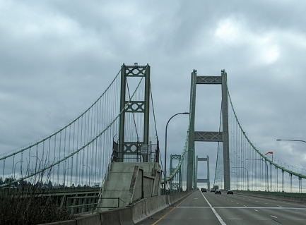 |
Tacoma Narrows Bridge
Position: 47°16.47’N, -122°33.54’W
We’ve driven over the Tacoma Narrows Bridge a few times recently, but always westbound. This is our first time heading east on the bridge since returning to Seattle.
|
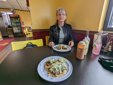 |
Taqueria la Michoacana
Position: 47°13.40’N, -122°27.07’W
Delicious street tacos at Taqueria la Michoacana in Tacoma, one of perhaps a half-dozen taquerias within a few blocks of each other.
|
 |
Road
Position: 47°18.07’N, -122°10.42’W
Taking the scenic route along SE Lake Holm Road near Auburn. We just crossed over, and are running adjacent to, the Green River. The waterway was made infamous by serial killer Gary Leon Ridgway. Known as the Green River Killer because his first five victims were found there, Ridgway was convicted of 49 murders taking place in the 1980s and 1990s, and is believed to have killed at least 71. His arrest and trial were international news when we lived in Seattle in the early 2000s
|
 |
Ten Trails
Position: 47°18.65’N, -122°2.43’W
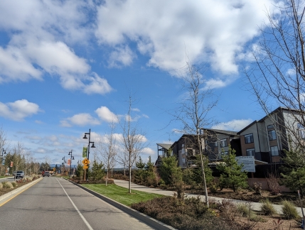
From rural country roads, we passed through the modern buildings and wide streets of Ten Trails, a new planned community in Black Diamond, WA.
|
 |
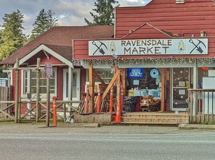
Ravensdale
Position: 47°21.47’N, -121°58.44’W
The Ravensdale Market has been a grocery store and ad-hoc community center for the small town of Ravensdale for over a century.
|
 |
Flooding
Position: 47°22.45’N, -121°58.53’W
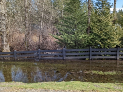
Several rivers in King County have entered flood stage due to recent steady, heavy rainfall. This fence is almost underwater in sections.
|
 |
Cedar River
Position: 47°22.49’N, -121°58.28’W
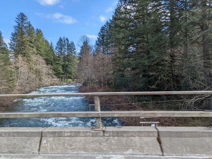
Crossing over the 45 mile (72 km) Cedar River. The river originates in the Cascade Range and flows west into the southern end of Lake Washington.
|
 |
Issaquah
Position: 47°31.84’N, -122°2.19’W
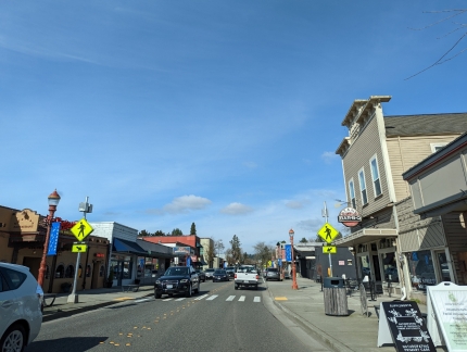
Passing along Front Street in Issaquah, headquarters of the multinational retail company Costco. The city is very close to the main Microsoft campus, where we worked in the 1990s, and many of our co-workers lived here in Issaquah.
|
 |
Lake Sammamish
Position: 47°38.08’N, -122°4.32’W
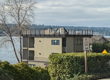
One of dozens of waterfront homes along Lake Sammamish. The “No Trail Access” sign refers to the East Lake Sammamish Trail, a rail-to-trail completed in 2006 along the former route of the BNSF railway. The railway right-of-way ran through dozens of waterfront properties whose owners delayed construction for a decade through legal battles, eventually backing down after losing a federal lawsuit.
|
 |
Wagly
Position: 47°36.27’N, -122°7.95’W
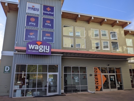
At Wagly Pet Campus in Bellevue to pickup Spitfire where we board him when we are out of town. We really like the care and attention he receives there, and their convenient operating hours. And with Spitfire’s advanced age of nearly 19 years, we particularly appreciate that they are a full-service veterinary hospital should anything go wrong. The only downside is that the location is a bit out of our way from downtown Seattle.
|
 |
Click the travel log icon on the left to see these locations on a map. And a map of our most recent log entries always is available at mvdirona.com/maps. |

If your comment doesn't show up right away, send us email and we'll dredge it out of the spam filter.