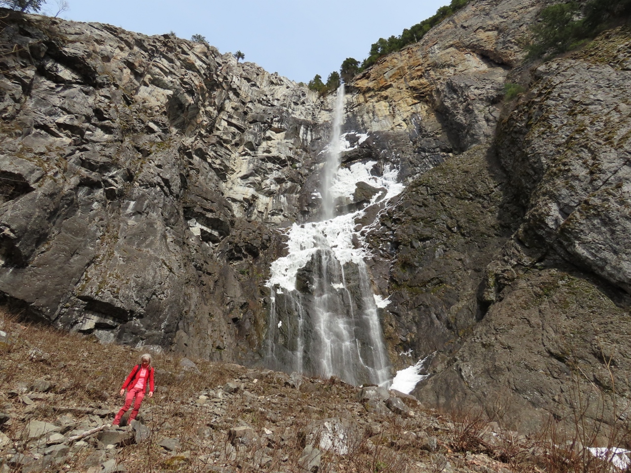
Snoquera Falls cascade 400 ft (122 m) over a cliff in the southern end of Mount Baker Snoqualmie National Forest near Mt Rainier. The volume of flow can vary dramatically from barely a trickle in the late summer to a torrent during the spring run-off, with the basin below filled with spray.
An easy 2-mile (3.2 km) trail through verdant rainforest leads directly beneath the falls. And when the outflow is low enough to be crossable, the hike in can be made in a loop.
The falls were partially frozen when we arrived in mid-March, with chunks of snow and ice continuously coming loose and falling from the wall in a dramatic display. Part of the outflow was snow-covered, but we were able to safely cross and return without tracing our steps there.
After our hike, we continue south to checkout nearby to Crystal Mountain Ski Resort, where the Mt. Rainier Gondola rises 2,400 vertical feet (731 m). The ride is popular year-round for its excellent views to Mt. Rainier and for a visit to Summit House Restaurant, Washington’s highest-elevation restaurant at 6,872 feet (2,095m). All the lifts had closed down for the day when we arrived, so we’ll save that for another day.
Below are highlights from March 11, 2022. Click any image for a larger view, or click the position to view the location on a map. And a map with our most recent log entries always is available at mvdirona.com/maps.
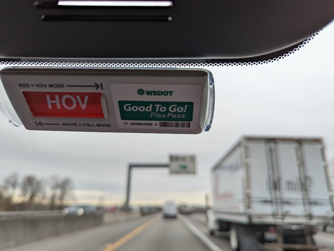 |
Flex Pass
Position: 47°23.86’N, -122°13.80’W
On the road with our new Flex Pass for the Washington State toll roads. The pass allows for reduced charges on basic toll roads, such as the Tacoma Narrows Bridge, and free use of high-occupancy vehicle (HOV) toll lanes when eligible (2 or 3 people in the car depending on the road and time of day). The left side of the pass has a slider that is normally left in standard toll mode (white), but can be set to HOV (red) to indicate HOV eligibility.
Right now we’re traveling in the SR 167 high-occupancy toll lanes and are HOV-eligible so we’ve slid it over to red. This indicates to the toll-recording equipment that we are claiming HOV status and shouldn’t be charged the toll. This also is visible to any law enforcement we might pass, who can issue a ticket if the vehicle is not in fact HOV-eligible. |
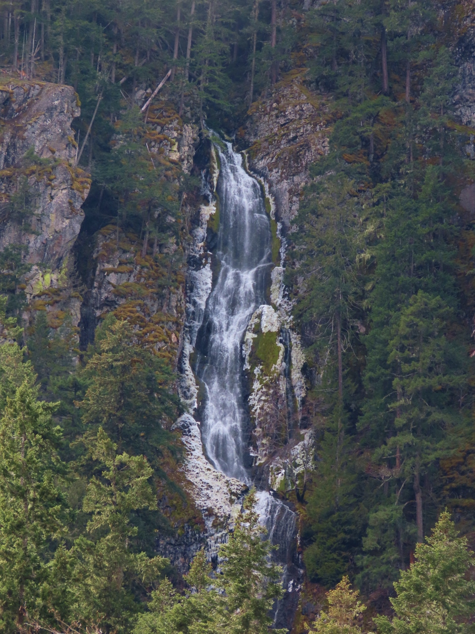 |
Skookum Falls
Position: 47°3.18’N, -121°34.29’W
250ft (76 m) Skookum Falls, seen from the viewpoint off Highway 410.
|
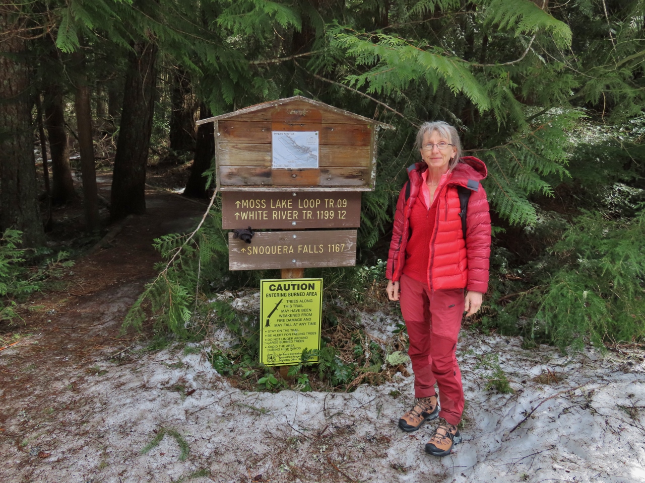 |
Trailhead
Position: 47°2.18’N, -121°33.51’W
At the trailhead for a short hike to Snoquera Falls in Mt. Baker Snoqualmie National Forest. A bit of snow is at the trailhead, but the trail itself was mostly bare and easy walking.
|
 |
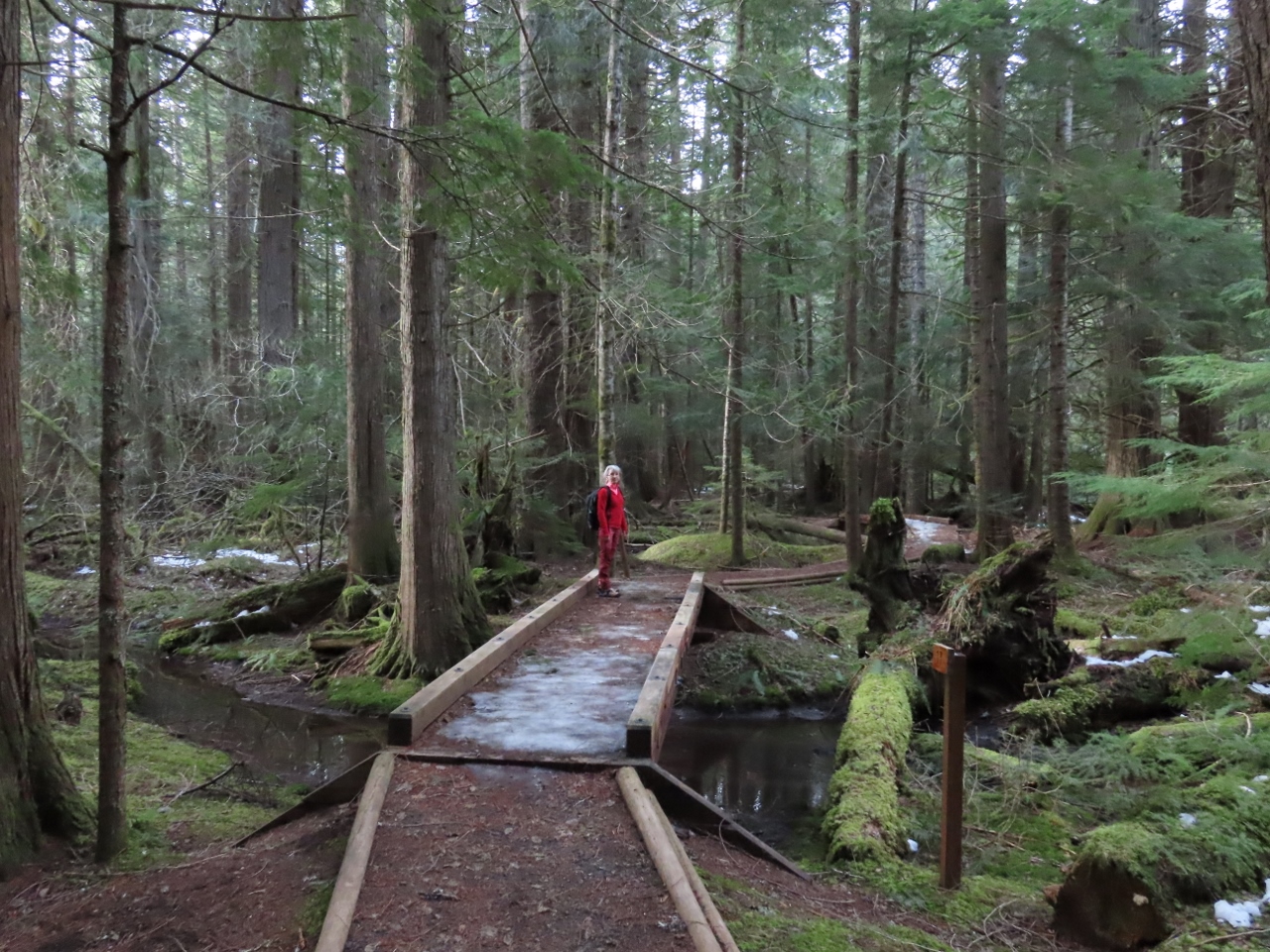
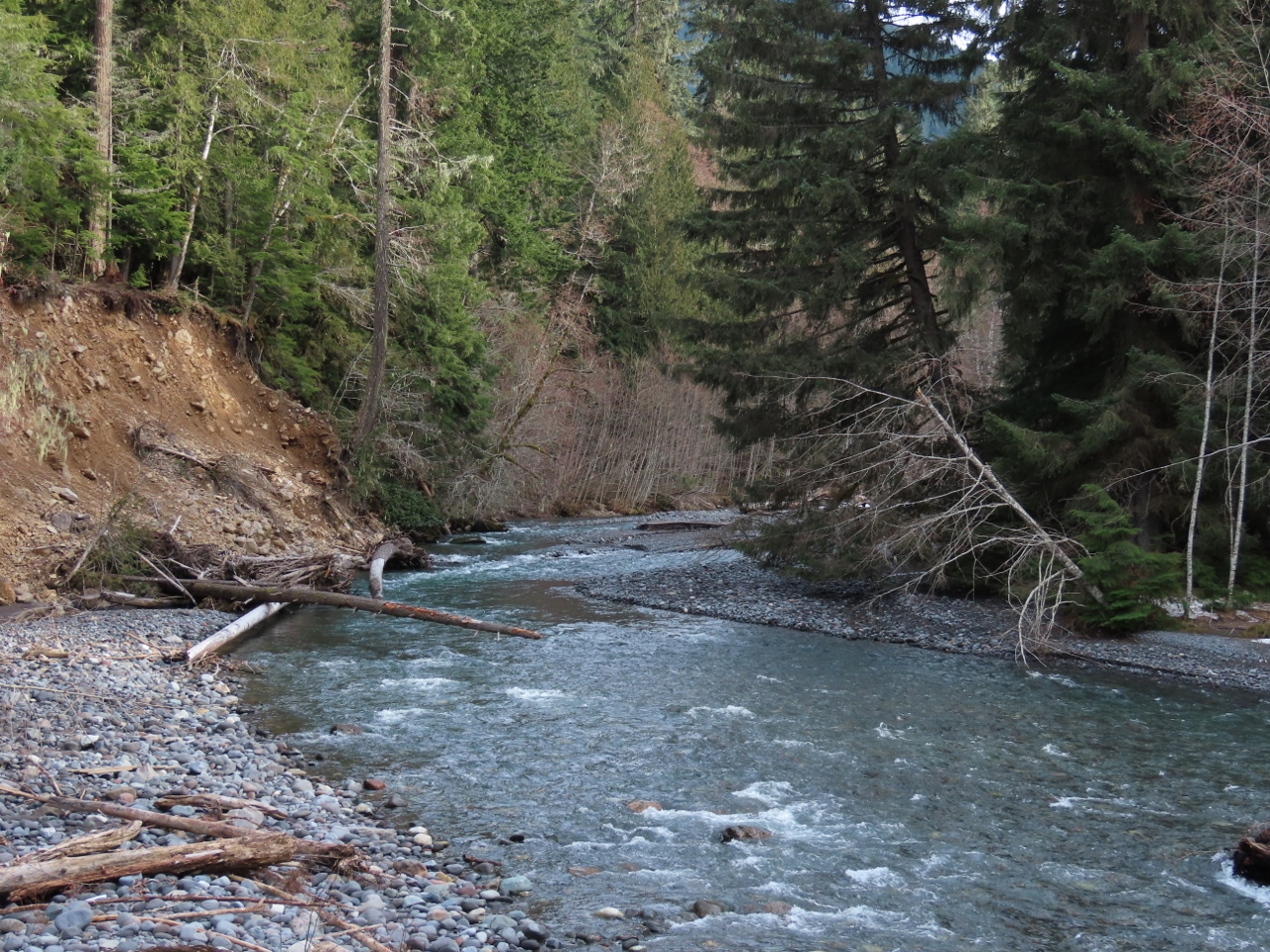
Snoquera Creek
Position: 47°2.19’N, -121°33.50’W
Footbridge crossing Snoquera Creek that flows from Snoquera Falls. We really enjoyed the walk through the wonderfully green and healthy forest.
|
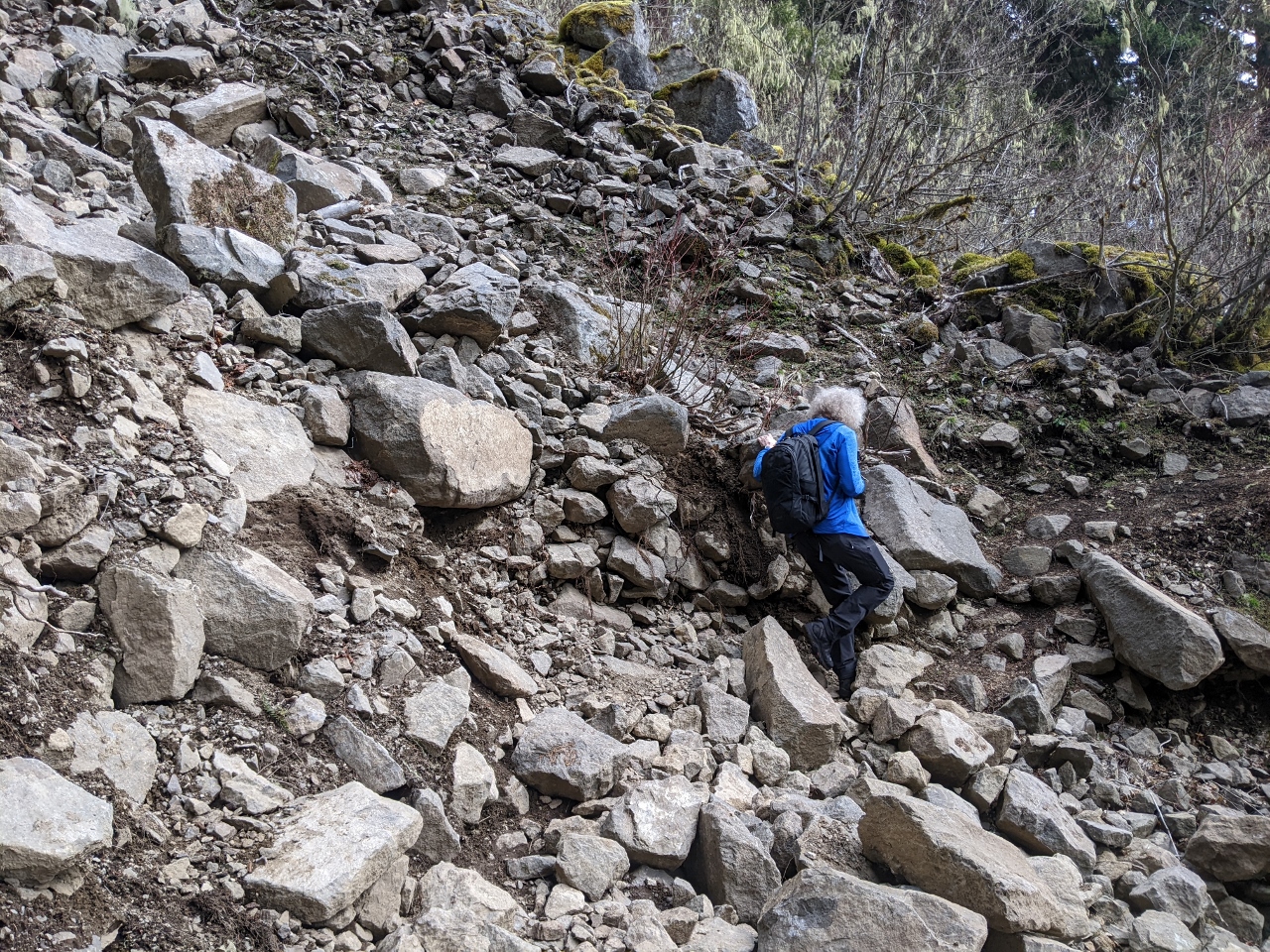 |
Rockslide
Position: 47°2.56’N, -121°33.67’W
Passing through a fairly large rockslide on the trail to Snoquera Falls. The slide looks recent, but actually occurred in 2008.
|
|
|
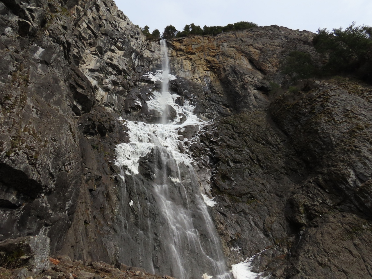
Snoquera Falls
Position: 47°2.37’N, -121°33.22’W
Snoquera Falls cascading 400 ft (122 m) over the cliff. The falls were partially frozen, but melting. While we were there, chunks of snow and ice continuously came loose and fell from the wall. We were careful not to get too close directly underneath.
|
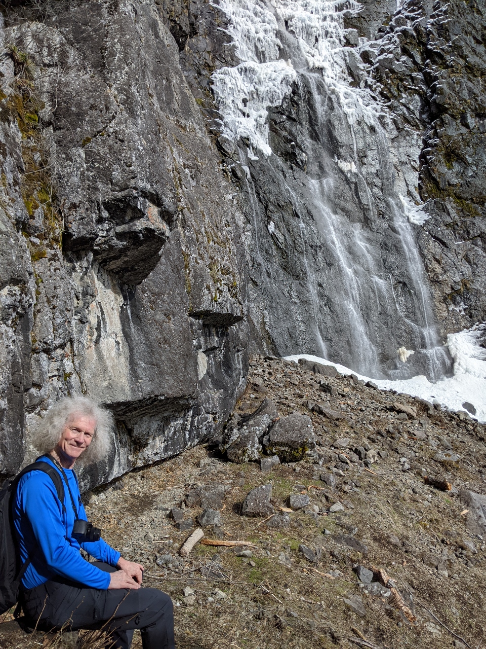 |
Break
Position: 47°2.39’N, -121°33.16’W
Taking a break with a view to the Snoquera Falls.
|
 |
Descending
Position: 47°2.40’N, -121°33.21’W
Jennifer descending the slope below Snoquera Falls.
|
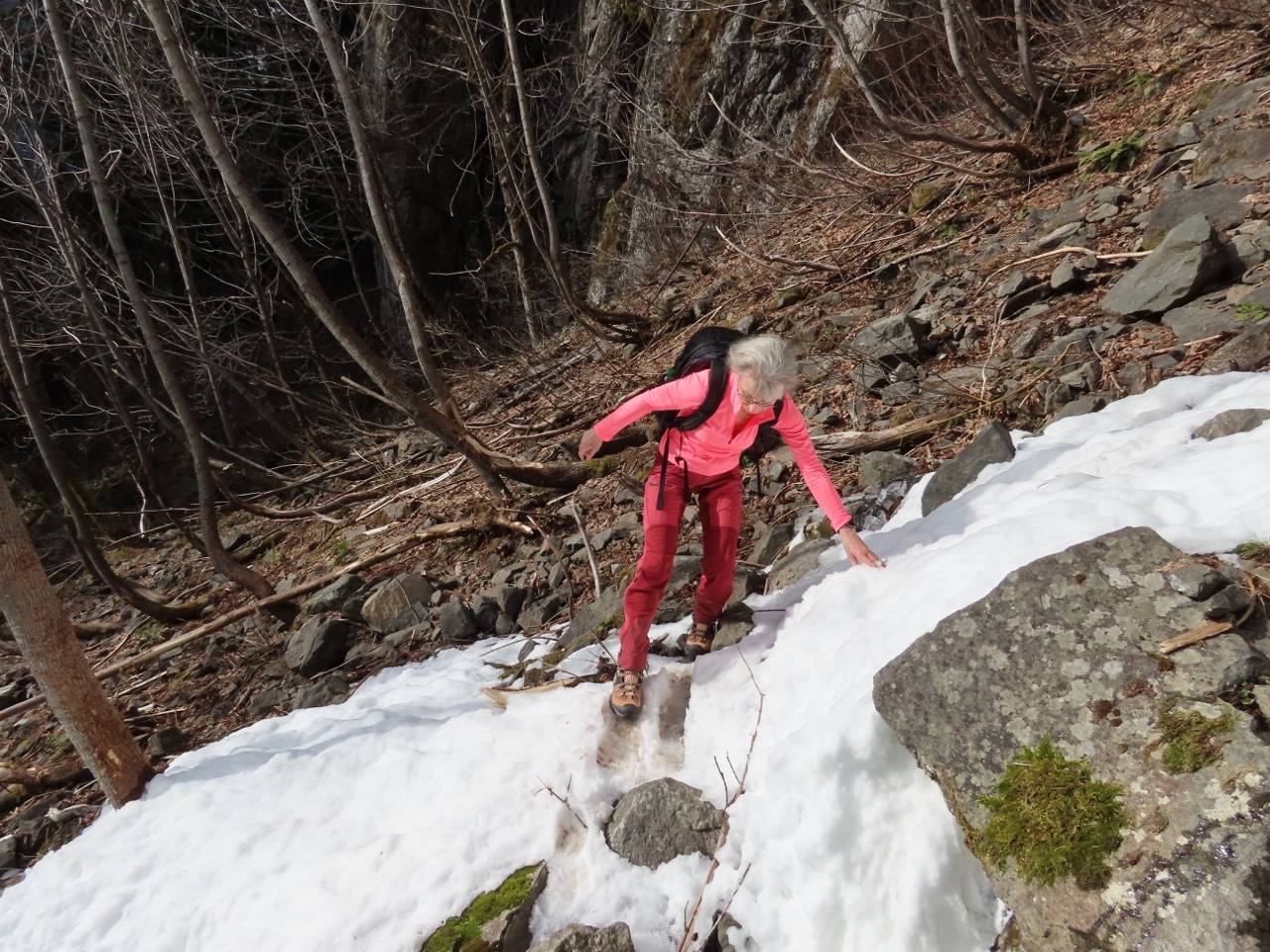 |
Crossing Creek
Position: 47°2.39’N, -121°33.20’W
Carefully crossing over the snow around Snoquera Creek to continue on a loop route back to the trailhead.
|
 |
Ice
Position: 47°1.96’N, -121°33.43’W
Crossing another bridge over Snoquera Creek. The bridge we’d passed earlier was fine, but this one was coated in ice and super-slippery.
|
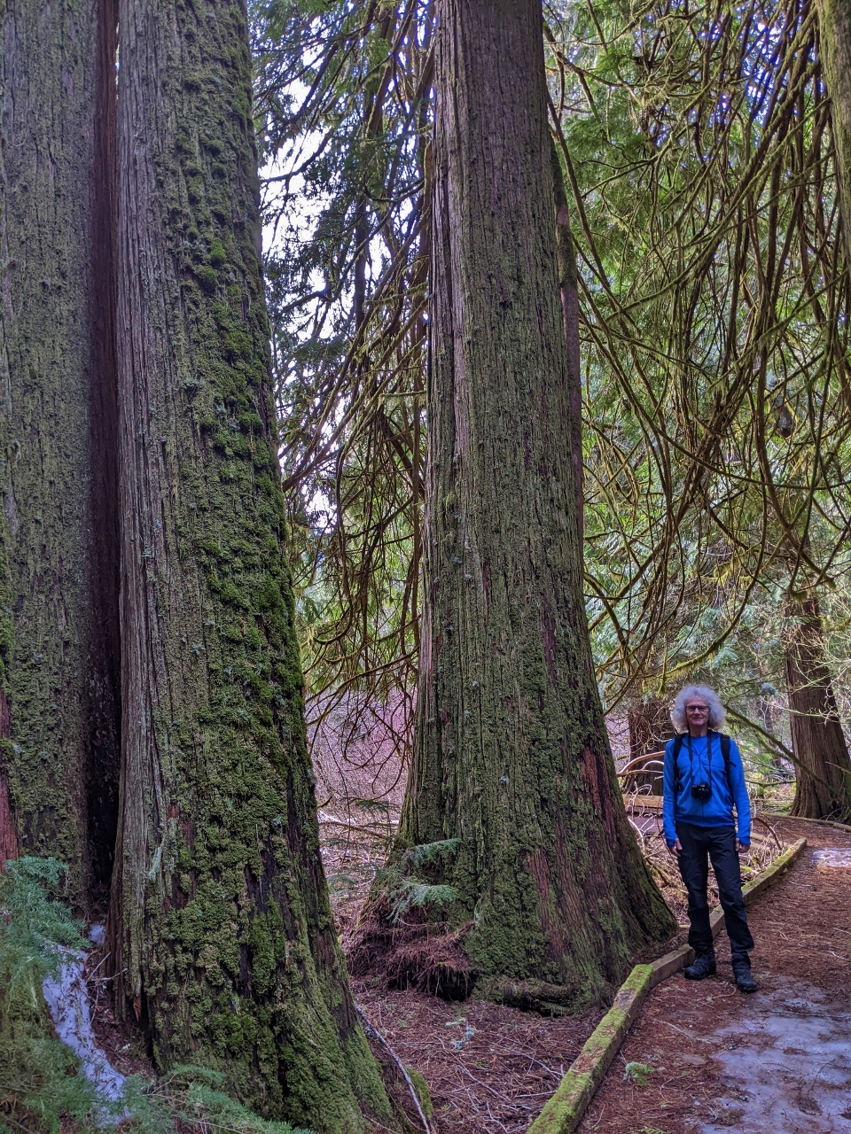 |
Old Growth
Position: 47°2.13’N, -121°33.45’W
Fabulous old-growth trees along the trail.
|
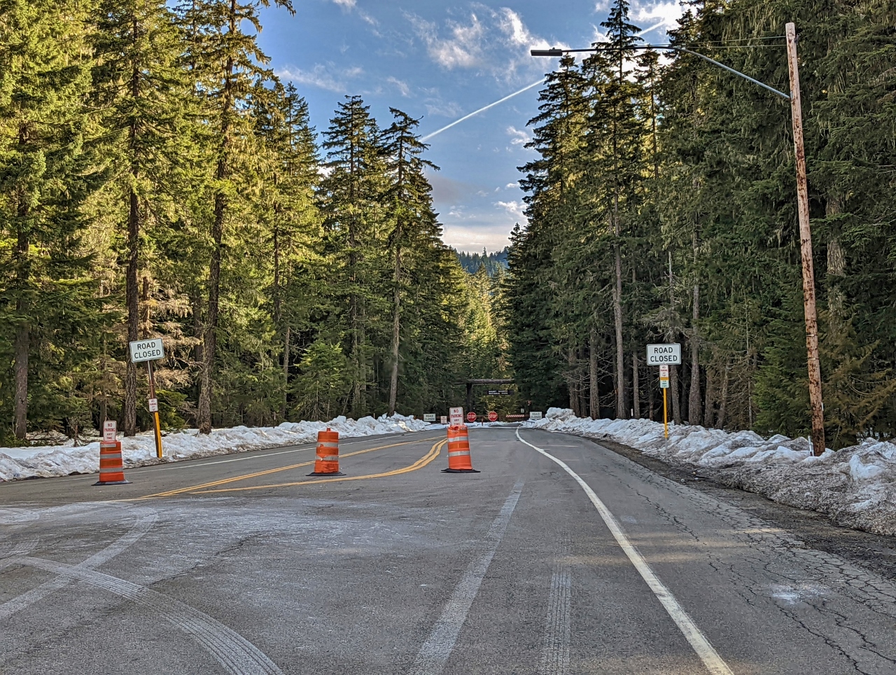 |
Road Closed
Position: 46°58.79’N, -121°32.17’W
In the winter, the last turn open on Highway 410 is up to Crystal Mountain ski area. You can see the road dead-ends just ahead. In the summer, you can drive all the way around Mt. Rainier. And weplan to.
|
 |
Parking
Position: 46°56.92’N, -121°28.43’W
The parking lot at Crystal Mountain Resort is pretty full for a Friday.
|
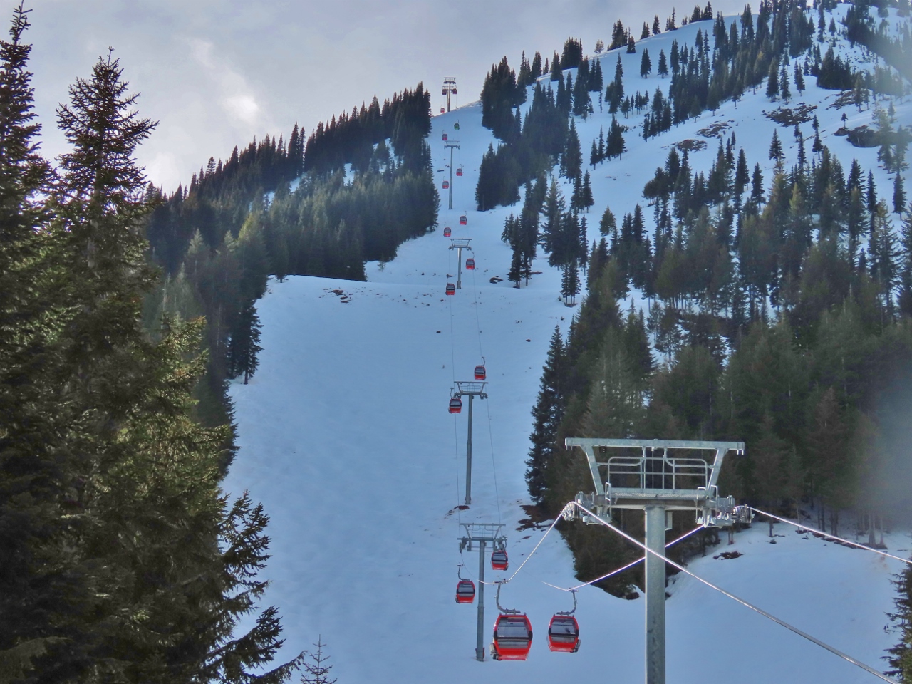 |
Gondola
Position: 46°56.20’N, -121°28.47’W
The Mt. Rainier Gondola rises 2,400 vertical feet (731 m) is popular year-round for it’s excellent views to Mt. Rainier. And at the top is the Summit House Restaurant, Washington’s highest-elevation restaurant at 6,872 feet (2,095m).
|
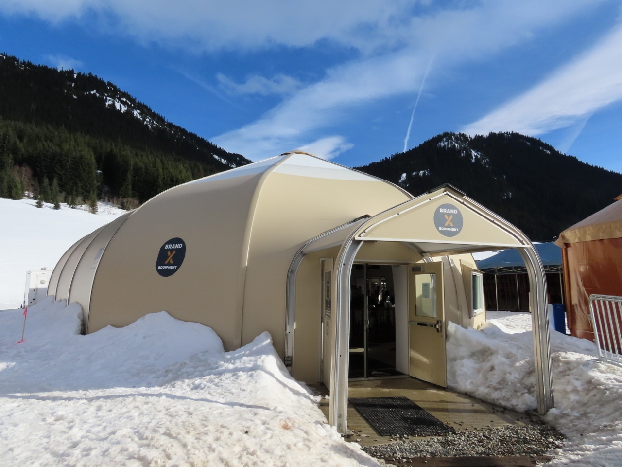 |
Brand X Equipment
Position: 46°56.20’N, -121°28.47’W
The Brand X Equipment Pro Shop at Crystal Mountain, housed in a tension fabric building.
|
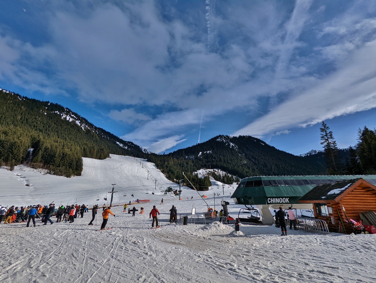 |
End of Day
Position: 46°56.10’N, -121°28.50’W
It’s close to the end of the day at Crystal and traffic on the slopes is beginning to thin.
|
 |
White River
Position: 47°4.71’N, -121°35.08’W
Crossing over the White River en route to the Sun Top Sno-Park.
|
 |
Sun Top Sno-Park
Position: 47°4.56’N, -121°35.19’W
End of the road at the Sun Top Sno-Park. The forest service roads beyond are closed for the winter. The Department of Transit plows small sections of roads throughout the state to create Sno-Parks that provide parking for winter activities such as snowshoeing, cross-country skiing and snowmobiling. We parked at one, Asahel Curtis, when we hiked to Franklin Falls and first tried our snowshoes.
|
 |
Click the travel log icon on the left to see these locations on a map. And a map of our most recent log entries always is available at mvdirona.com/maps. |
If your comment doesn't show up right away, send us email and we'll dredge it out of the spam filter.