Hurricane Ridge Road in Olympic National Park is among Washington’s most scenic. Starting at near sea level, the 18.6-mile (29.9 km) road leads to Hurricane Ridge at an elevation of 5,242 ft (1,598 m). The steep route curves and winds upwards, between steep mountains and deep gorges and through several tunnels, with spectacular views along the way.
The road is open year-round, but in the winter generally only from Friday through Sunday, road conditions permitting, and all vehicles must carry snow chains. At the top is cross-country and snowshoe trails, snow tubing and downhill runs, with one of only three ski lifts in a US National Park.
After hiking low-altitude Mt Storm King in early February, we returned to Olympic National Park a month later. This time we were armed with snowshoes and tire chains to experience winter on Hurricane Ridge. The day was wonderfully clear and sunny, and the winter scenery on the road up was so amazing that even if we just drove up and down and skipped the hike, we would have been happy
In the first of two days snowshoeing on Hurricane Ridge, we hiked 3 miles (4.8km) with an elevation gain of 800 ft (244 m) to the top of 5757-ft (1754 m) Hurricane Hill. The views all along the hike were exceptional, particularly the 360-degree view from the top. We had a fabulous time on our first official snowshoe hike, and were looking forward to more the next day.
Below are highlights from March 4th and 5th, 2022. Click any image for a larger view, or click the position to view the location on a map. And a map with our most recent log entries always is available at mvdirona.com/maps.
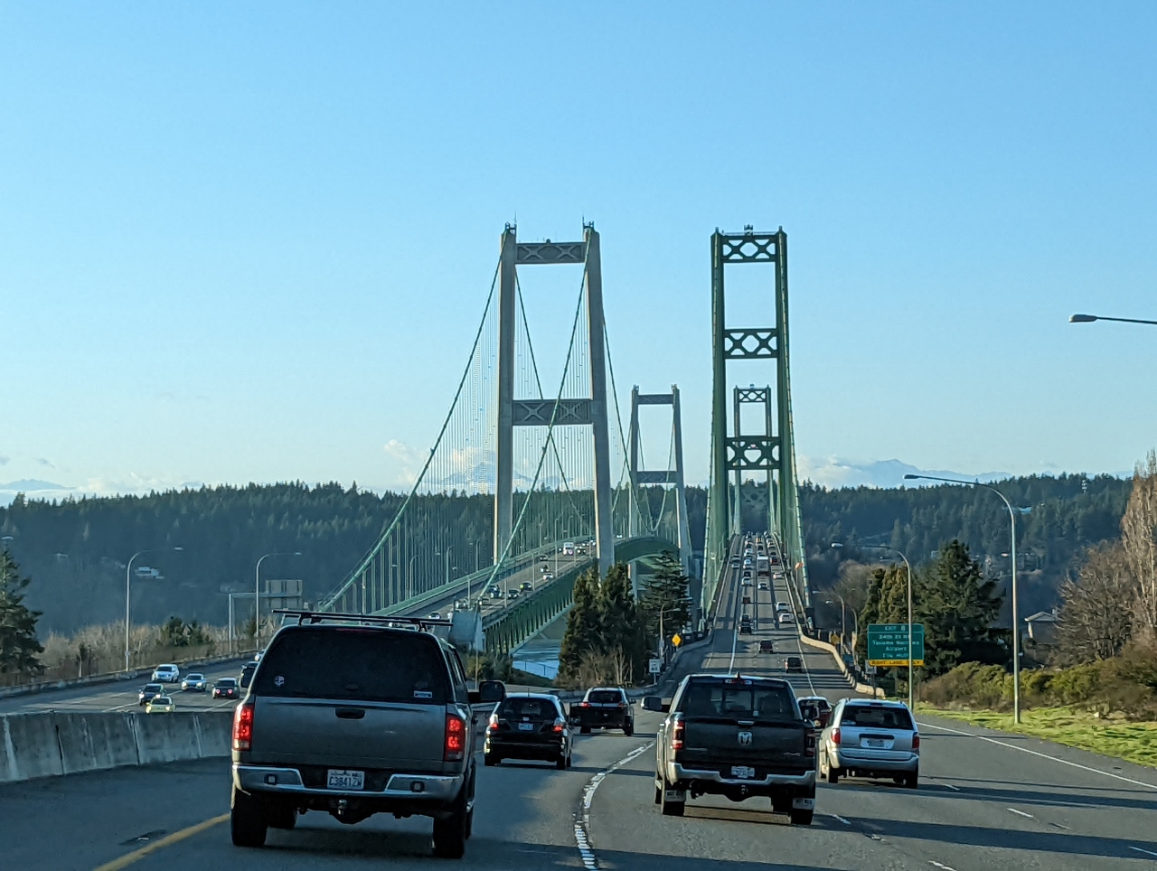 |
Rush Hour
Position: 47°15.53’N, -122°31.93’W
Heading over the Tacoma Narrows bridge on a Friday at rush hour for a weekend trip to Port Angeles and Olympic National Park for some snowshoeing. We’ve just cleared the worst of the traffic it shouldn’t be too bad from here on.
|
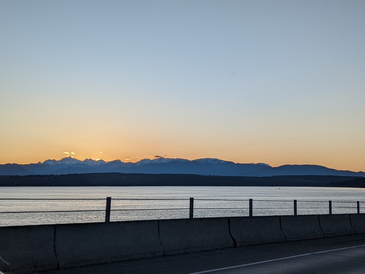 |
Sunset
Position: 47°51.08’N, -122°36.59’W
Sunset as we cross the Hood Canal Bridge with the Olympic Mountains in the background.
|
 |
Dusk
Position: 48°3.02’N, -122°55.59’W
Dusk heading towards the Olympic Mountains at Millar Penninsula between Port Townsend and Port Angeles.
|
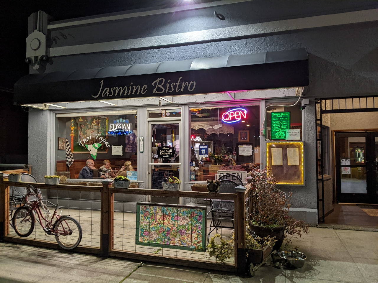 |
Jasmine Bistro
Position: 48°7.18’N, -123°25.83’W
Delicious take-out Thai dinner from Jasmine Bistro near our hotel in Port Angeles.
|
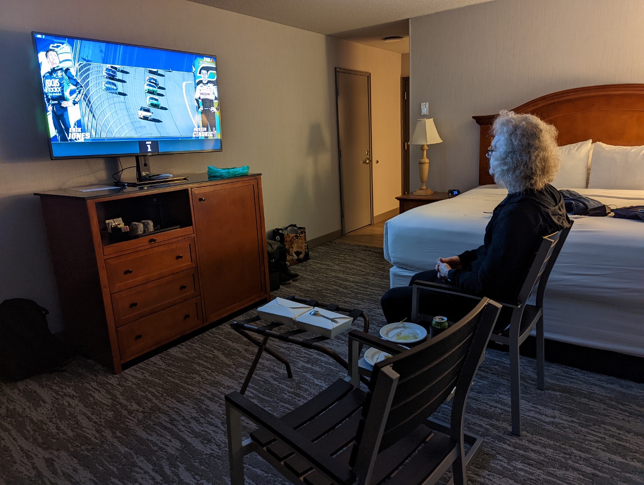 |
Nascar
Position: 48°7.13’N, -123°25.66’W
Enjoying a NASCAR race over dinner in our hotel, using the patio furniture as a make-shift dining area.
|
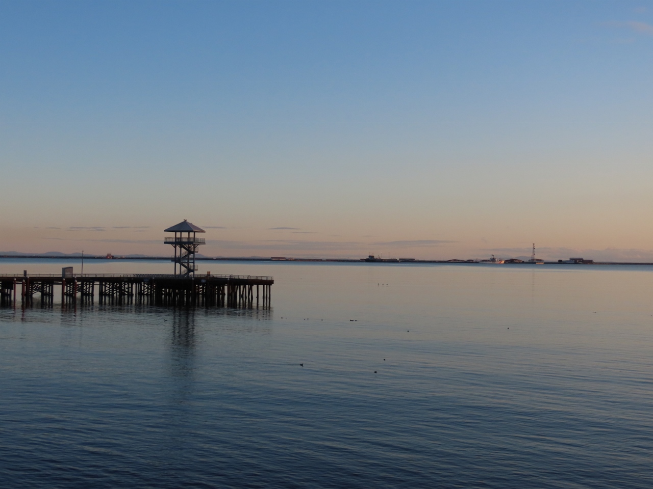 |
Dawn
Position: 48°7.14’N, -123°25.68’W
Dawn looking over the harbor at Port Angeles from our hotel room patio. The weather is predicted to be sunny all weekend and we’re really looking forward to taking the snowshoe trails at Hurricane Ridge in Olympic National Park.
|
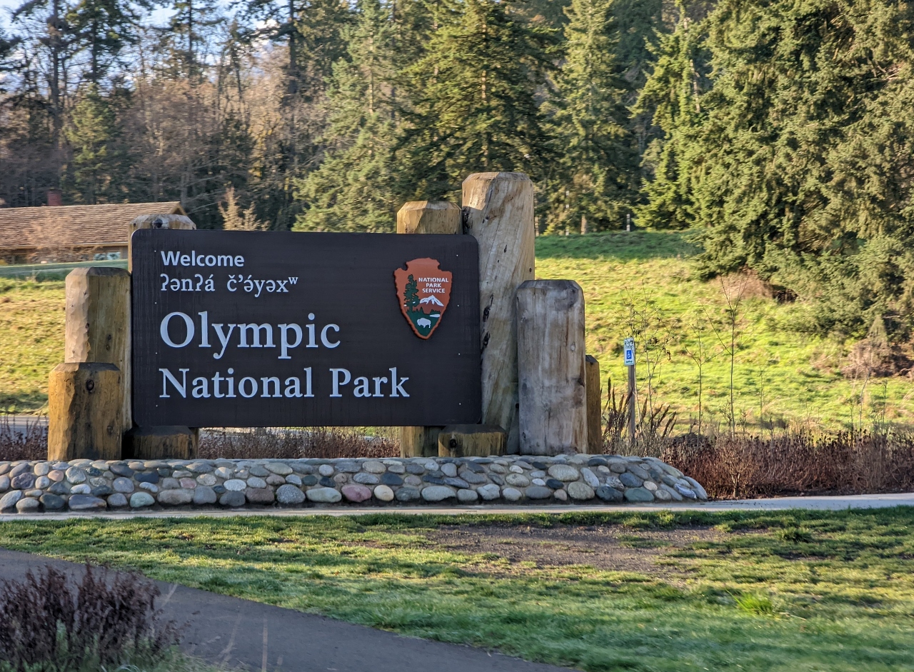 |
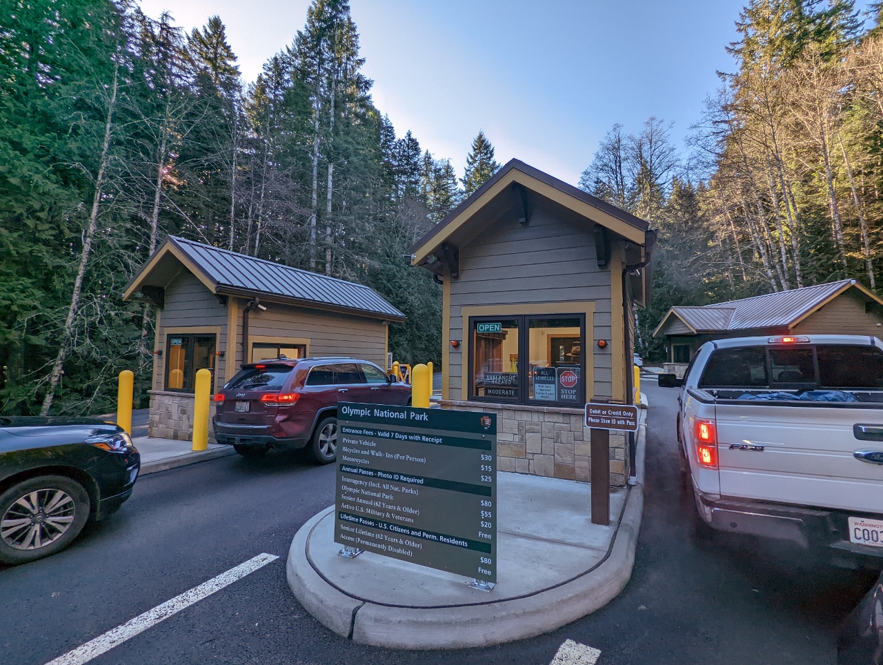
Olympic National Park
Position: 48°6.20’N, -123°25.57’W
Entering Olympic National Park, with the main visitor center partly visible behind. This is where we stopped by a month ago to hike Mt. Storm King.
|
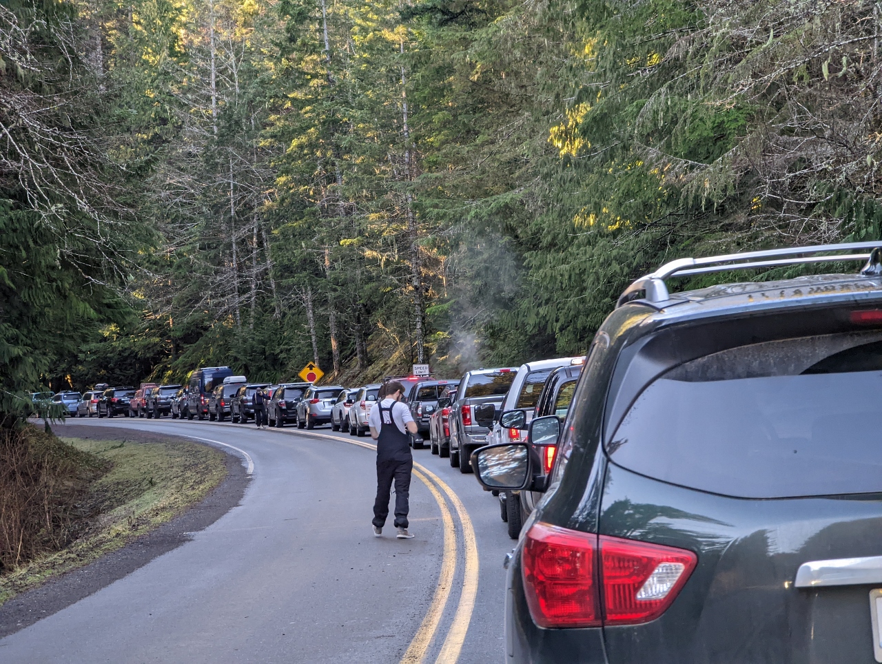 |
Queue
Position: 48°2.50’N, -123°25.47’W
During the winter, the road up to 5,242-ft (1,597m) Hurricane Ridge typically is only open Friday through Sunday and holidays between 9am and 4pm and winter storms can close or delay opening of the road. But one constant is the limited parking space available at the top, with room for only 200 cars in the plowed section. So people arrive early and wait in order to be sure of getting in.
This is the queue at 8:40am, shortly after we arrived. We can’t see the park gate, so don’t know how many cars are ahead of us or if we’ll even get in. But we were underway 20 minutes later and got in easily. |
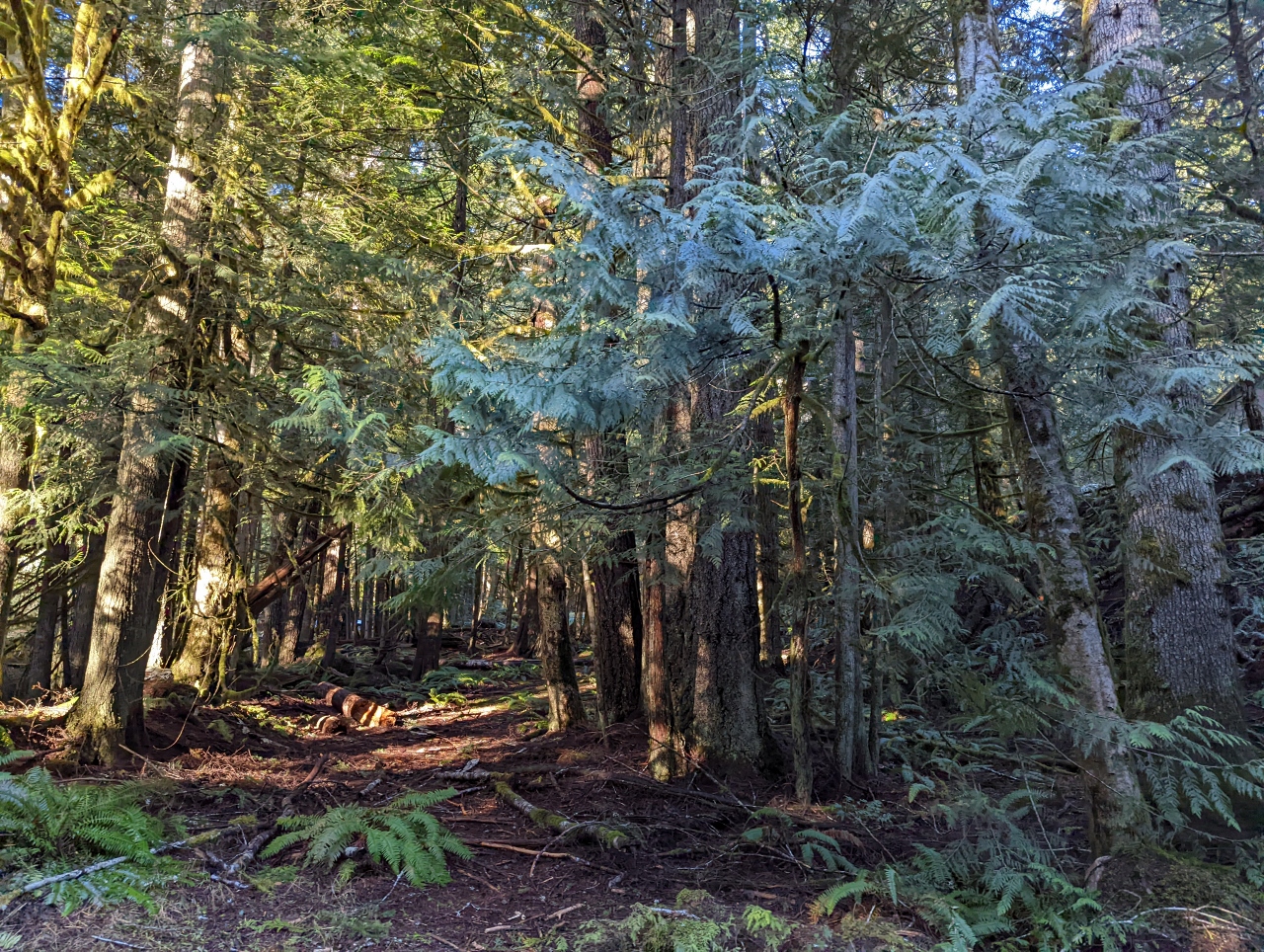 |
Rainforest
Position: 48°2.31’N, -123°25.79’W
While waiting for the park to open, we enjoyed the views into the vibrant and healthy rainforest beside the road.
|
 |
Gate
Position: 48°2.26’N, -123°25.82’W
The park gates, at altitude 1751ft (534m), opened precisely at 9am as scheduled. It turns out we were only a short distance from the gate with about 50 cars ahead of us. After the early arrivals, it took until 11:15am for the 200-car parking lot at the top to fill. Then cars were metered in as others departed, and the line-up didn’t drain until 1:30pm.
|
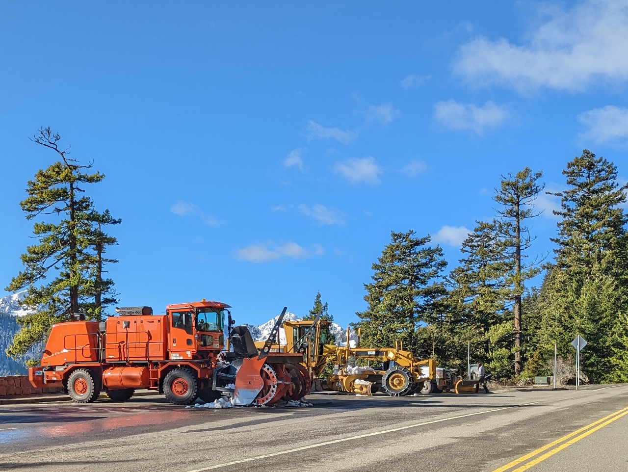 |
Snow Plows
Position: 47°59.58’N, -123°24.08’W
Snow removal equipment along the road to Hurricane Ridge at altitude 2,450 ft (747 m). Conditions can change quickly here and all cars entering during the winter are required to carry chains.
|
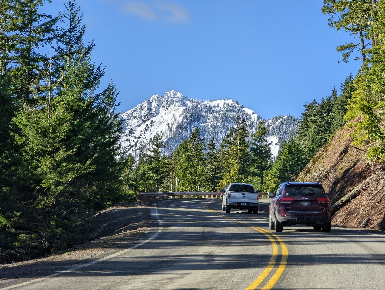 |
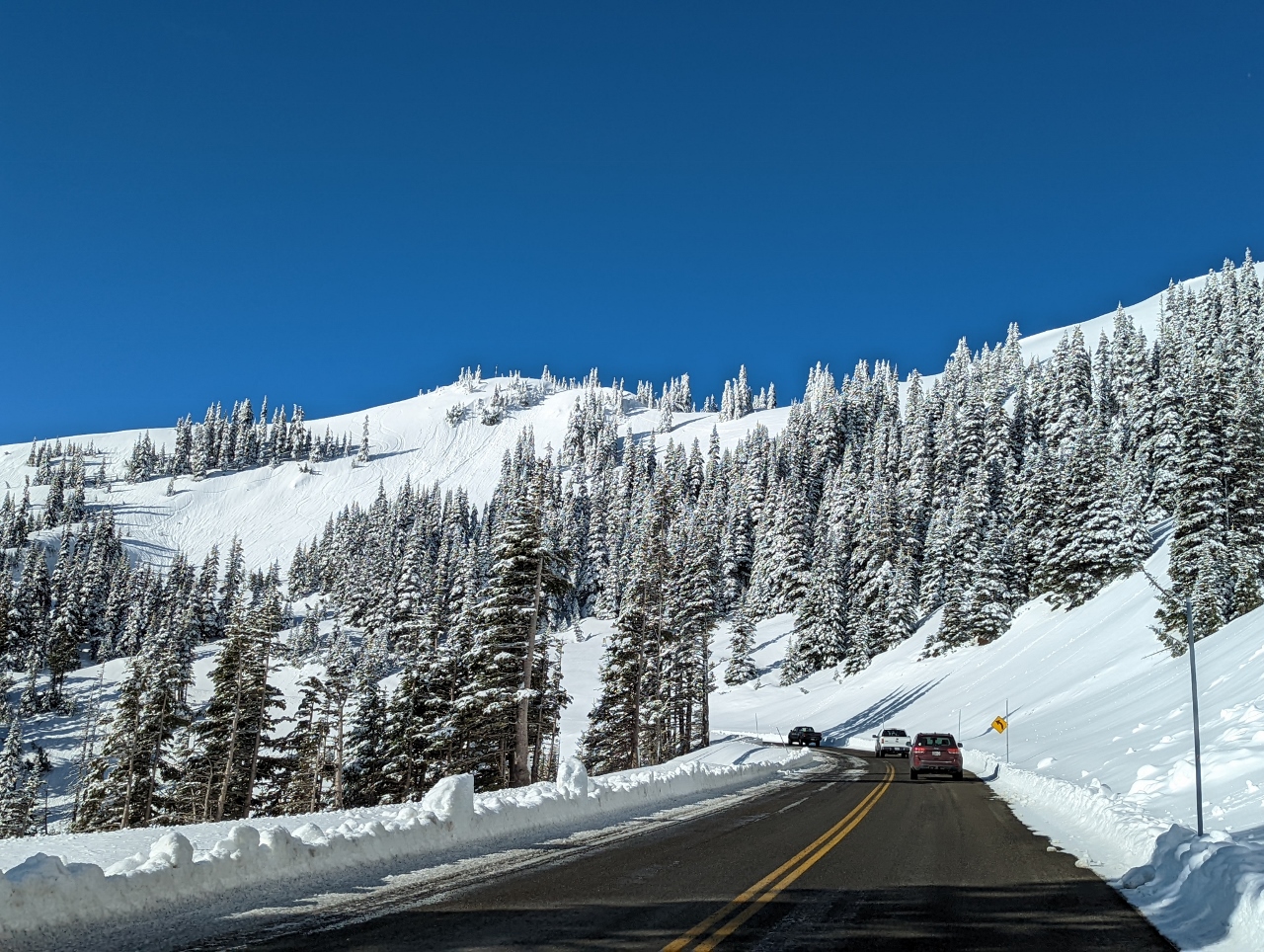
Hurricane Ridge
Position: 47°59.50’N, -123°24.44’W
A first glimpse to our destination, 5,242-ft (1,597m) Hurricane Ridge from 2,940ft (896m). We’re over halfway there by altitude and climbing quickly.
|
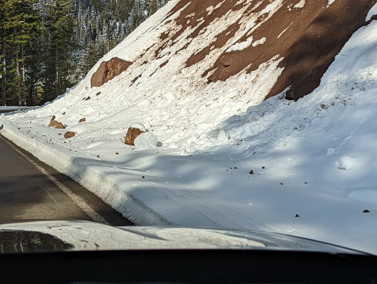 |
Slides
Position: 47°59.07’N, -123°27.39’W
Evidence of small rock and snow slides as we pass through the snow line at altitude 3,786ft (1,154m). We saw several quite large rocks on the side of the road that would have done some serious damage if they’d hit a vehicle.
|
 |
Klahhane Ridge
Position: 47°59.07’N, -123°27.39’W
6,080 ft (1,853 m) Klahhane Ridge towers above the road up to Hurricane Ridge.
|
 |
Snow
Position: 47°58.38’N, -123°28.80’W
We’re well above the snow line now at altitude 4,877ft (1,486 m) and the winter scenery is spectacular.
|
 |
Mount Olympus
Position: 47°58.20’N, -123°29.16’W
View to 7,980 ft (2,432 m) Mount Olympus, the highest and most prominent peak in Olympic National Park. The scenery is so amazing that even if we just drove up and down, and skipped the hike, we would have been happy.
|
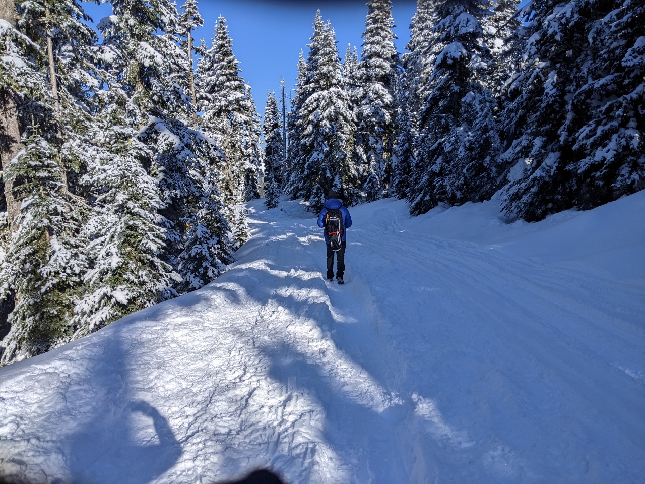 |
Walking
Position: 47°58.25’N, -123°30.06’W
In the summer, a 1.5-mile road leads from the Hurricane Ridge visitor center to the Hurricane Hill trailhead. But this road is not plowed in the winter, and instead is part of the snowshoe trail. The snow was fairly well-packed for the first section, so we initially walked with our snowshoes attached to our packs.
|
 |
Snowshoeing
Position: 47°58.29’N, -123°30.18’W
We donned our snowshoes about 10 minutes in to walk through the powder. This is the first of many spectacular views from the trail to Hurricane Hill in Olympic National Park. Port Angeles with the Strait of Juan de Fuca beyond, is just visible in the distance slightly right of center.
|
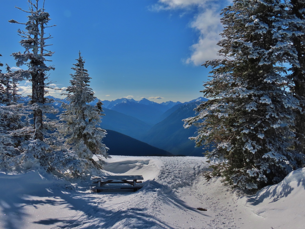 |
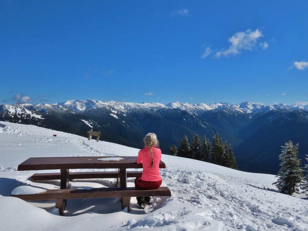
Bailey Range
Position: 47°58.37’N, -123°30.60’W
A picnic table along the road to the Hurricane Hill trailhead with a fabulous view to the Bailey Range in Olympic National Park.
|
 |
Trailhead
Position: 47°58.50’N, -123°31.05’W
Deep snow at the summer trailhead for the hike to Hurricane Hill. We’re getting pretty warm from the exertion and have exchanged our warm winter coats for a light shell.
|
 |
Hikers
Position: 47°58.63’N, -123°31.06’W
Most people on the trail were snowshoeing or skiing, but a few were hiking just in boots with microspikes.
|
 |
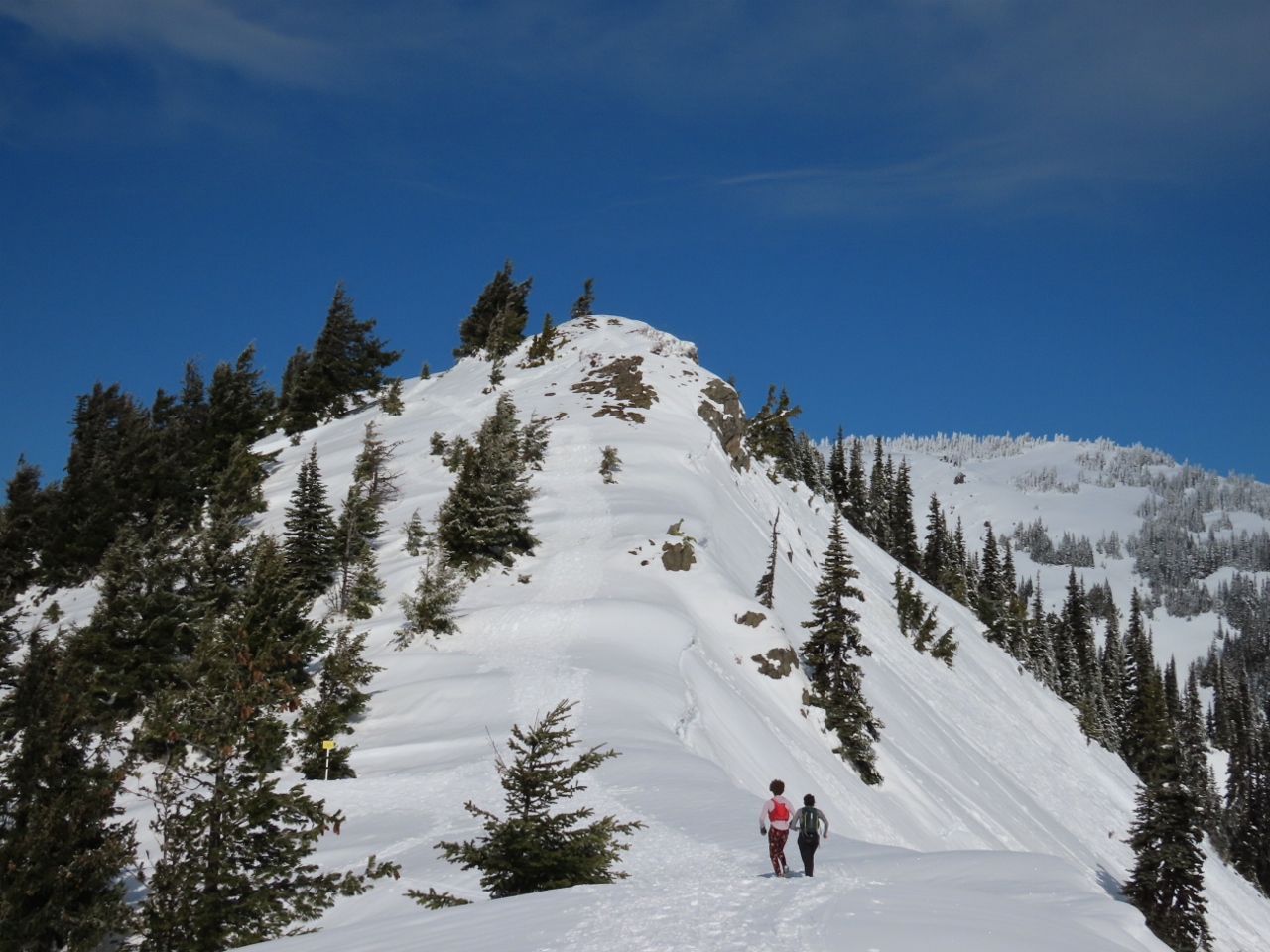
Detour
Position: 47°58.75’N, -123°31.17’W
The summer trail to Hurricane Hill runs below this ridge, but the winter path leads up and along the ridge to avoid an avalanche risk area.
|
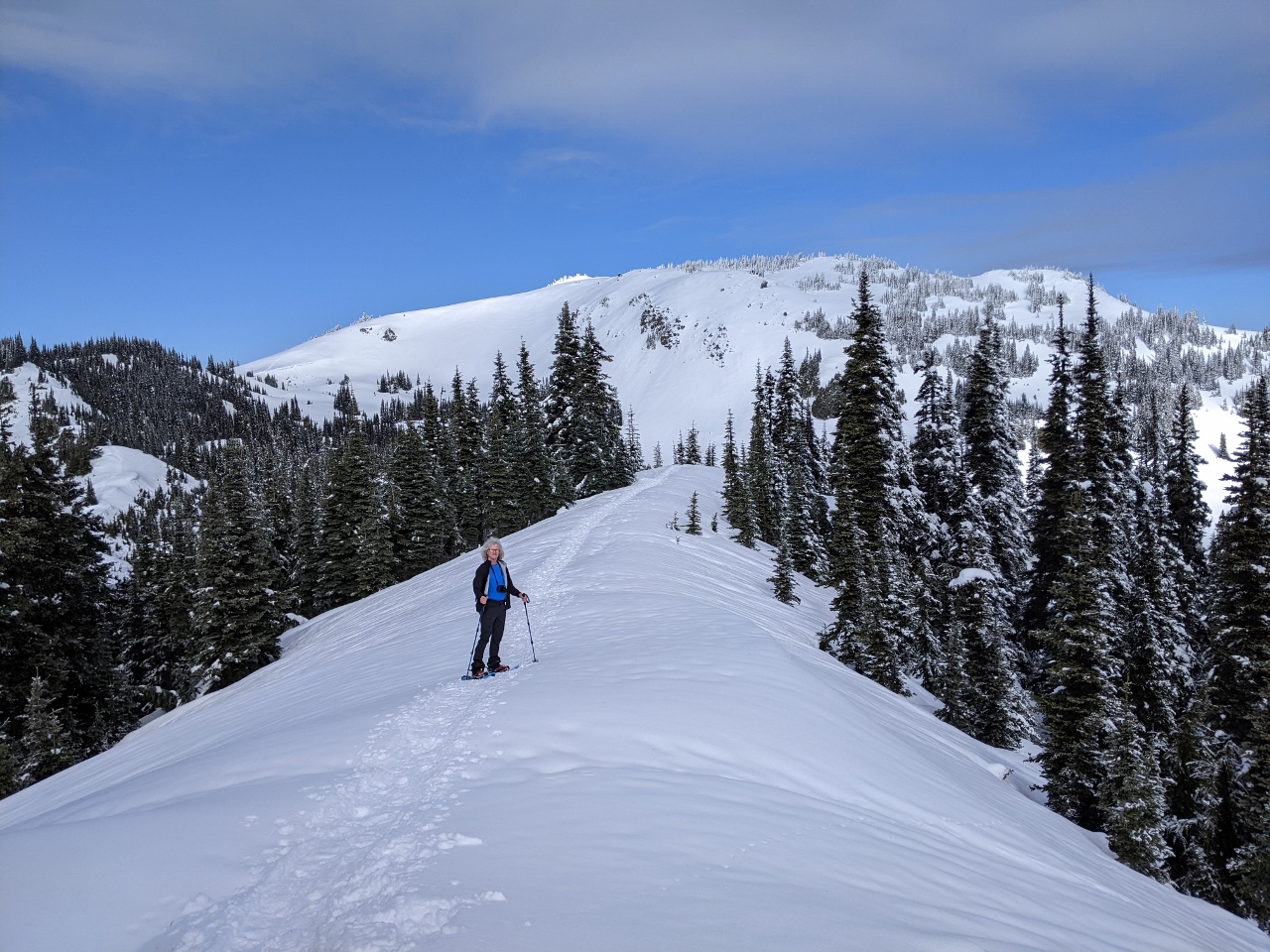 |
Detour Ridge
Position: 47°58.80’N, -123°31.21’W
Looking northwest along the detour ridge, with our destination of 5,765-ft (1,757m) Hurricane Hill in the background.
|
 |
Mt. Angeles
Position: 47°58.98’N, -123°31.61’W
Looking northeast to 6,454 ft (1,967 m) Mount Angeles, thick with snow.
|
 |
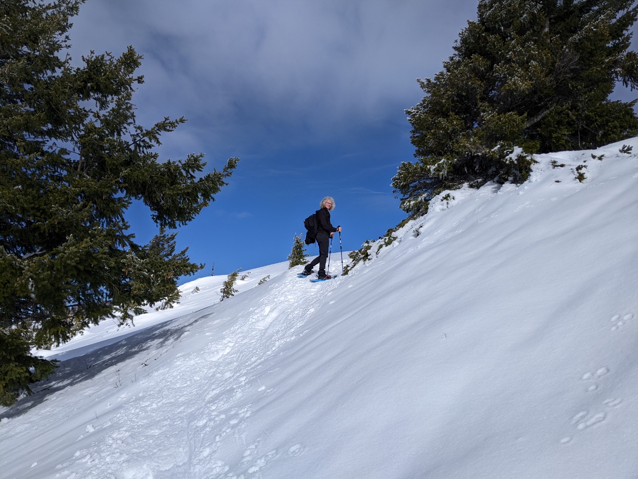
Final Ascent
Position: 47°59.07’N, -123°31.78’W
At the base of Hurricane Hill at altitude 5,309ft (1618 m) with a 400-ft climb ahead of us to reach the top.
|
|
|
Partway Up
Position: 47°59.25’N, -123°31.89’W
Looking back southeast to the trail we just walked from partway up Hurricane Hill with the Bailey Range visible in the distance.
|
 |
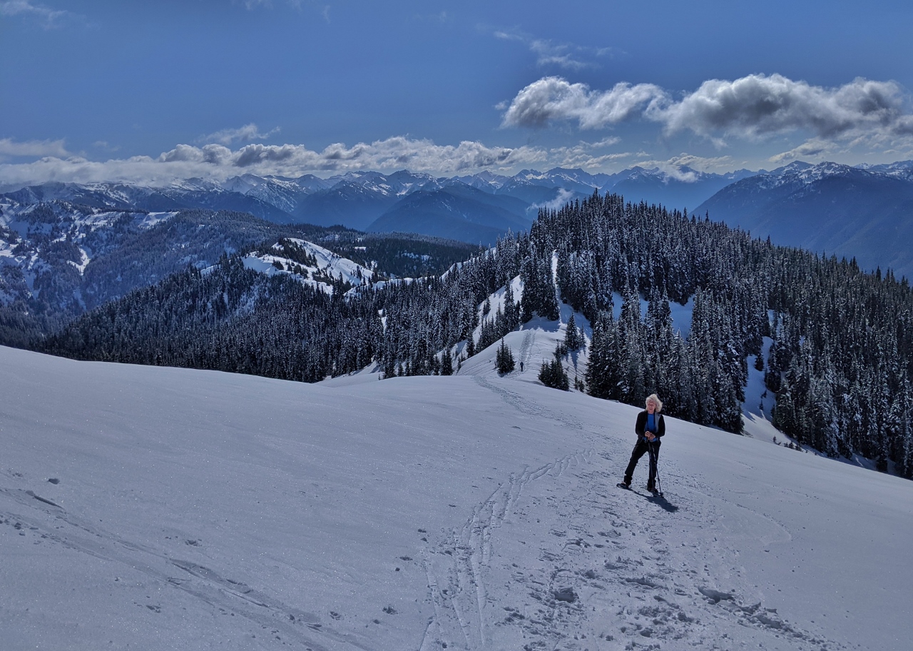
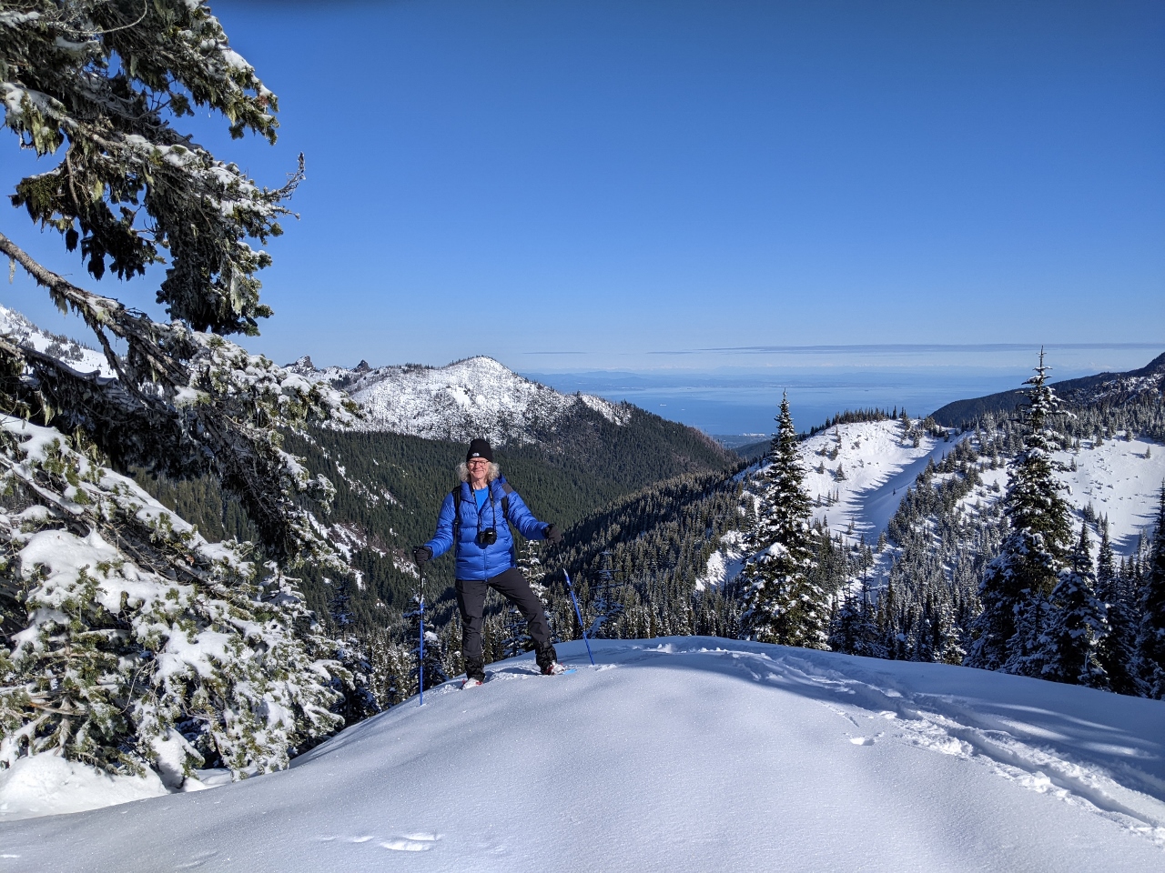
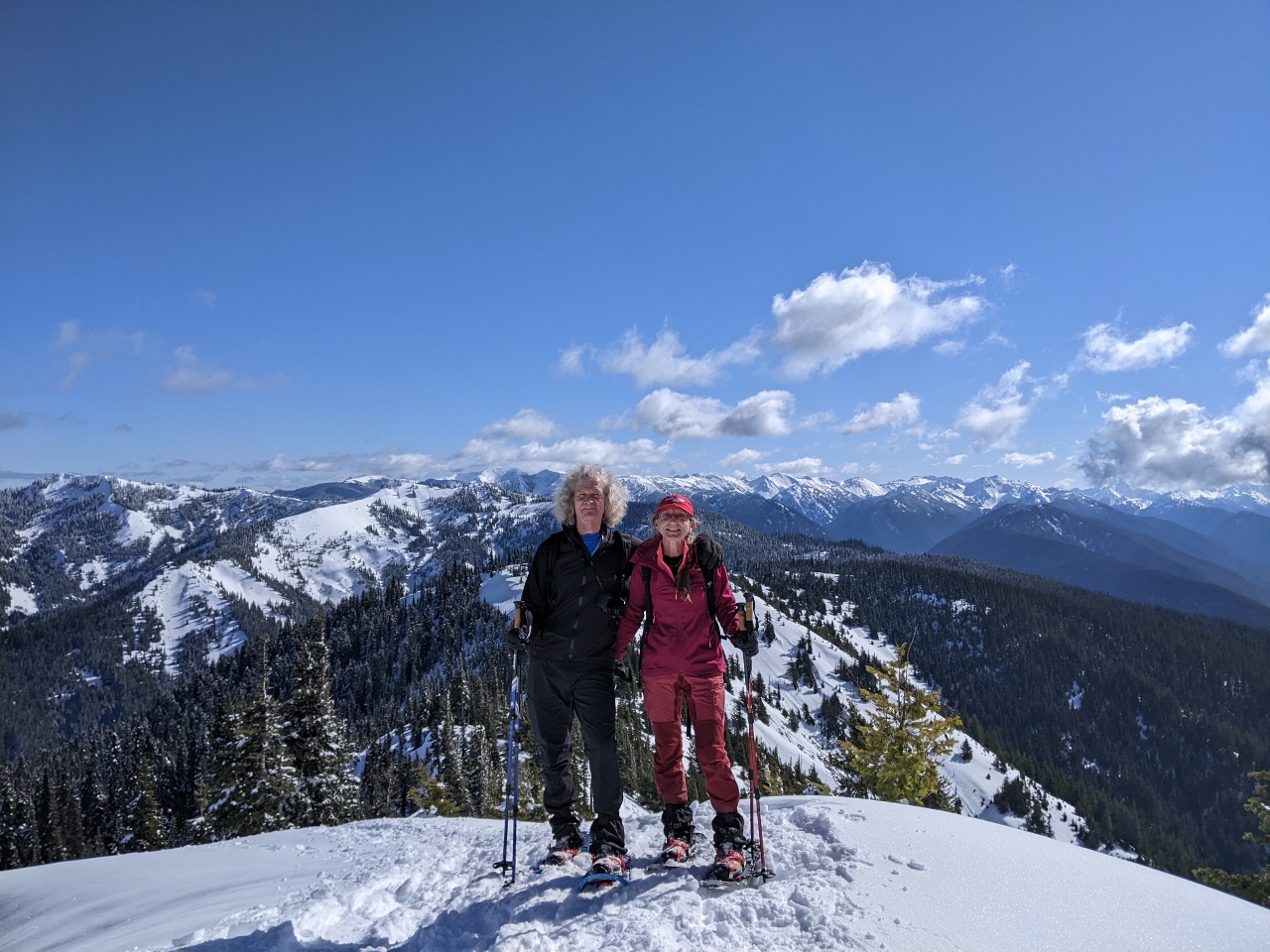
Hurricane Hill
Position: 47°59.42’N, -123°31.74’W
The spectacular view looking east from atop 5,309ft (1618 m) Hurricane Hill.
|
 |
Snow Sculptures
Position: 47°59.41’N, -123°31.74’W
Strong winds at the top of Hurricane Hill produces fabulous snow patterns, such as these horizontal formations on the trees.
|
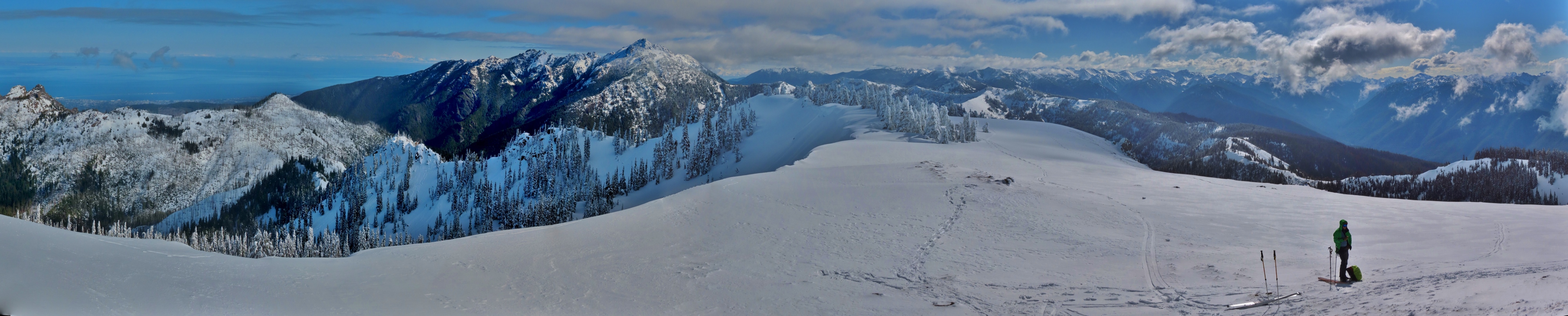 |
Panorama
Position: 47°59.42’N, -123°31.74’W
Panoramic view from 5,309ft (1618 m) Hurricane Hill. Port Angeles and the Strait of Juan de Fuca are visible at the left to the north, Mt. Angeles is slightly left of center to the east, and the Bailey range is southwest on the right (click image for a larger view).
|
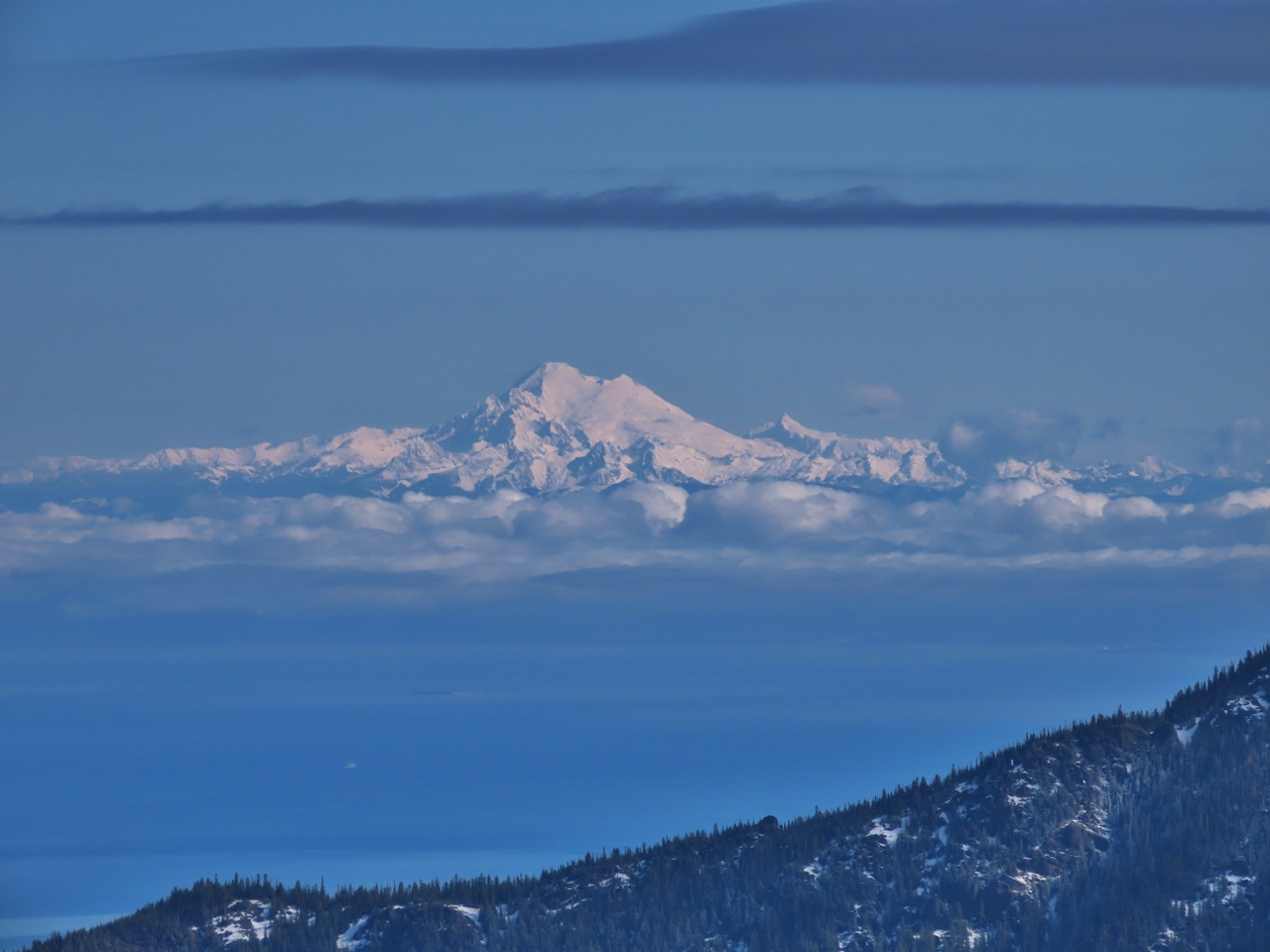 |
Mt. Baker
Position: 47°59.38’N, -123°31.79’W
Great view to snow-covered Mount Baker from atop Hurricane Hill in Olympic National Park.
|
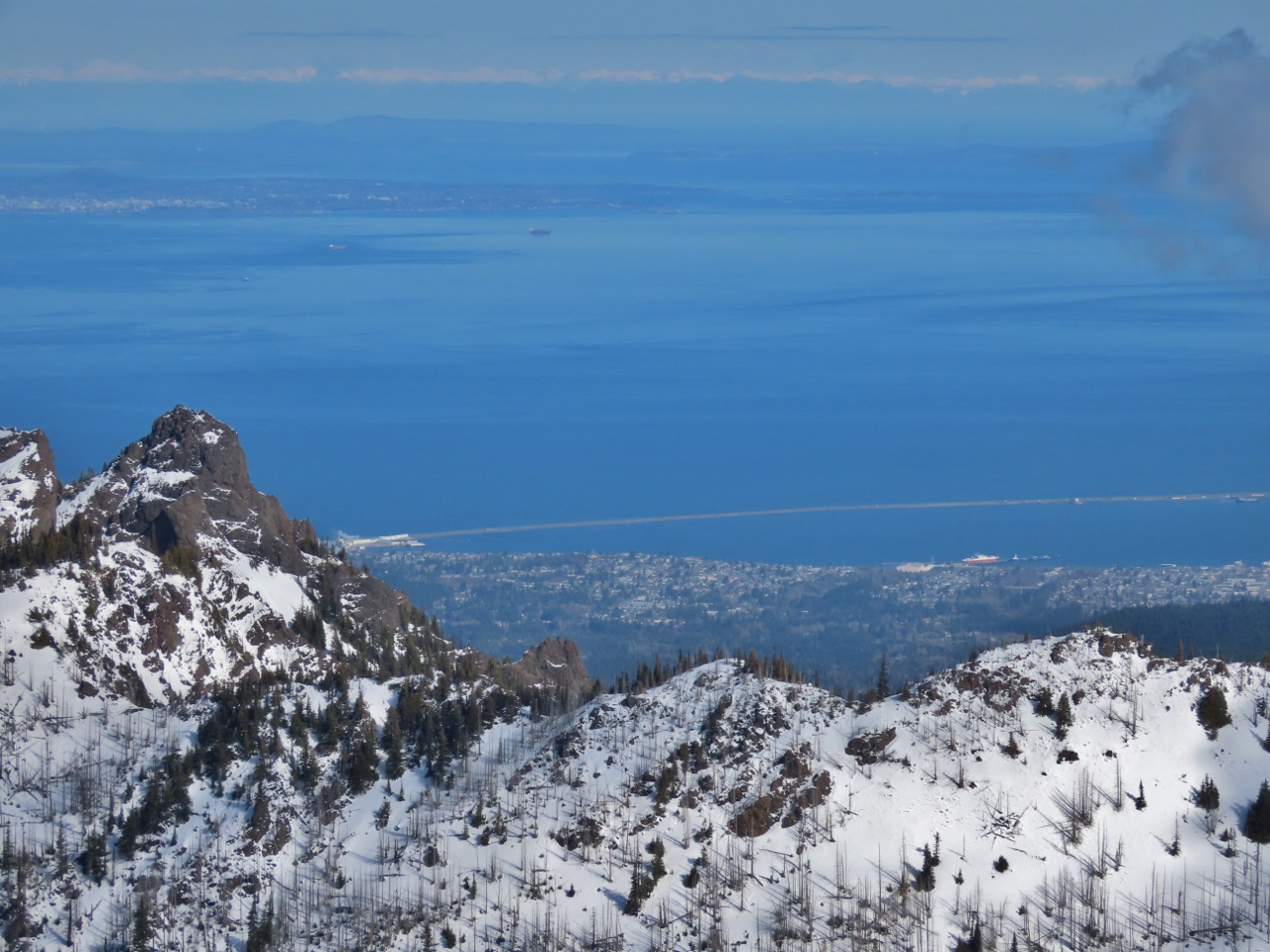 |
Port Angeles
Position: 47°59.42’N, -123°31.74’W
Port Angeles and the Strait of Juan de Fuca, with Victoria, Canada visible in the distance.
|
 |
Cornices
Position: 47°59.42’N, -123°31.74’W
Cornices (drifts of wind-blown snow that hang off one side of a ridge) along a ridge, with evidence below of sluffs, small loose snow avalanches. Sluffs are among the least dangerous types of avalanches, and often indicate stability in the snow below, but they do kill people on occasion, typically by carrying them off a cliff or burying them in a gully.
|
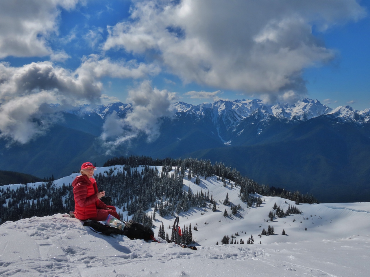 |
Snack
Position: 47°59.35’N, -123°31.62’W
Enjoying a snack with a hot cup of tea and a view to the Bailey Range from atop Hurricane Hill.
|
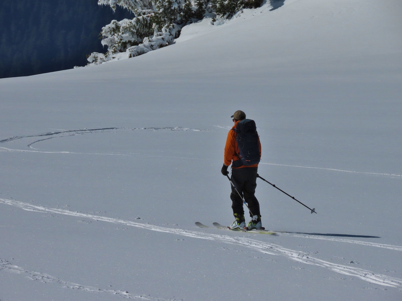 |
Skier
Position: 47°59.37’N, -123°31.65’W
Besides snowshowers and the occasional hiker, a larger number of people climb to the top and ski down. They attach high-friction ski skins to the skis for the way up, and remove the skins to ski down.
|
 |
Descent
Position: 47°59.01’N, -123°31.69’W
Back down on the detour ridge after a reluctant descent from Hurricane Hill, with the Bailey Range behind us. The scenery is so amazing it was hard to tear ourselves away.
|
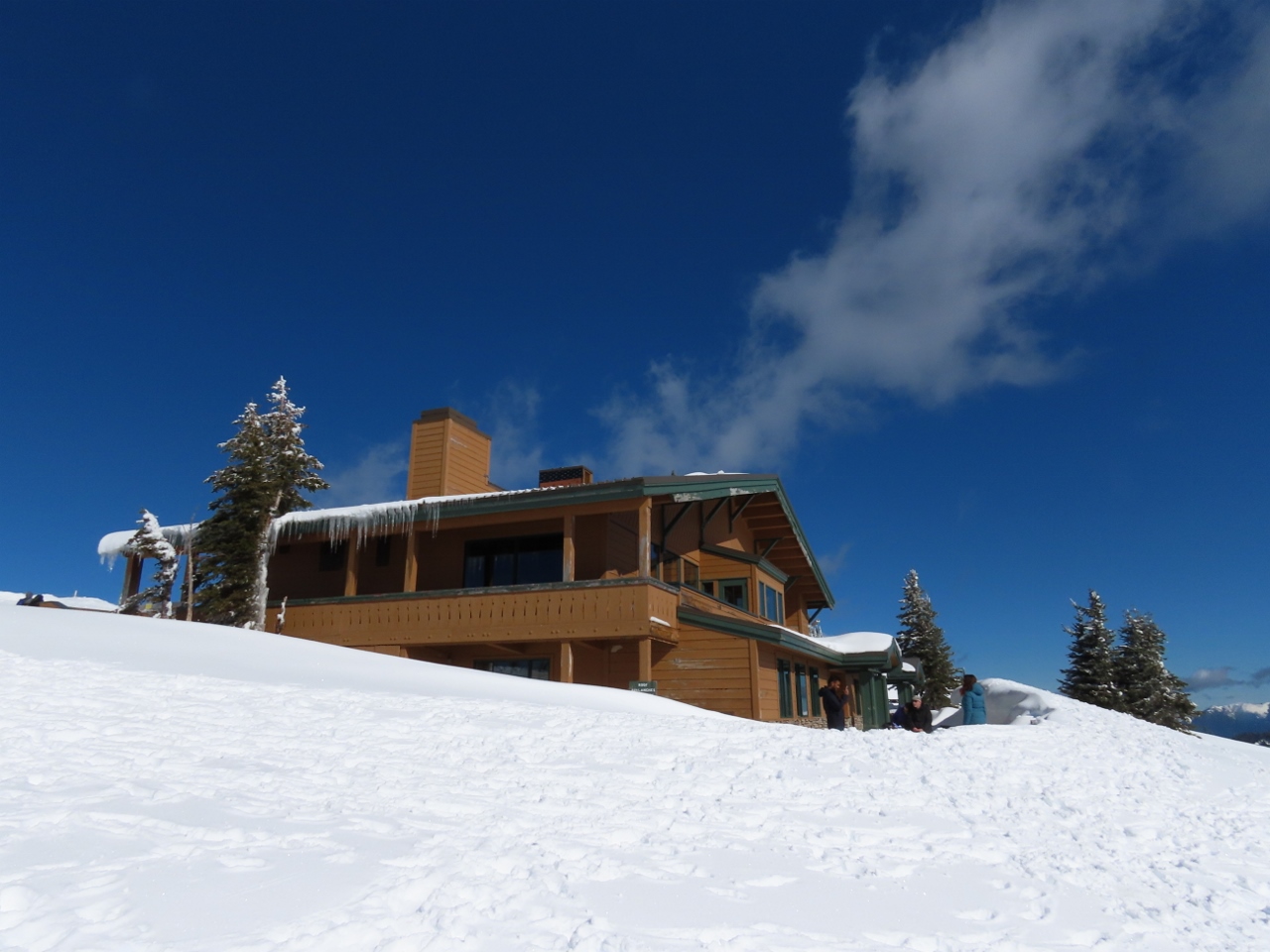 |
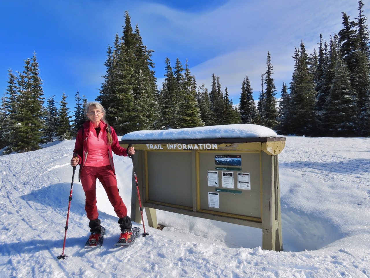
Visitors Center
Position: 47°58.19’N, -123°30.03’W
The Hurricane Ridge Visitor Center rents snowshoes and downhill ski equipment. The area just outside is a popular place for beginners to try out snowshoes.
|
 |
Buckhorn Wilderness
Position: 47°58.18’N, -123°29.88’W
Taking in the view to the mountains of the Buckhorn Wilderness, at 44,319-acre (17,935 ha) the largest of the five Congress-established wilderness areas at the eastern edge of Olympic National Park.
|
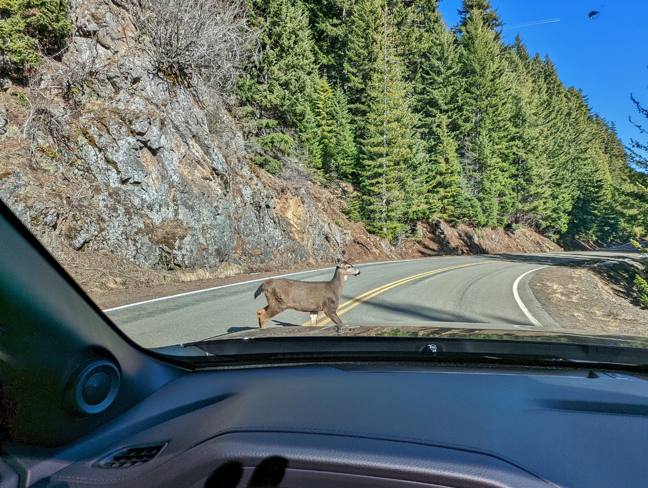 |
Deer Crossing
Position: 47°59.25’N, -123°25.75’W
Several deer at the side of the road decided it was a great time to cross as we approached. Apparently deer know they have the right of way in the park.
|
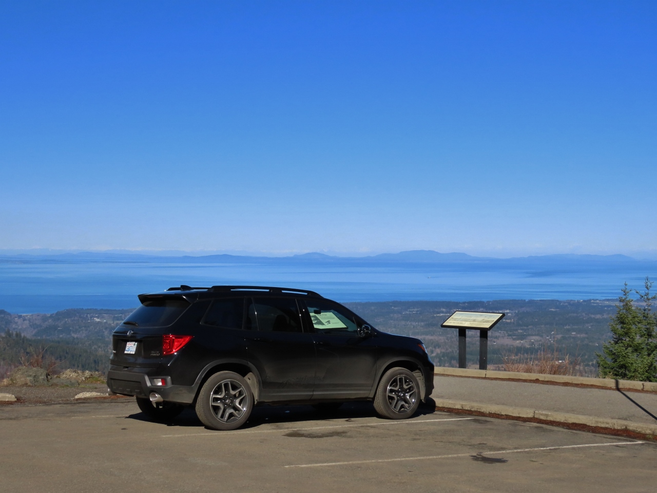 |
Morse Creek Overlook
Position: 48°0.77’N, -123°22.27’W
Our Honda Passport parked at the Morse Creek Overlook at altitude 2,533ft (772m) on Hurricane Ridge Road. Visible beyond is the Strait of Juan de Fuca and the Washington State mainland.
|
 |
Victoria
Position: 48°0.28’N, -123°22.51’W
View from the Morse Creek Overlook to Victoria, Canada with the mountains of Vancouver Island behind.
|
 |
Blue Mountain
Position: 48°0.77’N, -123°22.28’W
A short trail led from the Morse Creek Overlook parking lot to a viewpoint over Morse Creek to 6,007-ft (1,831) Blue Mountain.
|
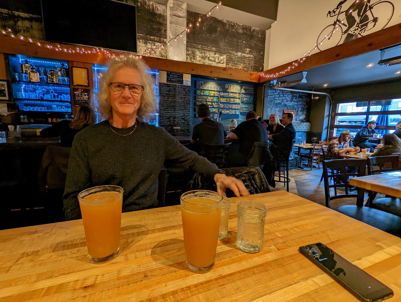 |
Next Door Gastropub
Position: 48°7.16’N, -123°26.05’W
A delicious late lunch at Next Door Gastropub in Port Angeles.
|
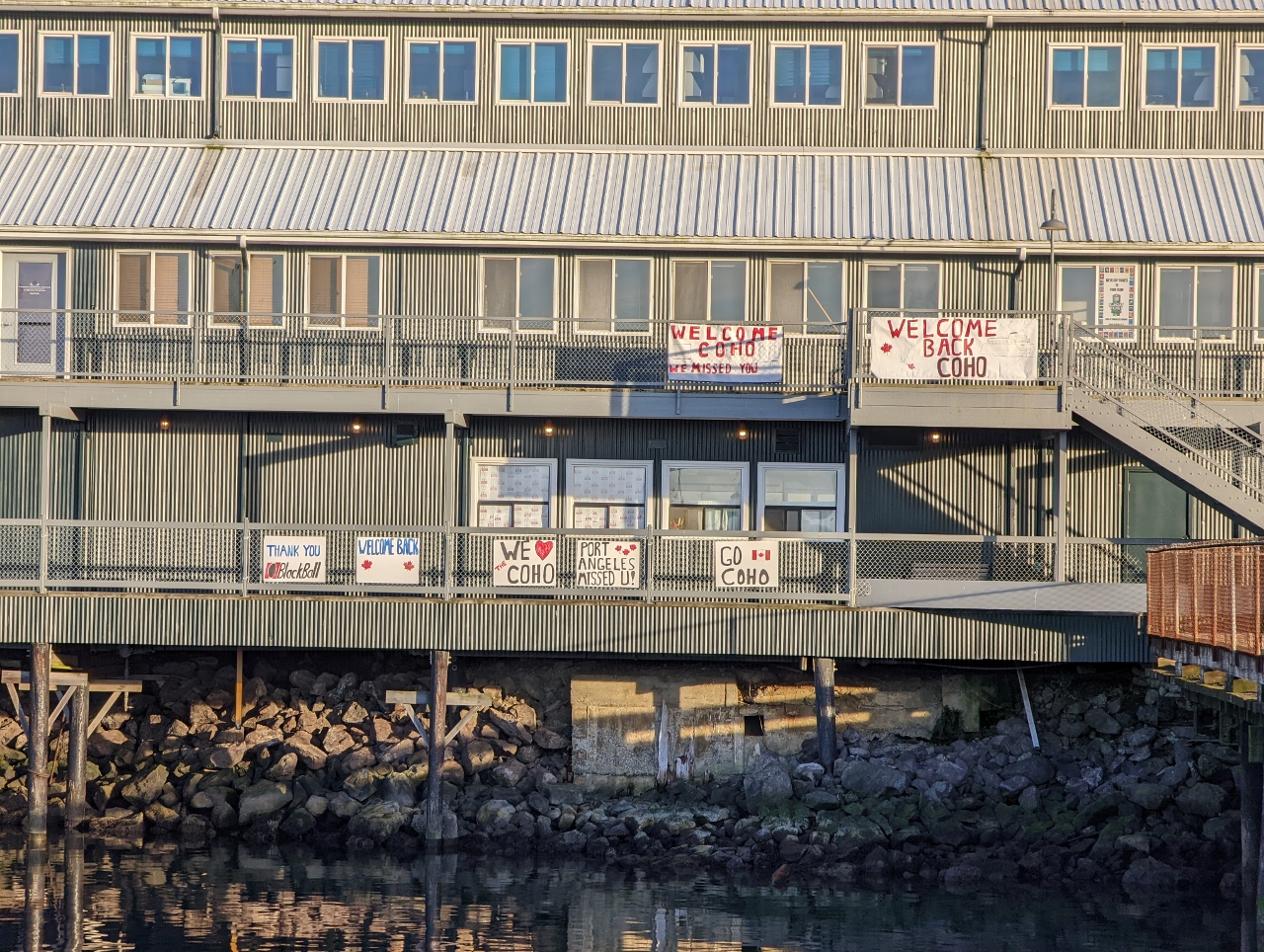 |
Welcome Coho
Position: 48°7.26’N, -123°25.89’W
The vehicle and passenger ferry Coho has been running between Port Angeles and Victoria, Canada several times a day since its launch in 1959, and is a fixture in both cities. With the Canadian-US border closed during the pandemic, the Coho was out of service for 19 months, and recently started up again in November when Canadian entry restrictions eased. Signs near the Coho dock show how happy people were to see the ship back in service.
|
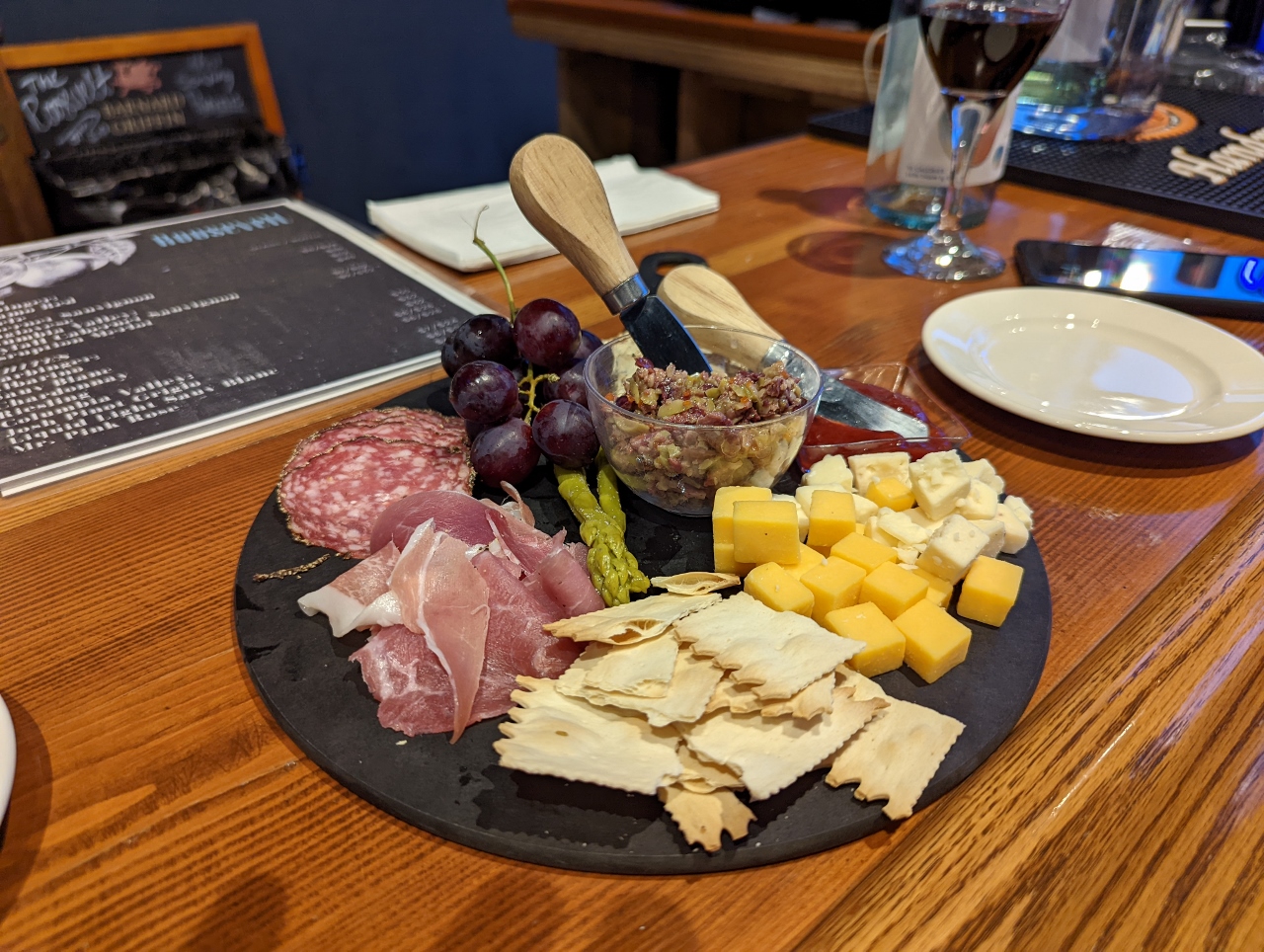 |
The Roosevelt
Position: 48°7.24’N, -123°25.82’W
A charcuterie plate for a light dinner at The Roosevelt in the Port Angeles Wharf.
|
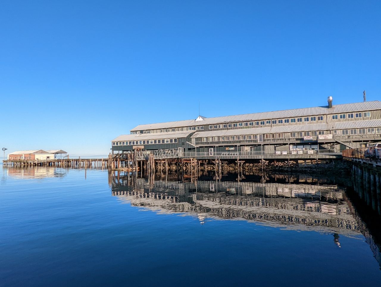 |
Port Angeles Wharf
Position: 48°7.26’N, -123°25.89’W
Wonderfully calm and clear evening at the Port Angeles Wharf.
|
 |
Click the travel log icon on the left to see these locations on a map. And a map of our most recent log entries always is available at mvdirona.com/maps. |
If your comment doesn't show up right away, send us email and we'll dredge it out of the spam filter.