Olympic National Park, at the northwest corner of Washington State, was high on our list of places to visit now that we had the extended range of a vehicle. Growing up in Victoria, Canada, James has hiked and camped there many times, but Jennifer had yet to go. In the winter, the popular hiking destination of Hurricane Ridge is snow-covered and accessible only to vehicles carrying chains, but many other hiking opportunities exist that are below the snow line.
Mt. Storm King is among the best no-snow winter view climbs in the park, and was the destination for our first real hike since returning to live in Seattle. We loved being back out hiking again and really enjoyed the trek through old-growth rainforest and the views to Crescent Lake and the Strait of Juan de Fuca. On descending we walked a short trail to beautiful Marymere Falls before returning to Port Angeles for another excellent evening.
Below are highlights from Feb 5th, 2022. Click any image for a larger view, or click the position to view the location on a map. And a map with our most recent log entries always is available at mvdirona.com/maps.
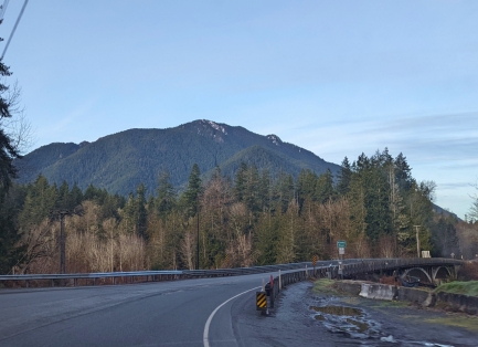 |
Elwha River
Position: 48°4.24’N, -123°34.41’W
Crossing over the Elwha River en route to hike Mt. Storm King in Olympic National Park. The weather is a little chilly, but clear—ideal for a winter hike.
|
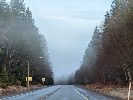 |
Fog
Position: 48°4.15’N, -123°37.54’W
Our clear weather disappeared into a thick fog bank. Fortunately it dissipated by the time we got to the trailhead.
|
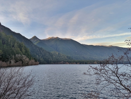 |
Crescent Lake Viewpoint
Position: 48°4.33’N, -123°46.44’W
Crescent Lake seen from a viewpoint along Highway 101, with the sun lighting up the mountain tops in the distance.
|
 |
Ranger Station
Position: 48°3.47’N, -123°47.30’W
The Olympic National Park Storm King Ranger Station, at the trailhead to Mt. Storm King. The station only is staffed during the summer.
|
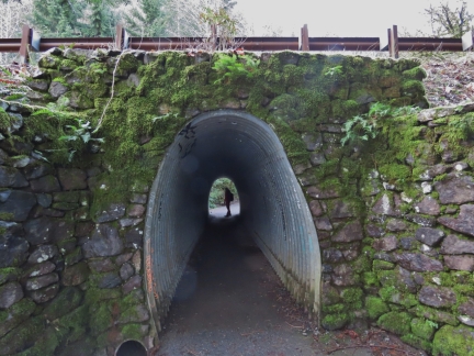 |
Tunnel
Position: 48°3.47’N, -123°47.18’W
Pedestrian tunnel under Highway 101, creatively made by forming a storm drain pipe into a oval shape.
|
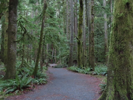 |
Forest
Position: 48°3.40’N, -123°47.29’W
The first part of the trail to Mt. Storm Kings shares a route with the beautiful and well-maintained path to Marymere Falls.
|
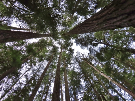 |
Old Growth
Position: 48°3.35’N, -123°47.37’W
The old-growth trees along the trail are fabulous, and really tall.
|
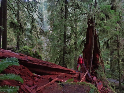 |
Fallen Cedar
Position: 48°3.09’N, -123°47.27’W
Bright red wood of a cedar fallen across the trail to Mt. Storm King.
|
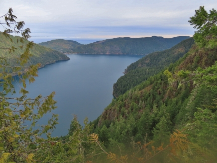 |
Crescent Lake
Position: 48°3.27’N, -123°46.80’W
Great view to Crescent Lake from altitude 1653 ft (504 m). We started out at 402 ft (122 m), so have climbed about 1200 ft (375m). In the distance a thick fog is visible over the Strait of Juan de Fuca (click image for a larger view).
|
 |
End Maintained Trail
Position: 48°3.32’N, -123°46.74’W
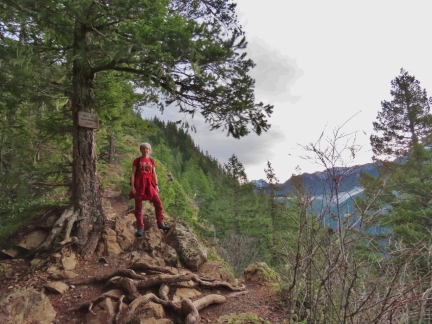
We reached the end of the maintained trail to Mt. Storm King at about altitude 2,000 ft (580m).
|
 |
Bluff
Position: 48°3.31’N, -123°46.58’W
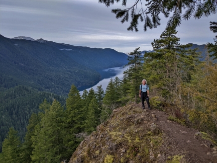
The unmaintained portion of the trail is a little more exposed, with great views.
|
 |
Climbing Ropes
Position: 48°3.28’N, -123°46.62’W
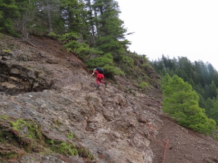
Climbing ropes along a steeper section of the ascent. Generally the going was not particularly difficult, and the ropes we’re really required.
|
 |
Climbing
Position: 48°3.30’N, -123°46.46’W
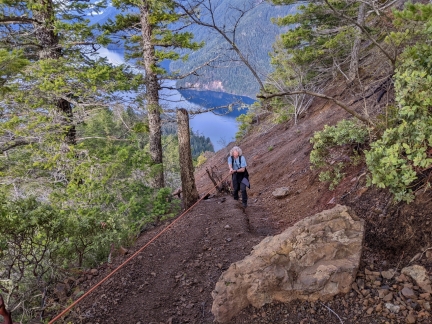
Clearing the top of the climbing ropes, with Crescent Lake visible behind.
|
 |
Mt Storm King
Position: 48°3.32’N, -123°46.42’W
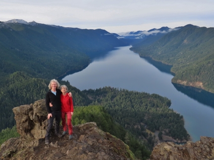
Atop Mt Storm King at 2600 ft (792m), with Crescent Lake to the north behind us.
|
 |
Panoramic View
Position: 48°3.32’N, -123°46.42’W
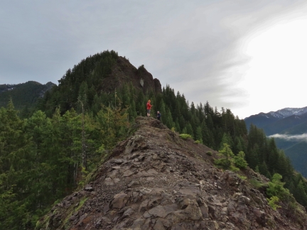
The fabulous view north across Crescent Lake from atop 2600 ft (792m) Mt Storm King in Olympic National Park. In the distance on the right is the Strait of Juan de Fuca, thick with fog (click image for a larger view).
|
 |
Hikers
Position: 48°3.32’N, -123°46.42’W
The trail to Mt. Storm King wasn’t very busy compared to the summer, but at least a dozen people arrived and departed during the time we were there.
|
 |
Snow
Position: 48°3.32’N, -123°46.42’W
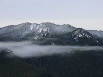
Snow-dusted mountain tops viewed from Mt. Storm King.
|
 |
Parking Lot
Position: 48°3.32’N, -123°46.42’W
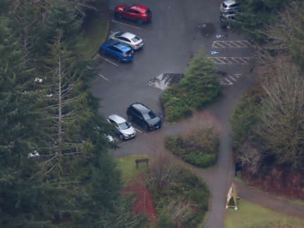
Our “tender to condo”, the black Honda Passport at center, seen from atop Mt. Storm King. When we arrived around 9am, the parking lot was pretty empty. By the time we returned a few hours later, it was completely full with people waiting for a spot. Most were taking the easier trail to Marymere Falls, but we did pass a few dozen climbing Mount Storm King.
|
 |
Canada Jay
Position: 48°3.32’N, -123°46.42’W
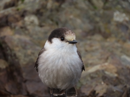
Seemingly fearless Canada Jays are known as ‘camp robbers’ for their habit of stealing food. They lived up to their reputation atop Mt. Storm King, creeping close and swooping in to steal a piece of granola bar right out of our hands as we stopped for a snack before returning back down.
|
 |
Footbridge
Position: 48°3.18’N, -123°47.38’W
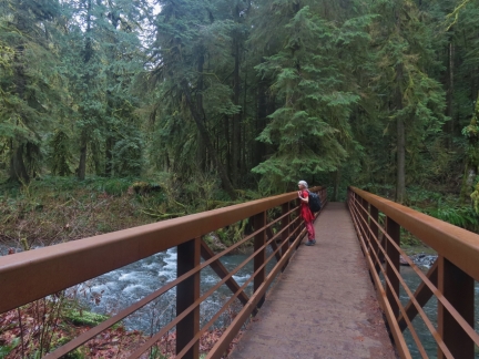
Enjoying to the view to Barnes Creek from a footbridge across, en route to Marymere Falls in Olympic National Park.
|
 |
Barnes Creek
Position: 48°3.09’N, -123°47.27’W
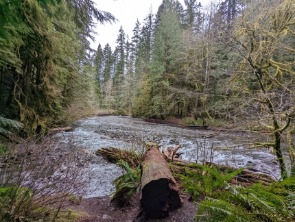
Beautiful old-growth forest looking down Barnes Creek.
|
 |
Trail to Falls
Position: 48°3.08’N, -123°47.28’W
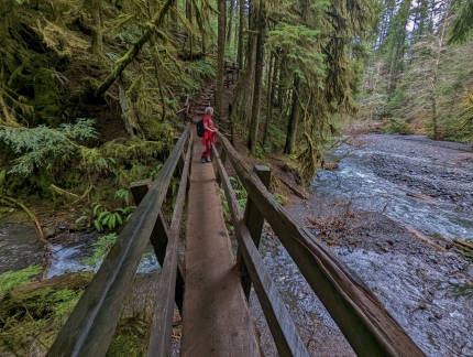
Another footbridge before steps leading up to Marymere Falls. The forest setting is fabulous.
|
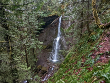 |
Marymere Falls
Position: 48°3.03’N, -123°47.32’W
90ft (27m) Marymere Falls are a beautiful sight at the end of a short and easy trail. We really enjoyed both hikes.
|
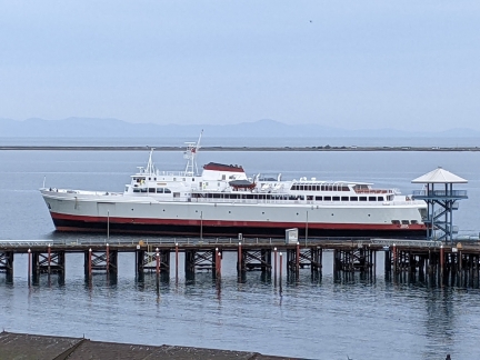 |
Coho
Position: 48°7.06’N, -123°25.63’W
We caught the Coho returning back to Port Angeles from Victoria, Canada as we arrived back from our hike. The mountains on Vancouver Island in Canada are just visible in the distance (click image for a larger view).
|
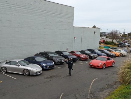 |
Rally
Position: 48°7.16’N, -123°25.80’W
As we walked out for dinner from our hotel, we passed a group of sports cars getting lining up for photos before a rally.
|
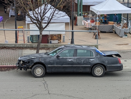 |
Wreck
Position: 48°7.16’N, -123°25.83’W
A vehicle at the opposite end of the spectrum from some of the high-end sports cars we watched lining up for the rally. This one appeared to have rolled, was crushed in the front, the rear window was missing and the trunk didn’t latch. It’s amazing it actually moved at all, but someone drove it up, ran an errand, and continued on their way.
|
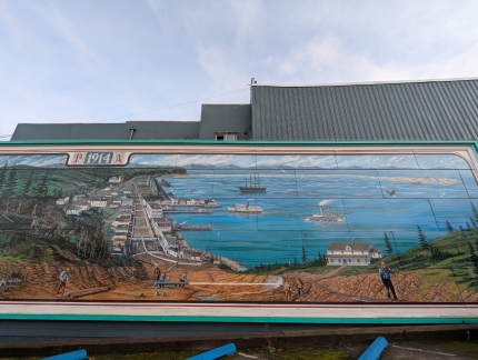 |
Port Angeles 1914
Position: 48°7.15’N, -123°25.99’W
Mural depicting Port Angeles in 1914, with the lighthouse on Ediz Hook at far right.
|
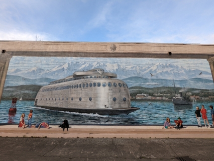 |
Kalakala
Position: 48°7.15’N, -123°25.99’W
A mural in Port Angeles showing the iconic ferry Kalakala. The art deco-styled vessel was an immensely popular tourist draw in Seattle, second only to the Space Needle during the 1962 World’s Fair. The vessel was launched in 1926 as a ferry between San Francisco and Oakland, but written off as a total loss when a 1933 fire destroyed the superstructure. The Black Ball Line purchased the hull, brought it to Seattle, and rebuilt the superstructure with a modern, streamlined design. The ship served between Bremerton and Seattle starting in 1935, but became obsolete by the 1950s, because its narrow car deck could not accommodate the larger American cars of the period.
With an enclosed bow design, the vessel was suitable for the rough-water run between Port Angeles and Victoria, and ran that route between 1955 and 1959, when the purpose-built Coho replaced it. The vessel returned to service on the Bremerton-Seattle run between 1960 and 1967 as a high-season-only ship, and was especially popular during the 1962 World’s Fair to bring tourists from Seattle to tour the Bremerton Navy Shipyard. After being retired from service in 1967, the ship operated as a seafood processing barge in Alaska until the 1980s when it fell into disuse. In the late 1990s, a new owner brought the ship back to Seattle at Bell Street Pier 66, with plans to renovate the vessel as a museum and event center. The plans never came to fruition and over the subsequent 20 years the unwanted vessel was shunted between locations including Lake Union, Neah Bay and finally Tacoma, where it eventually was scrapped in 2015. |
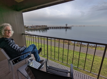 |
Harbor View
Position: 48°7.14’N, -123°25.68’W
View to Port Angeles harbor from the balcony of our room at the Red Lion Hotel.
|
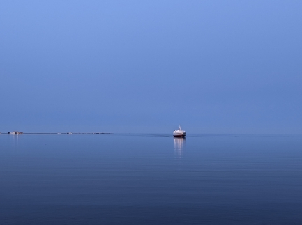 |
Coho Returning
Position: 48°7.14’N, -123°25.68’W
The Coho completing its second and final round-trip of the day between Port Angeles and Victoria, Canada. The evening was wonderfully calm and we spent ages out on our hotel room deck enjoying the view to Port Angeles harbor.
|
 |
Click the travel log icon on the left to see these locations on a map. And a map of our most recent log entries always is available at mvdirona.com/maps. |

If your comment doesn't show up right away, send us email and we'll dredge it out of the spam filter.