Dungeness Spit, on the Olympic Peninsula at the northeastern corner of Washington State, is one of the longest natural sand spits in the world at 6.8 miles (10.9 km) long. On the tip is a light station that has been in continuous operation as an aid to navigation since it was first lit in 1857, the second lighthouse in the territory of Washington. We’ve anchored off the spit several times, but have never been ashore until we stopped there on a recent weekend road trip to Port Angeles and Olympic National Park.
From Seattle we took a morning ferry to Bainbridge Island and drove north through Kitsap Peninsula, stopping in Sequim for lunch and a walk through John Wayne Marina. Afterwards we drove to nearby Dungeness National Wildlife Reserve to walk along the spit. In wonderfully calm weather, we had a great time walking alongside stacks of huge driftwood logs as waves gently lapped against the pebble beach and commercial traffic passed by in the Strait of Juan de Fuca. We finished the day with more water views in Port Angeles, both at dinner and from the balcony of our hotel room.
Below are highlights from February 4th, 2022. Click any image for a larger view, or click the position to view the location on a map. And a map with our most recent log entries always is available at mvdirona.com/maps.
 |
K-9 Unit
Position: 47°36.14’N, -122°20.31’W
The Washington State Police K-9 unit screening vehicles for explosives in the line for the ferry to Bainbridge Island. We’re crossing over on a weekend trip to Olympic National Park.
|
 |
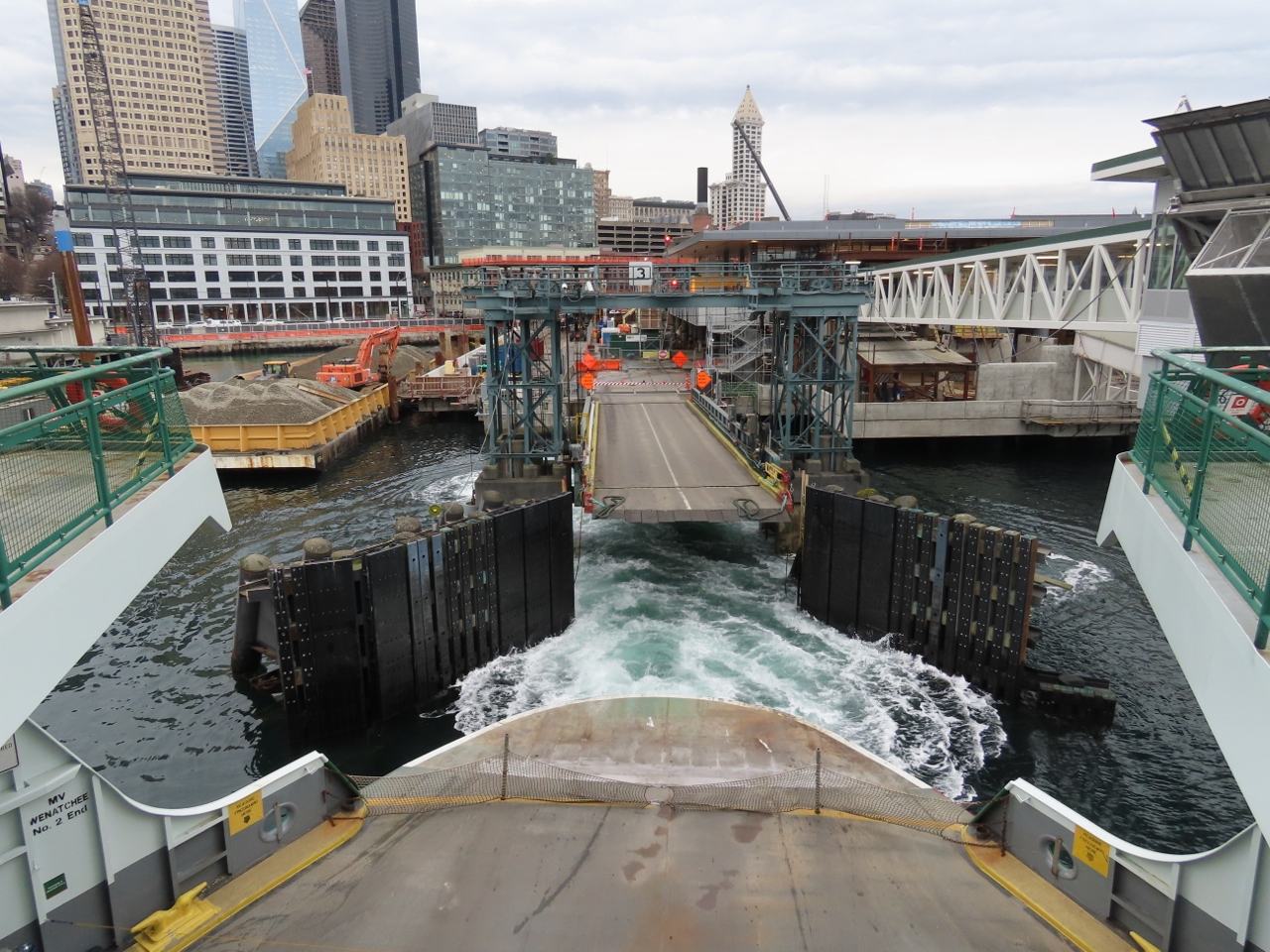
Wenatchee
Position: 47°36.14’N, -122°20.34’W
Boarding the ferry Wenatchee at Coleman Dock for Bainbridge Island. The ferry arrived with a full load of commuters on this Friday morning, but is departing only lightly loaded.
|
 |
Coleman Dock
Position: 47°36.14’N, -122°20.31’W
Departing Coleman Dock on the ferry Wenatchee with downtown Seattle in the background.
|
 |
Agate Pass
Position: 47°42.38’N, -122°33.65’W
Passing over Agate Pass that separates Bainbridge Island and Kitsap Penninsula. The Agate Pass Bridge was built in 1950, replacing a car ferry service that operated since the 1920s.
|
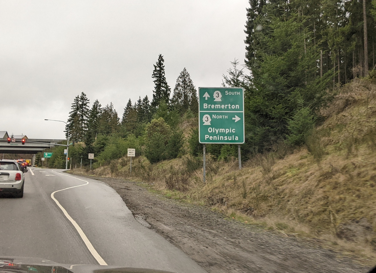 |
Olympic Peninsula
Position: 47°45.11’N, -122°38.73’W
Our turnoff to Washington State Route 3 towards the Olympic Peninsula.
|
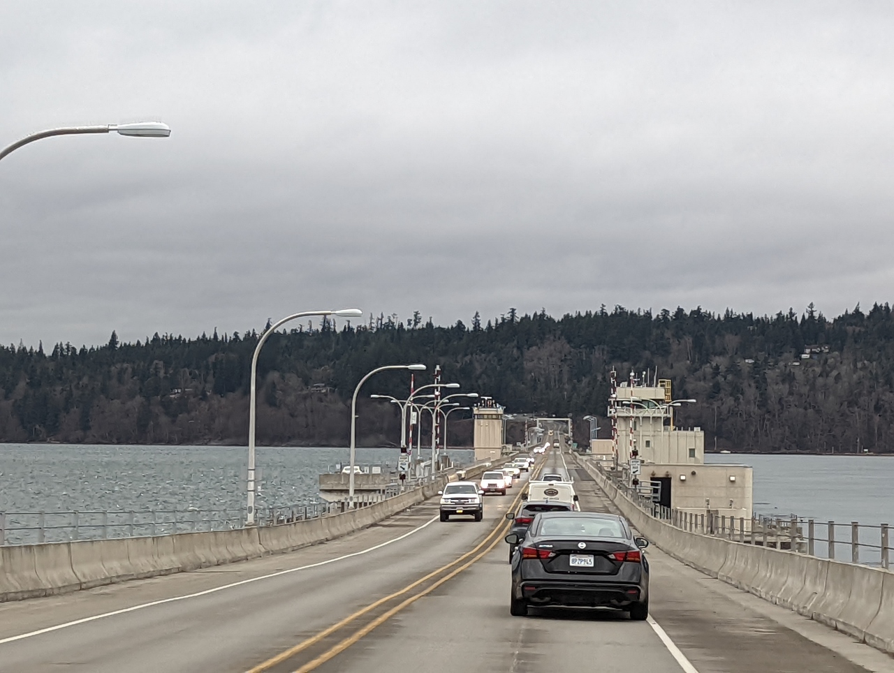 |
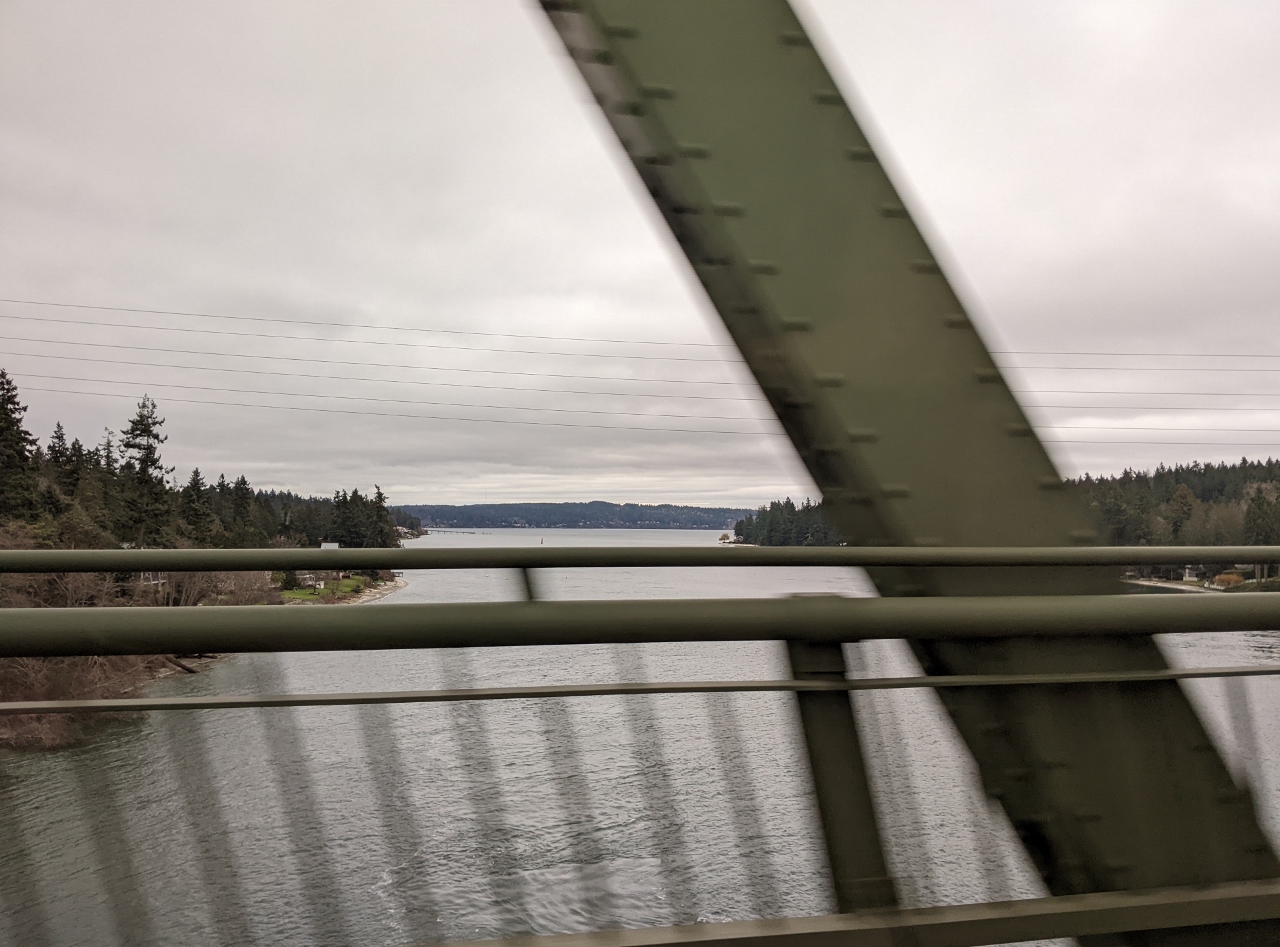
Hood Canal Bridge
Position: 47°51.20’N, -122°36.77’W
Crossing the Hood Canal Bridge from Kitsap to Olympic Peninsula. The bridge, completed in 1961, is the 3rd largest floating bridge in the world. We’ve boated a lot in this area and have often anchored in Bywater Bay northeast of the bridge. Just to the south is Naval Submarine Base Bangor, the only Trident Submarine Base in the US Pacific Fleet. We’ve occasionally seen the bridge open for one of the huge “boomers” to pass through.
|
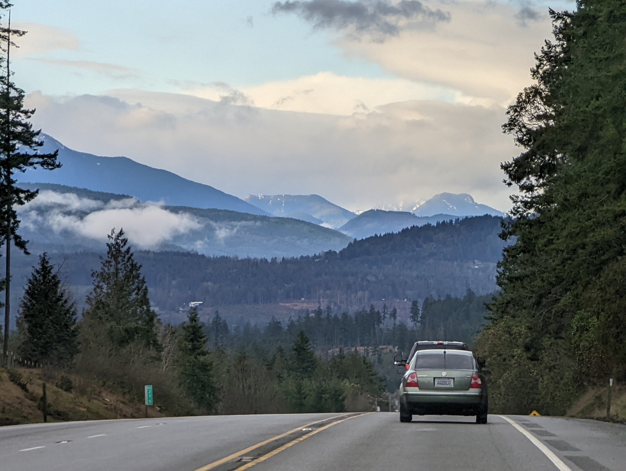 |
Olympic Mountains
Position: 48°3.02’N, -122°56.24’W
Great view to the Olympic Mountains from US Highway 101 at Miller Peninsula.
|
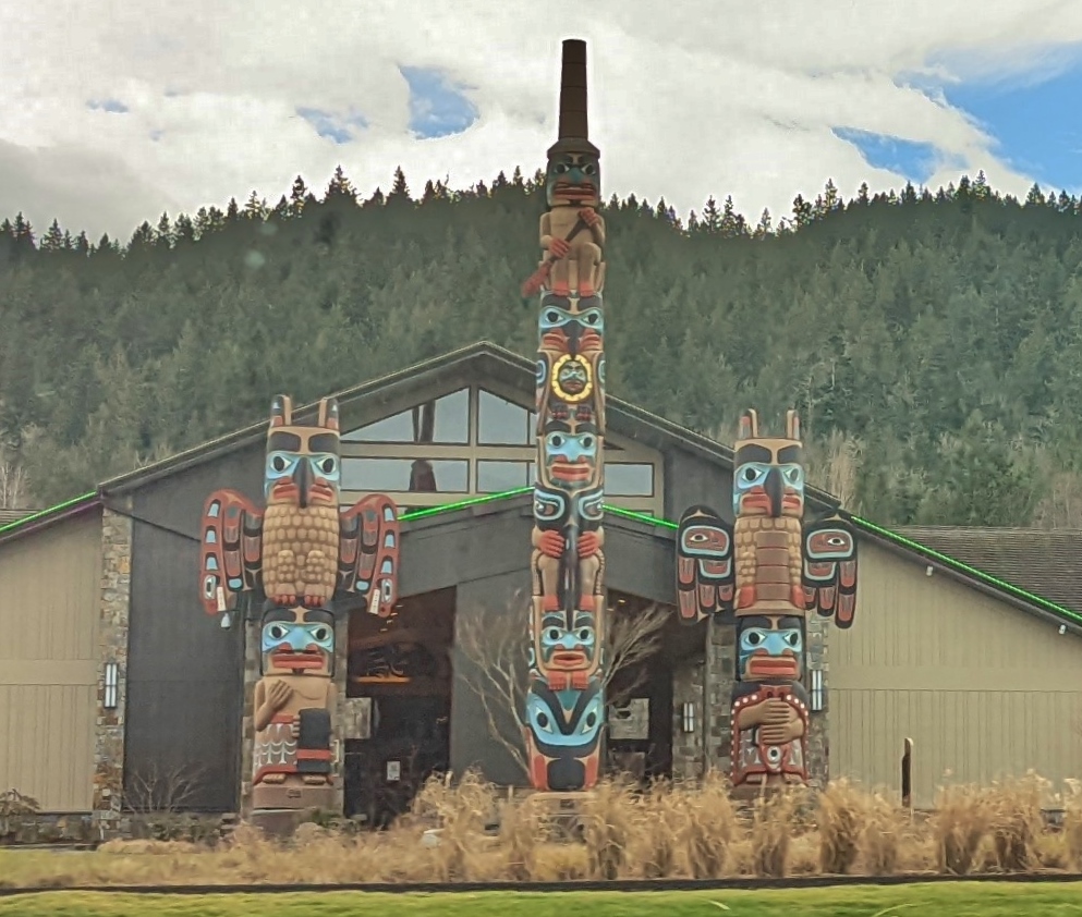 |
7 Cedars Casino
Position: 48°1.36’N, -123°0.60’W
Colorful totem poles at the 7 Cedars Casino on the Jamestown S’Klallam tribal land.
|
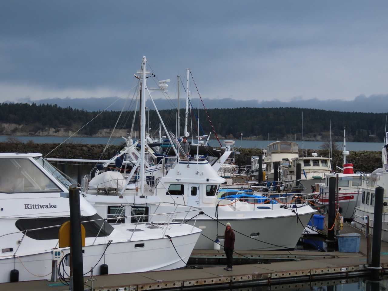 |
Irene
Position: 48°3.74’N, -123°2.52’W
Jeff (on flybridge) and Susie (on dock) Petty with their Nordhavn 40 Irene at John Wayne Marina in Sequim. The marina was built on land donated by the family of the actor John Wayne, who frequented Sequim Bay on his yacht Wild Goose.
|
 |
Native Art
Position: 48°4.78’N, -123°5.97’W
Vinyl-wrapped utility box in Sequim featuring striking native art by Dale Faulstich, a master carver from the nearby Jamestown S’Klallam tribe.
|
 |
David Family Taqueria
Position: 48°4.81’N, -123°5.91’W
Exceptional tacos for lunch at David Family Taqueria in Sequim.
|
|
|
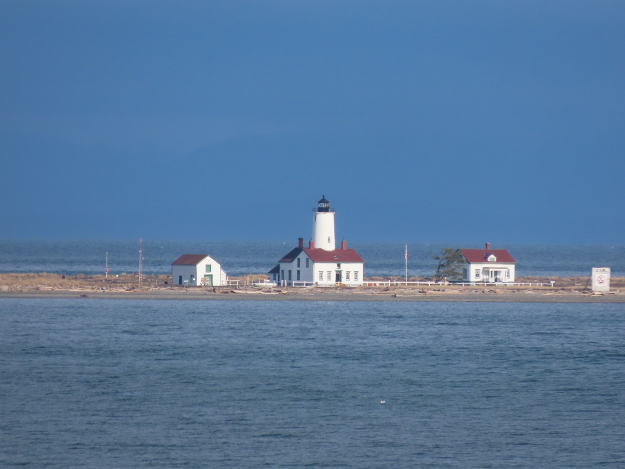
Dungeness Lighthouse
Position: 48°9.09’N, -123°8.62’W
View to the New Dungeness Lighthouse from Dungeness Landing County Park. The light has been in continuous operation as an aid to navigation since it was first lit in 1957, the second lighthouse in the territory of Washington. The original tower was 100ft (30m) tall, but after developing severe cracks was lowered to 63-ft (19m) to avoid it toppling. The light wasn’t automated until 1994, among the last in the country to have a full-time keeper. Today the New Dungeness Light Station Association mans the station 24×7 and offers tours of the facility. Visitors can either walk the 5 miles (8km) to the tip of Dungeness Spit, or arrive in a shallow-draft boat suitable for beaching.
|
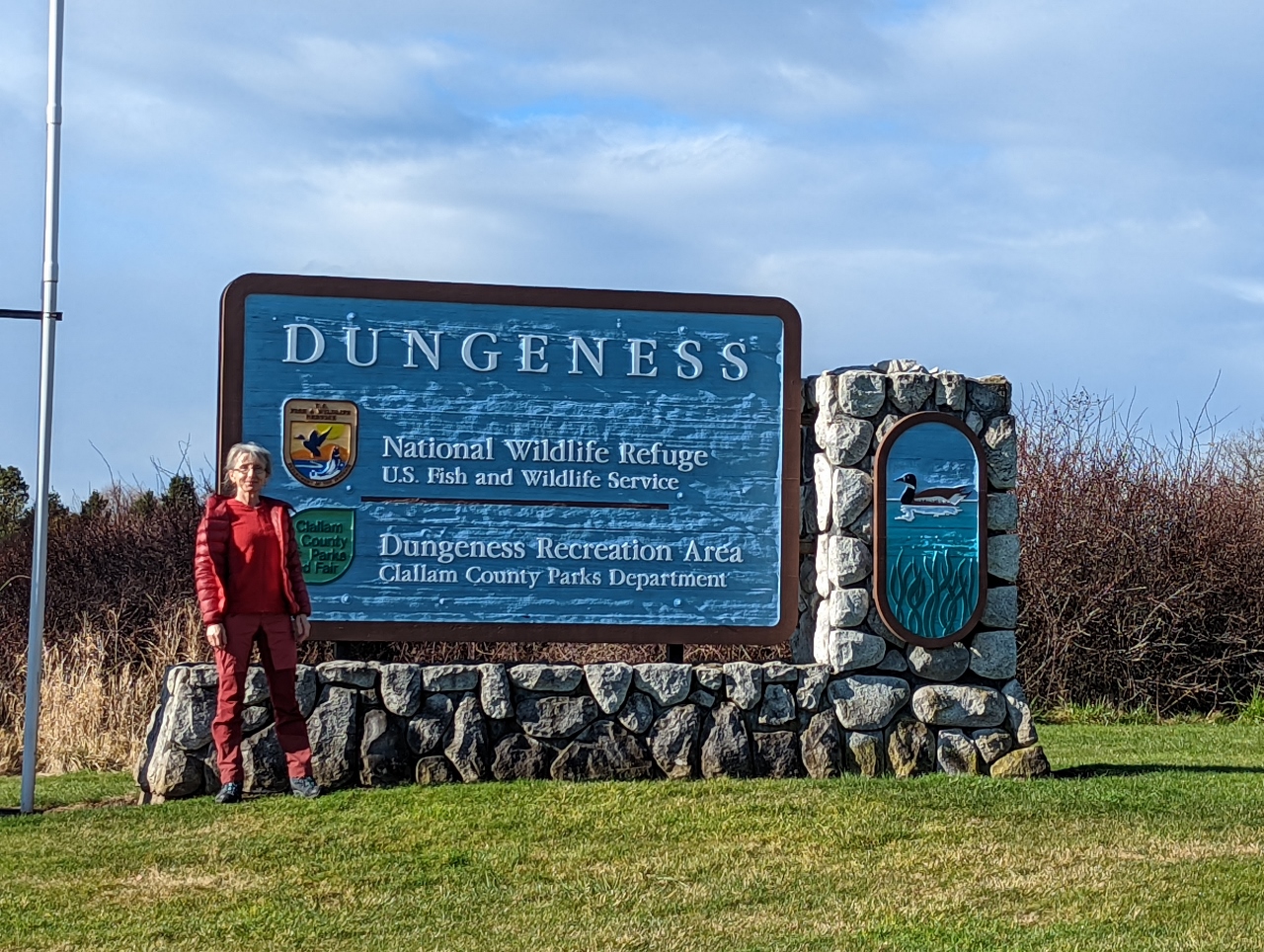 |
Dungeness NWR
Position: 48°7.84’N, -123°11.78’W
At the entrance to the Dungeness National Wildlife Reserve to walk Dungeness Spit.
|
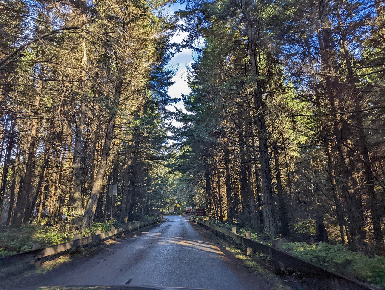 |
Voice of America Road
Position: 48°8.28’N, -123°11.63’W
The road to the parking lot for the Dungeness Spit trail head is along Voice of America Road. In 1952, the US State Department acquired 1,200 acres (485 hectares) of land with plans to build a Voice of America broadcasting station aimed at countries behind the iron curtain. Within a year the project was deemed overly expensive and ineffectively located, and was canceled. But the road name stuck.
|
 |
Dungeness Spit
Position: 48°8.48’N, -123°11.46’W
Looking northeast along narrow Dungeness Spit from a viewing platform along the trail. The lighthouse is out of the picture at top right. At 6.8 miles (10.9 km) long, it is one of the longest natural sand spits in the world. We’ve anchored off the spit several times, and getting a picture is challenging because it’s just so big.
|
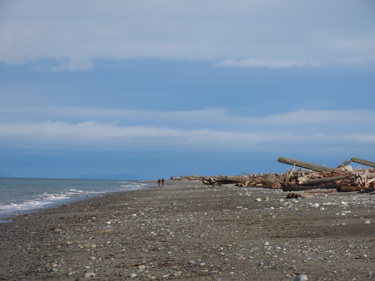 |
Driftwood
Position: 48°9.74’N, -123°10.12’W
Winter storms drive huge logs high ashore the length of Dungeness Spit.
|
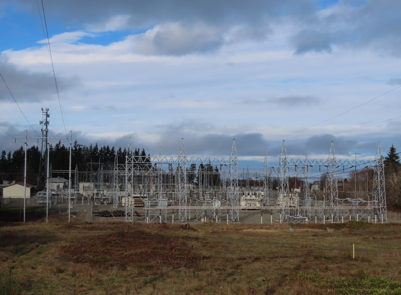 |
Substation
Position: 48°5.87’N, -123°25.10’W
Huge substation in Port Angeles operated by the Bonneville Power Administration. The non-profit agency initially was formed to market power from the Bonneville Dam, but its responsibilities later were expanded to include all federally-owned hydroelectric projects in the Pacific Northwest plus the Columbia Generating Station nuclear plant along the Columbia River near Richland, WA.
|
 |
EpiLog
Position: 48°5.97’N, -123°25.57’W
We stopped into the Olympic National Park visitor’s center to pickup some maps and brochures. This tree slab on display there is from a 650-year-old Douglas Fir.
|
 |
Cougar
Position: 48°5.97’N, -123°25.57’W
Cougars are common in the Olympic Peninsula, although sighting one of the solitary animals is rare. Males can weigh up to 250 lbs (113kg), while females usually weigh between 75 and 100 lbs (34 to 45 kg).
|
 |
Coast Guard
Position: 48°7.14’N, -123°25.73’W
Coast Guard Station Port Angeles on the end of 3-mile-long (4.8 km) Ediz Hook, viewed from the balcony of our room at the Red Lion Hotel in Port Angeles. Ediz Hook also is the location of the Port Angeles pilotage station all vessels en route to or from the sea.
|
 |
Bell M. Shimada
Position: 48°7.14’N, -123°25.73’W
The 208.6 ft (63.6 m) Oscar-Dyson class NOAA research vessel Bell M. Shimada, commissioned in 2010, at anchor off Port Angeles. The Oscar-Dyson class are among the world’s most advanced fisheries research vessels, with a unique capability to conduct both fishing and oceanographic research.
|
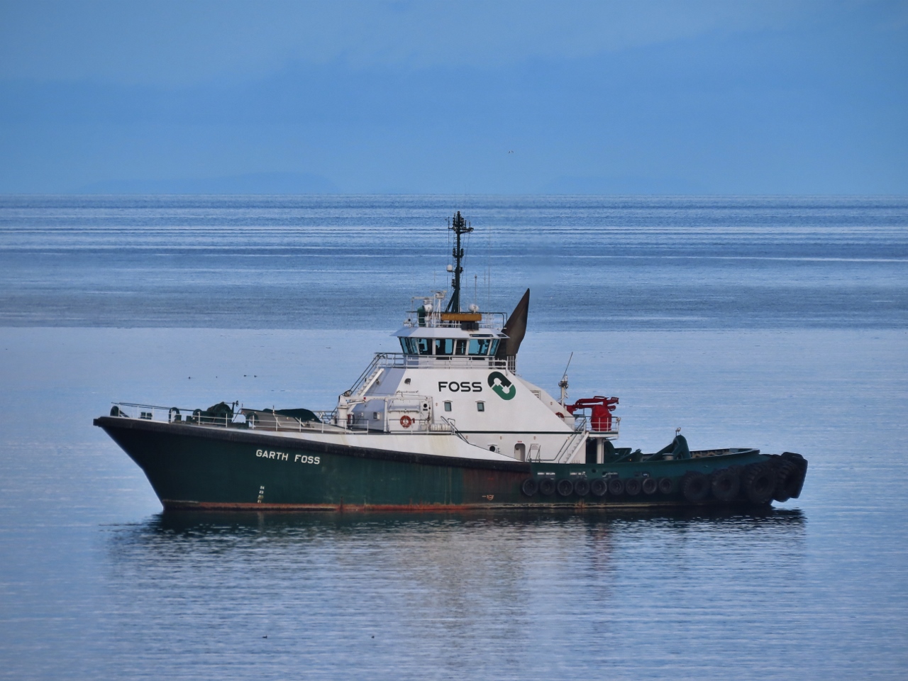 |
Garth Foss
Position: 48°7.14’N, -123°25.73’W
The powerful Voith Tractor tug Garth Foss at anchor in Port Angeles. The 155-ft (47m) tug has 8,000 horsepower and 87 tons of bollard pull and is primarily used for tanker escort and fire-fighting vessel. We often see the vessel with its twin, Lindsey Foss, doing ship assist work.
|
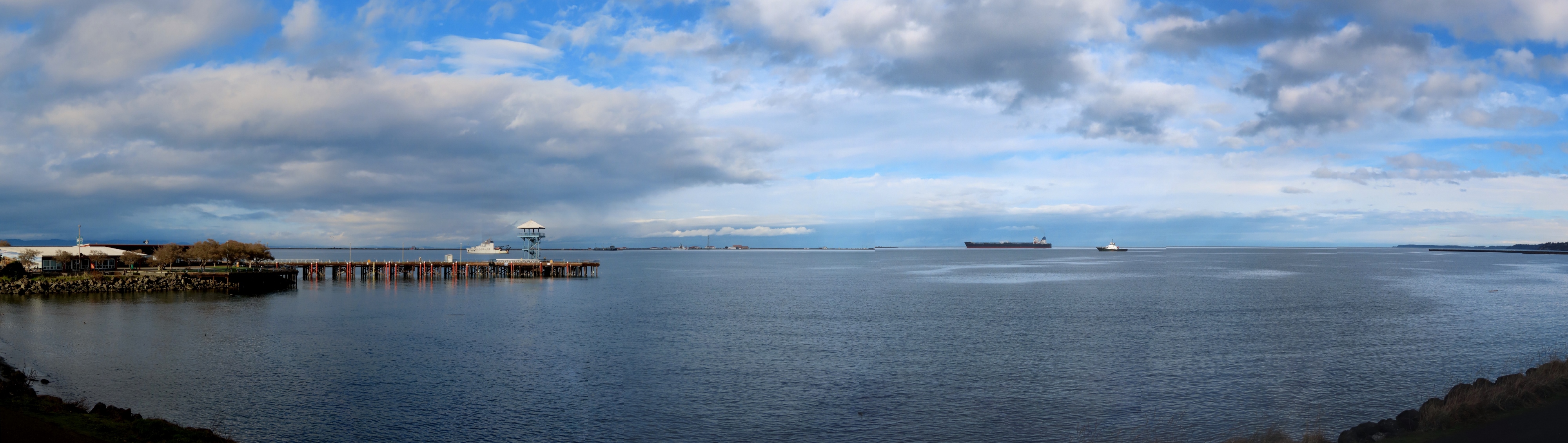 |
Port Angeles
Position: 48°7.14’N, -123°25.73’W
Panoramic view to Port Angeles harbor from the deck of our room at the Red Lion Hotel in Port Angeles. At left is the NOAA research vessel Bell M. Shimada, at right is the tug Garth Foss, and at center in the distance is the Coast Guard station (click image for a larger view).
|
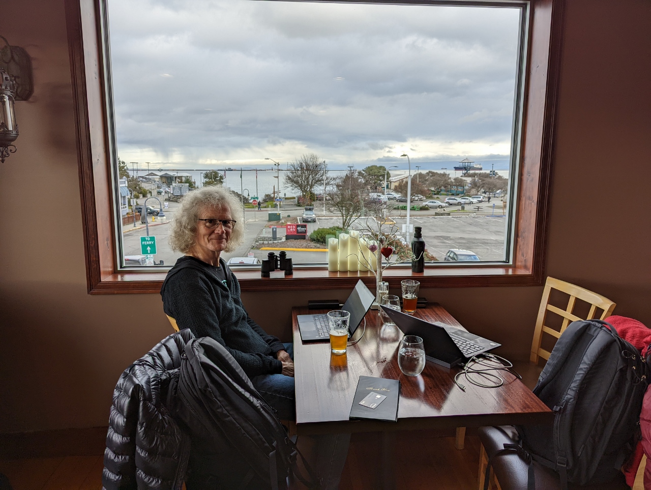 |
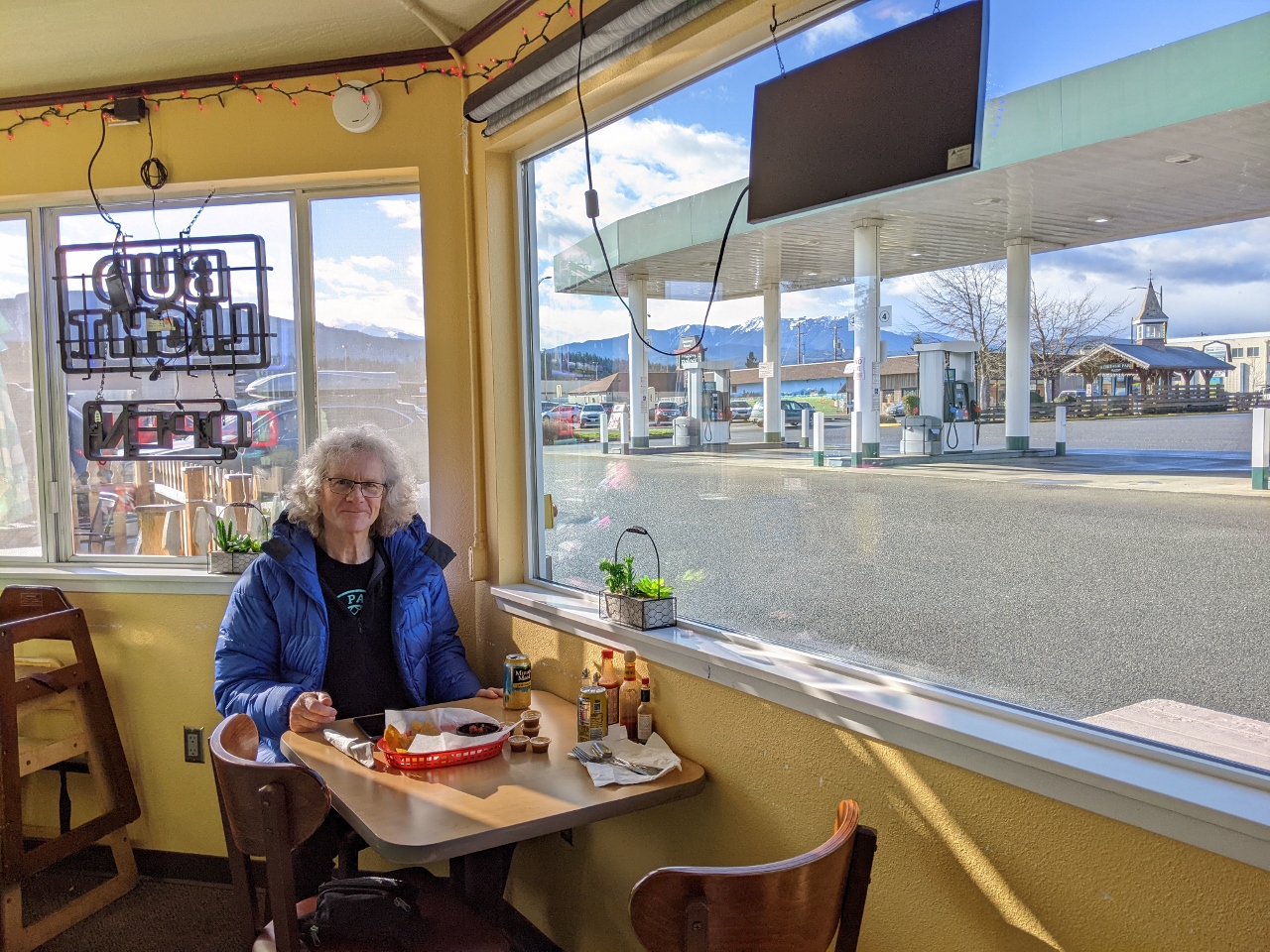
Office
Position: 48°7.16’N, -123°25.83’W
We stopped in mid-afternoon at Kokopelli Grill near our Port Angeles hotel for a drink and to get a little work done. With the restaurant empty between meals, we got an awesome window-view table.
|
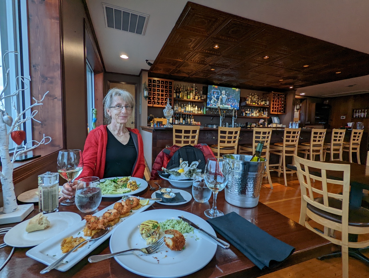 |
Dinner
Position: 48°7.16’N, -123°25.83’W
We enjoyed our “office” table by the window at Kokopelli Grill so much that we opted for an early dinner there as well. The food was good and the view was great.
|
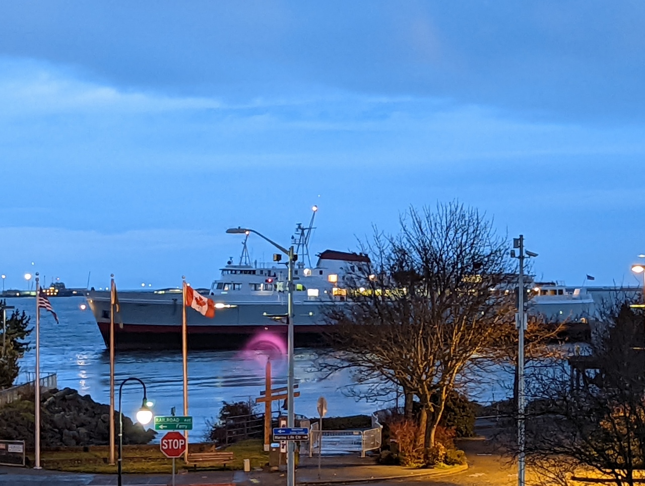 |
Coho
Position: 48°7.16’N, -123°25.83’W
The vehicle and passenger ferry Coho arriving into Port Angeles from Victoria, Canada. The ship has been plying this route several times a day since its launch in 1959 and is a fixture in both cities. We often saw the ferry arrive into the Inner Harbor when we lived in Victoria. With the Canadian-US border closed during the pandemic, the Coho was out of service for 19 months, and recently started up again in November when Canadian entry restrictions eased.
|
 |
Click the travel log icon on the left to see these locations on a map. And a map of our most recent log entries always is available at mvdirona.com/maps. |
Spits are always an interesting geographical feature (and cats :-). Eight years ago you passed Farewell Spit at the top SW corner of NZ’s South Island. It was named by Capt Cook on his first voyage when he left NZ for Australia and it was the last bit of NZ he saw. I see Dirona was in the same situation in 2014: https://mvdirona.com/Trips/NewZealand2013/NewZealand4.html
We loved our time in New Zealand, especially the South Island and have rounded Farewell Spit twice. We have anchored at Dungeness Spit numerous times and just love the scenery in the area and watching the shipping traffic coming south to drop off or pick up their Pilots at Port Angeles.