Whidbey Island is the 4th largest island in the contiguous United States at 169 square miles (437 km2), and the largest in Washington State. Along with Camano Island, it forms Island County at the northern boundary of Puget Sound. Whidbey has many waterfront parks, numerous interesting towns, and also is home to Naval Air Station Whidbey Island and the Nichols Brothers Boatbuilders, where many local commercial ships were built. For boaters, the island has several docks and sheltered anchorages. We’ve anchored at the island many times in our first boat.
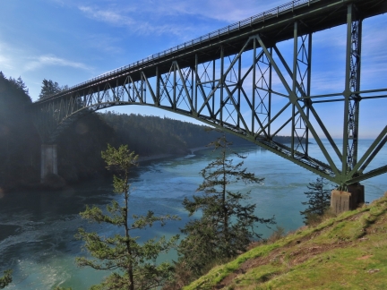
Until 1935, the only way to reach Whidbey Island was by air or sea. That changed with the completion of the Deception Pass Bridge, a factor in the decision to locate the Naval station on the island. The bridge spans narrow Deception Pass, where currents can exceed 9 knots, generating huge whirlpools and upwellings. Slow boats like Dirona need to pass through near slack water. The bridge is considered one of the scenic wonders of the Pacific Northwest, and the surrounding park, popular year-round, is the most visited in Washington.
Two ferries also serve Whidbey Island, one to Coupeville on the northwest side of the island from Port Townsend on the western side of Puget Sound, and the other to Clinton, on the southern part of the island, from from Mukilteo, halfway between Edmonds and Everett on the Washington mainland. These ferries are very busy, particularly in the summer, and the Coupeville-Port Townsend route is one of only three in the Washington State system that support vehicle reservations.
From Port Angeles, we drove to scenic Port Townsend and took the ferry across to Coupeville. We easily made it on stand-by in the morning, but the afternoon routes were already fully booked. From Coupeville, we made a driving tour of the northern portion of Whidbey Island and stopped of at Deception Pass State Park to take in the bridge and the view. We had lunch in La Conner, another favorite past boating destination for us, before returning back home to Seattle.
Below are highlights from February 6th, 2022. Click any image for a larger view, or click the position to view the location on a map. And a map with our most recent log entries always is available at mvdirona.com/maps.
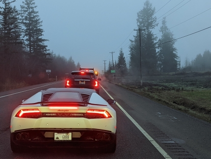 |
Lamborghini
Position: 48°2.84’N, -122°58.63’W
We could still hear the roar of this Lamborghini’s engine way in the distance a long time after it sped past us as we departed Port Angeles. We didn’t expect to see it again, but ended up right behind it at a roadblock on Highway 101.
|
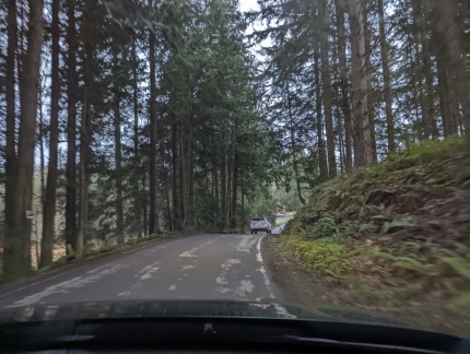 |
Detour
Position: 48°1.72’N, -122°58.77’W
No traffic was flowing in either direction, and at least a dozen cars had turned around. We followed suit and detoured around the obstruction along a pleasant country road.
|
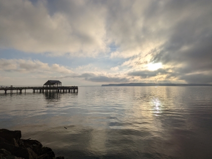 |
Marrowstone Island
Position: 48°6.79’N, -122°45.48’W
View to Marrowstone Island from Port Townsend on an ultra-calm morning. We’d arrived about an hour before our ferry departed for Whidbey Island, so parked our car in the ferry waiting line and took a walk through town.
|
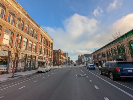 |
Port Townsend
Position: 48°6.82’N, -122°45.48’W
Port Townsend, at the northeast tip of the Olympic Penninsula, is known for its beautiful Victorian buildings that line the street. Full of restaurants, cafes and art galleries, the city is a popular weekend destination.
|
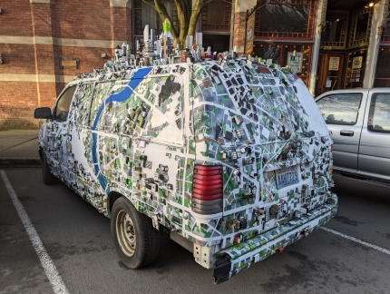 |
Van
Position: 48°6.85’N, -122°45.46’W
Three-dimensional building models cover the roof and sides of this elaborately-decorated van parked in Port Townsend.
|
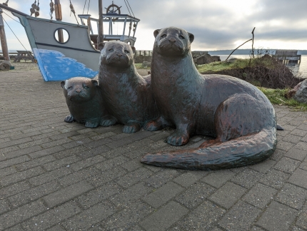 |
Three Otters
Position: 48°6.97’N, -122°45.08’W
Port Townsend is full of beautiful public art, such as Three Otters, created in 2011 by sculptor Georgia Gerber.
|
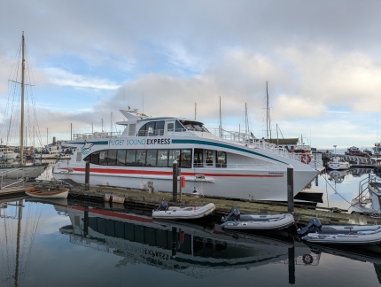 |
Puget Sound Express
Position: 48°6.98’N, -122°45.08’W
The whale-watching boat Puget Sound Express moored at Port Townsend. Whales, particularly orcas, are common in the Strait of Juan de Fuca. We’ve seen huge pods while cruising the area.
|
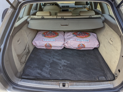 |
Popcorn
Position: 48°6.90’N, -122°45.42’W
We stopped and chatted the proprietor of the Rose Theater, who was unloading about a dozen huge bags of popcorn. When operating at peak load, that massive amount of popcorn will last about a month.
|
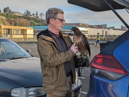 |
Hawk
Position: 48°6.71’N, -122°45.60’W
Beautiful hawk in the ferry line with us.
|
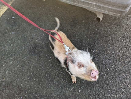 |
Pet Pig
Position: 48°6.70’N, -122°45.59’W
Another unusual pet waiting for the ferry.
|
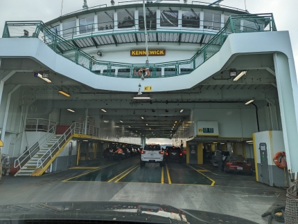 |
Kennewick
Position: 48°6.68’N, -122°45.55’W
Boarding the Kennewick in Port Townsend for Whidbey Island. The northern routes between Port Townsend and Whidbey Island, and between Anacortes and Friday Harbor or Sidney, Canada can fill up quickly, particularly in the summer. These are the only routes where reservations are available and even today in early February all reservations for the sailings later in the day were sold out. But the load was light this morning and we had no trouble boarding without a reservation.
|
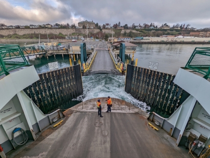 |
Departing Port Townsend
Position: 48°6.66’N, -122°45.54’W
The Kennewick departing Port Townsend with the city visible behind.
|
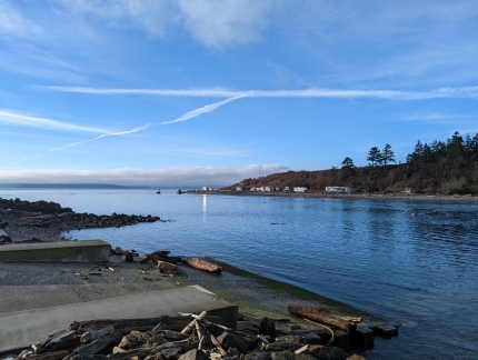 |
Keystone Harbor
Position: 48°9.51’N, -122°40.27’W
Looking northwest back to Port Townsend from Keystone Harbor. The last time we were here was over two decades ago during our PADI rescue diver course.
|
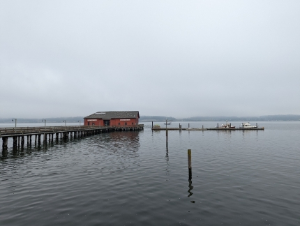 |
Coupeville Wharf
Position: 48°13.30’N, -122°41.26’W
Two boats moored at the Coupeville Wharf. We visited the area many times in our first boat, and it’s fun to be back, this time by car.
|
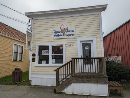 |
Kopaw’s Iskreme
Position: 48°13.27’N, -122°41.27’W
We got a giggle out of the Kopaw’s Iskreme “Worldwide Headquarters” sign in Coupeville.
|
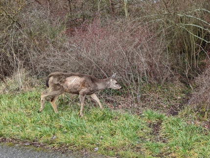 |
Deer
Position: 48°13.25’N, -122°41.30’W
Deer rushing into the woods as we passed just outside Coupeville.
|
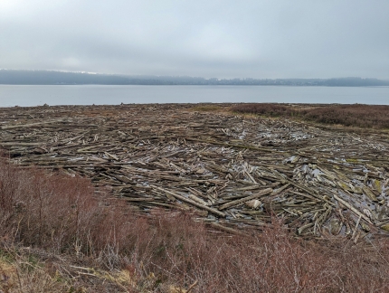 |
Driftwood
Position: 48°14.41’N, -122°40.64’W
An astonishing amount of driftwood captured in the lagoon at Monroe Landing.
|
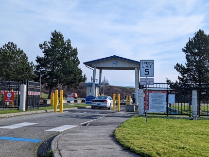 |
NAS Whidbey
Position: 48°17.24’N, -122°37.91’W
The entrance to Naval Air Station (NAS) Whidbey Island in Oak Harbor. The city divides the base into two separate facilities, and this component supports most of the living quarters and retail operations.
|
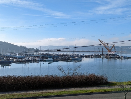 |
Oak Harbor Marina
Position: 48°17.30’N, -122°38.02’W
The huge Oak Harbor Marina has 420 permanent slips, plus ample room for guest boats.
|
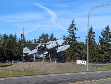 |
Ault Field
Position: 48°19.30’N, -122°37.75’W
The entrance to Ault Field, the aviation portion of NAS Whidbey Island. Constructed in 1942, it is the only naval aviation base in the Pacific Northwest. The base is home to 20 active duty Navy squadrons, 3 reserve squadrons, and a Search and Rescue unit. Navy fighter aircraft practicing in the area are a common sight.
|
 |
Moran’s Beach
Position: 48°22.38’N, -122°39.86’W
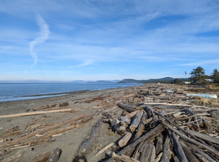
Looking north towards along piles of driftwood at Moran’s Beach County Park, with the San Juan Islands visible in the distance. Nowhere else in the world did we see such huge amounts of driftwood on the beaches.
Some of the logs are lost from the huge timber rafts that tugboats transport by water. Winter storms drive the logs far up onto the beaches, and high tides can pull them back into the water again. The logs are difficult to see and can be a real hazard to navigation, particularly at night. Storm Force Winds in the Strait of Georgia shows pictures of us navigating through log-littered Heriot Bay in British Columbia. |
 |
Deception Pass
Position: 48°24.32’N, -122°38.68’W
Looking into Deception Pass after walking across the bridge. Completed in 1935, the bridge considered one of the scenic wonders of the Pacific Northwest, and the park here is popular year-round. The current runs swiftly through Deception Pass, generating huge whirlpools and upwellings. Slow boats like Dirona need to pass through near slack water.
|
 |
Under Bridge
Position: 48°22.16’N, -122°39.15’W
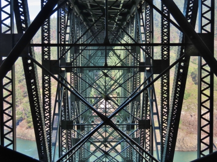
Looking through the complex girders underneath the Deception Pass bridge.
|
 |
LaConner Pub
Position: 48°23.39’N, -122°29.89’W
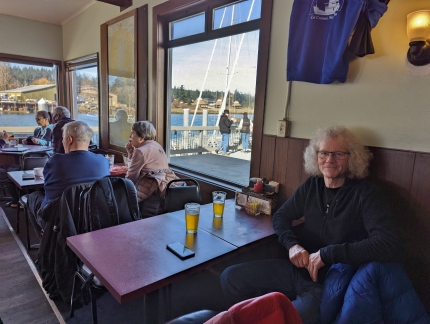
Lunch at the LaConner Pub. The place was packed on this sunny and warm Sunday afternoon and we were lucky to get a table. Sheltered LaConner, with its many waterfront restaurants and guest docks alongside, is a favorite Pacific Northwest boating stop of ours.
|
 |
Portions
Position: 48°23.39’N, -122°29.89’W
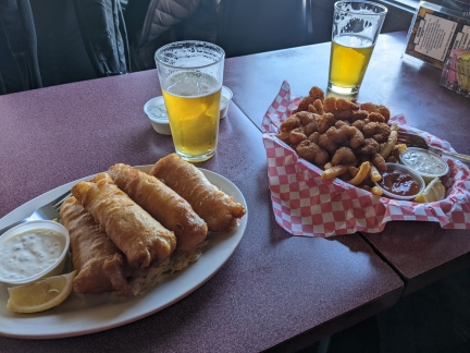
You’ll not go hungry at the LaConner Pub. We decided to share a lunch order and an appetizer, and still had enough for two meals. We did enjoy the fish sticks and shrimp.
|
 |
Fir Log
Position: 48°23.40’N, -122°29.85’W
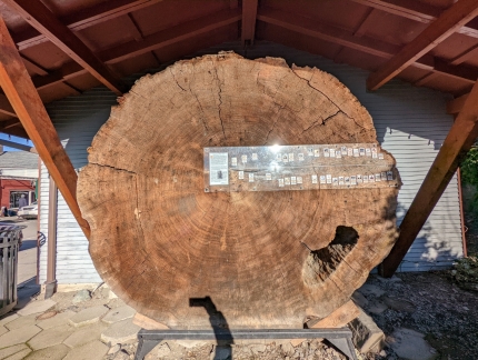
An 800-year-old fir log on display in LaConner dating from the year 1210, with a timeline showing key world events that this tree has grown through.
|
 |
Mt Baker
Position: 48°23.18’N, -122°29.74’W
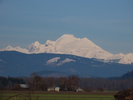
Fabulous view to Mt Baker from the outskirts of LaConner as we head towards Interstate 5 to return south to Seattle after an excellent trip to the Olympic Peninsula.
|
 |
Click the travel log icon on the left to see these locations on a map. And a map of our most recent log entries always is available at mvdirona.com/maps. |

If your comment doesn't show up right away, send us email and we'll dredge it out of the spam filter.