|
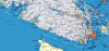
Up the West Coast of Vancouver Island:
Victoria to Bamfield,
Barkley Sound
 |
Day 1: Bamfield, Barkley Sound |
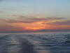 |
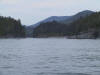
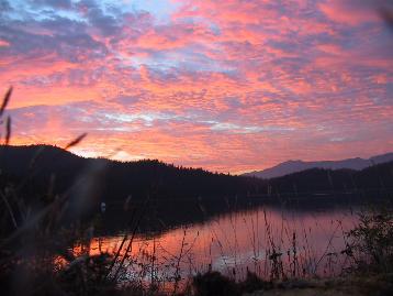
We left before dawn from Victoria, on the
southeast tip of Vancouver Island, to
travel west into the Juan de Fuca Strait. I was so excited the night
before that I could hardly sleep. The sun rose behind us as we passed Victoria,
painting the sky pink, orange, and gold. That's Mount Baker in the
distance, with Discovery Island to the left. Our sprits were already
fairly high, so the warm sun could do little to elevate them. But we
did take off our gloves. |
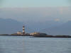 |
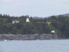
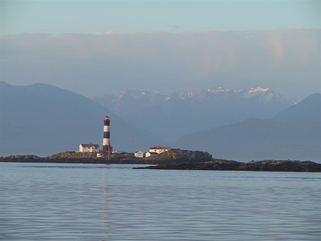
The morning sun lit up the lighthouse at
Race Rocks, shown here with the Olympic Mountains in the distance across the
Juan de Fuca Strait. Conditions were extremely calm, with few other
vessels about. A perfect day to start our big adventure. |
 |
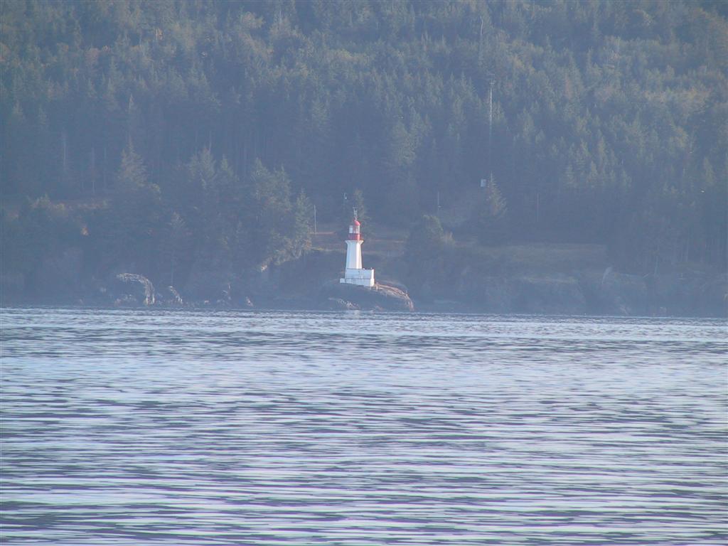
This is the Sheringham Point light.
Being a marine weather reporting station, we hear its name often in the
Environment Canada report. But its a west coast light, so we've never
actually seen it -- we'd never been farther west in the Juan de Fuca Strait than
Sooke. Although we were still well inside the strait, seeing this light made
us feel really "out there". |
 |
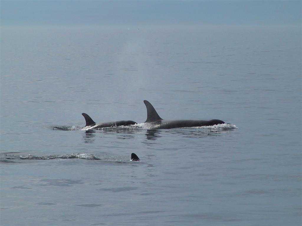
We saw an enormous pod of orcas near the end of the
Juan de Fuca Strait, just before Port San Juan. The pod stretched
from one side of the strait to the other, comprising maybe fifty animals.
We drifted at idle, enthralled, as they passed by. |
 |
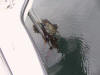
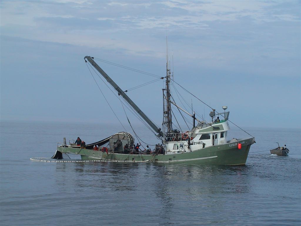
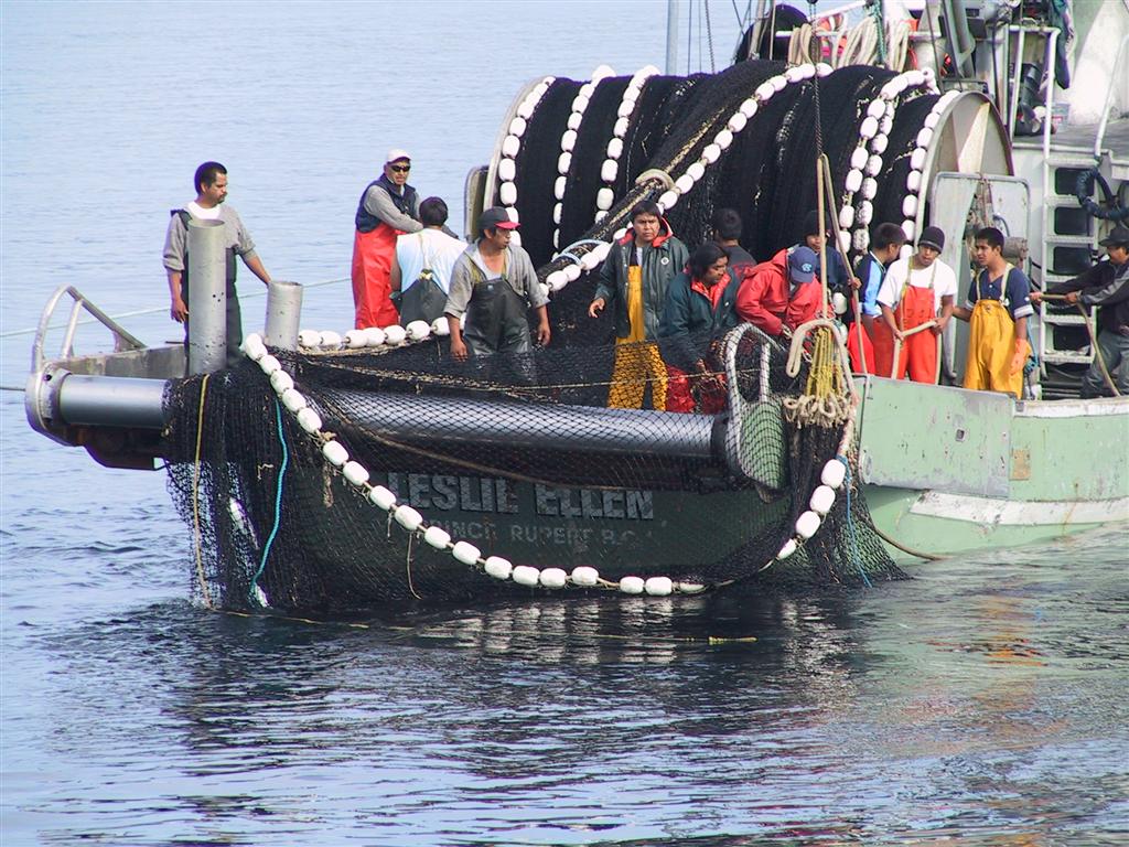
Just beyond the orcas, a seine boat was making
a set. We spent ages watching them run the net out in a huge circle,
with one end connected to the boat and the other brought around and back to
the seiner by the small skiff shown at right. The bottom of the net is
then tightened, like purse strings, which traps the fish inside, hence the
name "purse seine". At the time of this picture, the skiff had been
attached to the forward port quarter of the seiner with a bridle. As
the net is pulled onboard, the skiff powers in the opposite direction, I
believe to keep the seiner from tipping. They didn't catch many fish
on that set. We counted fourteen guys on board, plus two in the skiff.
Nobody looked very happy. |
 |
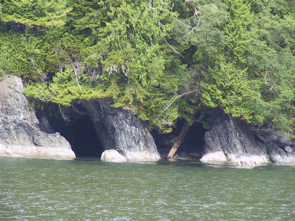
We took a quick look at Port San Juan, which is
the southern terminus of the
West Coast Trail. There isn't a whole lot to see in Port San Juan,
but there are some interesting sea caves on the northern shore. |
 |
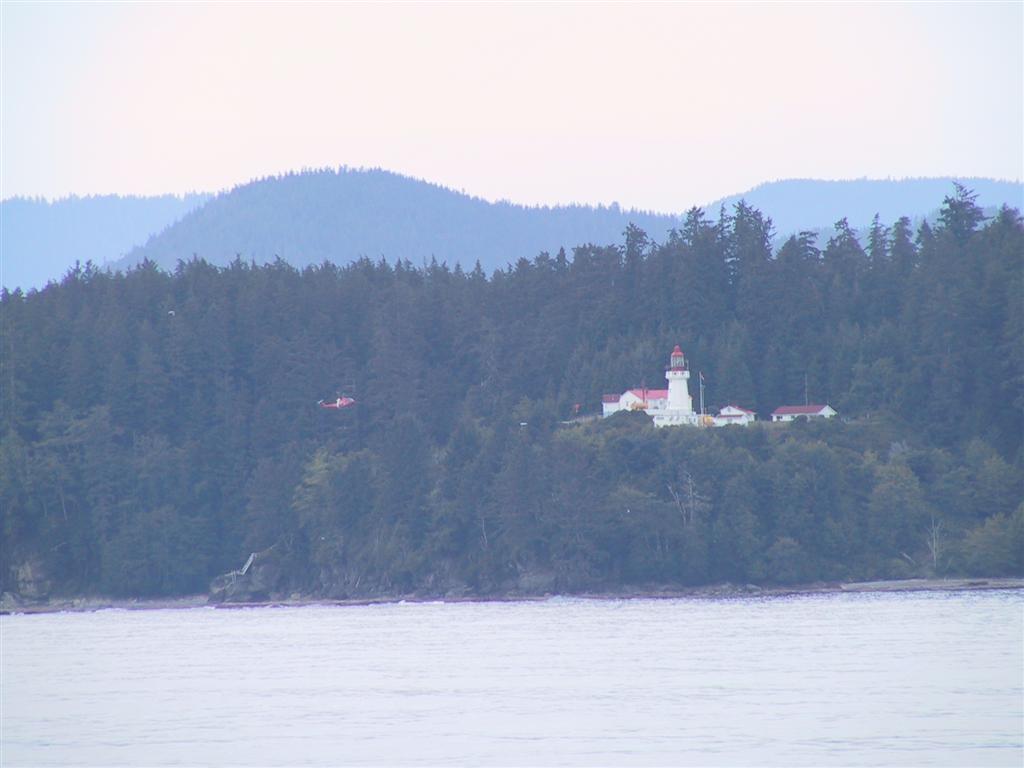
The next lighthouse along the coast is at Carmanah Point,
pictured here with a Coast Guard helicopter just about to land there.
Established in 1891, Carmanah Point is the second of three lighthouses built
on the southwest coast of Vancouver Island. The first was at Cape
Beale in 1874 and the third at Pachena Point in 1908. The region has long been known as the
Graveyard of the Pacific, where hundreds of lives and many ships have been
lost. Northbound vessels aiming for the Juan de Fuca Strait would frequently
become disoriented, turn too late, and find themselves on the rocks of
Vancouver Island.
Even if their position was known, sailing ships could easily be blown to
shore should a southeast storm build up. The Carmanah Point lighthouse was
actually supposed to be built at Bonilla Point, but the crew landed at the
wrong site in the fog and unloaded their construction material. When
visibility improved, they didn't want to transfer it, so the lighthouse was
built here instead. |
 |
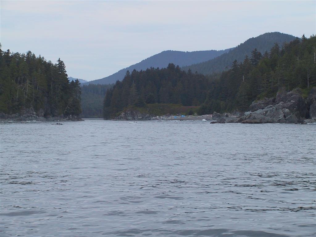
Just beyond Carmanah Point is the narrow
entrance to Nitinat Lake. Several small fishing skiffs are barely
visible just off the entrance. Many ships and lives have been lost here.
West of the entrance is a shallow bar with a least charted depth of 3 to 6
feet. It is very dangerous to cross when the sea is up, as large
breakers form on the bar. Once past the bar, the passage is tight and currents run up to eight knots. An outcoming ebb against the
ocean swell can make for some very nasty conditions. |
 |
We really wanted to go through. Prior to this trip, we researched when best to
do so, including talking to a local who had passed through many times.
Thus armed, our passage was exciting, but uneventful. You can see how narrow it is
from this picture, taken just after we've crossed the bar. |
 |
Well, it wasn't completely uneventful. We
had intended to anchor inside the narrows for the night at Cannery Bay, but
ended up wedging a huge rock in our anchor. The flukes were actually
sprung out a bit. This is a 66-lb Bruce, so the rock must have weighed
at least 100lb. Without any space to maneuver inside the bay, we ended
up just pulling the tackle up, rock and all, and returning back out to
release it. We had to chip away at it to loosen it before we could
dump it. A
Brief Foray into the Dangerous Waters of Nitinat describes the trip in
more detail. |
 |
We continued north to our new destination of Bamfield.
On the way, we passed the Pachena Point lighthouse, the third of the three
Graveyard of the Pacific lights. It was established in 1908, following
the horrific 1906 wreck of the steamship Valencia nearby.
The ship had
overshot the entrance to the Strait of Juan de Fuca while en route from San
Francisco to Victoria in winter fog. Over one hundred people lost
their lives, many of whom clung to the ship's rigging for almost two days as
heavy surf pounded and eventually broke up the wreck. This particular
disaster garnered intense public outrage at the inaction of those on shore
and the crews of several vessels, who left the scene without rendering any
aid, but also at the governments of both countries for the inadequacy of the
safety systems in place to prevent and respond to such accidents |
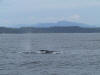 |
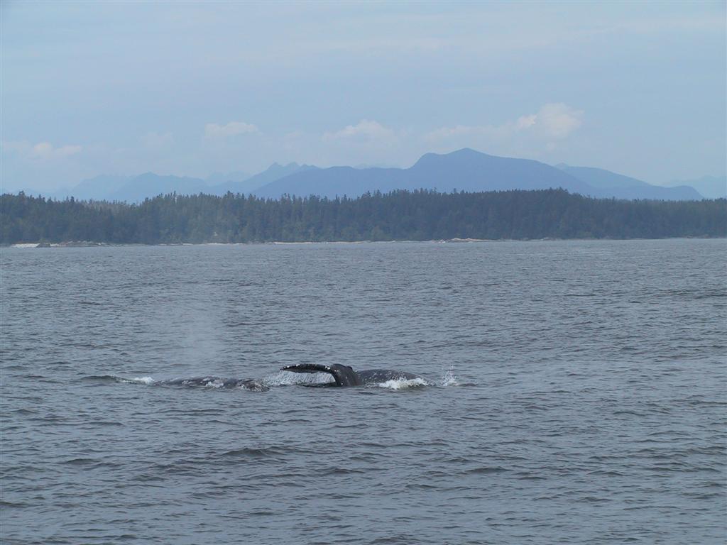
Just north of
Pachena Point, we saw a big pod of harbour porpoises and then 3-5 grey
whales. The logbook that I keep for the
BC Cetacean Sighting
Network has almost a full page from today alone. |
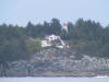 |
This is the Cape Beale lighthouse near Bamfield.
It was established in 1874, the first on Vancouver Island's west coast.
We are getting more and more "out there" with each nautical mile. |
 |
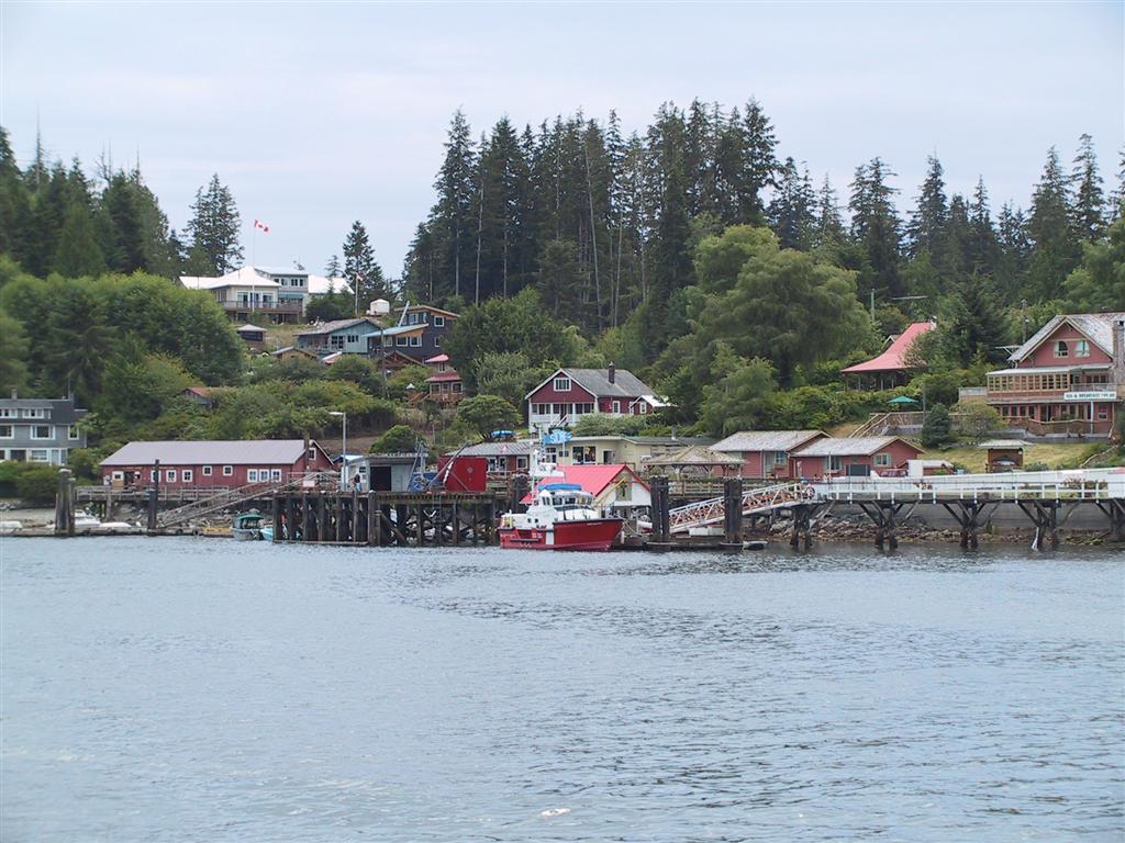
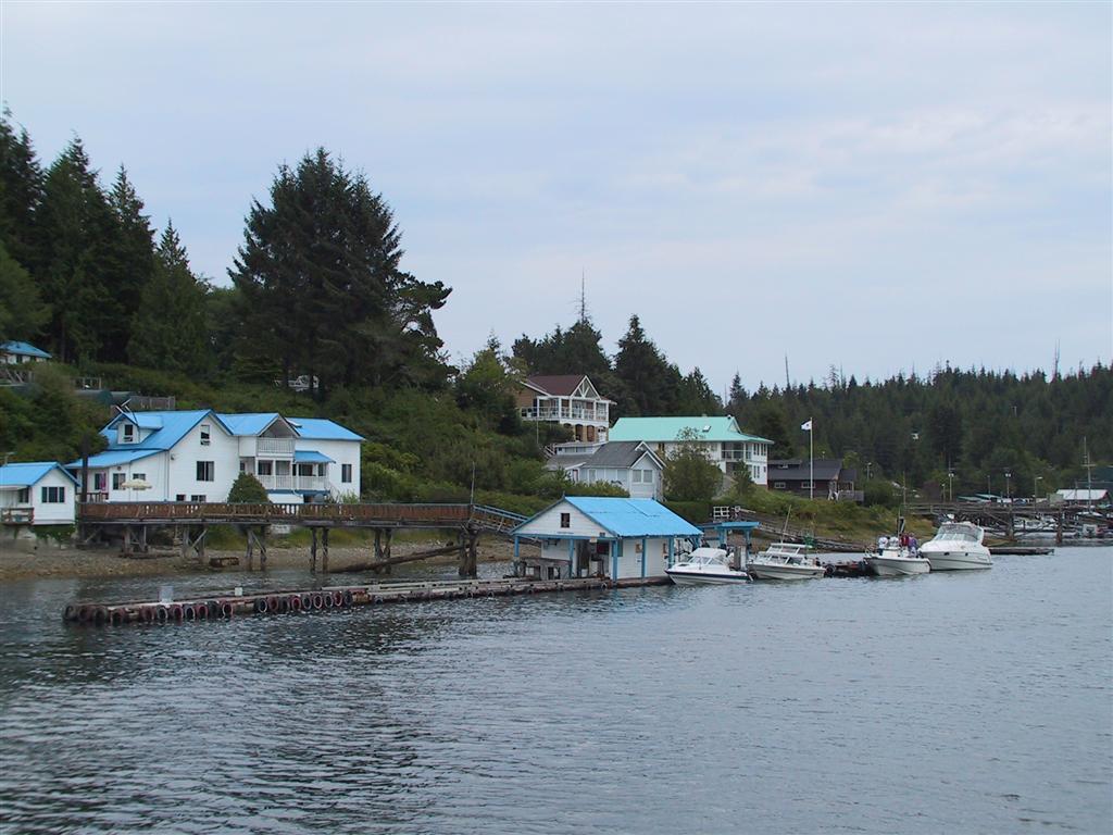
Bamfield is sometimes compared to Venice,
because the town is built on both sides of Bamfield Inlet and is connected
only by water. There are no roads from one side to the other.
Following the Valencia disaster, the government in 1907 established a
series of lifeboat stations along Vancouver Island's west coast, the first
organized SAR stations in the province. These were at Bamfield,
Clo-oose (near Nitinat Narrows),
Pachena Bay, Ucluelet and Tofino. Bamfield is now a Coast
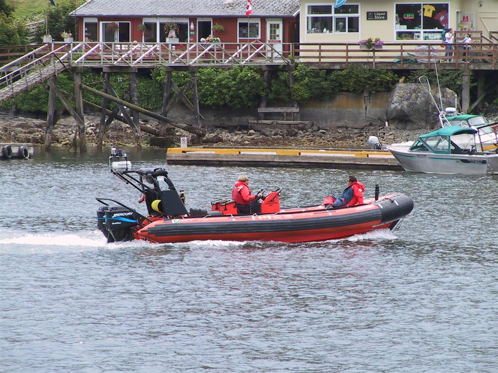
Guard station -- pictured is one of their modern lifesaving boats. |
 |
The Bamfield Coast Guard station is also home to
the Rigid Hull Inflatable Operator Training (RHIOT) school. It
operates only in the winter, when the weather is fiercest. Students
from all over North America attend, learning how to operate the
craft in extremely rough seas, including handling capsizes. The title of a
recent Pacific Yachting article written by one attendee pretty much sums it
up: "Getting Bashed at Bamfield." |
 |
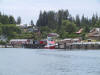
This is the other side, at
the fuel dock. We didn't stop in town.
We'd been underway for almost 12 hours, with much excitement, and had
eaten little. It was definitely time to end the adventures for this day.
We proceeded to the head of Bamfield Inlet, which we'd highlighted from our
research, and dropped the hook inside. |
 |
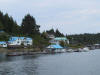
It was very tranquil here.
Nice tree-lined shores and a few houses, but other than a sailboat moored to
a permanent floats, no other boats on anchor. Locals go by close and fast,
but only in small boats, so no big deal.. There is one house with a "no wake"
sign that everyone stops for though -- they must be really intimidating.
It was good to finally stop and have a meal. Happy Birthday James.
|
|
|
[Previous]
[Next]
|
|


