Spectacular Trollfjord is 1.5 miles long and only 100m wide at the narrowest point. The fjord is a major tourist draw—tourist boats were running here from Svolvær several times a day, with more gearing up as the height of the season approaches. The large Hurtigruten coastal express ships also visit, turning around inside such that the passengers can almost touch the walls.
Below are trip highlights from May 31st, 2018 at Trollfjord, Norway. Click any image for a larger view, or click the position to view the location on a map. And a live map of our current route and most recent log entries always is available at mvdirona.com/maps
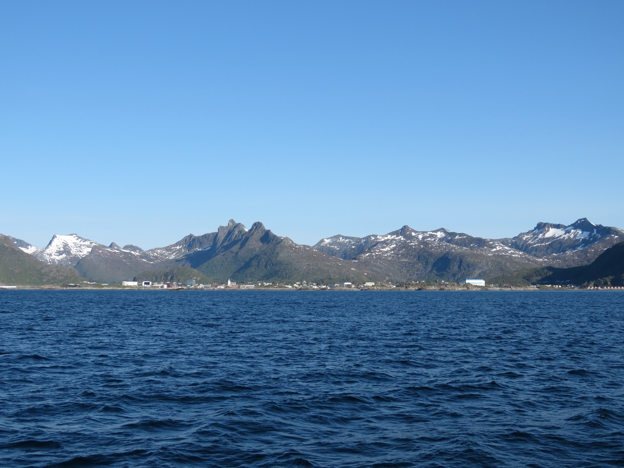 |
Svolvær
Position: 14 38.19, 68 13.26
A last view to Svolvær as we depart for Trollfjord.
|
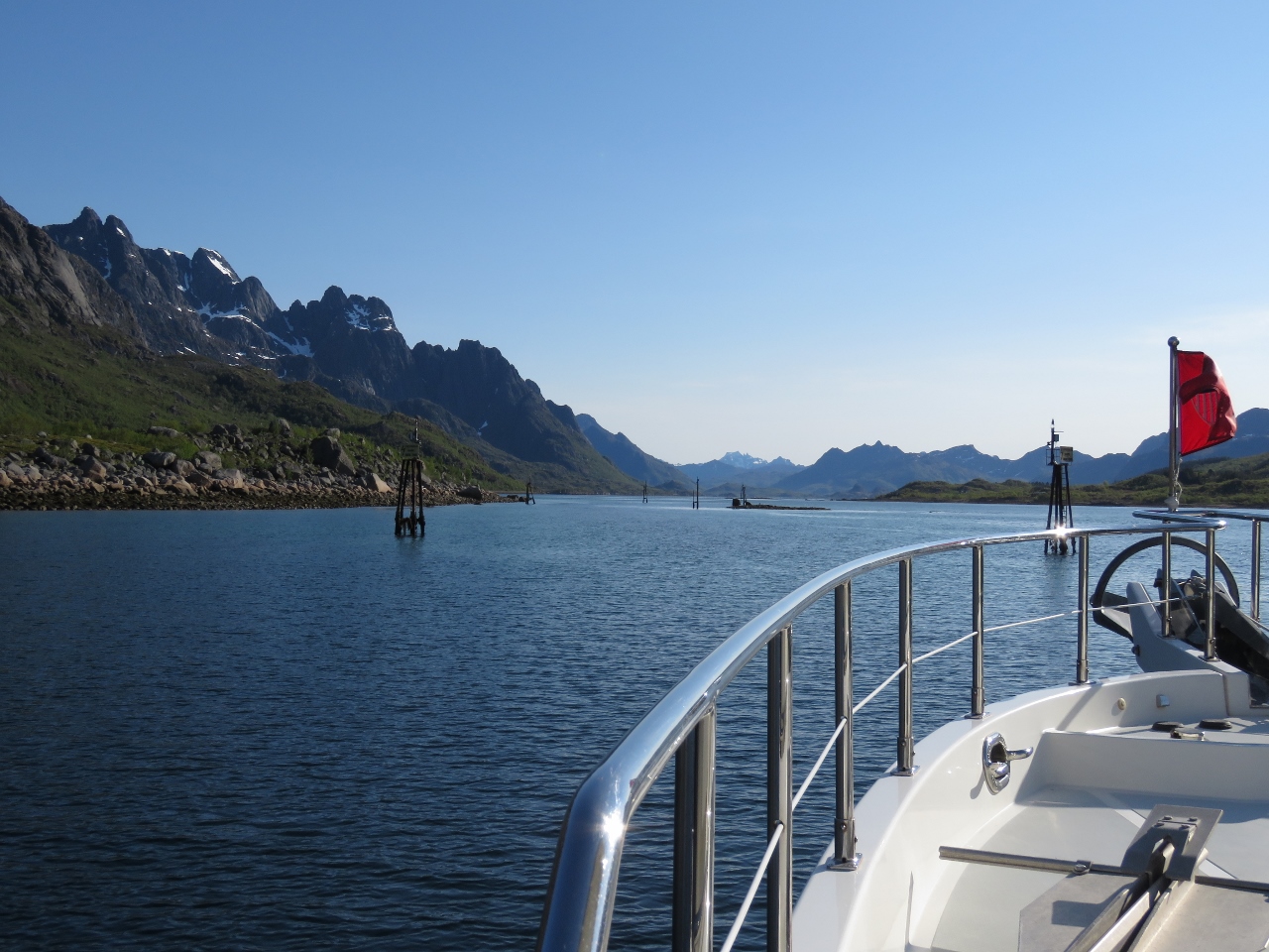 |
Narrows
Position: 14 50.77, 68 17.53
The channel Øyhellsundet generally is wide and deep, but has a narrow section with a minimum charted depth of 9ft. The narrows are well-marked and relatively easy to transit, but you need to pay attention.
|
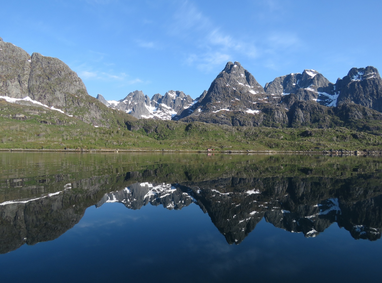 |
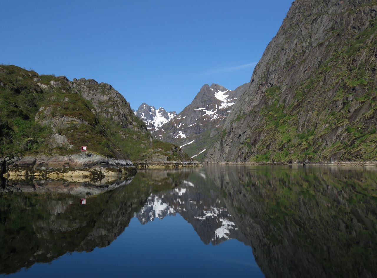
Reflections
Position: 14 54.17, 68 18.82
The calm and clear day is yielding wonderful mountain reflections.
|
 |
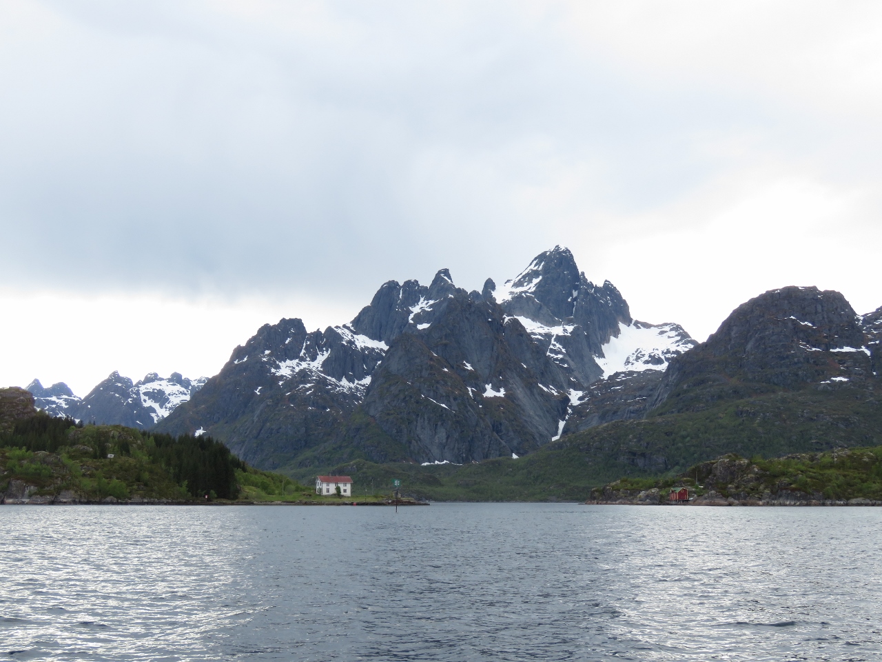
Trollfjord Mouth
Position: 14 59.45, 68 21.84
At the mouth of Trollfjord, a major tourist draw. Tourist boats were running here from Svolvær several times a day, with more gearing up as the height of the season approaches.
|
 |
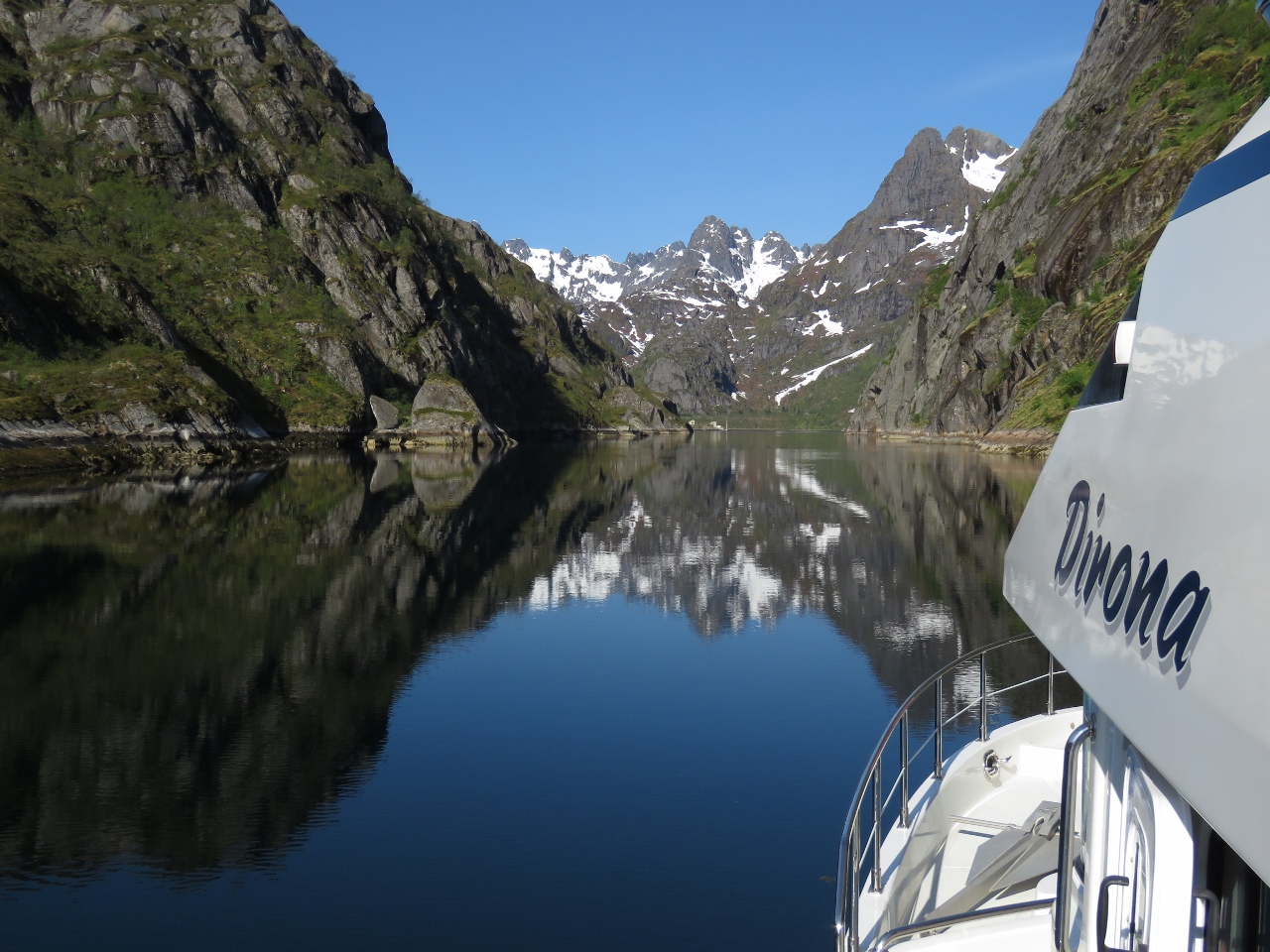
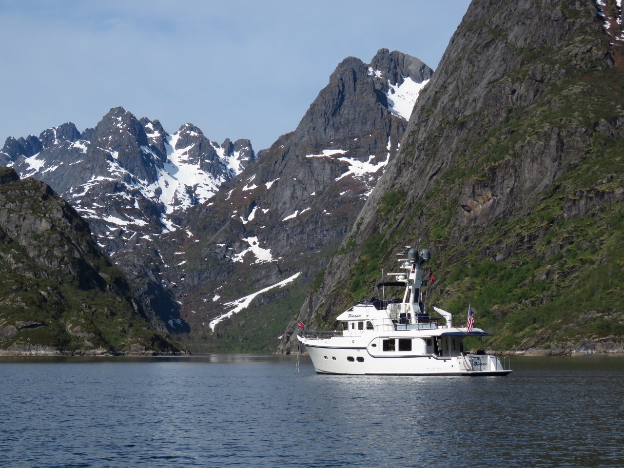
Trollfjord
Position: 14 58.95, 68 21.86
Heading down Trollfjord. The fjord is 1.5 miles long and only 100m wide at the narrowest point, with spectacular scenery. We were lucky to visit on such a clear and calm day.
|
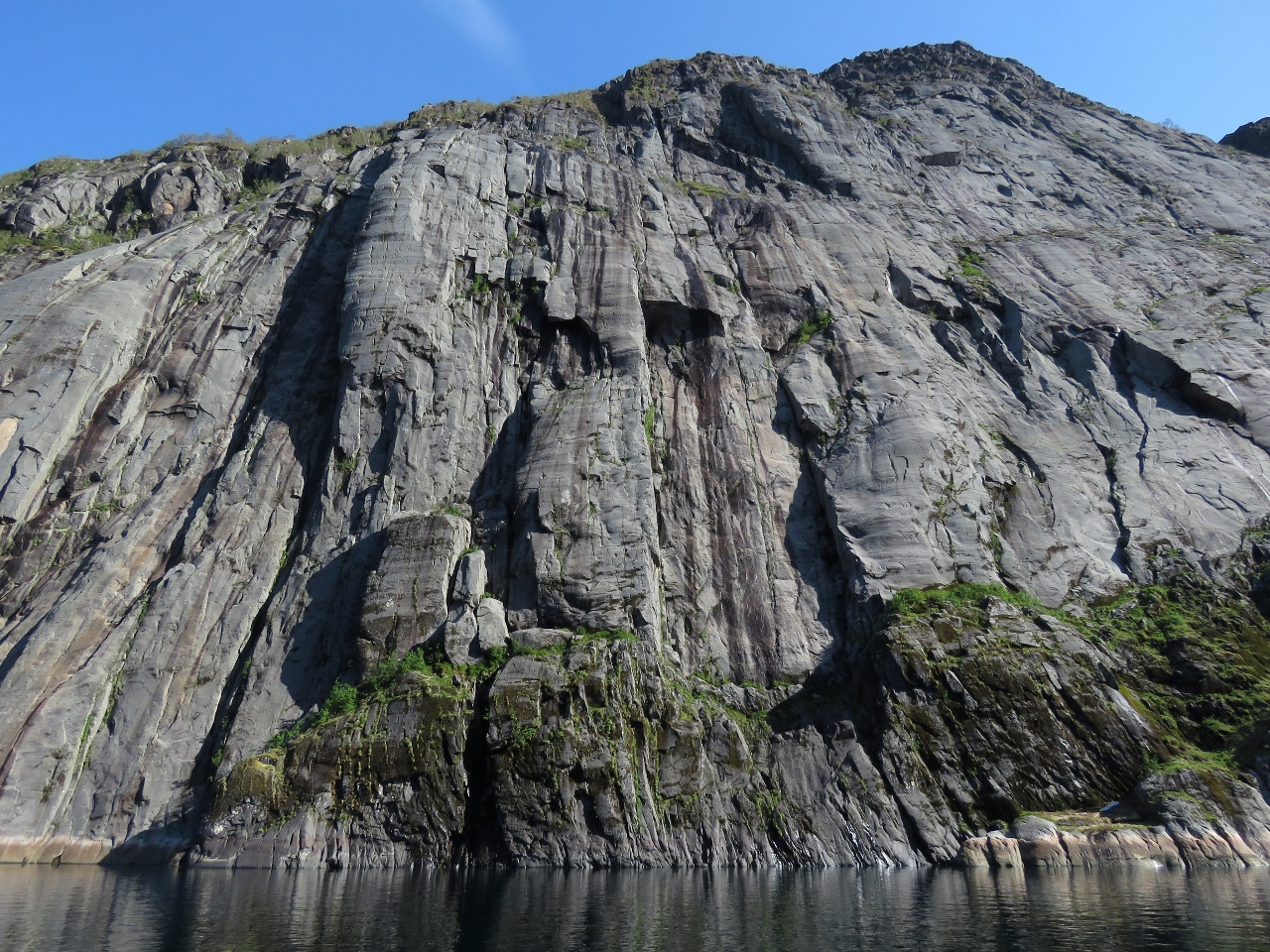 |
Cliff
Position: 14 57.49, 68 21.82
Dramatic cliff partway along Trollfjord.
|
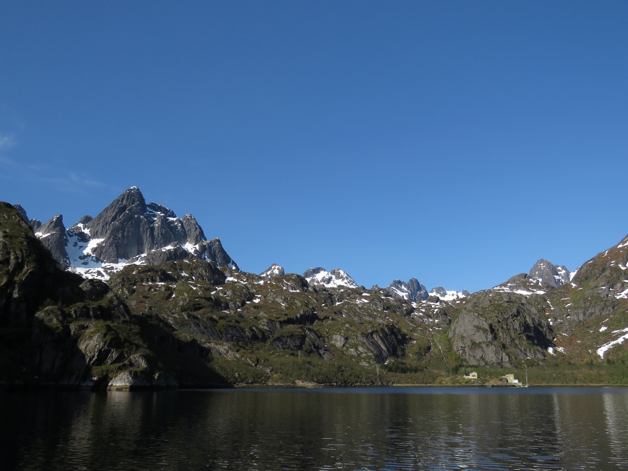 |
Trollfjord Head
Position: 14 56.73, 68 21.82
Mountain scenery at the head of Trollfjord.
|
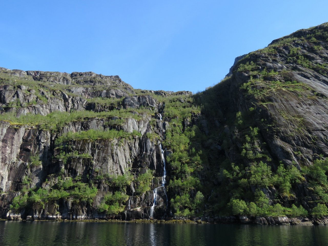 |
Jarsteinelva
Position: 14 56.73, 68 21.82
The waterfall Jarsteinelva plummeting into the head of Trollfjord.
|
 |
No Connectivity
Position: 14 56.24, 68 21.81
The head of Trollfjord is the only place since we’ve arrived in Norway where we’ve had no connectivity for any appreciable period of time. There’s no cellular coverage here, and the steep shores are blocking our KVH V7hts mini-VSAT satellite system. I guess we can last for an hour or two. :)
|
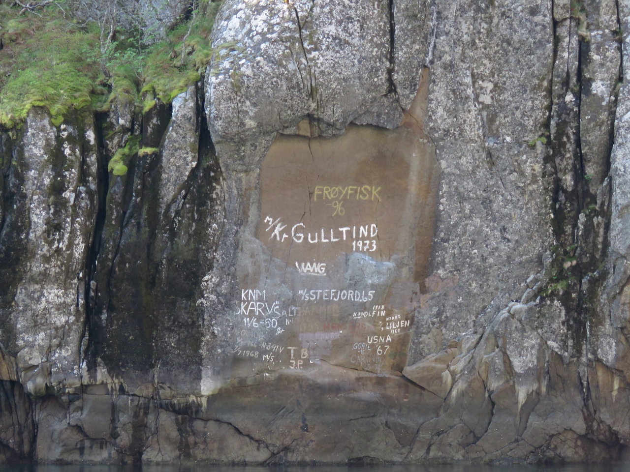 |
Graffiti
Position: 14 58.03, 68 21.84
Some boaters write the names of the boats on the walls of Trollfjord. We’d prefer them natural.
|
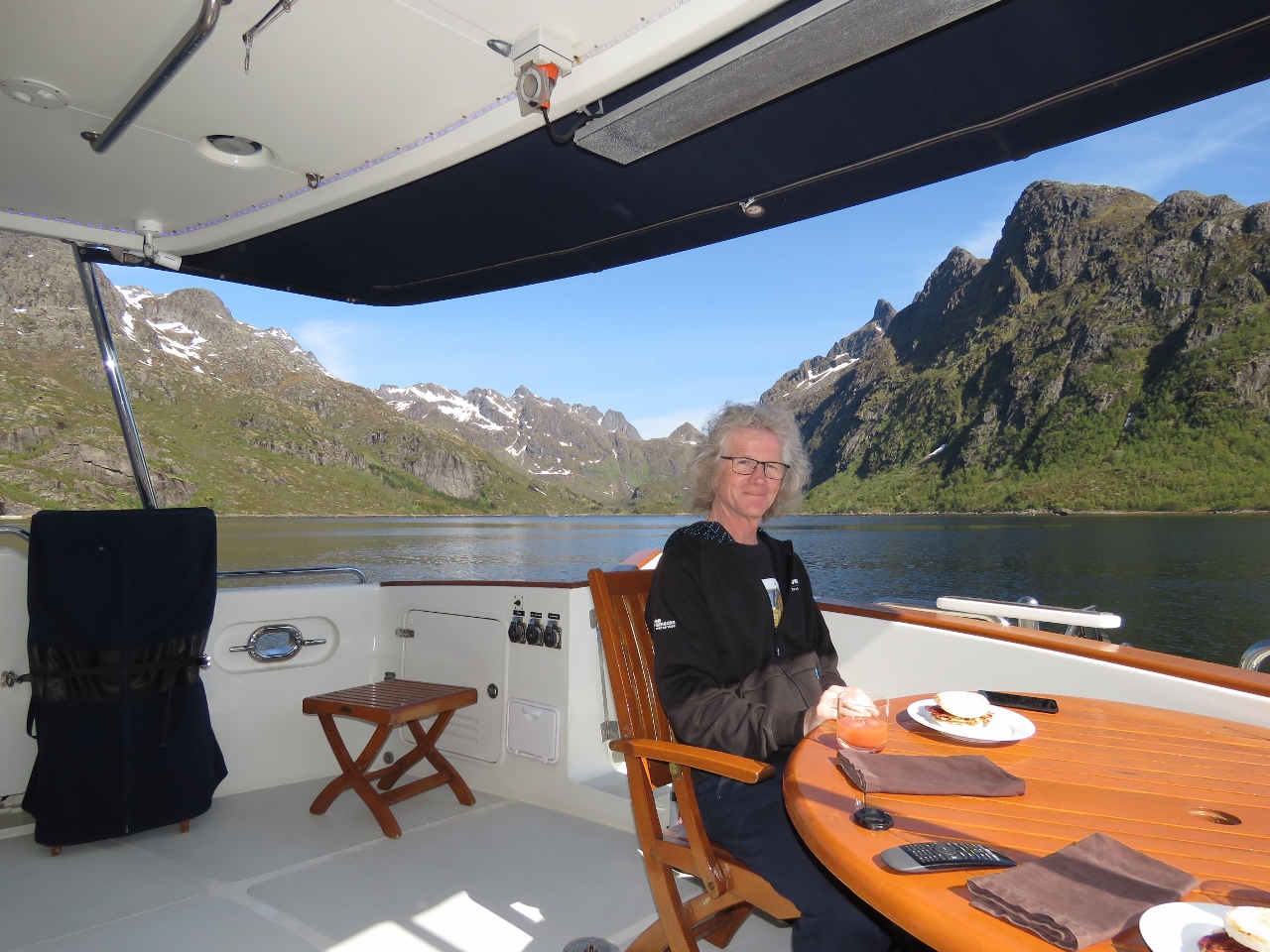 |
Brunch
Position: 15 0.95, 68 21.85
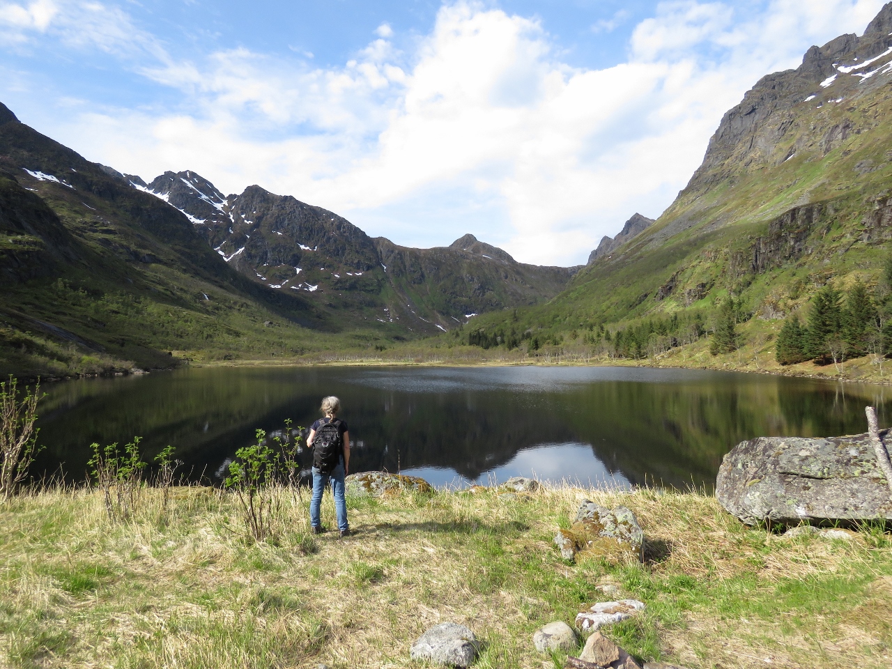
We anchored opposite Trollfjord in 95ft on 350ft of all-chain rode with good holding. It’s a wonderful anchorage with beautiful views straight down Trolljford and also down Grunnfjord. Conditions were so warm and calm that we had brunch on deck and didn’t even need the patio heater. The view behind James is northwest into Grunnfjord.
|
 |
Anchorage
Position: 15 0.95, 68 21.84
Our fabulous anchorage with a view up Trollfjord and Grunnfjord (not visible).
|
 |
Grunnfjord
Position: 14 59.66, 68 23.08
The tender tied off near a waterfall at the head of Grunnfjord.
|
 |
Grunnfjordvatnet
Position: 14 59.67, 68 23.08
Looking across Grunnfjordvatnet that drains into Grunnfjord.
|
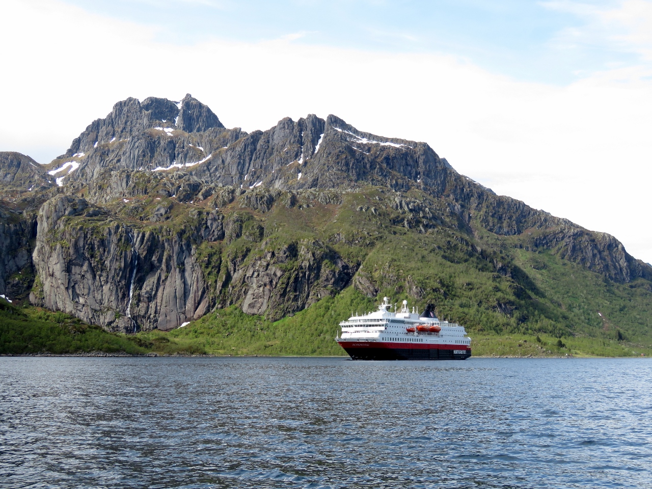 |
Hurtigruten
Position: 15 5.33, 68 23.19
The Hurtigruten Nordnorge heading south through Raftsund. It had slowed to transfer passengers to a smaller tour boat.
|
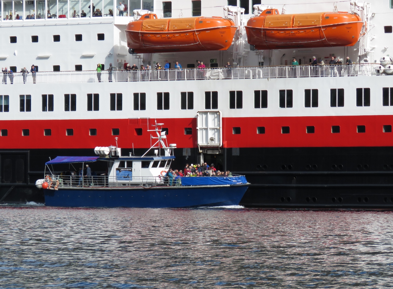 |
Offloading
Position: 15 4.52, 68 23.09
A small tour boat from Svolvær pulled up beside the underway Nordnorge and did a harbor pilot-like transfer, but rather than taking on a single experienced pilot instead it brought on board as many passengers as it could carry. This is the first underway transfer we’ve seen from a cruise ship to a tourist boat.
|
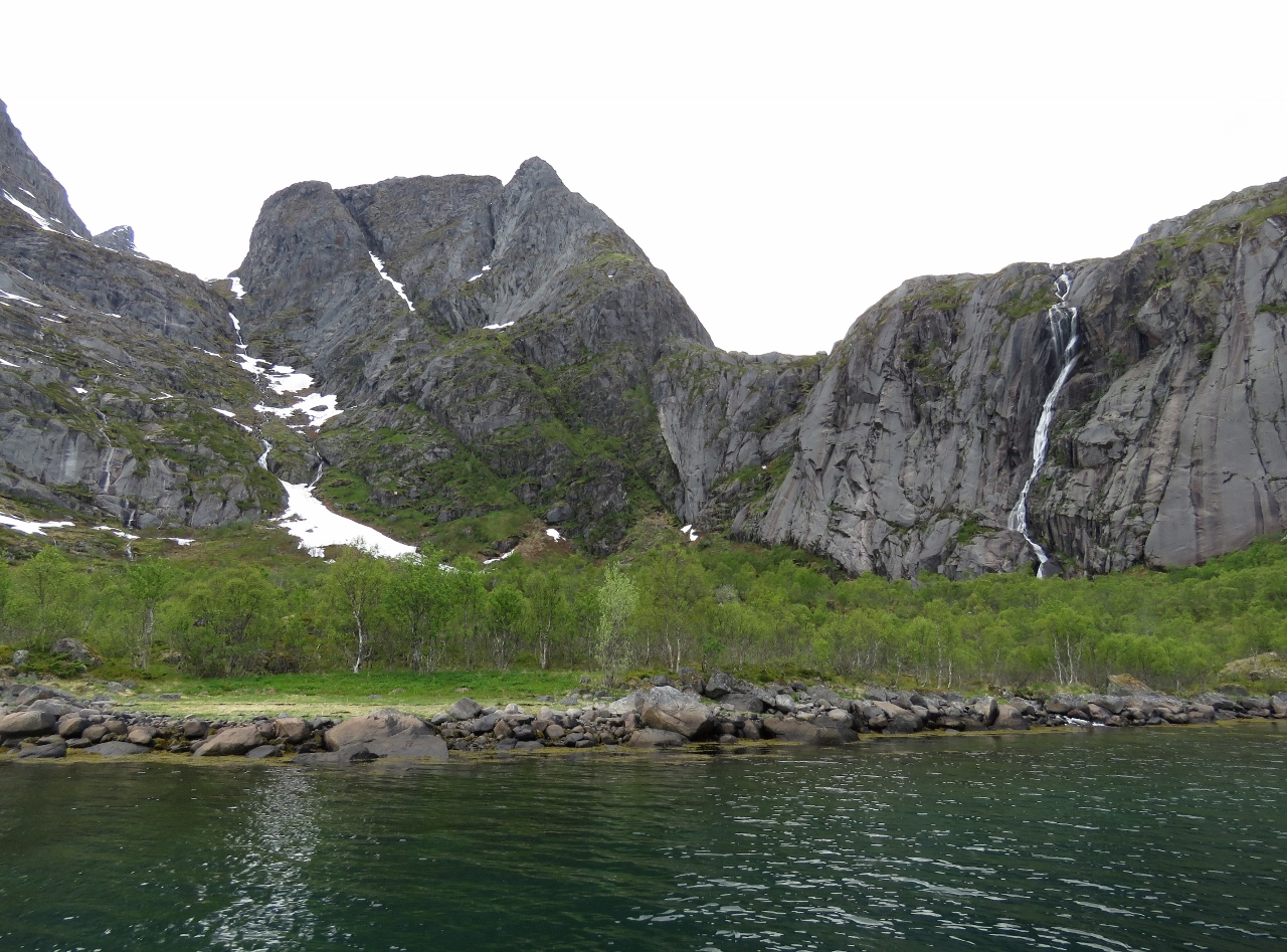 |
Fallvika
Position: 15 5.02, 68 23.82
The waterfall Fallvika, right, amid dramatic scenery along the west shore of Raftsund.
|
 |
Mountains
Position: 15 1.03, 68 20.88
Mountain views look west as we pass between the islands of Brakøy and Ulvøy
|
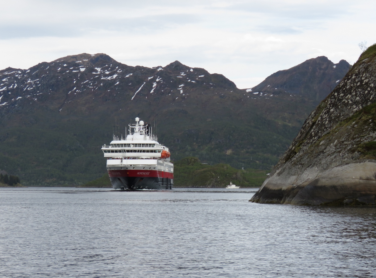 |
Nordnorge
Position: 14 58.41, 68 21.81
We’d read that the Hurtigruten ships passed through Trollfjord and were looking forward to seeing one inside when we first saw the Nordnorge. But when passengers were offloaded to the tour boat, we expected the Nordnorge would continue south and meet the passengers at Svolvær. It was therefore both surprising and exciting to see it round the corner and start heading towards us in Trollfjord. Dirona at anchor is visible in the distance on the right.
|
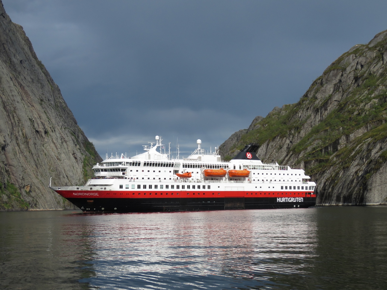 |
Almost Touching
Position: 14 56.17, 68 21.79
One of the reasons we wanted to see a Hurtigruten in Trollfjord was we’d read they turned around inside such that the passengers could almost touch the walls. The Nordnorge did not disappoint—what a sight.
|

|
Click the travel log icon on the left to see these locations on a map, with the complete log of our cruise.
On the map page, clicking on a camera or text icon will display a picture and/or log entry for that location, and clicking on the smaller icons along the route will display latitude, longitude and other navigation data for that location. And a live map of our current route and most recent log entries always is available at mvdirona.com/maps. |
That last image is amazing. I can only imagine the skill required. Especially on a windy day
The Hurtigrutens are docking and undocking many times a day in tight harbors with little space to operate. The schedule is tough to maintain so they waste little time and when in a rush can arrive, transfer cargo, and depart in under 10 min. They appear to be experts in close quarters operation.
It was really fun to watch a Hurtigruten operating in Trollfjord and to ride one between Kirkenes and Tromso.