Svolvær, with a population of over 4,500, is the largest city in the Lofoten archipelago and the biggest center we’d stopped at so far in Norway. It also is a Hurtigruten coastal ferry stop—we had a great view from our berth to the twice-daily Hurtigruten arrivals and departures. While in Svolvær, we climbed to the 1935ft (590m) summit of Fløya for sweeping views of the area, visited the Viking Museum in Borg, reprovisioned, and enjoyed the town’s many excellent restaurants.
Below are trip highlights from May 28th through 30th in Svolvær, Norway. Click any image for a larger view, or click the position to view the location on a map. And a live map of our current route and most recent log entries always is available at mvdirona.com/maps
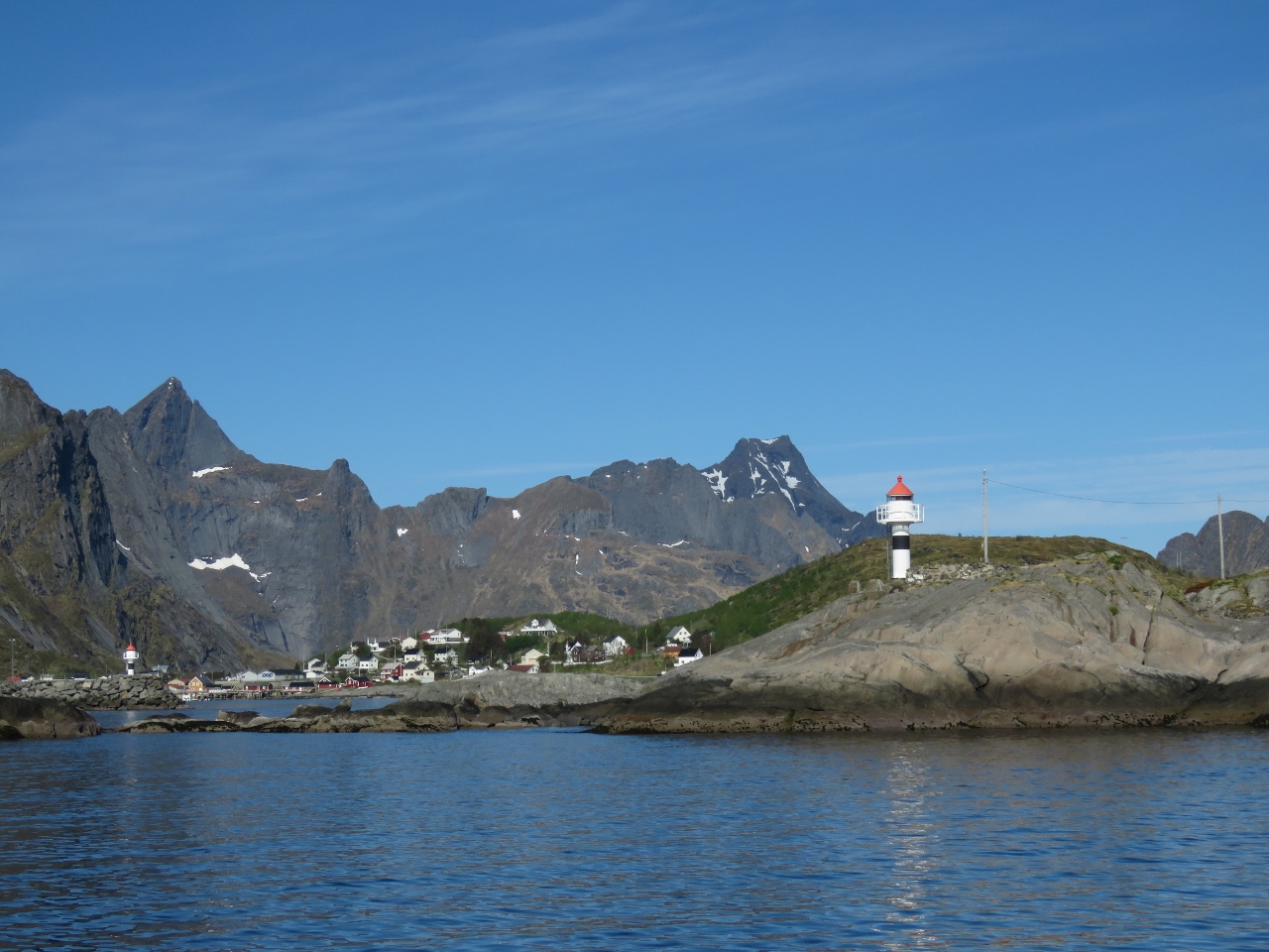 |
Reine Last View
Position: 13 7.06, 67 56.16
A last view to Reine as we depart for Svolvær.
|
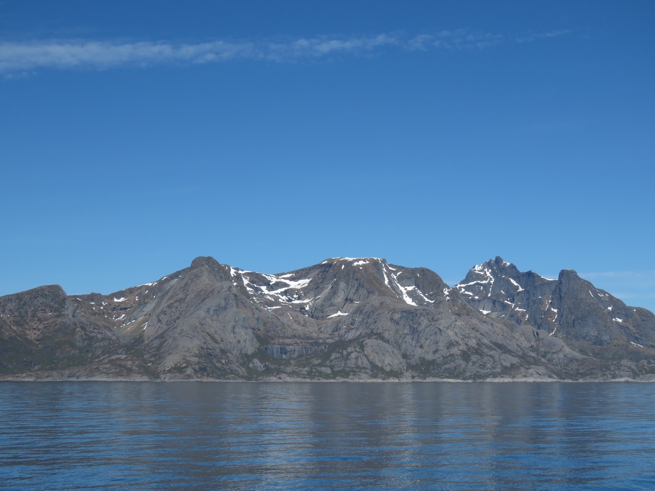 |
Flakstadøya
Position: 13 23.17, 67 59.12
Snow-capped mountains on the island of Flakstadøya.
|
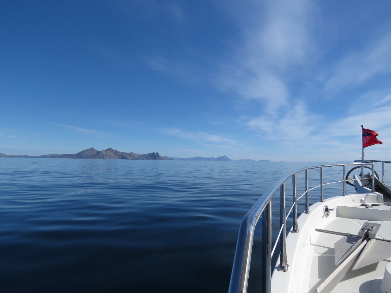 |
Calm Seas
Position: 13 32.06, 68 0.75
Calm seas and blue skies as we cruise along the island Vestvågøya.
|
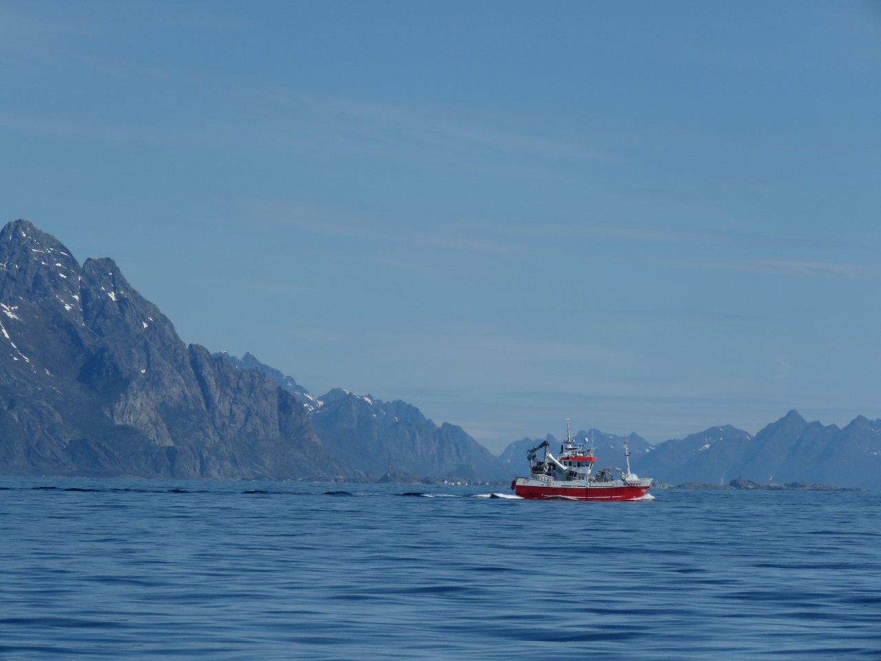 |
Fish Boat
Position: 13 52.65, 68 4.52
Fish boat departing Svolvær as we approach.
|
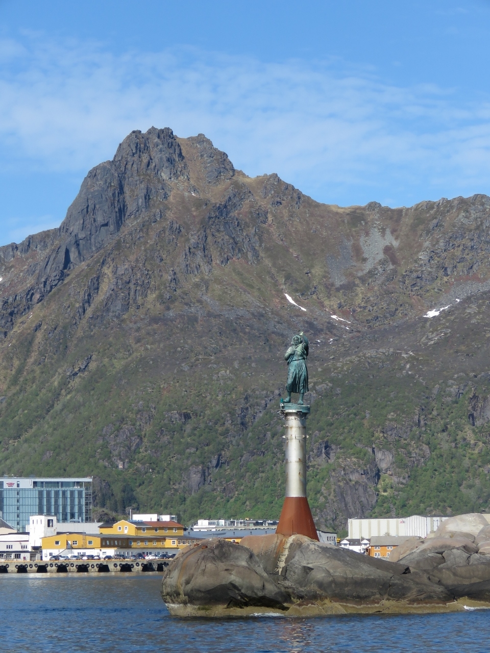 |
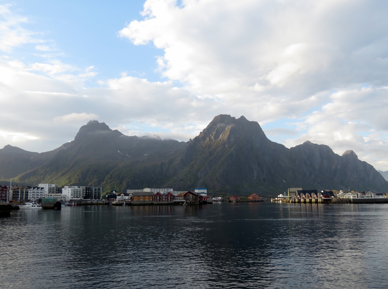
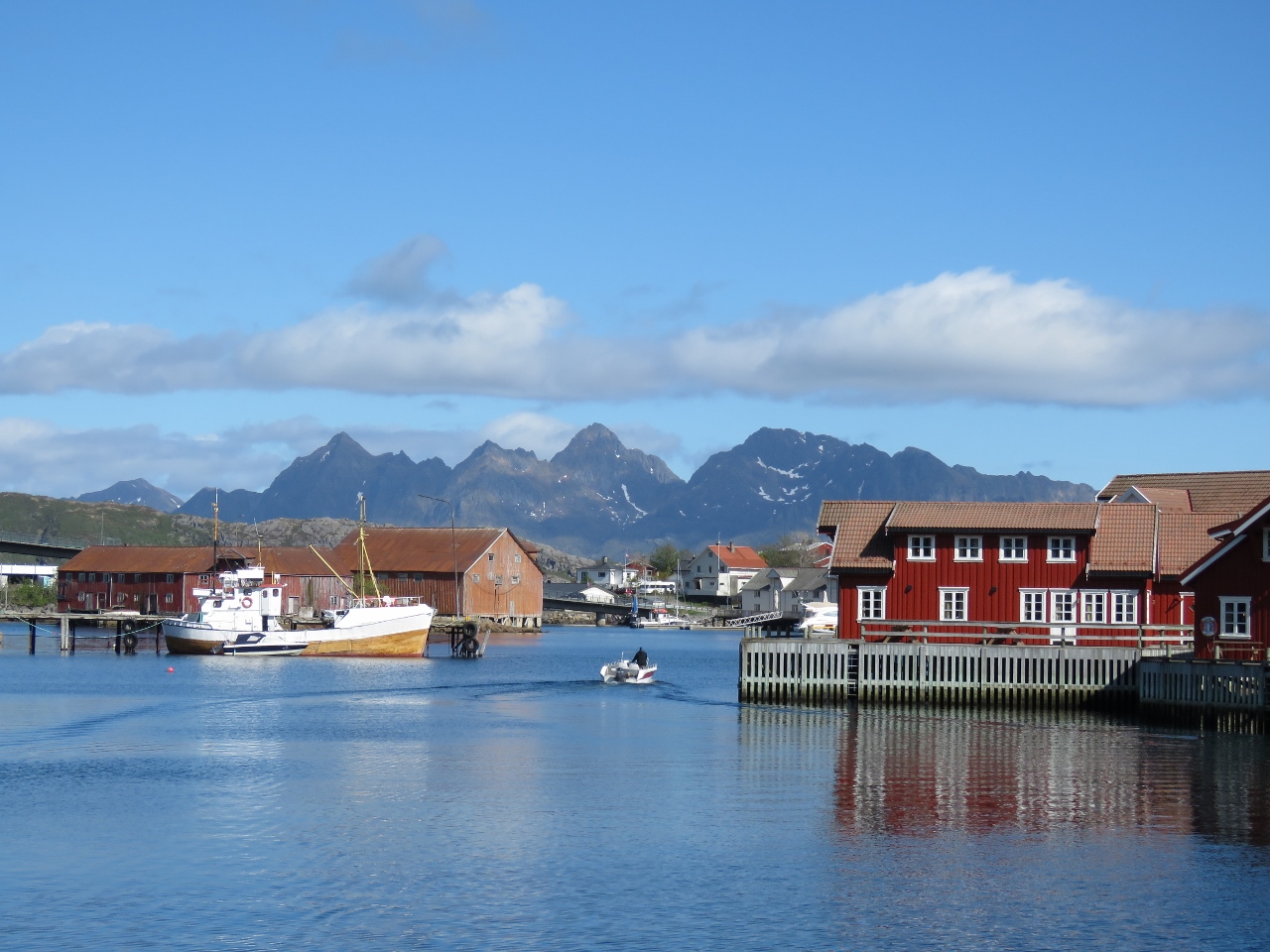
Svolvær
Position: 14 33.64, 68 13.43
Svolvær, the main center of the Lofoten Islands, has a dramatic entrance from sea with the statue of a fisher woman on the approach and steep mountains visible beyond. The statue, Fiskerkona, depicts a fisher woman waiting for her husband’s safe return.
|
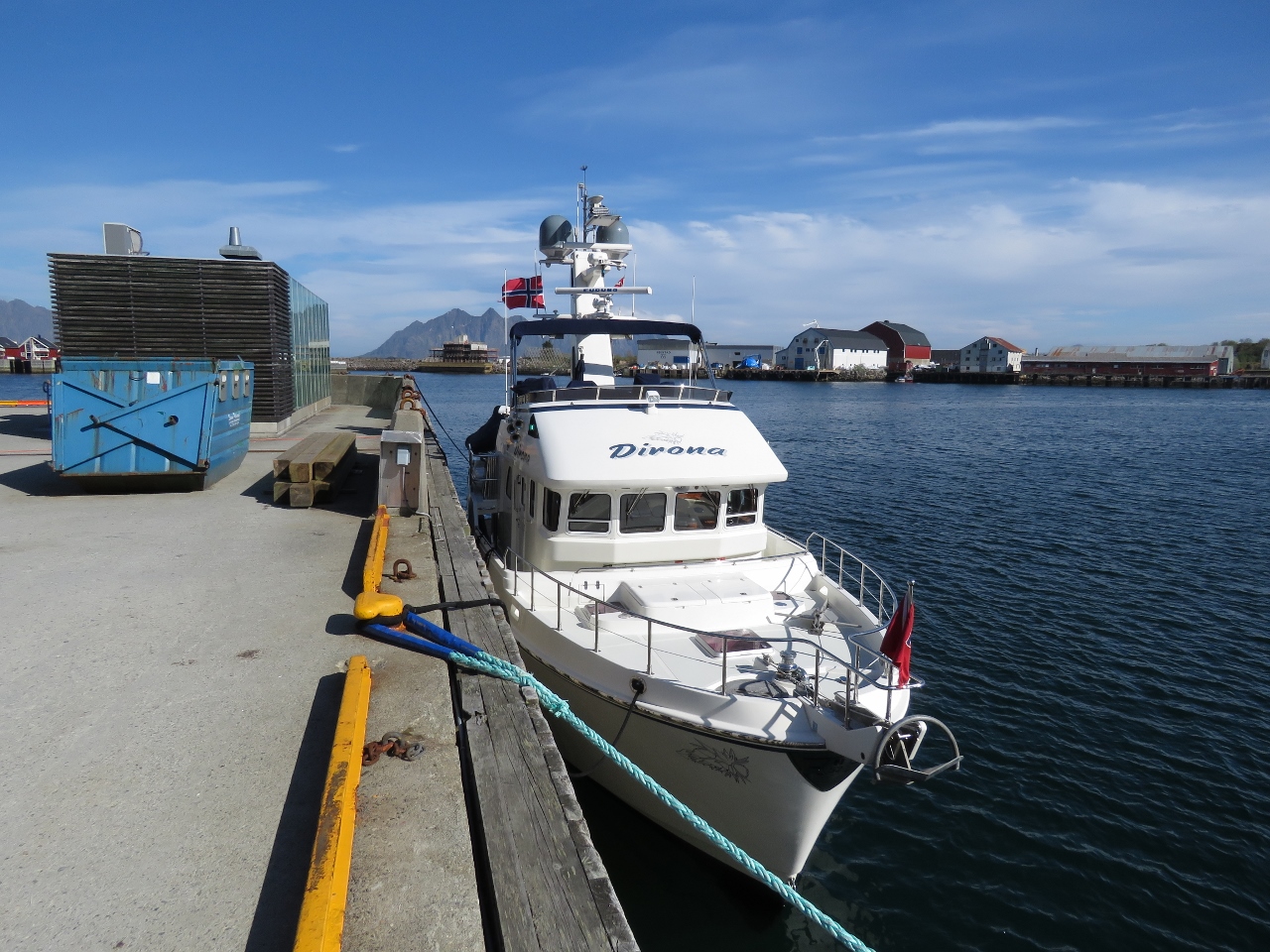 |
Pier
Position: 14 34.03, 68 13.96
Moored at the pier in Svolvær. The city does have floating docks, but the depths there are 2m or less and we draw 2.1m. Tying to a fixed pier is a little more challenging in that we need to allow the boat to rise and fall with the eight-foot tidal range. Long lines run criss-crossed, from the stern forward to shore and from the bow aft to shore, are the best way to ensure the lines are long enough for low tide, but not so long at high tide that we drift excessively off the dock.
|
 |
Power
Position: 14 34.03, 68 13.96
Our boat has a 90-ft 50-amp cable which is more than enough for the vast majority of marinas. But we have encountered situations where the closest pedestals nearest the boat aren’t working or its an unusually long distance to reach a pedestal, so we have four extensions. The first is a heavy 50ft extension that will carry 32 amps with minimal voltage loss, and the other three are 16-amp cables of 75ft each.
The only power sources near us at Svolvær are three-phase, but Dirona is a single-phase boat. We have in the past connected Dirona up to a single phase or a large 100-amp 3-phase connection, but its more work to go that route and you have to carry or borrow the appropriate connector. Here we thought we’d found 16 amps by running two of our 75ft lines to the top of the fixed dock, across to the other side, down the ramp heading into the floating pontoons, and then halfway down to the end of the pier. We were pretty proud of ourselves for being able to get 16-amp power over such a large distance, but it turned out the 16-amp receptacle was actually a 10-amp service. We added yet another 75-ft cable and went all the way to the far end of the pier where there was a 16-amp service available at the blue pedestal near the blue-roofed boat. In this case, we’re reaching out about 180 ft with still acceptable voltage loss. Using all the cables we have, we can actually move 16 amps 365 feet, or the length of a mid-sized ferry. Dirona can’t run efficiently on much less than a 16-amp shore power service. However, we have a solution for locations with less than 16-amp service. We’re adding a second shore power connection to supply each of our two charges independently. The shorepower connections will not be interconnected (isn’t safe and most jurisdictions don’t allow it) and we can adjust the draw on each to stay within the service capacity limits. With this design we’ll be able to run on 2 connections of 8-16 amps. |
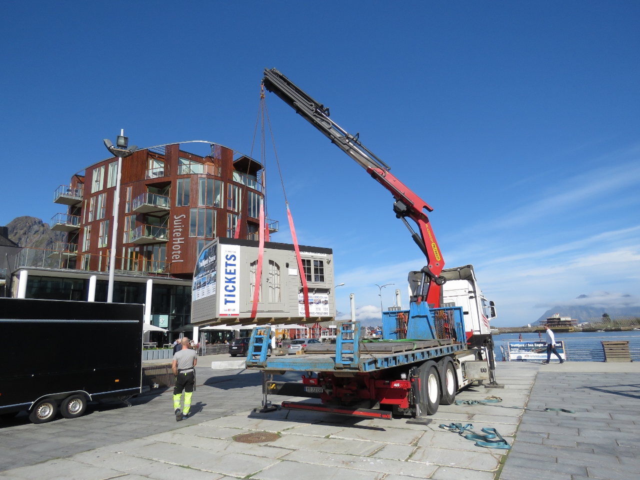 |
Crane Envy
Position: 14 33.89, 68 13.93
We watched this crane easily pick up a small building and deposit it on the dock. The crane can lift more than 1,000kg and reach more than 30ft. We’d love a crane like that one.
|
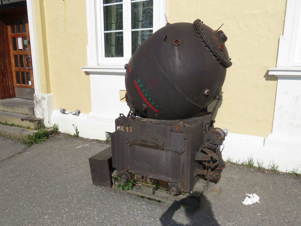 |
Mine
Position: 14 33.89, 68 13.86
Mine outside the Lofoten War Memorial Museum. The museum is only open from 6:30pm to 10:30pm in the off season.
|
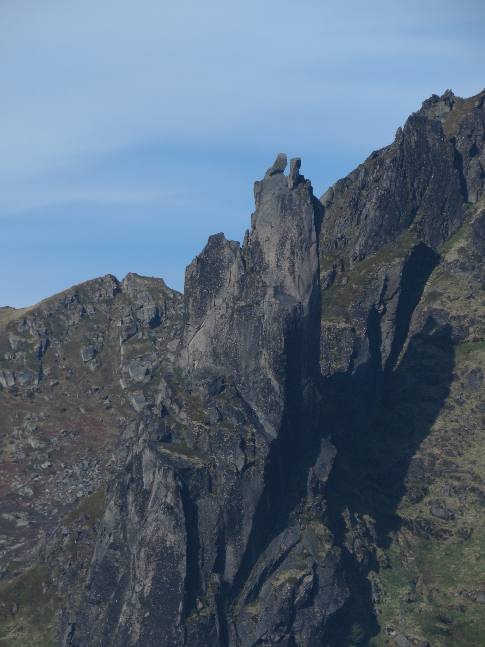 |
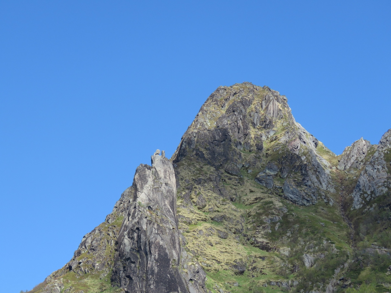
Svolværgeita
Position: 14 34.01, 68 13.88
View to Svolværgeita (“The Goat”) a twin pinnacled formation supposedly resembling a goat’s head. A popular activity for climbers is to scale one horn and leap to the other.
|
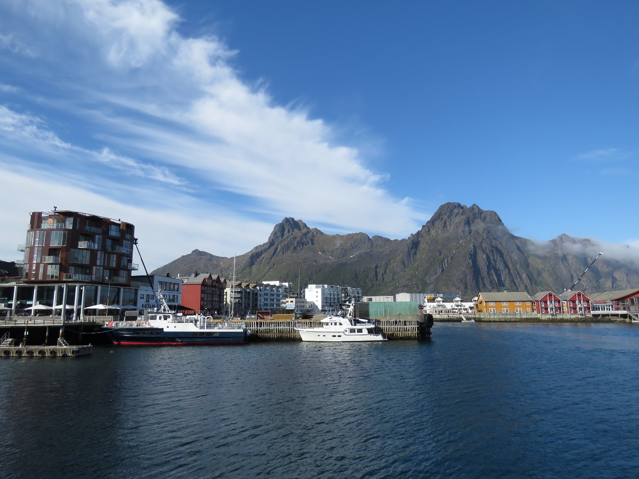 |
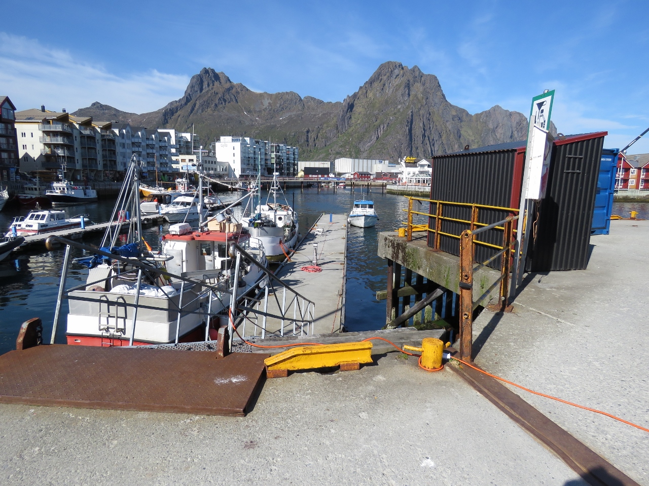
Svolvær
Position: 14 33.96, 68 13.90
Looking northeast across Svolvær harbour. Svolværgeita is roughly in the center of the mountains in the distance.
|
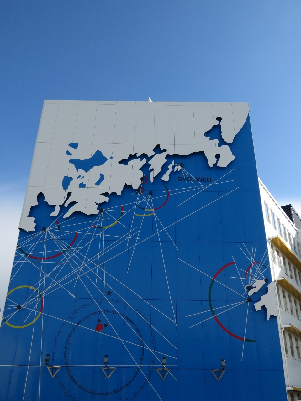 |
Mural
Position: 14 33.88, 68 13.86
Mural on the side of a building showing Svolvær major lighthouses in the vicinity.
|
 |
Boat Fire
Position: 14 33.94, 68 13.79
This boat had suffered an interior boat fire where the heat was so extreme that in some places the aluminum melted away and in other places it had crystalized and became brittle and was easy to crack away. Boat fires are scary.
|
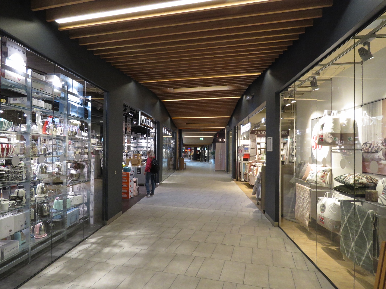 |
Mall
Position: 14 33.60, 68 14.01
Svolvær has a fair-sized mall with an unusually large proportion of outdoor gear and clothing stores.
|
 |
Sundt Flyer
Position: 14 34.14, 68 14.04
Norwegian SAR vessel Sundt Flyer at Svolvær.
|
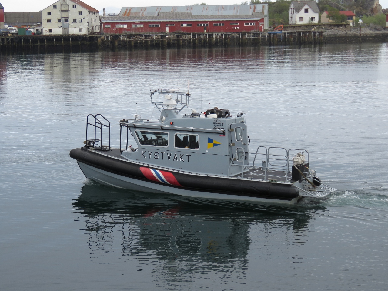 |
Kystvakt
Position: 14 34.05, 68 13.93
Kystvakt is Norwegian for Coast Guard.
|
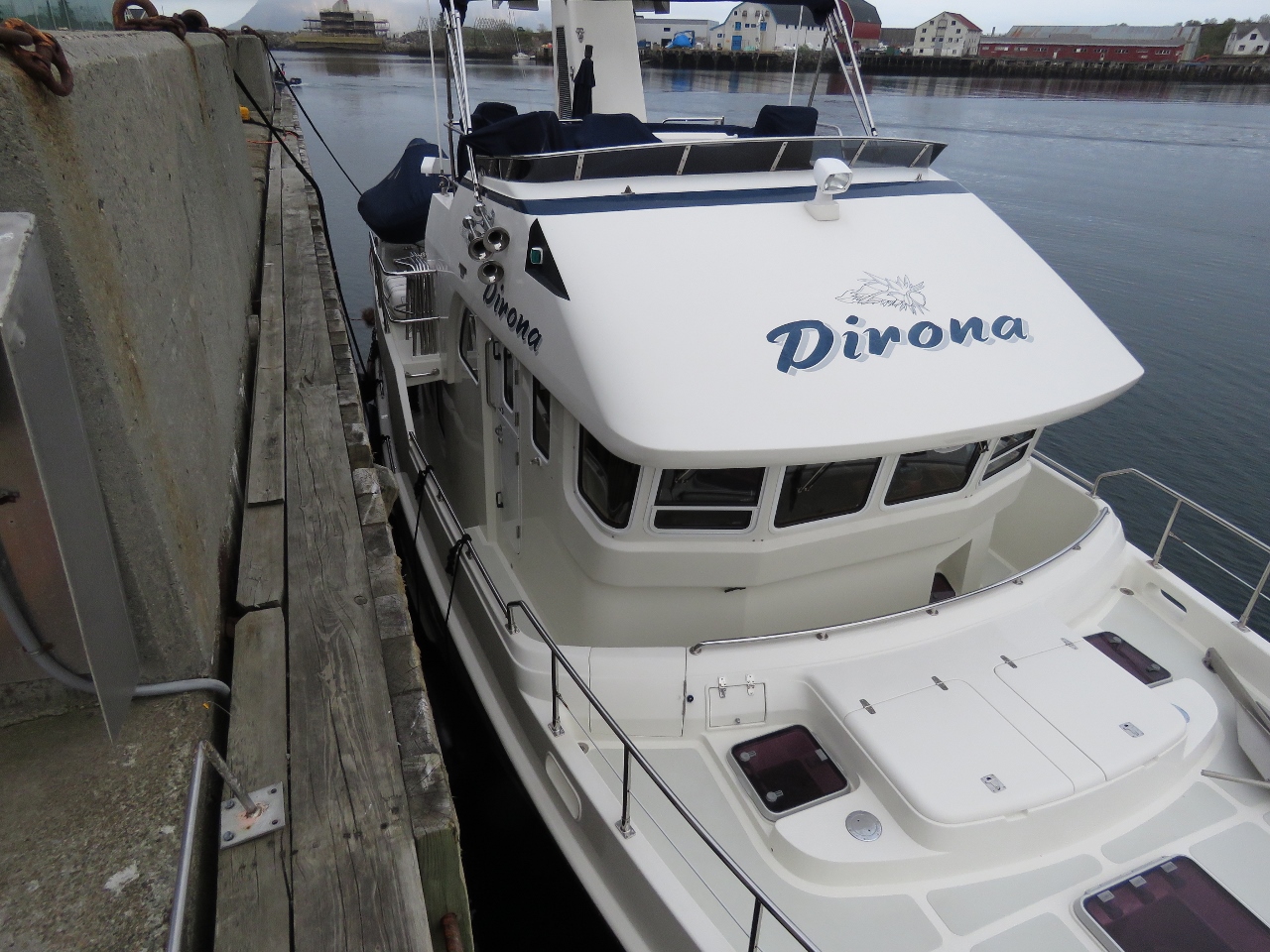 |
Low Tide
Position: 14 34.05, 68 13.93
Dirona is sitting much lower in the water now. Through much of the tide we can step across directly onto the boat deck, but at extreme low tide we climb down a ladder on the pier and get on into the cockpit.
|
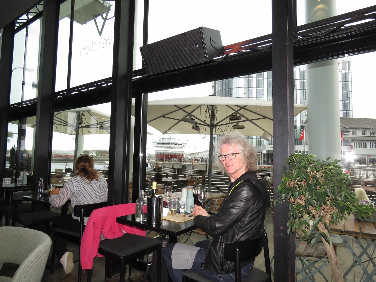 |
Du Verden
Position: 14 33.95, 68 13.94
We had a great dinner at Du Verden restaurant with a view to the Hurtigruten pier and Dirona. In the background is the Hurtigruten Polarsys that arrived about a half-hour earlier. Dirona is moored, but not visible, down the pier off the left side of the picture.
|
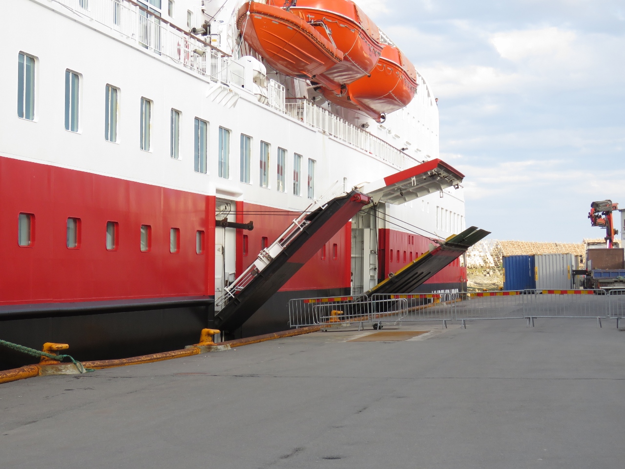 |
Ramps
Position: 14 33.97, 68 13.86
The Hurtigruten boats only stay on port for about 90 minutes. The Polarsys was leaving as we walked past after dinner, with it’s two folding ramps already partially tucked away.
|
 |
Evening
Position: 14 34.02, 68 13.77
Evening view across Svolvær harbour from the Hurtigruten pier.
|
 |
Magic Ice
Position: 14 34.00, 68 13.77
The bar at Magic Ice, a gallery housed in an old fish-freezing plant featuring ice sculptures and frozen furniture.
|
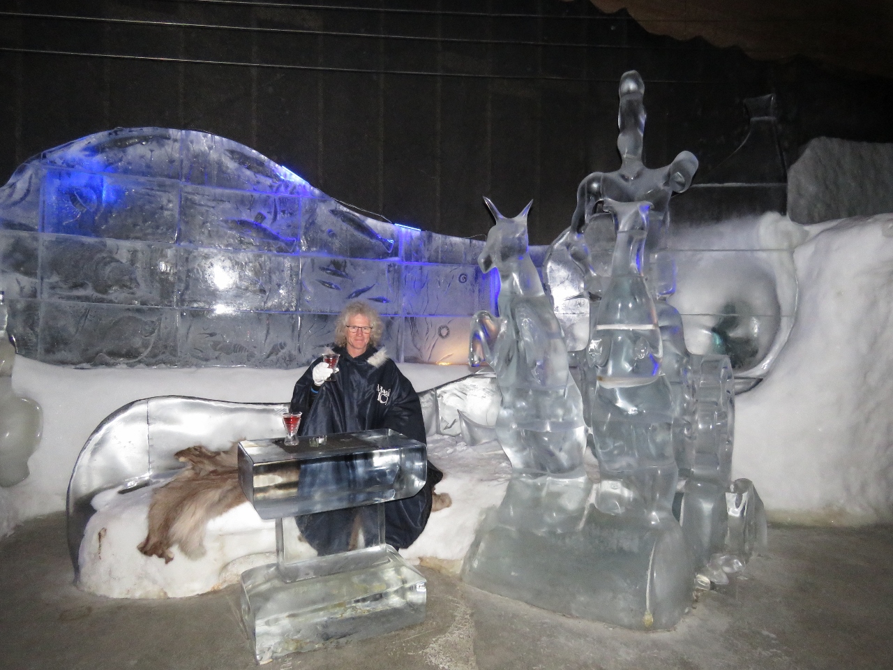 |
Ice Glass
Position: 14 33.99, 68 13.77
James with a drink in an ice glass seated on an ice bench in front of an ice table. Because the temperature is about 21°F (-6°C) Magic Ice supplies capes and gloves for warmth. It was a little touristy, but we had fun and are glad we went.
|
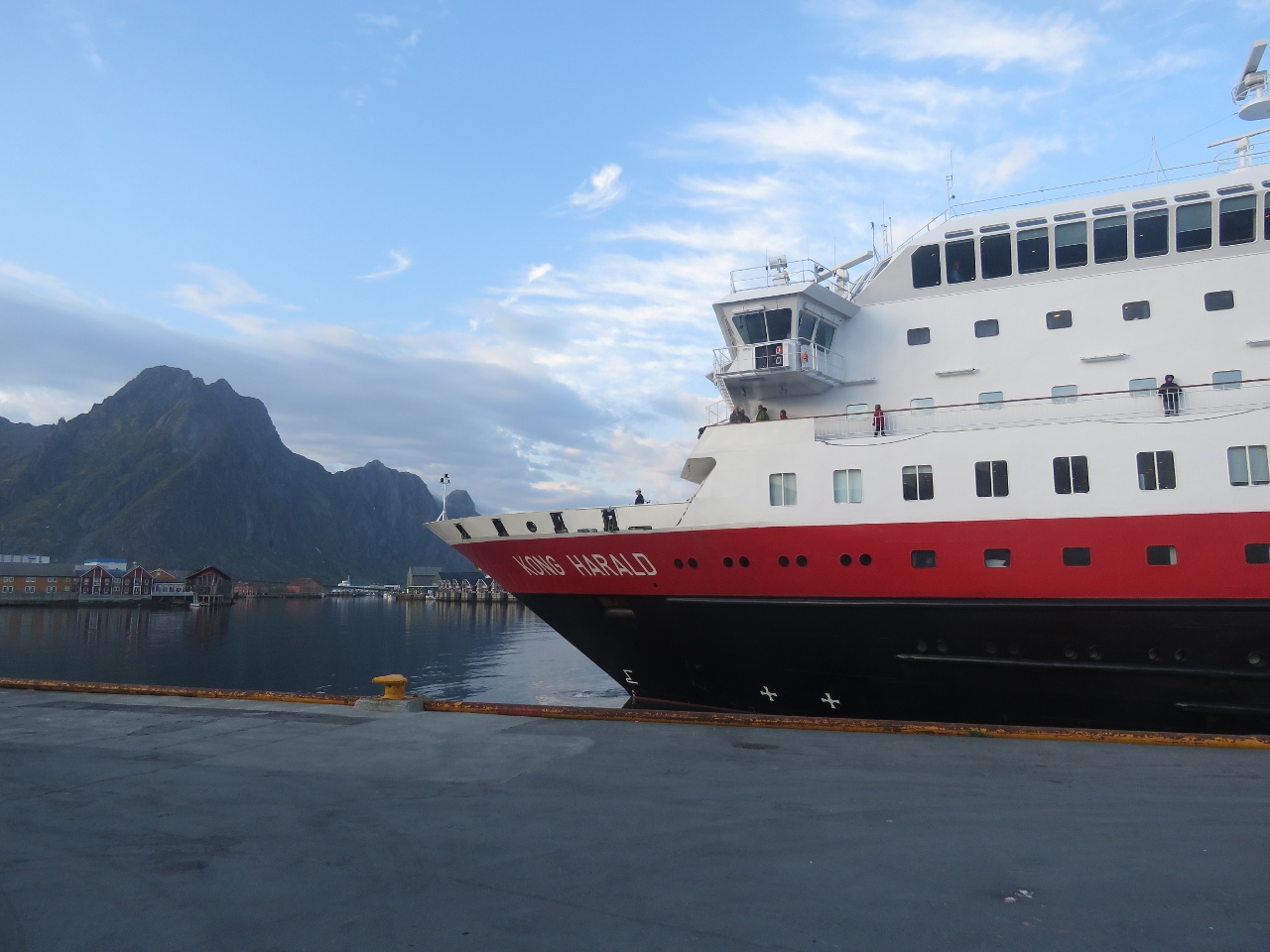 |
Kong Harald
Position: 14 33.98, 68 13.82
The Hurtigruten Kong Harald was arriving as we exited Magic Ice. We had seen that ship heading south near Trondheim about two weeks ago.
|
 |
Elevator
Position: 14 34.00, 68 13.83
The Kong Harald car ramp rested several feet below the car. They use an elevator to lift cars up to pier level.
|
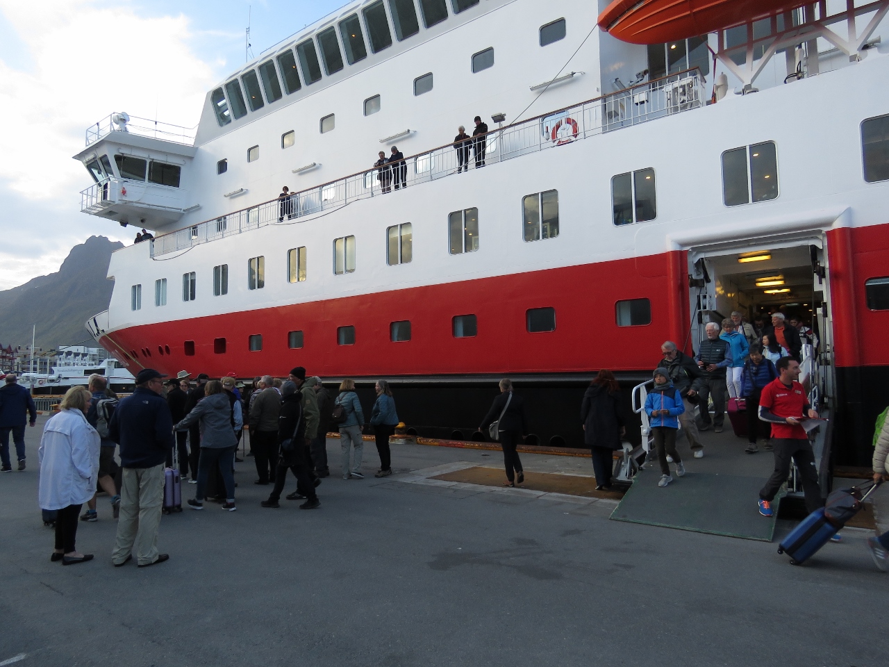 |
Crowds
Position: 14 33.97, 68 13.84
Crowds disembarking from the Hurtigruten Kong Harald at Svolvær. Some will stay in town, but many are just getting off for a brief walk around town and will continue on with the ship.
|
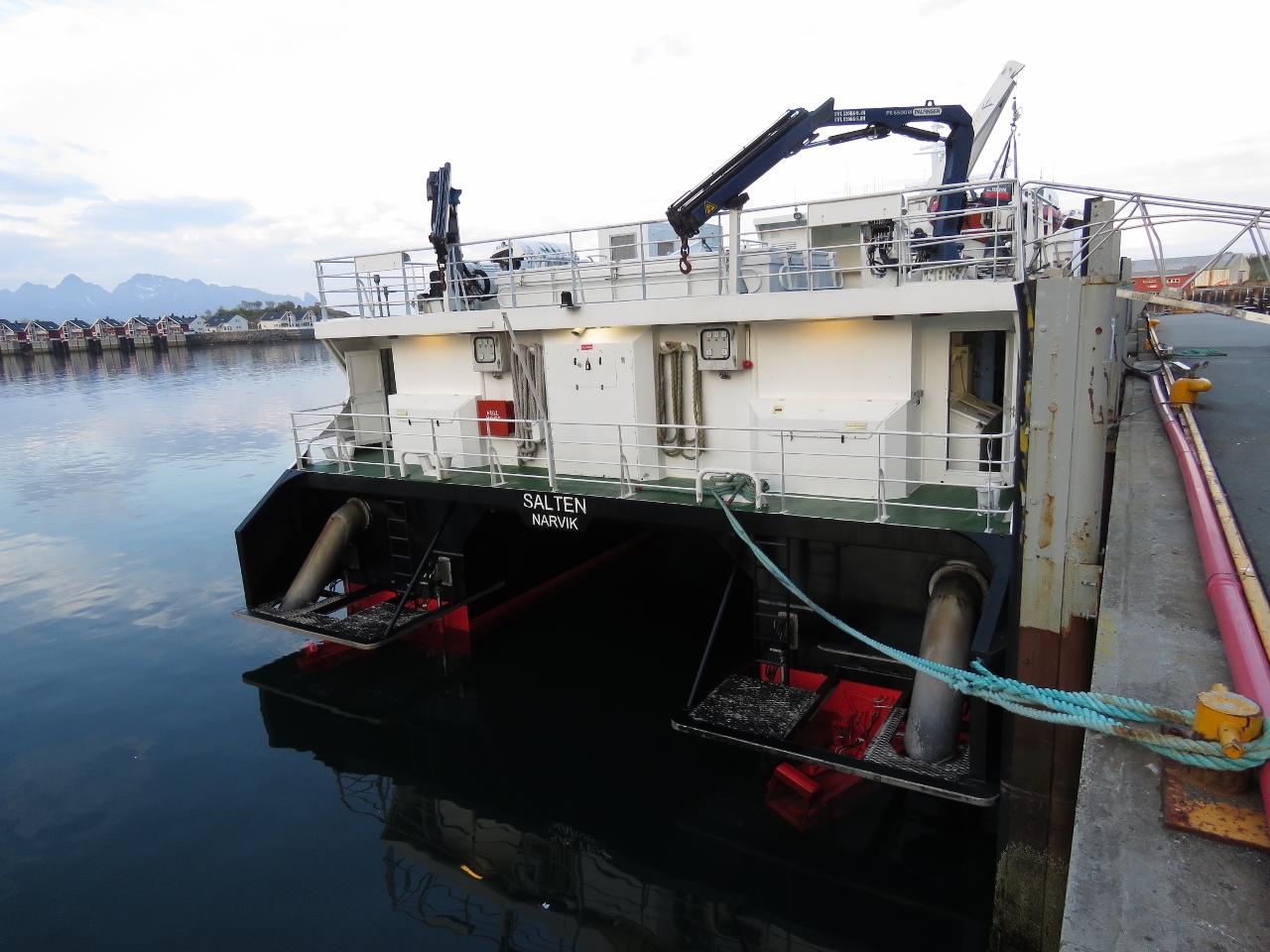 |
Position: 14 33.96, 68 13.90
The fast catamaran Salten also had arrived int Svolvær while we were in Magic Ice.
|
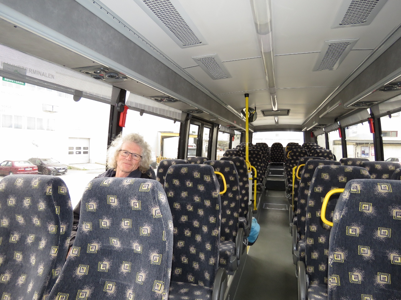 |
Bus
Position: 14 33.91, 68 13.85
We were the first on the bus at the first stop for a one-hour ride to the Viking Museum in Borg.
|
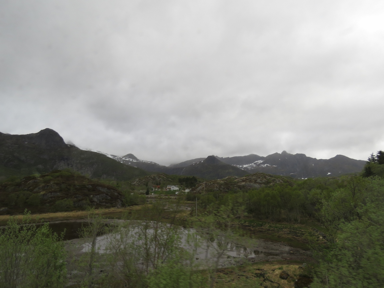 |
Scenery
Position: 14 25.89, 68 12.89
Despite the overcast day, the scenery along the way was impressive.
|
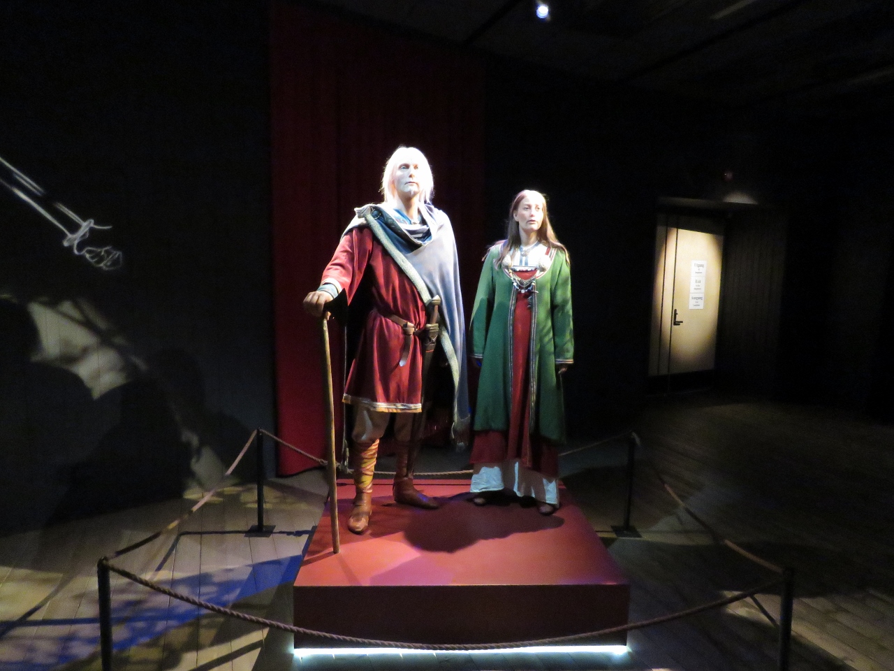 |
Viking Museum
Position: 13 45.42, 68 14.64
The remains of an 1000-year-old, 86-meter Viking chieftain’s house, the largest known in the world, were discovered at Borg in 1985. The chieftain’s house has been reconstructed near the excavation site, along with a museum displaying discovered artifacts and detailing the Viking history of the area.
|
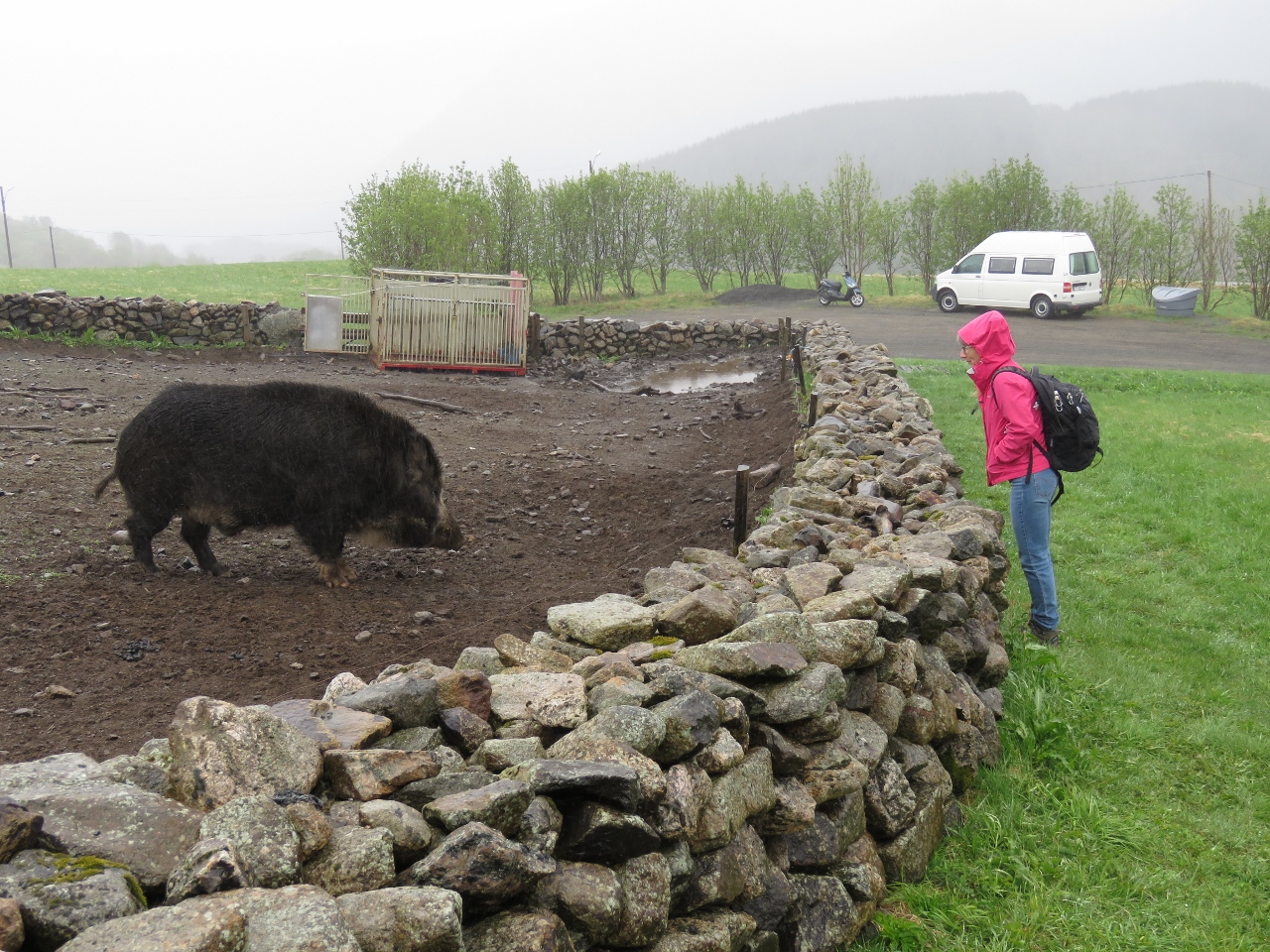 |
Wild Boar
Position: 13 45.51, 68 14.64
A wild boar is part of the display depicting Viking-era livestock.
|
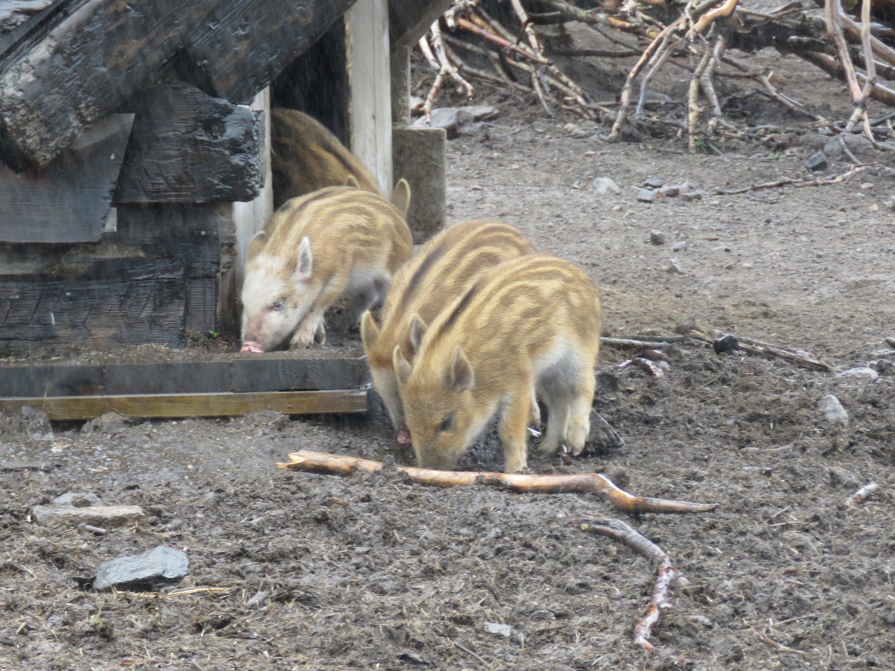 |
Piglets
Position: 13 45.51, 68 14.64
Some very cute piglets.
|
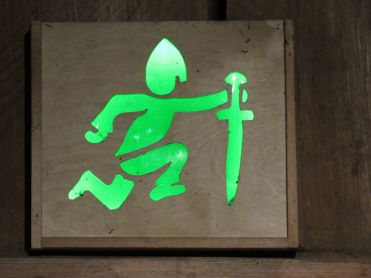 |
Emergency Exit
Position: 13 45.48, 68 14.66
We got a kick out of this emergency exit sign.
|
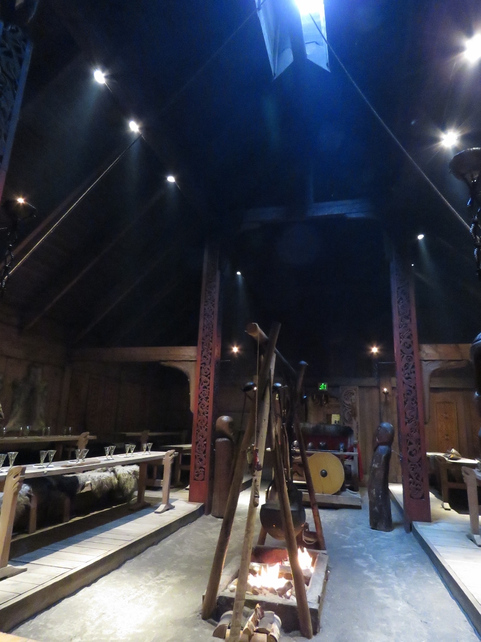 |
Chieftan’s House
Position: 13 45.50, 68 14.67
The feast area is one of several large rooms in the 86-meter chieftain’s house. The fire threw a fair bit of heat on this blustery day, but if visitors look carefully they can see central forced-air heat, a popular option with modern Vikings. :)
|
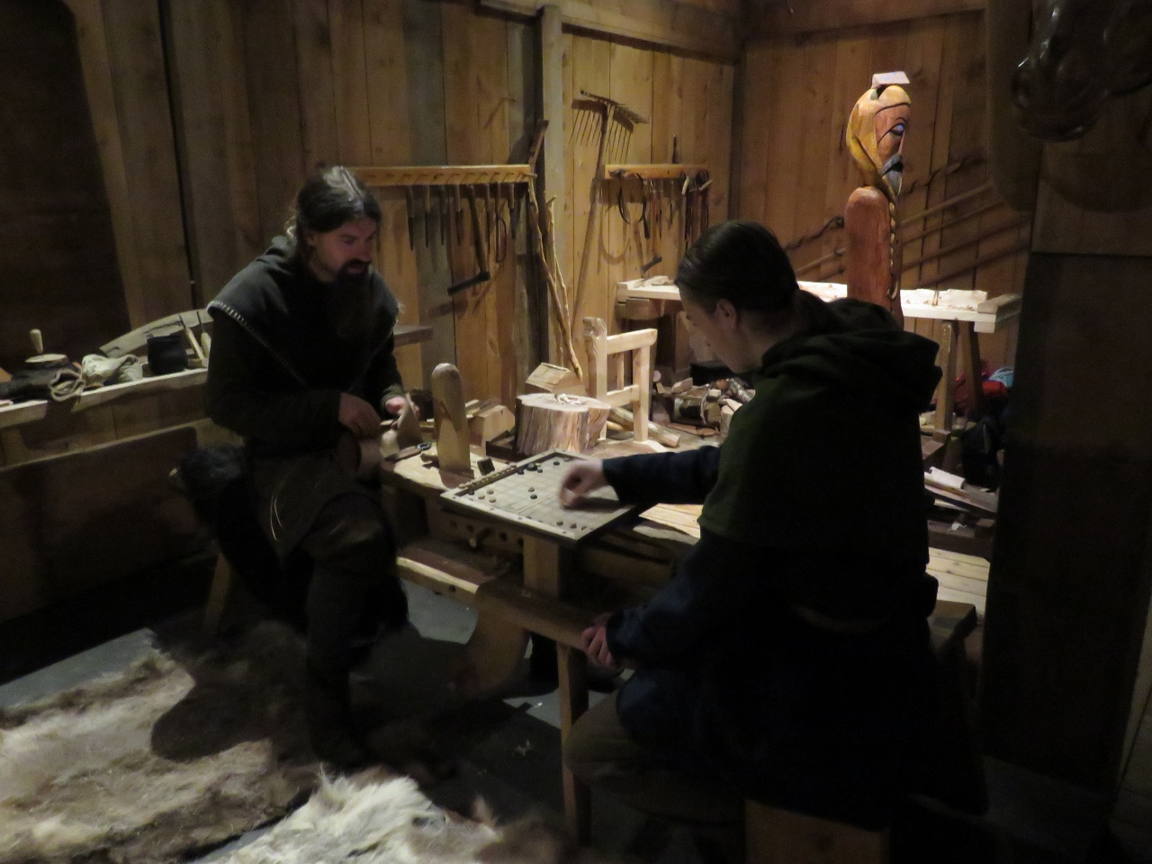 |
Cobblers
Position: 13 45.53, 68 14.68
One section of the chieftain’s house was dedicated to crafts such as shoe-making. Here two cobblers are making shoes while playing a board game.
|
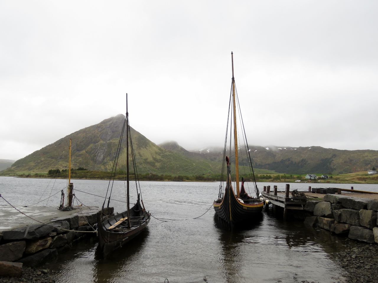 |
Viking Ships
Position: 13 47.13, 68 14.65
Replica Viking ships at the Viking Museum in Borg. In the summer, visitors can take a ride in them.
|
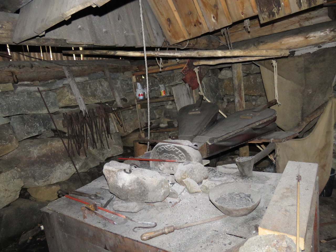 |
Blacksmith
Position: 13 46.76, 68 14.63
A reconstructed iron-age forge.
|
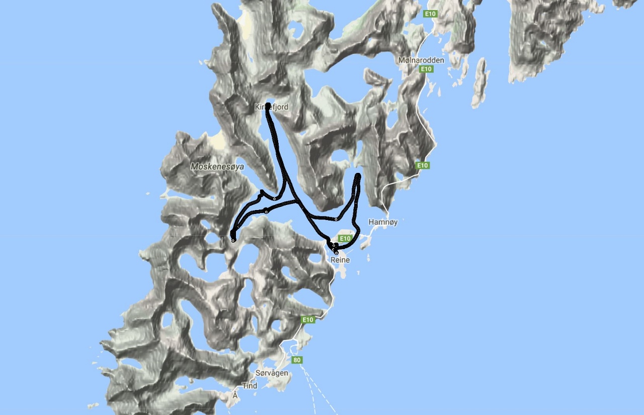 |
Maretron VDR100
Position: 14 34.05, 68 13.93
We are in the process of installing a NMEA2000 system in the new tender and it’s coming along very well. We’ll blog the system once we have had more experience with it.
The above map is from this morning’s tender run from Reine up to the end of Kjerkfjorden. The tender GPS system (Maretron GPS200) produces speed and location data multiple times per second. 100% of the data on the NMEA2000 network is stored by the Vessel Data Recorder (Maretron VDR100). Using N2KExtractor, this data can be inspected, exported, viewed through Excel or directly plotted using Google Maps to show the tender track (pictured). I’m finding the Maretron VDR100 a pretty interesting addition to a NMEA2000 installation. |
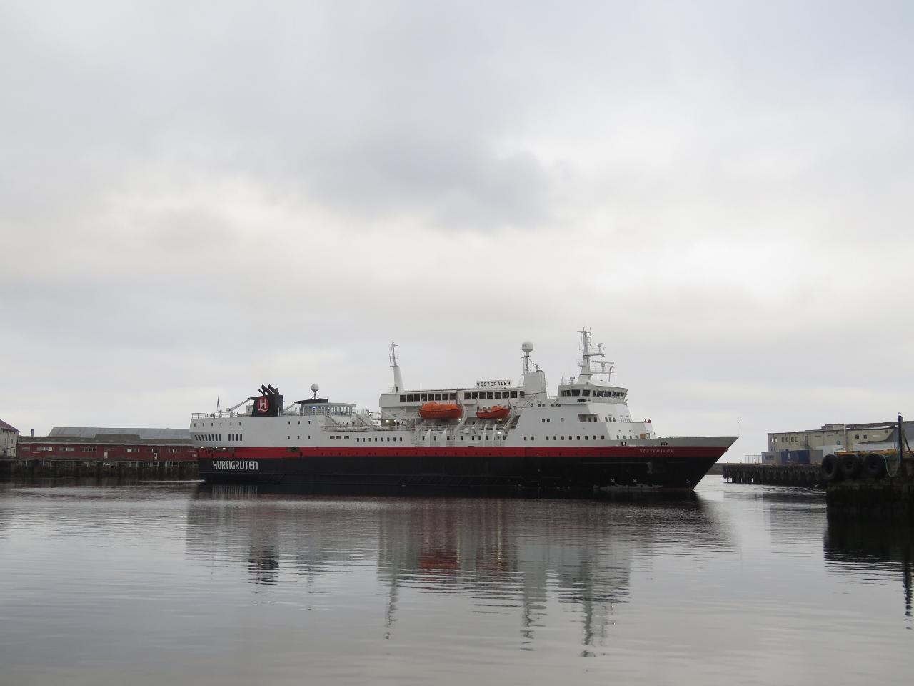 |
Vesterålen
Position: 14 34.04, 68 13.92
The Hurtigruten Vesterålen departing Svolvær.
|
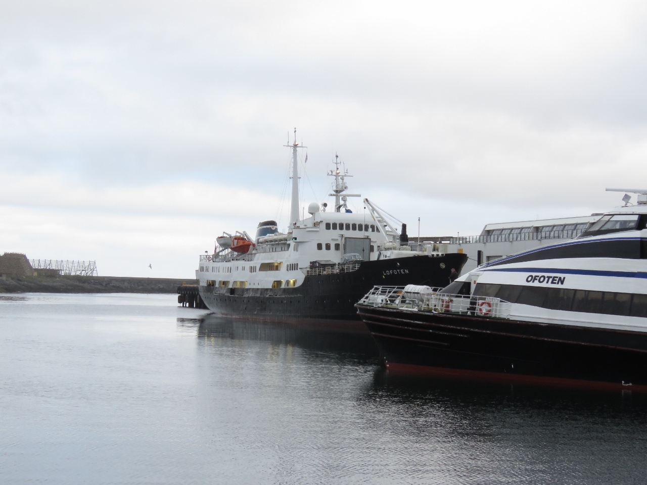 |
Lofoten
Position: 14 34.04, 68 13.93
The Lofoten was the second Hurtigruten of the evening at Svolvær. Commissioned in 1964, the Lofoten is the oldest vessel in the Hurtigruten fleet.
|
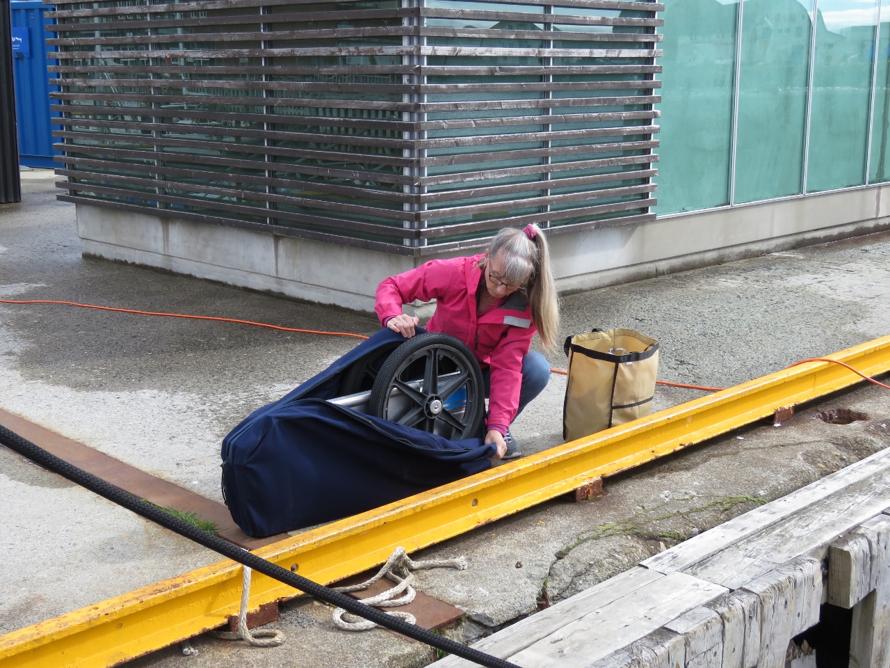 |
Folding Cart
Position: 14 34.04, 68 13.93
Jennifer unpacking our folding cart to go grocery shopping.
|
 |
Groceries
Position: 14 34.04, 68 13.93
A load of groceries, mostly fresh produce, from the nearby grocery store in Svolvær. We haven’t done any serious shopping since London and only picked up a few items as we left Harlingen.
|
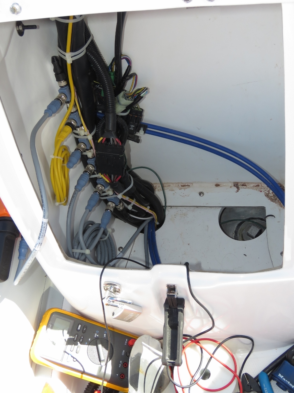 |
Rewiring
Position: 14 34.04, 68 13.92
The NMEA2000 power on the new tender is switched using one of the standard AB-provided dash-mounted switches. This works fine, but it’s easy to forget to turn on the NMEA2000 system on, more likely, fail to turn it off. Here James is installing a relay driven by the engine ignition switch to power the NMEA2000 system on engine start and to depower it on engine shut down. We could have powered the system directly from the ignition power source, but overloading engine ignition systems is a frequent cause of low voltage at the engine ECU and and other hard-to-trace engine faults. Better to just drive a relay and put the non-engine loads on a different circuit.
The other issue being corrected here is the engine was previously wired directly to the battery rather than through the battery switch. This means that shutting off the battery switch will do just about nothing since the engine is by far the biggest load and definitely the biggest electrical fire risk. |
 |
Svolvær Harbour
Position: 14 34.09, 68 14.02
A beautiful calm afternoon looking west across Svolvær Harbour from just north of our berth.
|
 |
Fløya
Position: 14 34.45, 68 14.53
We’re going to hike to the top of Fløya this afternoon. Svolværgeita (“The Goat”) is on the left and the 1935ft (590m) summit of Fløya is on the right. If you look closely, you can see the two horns of “The Goat” It’s hard to believe people jump between them.
|
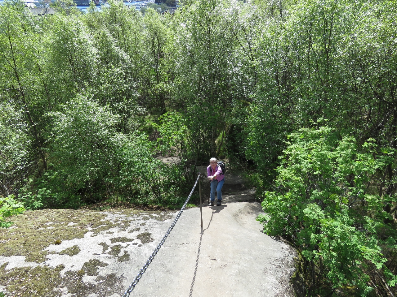 |
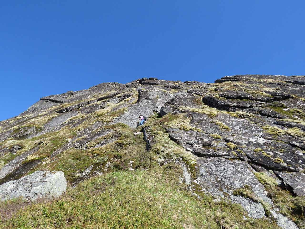
Climbing Chains
Position: 14 34.78, 68 14.71
The 1.2-mile (2km) track to the summit of Fløya is steep, with an average grade of about 30%. Climbing chains at only 200ft (60m) gave us a taste of what we were in for.
|
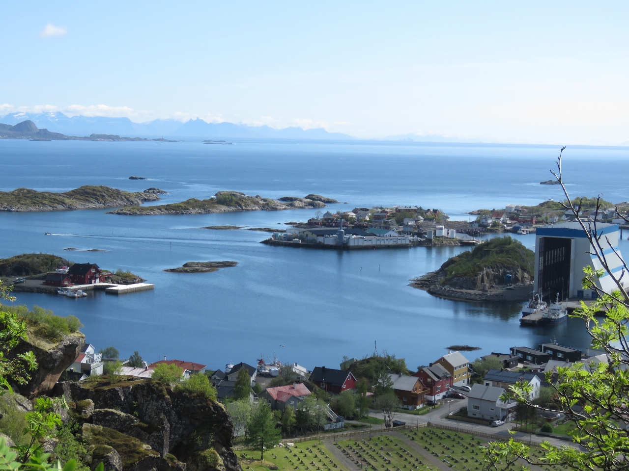 |
View 1
Position: 14 34.90, 68 14.74
At 400ft (121m) up, the view back to Svolvær already is pretty impressive.
|
 |
View 2
Position: 14 34.94, 68 14.82
Another great view to Svolvær at 787ft (240m) up.
|
 |
Climbers
Position: 14 34.98, 68 14.89
At 900ft (275m) up, we could see climbers scaling Svolværgeita (circled in red at bottom right—click image for larger view).
|
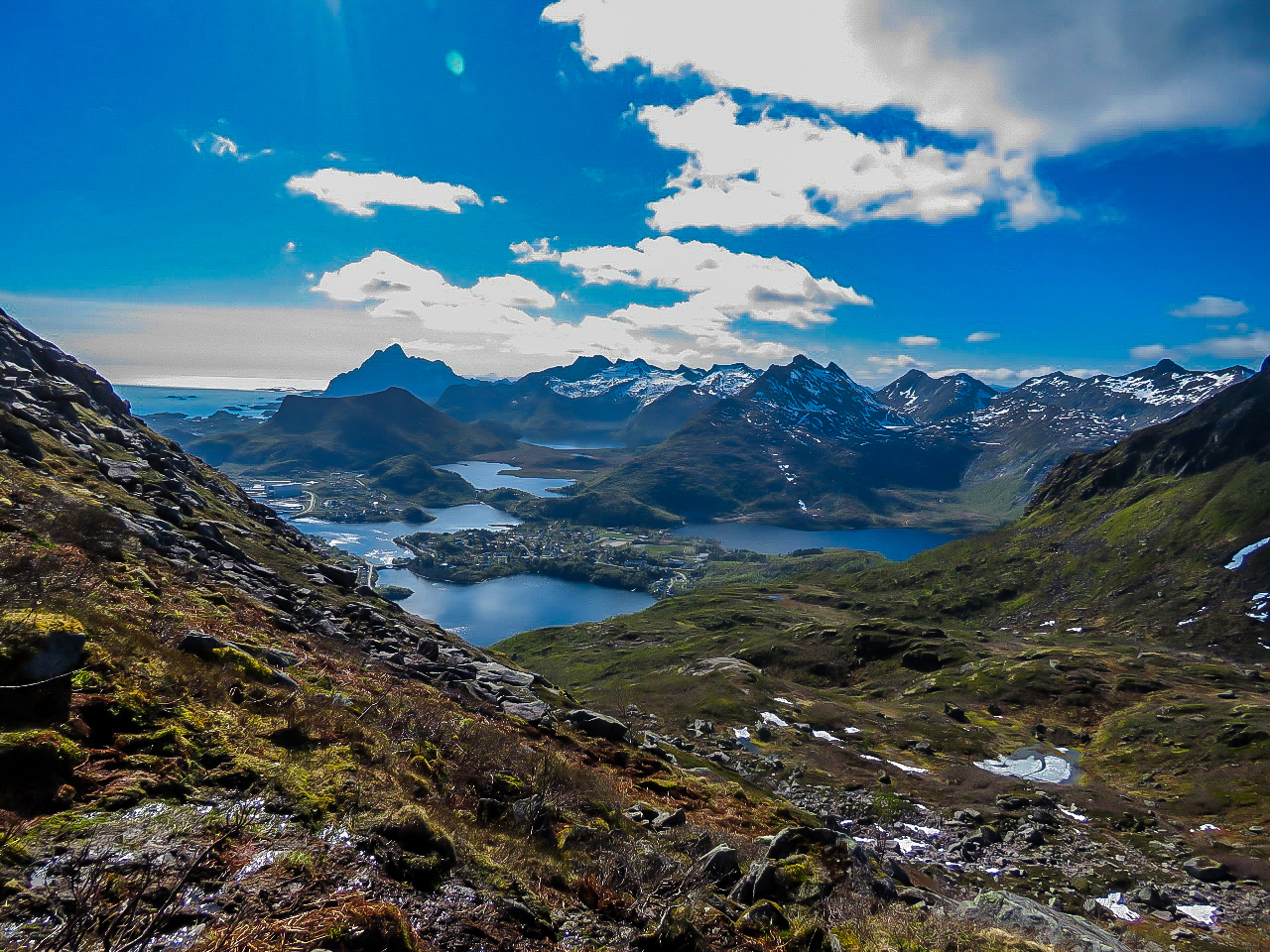 |
View 3
Position: 14 35.81, 68 14.96
One hour in, at 1535ft (467m), we took a break with this fabulous view south.
Update 06/05/2018: Improved photo editing by Edwin Hardesty |
 |
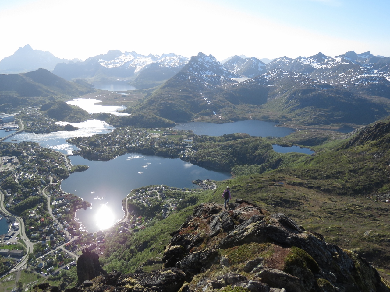
Fløya Summit
Position: 14 35.81, 68 14.84
The incredible view northeast across Høya was the reward for 1.5 hours of pretty strenuous going.
|
 |
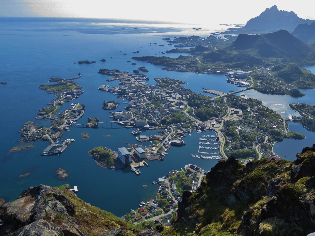
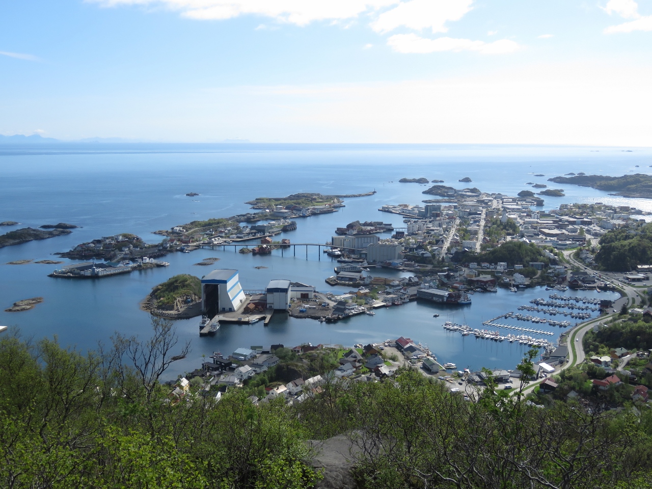
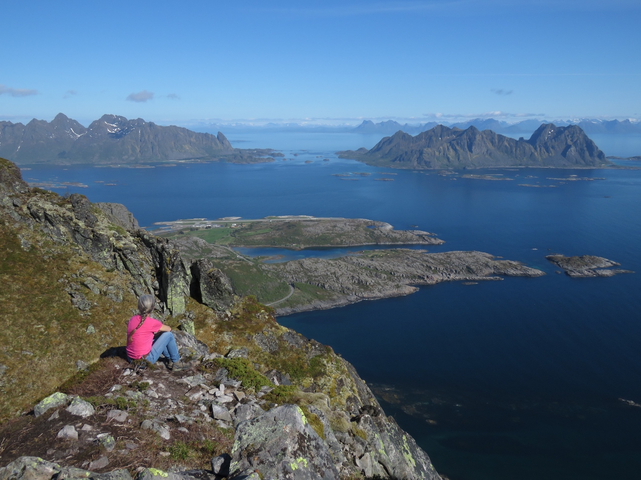
Svolvær
Position: 14 35.73, 68 14.83
Looking down onto Svolvær from 1912ft (582m) at the summit of Fløya.
|
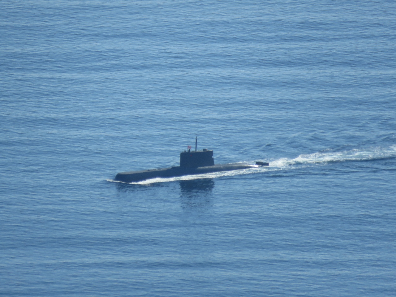 |
Submarine
Position: 14 35.75, 68 14.83
The Royal Norwegian Navy has six 193ft (59m) diesel-powered Ula-class submarines. One was running north through Høya while we were atop Fløya.
|
 |
South Trail
Position: 14 35.66, 68 14.83
Our topographic maps showed a trail leading south from the summit of Fløya that ran near Svolværgeita and eventually joined our original trail. We found a well-trod path following that route, so we decided to give it a try for the descent.
|
 |
Climbing Down
Position: 14 35.52, 68 14.83
The first portion of the the track down was steep, but manageable. Here Jennifer is making her way down a near-vertical ridge.
|
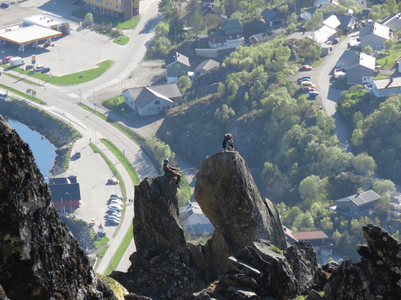 |
Svolværgeita
Position: 14 35.49, 68 14.82
As we descended through a narrow gully, we got an excellent view to climbers on Svolværgeita. A little beyond, at 1480ft (450m), the track came to a steep slope that we didn’t feel was safe for us to traverse. We tried to find another route, but eventually gave up, climbed back up the gully and found an easier way down farther north that brought us to our original trail.
|
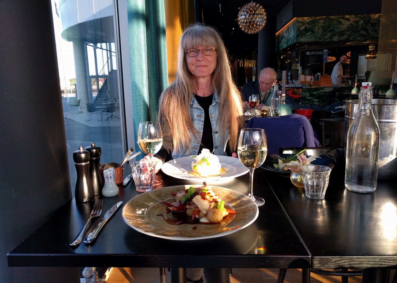 |
Paleo Artic
Position: 14 33.94, 68 13.91
We arrived back at the boat exhausted and sweaty, but very happy we made the hike. After hot showers, we had a beautifully-presented and delicious meal at Paleo Arctic with a view to Dirona (out of picture to the left.)
|
 |
Click the travel log icon on the left to see these locations on a map, with the complete log of our cruise.
On the map page, clicking on a camera or text icon will display a picture and/or log entry for that location, and clicking on the smaller icons along the route will display latitude, longitude and other navigation data for that location. And a live map of our current route and most recent log entries always is available at mvdirona.com/maps. |
If your comment doesn't show up right away, send us email and we'll dredge it out of the spam filter.