Inishmore Island, in the Aran Islands near Galway, Ireland, has several attractions. By far the most visited is Dun Aonghasa, a dramatic semi-circular fort built right to the edge of 300-foot cliffs with sweeping coastal views. And a popular way to tour the island is by bicycle. We saw literally hundreds of bicycles for rent when we arrived ashore in the morning, and most were hired out when we returned to town later that afternoon.
Trip highlights from June 25th, 2017 in the Aran Islands, Ireland follow. Click any image for a larger view, or click the position to view the location on a map. And a live map of our current route and most recent log entries always is available at http://mvdirona.com/maps
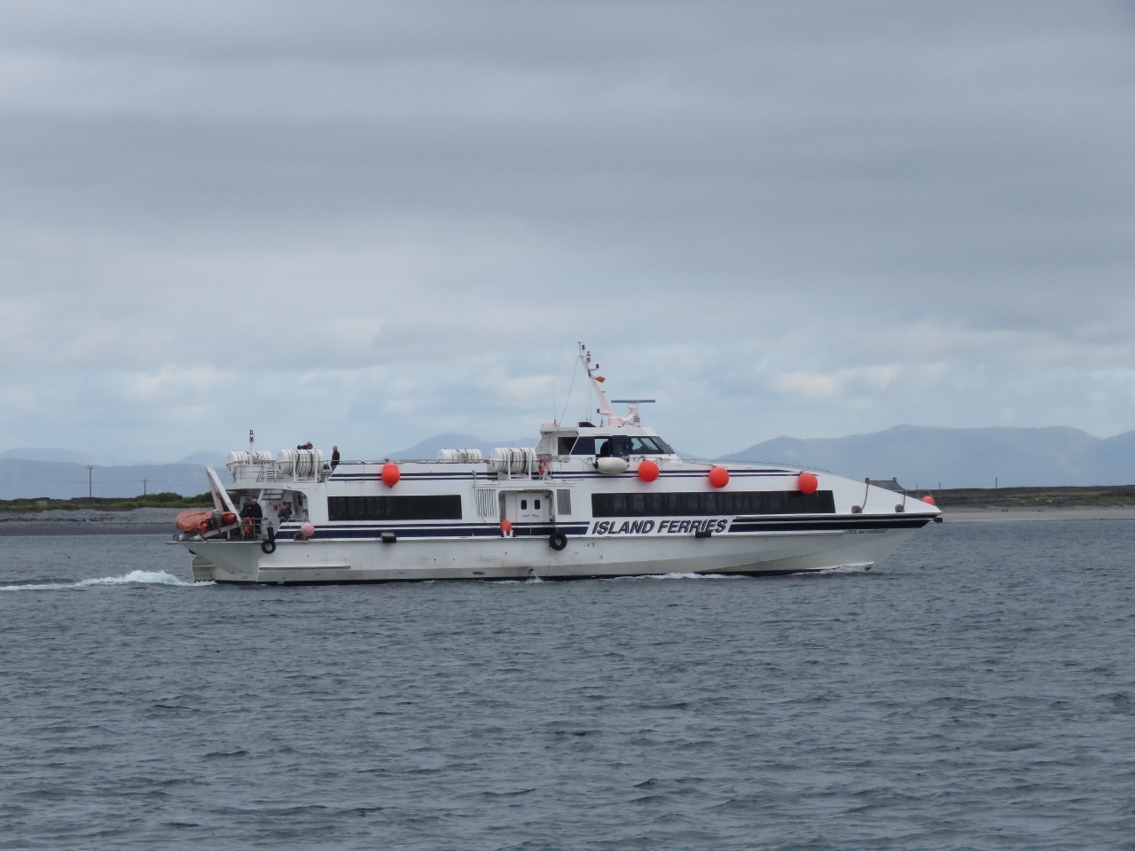 |
Island Ferries
Position: -9 39.75, 53 6.85
We’d had a long day, covering just over 100 miles, and had a relaxing meal in the comfortable anchorage at Killeany Bay. The island is a popular tourist destination with frequent ferries from Galway on the mainland.
|
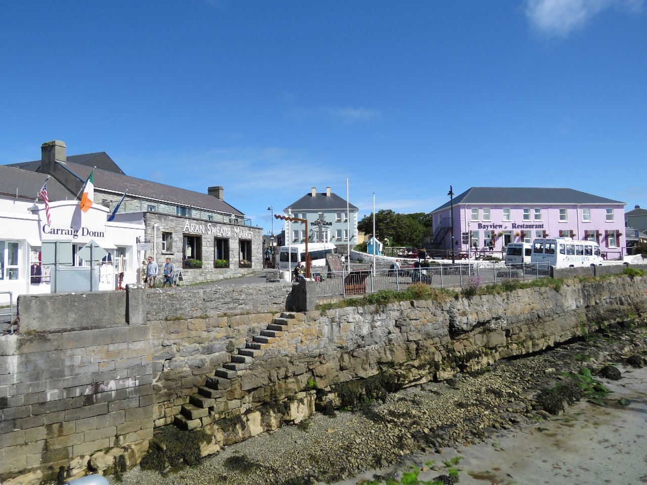 |
Kilronan
Position: -9 40.16, 53 7.13
Kilronan, on Killeany Harbour, is the main village on Inishmore Island. On the left is a sweater market, one of several we saw sweaters on the island. Aran sweaters, with their distinctive knit patterns, are popular worldwide. Fortunately there is another set of stairs off deeper water where we can land the tender to bring our bikes ashore.
|
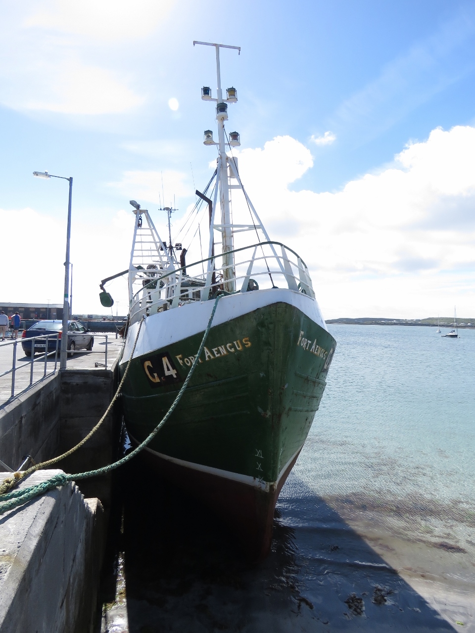 |
Fort Aengus
Position: -9 40.16, 53 7.13
The fishing vessel Fort Aengus high and dry on a tide grid at the Kilronan dock.
|
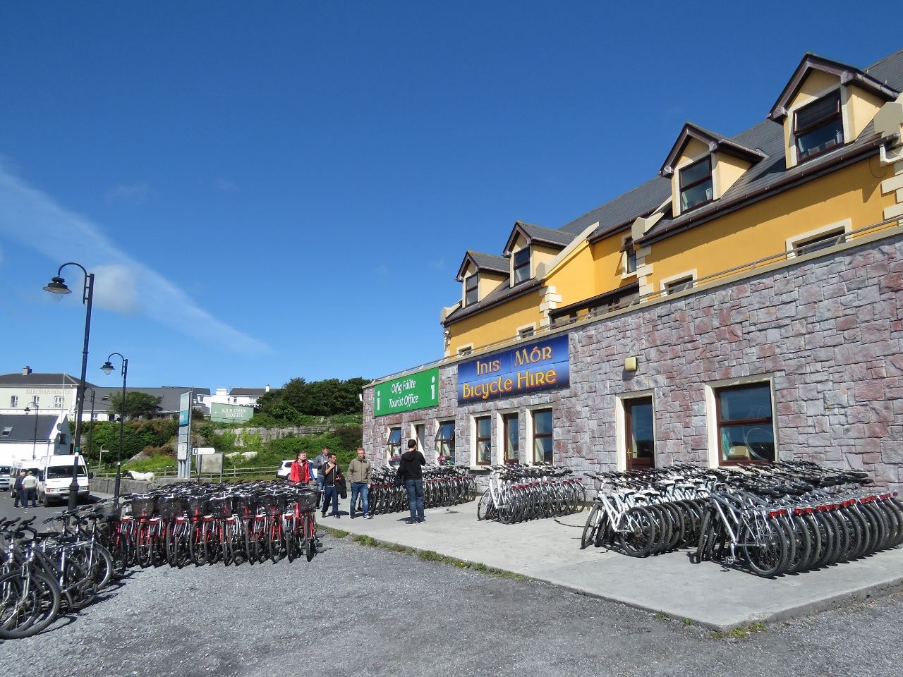 |
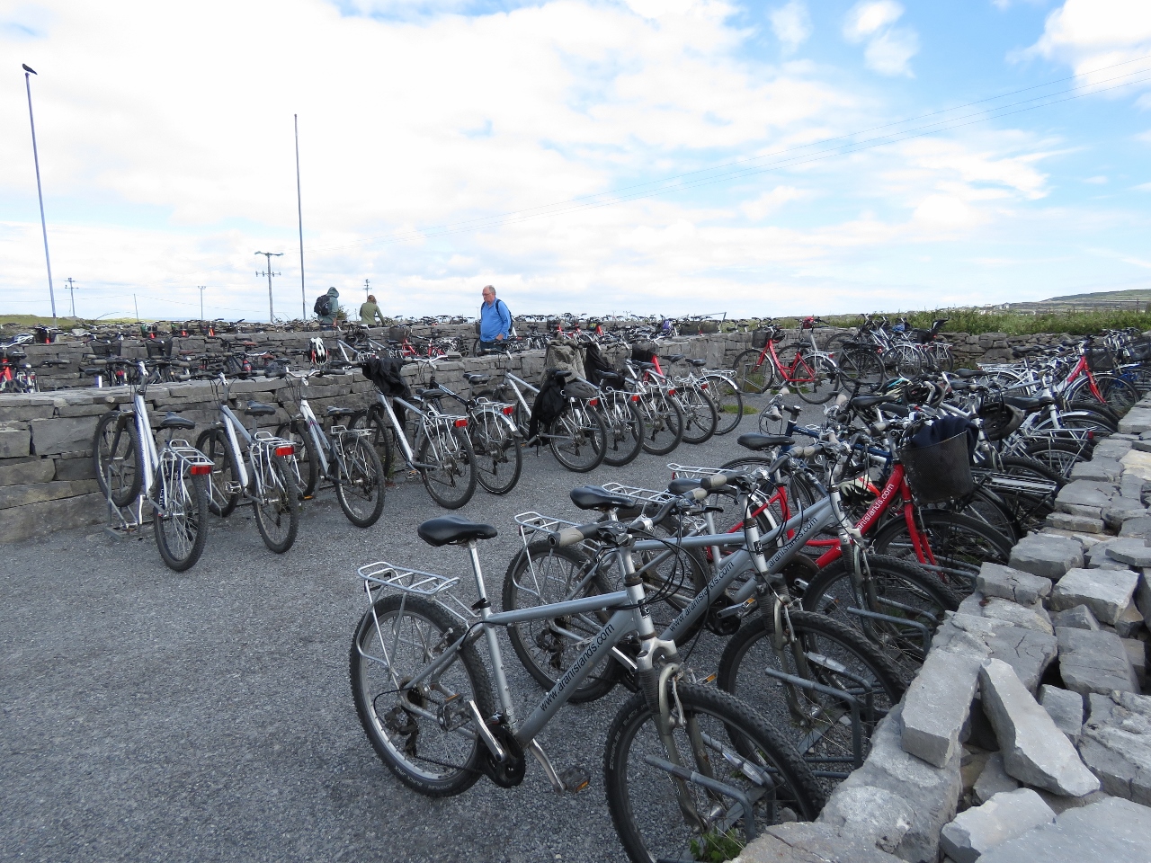
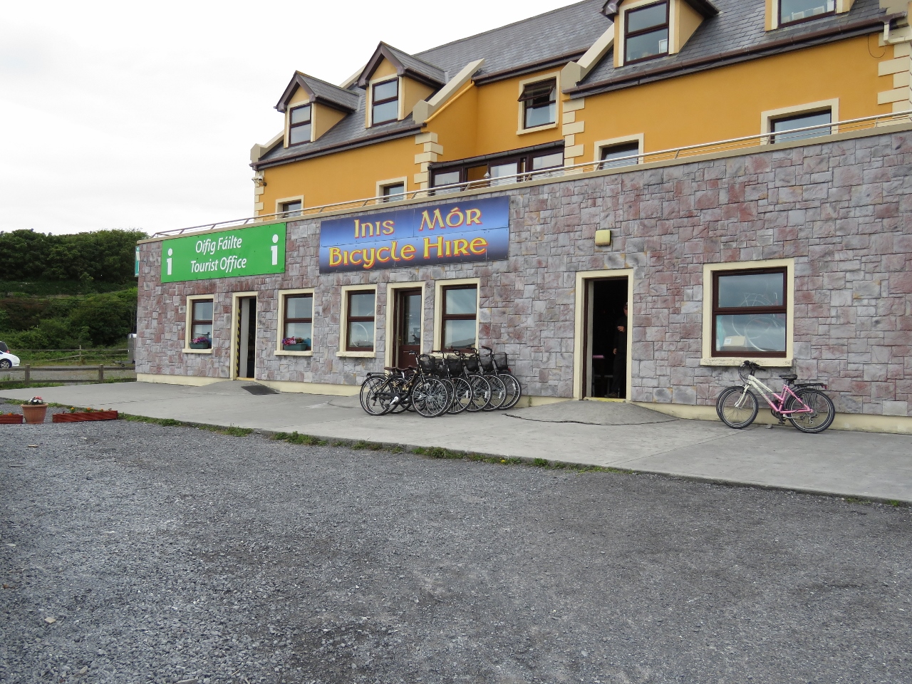
Bicycle Hire
Position: -9 40.01, 53 7.20
Bicycle rentals are popular on Inishmore Island. We saw several rental places with this many bikes. We were there in late June, a little early in the tourist season, and assumed they must be on hand for the high season.
|
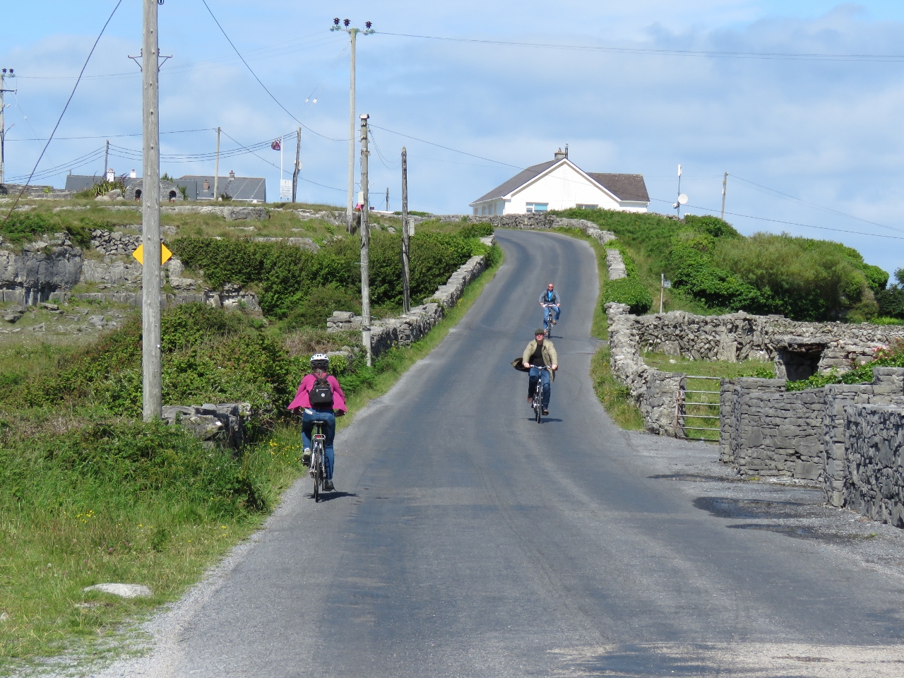 |
On the Road
Position: -9 41.09, 53 7.72
Biking on Inishmore Island.
|
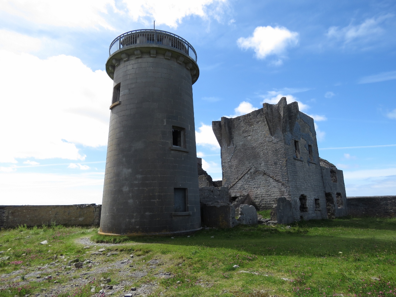 |
Towers
Position: -9 42.14, 53 7.64
Our first stop was another of the 81 Napoleonic signal tower and the island’s first lighthouse. The light went into service in 1818, but was discontinued in 1857 and replaced by newer lights because it was too high and didn’t cover the north or south sound entrances.
|
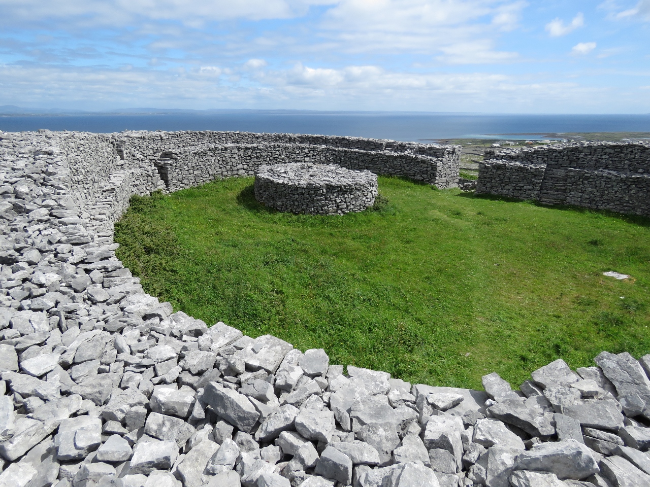 |
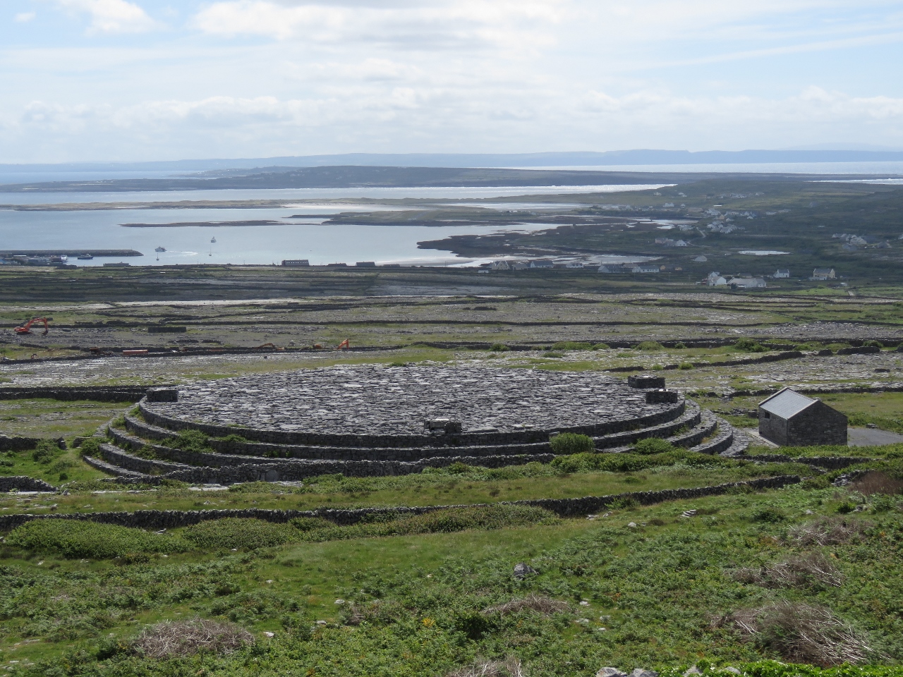
Dun Eochla
Position: -9 42.00, 53 7.62
A short walk from the towers is Dun Eochla, a restored stone ring fort likely built sometime between 500 and 800 AD. Dun means “fort of a king or chieftain” in Irish.
|
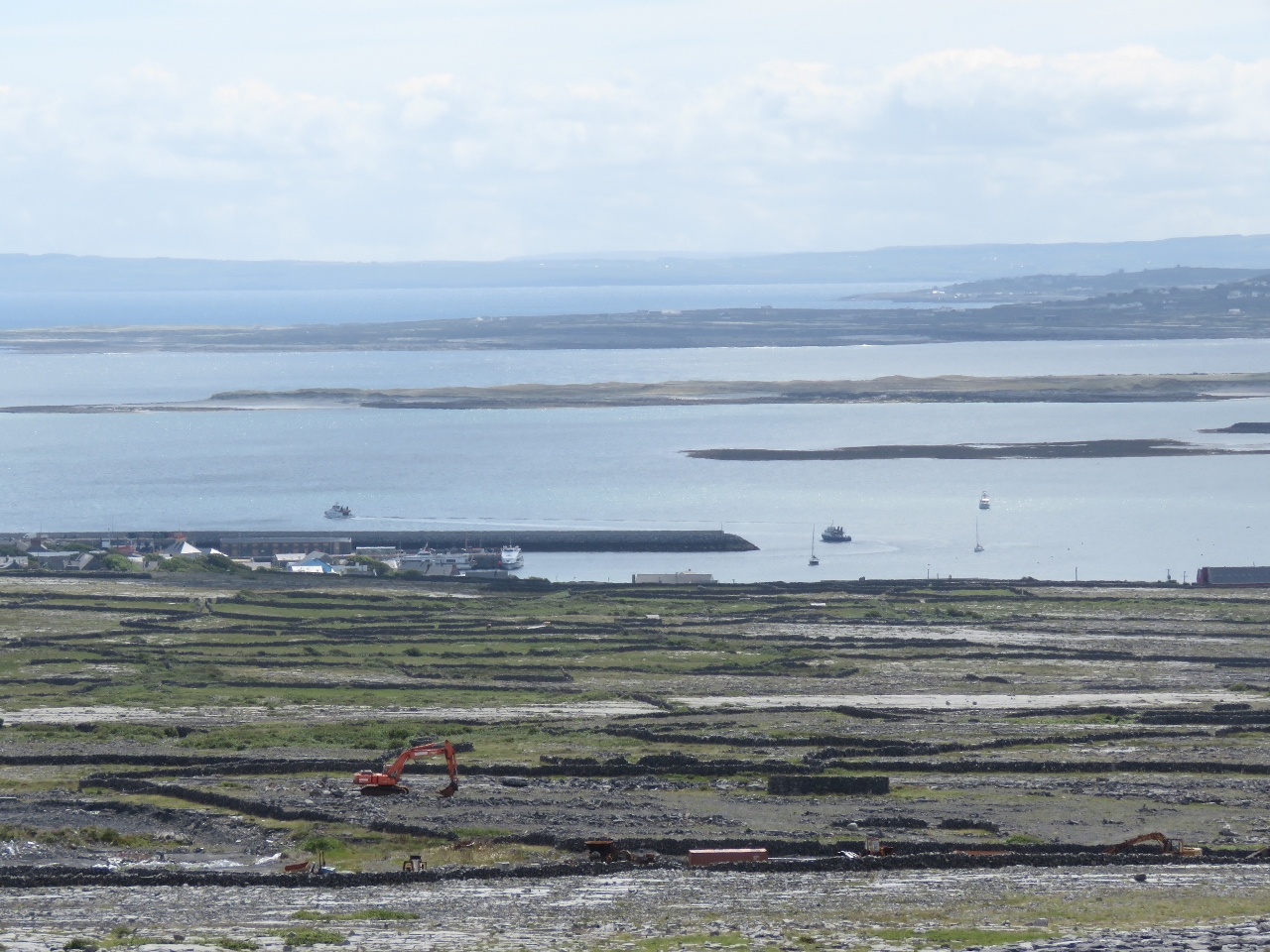 |
Killeany Bay
Position: -9 41.99, 53 7.61
Dun Eochla has a fantastic 360-degree view. This is looking east to Killeany Bay—Dirona is the rightmost and furthest boat at anchor.
|
 |
Camouflage
Position: -9 41.98, 53 7.62
What looks like an ancient edifice visible from Dun Eochla is actually a modern construction designed to disguise a large water reservoir.
|
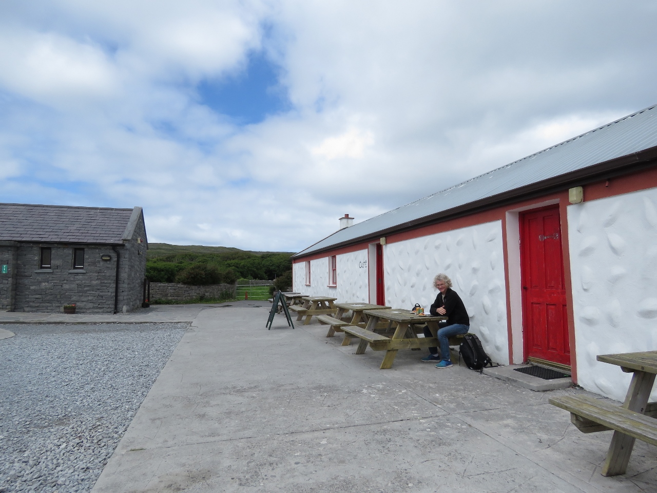 |
Snack
Position: -9 45.43, 53 7.80
Enjoying a snack at the Dun Aonghasa visitor center. The fort and surrounding cliffs are the major tourist attraction on the island.
|
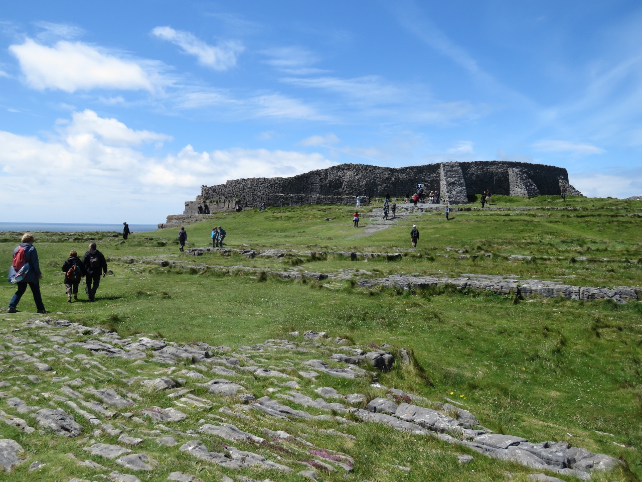 |
Dun Aonghasa
Position: -9 45.95, 53 7.51
Dun Aonghasa is a dramatic semi-circular fort built right to the edge of 300-foot cliffs , a point of dominance that must have intimidated potential attackers. The fort likely was built in three phases from around 500 BC through 500 AD. The fort encloses 14 acres behind three defensive walls. The site is popular—a steady stream of visitors were arriving the entire time we were there.
|
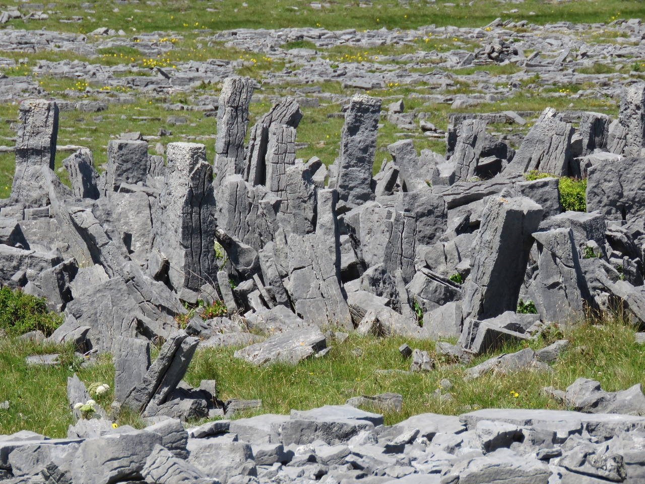 |
Chevaux de Frise
Position: -9 46.02, 53 7.55
Surrounding Dun Aonghasa has one of the best examples of chevaux de frise in Europe. This is a medieval defense system consisting of closely-space upright stakes or stones designed to thwart an attack on horseback and commonly used where stony terrain made digging a ditch too difficult.
|
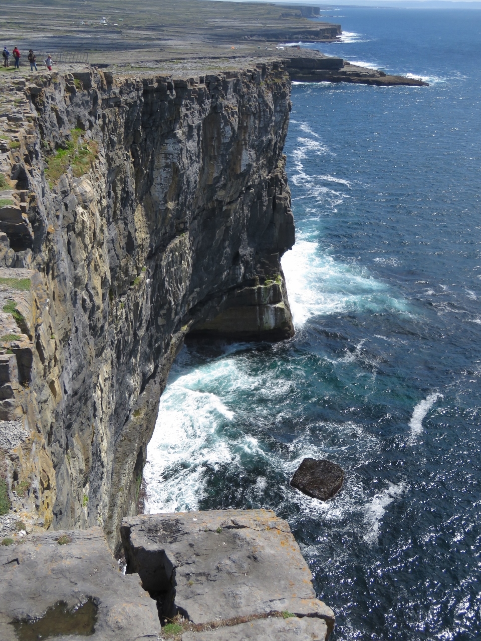 |
Cliffs
Position: -9 46.01, 53 7.51
Besides the fort itself, a major draw of Dun Aonghasa is the dramatic cliff views. This is looking south from just outside the fort wall.
|
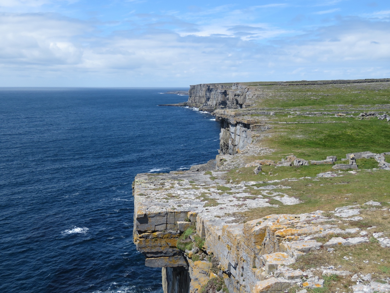 |
View North
Position: -9 46.04, 53 7.52
The cliffs looking north from Dun Aonghasa.
|
 |
Cliff Diving
Position: -9 45.94, 53 7.51
The Red Bull Cliff Diving Championship had finished up yesterday and, with no road to the dive site, a helicopter was ferrying gear back to the main road. RBCD Ireland 2017 shows some great footage of the top three men’s and women’s dives.
|
|
|
Busy
Position: -9 45.44, 53 7.85
We’d left our bikes in the large and completely empty bicycle parking area at Dun Aonghasa and returned to find the lot almost full of bikes.
|
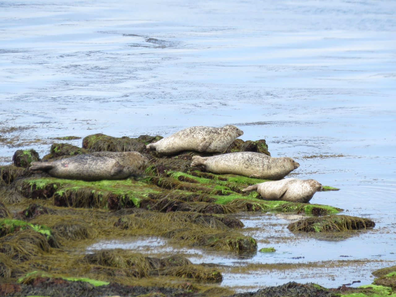 |
Seals
Position: -9 42.74, 53 8.26
We returned along the north shore, where several seals were basking in the sun.
|
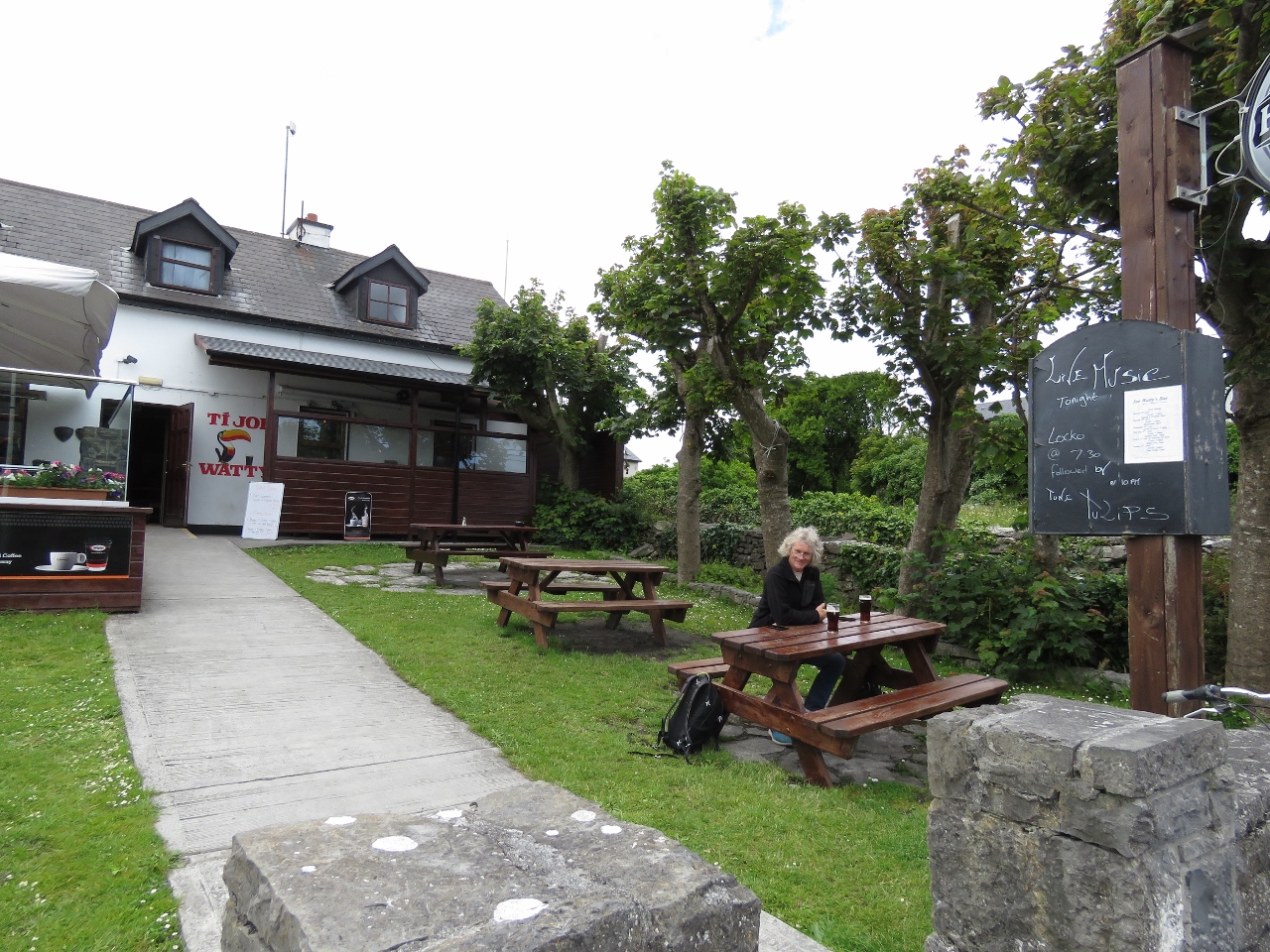 |
Ti Joe Wattys
Position: -9 40.24, 53 7.44
A great meal of local crab claws at Ti Joe Wattys. Ti means “house of” in Irish.
|
 |
Bicycles Hired
Position: -9 39.94, 53 7.17
Almost every bicycle in that huge lot we saw this morning had been hired out when we returned. We didn’t see many cyclists on the way out to Dun Aonghasa, but saw lots on the way back.
|
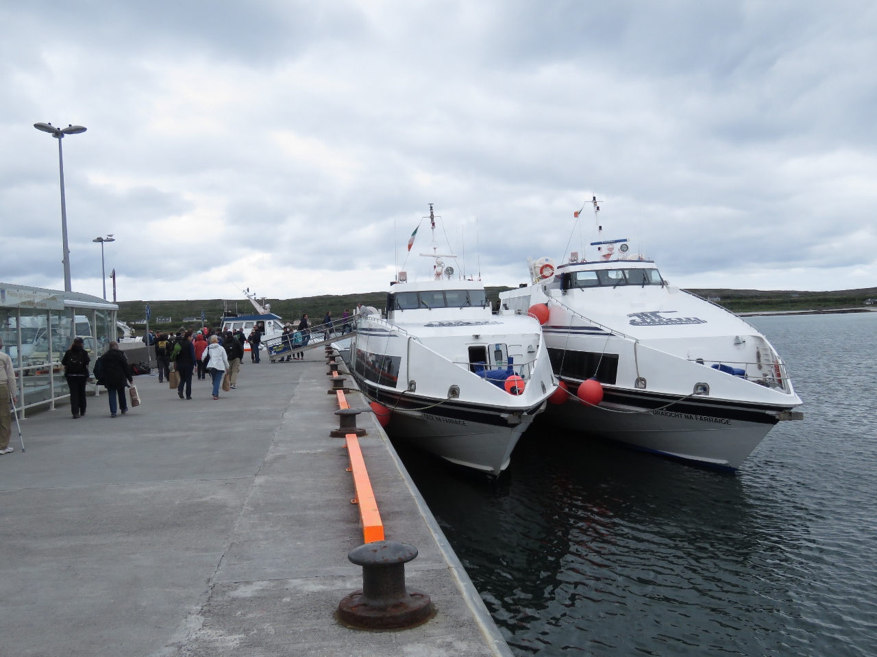 |
Ferries
Position: -9 40.00, 53 7.10
The docks at Kilronan are busy with ferries coming and going between the mainland and the other islands.
|
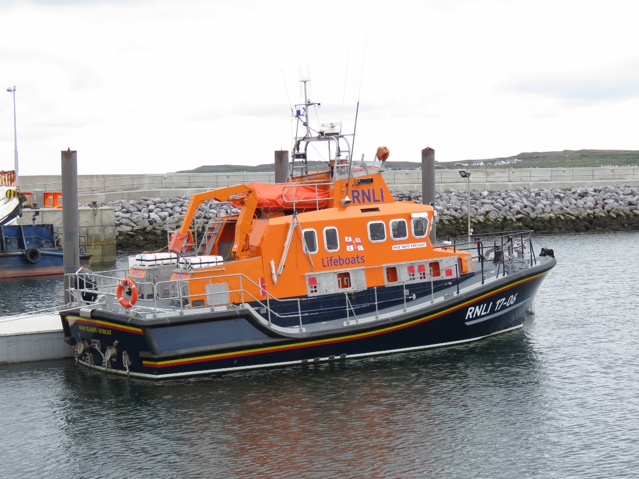 |
RNLI
Position: -9 39.84, 53 7.13
Most ports we’ve visited in Ireland have one of these capable RNLI (Royal National Lifeboat Institution) lifeboats, and we’ve posted several pictures. UK residents Micheal and Frances Crofts, who own Nordhavn 40 Coracle, gave us some background on the service: “I’m glad to see pictures of our lifeboats popping up here. Your are in Lifeboat Country while coastal cruising in the the UK, the Republic of Ireland, the Channel Islands and the Isle of Man and you’ll see many RNLI (Royal National Lifeboat Institution) boats of all shapes and sizes providing cover right around our coasts. All crews and support staff are volunteers except that the big boats usually have a salaried full-time mechanic. The RNLI receives no government funding whatsoever—its money comes from members (including Frances and me!) and legacies. And they don’t charge for salvage. If they tow you to safety it’s all part of the free service.”
|
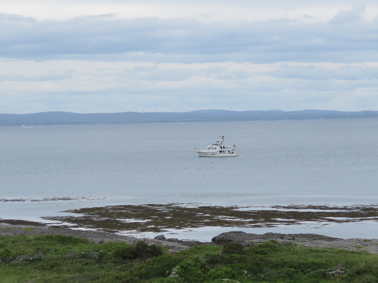 |
Dirona
Position: -9 40.12, 53 6.53
Dirona at anchor in Killeany Bay, viewed from the south shore.
|
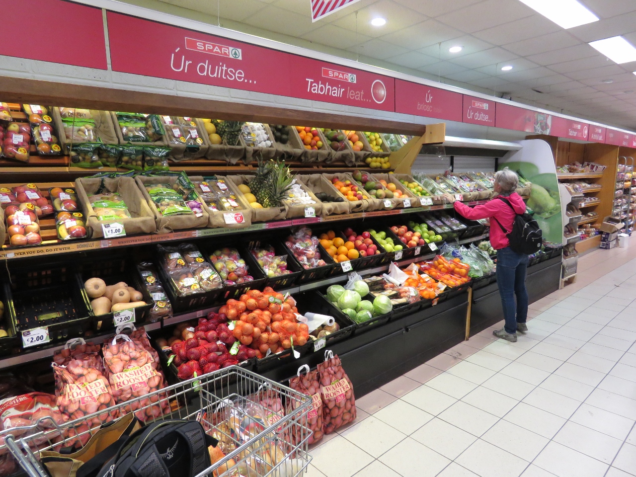 |
Spar
Position: -9 40.15, 53 7.20
We stopped off to pickup some fresh fruit at the local Spar grocery store before returning back to Dirona.
|
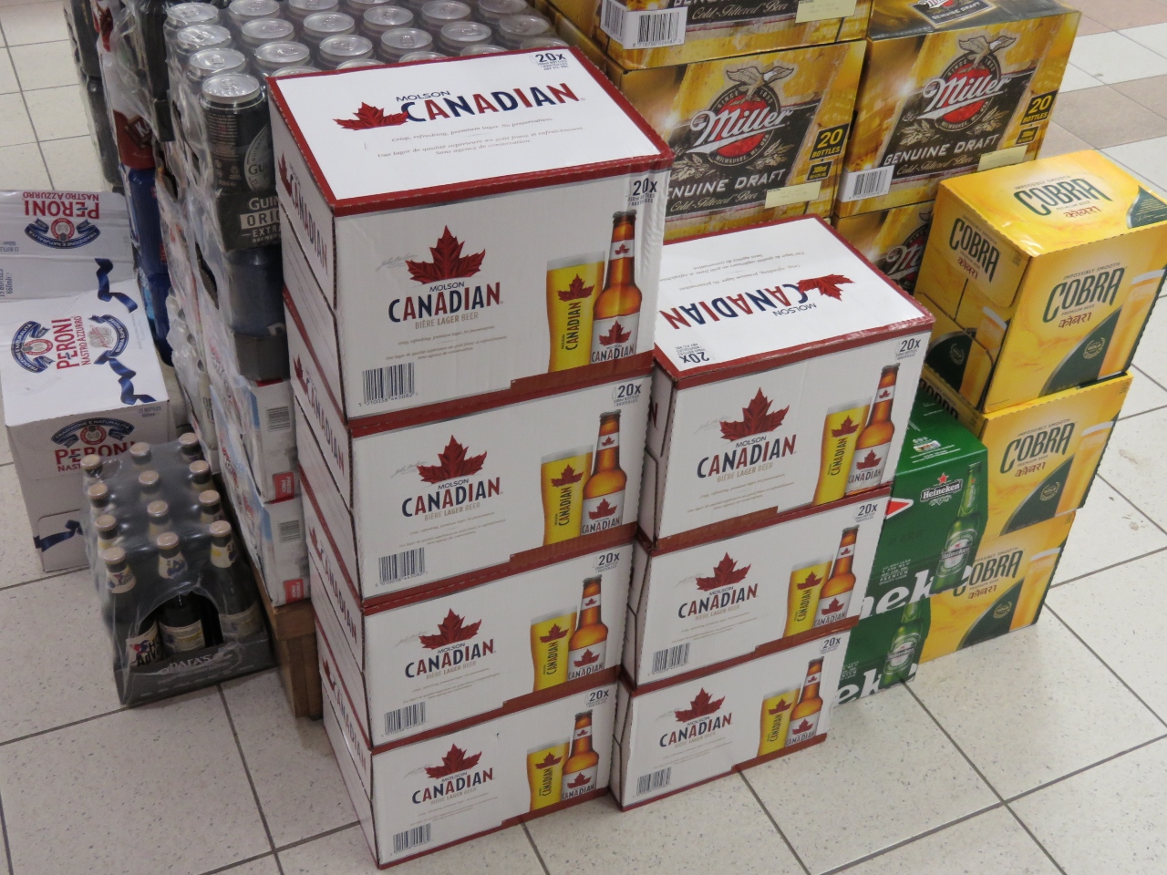 |
Molson Canadian
Position: -9 40.15, 53 7.20
We were amused to see Molson Canadian beer featured in the imports section of the Kilronan grocery store.
|
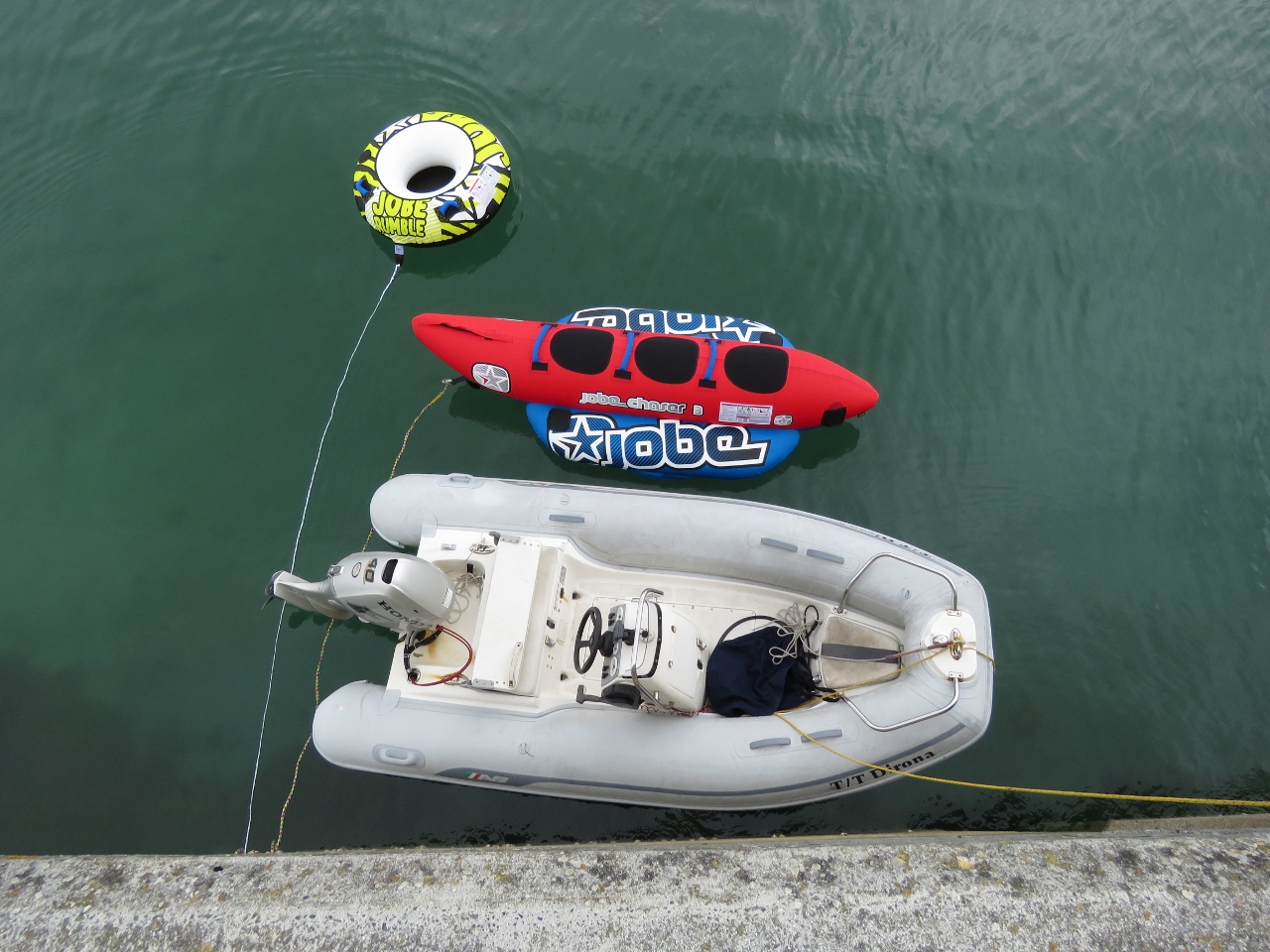 |
Tender
Position: -9 40.15, 53 7.14
Our tender had a couple of friends alongside when we returned back.
|

|
Click the travel log icon on the left to see these locations on a map, with the complete log of our cruise.
On the map page, clicking on a camera or text icon will display a picture and/or log entry for that location, and clicking on the smaller icons along the route will display latitude, longitude and other navigation data for that location. And a live map of our current route and most recent log entries always is available at http://mvdirona.com/maps. |
If your comment doesn't show up right away, send us email and we'll dredge it out of the spam filter.