The two-day run from the Aran Islands around Erris Head had an unusual diversity of sightings. Natural features included waterfalls, dolphins, plenty of dramatic seascape, and Ireland’s highest sea cliffs, the 2,168ft (661m) the Cliffs of Croaghaun. On the man-made side, we saw a ruined Cromwellian fort, an abandoned village and whaling station, three major lighthouses, a wave testing buoy, an aviation radar station, and vessels ranging from a local fishing skiff to a 337-foot (103m) offshore supply vessel.
Trip highlights from June 26th and 27th, 2017 follow. Click any image for a larger view, or click the position to view the location on a map. And a live map of our current route and most recent log entries always is available at http://mvdirona.com/maps
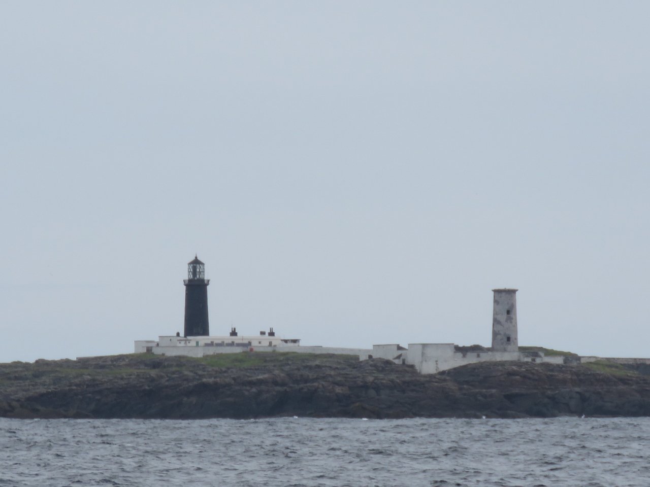 |
Syne Head
Position: -10 14.51, 53 22.74
The twin lighthouses at Syne Head were built around 1830. As at Skellig Michael and several other locations on the coast, two lighthouse were built to distinguish them from other nearby lights, as the ability to differentiate by flash characteristics was limited. And also as at Skellig Michael, the cost of maintaining and manning two lights was high and all the secondary lights were retired between 1865 and 1903.
|
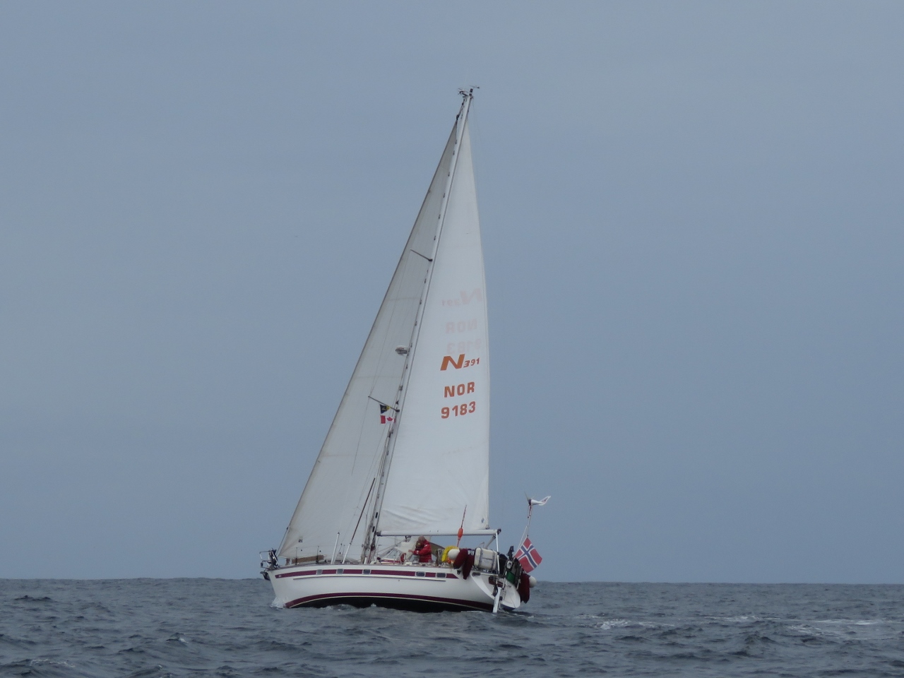 |
Pleasure Craft
Position: -10 16.72, 53 32.63
This Norwegian-flagged sailboat is one of the few pleasure craft we’d seen underway as we’ve cruised the Irish west coast.
|
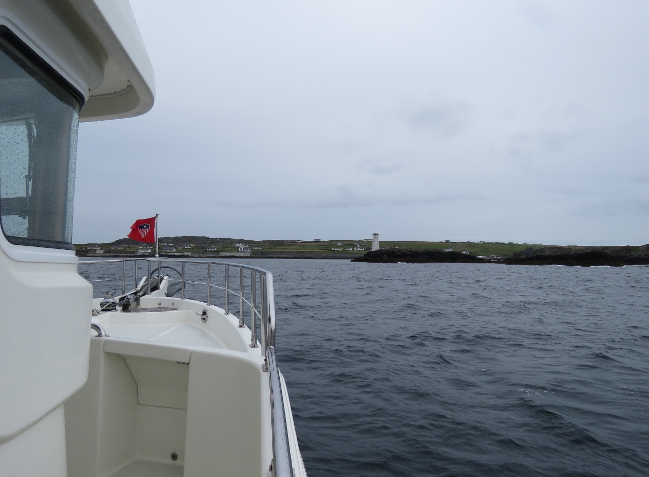 |
Inishbofin
Position: -10 13.39, 53 36.40
Approaching the narrow entrance to the harbor Inishbofin Island. We run very close to the starboard-side rocks where the white pillar stands.
|
 |
Star Fort
Position: -10 13.20, 53 36.70
The ruins of a star fort at the anchorage on Inishbofin Island, built by Oliver Cromwell’s troops in 1655. Inishbofin is a popular anchorage for those cruising the west coast of Ireland. We enjoyed the setting, but found the anchorage a little tight and exposed. The holding was poor further in, so we ended up anchoring near the exposed entrance channel. The island shore to our north was reinforced with massive wave-protection walls, indicating conditions can get quite rough here in a southerly blow.
|
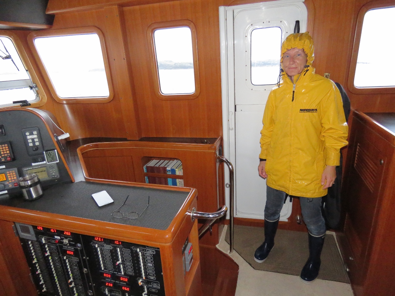 |
Rain
Position: -10 14.99, 53 36.02
Rain was pouring down this morning as we left the anchorage at Inishbofin Island. Jennifer was drenched after spraying off the anchor while we raised it.
|
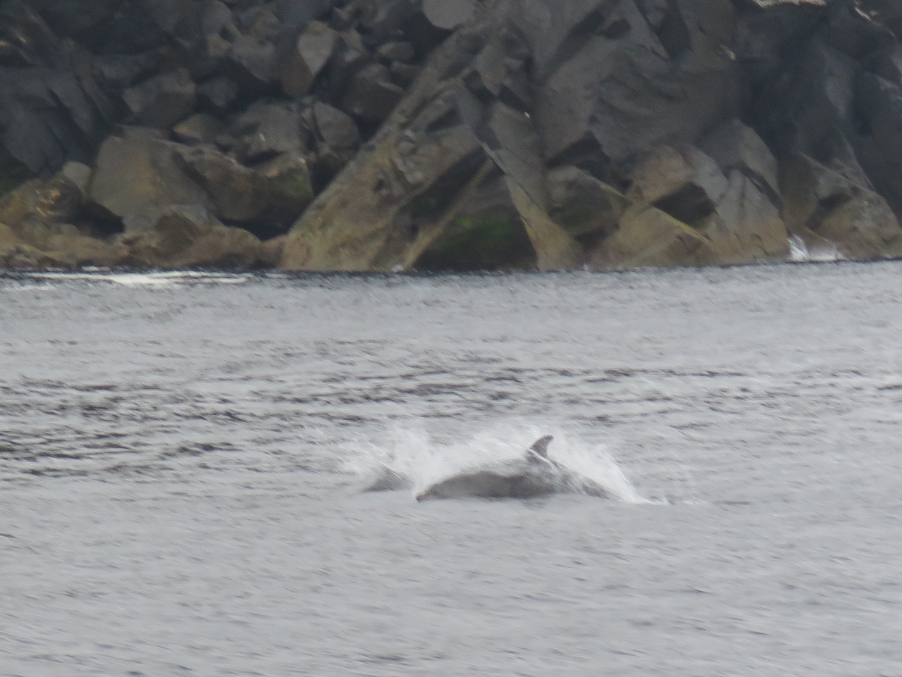 |
Dolphins
Position: -10 15.83, 53 58.77
A small group of dolphins swam around us as we rounded the northwest tip of Achill Island.
|
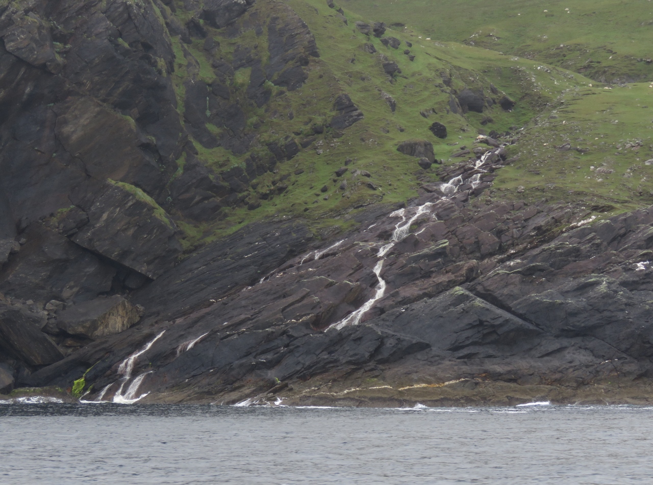 |
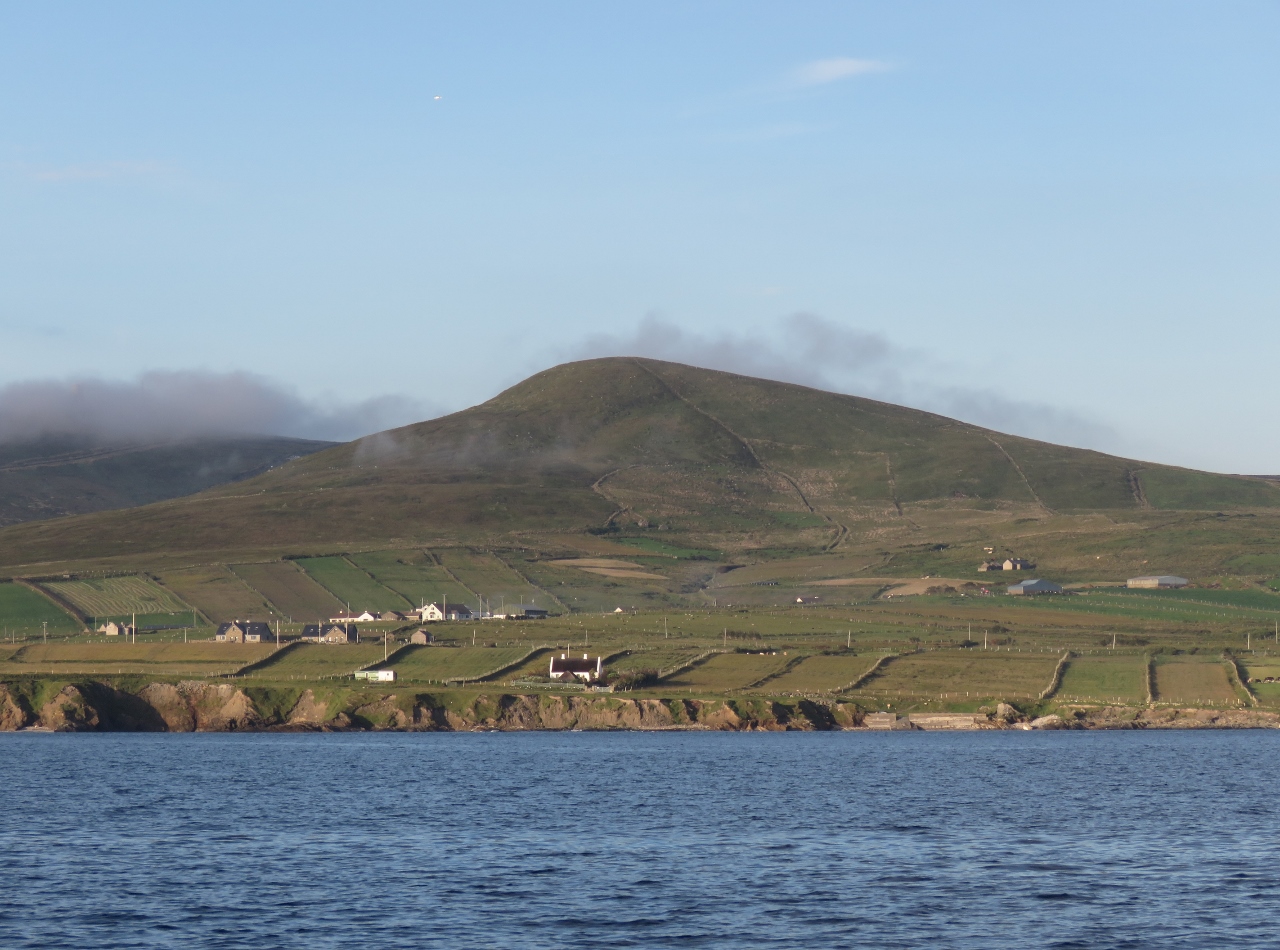
Waterfall
Position: -10 13.56, 53 59.10
We’d not seen many waterfalls so far in Ireland, but north shore of Achill Island more than made up for that. With the heavy rain overnight, an endless number spilled and gushed down the cliffs.
|
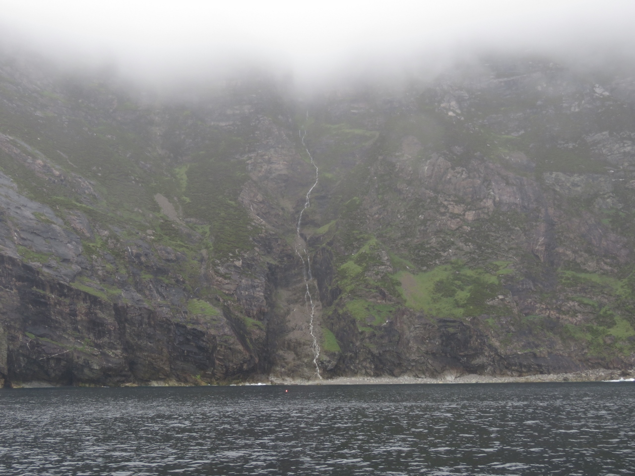 |
Cliffs of Croaghaun
Position: -10 11.75, 53 59.94
At 2,168ft (661m), the Cliffs of Croaghaun are Ireland’s highest sea cliffs. We couldn’t see the tops in today’s overcast conditions, but the scenery still was impressive, especially with all those waterfalls.
|
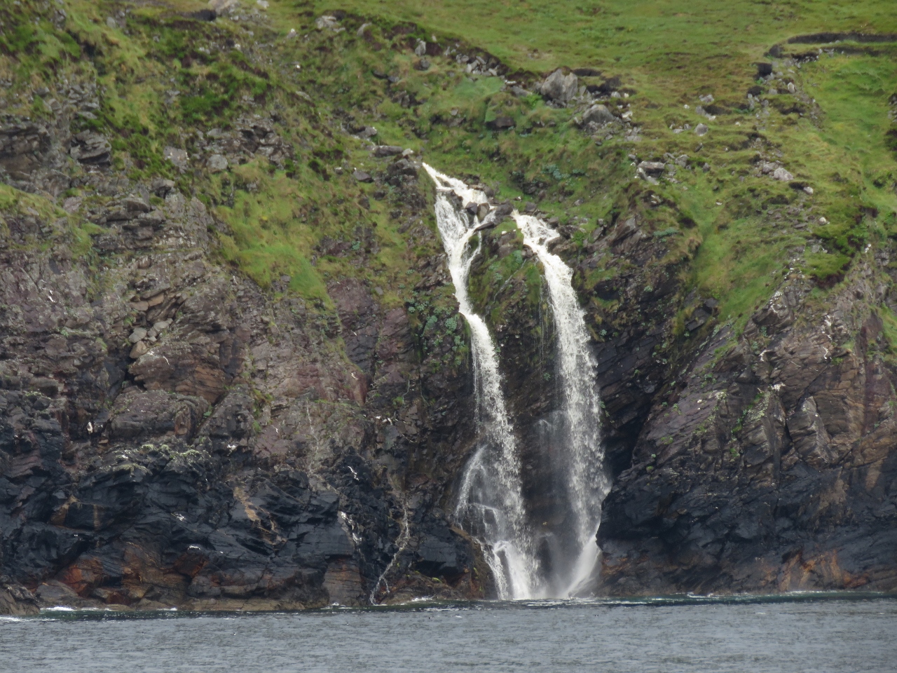 |
Double Waterfall
Position: -10 9.93, 54 0.74
Perhaps the best of all the waterfalls was around the corner from the cliffs, an active fall that split at the top and gushed over the cliffs.
|
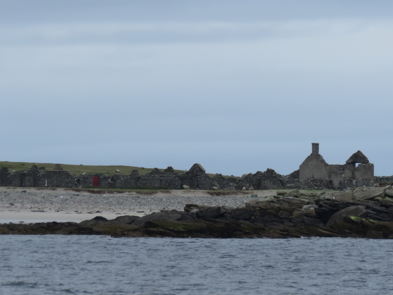 |
Inishkeas
Position: -10 11.74, 54 6.63
The Inishkea Islands, although remote and exposed, have been inhabited on and off since Neolithic times and were most recently repopulated in the 18th century. The people there did relatively well during the 1845-1849 potato famine, as the blight did not spread offshore and they could make a living off the sea. But in October of 1927, ten fishermen were killed when in an intense 976 mb low pressure system suddenly swept the area. The tiny community never recovered from the loss and the the island was evacuated in the 1930s. A few summer cottages have been built on the island, but the abandoned homes and buildings dominate the scene.
|
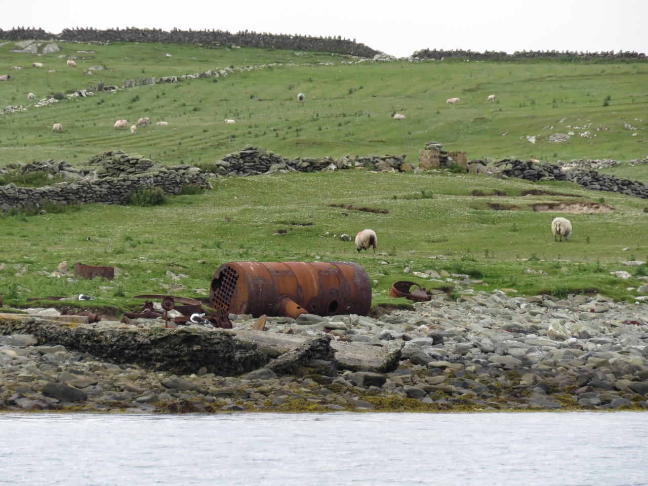 |
Whaling Station
Position: -10 11.73, 54 7.28
Ruins from a short-lived, early 20th-century whale processing plant on Rusheen Island in the Inishkeas.
|
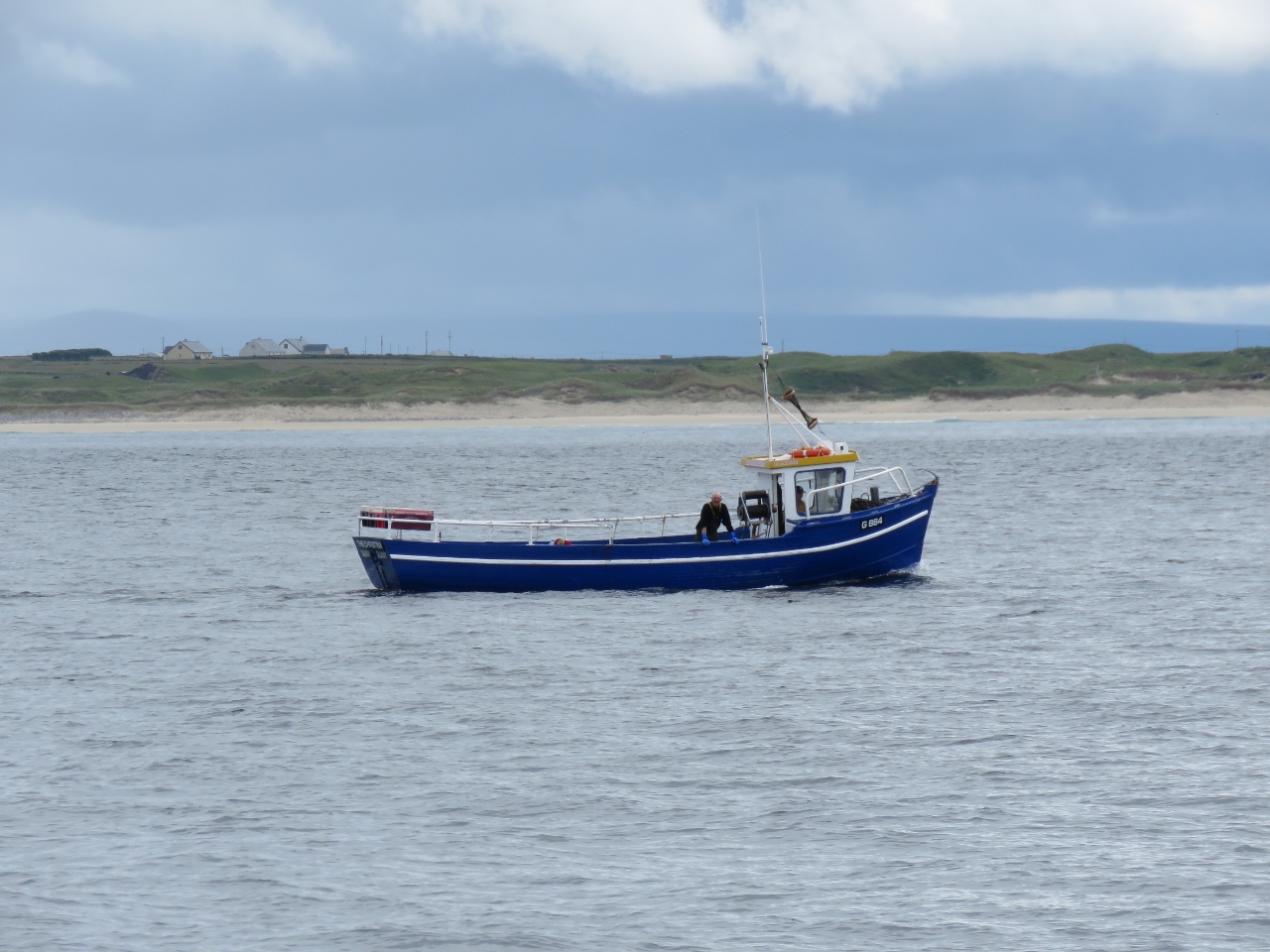 |
Fishboat
Position: -10 10.51, 54 7.57
A local fishboat working off the Inishkeas.
|
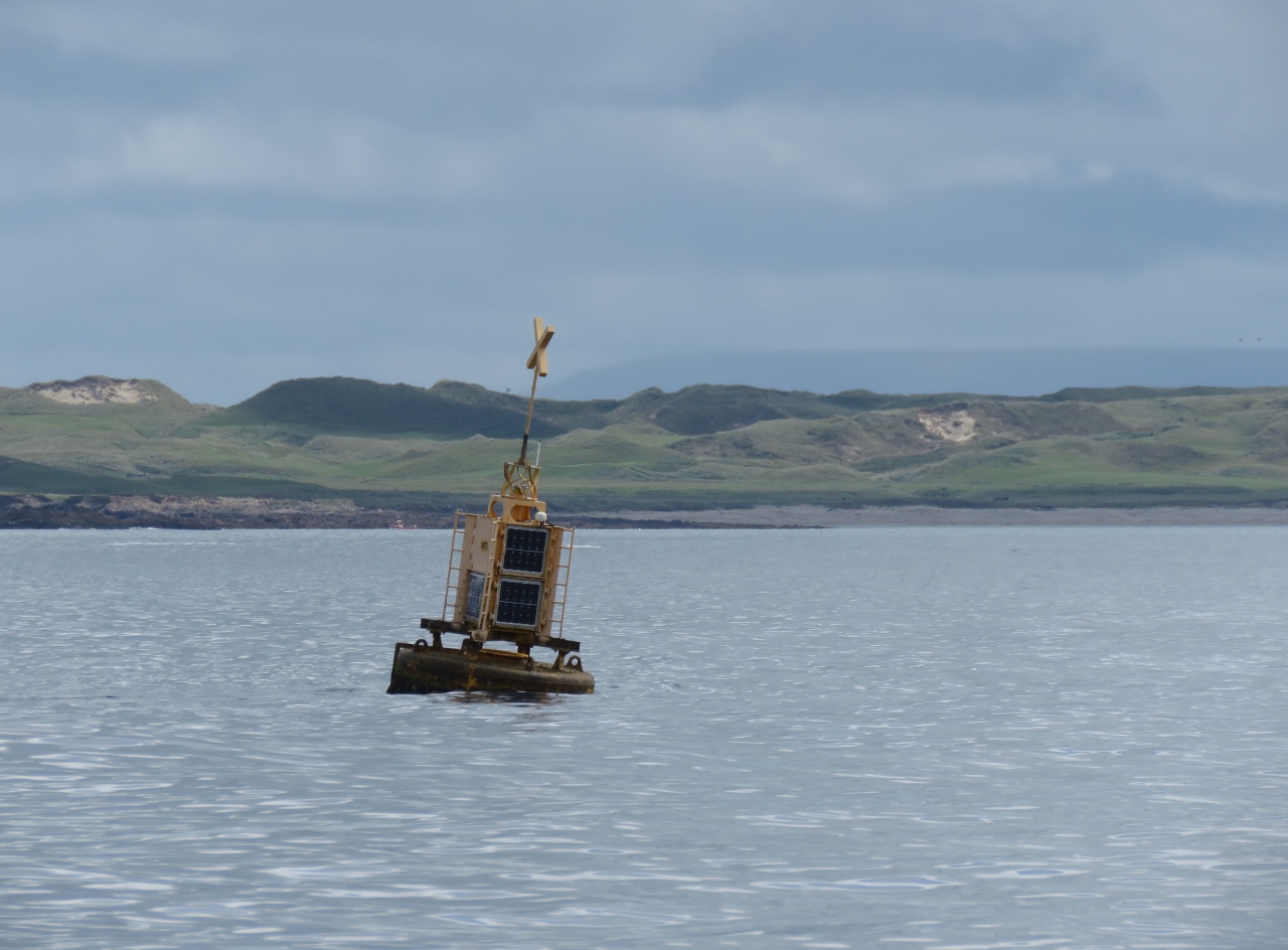 |
WT1
Position: -10 9.05, 54 13.86
Some of the biggest seas around the Irish coast occur here where the edge of the Continental Shelf is barely thirty miles offshore. Wave energy testing is done in the area and we’re guessing this buoy’s AIS name of “WT1” stands for “Wave Test 1” or something similar.
|
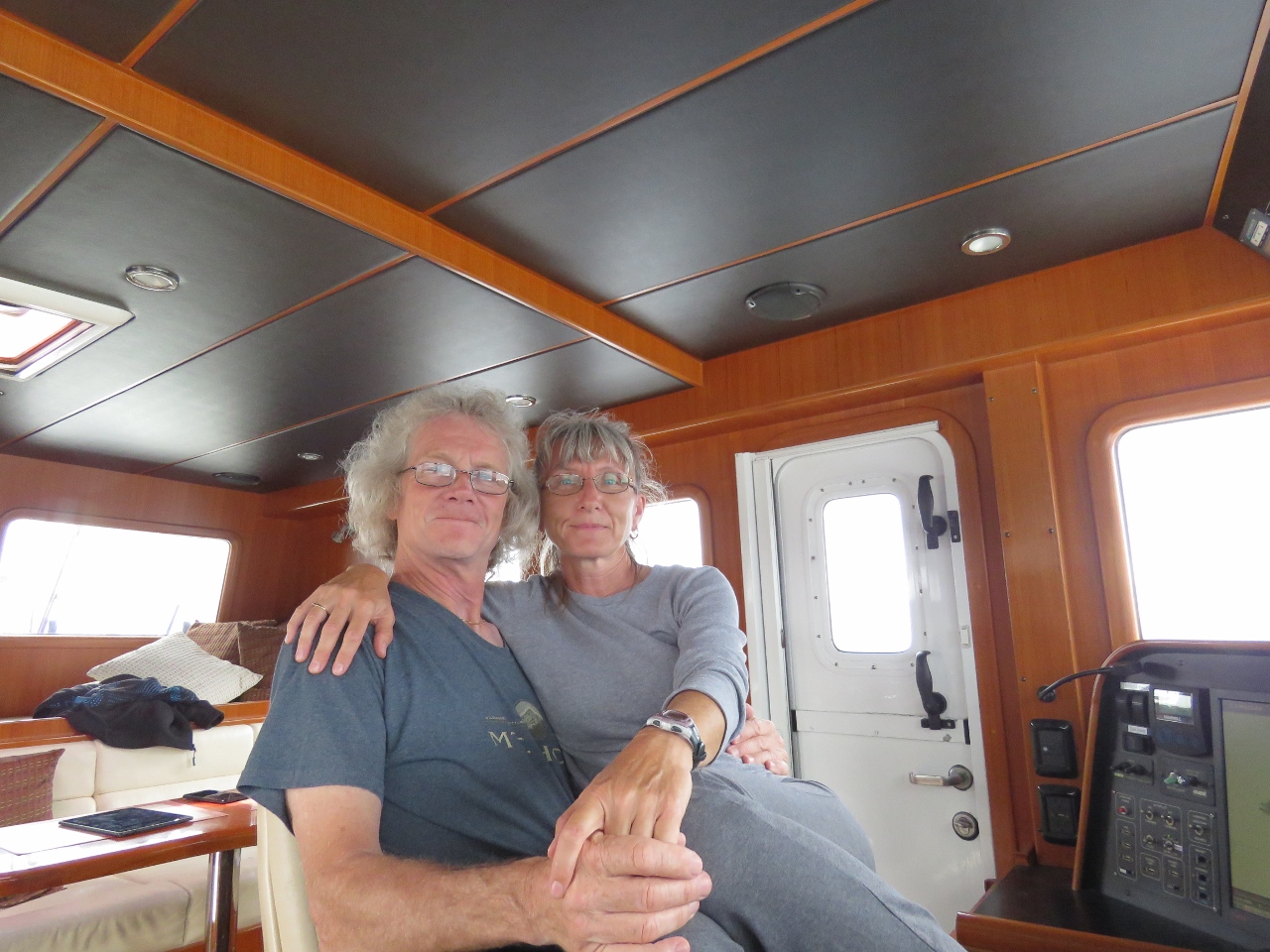 |
At the Helm
Position: -10 5.23, 54 16.28
Sometimes only one helm chair is just fine.
|
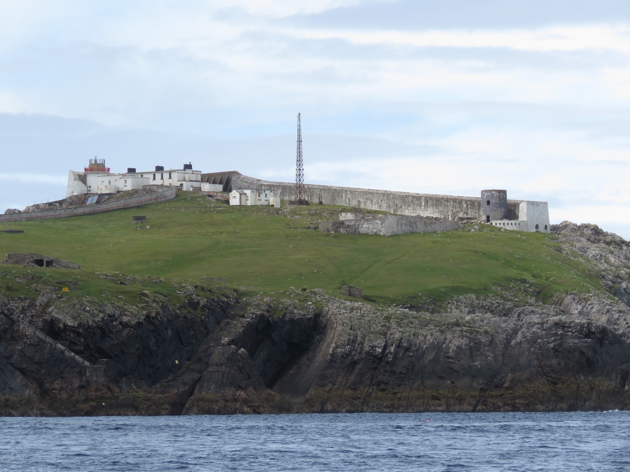 |
Eagle Island
Position: -10 4.68, 54 16.88
The light station on Eagle Island looks more like a fortress with that big wall to seaward and the light barely peeking above it. The walls are needed to protect the station from Ireland’s biggest seas. The west tower is 200ft (60m) above sea level, but a wave nearly destroyed it during construction in the 1830s. Severe weather also damaged the station in 1850, 1861, 1894, 1936, 1987 and 1988. The east tower took on so much seawater in the 1861 storm that the keepers had to drill holes in the door to drain the water and relieve the pressure in order to gain access.
|
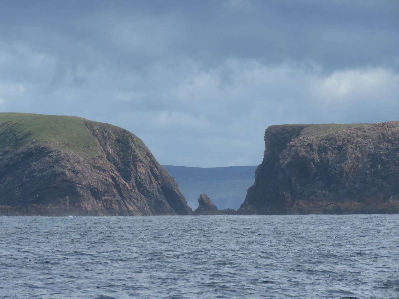 |
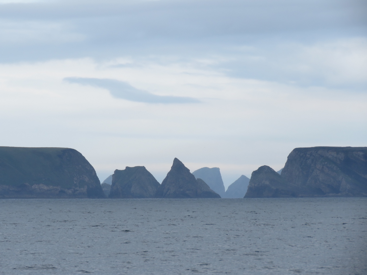
Erris Head
Position: -10 1.83, 54 18.25
Dramatic seascape looking through the gap between Illandavuck Island (left) and the mainland at Erris Head.
|
|
|
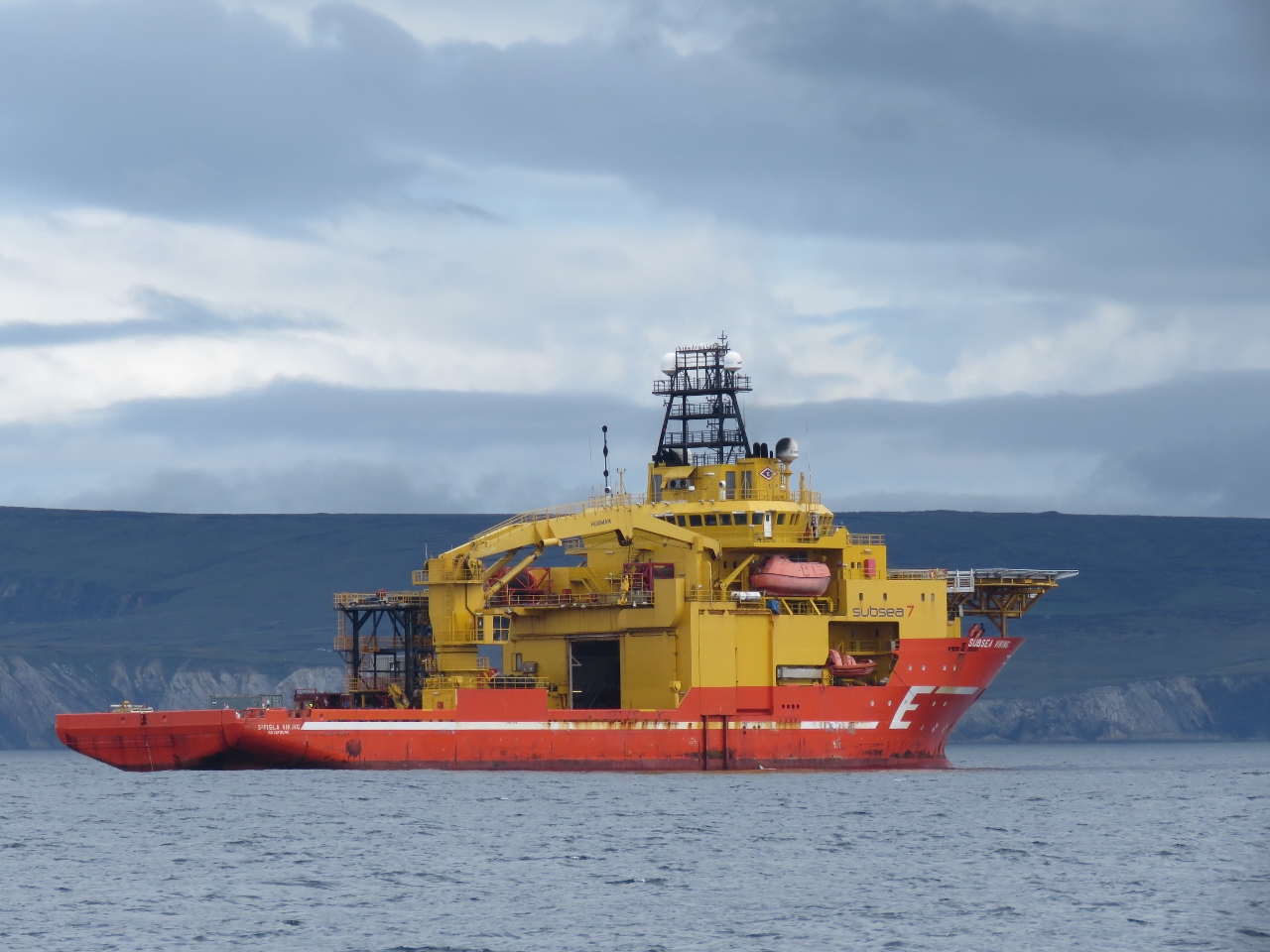
Subsea Viking
Position: -9 56.43, 54 17.99
The Corrib gas field lies about 30 miles offshore and our charts show many pipelines running from there to the mainland through Broad Haven Bay. So we weren’t surprised to see a large offshore supply vessel, the Subsea Viking, in the bay. The ship was holding station and we guessed it was laying pipe, something that has been a major controversy for the area.
|
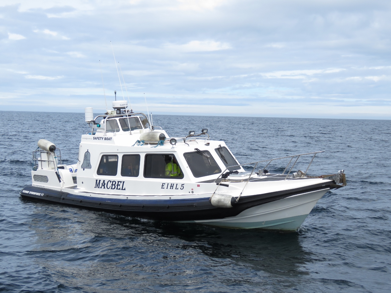 |
Safety Boat
Position: -9 56.35, 54 17.96
As we continued across Broad Haven Bay to our intended anchorage off Ballyglass, a small boat ran directly toward us at high speed. We felt there was risk of collision so we sounded the standard danger signal of five blasts on the horn. The vessel pulled in beside us and ironically was labelled “Safety Boat”. It turns out that the Subsea Viking was doing hydrographic survey work and they requested 500m of clearance. That message would have been better delivered by radio.
|
 |
Kid Island
Position: -9 55.76, 54 17.20
Looking north from Broad Haven Bay through the gap between Kid Island (left) and the mainland, with the Stags of Broad Haven visible in the distance through the gap. We can’t wait to check them out tomorrow.
|
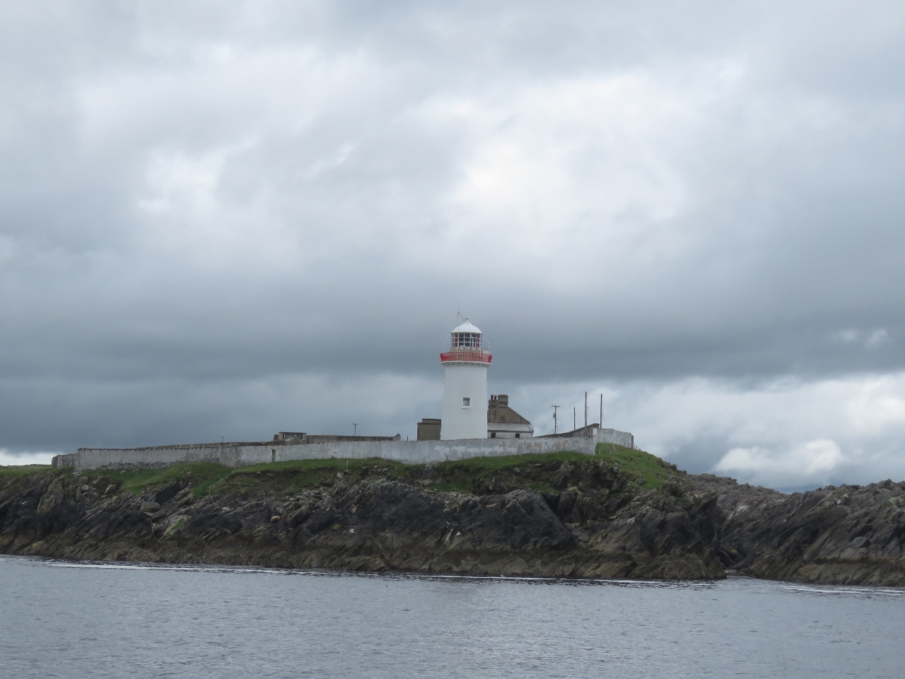 |
Broad Haven Light
Position: -9 53.13, 54 16.19
The Broad Haven light station on Gubacashel Point.
|
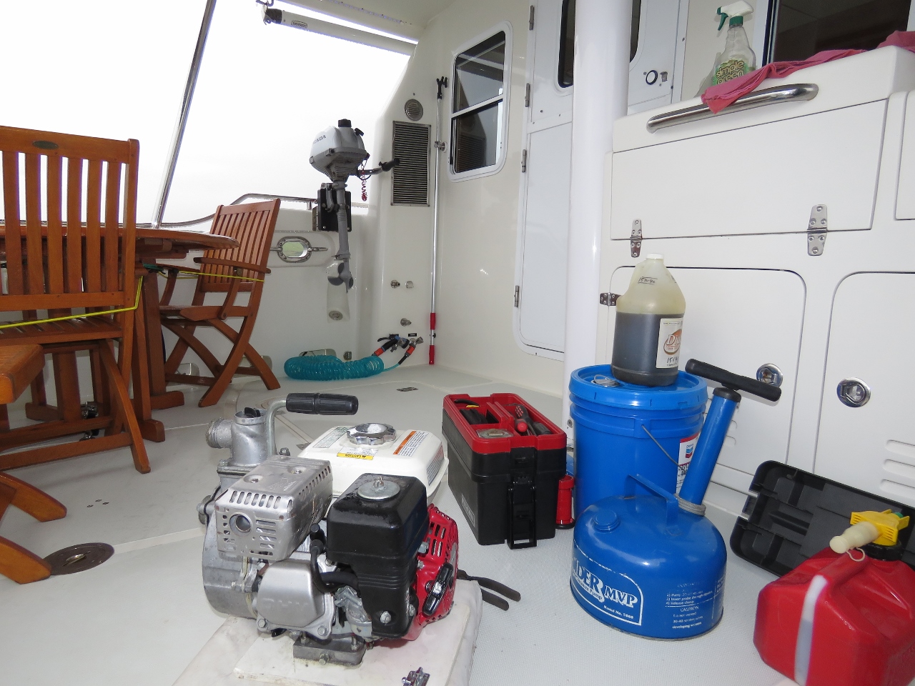 |
Annual Maintenance
Position: -9 53.35, 54 15.54
Time for the annual maintenance on all our auxiliary gas engines, which all happen to be Hondas. James replaced the fuel in the crash pump and the 2.1HP Honda, oiled and tested the crash pump, and on the 40HP Honda changed the oil and fuel filters and greased the tender steering and outboard.
|
 |
Clear Sky
Position: -9 53.35, 54 15.51
The view north from our anchorage off Ballyglass. We quite enjoyed the spot, particularly as the day continued to clear.
|
 |
RNLI
Position: -9 53.35, 54 15.51
The Ballyglass RNLI (Royal National Lifeboat Institution) boat moored to our south.
|
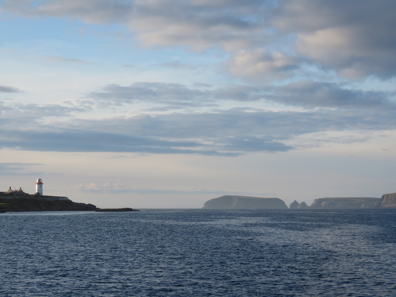 |
View North
Position: -9 53.35, 54 15.51
Looking north from the anchorage past the light at Gubacashel Point and across Broad Haven Bay.
|
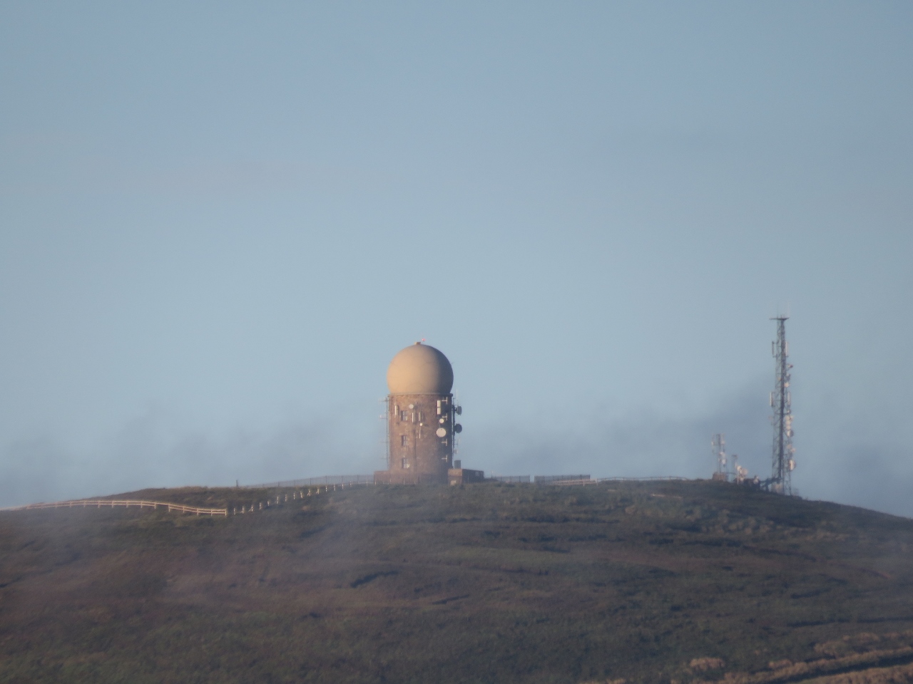 |
Radar Station
Position: -9 53.35, 54 15.51
The skies eventually cleared completely of clouds to reveal this Irish Aviation Authority radar station on Caubeen Mountain. The station was hidden in the clouds earlier.
|

|
Click the travel log icon on the left to see these locations on a map, with the complete log of our cruise.
On the map page, clicking on a camera or text icon will display a picture and/or log entry for that location, and clicking on the smaller icons along the route will display latitude, longitude and other navigation data for that location. And a live map of our current route and most recent log entries always is available at http://mvdirona.com/maps. |
If your comment doesn't show up right away, send us email and we'll dredge it out of the spam filter.