The spectacular Cliffs of Moher are one of Ireland’s most well-known features and popular tourist destinations. The cliffs extend for five miles, rising over 600ft from the water surface at their highest point. More than a million people visit the cliffs each year, but relatively few have an opportunity to view them from the water. On a 100-mile run from Valentia Island to the Aran Islands, we got a close-up view of the famous Cliffs of Moher and several equally striking coastal features en-route.
Trip highlights June 24th follow. Click any image for a larger view, or click the position to view the location on a map. And a live map of our current route and most recent log entries always is available at http://mvdirona.com/maps
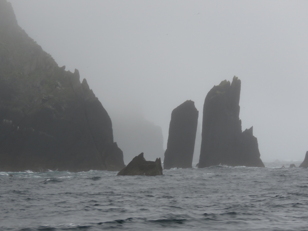 |
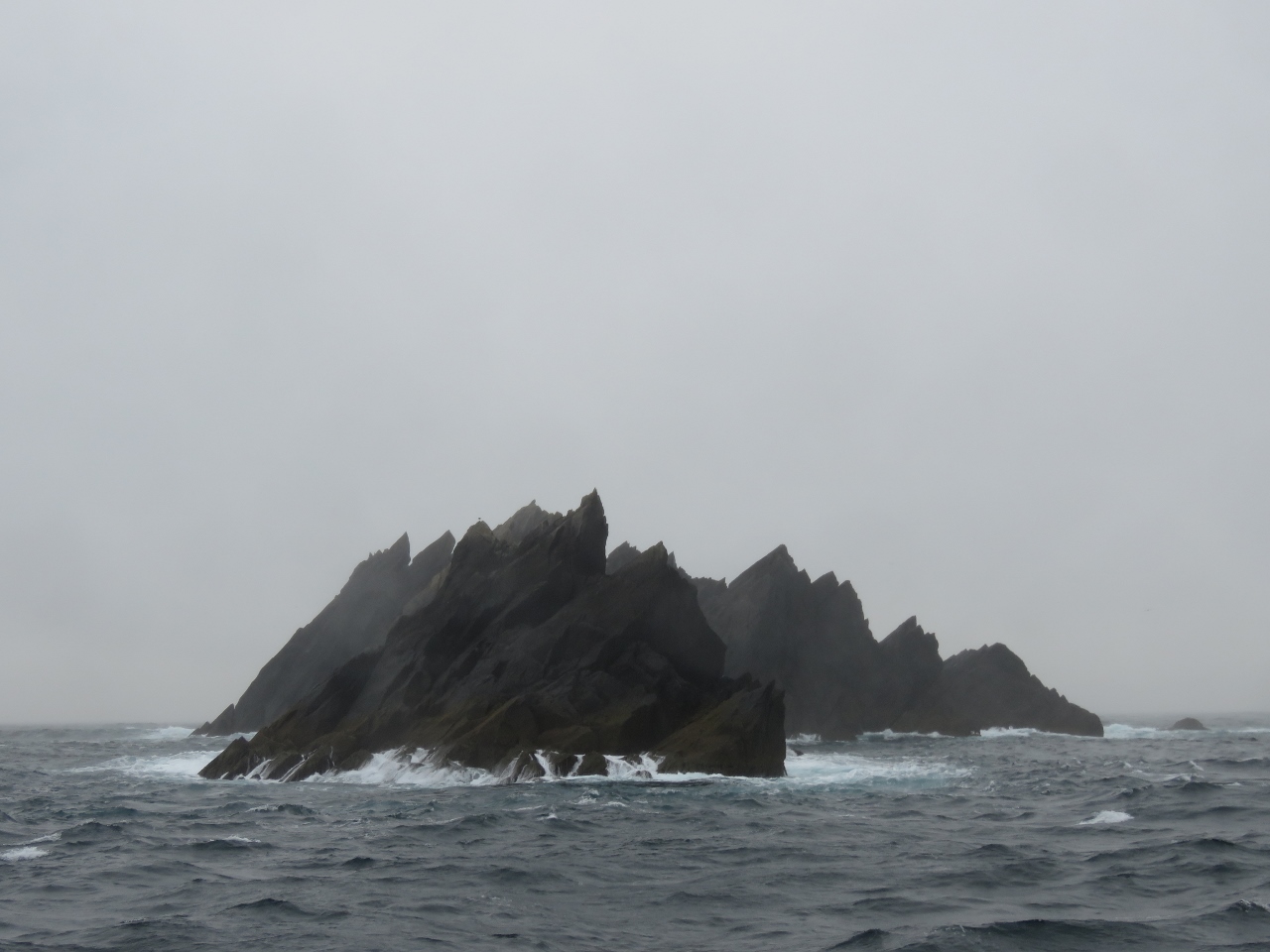
Inishnabro
Position: -10 36.04, 52 3.91
We woke up at the Valentia Island anchorage to a thick fog and almost skipped the Blasket Islands on our way north as we didn’t expect to see much. But even in such poor visibility, the formations off Inishnabro Island were spectacular.
|
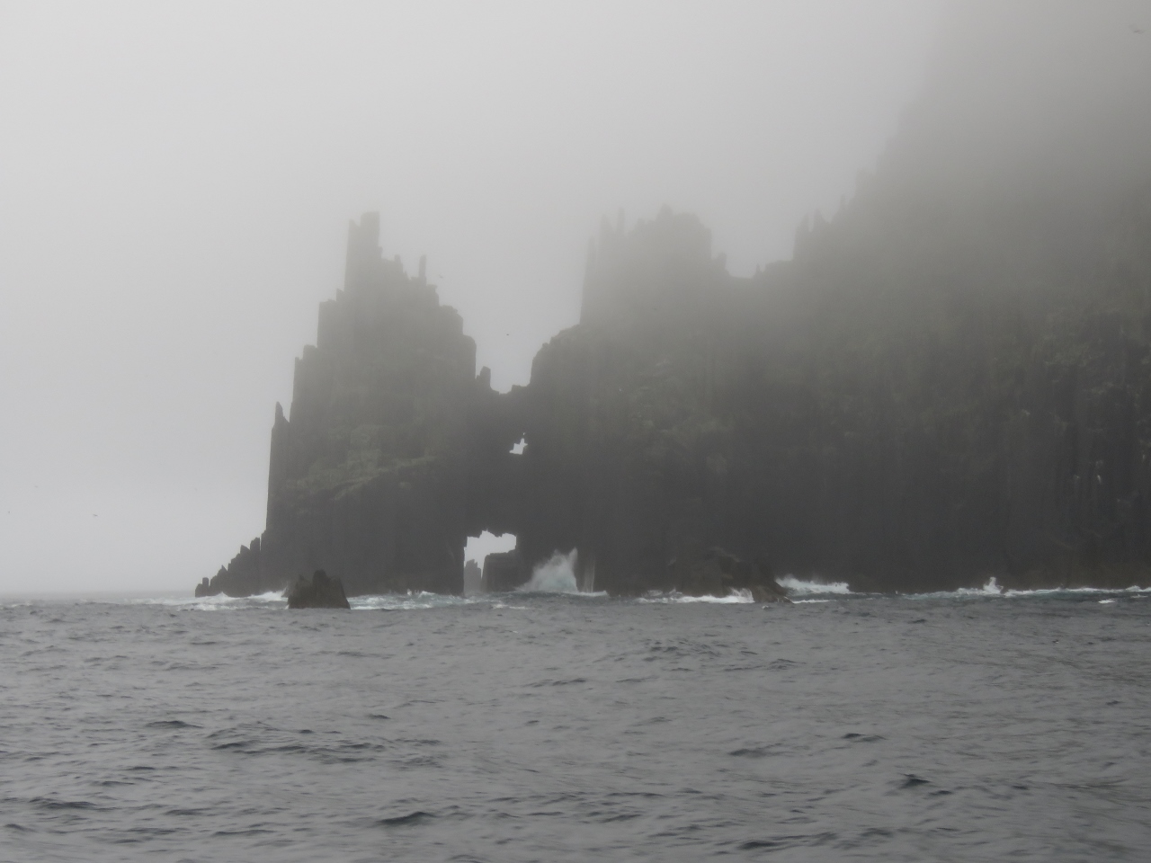 |
Seascape
Position: -10 36.56, 52 3.94
Looking back through multiple sea arches and castellated cliffs at the north end of Inishnabro Island. The fog actually added to the drama of the scene.
|
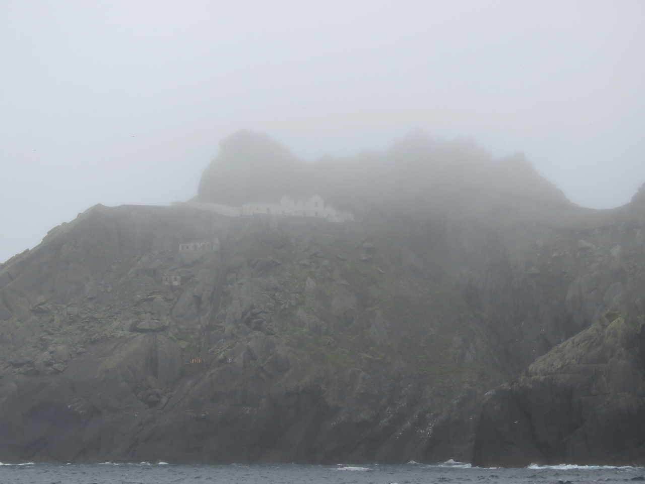 |
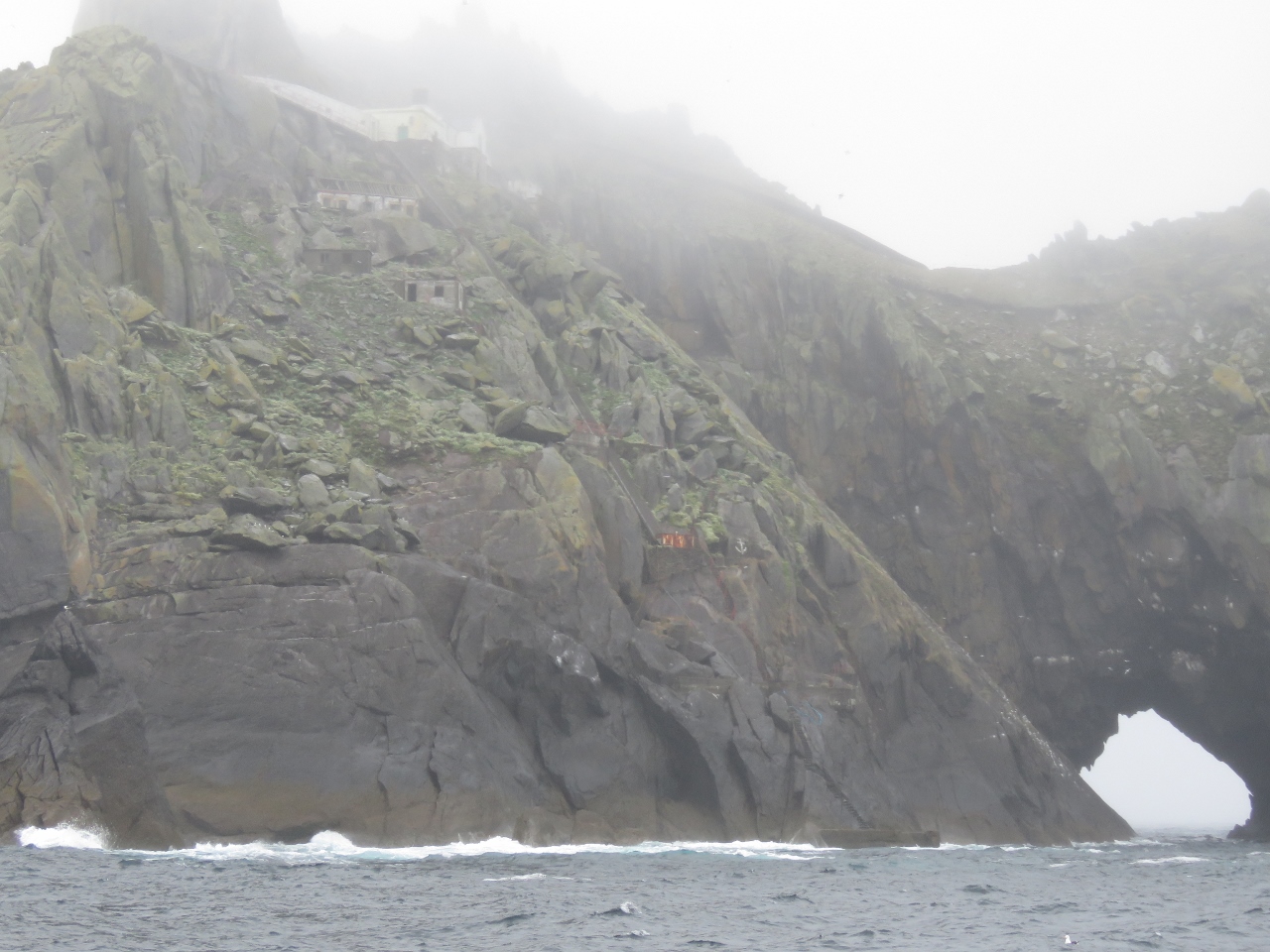
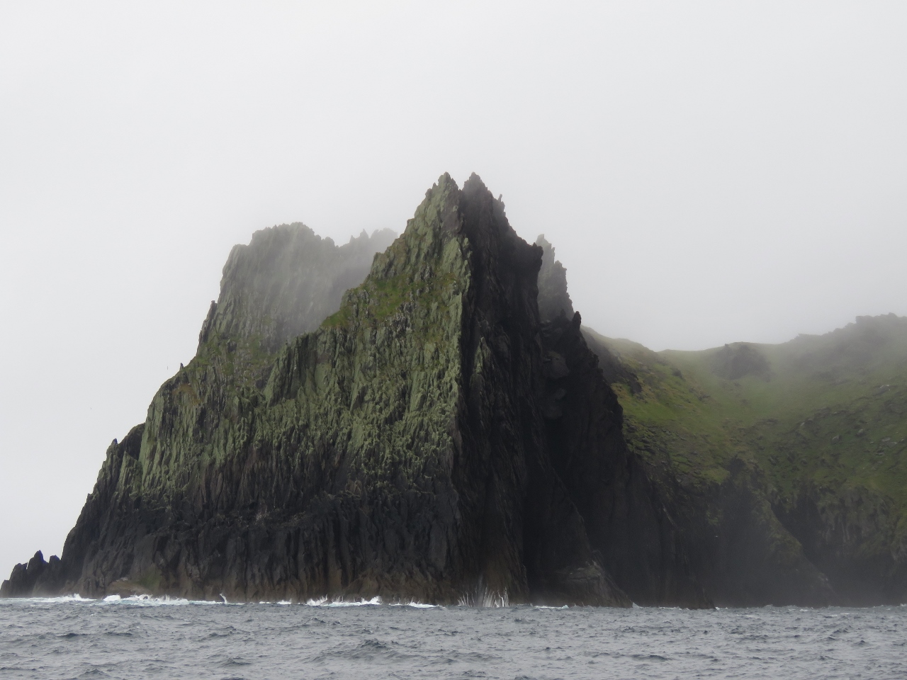
Tearaght Lighthouse
Position: -10 39.23, 52 4.21
The fog slowly lifted as we continued through the island group and we could just make out the lighthouse perched on the top of Tearaght Island. It sure takes some impressive engineering to build lighthouses on these remote and rugged islands.
|
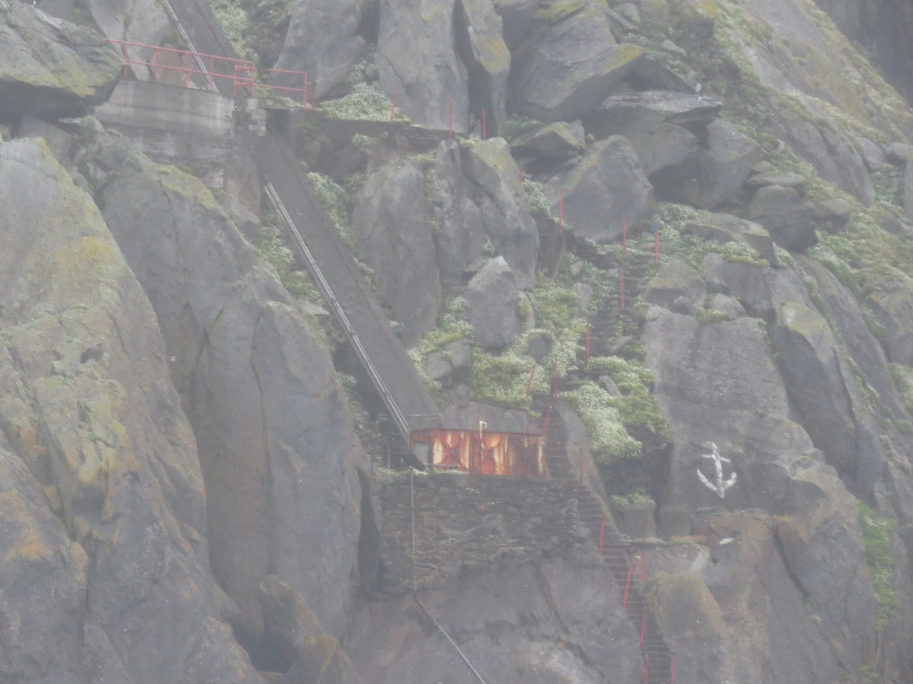 |
Stairs
Position: -10 39.68, 52 4.34
Below the lighthouse are several buildings and stairs leading down to a landing near the water.
|
 |
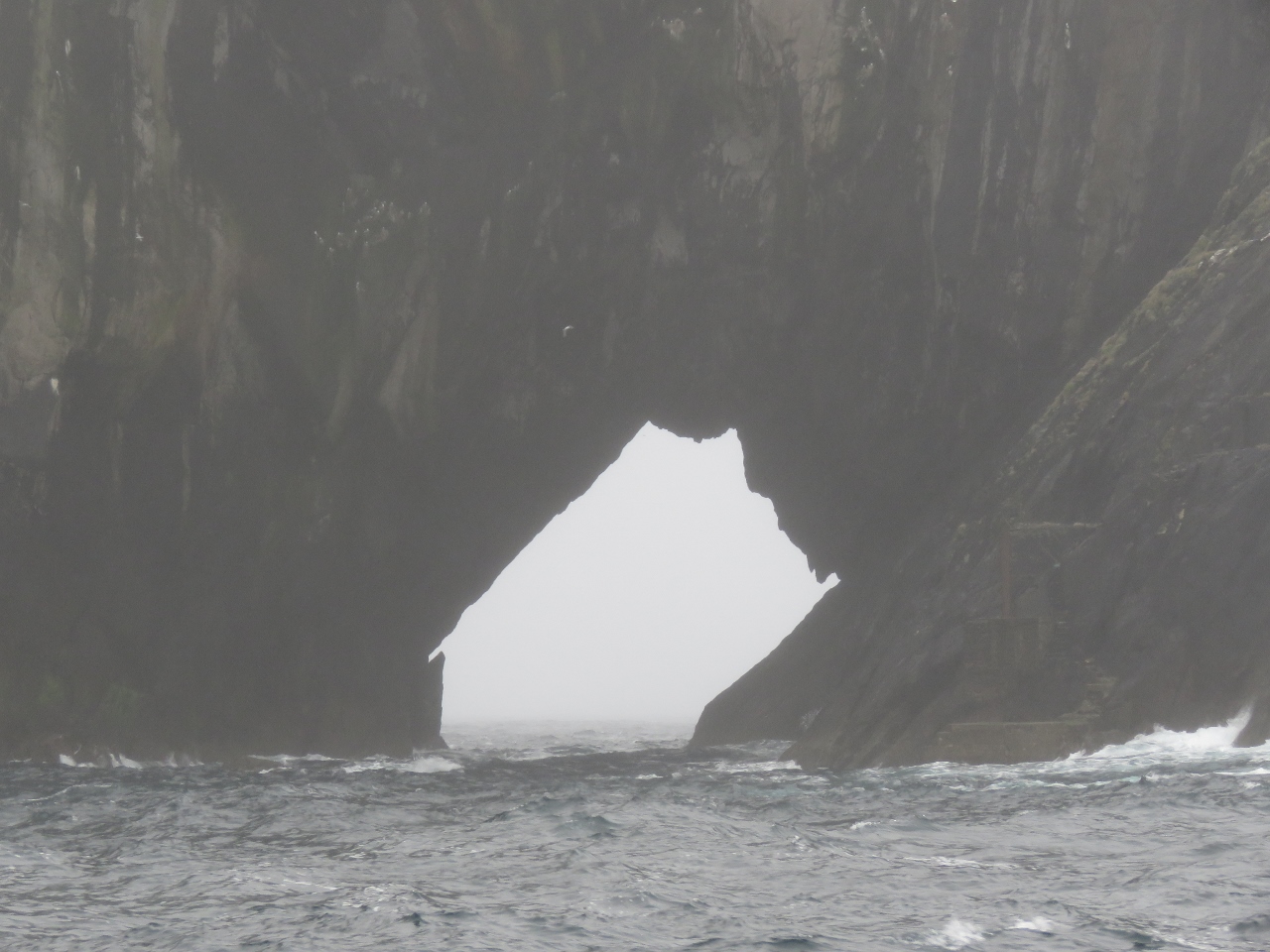
Tunnel
Position: -10 39.68, 52 4.34
As we continue west along Tearaght Island, perhaps the most dramatic feature of the island came into view: a tunnel all the way through to the other side.
|
 |
Hazards
Position: -10 39.84, 52 4.43
Rocks like these lurk just below the surface, so care is required when navigating the area.
|
 |
Tunnel from North
Position: -10 39.39, 52 4.72
Looking south through the tunnel on Tearaght Island.
|
 |
Landing
Position: -10 39.55, 52 4.72
Just off the tunnel on the right is another landing for the lighthouse. Both landings look like they’d be pretty challenging in even the smallest swell.
|
 |
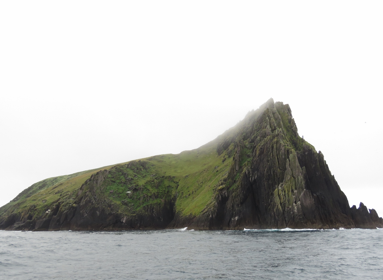
Inishtooskert
Position: -10 35.30, 52 7.96
The fog kept lifting and we got a great view to the sheer cliffs along the north shore of Inishtooskert Island.
|
 |
Slope
Position: -10 34.42, 52 8.38
A grassy green slope behind the cliffs on Inishtooskert Island.
|
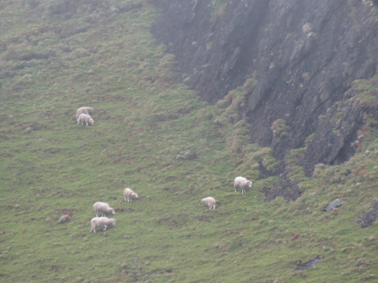 |
Sheep
Position: -10 34.31, 52 8.37
We were surprised to see sheep grazing on Inishtooskert Island. The island once was inhabited and now mainly sheep and seabirds live here, in particular the largest colony of European storm-petrels in Ireland.
|
 |
Loop Head
Position: -9 59.48, 52 32.30
Ireland has no shortage of lighthouses on dramatic seascapes. This is Dermot and Grania’s Rock standing just offshore from Loop Head. A light has been lit on Loop Head since 1670. The current building was completed in 1854 and the light was automated in 1991.
|
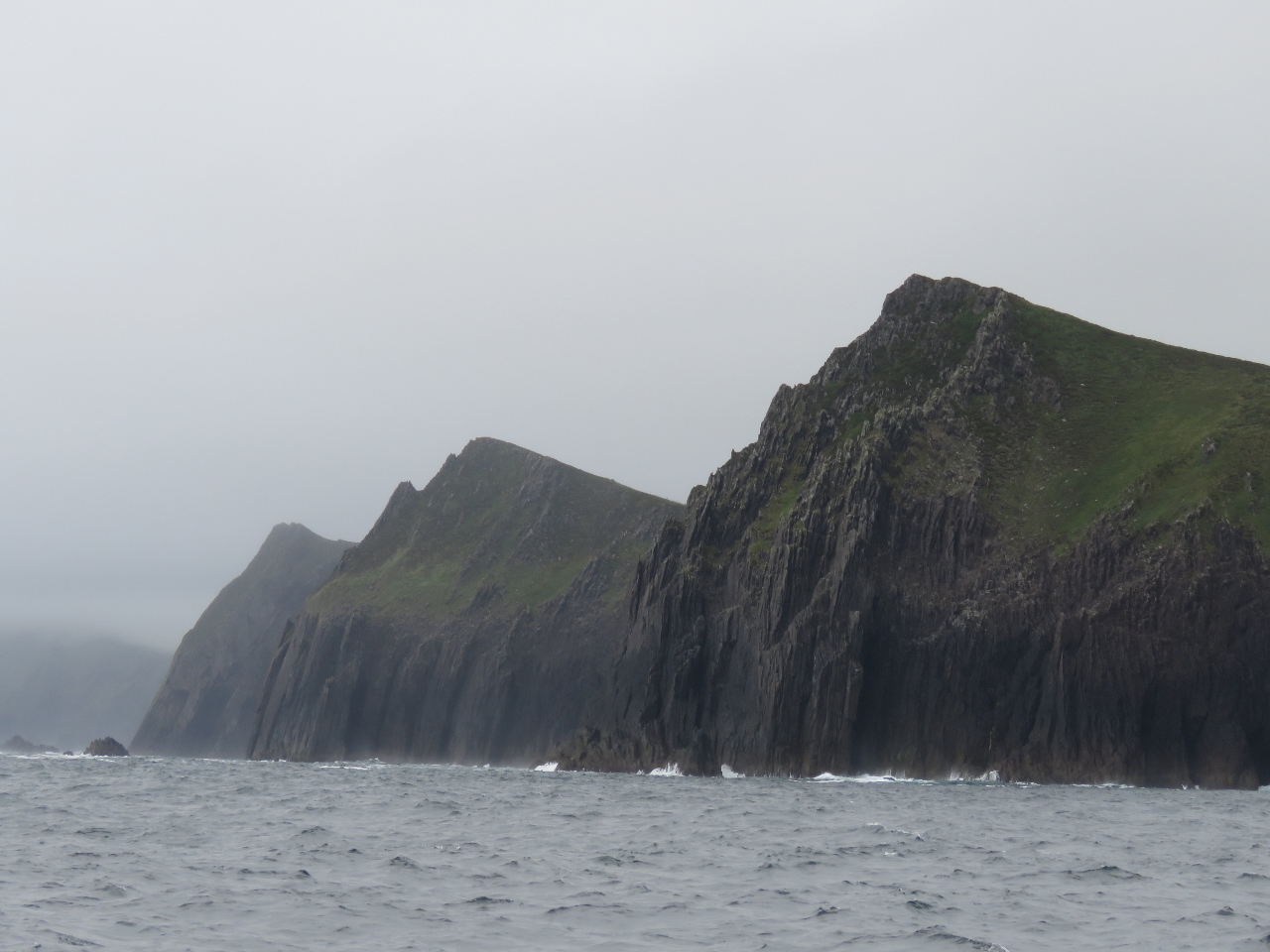 |
Three Sisters
Position: -10 27.05, 52 11.60
The Three Sisters cliffs just north of Sybil Point have surprisingly similar sheer slopes and cliff-top formations.
|
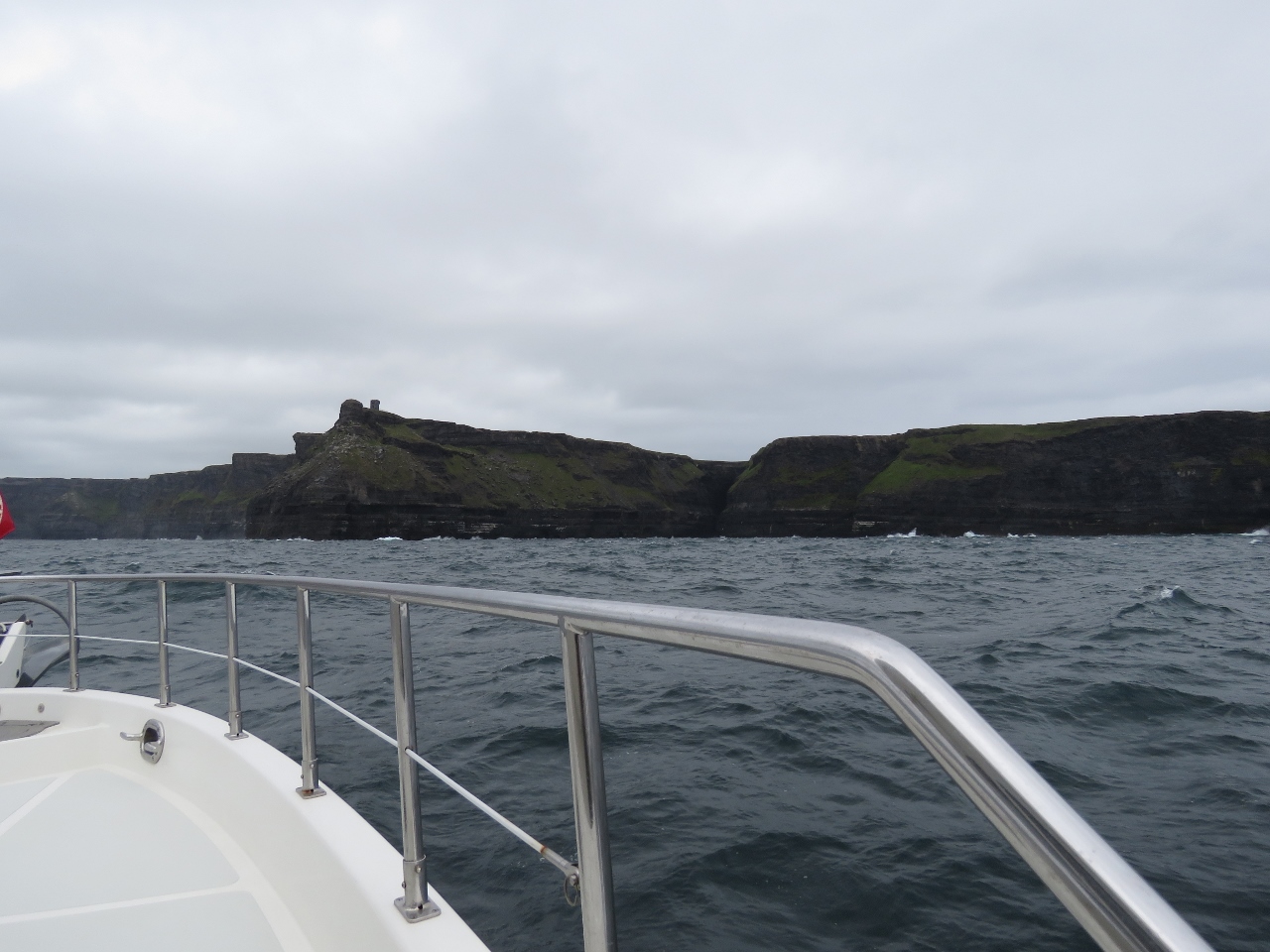 |
Approaching Cliffs of Moher
Position: -9 29.59, 52 56.56
We’re nearing the Cliffs of Moher, one of Ireland’s most well-known coastal features. We’ve been looking forward to seeing them from the water for a while.
|
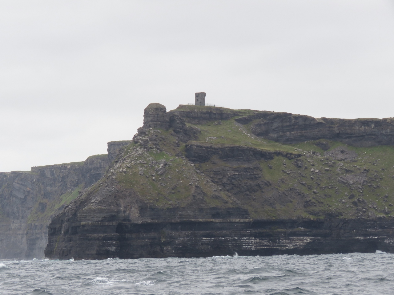 |
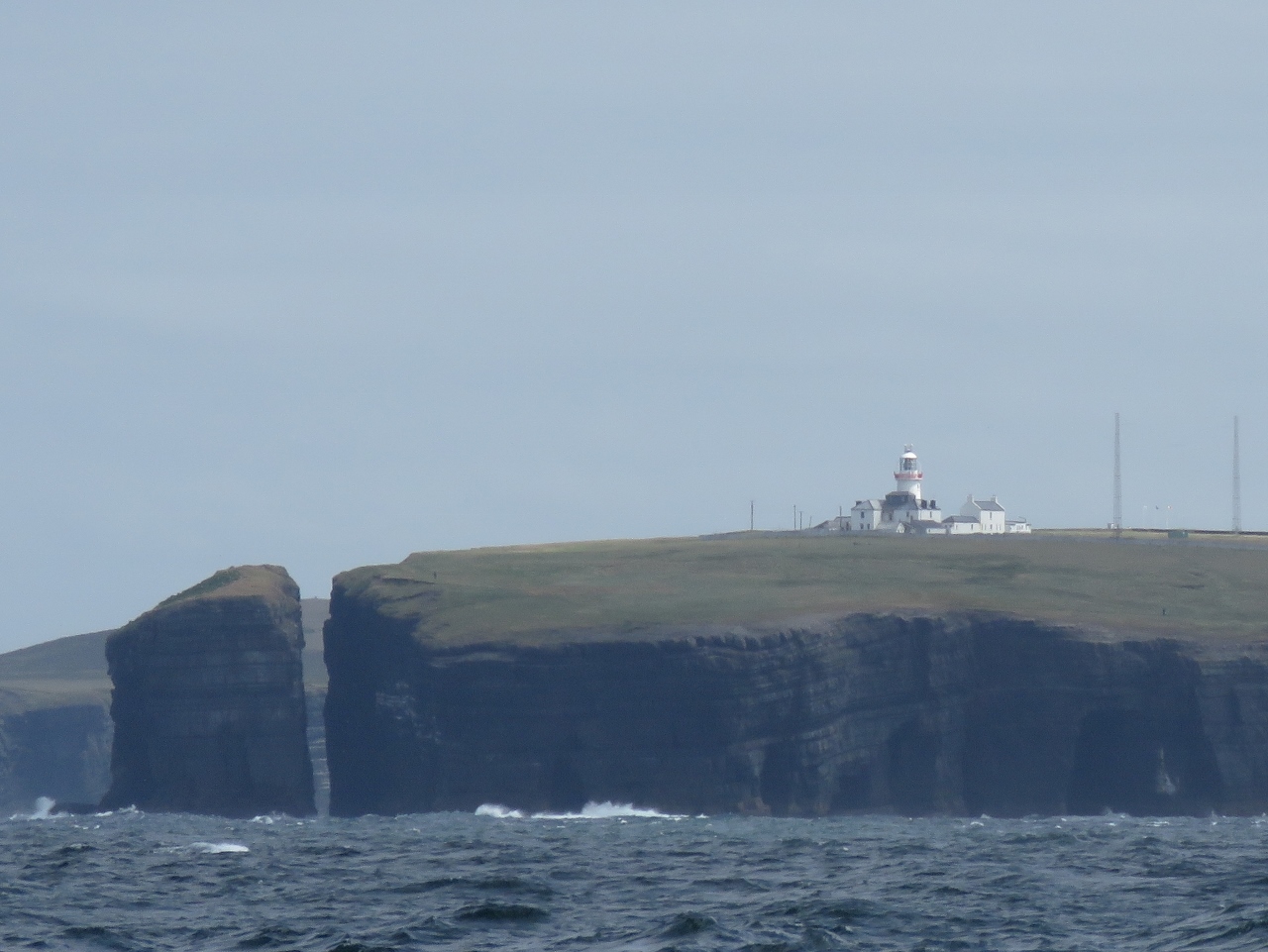
Hags Head Signal Tower
Position: -9 28.88, 52 56.85
The Hags Head signal tower, one of the 81 signal towers built along the Irish coast during the Napoleonic era. What looks like a small tower slightly lower on the point is a circular rock formation.
|
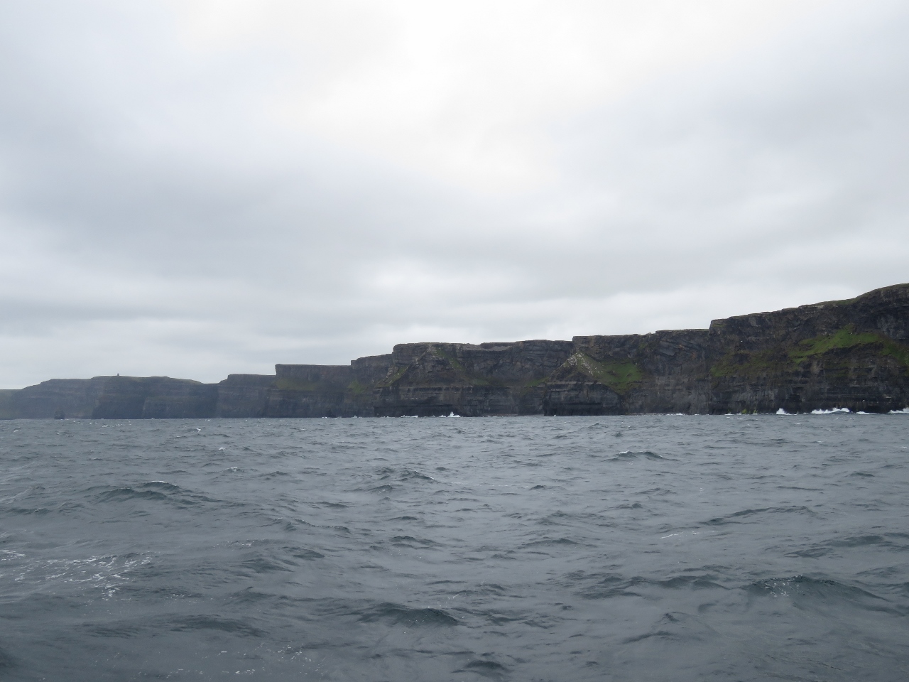 |
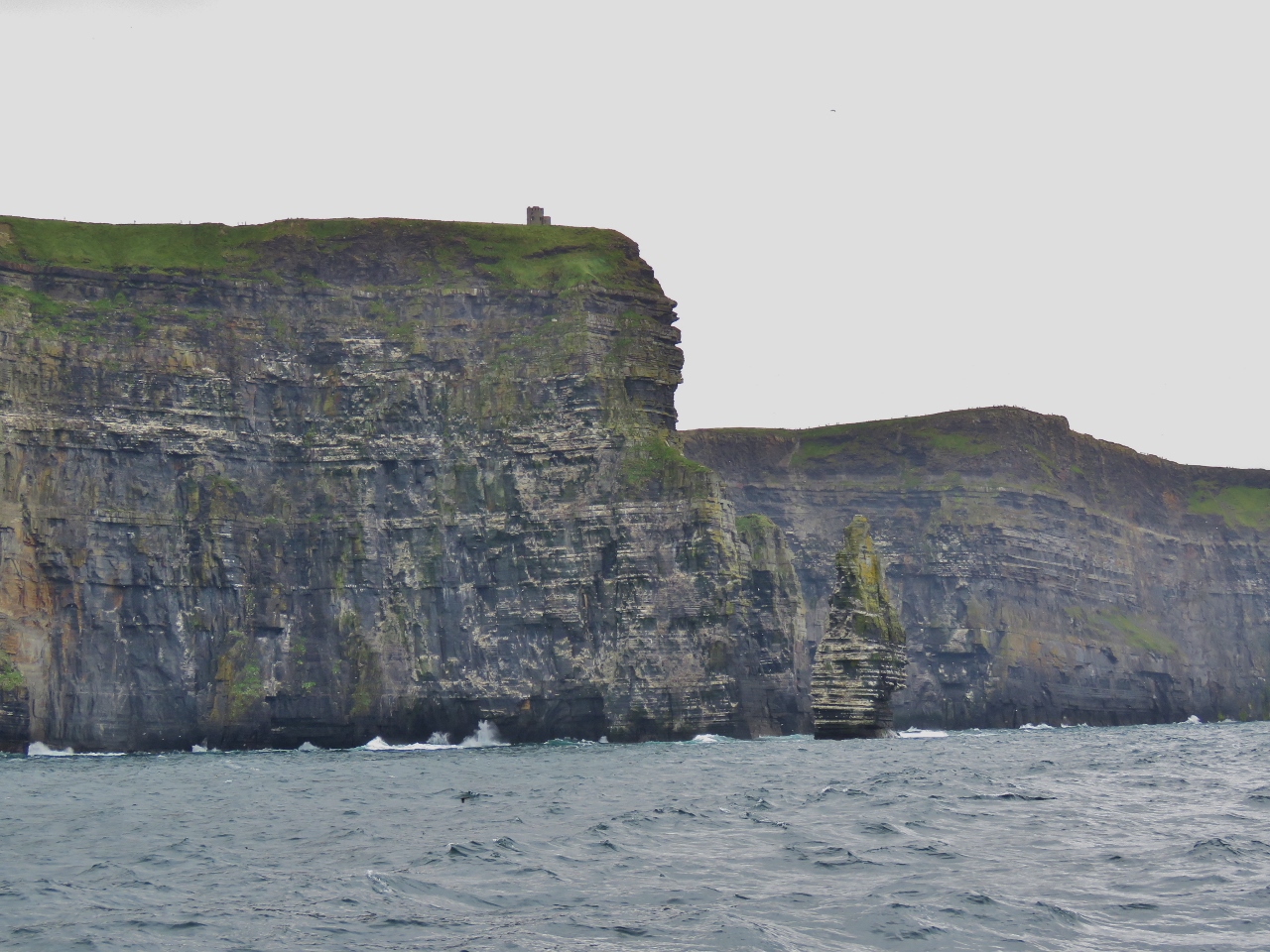
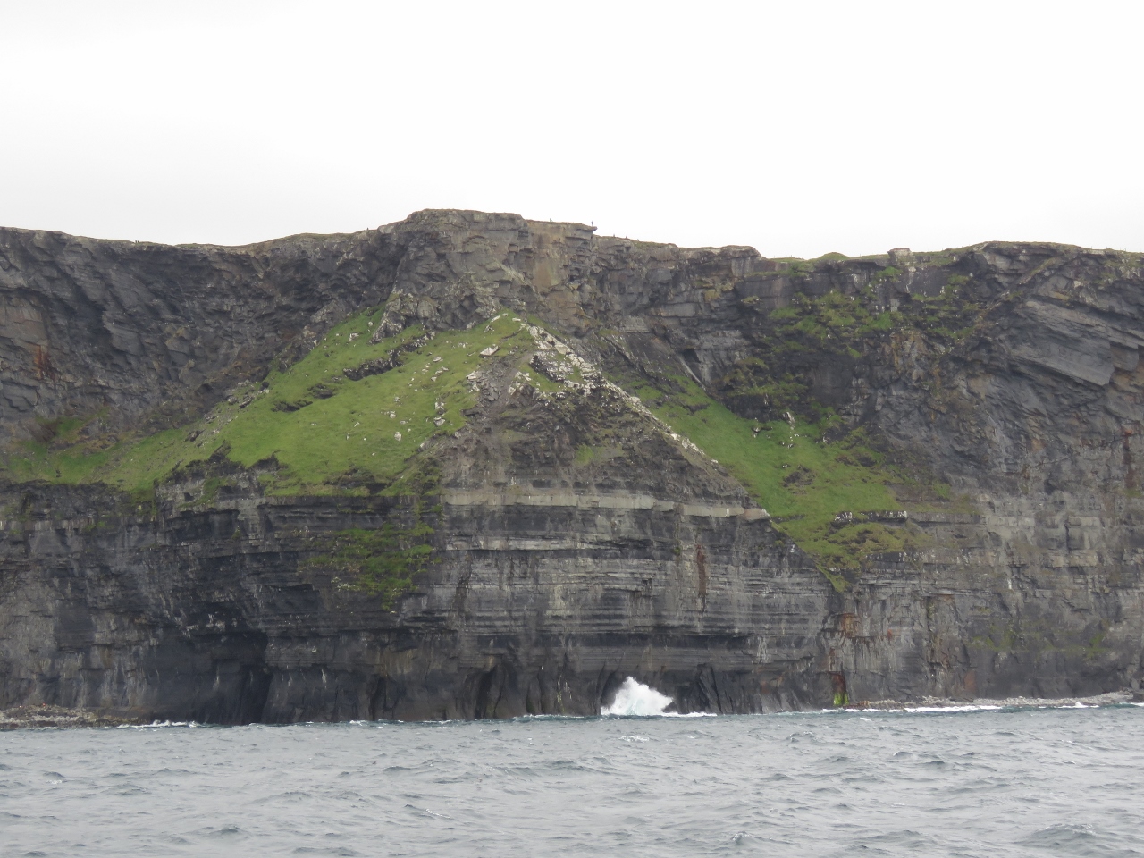
Cliffs of Moher
Position: -9 28.41, 52 57.08
The 600ft sheer Cliffs of Moher stretching out for five miles before us. Capturing their size and scale in a photograph is a real challenge.
|
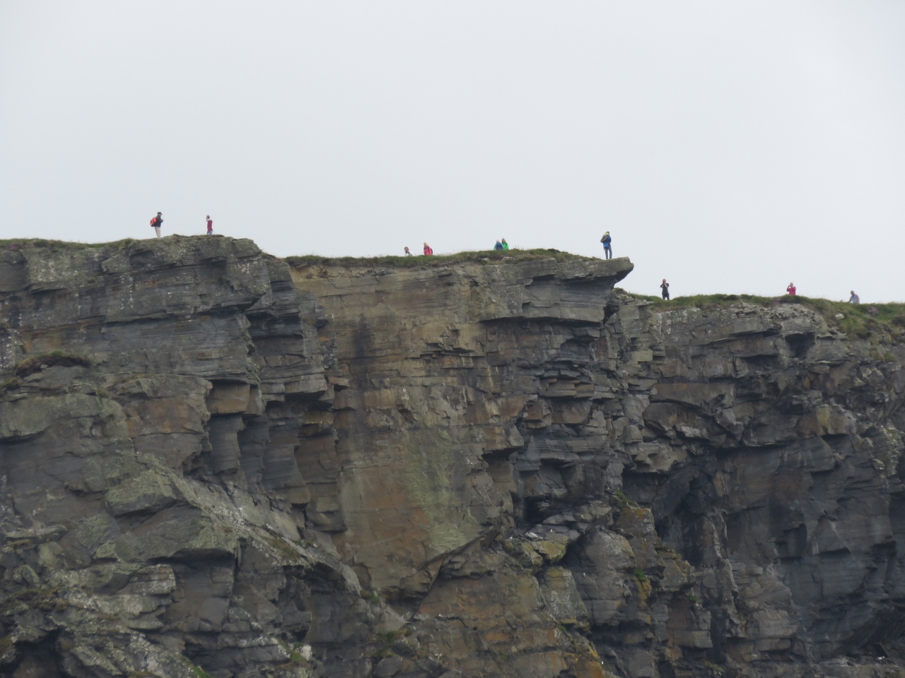 |
People
Position: -9 27.78, 52 57.44
The Cliffs of Moher are a popular tourist destination—many people were out taking in the view. We wondered if the person near the tip of the overhand knew how far out they were.
|
 |
Cliffs
Position: -9 27.78, 52 57.44
The cliffs were fabulous—we felt very lucky to have such calm conditions where we could approach reasonably closely. The small specks of people at the top of the cliffs give an idea of the scale.
|
|
|
Branaunmore Sea Stack
Position: -9 26.32, 52 58.69
Looking south past Branaunmore Sea Stack to the Cliffs of Moher, with O’Briens Tower at the top of the cliffs. Sir Cornelius O`Brien built the tower in 1835 as a tourist observation platform.
|
 |
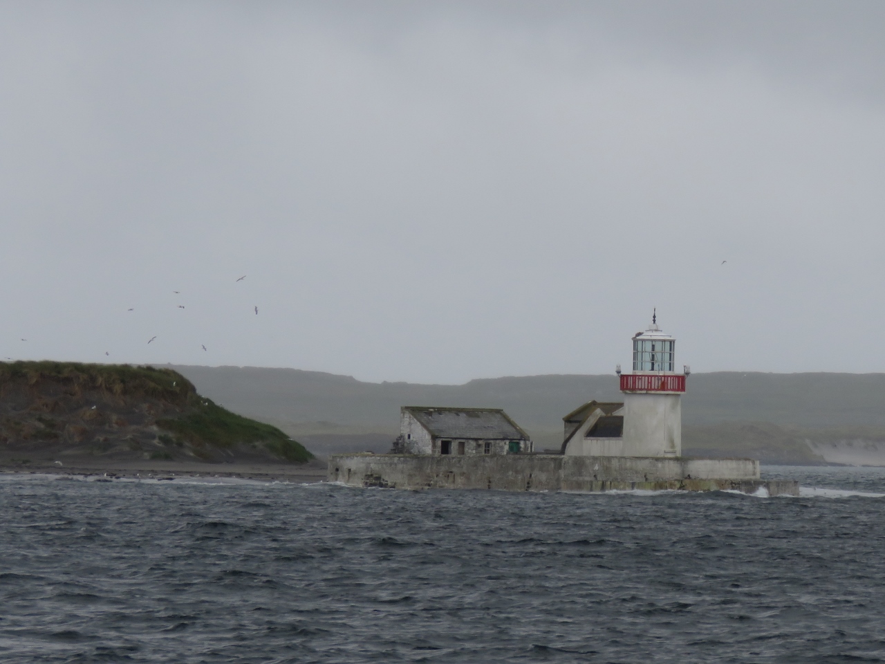
Fardurris Point Light
Position: -9 31.31, 53 2.18
The Fardurris Point Light on Innisheer Island in the Aran Islands.
|
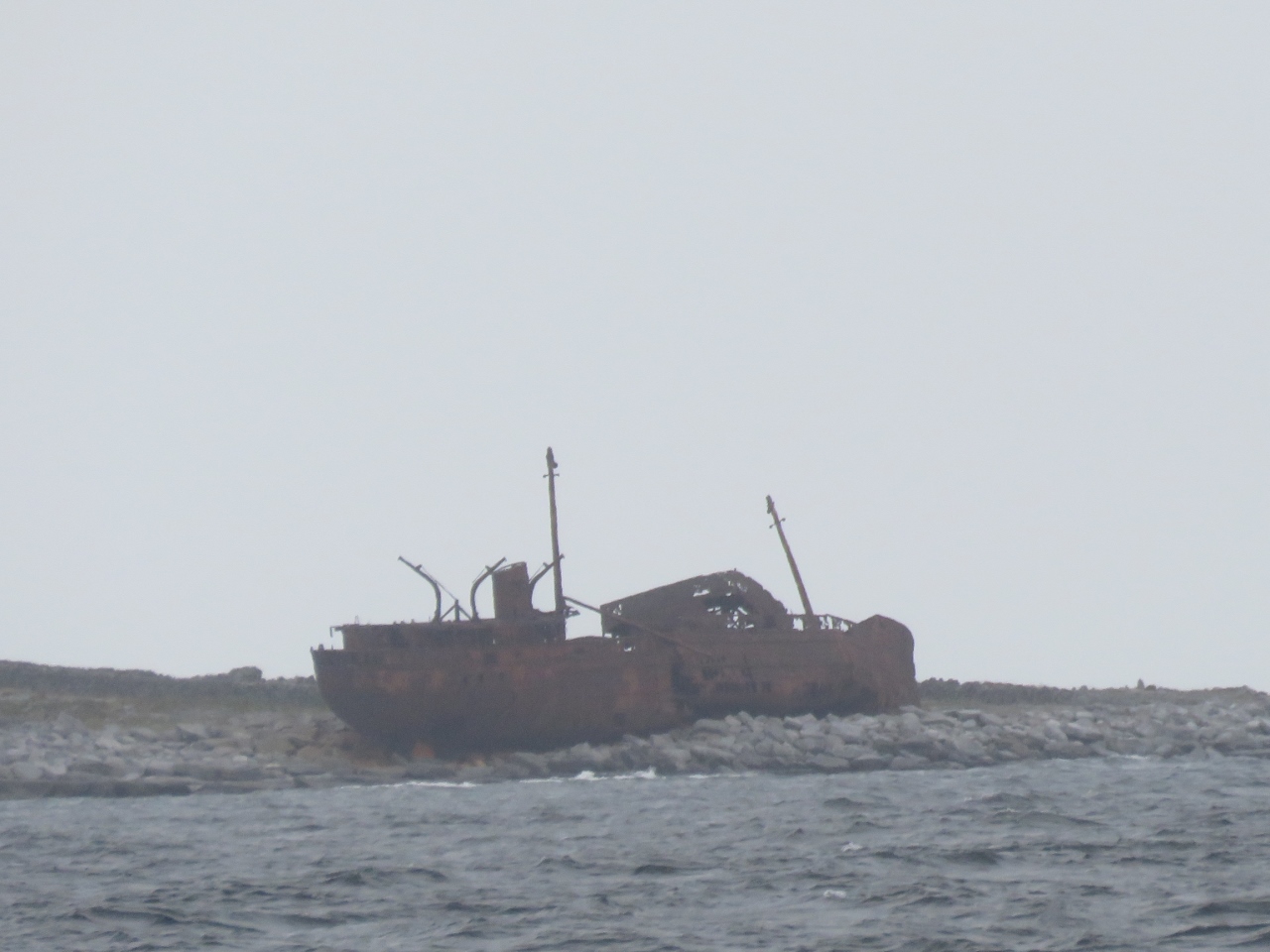 |
MV Plassy
Position: -9 31.46, 53 2.28
The MV Plassy was a steam-trawler launched in 1940. In 1960, the ship went aground in a severe storm on Finnis Rock off Inisheer Island and the entire crew was rescued with a breeches buoy. A few weeks later, a second storm washed the ship off the rock and onto Inisheer Island and features in the opening credits of the British television show Father Ted.
|
 |
Straw Island Light
Position: -9 37.61, 53 7.33
The Straw Island Lighthouse at the entrance to Killeany Bay on Inishmore Island in the Aran Islands.
|

|
Click the travel log icon on the left to see these locations on a map, with the complete log of our cruise.
On the map page, clicking on a camera or text icon will display a picture and/or log entry for that location, and clicking on the smaller icons along the route will display latitude, longitude and other navigation data for that location. And a live map of our current route and most recent log entries always is available at http://mvdirona.com/maps. |
Great photos! My daughter nearly gave me a heart attack at the top of the Cliffs of Moher a couple summers back — she was being perfectly responsible, but I am freaked out by any cliffs edge.