
Between 1913 and 1940, millionaire philanthropist John D. Rockefeller Jr. built 45 miles of carriage roads on Mt. Desert Island that were closed to automobiles and remain that way today. Rockefeller also financed the construction of sixteen stone bridges at gorge and stream crossings. The majority of the roads are within Acadia National Park and biking through them is a wonderful way to tour the park and view the graceful bridges.
Trip highlights from our October 1st, 2016 bike ride through the Acadia carriage roads follow. Click any image for a larger view, or click the position to view the location on a map. And a live map of our current route and most recent log entries always is available at http://mvdirona.com/maps
 |
Trailhead
Position: -68 17.58, 44 19.76
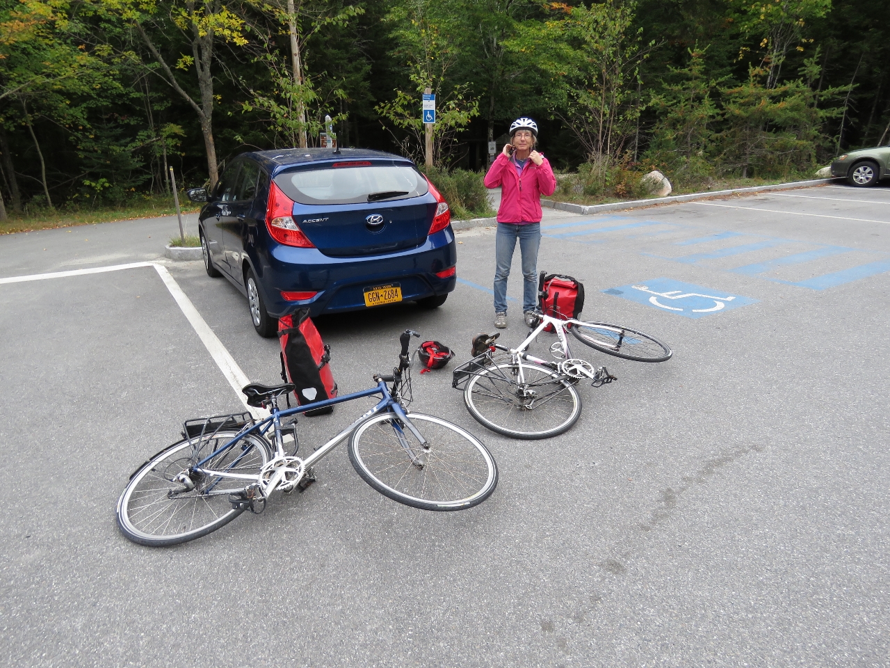
We managed to fit both bikes into our rental car and drove to the Parkman Mountain trailhead.
|
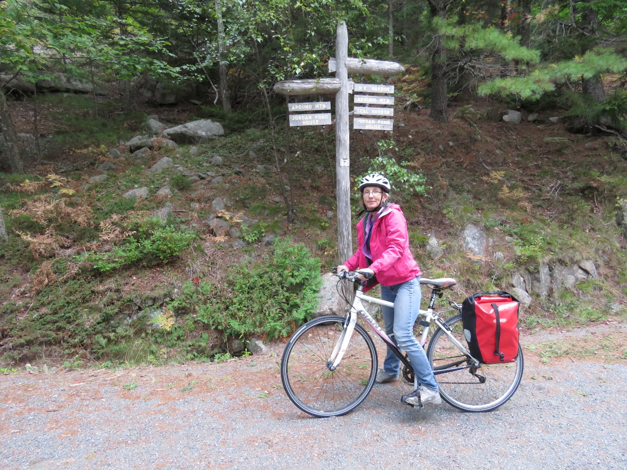 |
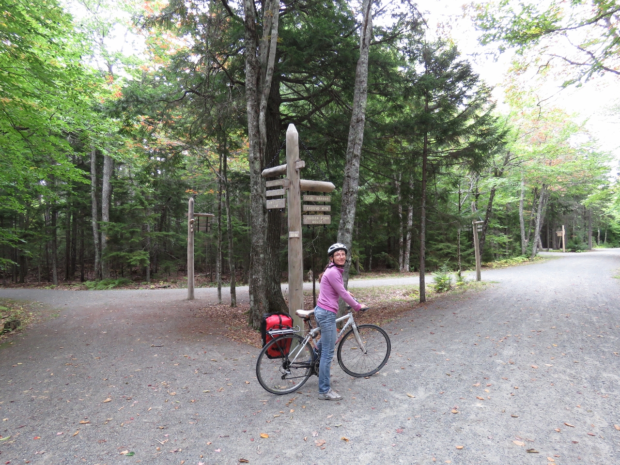
Signpost 12
Position: -68 17.40, 44 19.80
The carriage road intersections have numbered signposts shown on trail maps. We’re currently at signpost 12 and will take the Around Mountain Carriage Road north.
|
 |
Breakfast
Position: -68 17.35, 44 20.46
We stopped for breakfast with a view west over Sargent Cove in Somes Sound.
|
 |
Fall Colors
Position: -68 16.72, 44 21.15
We’re starting to see more fall colors in the trees. This is looking west over Somes Sound.
|
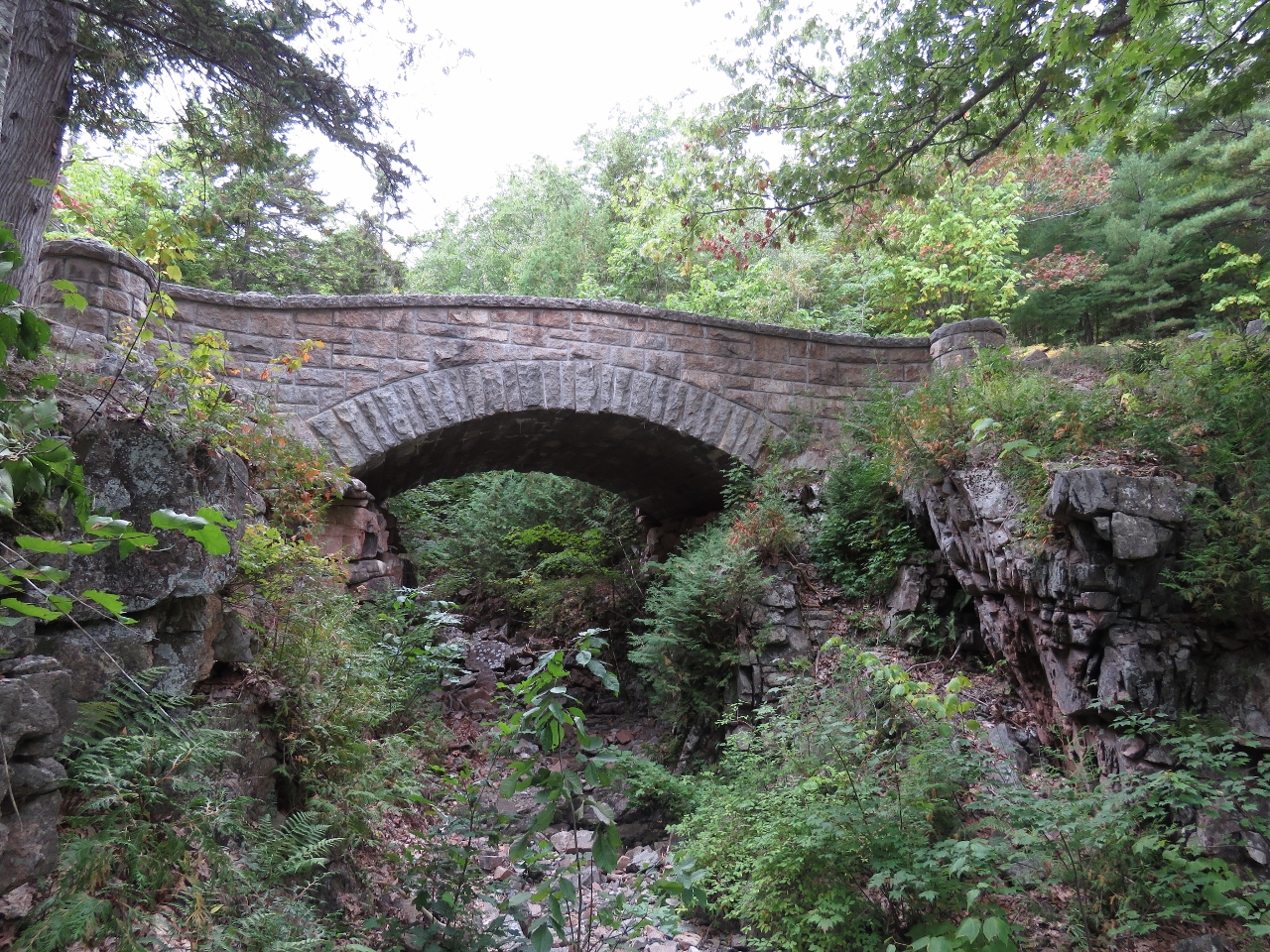 |
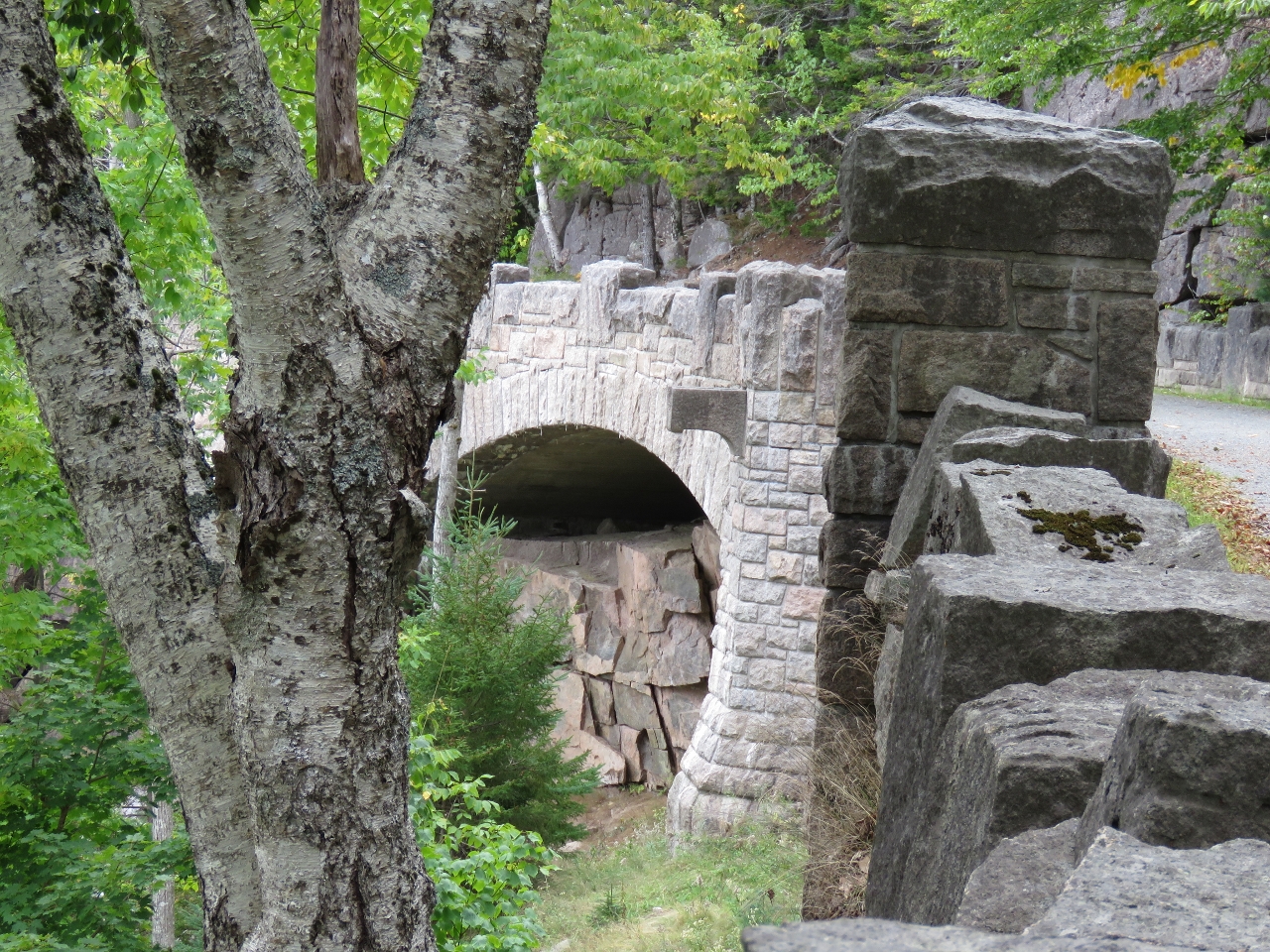
Chasm Brook Bridge
Position: -68 16.48, 44 21.20
The Chasm Brook Bridge, built in 1926, is one of the more remote bridges in the carriage road system. This is the first of ten carriage road bridges we’ll see on our ride today.
|
 |
Signpost 10
Position: -68 16.00, 44 21.11
At Signpost 10 where we’ll head east around the south end of Eagle Lake.
|
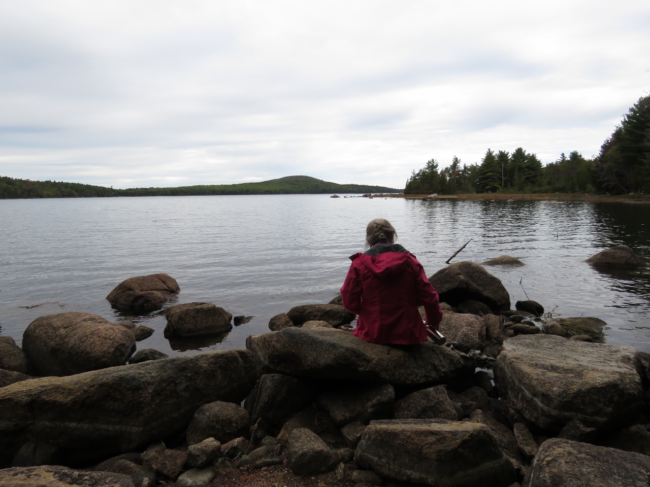 |
Eagle Lake
Position: -68 14.76, 44 21.21
“Second Breakfast” looking north into Eagle Lake. This is the lake we saw from the Cadillac Mountain road during our previous trip to Acadia National Park.
|
|
|
Bubble Pond Bridge
Position: -68 14.52, 44 20.94
Bubble Pond Bridge was built in 1928 and carries the main carriage road over a minor spur toward Bubble Pond.
|
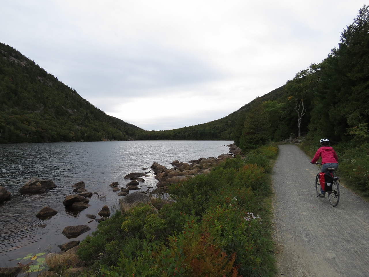 |
Bubble Pond
Position: -68 14.39, 44 20.55
Riding south along the west shore of Bubble Pond. The carriage road system is simply wonderful. We’re having a great time.
|
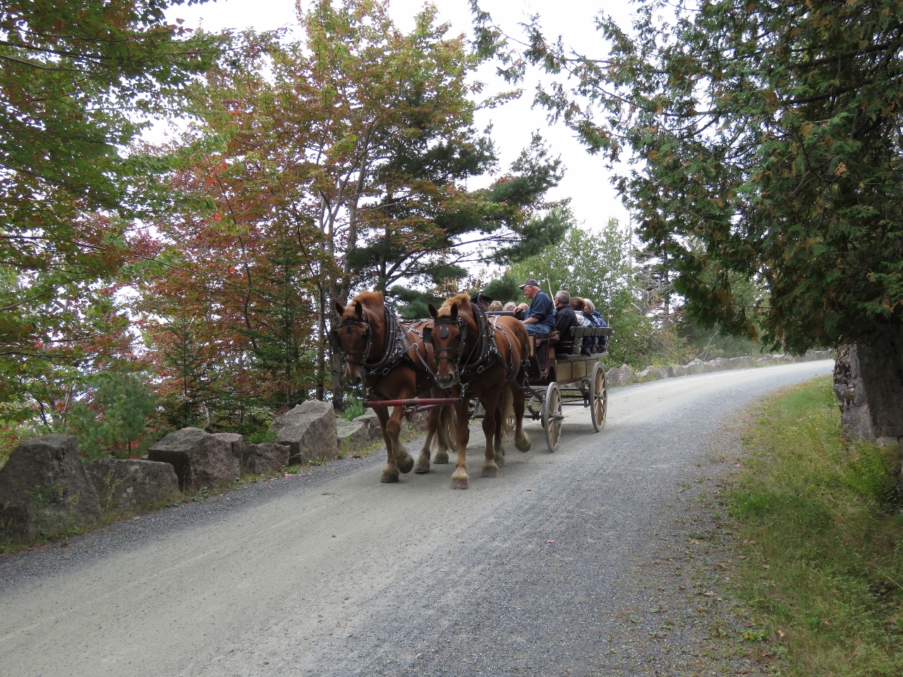 |
Carriage
Position: -68 13.62, 44 18.65
The carriage roads originally were designed for horse-drawn carriages and still can be toured that way.
|
 |
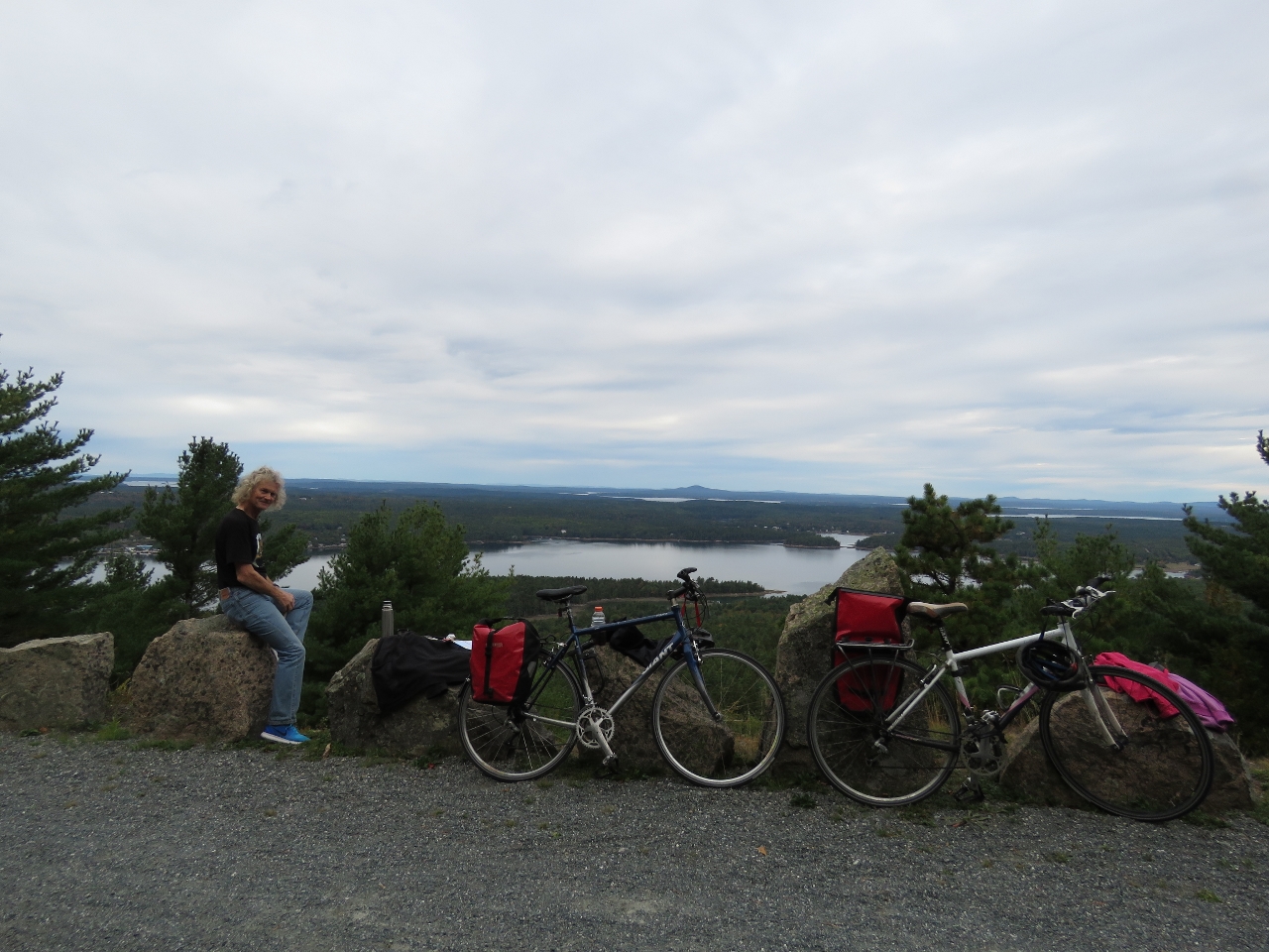
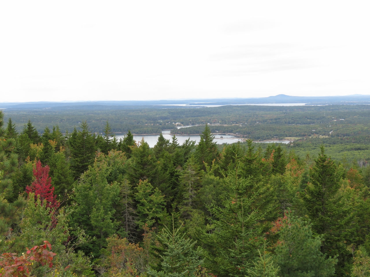
Day Mountain
Position: -68 13.93, 44 18.58
Lunch with a view south to the Cranberry Island from the top of 583ft Day Mountain.
|
 |
Jordan Pond Road Bridge
Position: -68 14.76, 44 18.58
Heading under the Jordan Pond Road Bridge that we walked to on our previous trip.
|
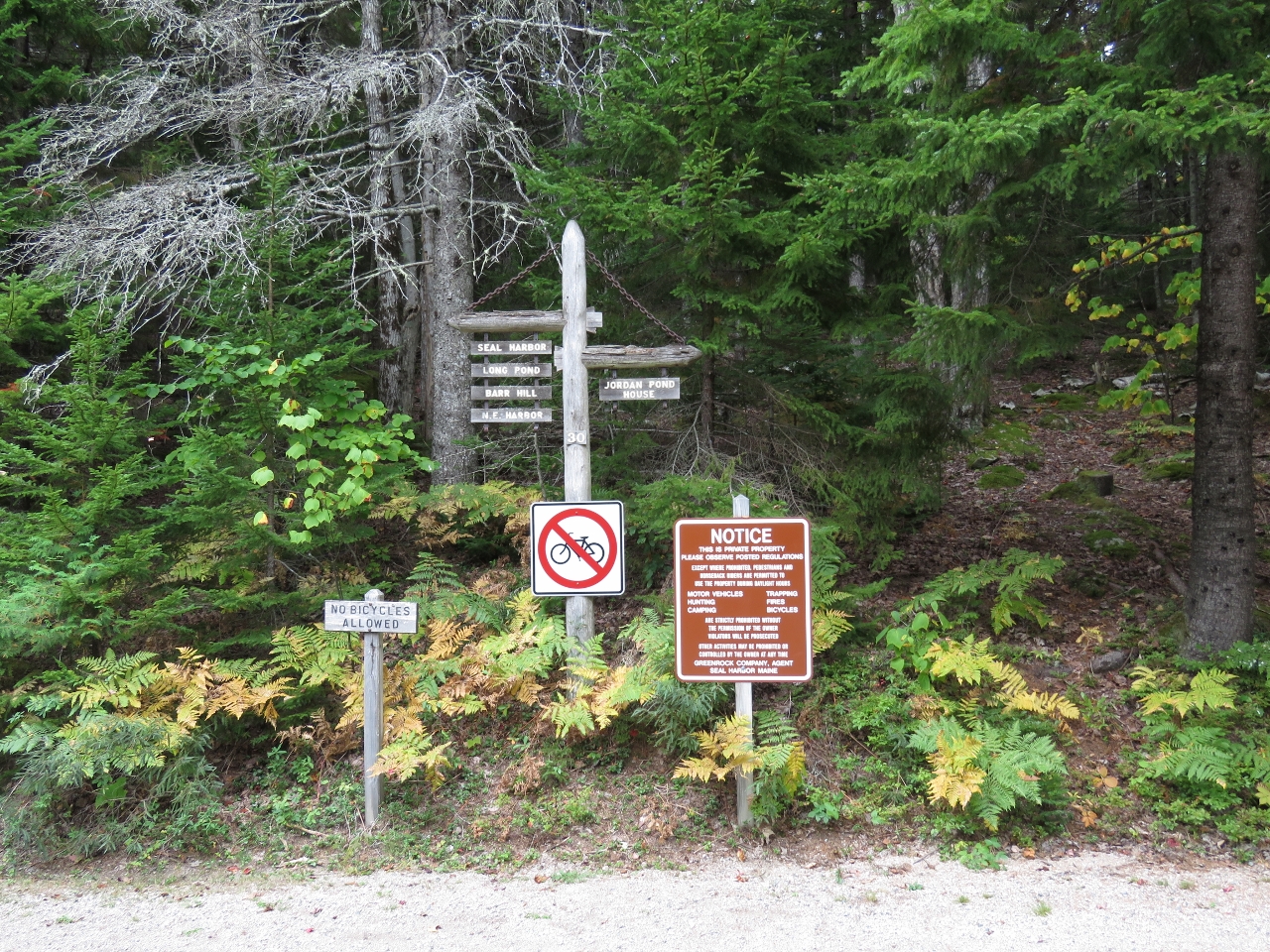 |
No Bikes
Position: -68 14.84, 44 18.62
We never could find out why, but bicycles aren’t allowed on the privately-owned carriage roads outside the park. From here we’ll take the park loop road and rejoin the carriage road system at Jordon Pond.
|
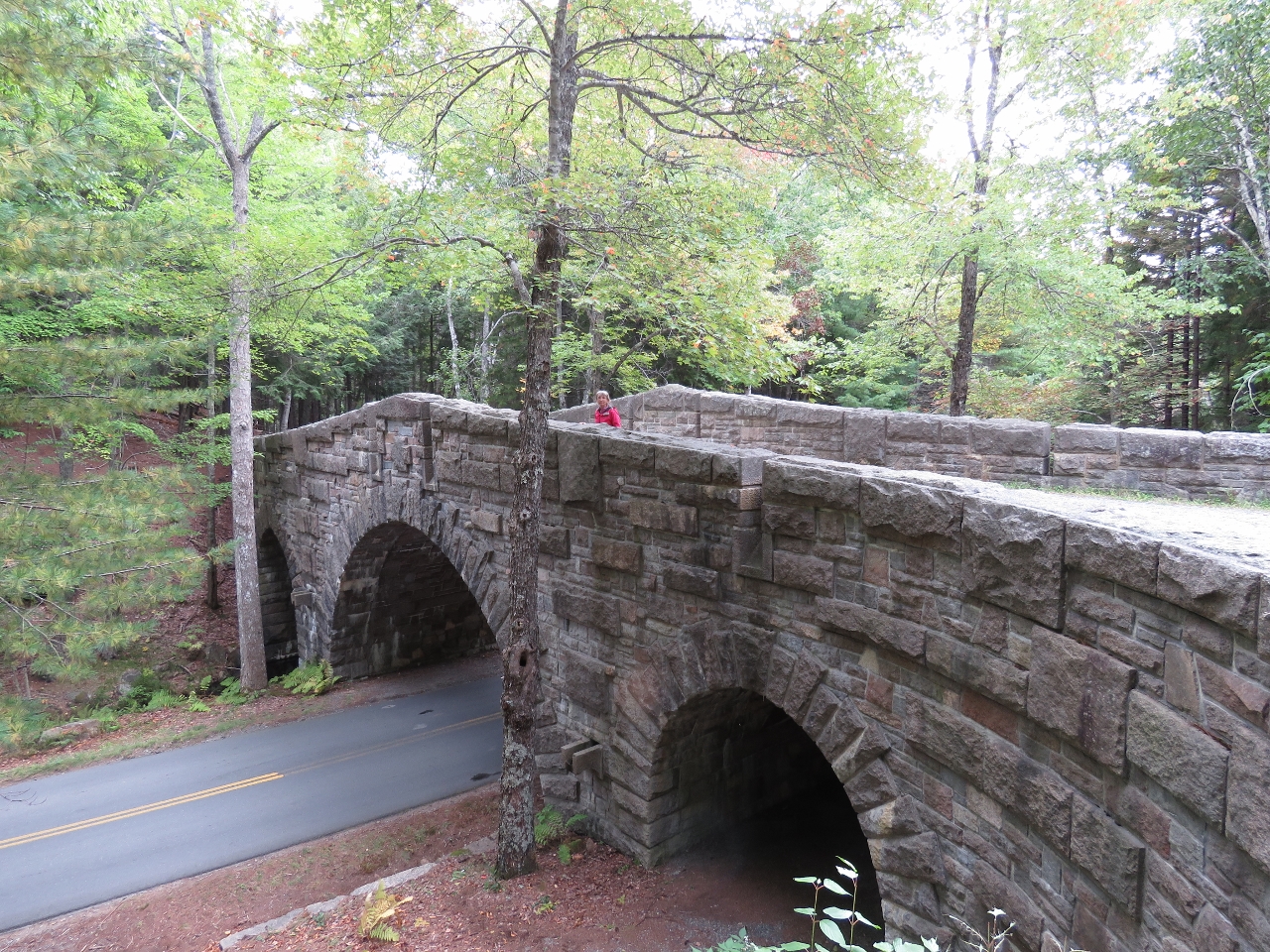 |
Stanley Brook Bridge
Position: -68 14.84, 44 18.62
The Stanley Brook Bridge was built in 1933, the last of the sixteen Rockefeller carriage-road bridges constructed. The three arches allow traffic, a hiking trail, and the brook to travel underneath.
|
 |
Gate Lodge
Position: -68 15.14, 44 19.15
The Jordon Pond Gate Lodge is one of two lodges that were built at entry points to the carriage road system to ensure that automobiles stayed off the carriage roads. The second is at Northeast Harbor opposite Somes Sound from Southwest Harbor.
|
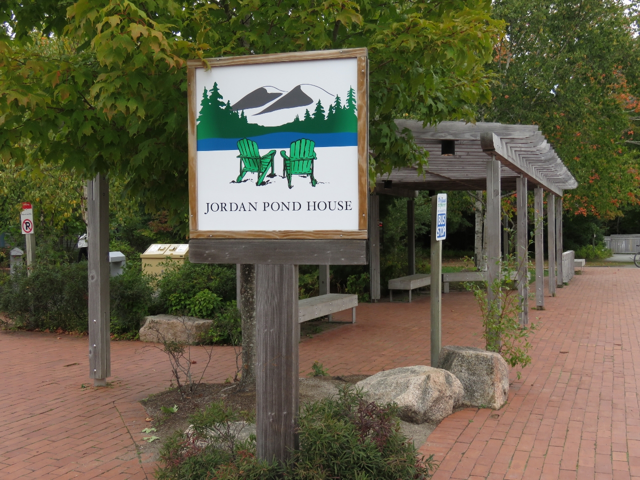 |
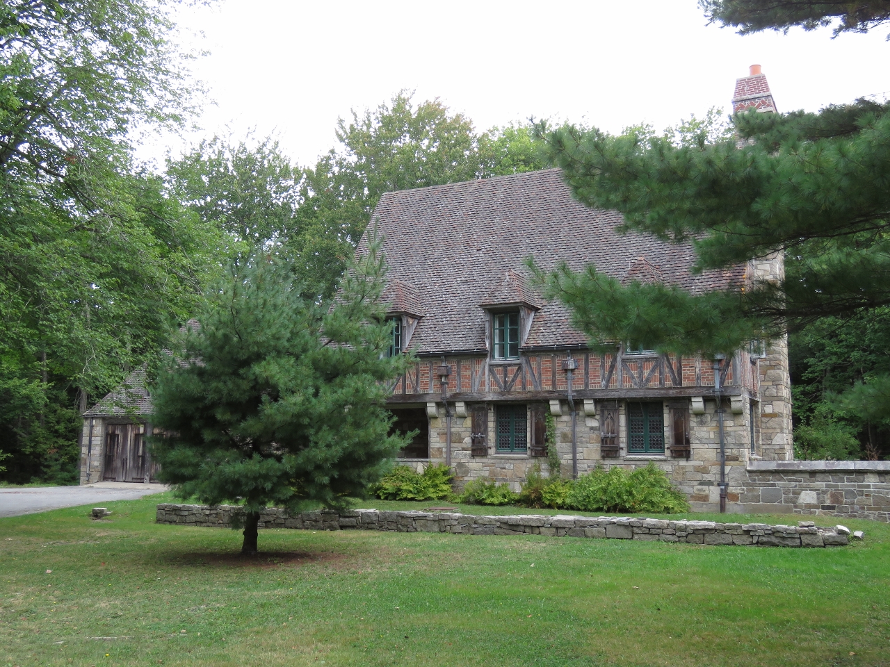
Jordon Pond House
Position: -68 15.20, 44 19.21
The original Jordon Pond House opened in 1896 to serve refreshments to hungry park-goers. The restaurant is exceedingly popular in the summer, with tourists arriving by the car- and bus-load to partake in the house specialty, popovers with strawberry jam.
|
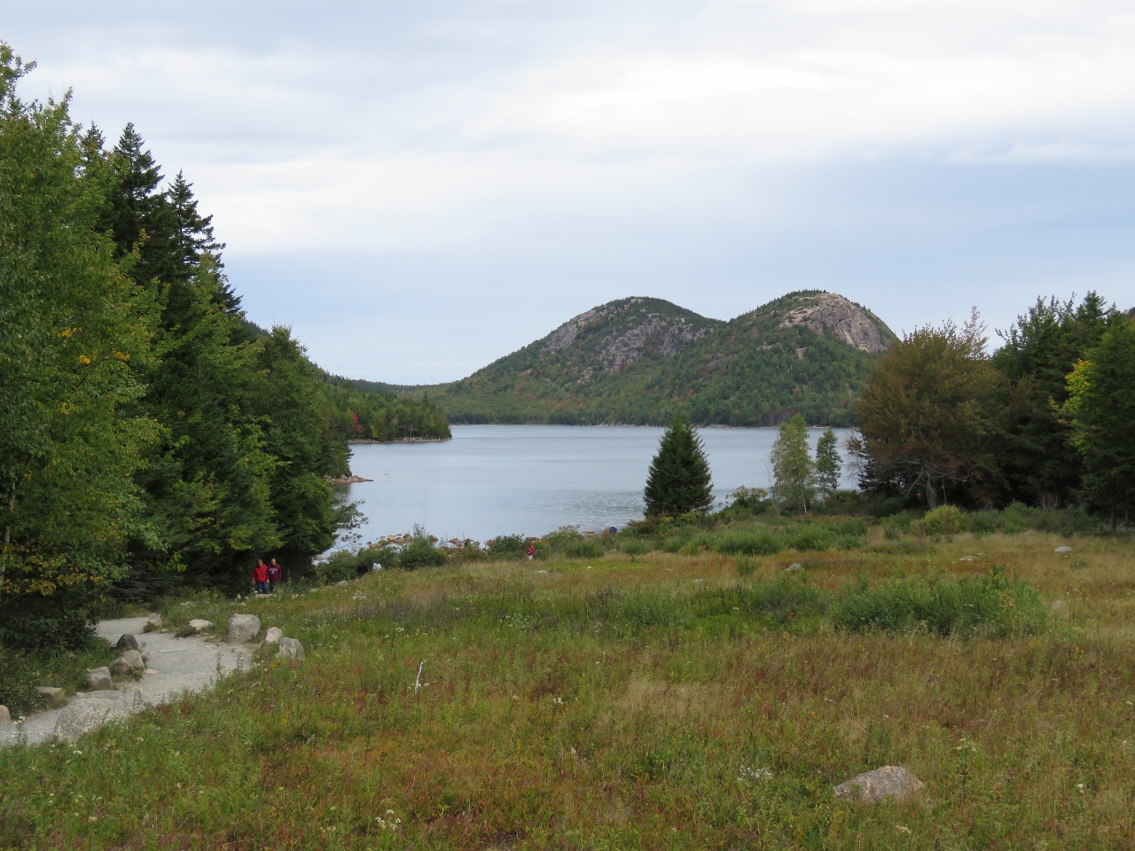 |
Lake from Jordon Pond
Position: -68 15.19, 44 19.26
Besides the food, visitors come to Jordan Pond House to take in the view over Jordan Pond to the Bubbles. We climbed South Bubble on the right during our previous trip.
|
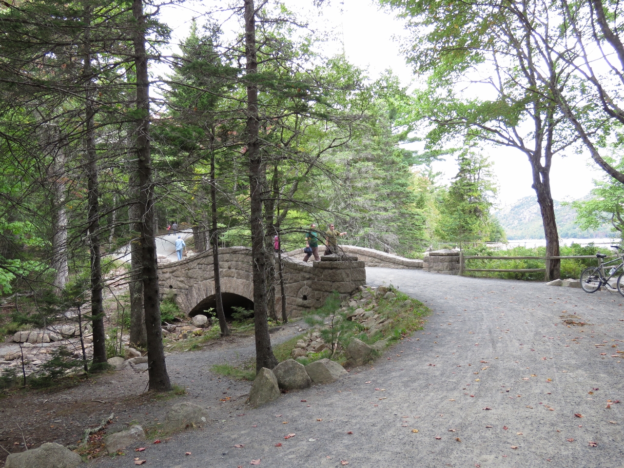 |
Jordon Pond Bridge
Position: -68 15.28, 44 19.31
The Jordon Pond Bridge was built in 1920 and leads from Jordan Pond House to the surrounding carriage roads.
|
 |
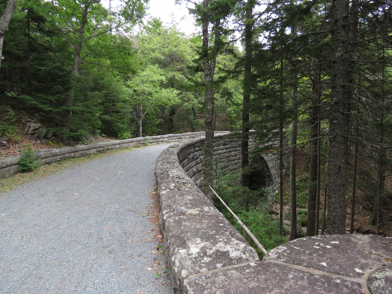
West Branch Bridge
Position: -68 15.53, 44 19.36
The West Branch Bridge was built in 1931 and has a single narrow arch in a 115ft span.
|
 |
Cliffside Bridge
Position: -68 15.80, 44 18.97
Cliffside Bridge was one of the last bridges constructed. Built in 1932, it carries the road past a steep section along the side of Penobscot Mountain. The bridge was built in the style of an English castle, with several platforms that provide sweeping views over the valley below.
|
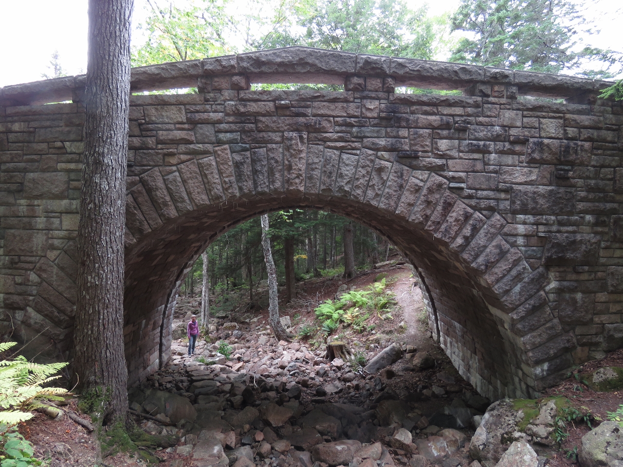 |
Amphitheater Bridge
Position: -68 16.19, 44 19.44
Jennifer standing at the bottom of the stone steps that carry the Amphitheater Trail creekside under Amphitheater Bridge. This bridge was built in 1931.
|
 |
Waterfall Bridge
Position: -68 16.85, 44 19.89
In the spring 40ft Hadlock Falls gush down the cliff beyond Waterfall Bridge. The falls framed by the bridge are one of Acadia’s iconic photo opportunities. The falls are not much more than a trickle now in early October.
|
 |
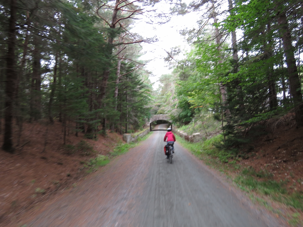
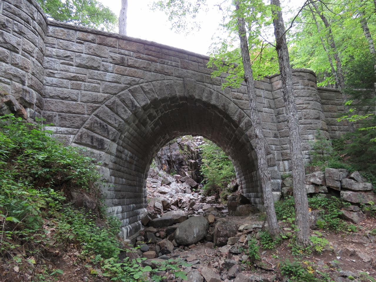
Hemlock Bridge
Position: -68 16.95, 44 19.92
Hemlock Bridge was built in 1924 and at 200ft long is one of the more expensive bridges built. It carries the road over Hadlock Brook. We’re almost back to signpost 12 now.
|

|
Click the travel log icon on the left to see these locations on a map, with the complete log of our cruise.
On the map page, clicking on a camera or text icon will display a picture and/or log entry for that location, and clicking on the smaller icons along the route will display latitude, longitude and other navigation data for that location. And a live map of our current route and most recent log entries always is available at http://mvdirona.com/maps. |
If your comment doesn't show up right away, send us email and we'll dredge it out of the spam filter.