Bar Harbor has been a popular tourist destination since the mid 1800s as tourists flocked in to experience Mt Desert Island’s incredible natural beauty. Thirty hotels operated in the town by 1880. Today Bar Harbor is the gateway to Acadia National Park, where over two million people from around the world visit annually. This year alone, 116 cruise ships were scheduled to call.
Trip highlights from our October 7th, 2016 visit to Bar Harbor, Maine follow. Click any image for a larger view, or click the position to view the location on a map. And a live map of our current route and most recent log entries always is available at http://mvdirona.com/maps
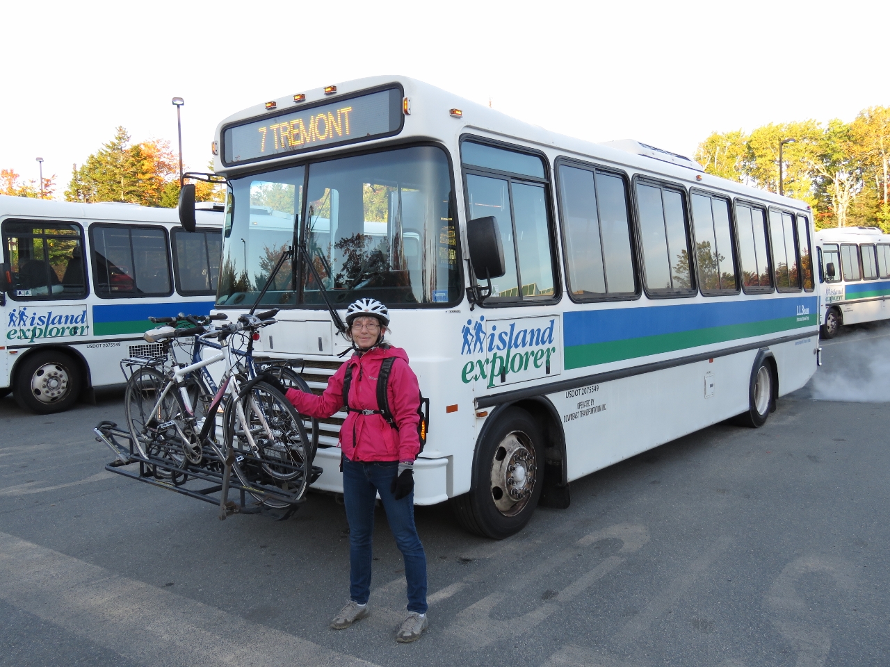 |
Island Explorer
Position: -68 22.43, 44 28.09
We dropped off our rental car in Ellsworth this morning and biked back toward Southwest Harbor to the start of the Island Explorer line, a free bus service that covers Mt. Desert Island. Here we are with the bikes loaded and ready to head into Bar Harbor. This will be our third form of transportation for the day.
|
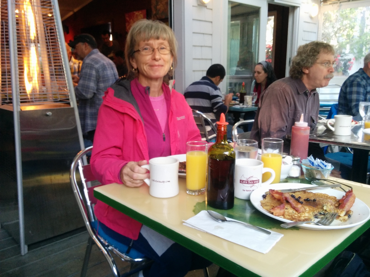 |
Cafe This Way
Position: -68 12.31, 44 23.22
We had an exceptional breakfast on the heated deck at Lonely Planet-recommended Cafe This Way. James had their signature dish, blueberry pancakes. The restaurant is incredibly popular and was packed the entire time we were there.
|
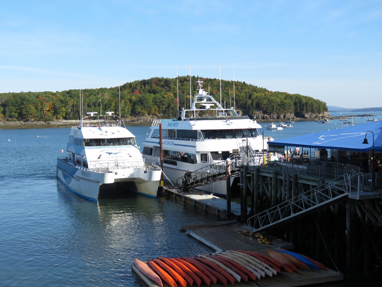 |
Whale Watching Boats
Position: -68 12.30, 44 23.47
Two large whale-watching boats at the piers in Bar Harbor were getting ready to take out a load of passengers.
|
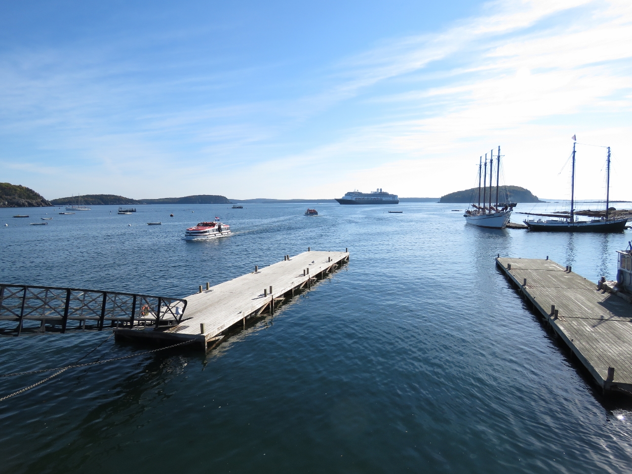 |
Rotterdam
Position: -68 12.24, 44 23.52
Tenders from the cruise ship Rotterdam, visible in the background, were ferrying passengers ashore all morning.
|
|
|
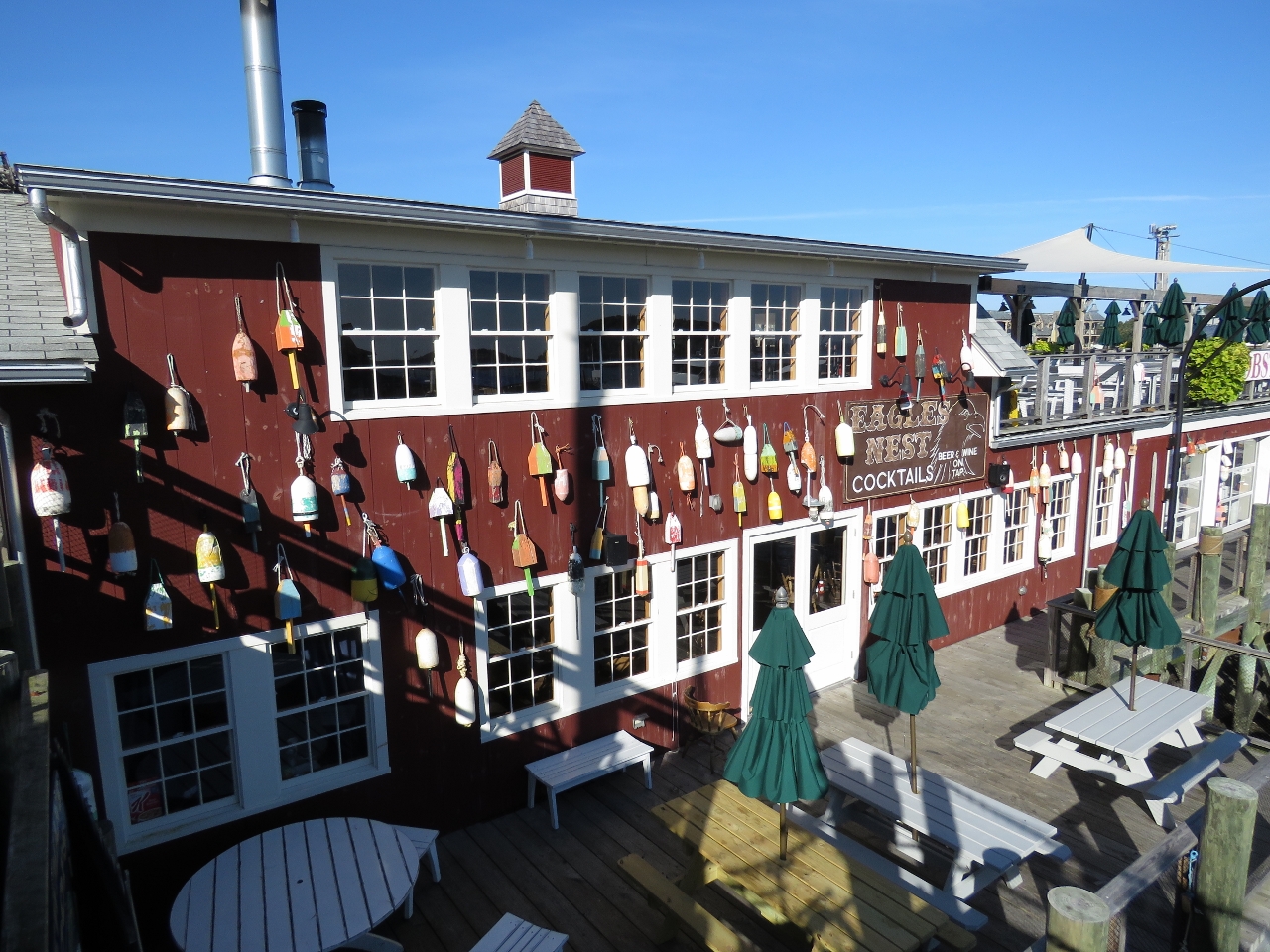
Floats
Position: -68 12.37, 44 23.46
Colorful floats on the wall of Stewman’s Lobster Pound. Lobster fisherman paint their floats in unique, bright patterns and colors to distinguish them among the hundreds of floats that pack the water.
|
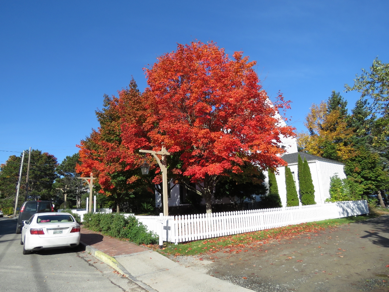 |
Fall Colors
Position: -68 12.58, 44 23.44
The fall colors are really starting to show now.
|
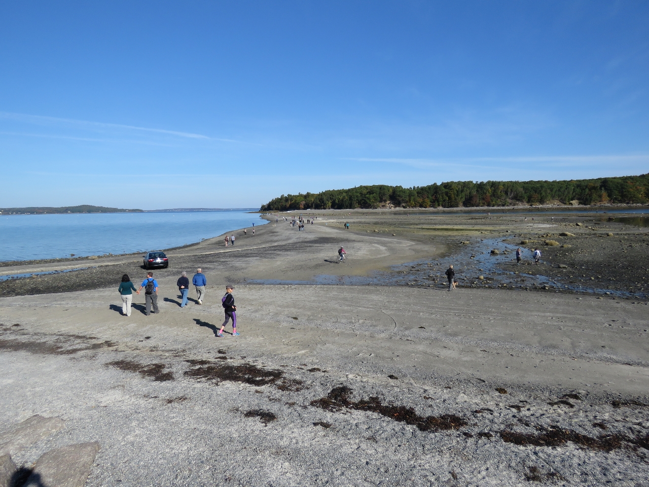 |
Bar Island Trail
Position: -68 12.61, 44 23.55
At low tide, the popular Bar Island Trail emerges to connect Bar Island with Bar Harbor. Jennifer is biking about center of the photo. We didn’t go all the way across as the going was a little difficult in soft sand for the bikes.
|
 |
Duck Brook Road
Position: -68 13.99, 44 23.65
About a mile from Bar Harbor, Duck Brook Road connects to the most northern section of Rockefeller’s Carriage Roads. Duck Brook Road isn’t part of the Carriage Road system, but has been closed to vehicle traffic since a washout damaged the road several years ago, making it an excellent bike path.
|
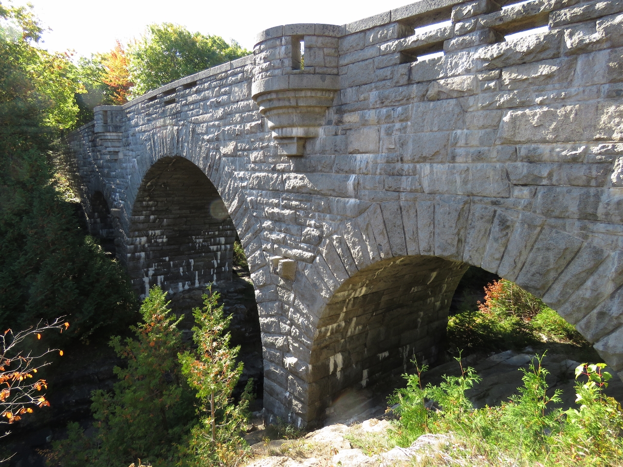 |
Duck Pond Bridge
Position: -68 14.15, 44 23.51
Duck Pond Bridge was completed in 1929 and is the tallest and most expensive Carriage Road bridge. It’s also the most ornate, with three arches and four viewing platforms. Stairs lead down to the creek below for a view back up to the bridge.
|
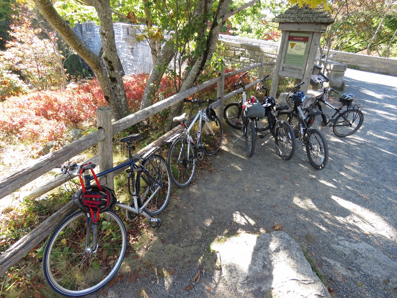 |
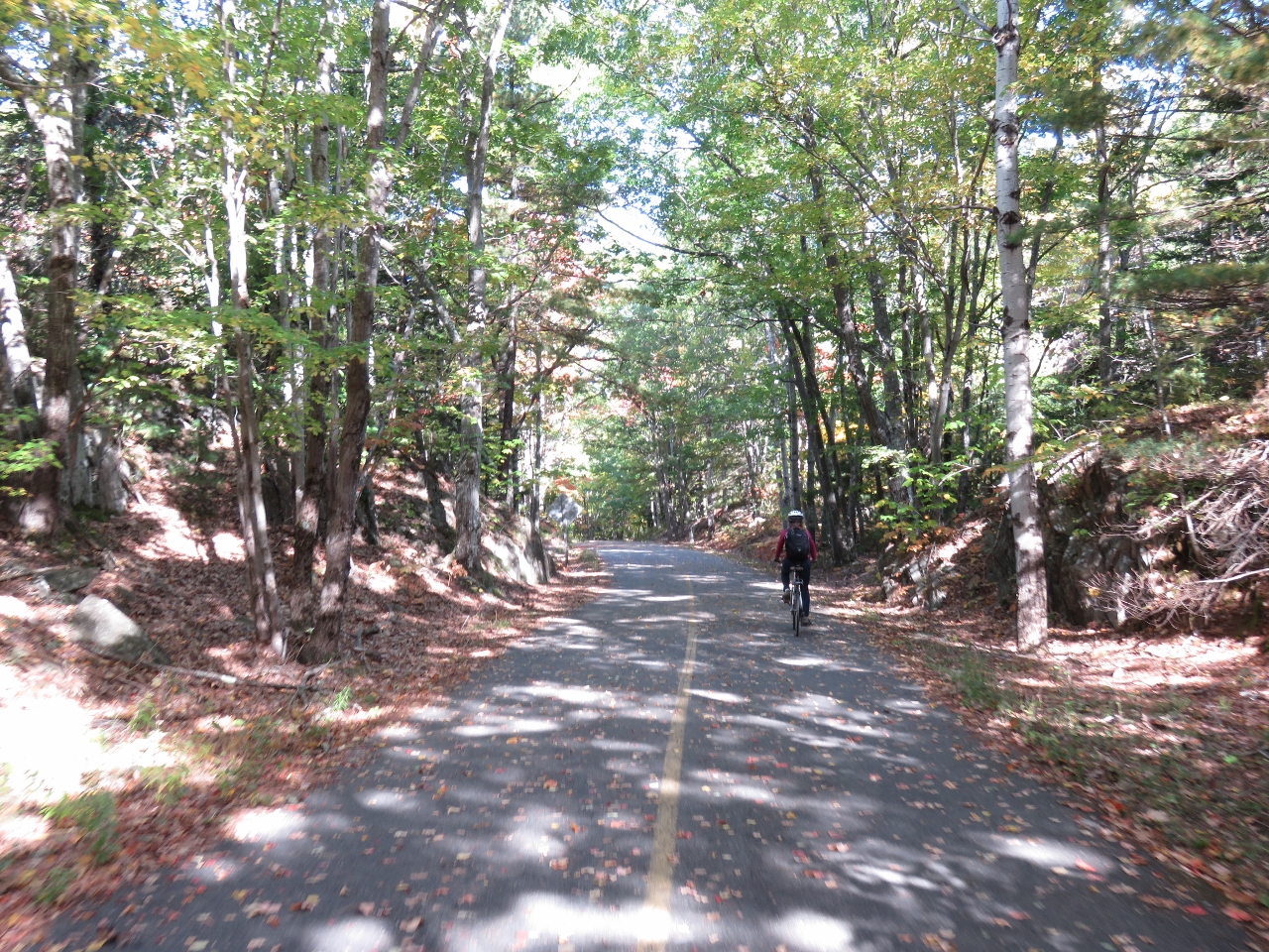
Bicycles
Position: -68 14.16, 44 23.52
We’re not the only ones enjoying the warm fall weather by bicycle on the carriage roads today.
|
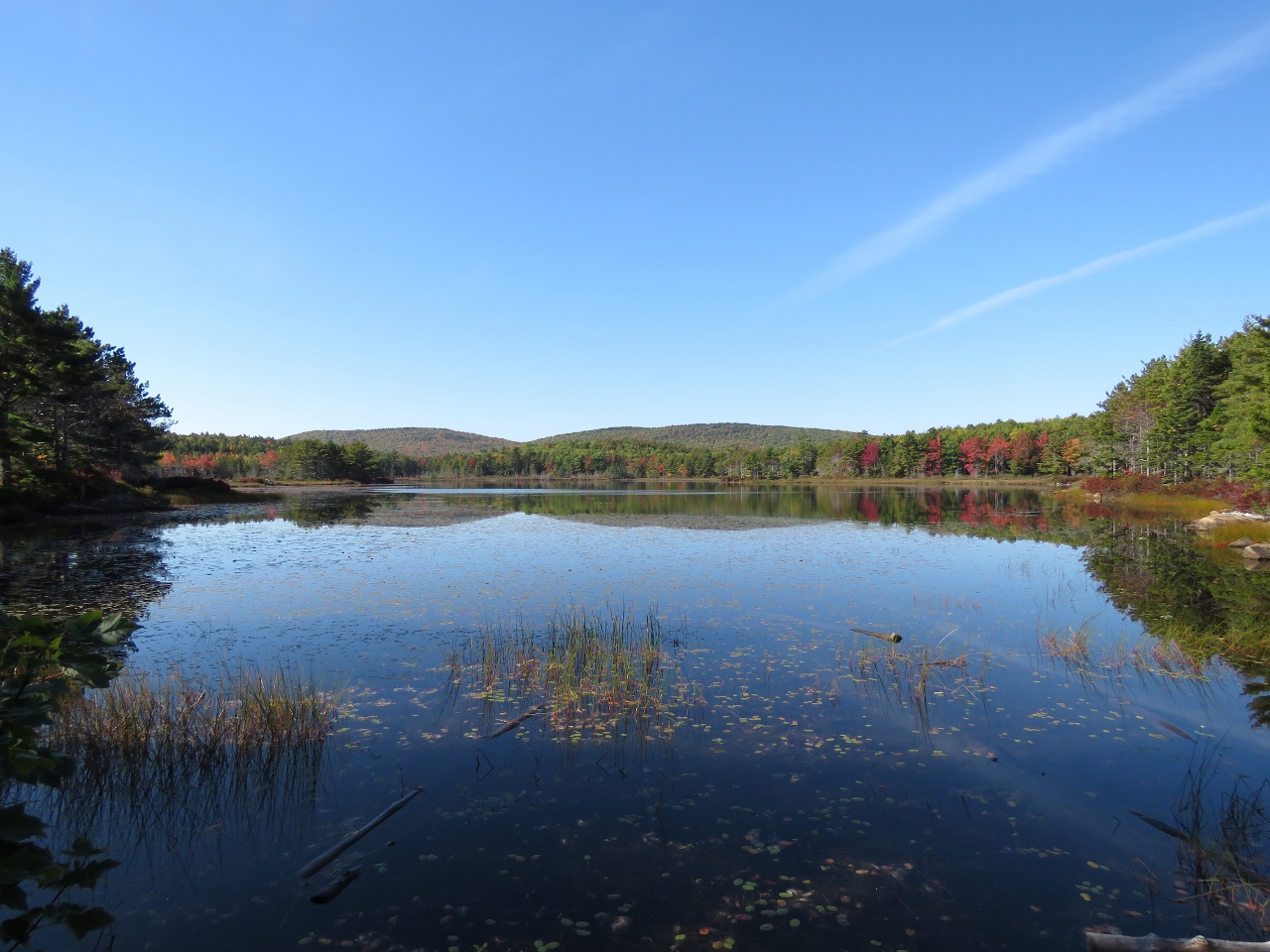 |
Witch Hole Pond
Position: -68 14.37, 44 24.13
Looking southwest across the northern tip of beautiful Witch Hole Pond. The weather today is wonderfully sunny and calm.
|
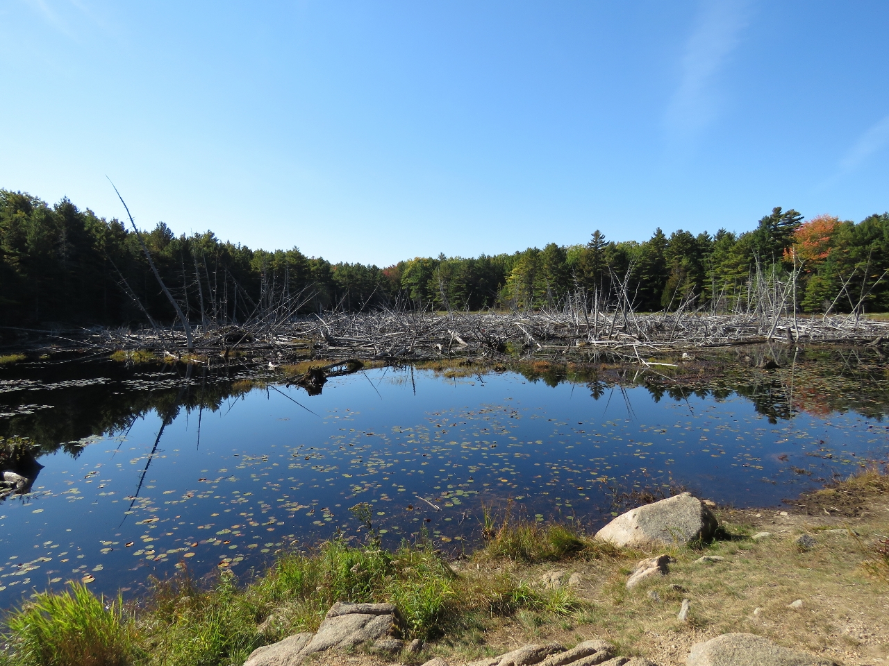 |
Beavers Pond
Position: -68 14.98, 44 23.69
Snags and a beaver lodge in Beavers Pond.
|
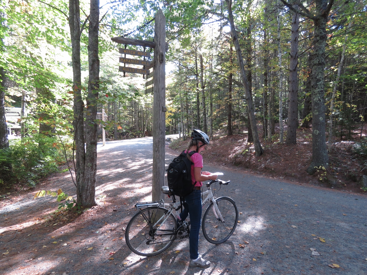 |
Signpost Four
Position: -68 15.01, 44 23.42
At signpost four, deciding which way to go. We could go south around Brewer Mountain to the north end of Eagle Lake, but opted instead to run east back to Bar Harbor.
|
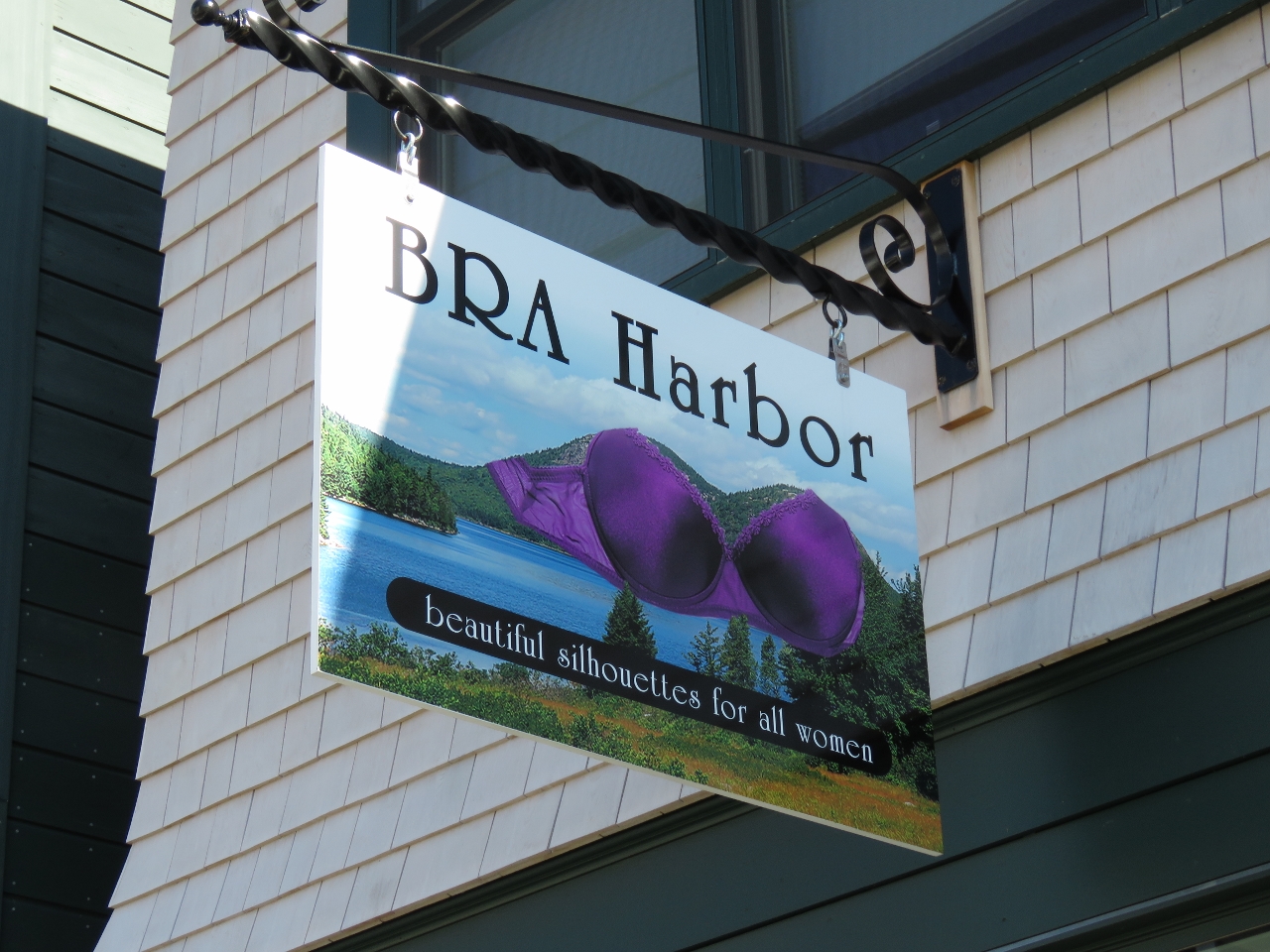 |
BRA Harbor
Position: -68 12.26, 44 23.30
We loved the name of this lingerie store in downtown Bar Harbor.
|
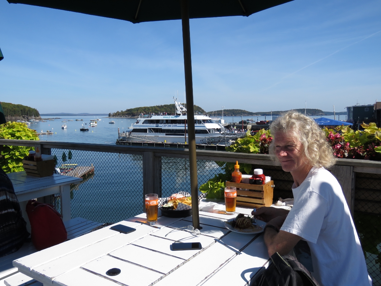 |
Stewman’s Lobster Pound
Position: -68 12.36, 44 23.48
We had a great seafood lunch on the upper deck overlooking the harbor at Stewman’s Lobster Pound.
|
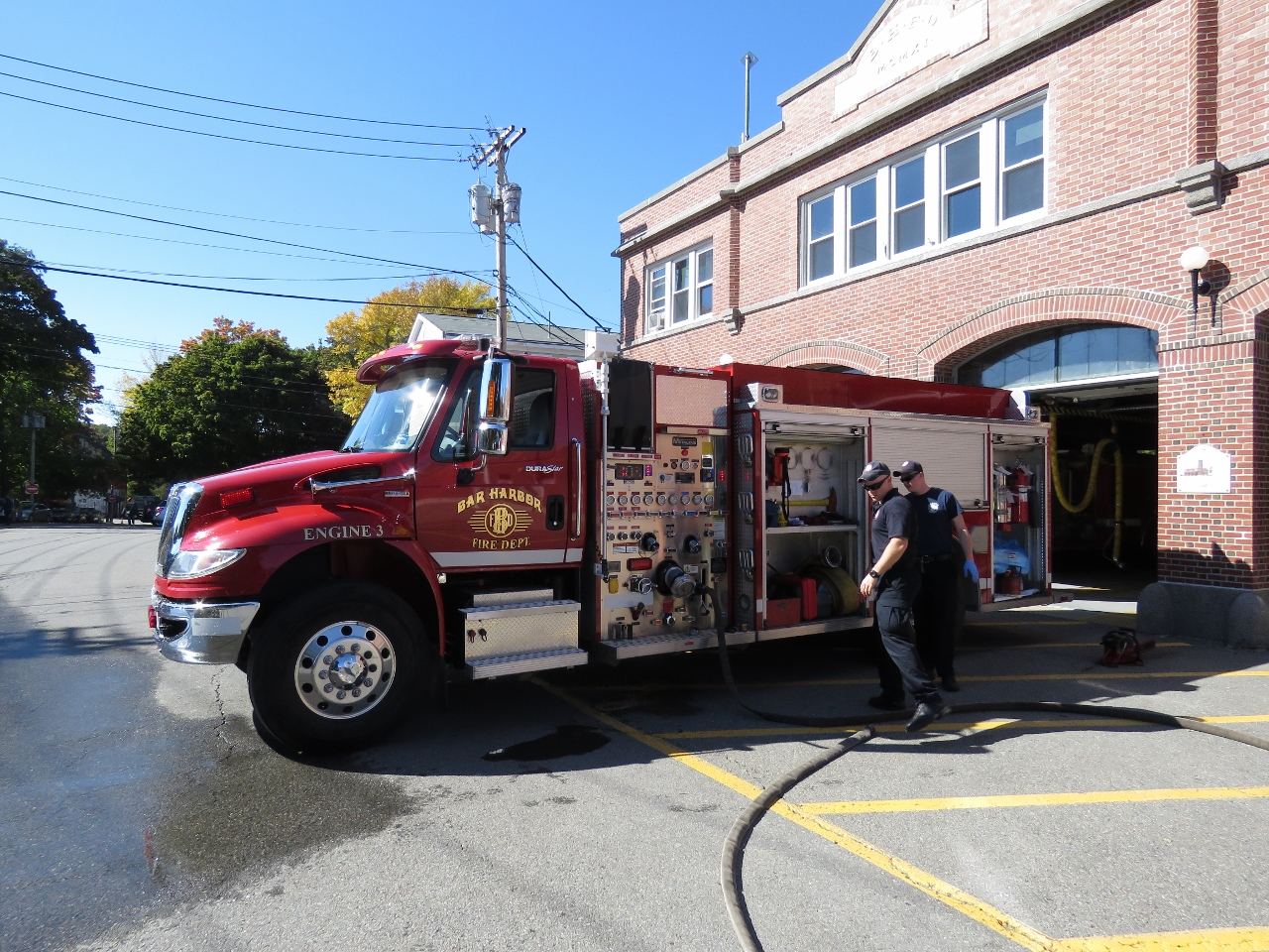 |
Fire Department
Position: -68 19.30, 44 16.47
The Bar Harbor Fire department is across the road from the Island Explorer bus stop. While waiting for our bus back to Southwest Harbor we watched them perform a weekly system check on one of the their fire engines.
|

|
Click the travel log icon on the left to see these locations on a map, with the complete log of our cruise.
On the map page, clicking on a camera or text icon will display a picture and/or log entry for that location, and clicking on the smaller icons along the route will display latitude, longitude and other navigation data for that location. And a live map of our current route and most recent log entries always is available at http://mvdirona.com/maps. |
If your comment doesn't show up right away, send us email and we'll dredge it out of the spam filter.