After landing in Newfoundland at Jersey Harbour, the following day we continued to the head of Harbour Breton and anchored in Nancys Cove in Northeast Arm. From there, we toured the area by dinghy and ended up running all the way back south to visit the town of Harbour Breton. With new jobs from the aquaculture industry and offshore oil drilling, the town appears to be thriving—great to see. We spent most of the day there and had a great time chatting with the locals, exploring the town and walking several view trails, and also stopped for lunch at a cafe overlooking the harbour.
Trip highlights from August 6th follow. Click any image for a larger view, or click the position to view the location on a map. And a live map of our current route and most recent log entries always is available at http://mvdirona.com/maps
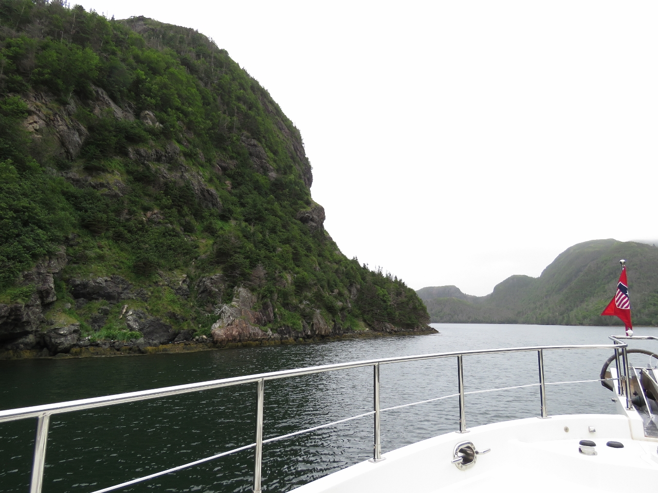 |
First Narrows
Position: -55 43.54, 47 34.12
Hugging the west shore as we pass through the First Narrows at the head of Northeast Arm at the extreme north end of Harbour Breton. The day is a little overcast, but the scenery still is amazing in this area.
|
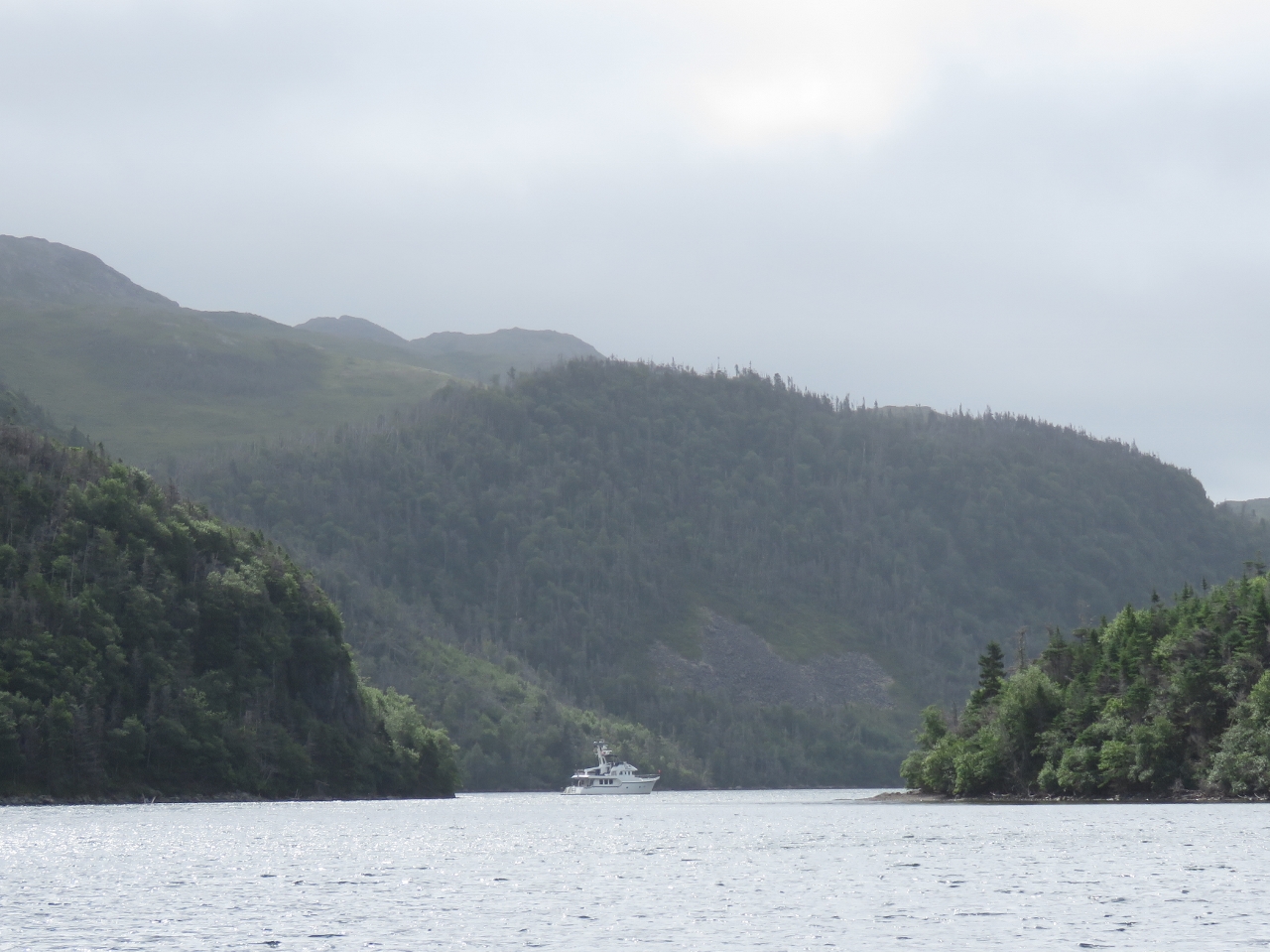 |
Nancys Cove
Position: -55 43.50, 47 34.97
We passed through the Second Narrows and toured Baldens Cove at the head for a possible anchorage. But a dozen houses face the water and the bay felt rather wide open, so we returned back go Nancys Cove between the First and Second Narrows. Here we had total privacy beneath soaring cliffs.
|
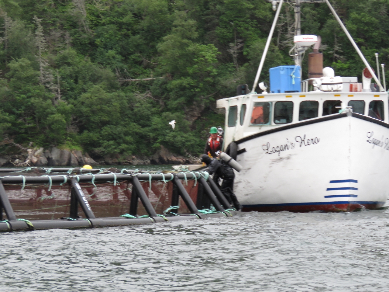 |
NHSF
Position: -55 45.01, 47 32.76
We toured Baldens Cove in the tender, looking for a place to climb up for a view, but couldn’t find one, so continued south. We’d passed several fish farms on the way north and stopped to chat with the workers there as a couple of divers worked to install new nets in the pens. The pens are owned by New Brunswick-based Northern Harvest Sea Farms (NHSF) and look relatively new. Each pen has 40,000 salmon and there were 12-16 pens at each of the three farms in the area. That’s over 1.5 million salmon.
|
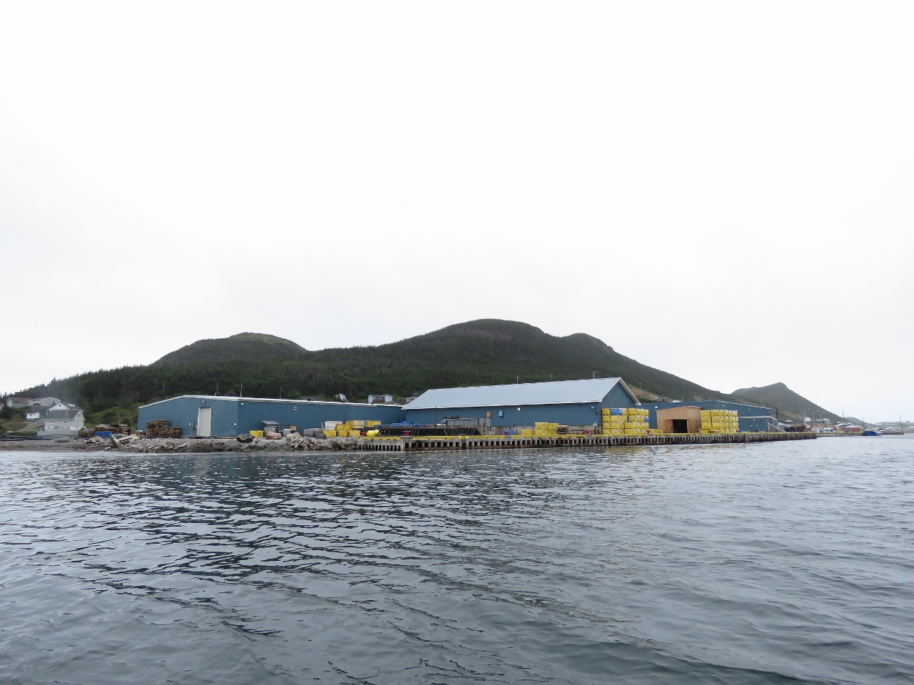 |
Aquaculture
Position: -55 47.75, 47 29.32
New buildings in support of the aquaculture industry at the town of Harbour Breton opposite last night’s anchorage at Jersey Harbour. We stopped to chat with some locals who said the industry brought 100+ jobs to the area. That and the skippering jobs available for the offshore oil industry were bringing a lot of people back to Harbour Breton who had moved away. The town seemed to be thriving, with much new home construction. Great to see.
|
 |
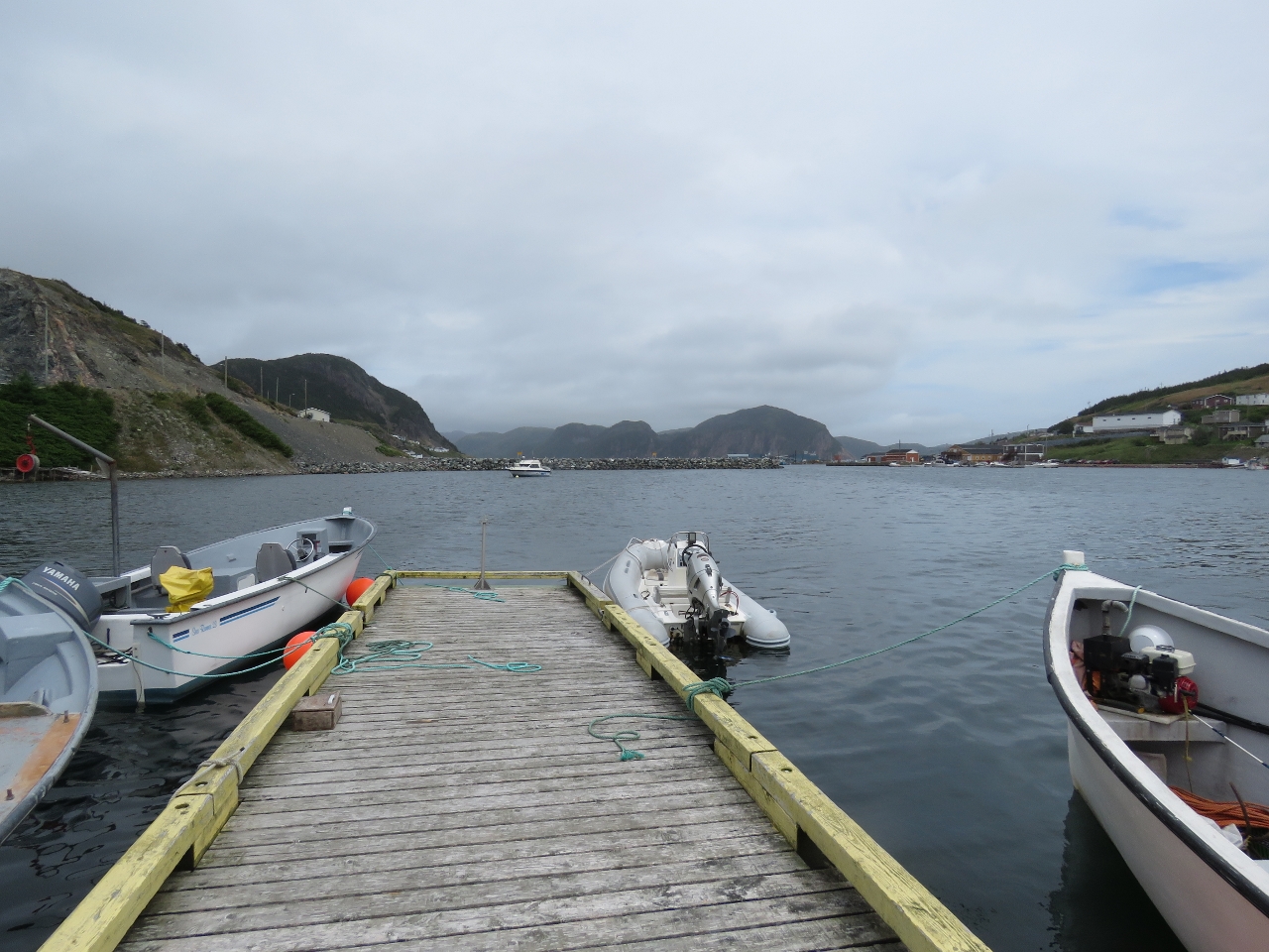
Moored
Position: -55 48.20, 47 28.90
The locals we spoke with said we could tie off at the floating dock nearby so we could have a walk around. The console of our tender is visible just west of their boat.
|
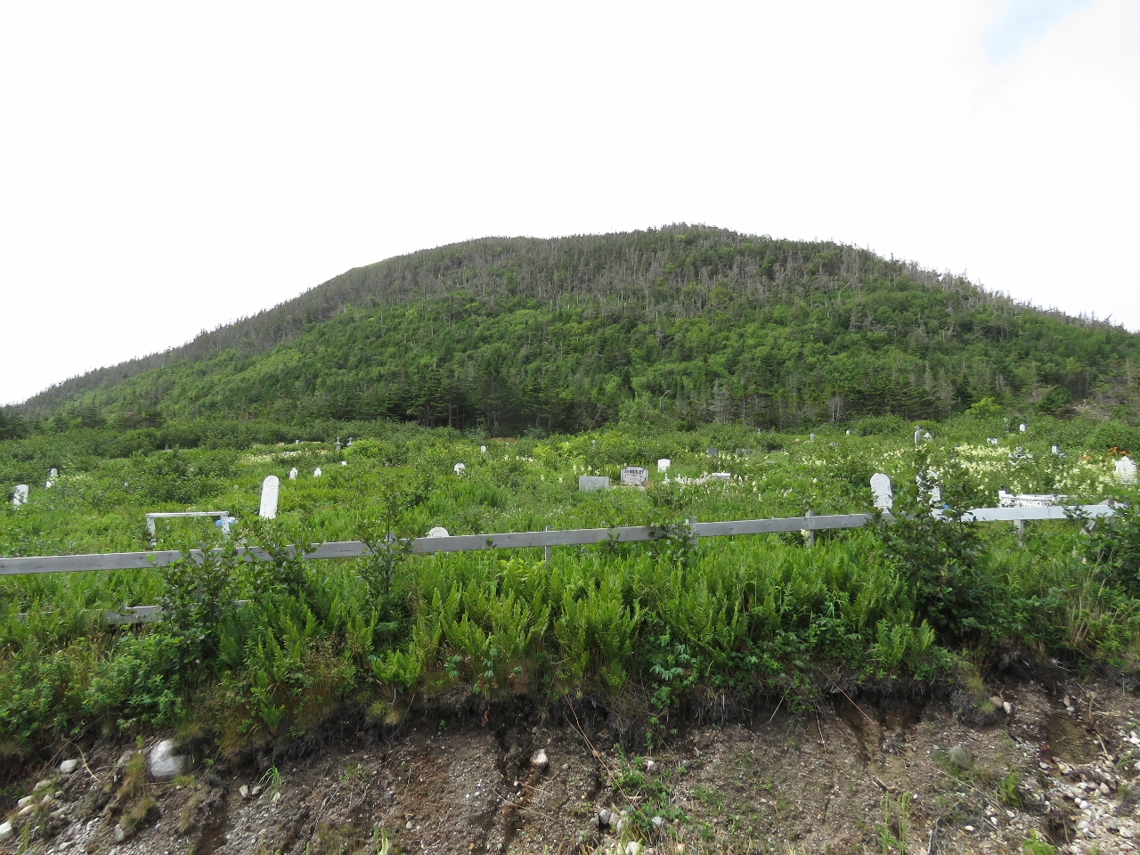 |
Anglican Cemetery
Position: -55 47.83, 47 28.73
Harbour Breton has been a fishing port since the mid-1600s. In 1687, 36 French fisherman and a Roman Catholic chapel were here. The 1713 Treaty of Utrecht excluded the French from the south coast of Newfoundland, and the Church of England became established here as British settlers and fishers moved in. This Anglican Cemetery one of several cemeteries in town.
|
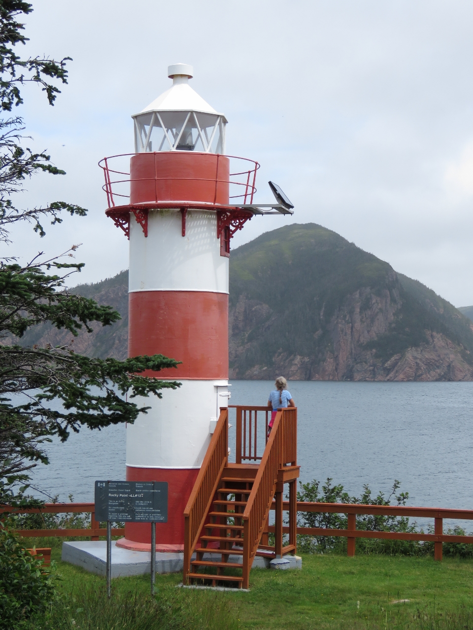 |
Rocky Point Light
Position: -55 47.65, 47 28.68
The town has built a nice trail to the Rocky Point Light with several interpretive signs and a great viewing platform. The original light at Rocky Point was built in 1873, the first light on the South Coast.
|
 |
Newman’s Lookout
Position: -55 48.07, 47 28.84
Harbour Breton has a series of nine trails and points of interests. This is the view from Number 8, Newman’s Lookout. The Newmans arrived in Harbour Breton in the 1790s and had a virtual monopoly on the South Coast fish trade. Their plantation was below the lookout that we’re on.
|
 |
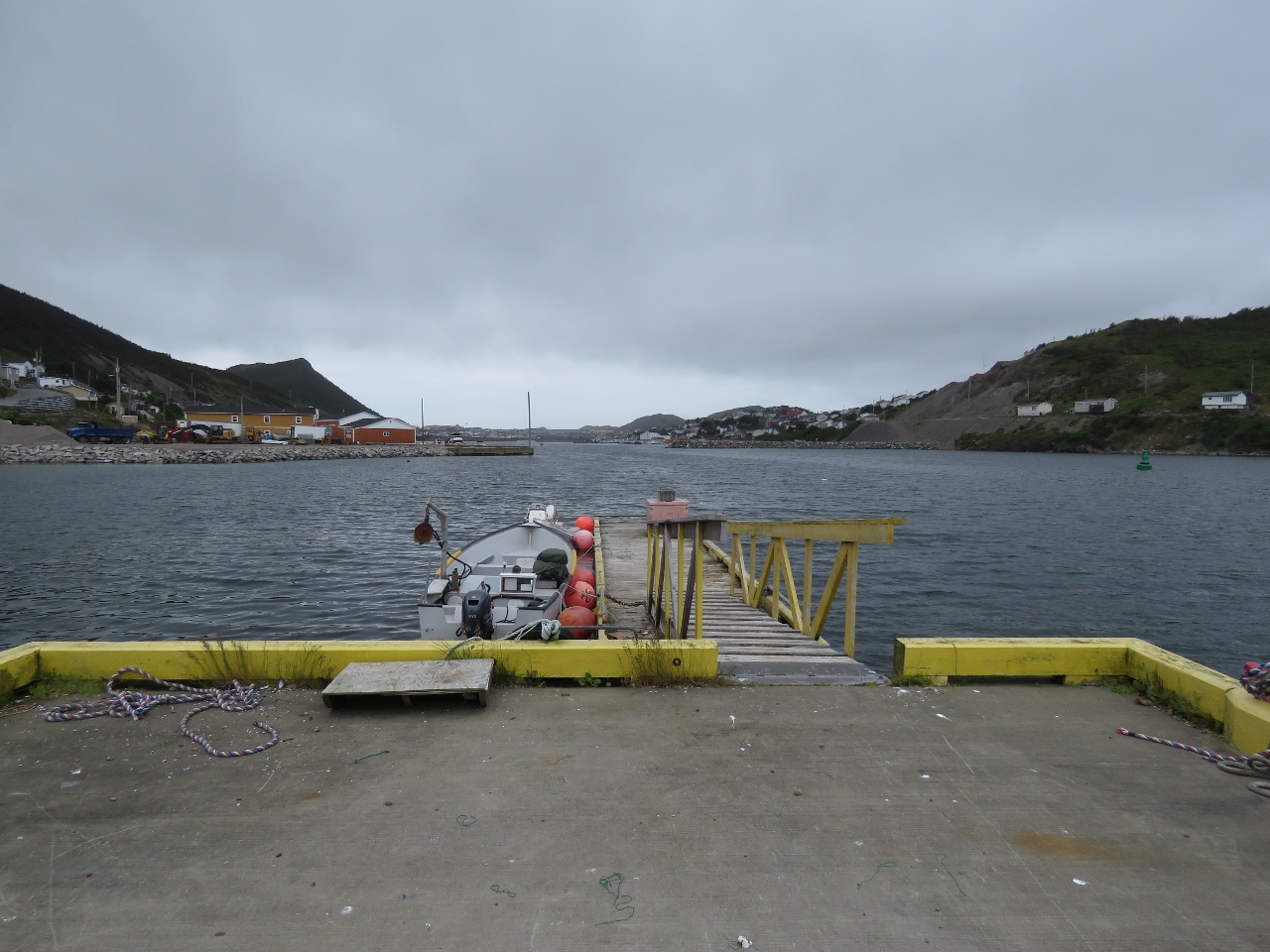
Government Wharf
Position: -55 48.73, 47 28.67
We ran the tender over to the north shore and tied off at the floating dock there to explore the other side of town.
|
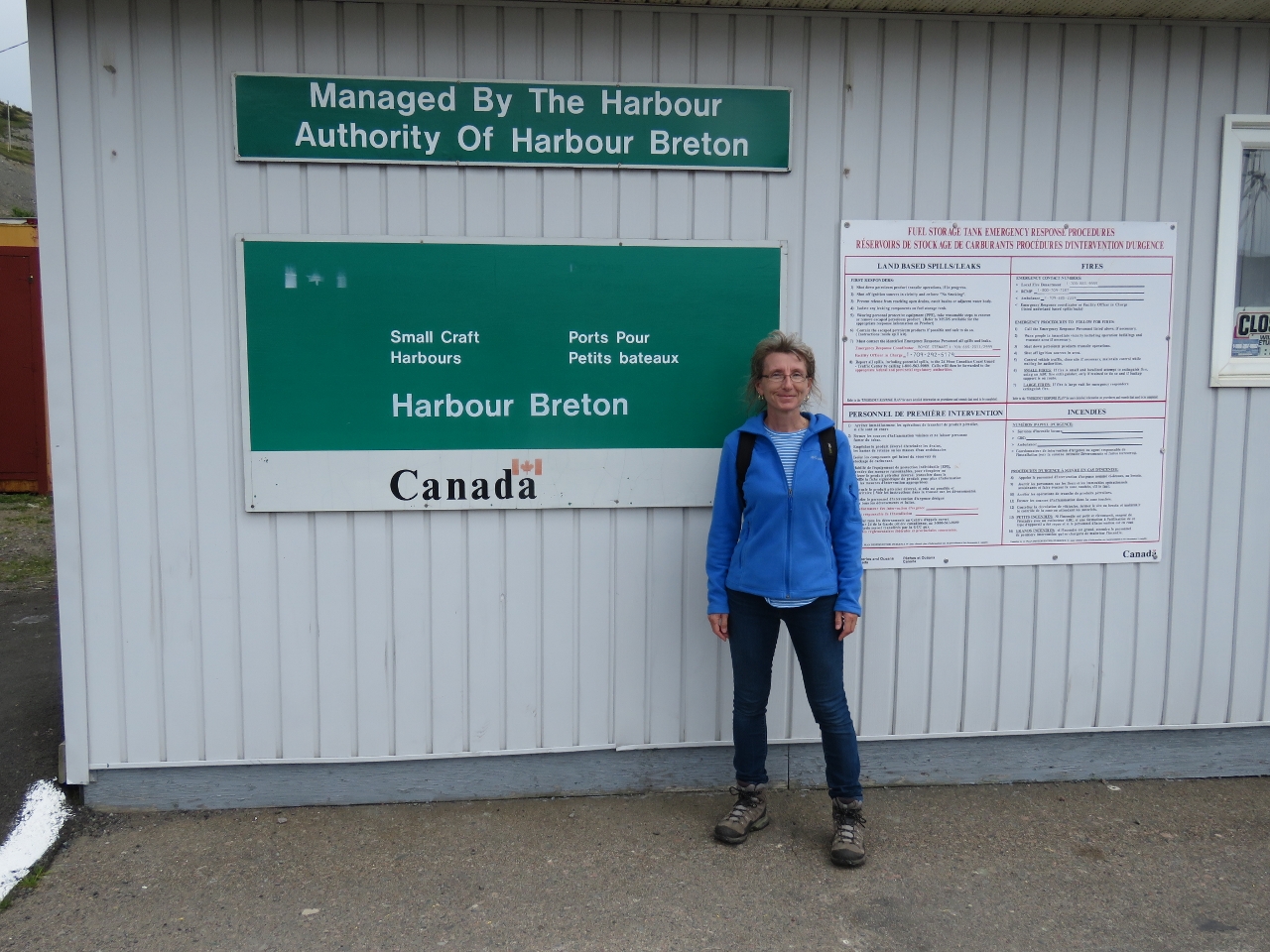 |
Harbour Breton
Position: -55 48.61, 47 28.77
Happy to be at Harbour Breton and back exploring in Canada.
|
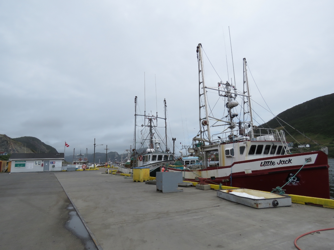 |
Little Jack
Position: -55 48.64, 47 28.75
Little Jack was one of a couple of dozen fishing vessels moored to the Government Wharf at Harbour Breton. Many were much smaller and more simply rigged than Little Jack though.
|
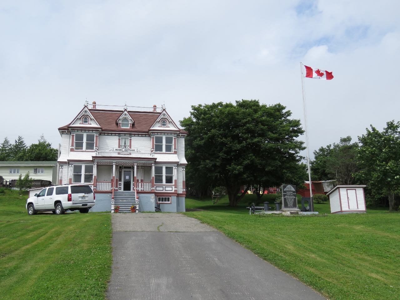 |
Sunny Cottage
Position: -55 48.74, 47 28.71
Sunny Cottage was built in the early 1900s for local fish merchant John J. rose using the ornate Queen Anne architectural style. The house was designated as a Registered Heritage Structure in 1988.
|
 |
Third Mooring
Position: -55 49.46, 47 28.28
The main commercial center for Harbour Breton is at the western head of the bay, but there are no public docks there. We asked a local if there was anywhere we might tie off to go ashore and he offered us a spot on the end if his pier.
|
 |
Inner Harbour
Position: -55 49.57, 47 28.26
The view across the inner harbour, just above where the tender is moored, looking east toward the Government Dock (beyond the bridge). Jersey Harbour where we anchored last night is in the far distance.
|
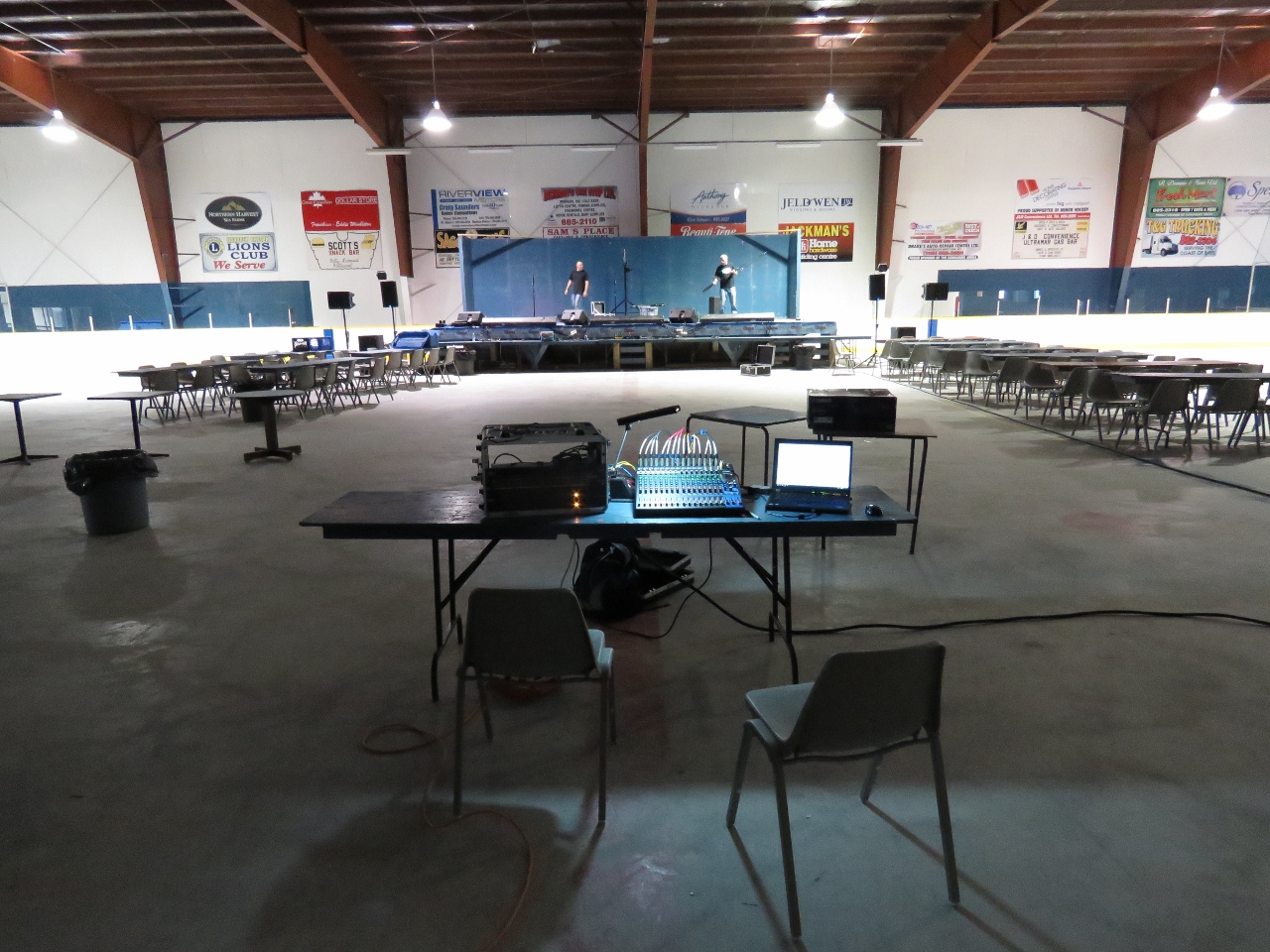 |
Connaigre Arena
Position: -55 49.76, 47 28.21
We heard loud music coming from the Connaigre Arena up the hill, but no cars in the parking lot, with a trailer being unloaded at one side. Thinking it might be a band doing a sound check, we went inside to investigate. It was the sound engineers preparing for a live concert that evening.
|
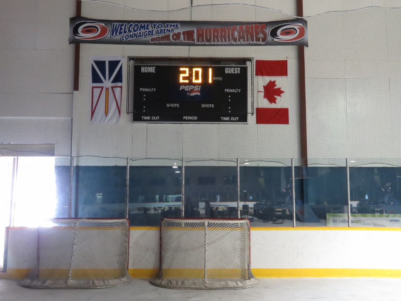 |
Hurricanes
Position: -55 49.76, 47 28.21
Connaigre Arena is home to the Hurricanes minor hockey team. We’ve not seen an ice hockey game since the Seattle Thunderbirds, a major Junior A team, moved out of downtown Seattle in 2009. It would have been great to watch a game, but we’re a little out of season.
|
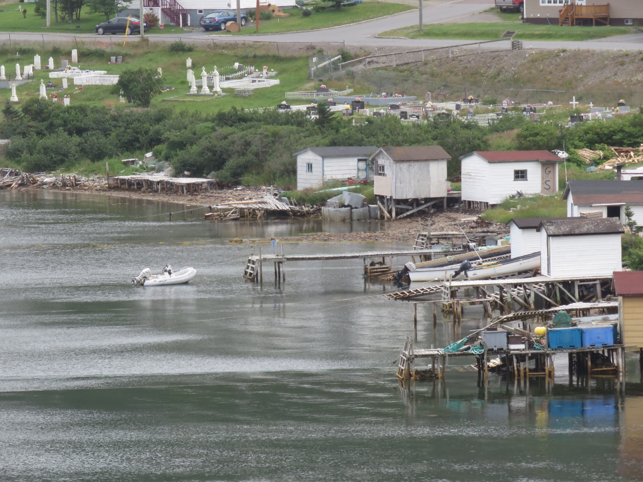 |
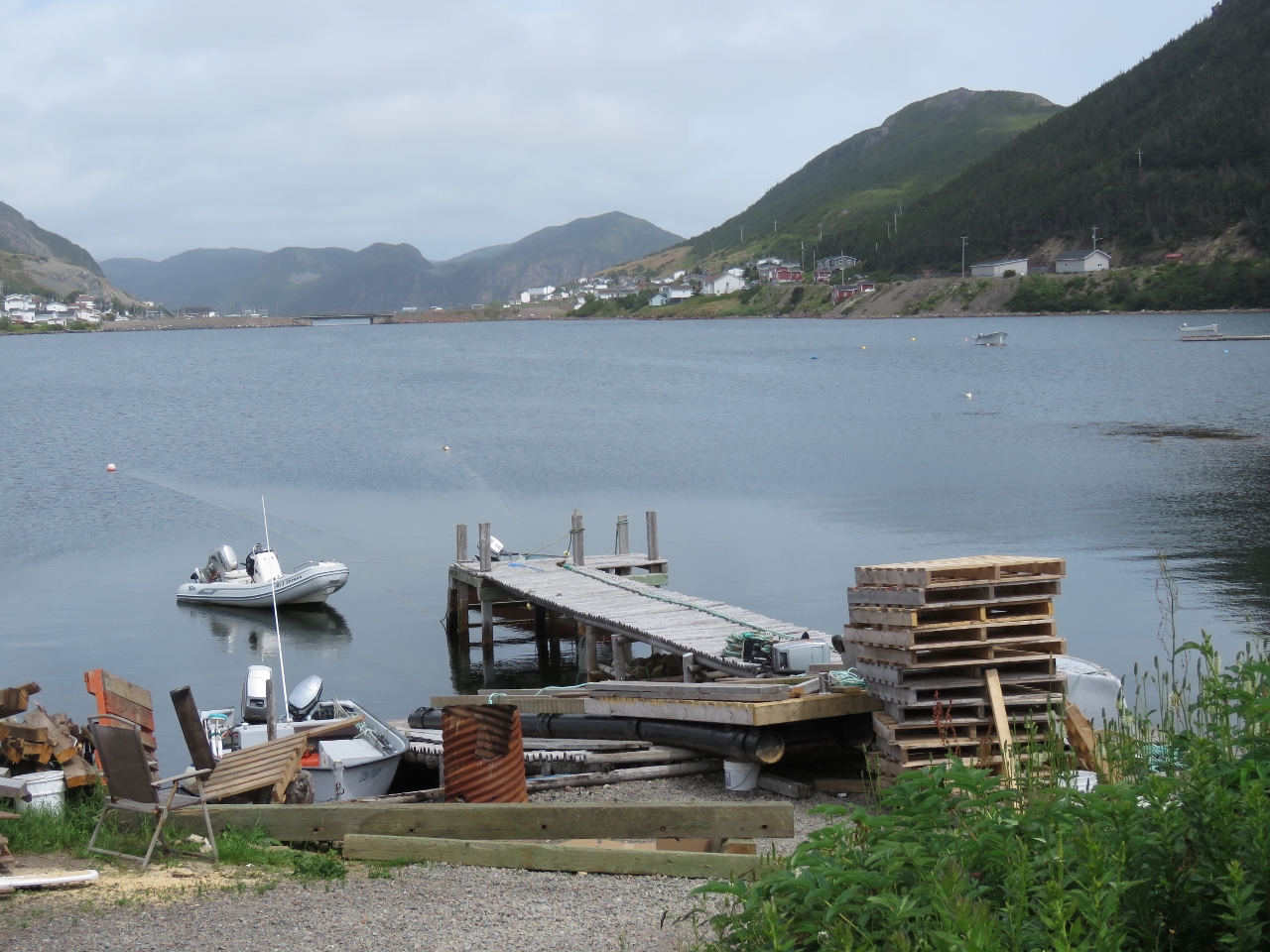
Docks
Position: -55 49.73, 47 28.34
Looking south across the private docks at the head of the inner harbour. Another cemetery is visible in the distance. That’s our tender in the middle of the picture.
|
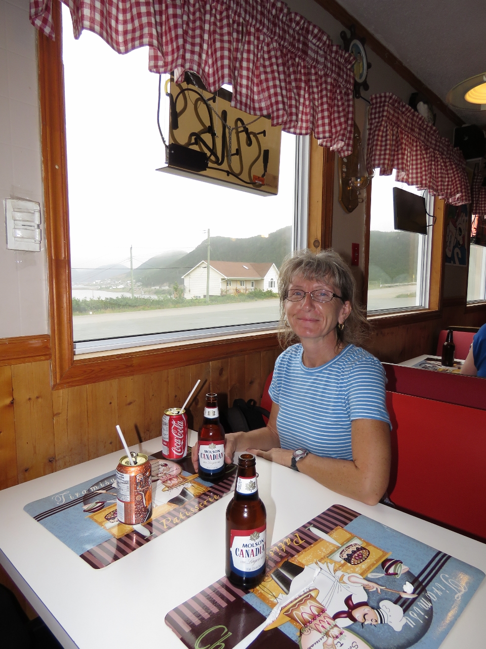 |
Scott’s
Position: -55 49.65, 47 28.17
We stopped for an good lunch at Scott’s Snack Bar with a view to the harbour. We had a late lunch around 2:30, and the place was empty when we’d first walked past. But by the time we left the restaurant was half-full and lined up nearly out the door. We couldn’t decide if people were having a late lunch or an early dinner, but there sure were a lot of them.
|
 |
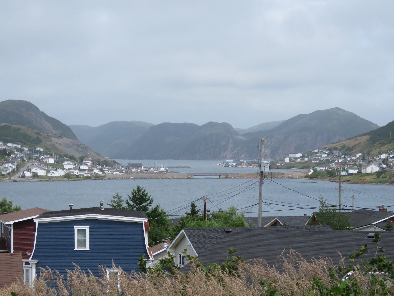
Pierce’s Point Lookout
Position: -55 48.65, 47 28.91
Number 4 on the 9-count Harbour Breton points of interest list is Pierce’s Point Lookout, and an easy walk from the Government Wharf on the north shore of town. The lookout has excellent views–this is looking east toward Jersey Harbor.
|
|
|
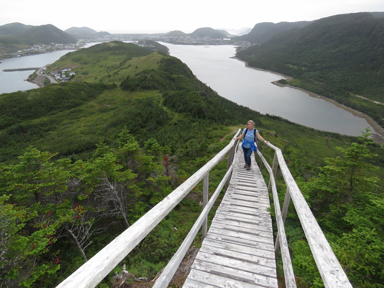
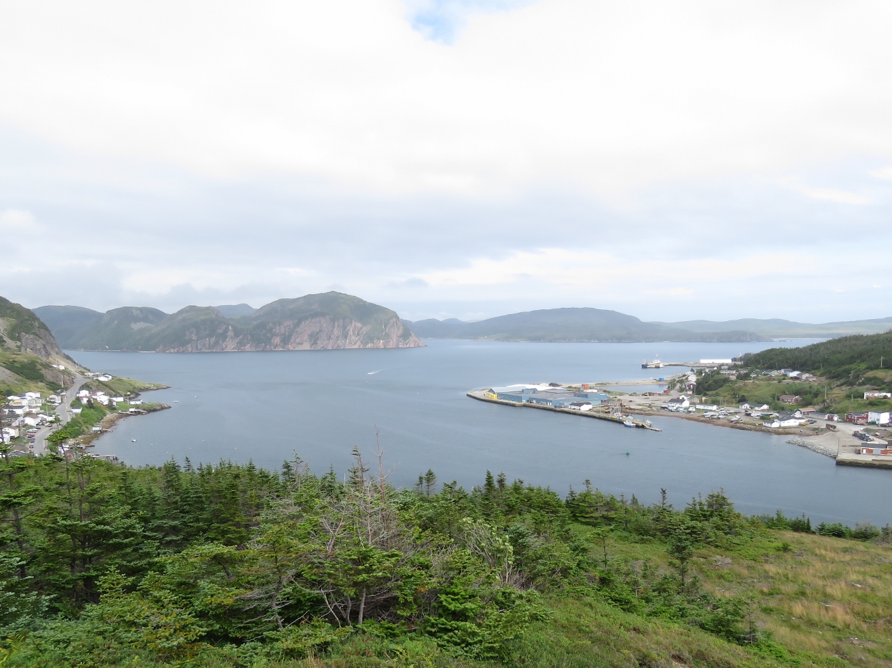
Gun Hill Trail
Position: -55 48.25, 47 29.27
We could see the stairs and walkways of the Gun Hill Trail from lunch at the restaurant way on the other end of town and weren’t planning to walk the trail as it looked to far for so late in the day. But from Pierce’s Point Lookout, it looked enticingly near. The trail is steep, but beautifully-built and relatively easy to walk. And the views along the way are incredible.
|
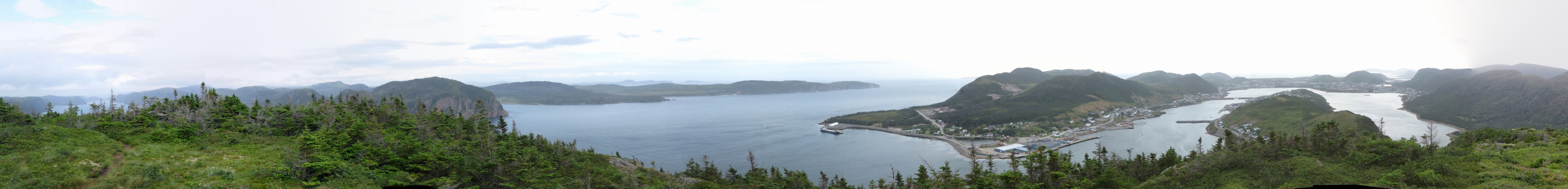 |
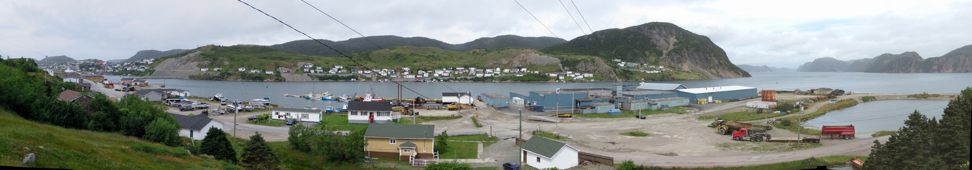
Gun Hill Lookout
Position: -55 48.05, 47 29.32
The 360-degree view from the top of the trail at Gun Hill Lookout, about 600ft above sea level. The extreme left of the photo is Northeast Arm where we are anchored at the head. Jersey Harbor where we anchored last night is roughly at the center of the photo, Rocky Point is slightly right of center, and the town of Harbour Breton extends to the right of the photo. The Government Wharf where our tender is tied off is behind the breakwater that extends partway across the waterway near the right of the photo.
|

|
Click the travel log icon on the left to see these locations on a map, with the complete log of our cruise.
On the map page, clicking on a camera or text icon will display a picture and/or log entry for that location, and clicking on the smaller icons along the route will display latitude, longitude and other navigation data for that location. And a live map of our current route and most recent log entries always is available at http://mvdirona.com/maps. |
If your comment doesn't show up right away, send us email and we'll dredge it out of the spam filter.