Little Bay was our first of many amazing anchorages in Bay d’Espoir on Newfoundland’s Southwest Coast. We left Harbour Breton in a fog thick enough to warrant our fog horn, but visibility improved in time for us to get a view to dramatic Connaigre Head and was clear once we reached Little Bay. There we anchored below a beautiful waterfall and climbed to the top for a sweeping view over the anchorage.
We’re sure loving the scenery here in Newfoundland. And it’s wonderful to be out cruising again. Ironically, even though we’ve covered 15,650 miles in the past year, it’s been fourteen months since our last real cruising, through the Kimberley region of Western Australia last June.
Trip highlights from August 7th, 2015 follow. Click any image for a larger view, or click the position to view the location on a map. And a live map of our current route and most recent log entries always is available at http://mvdirona.com/maps
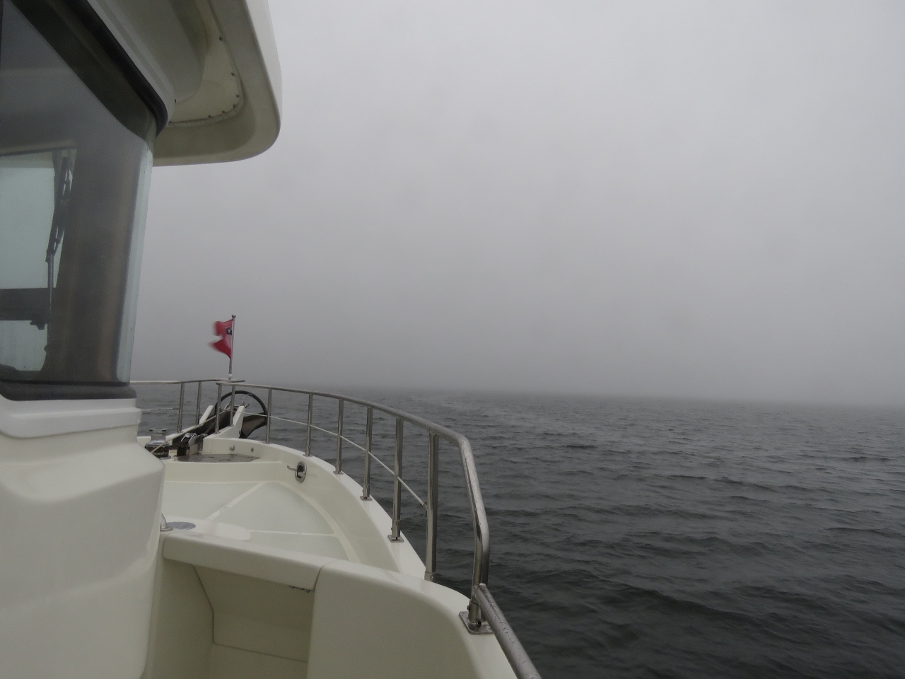 |
Fog
Position: -55 45.91, 47 31.91
Underway in a heavy fog with the newly-installed loudhailer sounding a fog signal (one long blast every two minutes). We also turn on the forward and side-facing floodlights—our experience with fishing boats in British Columbia is that the floodlights punch through the fog and make a boat visible considerably earlier.
|
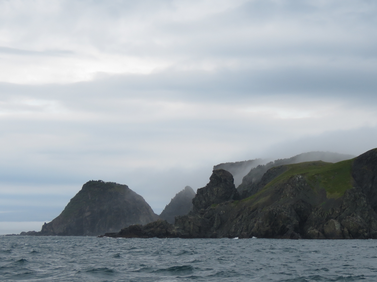 |
Connaigre Head
Position: -55 55.17, 47 25.92
Fortunately the fog lifted as we neared Connaigre Head and we got a great view to the dramatic coast line there. It sure looks rugged and forbidding.
|
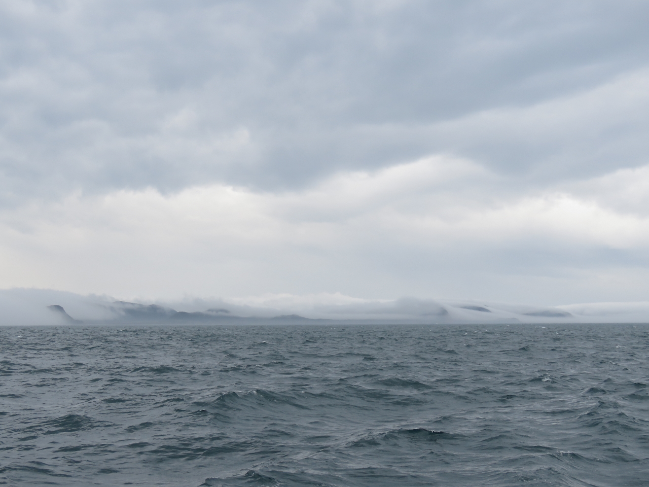 |
Fog scape
Position: -55 55.67, 47 25.93
Looking behind us the fog looked beautiful against the cliffs.
|
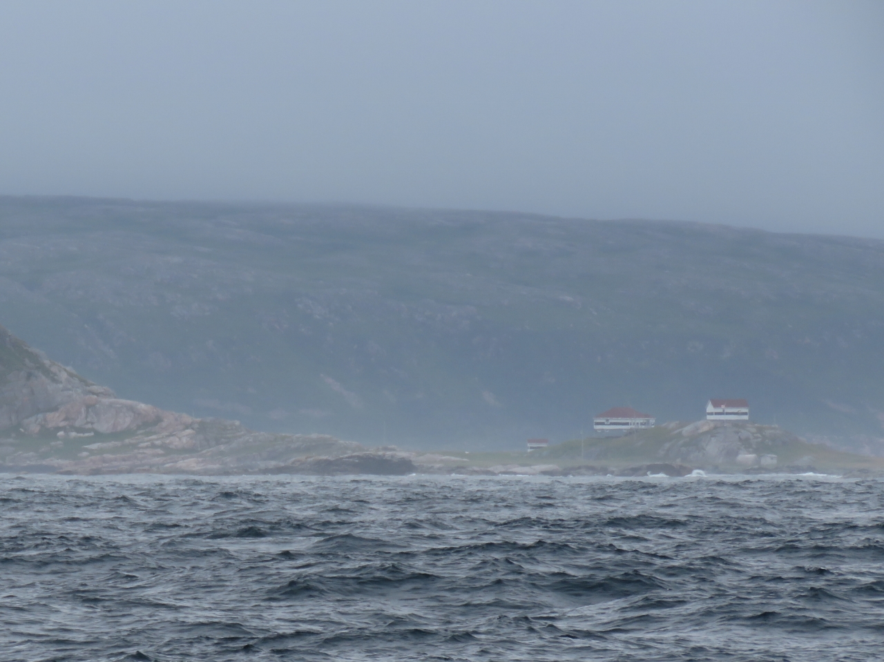 |
Pass Island
Position: -56 15.06, 47 28.93
We went around the west side of Pass Island, but could have run east through Pass Island Tickle. Pass Island has long been a fishing base—Captain Cook noted fishermen there in 1763. The close-knit community in the island resisted resettlement until finally relocating in 1794. This is the light station at the southern tip of Pass Island. The original lighthouse there was built in 1879.
|
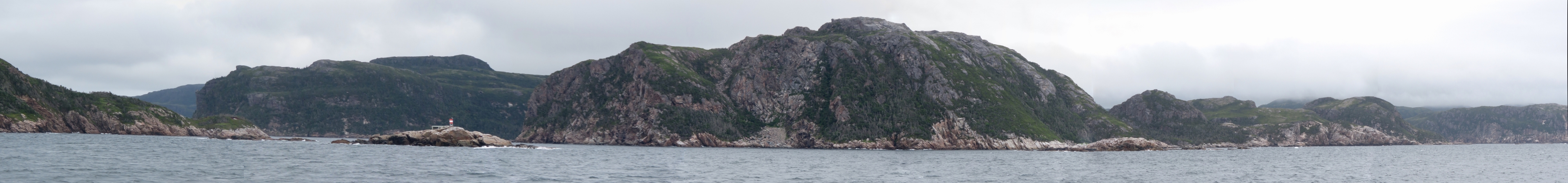 |
Tinker Rock
Position: -56 3.44, 47 36.47
The light on Tinker Rock, near the left of the photo, before a dramatic coastal seascape. We’ll be passing just to the right of Tinker Rock to enter Bay d’Epoir where we’ll cruise for a few days.
|
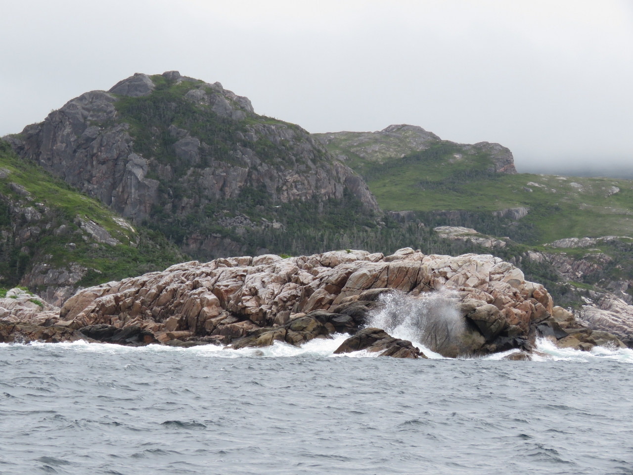 |
Rugged
Position: -56 3.17, 47 36.62
Wave-swept rocks opposite Tinker Rock as we enter the channel.
|
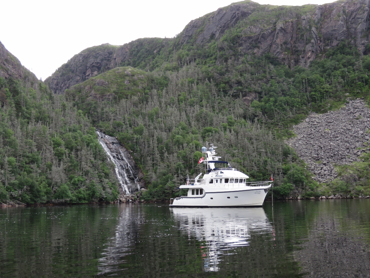 |
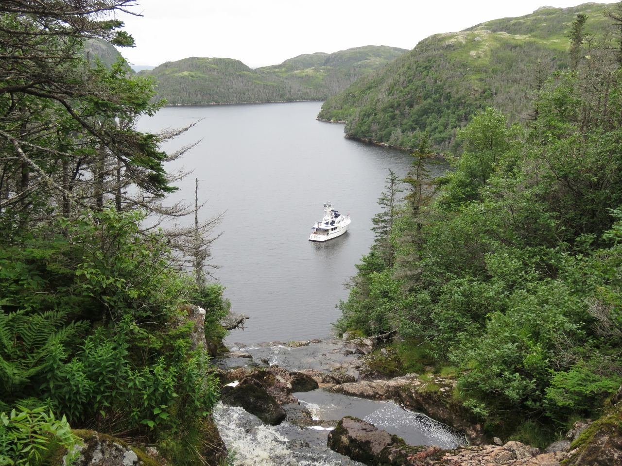
Little Bay
Position: -56 0.95, 47 37.98
The chart shows aquaculture in Little Bay, but it was clear when we arrived. We anchored in front of a beautiful waterfall, surrounded by steep cliffs. In 100ft we had just barely enough room to put out 300ft of chain, but held well when we tested the set. And wow, what an amazing spot.
|
 |
Falls
Position: -56 0.87, 47 38.05
Our cruising guide, The Cruising Guide to Newfoundland by Pilot Press, mentioned a “nice climb” to the top of the falls, but with no more detail. We landed on the east side of the falls, which looked like the best place to climb from.
|
 |
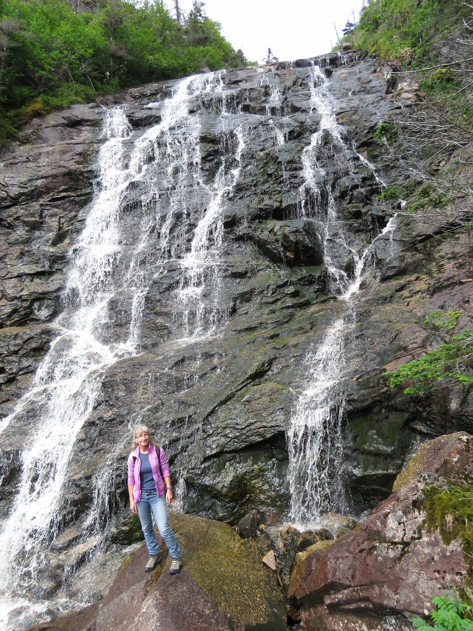
Climbing
Position: -56 0.86, 47 38.06
“Nice” wasn’t exactly the word that came to mind as we ascended the cliff. It’s pretty steep. But the views are amazing. On the return, we stayed inside the tree line, which was just as steep and quite overgrown, but safer and easier overall. Along the way down, we did see evidence that others had taken a similar path.
|
|
|
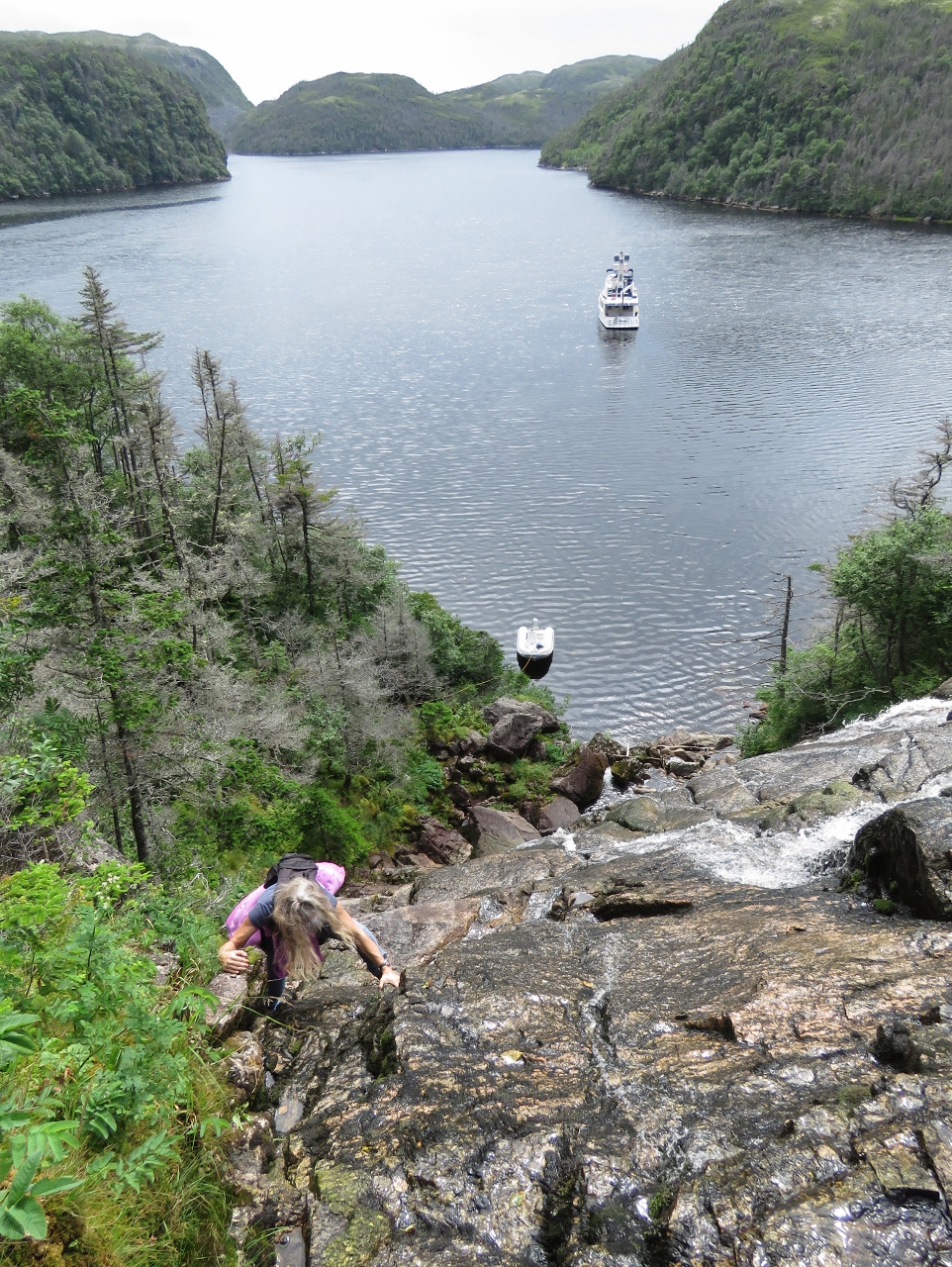
Halfway
Position: -56 0.86, 47 38.07
About halfway up we reached a cliff on the east side and crossed over to continue along the west side of the falls where we picked up a faint trail. This is the view looking down near where we crossed the falls.
|
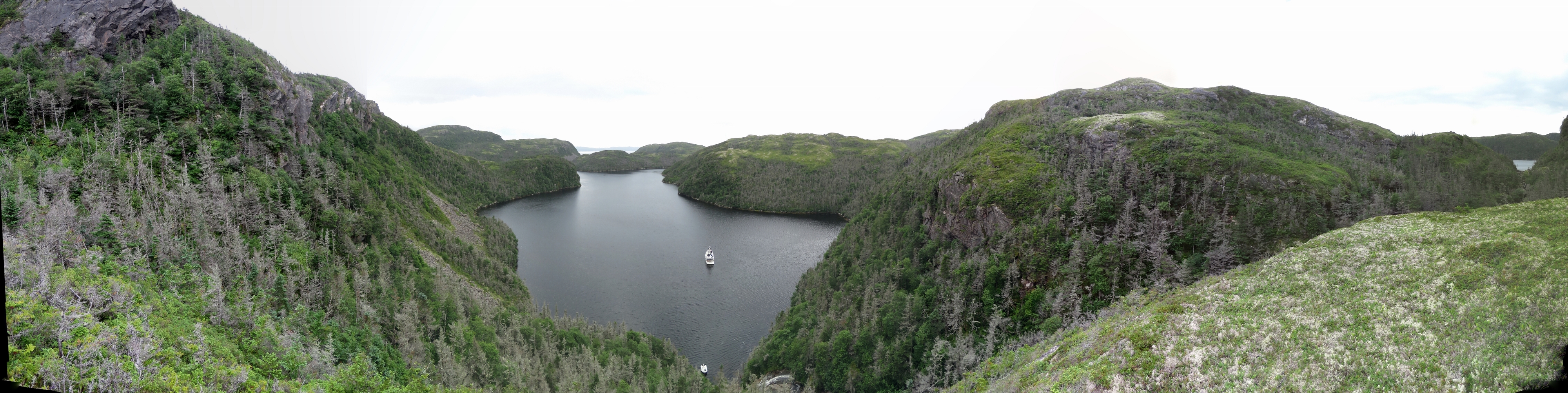 |
View
Position: -56 0.84, 47 38.09
Once at the top of the fall, we crossed back over the east side walked up to a bluff above the falls for a sweeping view of the anchorage and area. To our north, at the far right of the panorama, is the lake that feeds the falls.
|
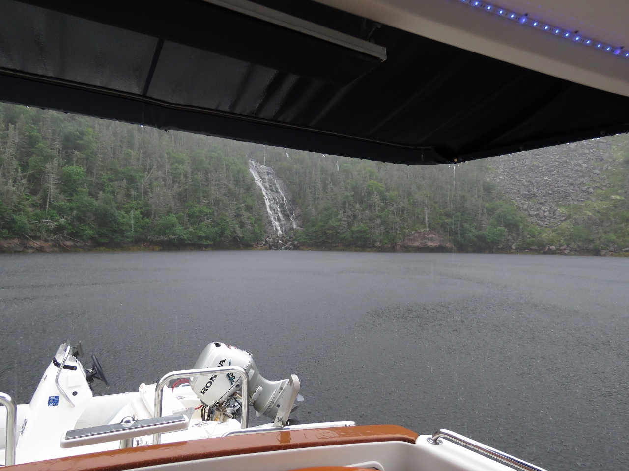 |
Rain
Position: -56 0.91, 47 38.00
After returning from the climb up the falls, we toured the area a bit and spent some time watching a couple of river otters in the east arm. We made it back to Dirona just before a lengthy downpour that washed away all remnants of salt on our decks left from the run between Nova Scotia and Newfoundland. In the picture, you can see how hard it was raining.
|

|
Click the travel log icon on the left to see these locations on a map, with the complete log of our cruise.
On the map page, clicking on a camera or text icon will display a picture and/or log entry for that location, and clicking on the smaller icons along the route will display latitude, longitude and other navigation data for that location. And a live map of our current route and most recent log entries always is available at http://mvdirona.com/maps. |
If your comment doesn't show up right away, send us email and we'll dredge it out of the spam filter.