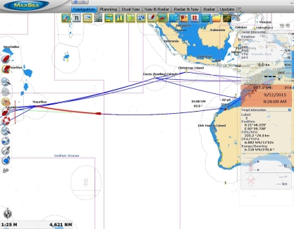
We arrived into Rodrigues, Mauritius from Dampier, Australia after 19 nights and 3,023 nautical miles at sea. The seas were a little rougher on the second half of the trip compared to the first half. But we still had several days of calm weather and the big seas didn’t last long.
Overall we had an excellent passage. All systems ran perfectly, we slept well and felt surprisingly energetic throughout, and generally enjoyed the run. The summary data from this trip are:
- Fuel consumed: 2,366 gallons (8,956 liters)
- Fuel left on arrival: 221 gallons (837 liters)
- Total actual distance: 3,023 nm
- Overall fuel economy: 1.28 nm/gal (0.34 nm/L)
- Overall speed: 6.55 kts
- Total trip hours: 461 (19 days, 5 hours)
- Fuel rate: 5.12 gal/hour (19.40 L/hour)
- Average RPM: 1682
The video below shows some footage taken when the seas were up. We’d been asked if our stabilizers were on during this time, as it didn’t appear they were from the boat motion. Our stabilizers are always on at sea and generally are very effective. But there comes a point when conditions overpower the stabilizers and the boat starts to move around quite a bit. Even in these conditions the stabilizers help, but as you can see, the boat motion can become quite noticeable.
Trip highlights from September 4th through 12th follow. Click any image for a larger view, or click the position to view the location on a map. And a live map of our current route and most recent log entries always is available at http://mvdirona.com/maps
 |
Weather systems
Position: 87 44.03, -21 59.28
On our routing, the biggest negative weather impact is high-pressure systems coming from the south that produce large, tight beam seas. This screen shot is of a GFS GRIB file displayed in ViewFax. We’re passing through the north quadrant of a high pressure system now, with beam seas and winds building. We expect this to last a couple of days. Then we’ll have a couple of days of calm weather, as a low-pressure system passes well to our south, until we meet that high pressure system over South Africa as it moves east and intensifies. The GRIB model indicates we’ll then be in 11ft beam seas on an 8-sec period for a day or two as it passes. That’s perfectly safe, but it won’t be comfortable. Overall conditions have been quite good on this trip, but when those high pressure systems hit, our stabilizers are getting a real workout.
|
 |
Roll
Position: 86 49.33, -21 57.74
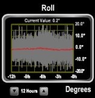
The wind picked up to steady in the 20s yesterday as we entered the northern quadrant of a high pressure system. Seas have been 10+ ft on the beam, with an 8-second period for the past 24 hours and we’ve been rolling steadily over 10 degrees and occasionally to near 20 degrees.
|
 |
Bulb replacement
Position: 85 27.42, -21 55.15
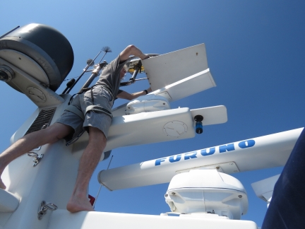
Our forward-facing floodlight failed two nights ago and conditions finally are settled enough for James to climb the stack to replace the bulb. We’ve replaced several bulbs over the years. They rarely actually burn out on Dirona–typically they fail from vibration. Fortunately that takes a year or two. We consider the floodlight an important piece of safety gear when at sea in making us visible at night many miles before our navigation lights can be seen. We’ve seen fishing boats with their floodlights on eight and ten miles away, when we’d likely not see just their navigation lights until we’re within two or three miles. Most of our outside lights are LED, but for this application where brightness is important the halogens still outperform LED. We expect to be able to change to LED in the near future as technology continues to improve.
|
 |
Rainbow
Position: 82 52.89, -21 48.66
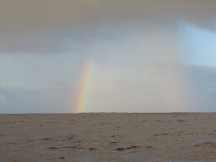
We’ve had occasional light showers on this trip, but overall not much rain.
|
 |
BGAN
Position: 82 52.77, -21 48.65
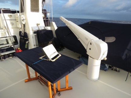
The BGAN terminal needs to be hand-aimed towards the satellite. This often is a little easier at sea compared to at anchor because the boat orientation remains relatively constant. On this trip, we’ve been able to strap the terminal to the boat deck table when in use to get a good, consistent connection without having to constantly hand-steer it.
|
 |
Bladder wash
Position: 82 18.92, -21 46.87
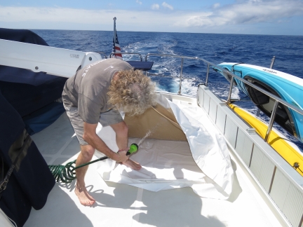
We brought the cockpit bladders up to the boat deck today and rinsed the saltwater off with freshwater before stowing them.
|
 |
Bladder stowage
Position: 82 12.73, -21 46.54
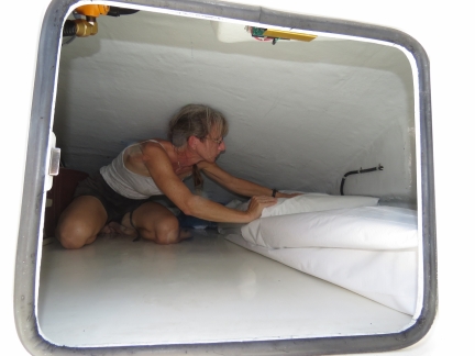
We stow the bladders folded up in the flybridge brow. Here Jennifer is pushing them into position along the outside wall. We decided to keep them in their white protective covers when stowing them this time, to reduce the risk of abrasion damage.
|
 |
Cockpit
Position: 82 6.57, -21 46.22
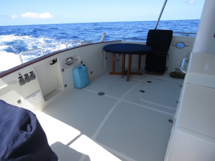
After stowing the bladders, we repositioned the cockpit furniture to it’s normal location. Nice to have the cockpit functional again and the bladders stowed. That blue jug strapped to the aft wall is an emergency water supply should we need to abandon ship.
|
 |
Triple digits left
Position: 80 51.96, -21 42.27
We just crossed down into triple-digit miles remaining with only 987 miles to go two weeks after leaving Dampier. This is the longest time we’ve ever been at sea before. Our longest passage previous to this was eleven nights over 2,000 miles from San Francisco to Hawaii. And our longest run between fuel stops was previously 2,650nm. But on that run we stopped at both Palmyra Atoll and Fanning Island. We’re enjoying the trip overall–we’re both feeling well-rested and surprisingly energetic.
|
 |
Positive current
Position: 80 39.94, -21 41.64
With some help from a positive current and unexpectedly good fuel economy, giving us both a push and allowing us to run faster than usual, we’re making excellent speed at 8.2 knots burning roughly 1.2 nm/gallon. Once that high-pressure system passed a couple of days ago, conditions have been wonderfully calm again, with winds less than 5 knots and only a gentle swell. We’ll only get another day or so of these conditions before we get into that next high-pressure system though.
|
 |
Birds
Position: 79 28.74, -21 36.40
Each day a few large grey seabirds circle the boat, giving Spitfire a little entertainment. We’re surprised to see them when we’re 1,000 miles from the nearest shore. We haven’t seen much of anything else though. Only one ship has passed in ten days, the Stellar Ocean en route to China. We were expecting to see a lot of garbage and debris in the water, but we’ve only seen one small white float and a 3-inch circular plastic ring two days ago.
|
 |
Watch commander
Position: 78 50.22, -21 33.55
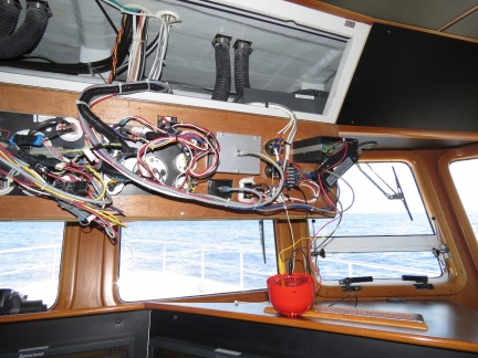
We use a Watch Commander Pro watch alarm as a guard against the person on watch falling asleep. If the alarm isn’t pushed within a preset time, the unit first flashes a light for 30 seconds, then emits a beep for 30 seconds, and then sounds an external alarm or siren. The external alarm on ours had failed, so we replaced it with a Klaxon spare (the red bowl-shaped device on the dash).
|
 |
Squall
Position: 78 18.59, -21 31.21
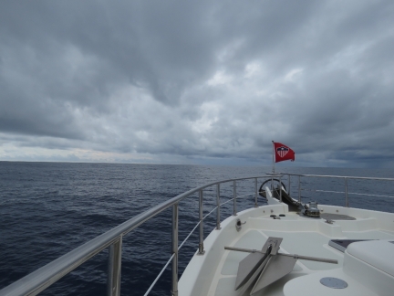
Approaching a small storm system. We were hoping for a little rain to rinse the light coating of salt that has settled on the boat, but only got a quick sprinkle.
|
 |
Muffins
Position: 76 47.14, -21 23.97
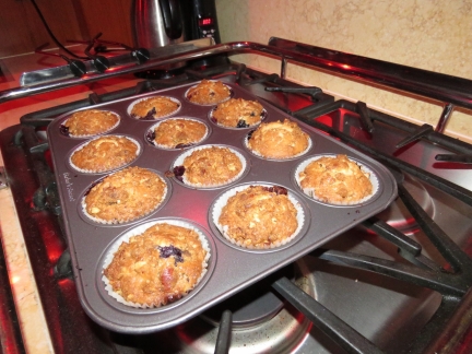
Fresh-baked blueberry muffins for breakfast using a recipe from SV Ocelot.
|
 |
Squall
Position: 76 31.61, -21 22.50
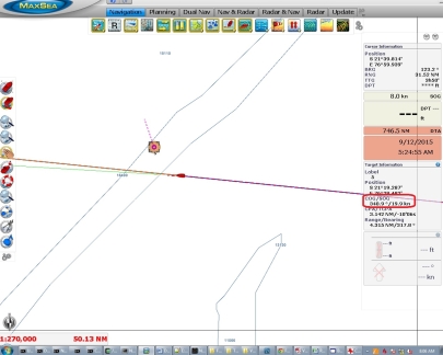
Squalls show up clearly on our radar and we can track them as ARPA (Automatic Radar Plotting Aid) targets. This one is moving at 20 knots, which is quite common. Some are faster, some are slower, but it shows why it can sometimes be a challenge to avoid the path of a storm at trawler speeds. These squalls don’t pose quite the same risk to us as to boats under sail, as we don’t have to reduce sail or make any other equipment adjustments when sudden gusts hit.
|
 |
9.1 knots
Position: 76 9.76, -21 20.42
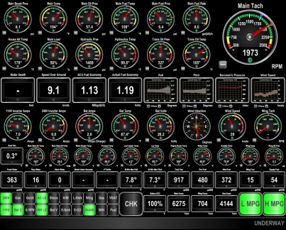
The winds are picking up and we’re starting to roll more as we enter the eastern edge of that high-pressure system we’ve been tracking. Conditions are predicted to deteriorate over the next couple of days, then slowly improve as we close on Rodrigues. The good news is that we’re doing 9.1 knots with a push from the current.
|
 |
Fuel filter
Position: 74 59.63, -21 13.77
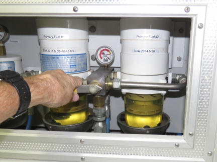
It’s time to change the main engine fuel filter. Our normal replacement indication is 5-7 inches of mercury on the vacuum gauge. This one was only running 3-4, but once it gets to there, the rest comes fairly quickly so we figured we might as well change it. The Racor design used in all Nordhavns allows for an easy change by pulling a lever to switch between two fuel filters so the other can be changed without shutting down the engine. It seems like we just changed this one, and in fact we did in May of this year, but that was 700 hours ago, so its due. The shortest interval between changes was 200 hours on low-volume fuel from Vanuatu and the best was 1,800 hours from the very high-volume Covich and Williams commercial fueling dock in Seattle, but most get changed in the mid hundreds of hours.
|
 |
Roll
Position: 73 32.21, -21 5.26
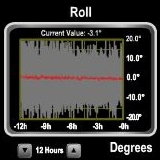
We’re well into that high pressure system now, with 12′ beam seas on 11 seconds, and have been rolling steadily up to 20 degrees with occasional rolls over 30. This is perfectly safe, but not particularly relaxing.
|
 |
Sleeping
Position: 73 30.29, -21 5.05
When conditions get rough, we slide around on the berth too much and have trouble sleeping. Jennifer sleeps well by wedging herself on the floor between the berth and the port side wall. James does the same, but in the larger walkway to starboard of the berth.
|
 |
Seas
Position: 72 15.29, -20 56.37
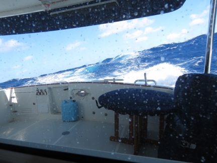
Waves never look as big in a picture as in person, but you can get a feel for conditions by the water height above the stern and the boat angle to the water surface.
|
 |
At the helm
Position: 72 6.11, -20 55.32
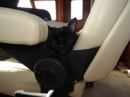
Spitfire at the helm. You’re, um, facing the wrong way Spit.
|
 |
Roll
Position: 71 20.51, -20 50.04
The waves tightened last night to 12 feet on 9 seconds, but also shifted from the beam to more on the stern. The end result was we’re rolling slightly less than before, and no longer are seeing swings to 30 degrees. But we’re in steady 15-degree rolls and frequently over 20.
|
 |
Below 500 miles
Position: 70 52.23, -20 46.76
We’re down to only 427 miles left to go and likely will arrive into Rodrigues in two days. Unfortunately conditions likely will be similar to now for the remainder of the run. The weather models indicate the wave height will gradually fall to 9 feet, but on an 8-9 second period, so we’ll still see a fair bit of boat motion.
|
 |
Squid
Position: 70 17.75, -20 42.77
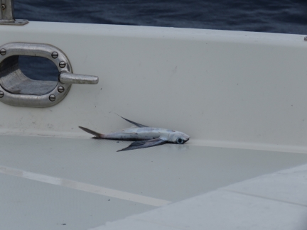
This morning we found the first sea life to land on the boat the entire passage: a half-dozen squid were along both walkways. On most passages we usually get a landing or two every couple of days. We’ve learned to look carefully for those that land in tucked-away or difficult-to-find spots. If you don’t, you’ll find them by the aroma in a couple of days. Apparently a stressed squid is able to spray ink more than a yard up the walls. In the picture you can see it running out on the deck. The ink bakes on to a persistent stain.
|
 |
Flying fish
Position: 70 6.08, -20 41.23
In addition to the squid, one flying fish hand landed on the fore deck as well.
|
 |
Power wash
Position: 69 58.61, -20 40.22
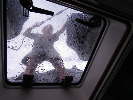
James gave the boat another quick power wash today to clean off the squid ink and saltwater.
|
 |
BGAN
Position: 66 52.28, -20 14.84
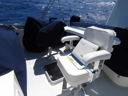
We had a moment of concern when the BGAN terminal would not hook up at all today. Then we realized we’d traveled outside the range of the satellite we’d been using and now need to aim the terminal westward instead of eastward. This direction is much better as the terminal can be strapped to the flybridge helm chair, with less risk of flying overboard or taking spray than on the boat deck table.
|
 |
Less than 200
Position: 66 47.84, -20 14.15
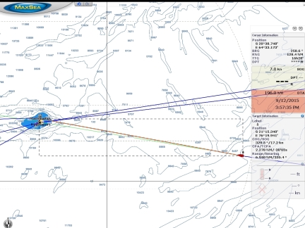
We’re only 195 miles out of Rodrigues and can now see the island outline and the boat at the same time on the chartplotter.
|
 |
Conditions
Position: 66 46.27, -20 13.88
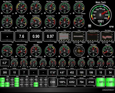
The winds and waves settled down a bit last night, but ramped up again this morning. We’re again seeing 25 kts of wind with waves about 9 ft on 9 seconds and we’re rolling between 15 and 20 degrees. The waves still are mostly from astern, which reduces boat motion somewhat. And we’re making good speed between 7 and 8 knots. We’ve been running with a 300-gallon fuel reserve for most of the trip, but have reduced that to 250 so we can speed up and have a better change of reaching Rodrigues before nightfall on the 12th.
|
 |
Raspberry Pi
Position: 66 14.42, -20 8.34
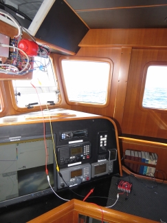
Testing out a Rasberry Pi as a sensor controller.
|
 |
Stack fan
Position: 66 7.43, -20 7.13
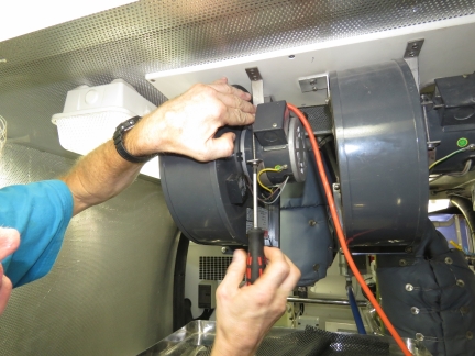
Reinstalling the secondary stack fan. On longer runs, it appears helpful.
|
 |
Ocean Garnet
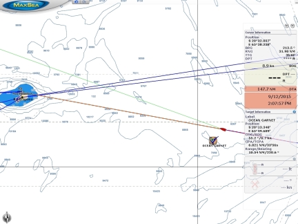
Position: 65 57.20, -20 5.34
The 751ft cargo ship Ocean Garnet en route to Singapore–the first ship we’ve seen since Ocean Ace ten days ago. We saw about ten ships in the course of twelve hours as we crossed the shipping route between South Africa and Asia and went almost two weeks without seeing any.
|
 |
Smell the barn
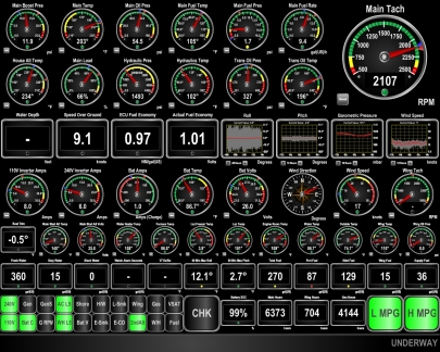
Position: 63 53.95, -19 43.86
Doing 9.1 kts as we can “smell the barn” less than twenty miles out of Rodrigues.
|
 |
Land ho!
Position: 63 48.47, -19 42.91
The outline of Rodrigues is just barely visible sixteen miles ahead.
|
 |
First contact
Position: 63 40.35, -19 41.50
Our instructions were to contact the Coast Guard about a mile out of Port Mathurin, but they picked us up on AIS much earlier and contacted us to ask our destination. After we supplied boat and crew information, we were cleared to enter the harbour.
|
 |
“Q” flag
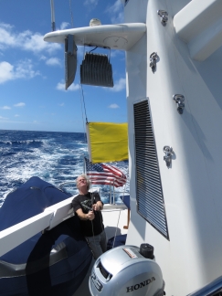
Position: 63 34.45, -19 40.47
Raising our Quarantine, or “Q” flag, to indicate that we request clearance into the country.
|
 |
Wind mills
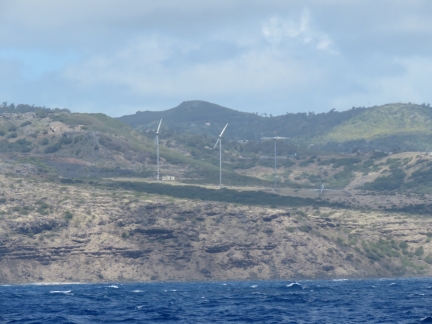
Position: 63 31.06, -19 39.87
A few wind mills on the windward shore of Rodrigues.
|
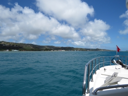 |
Approaching Port Mathurin
Position: 63 25.64, -19 40.17
Entering the channel into Port Mathurin. Our destination is in the center of the photo in the distance.
|
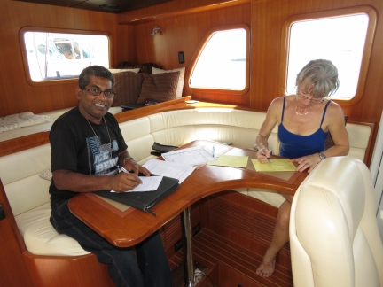 |
Quarantine
Position: 63 25.23, -19 40.84
A crowd of people were waiting for us on the jetty when we arrived to clear us through. The first was a quarantine officer.
|
 |
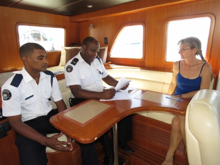
Immigration and customs
Position: 63 25.23, -19 40.84
After quarantine approved our entry, immigration (left) and customs cleared us and the boat through.
|
 |
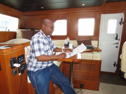
Coast guard
Position: 63 25.23, -19 40.84
The Coast Guard checked us in after customs and immigration.
|
 |
Govt. vet
Position: 63 25.23, -19 40.84
The last official to visit us was a government veterinarian to inspect Spitfire and check his paperwork. Spitfire continues to lead the pack in paperwork. We have a single sheet of paper between us with a scan of our two passport face pages and another with the ship’s registration. Spitfire has four pages: a two-page Australian health certificate, an Australian rabies vaccination certificate, and a USDA health certificate showing previous vaccinations and test results. Before arriving at a foreign port, we print out multiple copies of all our paperwork to give to the officials, which often makes the check-in process smoother. Here the government vet could just take a copy of our passports and Spitfire’s papers with him rather than transcribe all the data into his log book while we waited.
|
 |
Port Mathurin
Position: 63 25.23, -19 40.84
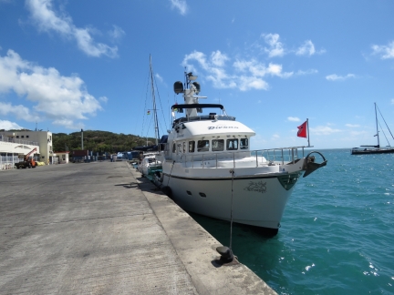
All cleared through at Port Mathurin with our Mauritian courtesy flag flying. About ten other pleasure craft are anchored off, with two more on the jetty with us. We can stay here until Monday morning, when the supply ship arrives and all boats must clear the jetty and the inner harbour while it docks.
|
 |
Click the travel log icon on the left to see these locations on a map, with the complete log of our cruise.
On the map page, clicking on a camera or text icon will display a picture and/or log entry for that location, and clicking on the smaller icons along the route will display latitude, longitude and other navigation data for that location. And a live map of our current route and most recent log entries always is available at http://mvdirona.com/maps. |

Oops, that’s embarrassing. I overlooked your very detailed fuel consumption log entry.
Well Done!
Andy
Andy, it’s great to hear from you! Jennifer and I still remember the dinner we had together years ago at Trawlerfest in Polsbo when you had just gotten Resolution and we were still dreaming of boats that can go anywhere in the world. Thanks for your advice back then. It was great getting a chance to see Resolution and it was fun to talk trawlers with you.
As you know, each trip brings more expereince and teaches a bit more. On this trip, the most interesting learning is we can go much further than the just over 3,000nm we did on this one.
When the boat was new, we carefully did a two way pass on flat water at every RPM from idle to WOT. Deere was on board to measure and record the results. We know from years of experience that the Engine Control Unit reported fuel economomy data is quite accurate when operating at “reasonable” power levels. But, when crossing an ocean, we run at very low power levels and the fuel ecomoy data is much less accurate at low engine power levels. Essentially we “found” 13% more range on this trip.
Over short distances we tend to run at much higher power levels so we had never noticed the imprecision of the ECU produced data. And, over short distances, the differences can easily get lost in the noise of fuel tank guage level imprecision. But, over longer distances, the tiny error slowly adds up and, by roughly half way, we had 160 gallons “too much.”
The other lesson we got from this longer trip was that, if the weather is good, it’s really pretty easy. When conditions are calm, it’s really not that tiring and we think we can more or less do it indefinitely. And, from the short periods where the weather was less cooperative, it’s amazing how tiring that can be. In good conditions, with only 2 people on the boat and someone always at the helm, it’s actully pretty easy. But wehn conditions get poor, it’s fairly tiring and you start to really notice the shift schedule. Running with only 2 people on the boat gets more difficult as the weather worsens.
More on fuel economy at: //mvdirona.com/2015/09/fuel-economy-and-range/
Congratulations, James and Jennifer, on your smooth uneventful 20 day passage from Australia. It shows the value of your meticulous planning. I still remember the feeling of accomplishment arriving Horta, the Azores 14 days after departing Newport, RI on “Resolution”, my N46, but then missing the solitude of the sea.
I’d be interested in your average speed and fuel consumption, and any comments on how all the machinery performed. We’d been advised that shutting down enroute to change oil on the Lugger main wasn’t necessary, so we ran the full 330 hours or so without stopping, even though that was well over the standard oil change recommendation. I assume you did the same for your 480 hours enroute since I saw no mention of an oil change.
Your voyages are an inspiration to us all.
Smooth seas,
Andy Lund
ex N46-81 “Resolution”
Glad you made it safely. I’m sure you’re preparation and maintenance discipline contributed to the relatively peaceful and uneventful trip!
Wyatt, you are right that boat and trip preparation help but the most important factor is weather. For longer trips, we chose when to cross to e when the weather is statistically likely to be excellent. Once you start travelling more than a week or so, there really are no weather reports you can trust. So it comes down to chosing times of the year when the weather is almost enver dangerous.
When the weather is good, even a long ocean crossing can be enjoyable.
Congratulations on your crossing – I was getting worried when I didn’t see an update for several days. I started following your excellent blog a couple months ago while you were roaming the rivers of Australia. Love your boat! We moored next to one while transiting down the US east coast a couple years ago and fell in love with the Nordhavn design. Maybe some day… :)
Was rolling through you log and was intrigued by your brief mention of the Raspberry Pi as a sensor controller as I am in the process of “developing” (generous use of the word as I am have not programmed in years so still learning the basics) a vessel monitoring system for my boat – small in comparison to yours (39′ Cruisers). Want to keep an eye on all systems while away from our boat. (Electric, bilge water, bilge pumps, cabin/engine compartment temperatures, frig/freezer status, etc)
Was wondering what your plans were as you mention “Sensor controller”. Again congrats on your crossing!
Tim
St Petersburg, FL
Tim, you were asking about the Raspbery PI sensor controller. Right now, I have software that reads the NMEA2000 network but we have some devices that are not on the NMEA network and I would still like to track there state and potentially operate on them. That can be done today using Maretron SIM100 to implement digital inputs to NMEA2000 and a Maretron DCR100 to implement digital outputs from NMEA2000. Both work well and I have the SIM100 monitoring bilge level, ER CO & Smoke, Laz CO & Smoke, and a couple of others. I have the DCR implementing 2 channels of load shedding (HVAC and HW heater), an eternal light and alarm, and signalling the generator to start when the batteries are low. I’m investigating using the PI as another source of digital inputs and as another driver of digital inputs.
I’ve tested out the PI and it seems to work well for both digital inputs and outputs. It’s a bit more work to integrate into my existing all NMEA 2000 control system but I’ll probably do it sometime over the next month or so as time allows. I have a simple task in mind that I’ll do on the PI and get some production experience with it.
Thanks for the Pi plan details James. The Maretron products certainly look look battle ready. For the SIM100, is it just connected in parallel to existing sensors or did you install new/redundant ones to monitor those parameters? Ditto on the outputs – is the DCM driving relays to actvate the various HVAC, HW, AC systems?
You also mentioned you have software to read the NMEA2000 network – is that something you wrote, bought is open source?
I’ve been following OpenSkipper, signal-K, freeboard and OpenCPN development. Some very interesting things coming to the marine industry. Wouldn’t rely on them for an ocean crossing just yet though :>). Enjoy your stay in Rodrigues.
Yes, the Maretron gear is easy to use and I have lots of it on Dirona. Wtih a SIM100, attach it to the Maretron network and you have 6 channels of digital input. The DCR does the same for digital output.
You asked how the DCR was controlling different devices. The DCR drives the following: 1) a light weight relay that sends the start signal to the generator controller (used to start generator when beatteries are low), 2) a 20A relay to shed the H/W heater when we get near the 240V supply capacity, and 3) a heavy weight (63A) relay to shed the HVAC when the system gets close to exceeding the capacity of the 240V supply system, 4) a light weight relay to run the externa warning light and alarm. and 5) a large 24V relay (225A) to parallel in the second alterantor when more power is needed underway. There is still one channel left on the DCR. I’m out of SIM100 ports so will give the PI a test and see how it does.
The low level software that reads the NMEA2000 bus is the Canboat package written by Kees Verruijt. It’s remarkably high quality, stable, and easy to work with.
You are right there is a lot happening in the Marinie electronics world right now.
Thanks James. From your background I’m sure these things are very straight forward. Will be interested in any updates on this development that you may have time to post.
I’m finding sensor are fairly straight forward to add so I have been experimenting with the communication path from a sensor to a globally available web site and android app. It may be easier on your vessel, but running wires on mine is a challenge so I’m planning on small arduino sensor processors using low power RF devices (probably battery operated but could also be on the 12VDC bus with battery back-up) to communicate with a Raspberry Pi serving as a message gateway, MQTT server and OpenHAB automation package for persistence, report and control.
Scaring myself that I actually almost understand these terms mean! :)
I don’t have powerful wifi on board nor satellite so I’ll most likely add a low cost 2G cellular card with GPS that can phone home or send info on command. Safe travels!
Your Raspberry Pi plans sound excellent.
I installed PI yesterday and hooked it up to digitial inputs. It’s reading them now and I’m working on the code to store the results in the central MySQL database where I store all the NMEA2000 data.
They are great little boards.
BTW – I’m following your blog via Feedly app so get notified when you post a new story, but wondered if there is a way to get notified when you post or respond to comments.
Tim, I don’t know of a way to get notifications on comments but you can see the last 5 comments on the blog main page as a primitive way to see what is recent or if there have been changes since you last looked.