MV Dirona travel digest for More Og Romsdal 2020

|
Click the travel log icon on the left to see these locations on a map,
with the complete log of our cruise. On the map page, clicking on a camera or text icon will display a picture and/or log entry for that location, and clicking on the smaller icons along the route will display latitude, longitude and other navigation data for that location. And a live map of our current route and most recent log entries always is available at //mvdirona.com/maps/LocationCurrent.html. |
 |
11/12/2020: Dirona Health Clinic
Position: 61°8.86'N, 5°12.75'E
We check our blood pressure every three months. Here's Jennifer getting a blood pressure check using an Omron Wrist Blood Pressure Monitor.
|
 |
11/12/2020: Blood Glucose
Position: 61°8.86'N, 5°12.76'E
James' family has some diabetes, so we check our blood glucose levels every three months using a TRUEresult Blood Glucose Monitoring System. We passed all the tests.
|
 |
11/12/2020: Exiting Listraumen
Position: 61°8.79'N, 5°11.77'E
Exiting Listraumen shortly after sunrise. The tide was higher when we departed, and the water level in the channel was deeper with less current.
|
 |
11/12/2020: Sorefjorden Anchorage
Position: 61°11.04'N, 5°18.09'E
Our anchorage at the head of Sorefjorden, a branch off Hyllestadfjorden, in 97 ft (30 m) on 330 ft (101 m) of rode.
|
 |
11/12/2020: Tender
Position: 61°10.96'N, 5°18.47'E
The tender tied ashore at the head of Sorefjorden for a hike up Katlenova.
|
 |
11/12/2020: Katlenova
Position: 61°11.05'N, 5°18.09'E
Dirona moored beneath 872-ft (266m) Katlenova at the head of Sorefjorden.
|
 |
11/12/2020: Risnesnipa
Position: 61°10.97'N, 5°18.50'E
View from the trail up Katlenova south across Hyllestadfjorden to Risnesnipa that the Havorn crashed into.
|
 |
11/12/2020: Katlenova Summit
Position: 61°10.84'N, 5°17.49'E
A windy day atop 872-ft (266m) Katlenova.
|
 |
11/12/2020: Sorefjorden
Position: 61°11.24'N, 5°16.73'E
View southeast from 872-ft (266m) Katlenova to Dirona moored at the head of Sorefjorden.
|
 |
11/13/2020: Skifjorden Anchorage
Position: 61°14.80'N, 5°6.38'E
Our anchorage in Skifjorden in 76 ft (23 m) on 300 ft (91 m) of rode. We considered anchoring at the head, but found this location next to a high cliff more appealing.
|
 |
11/13/2020: Tender Ride
Position: 61°13.91'N, 5°5.91'E
Out exploring Skifjorden in the tender. The temperature is around 58°F (14° C), so not too cold.
|
 |
11/13/2020: Kringlevagen
Position: 61°13.64'N, 5°1.37'E
Wooden boat moored below traditional boathouses in Kringlevagen just outside Skifjorden.
|
 |
11/13/2020: Perches
Position: 61°14.31'N, 5°5.72'E
Typical Norwegian day beacons, called perches, consisting of a steel pipe mounted on a rock with a topmark pointing to the side the perch should be passed on. We'll be passing between them in the tender.
|
 |
11/13/2020: Teigesata
Position: 61°14.80'N, 5°6.37'E
Dirona anchored beneath 1446-ft (441m) Teigesata in Skifjorden.
|
 |
11/14/2020: Entering Bygdevagen
Position: 61°15.19'N, 5°0.47'E
Running the narrow reef-edge channel into Bygdevagen.
|
 |
11/14/2020: Waves
Position: 61°14.35'N, 5°1.52'E
Westerly waves crashing into the rocks behind us just outside the entrance to Bygdevagen.
|
 |
11/14/2020: Vagsvagen Anchorage
Position: 61°16.10'N, 5°1.48'E
Our anchorage in Vagsvagen in 52 ft (15 m) on 200 ft (61 m) of rode.
|
 |
11/15/2020: Atlantic Storms
Position: 61°15.71'N, 4°58.58'E
It's not a good time to be crossing the Atlantic with three low-pressure systems out there. Fastnet Rock will be seeing 51-knot winds on Thursday. This isn't even close to as bad as it gets there, but is still pretty strong.
|
 |
11/15/2020: Lutelandet Offshore
Position: 61°14.64'N, 4°59.01'E
Equipment at Lutelandet Offshore, specializing in inspection, repair, maintenance and decommissioning of oil and gas platforms and windmill construction and support. They are in the process of a massive development that will cover most of the island of Lutelandet and will include a 1738x446x69-ft (530x136x21m) drydock, the largest in Europe. Norway appears to have an amazingly healthy marine construction and maintenance industry and seems to really encourage companies to establish in less-populated locations.
|
 |
11/15/2020: Awash
Position: 61°15.57'N, 4°56.66'E
Dangerous rock, barely awash, off the northeast corner of the island of Lutelandet.
|
 |
11/15/2020: Folsundet
Position: 61°15.70'N, 4°57.15'E
Running close to the starboard shore as we pass through a tight channel between islets and hazards in the channel Folsundet along the north end of the island Lutelandet.
|
 |
11/15/2020: Korssund Anchorage
Position: 61°15.70'N, 4°58.58'E
Our anchorage near the town of Korssund in 100 ft (30 m) on 300 ft (91 m) of rode.
|
 |
11/15/2020: Korssund
Position: 61°15.30'N, 4°59.36'E
Passing through a narrow and shallow marked small-boat channel, with the marina at the town of Korssund visible in the distance. The Norwegian coast is complex, but typically very well-marked, sometimes even channels barely suitable for our tender.
|
 |
11/15/2020: Korssundholet
Position: 61°15.16'N, 4°59.44'E
Looking back to the 26-ft (8m) bridge over Korssundholet that we just passed under in the tender. With a strong southerly wind blowing, the seas are picking up a bit in this more exposed section of the coast.
|
 |
11/15/2020: Dam
Position: 61°16.20'N, 4°58.60'E
In looking at the charts, we were hoping we might be able to get the tender through this channel into the lake Stroka, but that wasn't going to happen.
|
 |
11/15/2020: Alden
Position: 61°16.74'N, 4°58.36'E
Looking northwest to the island of Alden, jutting nearly straight up 1,575 ft (480m) above sea level. Hiking the trail to the top reportedly yields fabulous 360-degree views.
|
 |
11/15/2020: Happy Hour
Position: 61°15.70'N, 4°58.56'E
In a heavy rainfall, we turned on our deck lights and underwater lights for Happy Hour in the cockpit. The lights reflected off the rain so well in the dark that it made the raindrops look huge and we felt as if we were sitting underneath a waterfall. Wild!
|
 |
11/16/2020: Stad Weather
Position: 61°17.86'N, 5°1.15'E
Stad, a headland on Norway’s southwest coast, is one of 24 areas listed in the Norwegian Coastal Pilot as likely to have rough seas in certain wind and tide conditions. Stad is considered the worst and is so notorious for dangerous conditions that an escort service is provided for small boats and funds have been approved to build the world’s first full-scale ship tunnel through the headland.
We'll be rounding Stad in the next week or so, so have been monitoring the weather. It's definitely not a good time anytime soon, with 55-knot gusts forecast over the next few days. |
 |
11/16/2020: Lammetu Bridge
Position: 61°16.13'N, 4°58.46'E
This truck stopped to watch us pass under the bridge to the island of Lammetu. With a clearance of 32 ft (10m), Dirona's approaching with 30-ft (9.14m) air draft must have looked "interesting".
|
 |
11/16/2020: Feet to Spare
Position: 61°16.17'N, 4°58.45'E
Passing under bridge to the island of Lammetu. Two feet to spare sure doesn't look like much.
|
 |
11/16/2020: Dryer Vent
Position: 61°19.38'N, 5°8.45'E
The dryer vent works well and stays clear over long periods of time. But in cold, damp weather it will occasionally plug up. If we don't check up on it, this will catch us by surprise and we'll only notice the blockage when the dryer becomes less effective at drying clothes. This is what caused the dryer's single-use thermal fuse to blow a few years back. We've let it get pretty jammed up this time.
|
 |
11/16/2020: Flekkefjorden
Position: 61°20.19'N, 5°18.52'E
Cruising Flekkefjorden on a wonderfully calm and clear day.
|
 |
11/16/2020: Red Cross Nordic UWC
Position: 61°19.95'N, 5°19.79'E
The Red Cross Nordic United World Center is one of 18 schools and colleges worldwide focused on educating young people to be champions of peace and tolerance.
|
 |
11/16/2020: Boat House
Position: 61°19.85'N, 5°19.82'E
Boat house and autumn colours reflecting into the still waters of Flekkefjorden. We really enjoyed our cruise along the waterway.
|
 |
11/16/2020: Flekkefjorden Anchorage
Position: 61°18.83'N, 5°20.95'E
Our anchorage at the head of Flekkefjorden in 40 ft (12 m) on 200 ft (61 m) of rode.
|
 |
11/16/2020: Lunch
Position: 61°18.84'N, 5°20.95'E
The temperature is 50°F (10°C), but with the clear and sunny weather it was just warm enough for lunch outside.
|
 |
11/16/2020: Rapids
Position: 61°18.63'N, 5°20.68'E
Rapids from the lake Flosjoen mark the limit of our tender exploration to the head of Flekkefjorden.
|
 |
11/16/2020: Litlevikholmen
Position: 61°20.07'N, 5°19.89'E
Wooden bridge to the islet Litlevikholmen from the Red Cross Nordic UWC campus.
|
 |
11/16/2020: Low Clearance
Position: 61°20.08'N, 5°19.87'E
The tender just barely fit under the Litlevikholmen bridge.
|
 |
11/16/2020: Grounding
Position: 61°19.32'N, 5°20.25'E
On the tender, we have a chartplotter, but it's only effective when we look at it :). Here you can see the stripe left by an unhappy Honda on a rock.
|
 |
11/16/2020: IPAs
Position: 61°18.84'N, 5°20.93'E
One of the many things we like about Norway is the wide variety of IPA (India Pale Ale) beers brewed here. Here are five from Norway and one from the UK to choose from for tonight's Happy Hour. We're even started to pronounce it as they do here: eepa, rather than I-P-A as in North America.
|
 |
11/17/2020: Dalsfjord Bridge
Position: 61°21.98'N, 5°22.87'E
The 1,716 ft (523 metres) Dalsfjord Bridge, completed in 2013, with the waterfall Laukelandsfossen visible in the distance.
|
 |
11/17/2020: Fossedalselva
Position: 61°22.98'N, 5°24.26'E
Waterfall from the river Fossedalselva on the north shore of Dalsfjorden after heavy overnight rain.
|
 |
11/17/2020: Laukelandsfossen
Position: 61°23.04'N, 5°25.44'E
Dramatic Laukelandsfossen in Dalsfjorden has a drop of 445ft (135m).
|
 |
11/17/2020: Svealand
Position: 61°22.38'N, 5°38.33'E
The local freighter Svealand docked at the town of Bygstad.
|
 |
11/17/2020: Svaesundet
Position: 61°22.38'N, 5°38.52'E
Passing through the narrow channel Svaesundet in Dalsfjorden.
|
 |
11/17/2020: Kviteneset Anchorage
Position: 61°22.01'N, 5°39.81'E
Our anchorage in Kviteneset at the head of Dalsfjorden in 85 ft (26 m) on 300 ft (91 m) of rode.
|
 |
11/17/2020: Osfossen
Position: 61°22.02'N, 5°39.82'E
The waterfall Osfossen flowing into Kviteneset at the head of Dalsfjorden. The waterfall contains Norway's oldest salmon ladder, built in 1850, that brings the fish up 38ft (11.5m) into the dammed Guala river.
|
 |
11/17/2020: Washing Windows
Position: 61°22.02'N, 5°39.81'E
Washing salt spray off the pilothouse windows.
|
 |
11/17/2020: Night
Position: 61°22.01'N, 5°39.81'E
The lights of Bygstad viewed from our anchorage in Kviteneset.
|
 |
11/19/2020: Storm
Position: 61°22.01'N, 5°39.91'E
A major storm system is passing along the Norwegian coast over the next couple of days. We're in a good anchorage for it at the head of Dalsfjorden with excellent holding and plenty of swing room.
|
 |
11/19/2020: 67 Knots
Position: 61°22.01'N, 5°39.94'E
The winds have settled for now, but blew to 67 knots last night as the first part of storm system passed through. We're expecting more winds later in the day.
|
 |
11/19/2020: Temperature Drop
Position: 61°22.00'N, 5°39.86'E
The temperature dropped from50°F (10°C) to 36°F (2°C) in 12 hours as the storm system passes through.
|
 |
11/19/2020: Hail
Position: 61°22.01'N, 5°39.93'E
Last night's heavy rainfalls turned to hail with the falling temperature.
|
 |
11/19/2020: Spares
Position: 61°22.01'N, 5°39.90'E
Accessing the box of smaller Northern Lights spares for our wing engine and generator. At the center of the picture is the target of our search, a donut-shaped current transformer.
|
 |
11/19/2020: Current Transformer
Position: 61°22.02'N, 5°39.92'E
The original 11-year-old generator current transformer (CT), used to read generator output, has been damaged by vibration with the windings exposed. We have redundant sources of this data, so we weren't in a rush to replace this part, and it was just reading low rather than failed entirely. But any CT with exposed windings needs to be replaced.
|
 |
11/19/2020: CT Installed
Position: 61°22.02'N, 5°39.92'E
The Current Transformer (CT) was replaced due to vibration wearing through the side of the 11 year old part we had been using since new. We replaced it with a new part, tested the new configuration with a Fluke meter on the generator output and found the Wavenet reading to still be 2A low. It looks like the damaged part is still functioning since we're getting the same reading with a new part. The old one had exposed wiring so it did need to be replaced but we still have the low output reading. We tried artificially raising the turns ratio from the correct 75:5 to 80:5 and it then read 0.9A low. We then changed to 85:5 and got +0.3. This is the closest we can get so we left the CT turn ratio at 85:5 and it's quite accurate up and down the range.
|
 |
11/19/2020: Vent Covers
Position: 61°21.99'N, 5°39.87'E
When the weather is colder, we cover the engine room vents with canvas covers to keep the engine room warmer. It makes the engine room a nicer place to work and also reduces cooling to the rest of the house.
|
 |
11/19/2020: Ballast Failure
Position: 61°22.02'N, 5°39.91'E
The fluorescent light over the hydraulic reservoir in the lazarette failed. Changing the bulb didn't fix it, but changing the electronic ballast corrected the problem.
|
 |
11/19/2020: 60 knots
Position: 61°21.99'N, 5°39.94'E
The winds are picking back up again and we're seeing gusts to 60 knots at the head of Dalsfjorden (see tell-tale on the wind speed gauge at upper right).
|
 |
11/19/2020: Snow Falling
Position: 61°22.01'N, 5°39.93'E
Later in the day, the hail gave way to snow. This is our first Norwegian snowfall in Dirona.
|
 |
11/19/2020: Fresh Snow
Position: 61°22.02'N, 5°39.97'E
Fresh snow in the mountains around our anchorage at the head of Dalsfjorden.
|
 |
11/20/2020: Osfossen
Position: 61°22.01'N, 5°39.90'E
The waterfall Osfossen swollen with water and filling the air with spray following the heavy precipitation of the past couple of days.
|
 |
11/20/2020: Hatches Frozen
Position: 61°22.01'N, 5°39.91'E
The temperature is above freezing at 37°F (3°C) now, but did dip to freezing yesterday, and the bow locker latches are frozen. Here James is preying one open with a screwdriver.
|
 |
11/20/2020: Bygstad
Position: 61°22.28'N, 5°39.34'E
The town of Bygstad with fresh snow on the mountains behind, viewed as we depart the anchorage in Kviteneset at the head of Dalsfjorden.
|
 |
11/20/2020: Laukelandsfossen
Position: 61°22.86'N, 5°25.40'E
Laukelandsfossen looked spectacular when we passed it on the way in, but even more so in a fresh coating of snow.
|
 |
11/20/2020: 11400 Hours
Position: 61°19.75'N, 5°4.18'E
We just reached 11,400 trouble-free hours on our reliable John Deere 6068AFM75 main engine. Nothing runs like a Deere!
|
 |
11/20/2020: Davik
Position: 61°19.52'N, 5°4.32'E
The ferry Davik exiting the narrow channel Olssundet, south of Askvoll, as we approach.
|
 |
11/20/2020: Heggoyna Anchorage
Position: 61°23.51'N, 4°55.36'E
Our snug anchorage off the island of Heggoyna at the mouth of Stongfjorden in 53 ft (16m) on 200 ft (61m) of rode. We had considered anchoring in Eidsfjorden, a branch of Stongfjorden, but swing room was insufficient for the depth there.
|
 |
11/21/2020: 64 Knots
Position: 61°23.52'N, 4°55.42'E
Another big storm system arrive last night, bringing gusts of 64 knots to our anchorage at Heggoyna (see tell-tale on wind speed guage at top right). The winds have settled to "only" a steady 30 now.
|
 |
11/21/2020: Winds at Heggoyna
Position: 61°23.52'N, 4°55.44'E
Early morning view looking behind the boat as strong winds blow through the anchorage at Heggoyna. It's surprising how much the waves have kicked up in this tiny anchorage.
|
 |
11/21/2020: Windswept Smelvaerosen
Position: 61°27.60'N, 5°1.32'E
We decided to depart the anchorage at Heggoyna for one with better wind protection. Conditions in exposed Smelvaerosen were rough, with the wind blowing steady in the 30s behind us and gusts to over 40. We were pitching over 14° and rolling 11.5° as we passed through.
|
 |
11/21/2020: Svanoya Anchorage
Position: 61°29.93'N, 5°6.97'E
Our anchorage at the island of Svanoya in 70 ft (21m) on 300 ft (91m) of rode. We're only two hours away from our last anchorage, but it was rough enough out there that it's nice to be in a more sheltered more location.
|
 |
11/21/2020: Anchor Ball
Position: 61°30.15'N, 5°2.02'E
Our anchor ball lost one of its fins in last night's big winds.
|
 |
11/21/2020: Rainwater
Position: 61°29.94'N, 5°6.95'E
We haven't seen this one before. We have no external leaks and frequently see strong winds with rain, and yet this storm was driving rain in so hard from behind us it actually brought a fair amount of water down the stack area and into the engine room. It's probably less than a gallon, but did make a bit of a mess.
|
 |
11/21/2020: Tender Cover
Position: 61°29.93'N, 5°6.98'E
Our tender cover partially blew of in the storm, but fortunately was still held on by the bungee underneath the bow and across the engine. That's an expensive custom-fit cover, so we're glad we don't have to replace it.
|
 |
11/22/2020: Wind
Position: 61°29.93'N, 5°7.00'E
The winds aren't quite as strong as yesterday, but are steady in the 25-20-knot range, with gusts as high as 57 knots.
|
 |
11/22/2020: Asaholten
Position: 61°27.10'N, 5°28.36'E
The view to (217m) snow-dusted Asaholten as we approach the anchorage off the village of Kvammen in Fordefjorden.
|
 |
11/22/2020: Kvammen Anchorage
Position: 61°26.91'N, 5°27.35'E
Our anchorage near the town of Kvammen, partway along Fordefjorden, in 61 ft (19m) on 200 ft (61m) of rode.
|
 |
11/22/2020: Happy Hour
Position: 61°26.91'N, 5°27.35'E
We're still enjoying Happy Hour outside in the cockpit, but now that the temperature is down to 44°F (7°C), we've started wearing our Mustang suits for extra warmth.
|
 |
11/23/2020: Ship
Position: 61°27.70'N, 5°49.93'E
What appears to be a navy ship under construction in Forde at the head of Fordefjorden.
Update: Blog reader Olav Bjorneset tells us this is a "nobody wants" 269-ft (82m) Palmer Johnson World Explorer, originally built for a Russian billionaire who died before the papers were signed. |
 |
11/23/2020: Forde Berth
Position: 61°27.51'N, 5°50.71'E
Our berth at Forde, at the head of Fordefjorden, with a single 16A shorepower, and water available (the Navionics chartplotter app we run on our phone has much better navigation detail). We’re on the fuel dock since it’s the only place available with sufficient depth for us, and even this is effectively less than we need if we experience a low tide. But we have 10ft of water now and will be fine during the current low tidal exchange.
|
 |
11/23/2020: Forde Views
Position: 61°27.51'N, 5°50.71'E
Views to Forde from our berth (clockwise from top left: forward, aft, starboard and port).
|
 |
11/23/2020: Groceries
Position: 61°27.51'N, 5°50.71'E
Returning to the boat with a load of groceries. The store was so close we just brought their cart to the boat and walked it back.
|
 |
11/23/2020: Visitors
Position: 61°27.51'N, 5°50.71'E
Dirona is fairly prominent on the dock in Forde, and several locals came by to chat. One was a ferry captain, and they're all interested in boats, so we had a great discussion.
|
 |
11/24/2020: Studded Bike Tires
Position: 61°27.10'N, 5°50.95'E
In Norway, studded tires are common. They even sell studded bike tires.
|
 |
11/24/2020: Udder Support
Position: 61°27.44'N, 5°50.76'E
We stopped into a farm supply store in Forde and found all kinds of unusual products that we'd never use. But it's good to know that if we do get a pet cow for the boat that udder support is available.
|
 |
11/24/2020: Shopping
Position: 61°27.50'N, 5°50.71'E
Returning to the boat after doing some shopping in town to pickup a few more items of winter gear.
|
 |
11/24/2020: Gasoline
Position: 61°27.51'N, 5°50.71'E
We took advantage of our convenient location on the fuel dock at Forde to top up our gasoline supply.
|
 |
11/24/2020: Dirona
Position: 61°27.51'N, 5°50.71'E
Dirona on the dock in Forde at the head of Fordefjorden.
|
 |
11/25/2020: Departing Forde
Position: 61°27.57'N, 5°50.59'E
Running the shallow and narrow channel out of our berth at Forde before sunrise. Our forward spotlight is lighting up the shore in the distance and the starboard sidelight is illuminating the trees at right. The lights are super-helpful in navigating at night in tight quarters like this, giving us an ability to see our surroundings.
|
 |
11/25/2020: Oykevelta
Position: 61°27.90'N, 5°35.93'E
Waterfall gushing down the slope at Oykevelta along Fordefjorden.
|
 |
11/25/2020: Storelva
Position: 61°28.85'N, 5°23.25'E
The river Storelva, swollen after several days of rain, pouring into Fordefjorden near Vevring.
|
 |
11/25/2020: Stavang Church
Position: 61°32.20'N, 5°10.64'E
The Stavang Church was completed in 1957 on a site where a church has stood since the 1300s.
|
 |
11/25/2020: Modern Home
Position: 61°32.30'N, 5°10.67'E
Beautiful modern home in Stavang, with an open-space concept and floor-to-ceiling glass windows.
|
 |
11/25/2020: Stongasundet
Position: 61°32.79'N, 5°10.46'E
Approaching the 49-ft (15m) bridge across the channel Stongasundet.
|
 |
11/25/2020: Osstrupen
Position: 61°33.46'N, 5°20.96'E
Because of the angle, the bridge across Osstrupen looks much lower than its 49-ft (15m) clearance.
|
 |
11/25/2020: Osstrupen Anchorage
Position: 61°33.15'N, 5°23.51'E
Our anchorage at the head of Osstrupen in 145 ft (44m) on 420 ft (128m) of rode. The anchorage is deep, but we quite liked the setting, surrounded by steep cliffs and waterfalls.
|
 |
11/25/2020: River Current
Position: 61°33.14'N, 5°23.49'E
A strong river flow enters the head of Osstrupen, with the current visible in the water behind Dirona. It looks like we're underway, but that's the water rushing past us at anchor.
|
 |
11/25/2020: Osstrupen Waterfall
Position: 61°33.22'N, 5°22.70'E
One of the many dramatic waterfalls that spill into our anchorage at Osstrupen.
|
 |
11/26/2020: Poles
Position: 61°36.02'N, 5°22.48'E
We've seen several of these red-and-white pole pairs, such as this set while underway up Eikefjorden. They look like range markers, but aren't charted nor in a place requiring them.
|
 |
11/26/2020: Eikefjorden
Position: 61°34.94'N, 5°21.31'E
View west as we turn towards our intended anchorage at in Pollen at the head of Eikefjorden
|
 |
11/26/2020: Eikefjorden Anchorage
Position: 61°34.46'N, 5°21.52'E
Our anchorage tucked into snug and sheltered Pollen at the head of Eikefjorden in 51 ft (15m) on 200 ft (61m) of rode.
|
 |
11/27/2020: Insulation
Position: 61°34.46'N, 5°21.48'E
Adding a piece of thick foam to insulate the cockpit shower and reduce the likelihood of damage due to freezing as the temperature falls.
|
 |
11/27/2020: Dirona
Position: 61°34.44'N, 5°21.44'E
Dirona anchored in Pollen at the head of Eikefjorden with snow-dusted mountains in the background.
|
 |
11/27/2020: Logs
Position: 61°34.36'N, 5°26.21'E
Logs ashore at Eikford ready to load for marine transport, viewed on a tender tour of the area.
|
 |
11/27/2020: Kleivaelva
Position: 61°35.41'N, 5°27.48'E
The river Kleivaelva flowing in two branches under a road bridge in Eikford.
|
 |
11/27/2020: Brodrene
Position: 61°35.48'N, 5°25.41'E
Hull form at Brodrene, who specialize in high-speed carbon composite ferries. We've seen many of their vessels, including the fast ferry Fjordfart, the ambulance boat Rygerdoktoren and their visionary Seasight models, Vision of the Fjords, Legacy of the Fjords and Future of the Fjords.
|
 |
11/27/2020: Coastal Road
Position: 61°36.65'N, 5°16.27'E
Norway is famous for it's early 19th-century roads strung along cliff edges. Here is a portion of the old road along the north shore of Eikefjorden supported with an extensive rock wall.
|
 |
11/27/2020: Old Tunnel
Position: 61°36.67'N, 5°15.77'E
A small part-tunnel through the cliff on the old 19th-century road along Eikefjorden. Tunneling was expensive back then, so the engineers only resorted to it when necessary. Here they also added rock and avalanche protection.
|
 |
11/27/2020: Storoysundet Bridge
Position: 61°36.70'N, 5°14.74'E
Passing under the small bridge across Storoysundet to the island of Store Helgoya in Eikefjorden.
|
 |
11/27/2020: Hasteinen
Position: 61°35.18'N, 5°10.70'E
View down Hoydalsfjorden to snow-capped 3,060-ft (933m) Hasteinen.
|
 |
11/27/2020: Salmon Hatchery
Position: 61°35.21'N, 5°20.09'E
The Barlindbotn Settefisk salmon hatchery in Eikefjorden annually produces about 2 million juvenile fish.
|
 |
11/27/2020: 265 Hours
Position: 61°34.48'N, 5°21.07'E
We just crossed 265 hours on the "new tender". We've really been winding the hours on this year, with over 100 hours since arriving in Norway late July at 163 hours.
|
 |
11/28/2020: Forward Spotlight
Position: 61°34.45'N, 5°21.50'E
The forward spotlight illuminating the shore ahead as we depart before sunrise from the anchorage in Pollen at the head of Eikefjorden.
|
 |
11/28/2020: CHC
Position: 61°34.77'N, 5°1.77'E
CHC, based in Richmond, BC, Canada, is one of the largest commercial helicopter operators on the world, with major markets in Australia, Brazil, Ireland, the Netherlands, Norway, and the UK. The company operates a helicopter rescue service in Floro using an AS332L1 SuperPuma and a crew of six is on 15-minute standby.
|
 |
11/28/2020: Control Tower
Position: 61°34.65'N, 5°1.19'E
The Floro airport control tower.
|
 |
11/28/2020: EWOS
Position: 61°34.96'N, 4°59.93'E
Huge EWOS facility in Floro. Until purchased by Cargill in 2015, EWOS was one of the largest suppliers of feed and nutrition for farmed fish.
|
 |
11/28/2020: Stabben Lighthouse
Position: 61°35.53'N, 4°59.01'E
The Stabben Lighthouse just north of Floro was established in 1867 and takes up most of the islet it stands on.
|
 |
11/28/2020: Floro
Position: 61°36.23'N, 5°1.89'E
View to Floro Harbour as we pass by to the north. Floro has a population of 11,000 and is Norway's westernmost town.
|
 |
11/28/2020: Westcon
Position: 61°36.29'N, 5°3.11'E
Westcon's huge shipyard in Floro, one of several the company operates in Norway. We toured past their Olsfjorden facility earlier this year. The indoor shiphall, pictured, measures 656 x 131 ft (200 x 40 m). We were planning to continue through here to an anchorage, but new causeways not shown on our chart blocked our path.
|
 |
11/28/2020: Norsea Fighter
Position: 61°36.93'N, 5°4.04'E
The 269-ft (82m) offshore support vessel Norsea Fighter moored off Floro.
|
 |
11/28/2020: Energy Empress
Position: 61°36.93'N, 5°4.04'E
The Multi-Purpose Support Vessel (MPSV) Energy Empress was completed in 2019 following the Ulstein X-Bow design.
|
 |
11/28/2020: Crushed Cars
Position: 61°36.83'N, 5°6.56'E
A massive pile of crushed cars ashore on the outskirts of Floro.
|
 |
11/28/2020: Massoya Anchorage
Position: 61°37.22'N, 5°11.03'E
Our anchorage off the island fof Massoya, just west of Floro, in in 38 ft (12m) on 175 ft (53m) of rode.
|
 |
11/28/2020: View from Massoya
Position: 61°37.23'N, 5°11.06'E
View west from the anchorage at Massoya to the Energy Empress moored off Floro.
|
 |
11/28/2020: Kinn Marina
Position: 61°36.23'N, 5°8.40'E
Kinn Marina near Floro, seen on a tender tour of the area, offers year-round land storage and indoor, heated winter storage for boats.
|
 |
11/28/2020: Figure
Position: 61°36.13'N, 5°8.50'E
A small figure supervising traffic on the narrow waterway near Kinn Marina.
|
 |
11/28/2020: Waterfall
Position: 61°37.78'N, 5°10.34'E
Waterfall flowing into Klauefjorden north of Floro.
|
 |
11/28/2020: Havhesten
Position: 61°35.51'N, 5°3.35'E
The glass-enclosed Havhesten swimming facility near Floro has beautiful sea views from its pools.
|
 |
11/28/2020: Small Boat Channel
Position: 61°35.59'N, 5°3.20'E
Running a narrow and shallow small-boat channel at Floro back to Dirona. There's barely room for the tender, and with a fast current, some care is required just to stay off the wall.
|
 |
11/29/2020: Norddalsfjorden Anchorage
Position: 61°38.55'N, 5°24.26'E
Our anchorage at the head of Norddalsfjorden in 116 ft (35 m) on 375 ft (114 m) of rode.
|
 |
11/29/2020: Swamped
Position: 61°38.55'N, 5°24.28'E
We dropped the tender right after anchoring at Norddalsfjorden, in a rush to get out and tour the beautiful area. Don't launch your tender without the hull drain plug in.
|
 |
11/29/2020: Dirona
Position: 61°38.51'N, 5°24.17'E
Dirona anchored at the head of Norddalsfjorden.
|
 |
11/29/2020: Tender Tour
Position: 61°38.54'N, 5°24.82'E
Out on a tender tour of the complex and shallow channels around the head of Norddalsfjorden with Dirona visible in the distance.
|
 |
11/29/2020: Lakselva Channel
Position: 61°38.84'N, 5°25.40'E
We were able to run the tender all the way through the intimate channel to Lakselva, much farther than the charts indicated.
|
 |
11/29/2020: Otters
Position: 61°38.88'N, 5°25.52'E
Two of a group of six otters playing along the shore in the channel to Lakselva. They sure are cute.
|
 |
11/30/2020: Straumsneset Bridge
Position: 61°37.97'N, 5°20.74'E
Approaching the Straumsneset Bridge as we depart Norddalsfjorden in the dark at at 7:20am. The central section of the bridge is lit white by our forward spotlight.
|
 |
11/30/2020: Sore Naeroysundet
Position: 61°37.25'N, 4°57.63'E
Running the narrow channel Sore Naeroysundet between the islands of Tollaksoya (left) and Sore Naeroya. With winds from the south, there was a fair bit of surge as we entered.
|
 |
11/30/2020: Indre Hovdevagen Anchorage
Position: 61°42.16'N, 4°52.26'E
Our anchorage tucked behind an islet in Indre Hovdevagen along the northeast side of Hovden, in 71 ft (21 m) on 300 ft (91 m) of rode.
|
 |
11/30/2020: Oil Change
Position: 61°42.17'N, 4°52.23'E
Performing the biennial oil change on the Honda 50HP tender motor.
|
 |
12/1/2020: Dirona
Position: 61°42.16'N, 4°52.15'E
Dirona anchored at Indre Hovdevagen along the northeast side of Hovden beneath the 495-ft (151m) hill also called Hovden.
|
 |
12/1/2020: Tender
Position: 61°42.15'N, 4°52.03'E
Our tender tied ashore for a hike along the North Sea Trail around Hovden.
|
 |
12/1/2020: Trailhead
Position: 61°42.13'N, 4°52.04'E
At the trailhead on December 1st for our first official winter hike in Norway, along the North Sea Trail on Hovden. The trail is an EU-funded, international collaboration to create a network of hiking trails along the North Sea. Participating countries include Norway, Sweden, Scotland, England, the Netherlands, Denmark and Germany. We earlier walked on a section at Fedje.
|
 |
12/1/2020: Path to Lighthouse
Position: 61°41.87'N, 4°50.34'E
Walking along the old path to the Kvanhovden lighthouse, visible in the distance. The lighthouse opened in 1895, and the path likely was built at a similar time.
|
 |
12/1/2020: Stone Slabs
Position: 61°41.87'N, 4°50.29'E
Large stone slabs were placed to make a road-like route for this section of the path to the Kvanhovden lighthouse visible at upper right. The path was mostly intact, although heavy seas had disturbed some slabs.
|
 |
12/1/2020: Landing
Position: 61°41.87'N, 4°50.18'E
Enjoying the view to sea from the old Kvanhovden lighthouse landing.
|
 |
12/1/2020: Kvanhovden Lighthouse
Position: 61°41.83'N, 4°49.88'E
Looking south across the light at the Kvanhovden lighthouse to the distinctive island of Batalden. The days are getting shorter and shorter—the sun has just come up at 10am.
|
 |
12/1/2020: Second Breakfast
Position: 61°41.82'N, 4°49.89'E
Enjoying a Hobbit's second breakfast tucked in out of the wind at a picnic table behind the Kvanhovden.
|
 |
12/1/2020: Store Skorekinna
Position: 61°41.78'N, 4°50.61'E
Great views from the summit of 1017-ft (310m) Store Skorekinna on the northwest end of Hovden. It was a little cold at the top though.
|
 |
12/1/2020: Stream
Position: 61°41.23'N, 4°49.96'E
Crossing a stream after descending from Store Skorekinna and continuing around the island of Hovden.
|
 |
12/1/2020: Domba
Position: 61°40.43'N, 4°50.78'E
The old road at Domba on the west side of Hovden.
|
 |
12/1/2020: Steps
Position: 61°40.11'N, 4°51.08'E
Stone steps along the path as we climb up from sea level over to the southeast side of Hovden.
|
 |
12/1/2020: Sunset
Position: 61°40.09'N, 4°51.09'E
It's 2:20pm and the sun is getting low in the sky barely five hours after it rose. We weren't sure how we'd do with the super-short days of the Norwegian winter, but so far we haven't minded. We run the boat in the morning during the darkness and then hike or tour in the tender when we have daylight.
|
 |
12/1/2020: Climbing Chains
Position: 61°40.08'N, 4°51.10'E
Climbing chains on a steeper section of the Hovden North Sea Trail.
|
 |
12/1/2020: Stairs
Position: 61°40.08'N, 4°51.14'E
We climbed a sturdy wooden staircase for the final portion of the ascent up to the plateau at the south end of Hovden.
|
 |
12/1/2020: Footbridge
Position: 61°39.91'N, 4°51.93'E
Crossing a stone footbridge over a creek. We were really impressed with how well the Hovden North Sea Trail was built and maintained—it was a wonderful hike.
|
 |
12/1/2020: Sylvarnes
Position: 61°39.90'N, 4°52.11'E
The ferry Sylvarnes arriving into the south end of Hovden at Barekstad, the main town on the island.
|
 |
12/1/2020: Zach Person
Position: 61°42.17'N, 4°52.22'E
Zach Person put on a great show ahead of CEO Andy Jassy's keynote at the AWS re:Invent conference. The annual event normally is held in Las Vegas, but was virtual this year due to the pandemic.
|
 |
12/2/2020: Litle Skorekinn
Position: 61°42.19'N, 4°52.18'E
View southwest from our anchorage at Indre Hovdevagen on Hovden to 987-ft (301 m) Litle Skorekinn. The mountain is just in front of Store Skorekinna that we climbed yesterday.
|
 |
12/3/2020: Rikeloftet
Position: 61°44.80'N, 5°6.14'E
Snow on the 3746-ft t(1142 km) ridge Rikeloftet, viewed looking east along Midtgulen.
|
 |
12/3/2020: Sorgulen Anchorage
Position: 61°42.46'N, 5°6.66'E
Our anchorage off at the head of Sorgulen off the town of the same name in 55 ft (17 m) on 250 ft (76.2 m) of rode. We had considered anchoring in the bight to the east, off Gamleboen, but a non-official sign there prohibits anchoring although there was no indication of this on the charts.
|
 |
12/3/2020: Panel
Position: 61°42.45'N, 5°6.66'E
The third failed Chitai gauge. These ran perfectly for ten years, then one failed in the tenth year and two have failed in the eleventh year. They seem to be a weak link and are likely going to all need replacing. One smelled bad on failure, indicating it had gotten hot, which further suggests that replacing them all might be a good move.
|
 |
12/4/2020: Vindspollen
Position: 61°42.35'N, 5°9.89'E
Fabulous scenery approaching the head of Vindspollen, a branch of the fjord Gulen, on a calm day.
|
 |
12/4/2020: Vindspollen Anchorage
Position: 61°42.25'N, 5°9.84'E
Our anchorage at the head of Vindspollen in in 92 ft (28 m)on 275 ft (83 m) of rode.
|
 |
12/4/2020: Sea Puppy
Position: 61°42.22'N, 5°9.84'E
A curious "sea puppy" having a look at Dirona anchored in Vindspollen.
|
 |
12/4/2020: Wood Splitter
Position: 61°42.22'N, 5°9.85'E
Large power wood splitter ashore at the head of Vindspollen.
|
 |
12/4/2020: Trollefjellet
Position: 61°43.30'N, 5°10.38'E
The sheer face of snow-dusted 2604-ft (794 m) Trollefjellet, viewed on a tender tour of the fjord Gulen.
|
 |
12/4/2020: Lumber Mill
Position: 61°43.79'N, 5°12.71'E
Small lumber mill at Indrehus in the fjord Gulen.
|
 |
12/4/2020: Nesavagen
Position: 61°44.54'N, 5°9.21'E
The Panamanian-registered tug Fastnet Nore moored at Nesavagen.
|
 |
12/4/2020: Ridge
Position: 61°46.13'N, 5°13.95'E
Another view to the 3746-ft (1142 m) ridge Rikeloftet. The winter scenery is really beautiful.
|
 |
12/4/2020: Elkem Bremanger
Position: 61°46.34'N, 5°17.48'E
The massive smelter Elkem Bremanger in Svelgen at the head of Nordgulen. The plant, founded as an ironworks in 1928, now mainly produces ferrosilicon and silicon metal. Huge penstocks lead into the facility from the upper right.
|
 |
12/4/2020: Bremanger Aggregates
Position: 61°46.28'N, 5°9.71'E
The Bremanger Aggregates quarry in Nordgulen just outside Svelgen specializes in a product they call Bestone, the most common primary stone used in for infrastructure in the Benelux. We love how Norway has small, and large, industry scattered throughout the coast.
|
 |
12/4/2020: Happy Hour
Position: 61°42.23'N, 5°9.85'E
A chilly Happy Hour with the temperature at 33°F (0.5°C). So long as the beer doesn't freeze, we'll be fine. :)
|
 |
12/5/2020: Amaryllis
Position: 61°42.23'N, 5°9.84'E
We picked up an amaryllis in Forde and it's now in full bloom, with a second bloom on the way.
|
 |
12/5/2020: Breaking Ice
Position: 61°42.68'N, 5°10.02'E
The temperature last night dipped below freezing and we awoke surrounded by ice. It was quite thin and not hard to push through, but made a really loud noise as we broke through, reminiscent of breaking ice into Princess Lousia Inlet in British Columbia, Canada in our previous boat.
|
 |
12/5/2020: Froya Church
Position: 61°46.36'N, 4°54.05'E
The Froya Church, consecrated in 1865, aglow in the morning light.
|
 |
12/5/2020: Froya Bridge
Position: 61°46.69'N, 4°54.19'E
Passing under the last portion of the bridge to Froya that crosses several islets from Bremangerlandet.
|
 |
12/5/2020: Froya Anchorage
Position: 61°46.89'N, 4°54.83'E
Our anchorage off the east side of the island of Froya in 62 ft (19 m) on 200 ft (61 m) of rode.
|
 |
12/5/2020: Kalvag
Position: 61°45.87'N, 4°52.65'E
The picturesque town of Kalvag at the southern tip of Froya has lots of marina space and likely is very popular in the summer with boaters and other tourists. Viewed on a tender tour of the area.
|
 |
12/5/2020: Bow Watch
Position: 61°46.47'N, 4°56.93'E
Jennifer watching from the bow as we run the tender through a poorly-charted, narrow and shallow passage.
|
 |
12/5/2020: Bukta
Position: 61°47.58'N, 4°57.23'E
This floathome was one of several in the Bukta area that appeared to be part of a fishing lodge. They looked wonderfully built and maintained.
|
 |
12/5/2020: Beacon
Position: 61°47.52'N, 4°56.91'E
One of several statues and other figures serving as private marks of hazards in the area, likely installed by the same person who built the float homes.
|
 |
12/5/2020: Dusk
Position: 61°47.20'N, 4°55.81'E
Dusk at 2:40pm as we explore the area east of Froya by tender.
|
 |
12/5/2020: Sunset
Position: 61°46.45'N, 4°54.07'E
Spectacular sunset looking west from the southern tip of Froya. It's hard to believe the time is only 3:15pm.
|
 |
12/6/2020: Tender
Position: 61°46.78'N, 4°54.08'E
Our tender tied off at Froya for a hike ashore.
|
 |
12/6/2020: Deere
Position: 61°46.72'N, 4°53.97'E
Another John Deere in the wild. Shhh—it's sleeping.
|
 |
12/6/2020: Trail
Position: 61°46.68'N, 4°53.65'E
On the trail for our hike, with the Froya church visible behind. It looks like early in the morning, but the time is just past 9am.
|
 |
12/6/2020: Choices
Position: 61°46.90'N, 4°51.59'E
As do many of Norway's outer islands, Froya has an extensive network of well-maintained hiking trails. Here are our choices at this point.
|
 |
12/6/2020: Overcast
Position: 61°46.85'N, 4°51.93'E
Our original plan was to hike to the Dosabu stormwatching cabin on the northwest side of the island, a recommendation from blog reader Rene Bornmann. But the forecast partly sunny skies did not materialize. Instead we got rain and low fog, not very appealing for a view hike. So we instead of turning northwest, we turned southeast towards Kalvag, the town we visited by tender yesterday.
|
 |
12/6/2020: Ice
Position: 61°46.56'N, 4°52.27'E
It's cold on the trail, with the puddles starting to ice over.
|
 |
12/6/2020: Footbridge
Position: 61°46.56'N, 4°52.27'E
Walking over a footbridge on the descent to Kalvag.
|
 |
12/6/2020: Kalvag
Position: 61°46.41'N, 4°52.22'E
The view southeast from the trail to Kalvag and across the waterway Froysjoen to mainland Norway in the distance.
|
 |
12/6/2020: Waterfall
Position: 61°54.23'N, 5°0.35'E
We'd returned from our hike earlier than expected, so decided to move the boat. Since conditions were calm, we made a pass around the rugged outer coast of Bremangerlandet and back around into Fajforden. This is one of several waterfalls we viewed en route.
|
 |
12/6/2020: Tennebo Anchorage
Position: 61°54.74'N, 5°9.85'E
Our anchorage off Tennebo in 129 ft (39 m) on 330 ft (100 m) of rode.
|
 |
12/6/2020: Happy Hour
Position: 61°54.74'N, 5°9.84'E
Tennebo was particularly beautiful on a calm night and the hillside houses aglow with holiday lights.
|
 |
12/7/2020: Maloybrua
Position: 61°55.70'N, 5°7.42'E
Passing under the Maloybrua (Maloy Bridge). When completed in 1973, the 4,015-ft bridge (1,224 m) was the longest in Norway and currently is the 7th longest.
|
 |
12/7/2020: Maloy
Position: 61°55.94'N, 5°7.57'E
The lights of Maloy at 5:20am as we pass en route to rounding the headland Stad. This is the headland Norway plans to build a boat 5,900-ft (1,800 m) boat tunnel through. The tunnel will be 161 ft (49 m) high, 188 ft (36 m) wide and 39ft (12 m) deep, and can transport the large Hurtigruten coastal ferries.
|
 |
12/7/2020: Traffic
Position: 62°4.33'N, 5°7.05'E
Only three vessels are in the vicinity of Stad and we're all going to meet in nearly the same place. Overtaking us on the port side is the passenger ferry Landegode and passing to port is the ship Argo.
|
 |
12/7/2020: Landegode
Position: 62°4.53'N, 5°6.94'E
The passenger ferry Landegode overtaking us to starboard as we round Stad. The ferry normally runs a northern route from Bodo to the outer islands and possibly is returning to service after maintenance work.
|
 |
12/7/2020: Bourbon Monsoon
Position: 62°5.08'N, 5°32.44'E
The platform supply vessels Bourbon Monsoon and Bourbon Orca stored at Fiskabygd in Syltejforden. With the oil industry downturn, we sure are seeing a lot of these ships temporarily out of service.
|
 |
12/7/2020: Syltejforden Anchorage
Position: 62°4.71'N, 5°33.13'E
Our anchorage in Syltejforden, a branch of Vanylvsfjorden, in 80 ft (24 m) on 280 ft (85 m) of rode.
|
 |
12/7/2020: PSS Fault
Position: 62°4.71'N, 5°33.13'E
After a long, slow run, we occasionally run the engine at full RPM. When we did this shortly before anchoring at Syltejforden, we received multiple bilge alarm alerts. The PSS (packless shaft seal) backed off due to shaft vibration. As a safety precaution, we have another collar preventing the PSS from backing off all the way. But it still let a lot of water in.
|
 |
12/7/2020: Local Resident
Position: 62°4.71'N, 5°33.14'E
A local resident who'd been out fishing in Syltejforden came by to say hello.
|
 |
12/7/2020: Dirona Crew
Position: 62°4.62'N, 5°35.62'E
Ole Magne Kvalsvik, a reporter for the local newspaper Synste More, came out to interview us and sent us this picture he took of us and Spitfire.
|
 |
12/7/2020: Waves4Power
Position: 62°5.75'N, 5°33.02'E
A Waves4Power buoy ashore at Fiskabygd. The system uses wave-activate pump to convert wave power into electricity. The Swedish company has a test site off Runde Island to the northwest and their local Norwegian office is nearby at Syvde.
|
 |
12/7/2020: Kjodspollen
Position: 62°0.46'N, 5°27.77'E
Reflections in Kjodspollen at the head of Vanylvsfjorden. This is where the northern end of the ship tunnel through Stad will exit.
|
 |
12/7/2020: Sibelco Nordic
Position: 62°2.61'N, 5°30.65'E
The massive Sibelco Nordic plant at Aheim. The area has one of the world's largest deposits of Olivine, used as an additive in the pig iron industry among other uses. Norway is the largest Olivine producer in Europe and it is one of the top exported mineral in the country.
|
 |
12/7/2020: Modern Homes
Position: 62°5.00'N, 5°34.71'E
Modern homes built over the water at Fiskabygd in Syltejforden.
|
 |
12/7/2020: Syltejforden
Position: 62°3.13'N, 5°36.97'E
Multiple traditional red-painted boathouses reflecting into the waters at the head of Syltejforden.
|
 |
12/7/2020: Dirona
Position: 62°4.65'N, 5°33.11'E
Dirona anchored just north of Stad at Syltejforden, looking north towards Fiskabygd.
|
 |
12/8/2020: LOS 124
Position: 62°10.49'N, 5°25.80'E
Pilot boat LOS 124 heading out from Alesund to meet a ship.
|
 |
12/8/2020: Sandsoya
Position: 62°15.50'N, 5°22.97'E
The rugged western tip of Sandsoya Island.
|
 |
12/8/2020: Svinoy Lighthouse
Position: 62°15.70'N, 5°22.95'E
The Svinoy Lighthouse, established in 1905, was automated 100 years later in 2005. For a time, the keeper's accommodation operated as a hotel that could sleep 10 people, but in 2013 the government forbid helicopter flights to the island except for light maintenance.
|
 |
12/8/2020: Samskip Ice
Position: 62°16.84'N, 5°24.47'E
The Bahamian-registered reefer (Refrigerated Cargo Ship) Samskip Ice heading south off Sandsoya Island.
|
 |
12/8/2020: Maursund
Position: 62°18.01'N, 5°29.85'E
The landing craft Maursund underway off Sandsoya Island.
|
 |
12/8/2020: Bergen Star
Position: 62°18.51'N, 5°33.66'E
The tanker Bergen Star exiting Heroyfjorden north of Sandsoya Island. We're definitely on the main coastal shipping route having passed three ships in a half hour.
|
 |
12/8/2020: Flavaer Lighthouse
Position: 62°18.60'N, 5°34.30'E
The Flavaer Lighthouse was built in 1870, connected to the power grid in 1952, and automated in 1979.
|
 |
12/8/2020: Flavaer Anchorage
Position: 62°18.93'N, 5°35.77'E
Our anchorage in the Flavaer Islands in 63 ft (19m) on 200 ft (61 m) of rode.
|
 |
12/8/2020: Dirona
Position: 62°18.96'N, 5°35.41'E
Dirona anchored in the Flavaer Islands, viewed looking west. It's a somewhat exposed anchorage out on the edge of Heroyfjorden, but we love it and conditions are forecast to be calm for the next couple of days.
|
 |
12/8/2020: Supply Vessels
Position: 62°17.96'N, 5°39.26'E
Nearly a dozen offshore supply vessels stored near Moltustranda during the oil industry downturn.
|
 |
12/8/2020: Fishing Vessels
Position: 62°19.45'N, 5°39.79'E
Two of Norway's many, many fishing vessels, moored at Eggesbo. Almost every ship we see in Norway looks brand new they are so well-maintained.
|
 |
12/8/2020: Fish Farm
Position: 62°19.30'N, 5°39.40'E
Salmon jumping in the pens of a fish farm at Eggesbo.
|
 |
12/8/2020: Havila Shipping
Position: 62°19.26'N, 5°40.29'E
Havila Shipping's striking headquarters building. The company operates 23 vessels focusing on subsea construction, anchor handling, platform supply vessels and multi-field rescue recovery.
|
 |
12/8/2020: Cable
Position: 62°19.31'N, 5°40.63'E
Running a cable from shore to the fishing vessel Remoy, visible in the distance. The cable leads from the spool through equipment in the shipping container beside the Egersund Heroy building and then out to the ship.
|
 |
12/8/2020: Nexans Aurora
Position: 62°20.35'N, 5°49.45'E
The cable-layer Nexans Aurora under construction at the Ulstein yard in Ulsteinvik. Ulstein is the company that invented the popular X-BOW inverted bow design.
|
 |
12/8/2020: Turntable plates
Position: 62°20.37'N, 5°49.61'E
Offshore cable layers carry miles of cable, stored in and payed out from large turntables. These yellow plates form the outer wall of the Nexans Aurora's on-deck turntable. When completed in 2021, the ship will be the most advanced cable layer in the world with a 10,000-tonne capacity split turntable.
|
 |
12/8/2020: Boabarge 33
Position: 62°19.43'N, 5°50.83'E
The heavy lift, semi-submersible barge Boabarge 33 moored at the Green Yard Kelvin shipyard near Ulsteinvik. This was the ship used to refloat of Norwegian Navy vessel KNM Helge Ingstad after it collided with the tanker Sola TS off the Sture oil terminal.
|
 |
12/8/2020: Vesteralen
Position: 62°19.49'N, 5°50.56'E
The Hurtigruten coastal ferry Vesteralen being refurbished in the Green Yard Kelvin shipyard near Ulsteinvik.
|
 |
12/8/2020: Sunset
Position: 62°18.94'N, 5°35.80'E
Sunset over the anchorage in the Flavaer Islands.
|
 |
12/8/2020: Bunkering
Position: 62°18.93'N, 5°35.77'E
We've again used up all the fuel in our 4 1.25-gallon and 2 5-gallon tanks, so it's time to refill them from the big 29-gallon tanks on Dirona's boat deck. Despite the colder weather, we're still using the tender a ton and continue to burn through the gasoline.
|
 |
12/9/2020: Battery Replacement
Position: 62°18.94'N, 5°35.82'E
We keep a Pelican case in the tender holding emergency gear such as a strobe light, flares, signal mirror, and EPIRB. Here we are doing regular battery replacement.
|
 |
12/9/2020: Sore Vaulen
Position: 62°20.19'N, 5°35.79'E
Running the channel Sore Vaulen towards the bridge between the islands Nerlandsoya and Bergsoya. The channel is narrow, but well-marked for large ships, with a port and starboard navigation marks visible just ahead of us on either side of Dirona, and more in the distance.
|
 |
12/9/2020: Leinevika Anchorage
Position: 62°20.73'N, 5°40.67'E
Our anchorage in Leinevika in 96 ft (29 m) on 300 ft (91 m) of rode.
|
 |
12/9/2020: Hallgeir Skorpen
Position: 62°20.50'N, 5°41.39'E
On a tour in the tender, we stopped to look at some Westplast workboats that caught our attention. Westplast founder Hallgeir Skorpen, who had seen us arrive in Dirona, answered some of our questions and generously offered us dock space in his yard and also a tour of the facility. The model pictured with Hallgeir, a Westplast WP960, is designed for the seismic survey industry and is similar to the workboats we'd seen outside. The mechanism outside the hull near the helm is used to lift and repair damaged cables streaming behind a moving seismic survey vessel.
|
 |
12/9/2020: Oceanic Vega
Position: 62°20.50'N, 5°41.39'E
A picture at Westplast of the Oceanic Vega seismic survey ship at work. The ship, an X-BOW design built in the nearby Ulstein shipyard, can support a configuration of up 16 seismic streamers (buoyant marine cables connected to hydrophones) separated by 100 m or more. The streamers must be towed at a constant speed, so when a cable needs repairing, a workboat such as the Westplast WP960 will fix the issue underway.
|
 |
12/9/2020: Leinevika
Position: 62°20.50'N, 5°41.41'E
Photograph in the Westplast office of our anchorage, Leinevika, taken looking west from (270 m) Vardeheida at dusk. The Westplast yard is at bottom center, on the peninsula to the right of the large marina. We'll definitely have to get up Vardeheida to enjoy the view while we're here.
|
 |
12/9/2020: Dirona
Position: 62°20.52'N, 5°41.33'E
Dirona at anchor in Leinevika.
|
 |
12/9/2020: BoaBarge 33
Position: 62°22.23'N, 5°45.31'E
The BoaBarge 33 we saw yesterday under tow from the Green Yard Kelvin shipyard near Ulsteinvik.
|
 |
12/9/2020: Pedestrian Bridge
Position: 62°20.56'N, 5°38.10'E
The pedestrian bridge across the waterway in Fosnavag operates on demand. When someone wants to cross, they push a button on their side to close the bridge.
|
 |
12/9/2020: Cat Ladder
Position: 62°20.43'N, 5°38.33'E
Cat ladder outside an apartment in Fosnavag.
|
 |
12/9/2020: Idar Ulstein
Position: 62°20.38'N, 5°38.40'E
The Search and Rescue boat Idar Ulstein at its station in Fosnavag. The nearby Ulstein yard built and mostly financed the vessel as a gift in memory of the Ulstein Group's longtime CEO and Chair of the Board, Idar Ulstein, who was a major supporter of the Norwegian Rescue Service.
|
 |
12/9/2020: Tender
Position: 62°20.59'N, 5°37.86'E
Tying the tender off at Fosnavag to buy some groceries. The grocery store is in the yellow pictured, so is super-convenient.
|
 |
12/9/2020: Meny
Position: 62°20.58'N, 5°37.81'E
Jennifer, at right, loading a cart in our favourite Norwegian grocery store, Meny ("menu" in Norwegian), in Fosnavag. Their produce and meats are of particularly high quality.
|
 |
12/10/2020: Synste More
Position: 62°20.73'N, 5°40.65'E
Ole Magne Kvalsvik, a reporter for the local newspaper Synste More, came out to interview us a few days ago while we were anchored at Syltejforden. The article, "On a boat trip for eight years" appeared in today's newspaper (Norwegian only). View page 2.
|
 |
12/10/2020: Bat Magasinet
Position: 62°20.50'N, 5°41.40'E
Atle Knutsen, editor of Bat Magasinet, the largest boating magazine in Norway, took this photo of us heading ashore in the tender from our anchorage at Leinevika. Atle was visiting with his friend Westplast founder Hallgeir Skorpen, and contacted us for an interview.
|
 |
12/10/2020: Tender
Position: 62°20.50'N, 5°41.41'E
Westplast founder Hallgeir Skorpen let us use his boat shed for our shore excursions in the area. That's one of Hallgeir's two pleasure craft moored behind us. As you would expect, both boats are in pristine condition.
|
 |
12/10/2020: Trailhead
Position: 62°20.29'N, 5°41.13'E
At the trailhead for the hike to 885-ft (270m) Leinebjornen.
|
 |
12/10/2020: Westplast
Position: 62°20.40'N, 5°42.10'E
View to the Westplast facility from altitude 722 ft (220 m) on the Leinebjornen trail. Visible are several of the distinctive yellow Westplast workboats that caught our attention yesterday.
|
 |
12/10/2020: Bergsoya
Position: 62°20.28'N, 5°41.40'E
The island of Bergsoya, viewed from altitude 359 ft (109 m) on the Leinebjornen trail. Dirona is visible at the right of the picture (click image for a larger view).
|
 |
12/10/2020: Leinevika
Position: 62°20.45'N, 5°42.18'E
View into Leinevika from altitude 784 ft (239 m) on the trail up Leinebjornen. Westplast is directly to the right of James and Dirona is anchored roughly at the center of the picture (click image for a larger view). The area is a wonderful complexity of bridge-connected islands with navigable channels between them. We're on the island of Leinoya, directly above James head is Bergsoya, beyond is Nerlandsoya (we brought Dirona through the channel between these two yesterday), and at right is Remoya, with the peaks of Runde just visible at far right. And several large islands are behind us and not visible in the picture. Every island has great hiking—we could spend days, if not weeks, exploring here.
|
 |
12/10/2020: Mainland View
Position: 62°20.45'N, 5°42.18'E
View east to the snow-covered peaks on the Norwegian mainland from the trail up Leinebjornen. The city of Ulsteinvik, home of the Ulstein shipyard, is partially visible at left.
|
 |
12/10/2020: Vardeheida
Position: 62°20.40'N, 5°42.64'E
Looking west from Vardeheida, the 885-ft (270m) summit of Leinebjornen. It's 2:20pm and the sun already is getting low in the sky. Directly behind Jennifer is the southern side of the island of Bergsoya and beyond are the Flavaer Islands where we anchored two days ago. Slightly left of the cairn is where we saw the large number of offshore supply vessels in storage near Moltustranda .
|
 |
12/10/2020: Holiday Display
Position: 62°20.63'N, 5°41.50'E
Most Norwegian towns we've visited have a lit tree- or star-shaped holiday display in the hills above the community. The tree-shaped display on Leinebjornen above Leinevika is lighting up as the sky darkens.
|
 |
12/10/2020: Spitfire
Position: 62°20.72'N, 5°40.65'E
Spitfire has really taken to our Christmas tree. He's actually knocked it over several times while playing with the ornaments.
|
 |
12/11/2020: Tender
Position: 62°20.64'N, 5°36.41'E
Tying the tender off at Kvalsund Harbour on Nerlandsoya for a hike up 1,410-ft (430m) Storevarden.
|
 |
12/11/2020: Trailhead
Position: 62°20.83'N, 5°35.49'E
At the trailhead for Storevarden, plus several other trails. The green figure means an easy trail and blue is medium. Other colors are red for challenging and black for expert.
|
 |
12/11/2020: Radio Tower
Position: 62°20.95'N, 5°34.95'E
Communications tower atop 879-ft (268m) Teigetua on Nerlandsoya. We could see the tower clearly from our anchorage at Leinevika.
|
 |
12/11/2020: Teigetua
Position: 62°21.18'N, 5°35.21'E
The sweeping view north from 879-ft (268m) Teigetua on Nerlandsoya on a wonderfully clear and calm winter day. At left is the island of Runde, with Remoya at center, Leinoya right of center and Bergosoya rightmost. The large group of buildings this side of Bergosoya is Fosnavag, where we shopped at Meny. Dirona is just visible anchored off the western tip of Bergosoya (click image for a larger view).
|
 |
12/11/2020: Local Features
Position: 62°21.14'N, 5°35.12'E
Sign at Teigetua labeling local features visible from the top.
|
 |
12/11/2020: Choices
Position: 62°20.97'N, 5°34.95'E
After returning from a detour to Teigetua, we resumed the trail to Storevarden.
|
 |
12/11/2020: Kvalsund Harbour
Position: 62°21.00'N, 5°33.43'E
Our tender, at top center, tied off to the wall inside Kvalsund Harbour.
|
 |
12/11/2020: Storevarden
Position: 62°21.00'N, 5°33.43'E
Taking in the fabulous view from 1,410-ft (430m) Storevarden. The city directly opposite is Fosnavag on Bergosoya.
|
 |
12/11/2020: Skorpa
Position: 62°20.40'N, 5°32.09'E
Looking southwest from Nerlandsoya to the island of Skorpa. From the other side of the island, a trail leads up to the top of 1,414-ft (431m) Keipen. We'd love to take it if we had more time in the area.
|
 |
12/11/2020: Flavaer Islands
Position: 62°20.40'N, 5°32.09'E
View from Nerlandsoya to the Flavaer Islands where we anchored a couple of nights ago. The islands are really exposed, but make a wonderful anchorage in calm conditions.
|
 |
12/11/2020: Sore Vaulen
Position: 62°20.40'N, 5°32.09'E
The bridge across the channel Sore Vaulen, between Nerlandsoya and Bergosoya, with Kvalsund Harbour at left. We passed through the channel and under the bridge en route from the Flavaer Islands to our current anchorage in Leinevika.
|
 |
12/11/2020: Santa
Position: 62°20.68'N, 5°36.15'E
For his day job, Santa runs a front-end loader.
|
 |
12/11/2020: Holiday Tree
Position: 62°20.53'N, 5°35.55'E
The holiday tree in the hills above Kvalsund.
|
 |
12/11/2020: Happy Hour
Position: 62°20.72'N, 5°40.67'E
The lights of Leinoya reflecting into Leinevika during Happy Hour on a calm evening.
|
 |
12/12/2020: Nordre Vaulen
Position: 62°21.86'N, 5°40.27'E
Running the narrow channel Nordre Vaulen between Remoya (port) and Leinoya en route to Alesund from Heroy.
|
 |
12/12/2020: Hessajforden
Position: 62°27.44'N, 6°10.08'E
Mountain views looking east along Hessajforden as we approach Alesund.
|
 |
12/12/2020: Aspevagen Anchorage
Position: 62°27.79'N, 6°8.63'E
Our anchorage in Aspevagen just across from Alesund in 100ft (30 m) on 300 ft (91 m) of rode.
|
 |
12/12/2020: Andenes
Position: 62°27.77'N, 6°8.62'E
The Norwegian Coast Guard vessel Andenes departing Alesund close behind our anchorage. Each crew was equally interested in the other vessel.
|
 |
12/12/2020: Dirona
Position: 62°27.81'N, 6°8.58'E
Dirona at anchor off Alesund. Visible in the background are several cruise ships in storage, including four Hurtigruten ferries.
|
 |
12/12/2020: Fridtjof Nansen
Position: 62°28.11'N, 6°8.69'E
Only two Hurtigruten coastal ferries currently are operating during the pandemic instead of the usual eleven. The rest are stored along the coast, with four in Alesund: Fridtjof Nansen, Nordkapp, Richard With and Lofoten. Stored in Alesund are the oldest and the newest: the battery hybrid-powered Fridtjof Nansen was completed in 2020, and the recently-retired Lofoten was launched in 1964. After passing the ships nearly every day on our last trip to Norway, it's strange not to see them underway. We miss seeing them out on the water.
|
 |
12/12/2020: Alesundet
Position: 62°28.30'N, 6°9.15'E
Running the tender along intimate Alesundet through the middle of Alesund. The city is considered one of the most beautiful in Norway. After a devastating 1904 fire destroyed much of downtown, the city was rebuilt in an art nouveau style with many of the buildings overlooking Alesundet.
|
 |
12/12/2020: NMCC
Position: 62°28.19'N, 6°14.05'E
We ran the tender around the island of Norve and back towards Dirona through the channel Norvasundet. This profusion of satellite domes atop the Norwegian Maritime Competency Center (NMCC) caught our attentions. It's part of the Campus Alesund, and aims to be "one of Norway’s most important meeting places for innovation, competence and development".
|
 |
12/12/2020: OV Hekkingen
Position: 62°28.14'N, 6°12.82'E
The Kystverket (Norwegian Coastal Administration) buoy-laying ship OV Hekkingen at it's home port of Alesund. This ship was just delivered—we saw it being completed at the Fitjar Shipyard earlier this year.
|
 |
12/12/2020: World Diamond
Position: 62°28.17'N, 6°7.17'E
The World Diamond and World Pearl, mid-sized platform supply vessels, moored at Alesund. They may be "mid-sized", but at 263ft (80m) long, they're pretty big boats.
|
 |
12/12/2020: Gamlemsveten
Position: 62°28.39'N, 6°7.89'E
2,591-ft (790m) snow-dusted Gamlemsveten, looking northeast from Alesund.
|
 |
12/12/2020: Vagen
Position: 62°28.48'N, 6°8.96'E
Looking into the entry to the Alesund harbour, Vagen. We moored here on our previous visit in 2018. Visible in the background are some of the 481 steps up to the Kniven Viewpoint that we climbed while here.
|
 |
12/12/2020: Alesund Lights
Position: 62°27.77'N, 6°8.61'E
The lights of Alesund, viewed from our anchorage in Aspevagen, with the Kniven Viewpoint prominent at center and the Hurtigruten ships moored directly below and also to the left.
|
 |
12/13/2020: Tender
Position: 62°27.68'N, 6°8.09'E
The tender tied ashore for a hike up 1,030-ft (314m) Sukkertoppen (the Sugar Top).
|
 |
12/13/2020: Trail
Position: 62°27.56'N, 6°7.54'E
On the trail to Sukkertoppen. Temperatures are moderate at at 42°F (6°C), but we're still bundled up.
|
 |
12/13/2020: Alesund
Position: 62°27.54'N, 6°6.59'E
View down to Alesund from altitude 724 ft (220 m) on the Sukertoppen trail. The bright yellow ships World Diamond and World Pearl are visible at left with the Fridtjof Nansen at far right. Dirona is anchored out of the picture farther to the right.
|
 |
12/13/2020: Short Days
Position: 62°27.55'N, 6°6.25'E
At 12:20pm, the sun is just cresting 2,545-ft (776m) Tverrfjellet to the south of Sukkertoppen. We barely have five hours of daylight today with sunrise at 9:58am and sunset at 3:20pm.
|
 |
12/13/2020: Sukkertoppen
Position: 62°27.57'N, 6°5.98'E
The fabulous view east from near the top of 1,030-ft (314m) Sukkertoppen (click image for a larger view).
|
 |
12/13/2020: Kniven Viewpoint
Position: 62°27.57'N, 6°5.98'E
The 481 steps up to the Kniven Viewpoint, viewed from Sukkertoppen.
|
 |
12/13/2020: Godoya
Position: 62°27.57'N, 6°5.98'E
The view northwest to the island of Godoya from Sukkertoppen in the glow of the setting sun.
|
 |
12/13/2020: Summit
Position: 62°27.57'N, 6°5.92'E
The Sukkertoppen trail is popular on this clear Sunday afternoon. We saw literally dozens of other hikers, several with their dogs.
|
 |
12/13/2020: Fast Ferry
Position: 62°27.56'N, 6°6.17'E
Fast ferry departing Alesund, viewed from Sukkertoppen.
|
 |
12/13/2020: Holiday Star
Position: 62°27.55'N, 6°6.50'E
We can see the Alesund holiday star from our anchorage. Dirona is just visible behind the upper left arm (click image for a larger view).
|
 |
12/14/2020: Steinvagsundet
Position: 62°27.98'N, 6°7.24'E
Heading towards the bridge across Steinvagsundet as we depart Alesund shortly before 5am. The stern of World Diamond is visible to port.
|
 |
12/14/2020: Lepsoy Bridge
Position: 62°35.49'N, 6°15.27'E
As we approached the marked narrow channel through the shallows southeast of the island of Lepsoya in the dark, we had both oncoming and overtaking traffic to contend with. According to our charts we could run just outside the channel to avoid the other traffic, but the radar image showed not only the channel markers but large uncharted obstructions completely across the channel ahead. We instead stayed in the marked channel, slowing to allow the other traffic to pass. As we neared the narrowest point, we realized the radar was showing a new bridge under construction and the places the charts showed as clear now were blocked.
|
 |
12/14/2020: Nyhamna Gas Plant
Position: 62°54.43'N, 6°45.67'E
Mass of charted pipelines heading to and from the Ormen Lange gas field into the Nyhamna Gas Plant to our southeast. When the plant was built in 2005, it was Norway's largest construction project, at an estimated cost of USD 7.5 billion. The processed gas is then shipped across the North Sea to Yorkshire, UK via the 745 mile-long (1,200 km) Langeled pipeline. The pipeline was the longest in the world when completed in 2007 and supplies 20% of the UK's total annual needs. Through a connector halfway at Sleipner Riser to the existing Gassled transport system, the gas also can be diverted to European terminals.
|
 |
12/14/2020: Visnes Kalk
Position: 63°1.55'N, 7°17.40'E
The massive Visnes Kalk limestone quarry to our southeast as we approach the Karvag area. The quarry was established in 1904 and supplied much of the limestone for the rebuilding of Alesund after a devastating fire destroyed much of the city that same year.
|
 |
12/14/2020: Eldhusoya
Position: 63°1.42'N, 7°21.69'E
The walking path around the outside of the island of Eldhusoya, built as part of Norway's famed Atlanterhavsvegen (Atlantic Ocean Road).
|
 |
12/14/2020: Karvag Anchorage
Position: 63°1.22'N, 7°24.31'E
Our anchorage among the islets off Karvag in 67 feet (20m) on 250 feet (76m) of rode.
|
 |
12/14/2020: Tender
Position: 63°1.10'N, 7°22.00'E
The tender tied off at Eldhusoya for a walk ashore.
|
 |
12/14/2020: Atlanterhavsvegen
Position: 63°1.13'N, 7°21.99'E
The famed Atlanterhavsvegen (Atlantic Ocean Road) is one of Norway's 18 National Tourist Routes that the construction industry in 2005 named "Norwegian Construction of the Century". The road runs 5 miles (8 km) along the outer edge of the Atlantic Ocean across an archipelago of islands and seven bridges. Popular for filming auto commercials, the route has also been voted the world's best road trip and best place to test drive a car. Here we are at the Eldhusoya rest stop, the largest of the four along the route.
|
 |
12/14/2020: Walkway
Position: 63°1.17'N, 7°21.89'E
The walkway around the outside of Eldhusoya, that we saw from sea, is suspended above wetlands and gives an opportunity to get right out on the edge of the Atlantic.
|
 |
12/14/2020: Crab Sculpture
Position: 63°1.17'N, 7°21.89'E
Huge crab sculpture made of beachcombed plastic along the Eldhusoya walkway.
|
 |
12/14/2020: Memorial
Position: 63°1.11'N, 7°21.71'E
Memorial on Eldhusoya in memory to those lost at sea.
|
 |
12/14/2020: Storseisundbrua
Position: 63°1.05'N, 7°21.27'E
Passing under Storseisundbrua, the symbol of Atlanterhavsvegen (Atlantic Ocean Road) and the longest bridge en route.
|
 |
12/15/2020: Window Washing
Position: 63°1.48'N, 7°23.70'E
Washing the salt off the pilot house windows shortly after departing the anchorage off Karvag.
|
 |
12/15/2020: Bergsoya Anchorage
Position: 62°59.51'N, 7°47.16'E
Our anchorage off the island of Bergsoya in Kvernesfjordenin 75 ft (23m) on 275 ft (84m) of rode. The anchorage is completely exposed to the southwest, but we expect only light winds from the northeast for the next couple of days.
|
 |
12/15/2020: Sandnestindan
Position: 62°58.42'N, 7°43.20'E
View southwest to 2,923-ft (891m) Sandnestindan from the anchorage at Bergsoya.
|
 |
12/16/2020: Vaagland Batbyggeri
Position: 63°7.02'N, 8°17.17'E
The Vaagland Batbyggeri in Skalvikfjorden, one of the many Norwegian shipyards, builds steel fishing vessels and other work boats for local and international customers. Most recent was the 203-ft (62m) fishing vessel Gier.
|
 |
12/16/2020: Skalvikfjorden Anchorage
Position: 63°6.49'N, 8°18.78'E
Our anchorage at Skalvikfjorden in 65 ft (20m) on 250 ft (76m) of rode.
|
 |
12/16/2020: Sunset
Position: 63°6.49'N, 8°18.79'E
Sunset from the anchorage at Skalvikfjorden.
|
 |
12/16/2020: Happy Hour
Position: 63°6.48'N, 8°18.80'E
With a calm evening, we had happy hour on the bow to view the shoreside lights.
|
 |
12/17/2020: Bow Watch
Position: 63°20.00'N, 8°27.45'E
Bow watch passing through the shallows in Lesundet. With 8ft of tide, we saw a minimum depth of 16 ft.
|
 |
12/17/2020: Mellandsvagen Anchorage
Position: 63°22.07'N, 8°29.87'E
Our anchorage in 34 ft (10 m) on 175 ft (53 m) of rode off the Mellandsvagen Nature Reserve, protected in 1988 due to its importance for migratory birds.
|
 |
12/17/2020: Sunset
Position: 63°22.06'N, 8°29.88'E
Sunset from the anchorage off the Mellandsvagen Nature Reserve.
|
 |
12/17/2020: Warning Buzzer
Position: 63°22.06'N, 8°29.86'E
The wing engine low oil and high temp warning buzzer has rarely just gently buzzed since new. When it was new it almost never happened but it's been getting more frequent and is becoming annoying, so we decided to investigate today.
|
 |
12/17/2020: Wing Wiring
Position: 63°22.07'N, 8°29.84'E
While investigating the wing oil pressure and temperatures warning buzzer sometimes just barely triggering, we found an overheating butt connection at the alternator. This is almost certainly unrelated to the warning buzzer problem but we replaced the wire and terminations. The warning buzzer hasn't triggered since, but it's an intermittent issue and we suspect that this wiring problem isn't related.
|
 |
12/18/2020: Equinor Tjeldbergodden
Position: 63°24.97'N, 8°40.11'E
Petroleum processing plant at the Equinor Tjeldbergodden industrial facility aglow in the early morning.
|
 |
12/18/2020: Terningen
Position: 63°25.31'N, 8°41.70'E
The fast ferry Terningen underway at 30 knots.
|
 |
12/18/2020: Bystingsholmen Anchorage
Position: 63°32.95'N, 9°21.17'E
Our anchorage of the island of Bystingsholmen off Trondheimsleia in 58 ft (18 m) on 200 ft (61 m) of rode.
|
 |
12/18/2020: Sewage Odor
Position: 63°32.95'N, 9°21.17'E
We've been noticing an occasional sewage odor in the guest stateroom, and suspected an open anti-siphon valve. The anti-siphon hosing for the guest stateroom head and the blackwater tank is located behind the starboard guest stateroom locker, so here we have emptied the locker and removed the shelves for access.
|
 |
12/18/2020: Anti-Siphon Hoses
Position: 63°32.96'N, 9°21.18'E
The anti-siphon hoses for the guest stateroom head and the black water tank, behind the starboard guest stateroom locker. These aren't that easy to gain access to, but this is only the second time in eleven years.
|
 |
12/18/2020: Anti-Siphon Valves
Position: 63°32.95'N, 9°21.18'E
As suspected, the anti-siphon valve for the guest stateroom head (bottom) had hardened and was leaking, producing the sewage smell. We replaced it with a spare and that resolved the problem.
|
 |
12/18/2020: Happiness Is
Position: 63°32.96'N, 9°21.21'E
... a warm engine. Spitfire loves sleeping on the tray above the engine after we've just been underway.
|
 |
12/19/2020: Lensvikbukta
Position: 63°30.64'N, 9°50.15'E
Approaching Lensvikbukta, 20 miles out of Trondheim, our intended anchorage for the night.
|
 |
12/19/2020: Lensvikbukta Anchorage
Position: 63°30.32'N, 9°50.24'E
Our anchorage in Lensvikbukta (Lensvik Bay) in 110 ft (34m) on 315 ft (96 m) of rode.
|
 |
12/19/2020: Sunset
Position: 63°30.31'N, 9°50.24'E
Sunset from the anchorage at Lensvikbukta.
|
 |
12/19/2020: Ferry
Position: 63°30.31'N, 9°50.23'E
Fast ferry departing the dock at Lensvikbukta.
|
 |
12/19/2020: Dirona
Position: 63°30.29'N, 9°50.21'E
Mari Elin sent us this photo of Dirona anchored in Lensvikbukta, 20 miles out of Trondheim.
|
 |
12/20/2020: Skansen Berth
Position: 63°25.97'N, 10°22.39'E
Our berth in the Skansen guest harbour in Trondheim with one 16-amp shorepower available.
|
 |
12/20/2020: Skansen Views
Position: 63°25.97'N, 10°22.40'E
Views from our berth in the Skansen guest harbour at Trondheim (clockwise from top left: forward, aft, starboard and port).
|
 |
12/20/2020: Web Cam
Position: 63°25.97'N, 10°22.40'E
Blog reader Michel sent us a link to a Trondheim web cam showing Dirona moored at the Skansen guest harbour with the city in the background.
|
 |
12/20/2020: Oil Disposal
Position: 63°25.97'N, 10°22.40'E
We've built about 13 gallons (50L) of waste oil since Stornoway. Trondheim has a convenient disposal station at the head of the dock.
|
 |
12/20/2020: Garbage
Position: 63°25.97'N, 10°22.40'E
In addition to disposing of waste oil, we also emptied our garbage in Trondheim.
|
 |
12/20/2020: Dusk
Position: 63°25.98'N, 10°22.38'E
Dusk in Trondheim at 3:40pm, viewed from our berth in the Skanse guest harbour. We're two days from shortest day of the year in Trondheim with only 4.5 hours of daylight. The sun rose at 10:02am and set at 2:32pm
|
 |
12/20/2020: Ferry Terminal
Position: 63°26.30'N, 10°23.84'E
Pirbadet, Norway's largest indoor water park, aglow at night with the new Brattora marina in the foreground.
|
 |
12/20/2020: Sculpture
Position: 63°26.27'N, 10°23.91'E
Sculpture along the Trondheim waterfront made in form of oversized cup anenometers that spin in the wind.
|
 |
12/20/2020: Roft
Position: 63°26.23'N, 10°23.96'E
We ate at Roft on our last visit and would very much like to stop in again. But our next restaurant visit won't be for quite some time still.
|
 |
12/20/2020: Kanalhavn
Position: 63°26.16'N, 10°23.96'E
Looking down Kanalhavn, Trondheim's inner canal, where we stayed for a month on our previous visit in 2018. We didn't want to deal with a time-restricted railway bridge opening this time around, so stayed outside in Skansen instead.
|
 |
12/20/2020: Skansen Bridge
Position: 63°25.90'N, 10°22.77'E
Walking under the Skansen railway bridge in Trondheim back to Dirona. This is the bridge we'd need to pass through to reach the inner berths in Kanalhavn.
|
 |
12/21/2020: Dirona
Position: 63°25.94'N, 10°22.39'E
Dirona moored at Skansen guest harbour in Trondheim. It's 7:30am, but the sun won't be up for three more hours.
|
 |
12/21/2020: Njord
Position: 63°25.93'N, 10°22.37'E
The Kystvakt (Coast Guard) vessel Njord arrived last night opposite our berth at Skansen.
|
 |
12/21/2020: Holiday Display
Position: 63°25.90'N, 10°23.79'E
Holiday light display at Stiftsgardsparken in Trondheim as we walk to Avis to pickup a rental car.
|
 |
12/21/2020: Avis
Position: 63°25.92'N, 10°24.14'E
At Avis in Trondheim to pickup a rental car to make another road trip to Sweden. As an EU citizen and accompanying family member, we can stay in the Schengen immigration area for an unlimited time period. But we can't stay longer than 90 days in Norway, and most other Schengen countries, without registering as residents. We’ve decided not to do that, and instead exit the country briefly to Sweden.
This trip will be a lot faster than the 400-mile (650km) road trip to Torsby, Sweden from Bergen, as Trondheim is only 65 miles (104km) from Storlein, Sweden. |
 |
12/21/2020: Vaeretunnelen
Position: 63°25.38'N, 10°35.04'E
Passing through the 1-mile 1.6 km Vaeretunnelen outside Trondheim.
|
 |
12/21/2020: In Hell
Position: 63°26.79'N, 10°53.46'E
We are now in Hell, and it doesn't look so bad. The word means prosperity in Norwegian and is the name of the town next to the Trondheim airport.
|
 |
12/21/2020: Border Check
Position: 63°22.14'N, 11°56.80'E
We didn't pass any border checks on our last trip to Sweden, but a few miles from the border the police were stopping westbound vehicles. We weren't expecting to have any problems returning back to Norway, but it did make us a bit nervous.
|
 |
12/21/2020: Border
Position: 63°20.25'N, 12°3.36'E
About to cross the border from Norway into Sweden. Unlike our previous crossing, this border was much more obvious.
|
 |
12/21/2020: Sweden
Position: 63°19.80'N, 12°3.47'E
As usual, there were no checks on the border from Norway to Sweden, and we are now are in another country. It still seems so strange not to have a passport check when crossing a country border.
|
 |
12/21/2020: Customs Border
Position: 63°19.02'N, 12°5.54'E
After purchasing gasoline in Sweden to document we'd been out of the country, we returned back to Norway. Since both countries are in the Schengen immigration zone, no immigration checks are required when crossing the border. But those with goods to declare need to handle that here.
|
 |
12/21/2020: Returning to Norway
Position: 63°21.64'N, 11°58.50'E
Approaching the police checkpoint on our return to Norway. They are checking for COVID-19 compliance.
|
 |
12/21/2020: Ice and Snow
Position: 63°22.08'N, 11°57.09'E
Enjoying the Norwegian ice and snow now that we're safely back in country.
|
 |
12/21/2020: Norwegian Customs
Position: 63°24.31'N, 11°45.87'E
As we were approaching Meraker, this car suddenly appeared behind us with police lights flashing. We'd been pretty careful with our speed, but must not have been paying attention in this section. But it wasn't police, it was Norwegian Customs checking that we weren't smuggling goods back in from Sweden. As soon as they were satisfied we hadn't done any shopping, we were back underway.
|
 |
12/21/2020: Offloading
Position: 63°25.93'N, 10°22.41'E
A truck was offloading at the commercial docks opposite Skansen guest harbour when we returned. With the top and side of the trailer lifted out of the way, a forklift can easily pick up the pallets inside.
|
 |
12/22/2020: Skansen Lighthouse
Position: 63°25.99'N, 10°22.52'E
Passing the Skansen Lighthouse as we depart Trondheim after a successful mission to Sweden.
|
 |
12/22/2020: Blackwater Tank
Position: 63°36.06'N, 9°30.06'E
Over the last year, our black water tank is no long able to pump down to the bottom. It's not a big problem, in there is still plenty of capacity in the tank, but we decided to investigate it today. We removed the tank level sensor, cleaned it up, and it is reading fine. So that isn't the problem.
|
 |
12/22/2020: Boat Yoga
Position: 63°30.31'N, 9°15.10'E
The blackwater pump is in a particularly difficult to access location, but the good news is that before today we've never had to. Upon investigation, the pump is working fine, but since it has been 11 years, we replaced the valves while we were there. Our current working theory is the in-tank pickup pipe is corroded through, leaking air, and no longer allows pumping to the bottom. That will be difficult to correct. The system remains operational, so we're not sure when we'll get to that one.
|
 |
12/22/2020: Valslagvagen Anchorage
Position: 63°30.30'N, 9°15.09'E
Our anchorage in sheltered Valslagvagen in 43 ft (13m) on 180 ft (55m) of rode. The shallow entrance to the the bay takes care to navigate, but is well-marked.
|
 |
12/22/2020: Visitors
Position: 63°30.31'N, 9°15.10'E
Local residents from the nearby fishing resort came by to wish us Merry Christmas and deliver a welcome gift of seasonal treats.
|
 |
12/22/2020: Treats
Position: 63°30.31'N, 9°15.10'E
The local residents dropped of a wonderful selection of delicious home-baked treats, plus fruit, chocolate and bottle of German liqueur. We were really impressed at their thoughtfulness and generosity.
|
 |
12/23/2020: Ulvsnestangan Bridge
Position: 63°21.60'N, 8°41.93'E
Passing under the Ulvsnestangan Bridge as we head south from Valslagvagen.
|
 |
12/23/2020: Stokkbukta Anchorage
Position: 63°8.94'N, 8°32.81'E
Our anchorage in Stokkbukta in 67 ft (20 m) on 250 ft (76m) of rode.
|
 |
12/24/2020: Blizzard
Position: 63°9.43'N, 8°30.45'E
Heavy snow falling in strong winds looks almost like a fireworks display in the light from our forward spotlight.
|
 |
12/24/2020: Omsund Bridge
Position: 63°6.36'N, 7°50.07'E
Approaching the Omsund Bridge across the the strait Omsundet as we near Kristiansund.
|
 |
12/24/2020: Apartments
Position: 63°6.40'N, 7°44.79'E
Waterside apartments in Kristiansund aglow with holiday lights.
|
 |
12/24/2020: Kristiansund Anchorage
Position: 63°6.69'N, 7°44.16'E
Our anchorage in Kristiansund Harbour in 77 ft (23 m) on 225 ft (69m) of rode. It's a fabulous spot with holiday lights all around.
|
 |
12/24/2020: God Jul
Position: 63°6.70'N, 7°44.18'E
"God Jul" (Merry Christmas) sign in the hill above Kristiansund to our southeast.
|
 |
12/24/2020: Kaibakken
Position: 63°6.70'N, 7°44.19'E
Christmas tree at the bottom of the light-decorated street Kaibakken, viewed from our anchorage in Kristiansund harbour.
|
 |
12/24/2020: Kristiansund Sentrum
Position: 63°6.70'N, 7°44.19'E
A blog reader found us in the Kristiansund Sentrum web cam that looks from east to west.
|
 |
12/24/2020: North Web Cam
Position: 63°6.70'N, 7°44.20'E
Dirona on the Radhuset web cam, sent to us from German blog reader Ulrich Sonneborn. The view is from west to east, with the harbour ferry just coming onto the dock at the bottom of Kaibakken.
|
 |
12/24/2020: Boat Wash
Position: 63°6.71'N, 7°44.20'E
It's Christmas Eve in Kristiansund and the crew of the Gaso Jarl are out washing their boat. Norwegians take their ship maintenance very seriously.
|
 |
12/24/2020: Terningen
Position: 63°6.71'N, 7°44.20'E
The fast ferry Terningen arriving into Kristiansund. We've seen that ship a lot recently. This will be their last trip before the Christmas holiday.
|
 |
12/24/2020: Kristiansund Berth
Position: 63°6.83'N, 7°44.09'E
Kristiansund harbour is marked as an anchorage on our charts, but after a few hours at anchor, the harbour authority said it wasn't allowed and asked us to move. They found a berth for us a little to the north (at the top of the chartplotter screenshot), still with great views into the harbour. We don't have power or water here, but we didn't at anchor either.
|
 |
12/24/2020: Klippfiskkjerringa
Position: 63°6.69'N, 7°43.98'E
A sculpture of Kristiansund's symbol, Klippfiskkjerringa (fish-wife), at the foot of Kaibakken.
|
 |
12/24/2020: Maintenance Hole Cover
Position: 63°6.69'N, 7°43.95'E
Kristiansund's symbol, Klippfiskkjerringa, is on most of the maintenance hole covers in town.
|
 |
12/24/2020: Pullers
Position: 63°6.87'N, 7°43.95'E
This commercial marine supply store in Kristiansund had an astonishing variety of pullers on display. The next window showed a similar variety of wrenches of all shapes and sizes.
|
 |
12/24/2020: Dirona
Position: 63°6.86'N, 7°44.14'E
View to our berth in Kristiansund alongside a barge, with the tender tied of on our starboard aft quarter. We'd already launched it at anchor, so just secured it there to move to the berth.
|
 |
12/24/2020: Mines
Position: 63°6.86'N, 7°44.16'E
During the World War II occupation of Norway, the Nazis had a base at Kristiansund and heavily mined the surrounding waters. After Germany surrendered, those soldiers remaining were forced to clear those mines. These three mines outside the ferry terminal in Kristiansund likely are from that effort.
|
 |
12/24/2020: Anchors
Position: 63°6.92'N, 7°44.10'E
Kristiansund is a major supplier to the offshore oil industry. This yard had literally dozens of brand new 4,400-pound (2,000kg) oil rig anchors.
|
 |
12/24/2020: Pilot Boat
Position: 63°6.97'N, 7°44.05'E
Kristainsund pilot boat.
|
 |
12/24/2020: Fosnagata
Position: 63°6.97'N, 7°43.94'E
Traditional buildings along Fosnagata in Kristainsund.
|
 |
12/24/2020: Kranskjaeret
Position: 63°7.05'N, 7°43.85'E
The marina Kranskjaeret in the Kristainsund inner harbour just north of our berth. We could have gone there, but we prefer the harbour view where we are.
|
 |
12/24/2020: Thomas Fearnley
Position: 63°7.14'N, 7°43.77'E
The former Redningsselskapet (Rescue Society) ship Thomas Fearnley at Mellemvaerftet, Norway's only working shipbuilding museum. The vessel was built in 1938 and the RS sold it in 1967.
|
 |
12/24/2020: Mellemvaerftet
Position: 63°7.15'N, 7°43.76'E
One of several outdoor displays on traditional shipbuilding at the Mellemvaerftet shipbuilding museum in Kristainsund.
|
 |
12/24/2020: Deere
Position: 63°7.19'N, 7°43.76'E
Another Deere in the wild, this one is used to pull small boats out of the water.
|
 |
12/24/2020: Kristiansund
Position: 63°6.83'N, 7°44.09'E
Kristiansund aglow with holiday lights during a Christmas Eve Happy Hour, with a holiday star in the hills at upper left.
|
 |
12/25/2020: Christmas Snow
Position: 63°6.82'N, 7°44.09'E
Snowfall Christmas morning. We're really enjoying our winter in Norway.
|
 |
12/25/2020: Ocean Pride
Position: 63°6.44'N, 7°43.70'E
The offshore supply ship Ocean Pride, viewed on a Christmas Day tender tour of the Kristiansund area.
|
 |
12/25/2020: Kristiansund Base
Position: 63°6.11'N, 7°42.75'E
Looking way down Bremsnesfjorden to an oil rig moored at the docks of Kristiansund Base, a multi-purpose base and a oil-industry supply specialist.
|
 |
12/25/2020: Sub Sea Services
Position: 63°5.55'N, 7°46.87'E
What appears to be undersea pipeline stacked outside Sub Sea Services near Kristainsund. The company specializes in drilling, production vessels and subsea applications.
|
 |
12/25/2020: Ocean Art
Position: 63°6.18'N, 7°47.01'E
The distinctively-painted offshore supply vessel Ocean Art moored at Kristainsund.
|
 |
12/25/2020: Tender
Position: 63°6.73'N, 7°52.39'E
Bundled up for a Christmas Day tender ride around the island of Nordlandet in Kristiansund.
|
 |
12/25/2020: Skala
Position: 63°8.02'N, 7°51.32'E
Beautiful aluminum footbridge across a surge channel to the islet Skala at the eastern tip of Nordlandet.
|
 |
12/25/2020: Torpedo Battery Nordlandet
Position: 63°8.10'N, 7°51.16'E
Ruins of Torpedo Battery Nordlandet on the eastern tip of the island. Built to protect the entrance to Kristainsund, this was one of nine torpedo batteries the occupying Germans constructed along the Norwegian coast during World War II.
|
 |
12/25/2020: Skarven
Position: 63°8.12'N, 7°51.07'E
Ferry crossing Korndesfjorden with snowy 2,939-ft (896m) Skarven in the background, viewed from eastern tip of Nordlandet.
|
 |
12/25/2020: Anna's Footsteps
Position: 63°7.75'N, 7°48.12'E
Portion of a cliff-side trail to the Kvitnesset lighthouse at the northeast end of Nordlandet. The trail is named "Anna's Footsteps" after a former lighthouse keeper. Visible near the cliff wall are rock climbing ropes.
|
 |
12/25/2020: View Homes
Position: 63°7.66'N, 7°47.70'E
Modern view homes perched on the cliffs on the northeast side of Nordlandet.
|
 |
12/25/2020: Abyss
Position: 63°6.92'N, 7°45.61'E
Kristiansund-based Abyss operates one of Norway's largest fleets of work boats, ROV and diving/service vessels. They provide above and below the water service in the oil, aquaculture, and sea contractor industries.
|
 |
12/25/2020: Dunkarsundet Marina
Position: 63°7.42'N, 7°45.27'E
Snow-dusted launch ramp at the Dunkarsundet Marina.
|
 |
12/25/2020: Kvernberget
Position: 63°7.43'N, 7°45.81'E
The 446-ft (204m) mountain Kvernberget on Nordlandet is the highest in the Kristiansund area, and a popular day hike for its great views. The mountain also contains a drinking water reservoir. We're not sure what this distinctive-looking structure is, likely it is related to the water reservoir.
Update: Blog reader Ron Hellmann tells us this is a VHF Omnidirectional Radio Range (VOR), an aircraft navigation system operating in the VHF band. |
 |
12/25/2020: Divers
Position: 63°6.91'N, 7°44.91'E
Returning to Kristainsund harbor we were surprised to see about a dozen recreational divers in the channel, marked with orange floats.
|
 |
12/25/2020: Erik Bye
Position: 63°7.03'N, 7°44.23'E
The 67-ft (20.4 m) Redningsselskapet (rescue service) ship Erik Bye, named after the 20th-century Norwegian artist.
|
 |
12/25/2020: Warehouse
Position: 63°7.14'N, 7°44.04'E
Brightly-painted traditional warehouse along the Kristiansund waterfront. It's hard to date this building, but much of Kristainsund was destroyed in World War II bombing.
|
 |
12/25/2020: Slippery
Position: 63°6.88'N, 7°43.94'E
Walking up a slippery snow-covered road in Kristiansund. Most of the vehicles have studded-tires or at least winter tires, and seem to have little problem with these roads that we're even having trouble walking on.
|
 |
12/25/2020: Kirkelandet Church
Position: 63°6.86'N, 7°43.57'E
Kirkelandet Church was considered one of the most daring modern church buildings in the country when completed in 1964, and was nominated for Norway's "Building of the Century 1905-2005". Architect Odd Ostbye broke with traditional church architecture in this modern replacement for the earlier Nordlandet Church that was destroyed during German World War II bombing.
|
 |
12/25/2020: Carl Gustaf Backstrom
Position: 63°6.93'N, 7°43.37'E
Memorial to Kristiansund city engineer Carl Gustaf Backstrom at Vanndamman Park.
|
 |
12/25/2020: Vanndamman Park
Position: 63°6.89'N, 7°43.24'E
The lakes at Vanndamman Park once provided the water supply for Kristiansund and form part of a popular and extensive park area called Kringsja. It was an ideal setting for a Christmas Day walk.
|
 |
12/25/2020: Varden Watchtower
Position: 63°7.00'N, 7°43.11'E
The old Varden Watchtower on the hill of the same name has 360° views to sea and Kristiansund. The tower was used between 1742 and 1892 to look for enemy activity in times of war and for ship's pilots to see ships during times of peace.
|
 |
12/25/2020: Varden
Position: 63°7.01'N, 7°43.16'E
View to sea from the hill Varden in Kringsja Park. Even better views can be had from the tower, but it was closed, likely due to the pandemic.
|
 |
12/25/2020: Kringsja Park
Position: 63°6.96'N, 7°42.51'E
Kringsja Park in Kristiansund is full of beautifully-constructed raised walking paths. It was a real treat to be walking along them in the snow on Christmas Day.
|
 |
12/25/2020: Ruins
Position: 63°6.89'N, 7°41.81'E
Taking the steps up to old ruins in Kringsja Park.
|
 |
12/25/2020: Havstien
Position: 63°6.82'N, 7°41.81'E
Walking right along the coast along the trail Havstein (The Sea Path) in Kristiansund's Kringsja Park.
|
 |
12/25/2020: Evening Lights
Position: 63°6.85'N, 7°43.02'E
Evening lights reflecting into the lakes in Vanndamman Park as we loop back to Dirona. We really enjoyed our Christmas Day walk.
|
 |
12/25/2020: House
Position: 63°6.90'N, 7°43.50'E
Traditional house near Vanndamman Park in Kristiansund.
|
 |
12/25/2020: Festiviteten
Position: 63°6.70'N, 7°43.51'E
Kristiansund's dramatic theater building, Festiviteten, was built in 1914 and is home to Norway's oldest opera company.
|
 |
12/26/2020: Pitch & Roll
Position: 63°0.10'N, 7°7.26'E
The winds have settled after blowing strongly for the past couple of days. The seas still are reasonably choppy though, and we're pitching 13.7° and rolling 8.8° as we pass through a short section coast that is exposed to the North Sea.
|
 |
12/26/2020: Storsundet
Position: 62°54.63'N, 6°53.44'E
Waves crashing into the shore as we turn into more sheltered waters at Storsundet.
|
 |
12/26/2020: Nyhamna Gas Plant
Position: 62°51.72'N, 6°57.11'E
Passing the Nyhamna Gas Plant, where we saw all the charted pipelines a couple of weeks back on our way north.
|
 |
12/26/2020: Orca
Position: 62°49.95'N, 7°0.71'E
A small pod of Orcas were feeding in Fraenfjorden as we passed through. Orcas are common in the Pacific Northwest, but we've not seen many since leaving Seattle.
|
 |
12/26/2020: Fraenfjorden Anchorage
Position: 62°50.34'N, 7°7.23'E
Our anchorage in Fraenfjorden in 54 ft (16 m) on 225 ft (69 m) of rode.
|
 |
12/26/2020: Dirona
Position: 62°50.33'N, 7°7.18'E
Dirona anchored in Fraenfjorden with the dramatic peaks of 2,995-ft (913m) Talstadhesten and 2,936-ft (895m) Stordalstinden in the background.
|
 |
12/26/2020: Tower
Position: 62°48.80'N, 7°11.89'E
Radio tower in the snow-covered mountains above Fraenfjorden.
|
 |
12/26/2020: Eagle
Position: 62°49.68'N, 7°4.62'E
Eagle perched in a tree along Fraenfjorden. We've seen quite a few on this visit to Norway.
|
 |
12/26/2020: Vagoy Church
Position: 62°49.37'N, 7°1.91'E
Vagoy Church, completed in 1914 on a site where a church has stood since at least 1412.
|
 |
12/26/2020: Noise Level
Position: 62°50.87'N, 7°6.70'E
Noise level reading at Omya Hustadmarmor in Fraenfjorden. Presumably the local jurisdiction restricts noise in their loading area, or they've set internal company goals. The plant is a major international producer of lime-based coatings for the paper industry.
|
 |
12/26/2020: Omya
Position: 62°50.99'N, 7°7.65'E
Beautiful metal sign outside the Oyma Hustadmarmor offices. Oyma is a Swiss-based company that owns industrial minerals plants around the world.
|
 |
12/26/2020: Spitfire
Position: 62°50.35'N, 7°7.21'E
Spitfire is always on the lookout for new places to sleep, particularly in the warm engine room. Here he's found a spot in the forward port alcove above the fuel filters.
|
 |
12/26/2020: Dusk
Position: 62°50.34'N, 7°7.21'E
View to the snow-capped peaks Talstadhesten and Stordalstinden from our anchorage in Fraenfjorden.
|
 |
12/27/2020: Molde
Position: 62°43.72'N, 7°9.45'E
The bright lights of Molde as we enter Fannefjord shortly before 8am. This is a busy ferry area, with many routes crossing our planned path. We had to pay close attention, particularly for high-speed craft, as we passed through.
|
 |
12/27/2020: Oltervagen Anchorage
Position: 62°47.37'N, 7°39.97'E
Our anchorage in Oltervagen at the head of Fannefjord in 42 ft (13 m) on 175 ft (53 m) of rode.
|
 |
12/27/2020: Boat Sheds
Position: 62°47.33'N, 7°42.62'E
Colorful boat sheds along Osen, the basin south of our anchorage in Oltervagen.
|
 |
12/27/2020: Ice
Position: 62°47.38'N, 7°42.93'E
Fairly thick ice in shallow basin at the head of Osen in Fannefjord.
|
 |
12/27/2020: Skala
Position: 62°47.45'N, 7°39.08'E
Snow atop 3,700-ft (1,128 m) Skala in Fannefjord.
|
 |
12/27/2020: More Ice
Position: 62°47.40'N, 7°40.24'E
Ice also was forming at the head of Oltervagen. Here ice is visible in foreground of this picture looking out from the head towards our anchorage.
|
 |
12/28/2020: Radar
Position: 62°44.44'N, 7°21.56'E
The Bolsoysundet Bridge shows up clearly on our radar as we approach shortly after 6am.
|
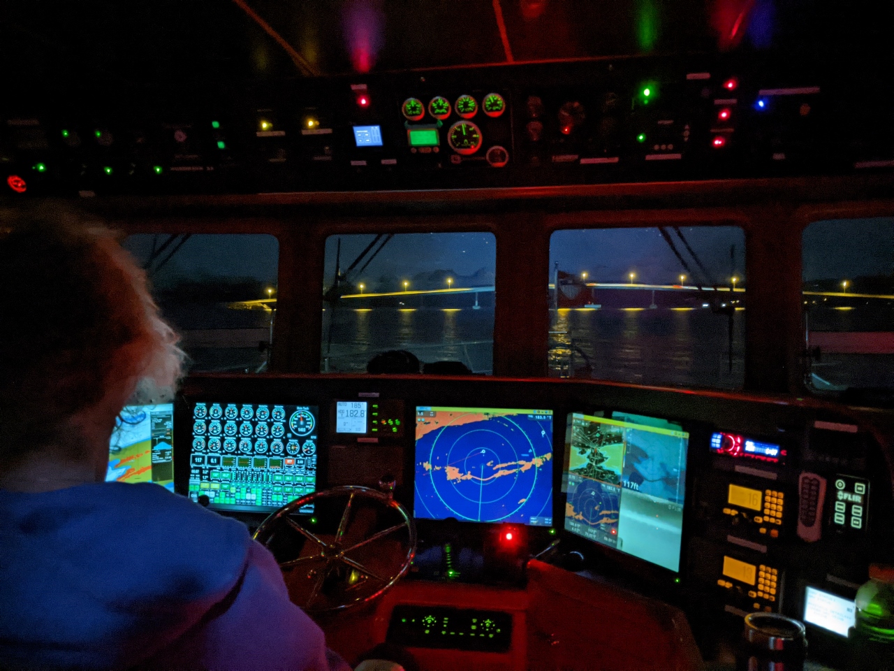 |
12/28/2020: Bolsoysundet Bridge
Position: 62°44.35'N, 7°21.43'E
Approaching the Bolsoysundet Bridge. The clearance is 52 ft (16m), plenty for our 30-ft (9.1m) air draft, but it looks a lot closer at night. We always verify clearances that look remotely close with a Nikon Forestry Pro Laser Rangefinder.
|
 |
12/28/2020: Moonrise
Position: 62°44.15'N, 7°21.38'E
Moonrise over Molde behind us as we approach the Bolsoysundet Bridge.
|
 |
12/28/2020: Vistdal Anchorage
Position: 62°43.56'N, 7°56.22'E
Our anchorage off the town of Vistdal in Langfjorden in 120 ft (37 m) on 400 ft (122 m) of rode.
|
 |
12/28/2020: Prestaksia
Position: 62°41.30'N, 8°7.66'E
The snow-dustd peaks 1,998-ft (609m) peak Prestaksia (foreground) and 1,640-ft (500m) Langfjellet.
|
 |
12/28/2020: Eresfjorden
Position: 62°41.30'N, 8°7.73'E
Mountain views at the head of Eresfjorden, a branch of Langfjorden, viewed on a tender tour of the area.
|
 |
12/28/2020: Langford Lodge
Position: 62°46.10'N, 8°0.35'E
River rock breakwater matching the buildings at the Langford Lodge in Langfjorden.
|
 |
12/29/2020: Ferry
Position: 62°40.65'N, 7°29.75'E
Ferry crossing Langfjorden at 7am on the Afarnes-Solsnes route.
|
 |
12/29/2020: Traffic
Position: 62°39.40'N, 7°9.13'E
Heavy traffic, most heading to or from Molde, at we exit Langfjorden. Directly off our bow is the fast ferry Jektoey (highlighted red triangle), a fishboat is close to port (black circle with dashed line extending forward, indicating course and speed), the ferries Moldefjord and Fannefjord are crossing ahead (blue triangles), the ferry Glutra just arrived at the terminal Moldefjord departed from, and the vessel Skorgnes (green triangle) is southeast of Glutra. The triangles are AIS targets and the circle is an ARPA target.
|
 |
12/29/2020: Fannefjord
Position: 62°39.69'N, 7°6.33'E
The ferry Fannefjord passing in front of us towards the dock at Vestnes.
|
 |
12/29/2020: Scanbio Dart
Position: 62°35.46'N, 6°15.14'E
The waste disposal vessel Scanbio Dart passing us in the channel to the new Lepsoy Bridge that surprised us a couple of weeks back. The channel is narrow and a bit of a constriction point along the coast, and we always seem to encounter other traffic there.
|
 |
12/29/2020: Alesund
Position: 62°28.27'N, 6°7.43'E
Approaching the bridge over Steinvagsundet as we head through Alesund en route to spend New Year's Eve in Geirangerfjord.
|
 |
12/29/2020: Tug Assist
Position: 62°26.46'N, 6°17.60'E
Small tug assisting one of several Russian ships at a shipyard outside Alesund. And even though the tug on the bow is remarkably small for the size of the vessel it's pulling, the outboard-powered skiff visible at the right side of the picture has just dropped his line from helping with the stern.
|
 |
12/29/2020: Torlevagen Anchorage
Position: 62°26.27'N, 6°18.85'E
Our anchorage in Torlevagen outside Alesund in 79 ft (24 m) on 250 ft (76 m) of rode.
|
 |
12/29/2020: Moonrise
Position: 62°26.27'N, 6°18.85'E
Spectacular moonrise over the anchorage at Torlevagen.
|
 |
12/29/2020: Impeller Failure
Position: 62°26.28'N, 6°18.84'E
Broken impeller blades sticking out of the generator heat exchanger inlet boot. All but three blades on the raw water pump impeller were thrown, but we found them all.
|
 |
12/29/2020: Dusk
Position: 62°26.28'N, 6°18.82'E
Dusk looking west from the anchorage at Torlevagen to the shipyard we passed en route to the anchorage.
|
 |
12/30/2020: Vegsundet
Position: 62°25.88'N, 6°20.13'E
Approaching the narrow and shallow channel Vegsundet, that will bring us to Storfjorden and on to Geirangerfjorden.
|
 |
12/30/2020: Close Quarters
Position: 62°25.88'N, 6°20.13'E
Close quarters as we approach the 53-ft (16.2m) bridge over Vegsundet.
|
 |
12/30/2020: Shallow
Position: 62°25.91'N, 6°20.88'E
The channel Vegsundet is well-marked, but really narrow, with the shallows right next to the boat clearly visible in our sidelights.
|
 |
12/30/2020: Stranda
Position: 62°18.58'N, 6°58.85'E
The town of Stranda with the Sunnmore mountains beyond.
|
 |
12/30/2020: Sunnylvsfjorden
Position: 62°16.40'N, 7°0.70'E
Cruising up mountainous Sunnylvsfjorden shortly before sunrise at 9:42am.
|
 |
12/30/2020: Grautnibba
Position: 62°5.54'N, 7°3.03'E
Dramatic Grautnibba rises 4,133-ft (1,260m) nearly strait up from Geirangerfjorden. The fjord's spectacular scenery make it one of Norway's most visited attractions.
|
 |
12/30/2020: Nearing Geiranger
Position: 62°6.25'N, 7°11.78'E
Approaching Geiranger at the head of Geirangerfjorden. On our previous visit in the summer of 2018, a large cruise ship was in town and the place was packed with tourists. It's looking pretty quiet now.
|
 |
12/30/2020: Geirangerfjord Anchorage
Position: 62°6.16'N, 7°11.93'E
Our anchorage at the head of Geirangerfjord in 107 ft (33m) on 300 ft (91 m) of rode. The depth makes it a less common choice for another pleasure craft to anchor here, but this normally wouldn't even be allowed because we are right where the cruise ships moor. With the cruise industry on hold during the pandemic however, there aren't any ships for us to interfere with. We feel particularly lucky to be in this unique and beautiful anchorage.
|
 |
12/30/2020: Web Cam
Position: 62°6.17'N, 7°11.93'E
Blog reader Ulrich Sonneborn found us on the Geiranger web cam.
|
 |
12/30/2020: Anchor Ball
Position: 62°6.17'N, 7°11.94'E
One of the fins on our anchor ball tore off in a storm, so we replaced the entire unit with a spare.
|
 |
12/30/2020: Geitfjellet
Position: 62°6.16'N, 7°11.95'E
Looking down Geirangerfjorden across our anchorage to snow-covered 5,298-ft (1615m) Geitfjellet.
|
 |
12/30/2020: Geiranger
Position: 62°6.16'N, 7°11.95'E
The view to Geiranger from our anchorage at the head of Geirangerfjorden.
|
 |
12/30/2020: Happy Hour
Position: 62°6.17'N, 7°11.95'E
The lights of Geiranger, viewed from Happy Hour in the cockpit.
|
 |
12/31/2020: Wing Fuel Filter
Position: 62°6.17'N, 7°11.93'E
The wing engine primary filter changed after 184 hours. The filter is still in good shape and not close to having measurable flow resistance, but there is black showing on the bottom 1/2 of the filter. This residue is asphaltenes that precipitate out of diesel during storage. A good measure of this is to watch the main engine filters since they get more hours of use and are changed on flow resistance rather than time. Since the main engine filters still last 375 to 500+ hours between changes, the asphaltenes building up in the tanks aren't yet a problem. Most boats will need a tank clean after 10 to 20 years and we suspect we will eventually as well.
|
 |
1/1/2021: Fireworks
Position: 62°6.15'N, 7°11.96'E
We usually try catch a fireworks display on New Year's Eve, but with most celebrations this year canceled or heavily curtailed, we felt being in Geirangerfjorden would be special enough. We weren't expecting to see any fireworks, but Geiranger residents put on quite a display. This will certainly be one of our more memorable New Year's Eve stops.
|
 |
1/1/2021: Tender
Position: 62°6.07'N, 7°12.29'E
The tender tied off at the Geiranger guest harbour for a New Year's Day hike to Storsaeterfossen.
|
 |
1/1/2021: Trailhead
Position: 62°5.97'N, 7°12.23'E
At the trailhead for our hike to Storsaeterfossen, along Fosserasa (The Waterfall Trail).
|
 |
1/1/2021: Marakelva
Position: 62°5.84'N, 7°12.46'E
The first part of the Fosserasa trail leads up a staircase with viewing platforms beside the river Marakelva. The river spills down through the middle of Geiranger and down into Geirangerfjorden.
|
 |
1/1/2021: Fosserasa
Position: 62°5.83'N, 7°12.47'E
Map of Fosserasa, the waterfall trail, along the staircase beside the river Marakelva.
|
 |
1/1/2021: Marakelva from Above
Position: 62°5.82'N, 7°12.49'E
Looking down into Geirangerfjorden from the top of the stairs along the river Marakelva. Dirona is just visible at anchor in the distance (click image for a larger view).
|
 |
1/1/2021: Fireworks
Position: 62°5.79'N, 7°12.55'E
Remnants of the New Year's Eve fireworks displays.
|
 |
1/1/2021: eMobility
Position: 62°5.75'N, 7°12.68'E
Dozens of eMobility electric Twizzy cars stored at Geiranger.
|
 |
1/1/2021: Morkja
Position: 62°5.86'N, 7°12.87'E
The path up the hillside Morkja follows the old road up to Vesteras.
|
 |
1/1/2021: Grinddalsnibba
Position: 62°6.00'N, 7°13.05'E
5,367-ft (1,636m) Grinddalsnibba burst into view as we entered a clearing.
|
 |
1/1/2021: Vesteras
Position: 62°6.11'N, 7°12.79'E
Looking southeast to Vesteras towards Grinddalsnibba on a spur trail to the Vesterasfjellet viewpoint. The old Vesteras farmhouse, dating from 1603, now is a popular restaurant and hotel.
|
 |
1/1/2021: Lostad
Position: 62°6.35'N, 7°12.51'E
We walked a little way along the trail to Lostad, looking for views, then returned back out to the Vesterasfjellet viewpoint.
|
 |
1/1/2021: Vesterasfjellet
Position: 62°6.23'N, 7°12.43'E
Fabulous views down Geirangerfjorden from the Vesterasfjellet viewpoint 920 ft (280m) above the water.
|
 |
1/1/2021: Moorage
Position: 62°6.23'N, 7°12.43'E
View down to Dirona anchored at the head of Geirangerfjorden from the Vesterasfjellet viewpoint. The two bouys in front of the boat and the one behind are part of the mooring system for large cruise ships. The white snake-like structure with blue edges at the bottom of the picture is the Geiranger SeaWalk, a floating ramp that is extended out to the moored ship to allow passengers to walk directly from ship to shore. This is much more environmentally friendly than shuttling passengers back and forth in the cruise ship's small boats.
|
 |
1/1/2021: Geiranger
Position: 62°6.22'N, 7°12.45'E
View to the town of Geiranger from the Vesterasfjellet viewpoint. The river Marakelva that we walked alongside on the first part of the trail is roughly at center, near the clump of trees.
|
 |
1/1/2021: Stairs
Position: 62°6.22'N, 7°12.45'E
The stairs we took from the waterfront along the river Marakelva to the upper level of town.
|
 |
1/1/2021: Geitfjellet
Position: 62°6.23'N, 7°12.44'E
View down Geirangerfjorden from the Vesterasfjellet viewpoint to snow-covered 5,298-ft (1615m) Geitfjellet
|
 |
1/1/2021: Back on Fosserasa
Position: 62°6.09'N, 7°13.16'E
Back on the trail Fosserasa to the waterfall Storsaeterfossen. The snow was getting pretty deep now at altitude 1208 ft (368 m).
|
 |
1/1/2021: Footsteps
Position: 62°6.30'N, 7°13.65'E
Looking northeast on the trail to Storsaeterfossen with 5,367-ft (1,636m) Grinddalsnibba in the background. We're definitely not the only ones to be out hiking recently—there are lots of footprints in the fresh snow.
|
 |
1/1/2021: Storsaeterfossen
Position: 62°6.31'N, 7°13.69'E
Our first view to beautiful Storsaeterfossen.
|
 |
1/1/2021: Finger Post
Position: 62°6.33'N, 7°13.88'E
Lots of trail choices near Storsaeterfossen.
|
 |
1/1/2021: Towards Falls
Position: 62°6.33'N, 7°13.87'E
There weren't any footsteps on the spur trail to Storsaeterfossen and the snow was quite deep.
|
 |
1/1/2021: Deep Snow
Position: 62°6.32'N, 7°13.87'E
Jennifer almost up to her knees in snow as we near Storsaeterfossen.
|
 |
1/1/2021: Path to Falls
Position: 62°6.30'N, 7°13.83'E
Storsaeterfossen is a popular destination because a trail leads right under the falls.
|
 |
1/1/2021: Slippery
Position: 62°6.30'N, 7°13.82'E
Thick ice had formed near the falls and the going was extremely slippery.
|
 |
1/1/2021: Under Falls
Position: 62°6.31'N, 7°13.83'E
Standing underneath the falls. What a fabulous New Years Day hike!
|
 |
1/1/2021: Ice
Position: 62°6.30'N, 7°13.74'E
The railings underneath the falls were coated with thick ice and looked wild.
|
 |
1/1/2021: Icicles
Position: 62°6.31'N, 7°13.72'E
Long icicles hung from the cavern behind the falls—we were careful not to get underneath any of them as they could do some serious damage if one fell on us.
|
 |
1/1/2021: Skiing
Position: 62°6.30'N, 7°13.66'E
We were able to partially ski back down on some of the steeper sections as we returned back out from Storsaeterfossen.
|
 |
1/1/2021: Summer Cabins
Position: 62°5.74'N, 7°13.04'E
Back at Geiranger, we passed these striking summer cabins.
|
 |
1/1/2021: Marakvegen
Position: 62°6.13'N, 7°12.38'E
The last time we were walked Marakvegen in Geiranger, the streets were packed with tourists. Today we saw perhaps two other people.
|
 |
1/1/2021: Geirangerfjord
Position: 62°5.93'N, 7°12.38'E
View from Geiranger to our anchorage in spectacular Geirangerfjord.
|
 |
1/2/2021: Snow
Position: 62°6.28'N, 7°11.63'E
Snow and strong winds as we depart the anchorage at Geirangerfjorden.
|
 |
1/2/2021: 49 knots
Position: 62°15.59'N, 7°1.74'E
We saw gusts to 49 knots from the south as we ran out of Sunnylvsjforden from Geirangerfjorden. But the winds have settled and we expect calm conditions overnight at the head of Tafjorden.
|
 |
1/2/2021: Sylte
Position: 62°17.06'N, 7°14.57'E
The town of Sylte beneath snow-covered mountains in Norddalsfjorden, a branch of the main Storfjorden.
|
 |
1/2/2021: Langhammeren
Position: 62°16.38'N, 7°21.81'E
In 1934, a 2.6 million cubic yard (2 million cubic meter) section of the mountain Langhammeren broke off and dropped over 2,300 ft (700m) into Tafjorden. The water displaced produced a 200-ft (60m) tsunami that raced up the fjord and overtook three villages, killing 40 people. The scar from the landslide is visible roughly at the center of the photo, directly beneath the highest peak.
|
 |
1/2/2021: Tafjord Anchorage
Position: 62°14.20'N, 7°24.84'E
Our anchorage off the village of Tafjord at the head of Tafjorden in 100ft (30m) on 300ft (90m) of rode.
|
 |
1/2/2021: 31.2 Degrees
Position: 62°14.20'N, 7°24.84'E
The temperature (upper center) is just below freezing at 31.2°F (-0.4°C).
|
 |
1/2/2021: PSS
Position: 62°14.20'N, 7°24.84'E
On a recent run up to full RPM, the PSS (packless shaft seal) backed off due to shaft vibration. As a safety precaution, we have another collar preventing the PSS from backing off all the way, but it still let a lot of water in. The primary problem is the shaft vibration, which isn't really noticable but still needs to be resolved.
For now, we tightened the PSS boot to the correct tension and moved the safety collar up so the rotor can't move down. This will work fairly well with only a occasional drip due to shaft vibration. |
 |
1/2/2021: Spitfire
Position: 62°14.20'N, 7°24.84'E
Spitfire in his latest new sleeping spot, on the rug above the generator where we dry our hiking boots after washing them.
|
 |
1/2/2021: Tafjord
Position: 62°14.20'N, 7°24.85'E
View to the landslide scar in the mountain Langhammeren from the anchorage off Tafjord at the head of Tafjorden. When the tsunami reached Tafjord, it was still 55 ft (17m) high and sent water up to a thousand feet (300 m) inland, decimating the village and killing 23 people.
|
 |
1/2/2021: Fishfinder
Position: 62°14.21'N, 7°24.87'E
Our Furuno DFF1 fish finder that we use as a depth sounder has been intermittent for a few weeks and now never shows depth. Here we are testing the connections to make sure everything it secure, but that didn't resolve the problem.
|
 |
1/2/2021: The Wave
Position: 62°14.20'N, 7°24.84'E
Since we were in Tafjord, we decided to watch the Norwegian disaster movie The Wave. The movie is filmed and set in Geiranger where we just were, but is based on the Tafjord Tsunami. We quite enjoyed the movie and it was interesting to see some of the places we'd just visited.
|
 |
1/3/2021: High RPM
Position: 62°26.89'N, 6°48.38'E
Running at high RPM to verify that the PSS no longer leaks in that situation. It doesn't.
|
 |
1/3/2021: Valle
Position: 62°28.42'N, 6°41.41'E
The town of Valle with snow-covered 3,507-ft (1,069m) Blaskjerdingen in the background.
|
 |
1/3/2021: Solnorvika Anchorage
Position: 62°29.10'N, 6°42.65'E
Our anchorage in Solnorvika in 74 ft (23 m) on 250 ft (76 m) of rode. You can see the warning on the top of the screen that one of our depth sounders no longer is working.
|
 |
1/3/2021: Oil Change
Position: 62°29.09'N, 6°42.65'E
Performing the 43rd oil and filter change on the main engine, at 11,533 hours. Our standard change interval is every 250 hours.
|
 |
1/3/2021: Dirona
Position: 62°29.09'N, 6°42.57'E
Looking northeast across the anchorage at Solnorvika towards 2,060-ft (628 m) Lebergsfjellet.
|
 |
1/3/2021: Sore Dragsundet
Position: 62°29.38'N, 6°43.32'E
Breaking a thin surface ice as we enter the narrow and shallow channel Sore Dragsundet. It's cold today with the temperature at 27°F (-2.7°C)
|
 |
1/3/2021: Skodjevika
Position: 62°29.88'N, 6°39.38'E
Reflections into Skodjevika on a calm and clear day.
|
 |
1/3/2021: Storstraumen Bridge
Position: 62°30.08'N, 6°36.67'E
The old National Heritage Board-protected Storstraumen Bridge with the new Straumsbrua behind. The original bridge opened on 1922, and was closed to traffic in 2004 when the new bridge was completed.
|
 |
1/3/2021: At Speed
Position: 62°30.15'N, 6°35.91'E
It gets cold running at speed in the tender, but we're dressed warmly. We've been making good use of the winter gear we picked up in Bergen and Forde.
|
 |
1/3/2021: Alesund
Position: 62°28.52'N, 6°8.98'E
Without really intending to, we ended up running the 16-nm length of the island Uksenoya all the way to Alesund on our tender tour from Solnorvika.
|
 |
1/3/2021: Mountains
Position: 62°28.03'N, 6°11.54'E
Mountain views as we return to Solnorvika from Alesund. The winter scenery is really starting to take shape.
|
 |
1/4/2021: Raising Anchor
Position: 62°29.10'N, 6°42.67'E
Raising anchor at 6am on a chilly 23°F (-5°C) morning.
|
 |
1/4/2021: Ferries
Position: 62°22.81'N, 6°16.62'E
Passing three ferry routes at the intersection with Storfjorden of Hjorundfjorden behind us to our south, Sulafjorden coming up to starboard and Vartdalsfjorden to port. One route crosses Hjorundfjorden, another crossed Storfjorden and the third crossed Sulafjorden. Visible are the blue triangular AIS targest of ferries either at their terminals or underway.
|
 |
1/4/2021: Vartdalsfjorden
Position: 62°15.11'N, 5°55.07'E
Mountain views in Vartdalsfjorden.
|
 |
1/4/2021: Laupsnipa
Position: 62°14.89'N, 5°53.48'E
The sheer south side of 1,843-ft (562m) Laupsnipa, viewed looking southwest.
|
 |
1/4/2021: Haddalsvika Anchorage
Position: 62°16.49'N, 5°51.92'E
Our anchorage in Haddalsvika in 110 ft (34m) on 300 ft (91 m) of rode.
|
 |
1/4/2021: Rjahornet
Position: 62°16.48'N, 5°51.91'E
1,968-ft (600 m) Rjahornet, viewed from the anchorage at Haddalsvika.
|
 |
1/4/2021: Anchorage Views
Position: 62°16.49'N, 5°51.91'E
Views from our anchorage in Haddalsvika (clockwise from top left: forward, aft, starboard and port).
|
 |
1/4/2021: Dirona
Position: 62°16.48'N, 5°51.86'E
Dirona anchored at Haddalsvika with 2,145-ft (654m) Gardnestua in the background. The majority of the mountains we see have hiking trails to them—you could spend a lifetime hiking here and not cover them all.
|
 |
1/4/2021: Fish Farm
Position: 62°17.16'N, 5°51.51'E
A new floating fish farm service building under construction at a yard in Haddal.
|
 |
1/4/2021: Sundgotstraumen
Position: 62°18.64'N, 5°50.79'E
With a combination of current, shallows and ice, we barely made it through the channel Sundgotstraumen. But made it we did.
|
 |
1/4/2021: Storevagen
Position: 62°18.99'N, 5°50.89'E
Looking into Storevagen partway along the channel from Garsholholen.
|
 |
1/4/2021: Hazard
Position: 62°19.02'N, 5°50.92'E
This stick, that problably once held a mark, is a real hazard extending just above the water.
|
 |
1/4/2021: Boiler
Position: 62°17.23'N, 5°45.30'E
What looks like an old steam boiler on a solitary rock near the island of Saudeholmen.
|
 |
1/4/2021: Paraglider
Position: 62°17.72'N, 5°47.46'E
Paraglider floating above us. It's cold down here, so it must be much colder up there.
|
 |
1/4/2021: Kjeldsund
Position: 62°16.34'N, 5°49.62'E
Wooden boat tucked away at Kjeldsund.
|
 |
1/5/2021: Dragsundet Bridge
Position: 62°16.83'N, 5°50.05'E
Approaching the Dragsundet Bridge. The air clearance is 65-ft (20m), but the channel between the bridge supports is quite narrow. We felt we could almost touch each side as we passed through. At night everything seems closer.
|
 |
1/5/2021: Stad
Position: 62°12.64'N, 5°7.70'E
Rounding a snow-dusted Stad.
|
 |
1/5/2021: SendError
Position: 62°12.61'N, 5°7.60'E
Our primary depthsounder has been intermittent for the last two weeks and recently has gone away entirely. We have a second depthsounder that we can rely on, but when operating in tight quarters, not always with excellent charts, we really like two pieces of data confirmation the situation.
|
 |
1/5/2021: Sunrise
Position: 62°10.66'N, 5°4.58'E
Spectacular 9:49am sunrise as we complete our rounding of Stad.
|
 |
1/5/2021: Krakenes Lighthouse
Position: 62°2.15'N, 4°58.19'E
Conditions were calm, so we continued south past Stad on the exposed outer coast rather than taking the more protected channel past Maloy. This is Krakenes Lighthouse, completed in 1906. The lighthouse was automated in 1986 and the keeper's house, Stormhuset (the Stormhouse) can now be rented for overnight stays. The lighthouse stands on one of the most exposed sections of the Norwegian west coast between Bergen and Alesund, and has recorded several wind records.
|
 |
1/5/2021: Veten
Position: 61°57.54'N, 4°59.04'E
2,011-ft (613m) Veten, viewed from sea.
|
 |
1/5/2021: Hennoysundet Anchorage
Position: 61°48.99'N, 5°13.54'E
Our anchorage in Hennoysundet in 46 ft (14 m) on 175 ft (53 m) of rode.
|
 |
1/5/2021: Faucets
Position: 61°48.96'N, 5°13.50'E
Likely our first bit of cold weather damage. The freshwater faucet froze up, damaging the sealing washer. We replaced the faucet with a spare, but since we're down to only one remaining spare, we took apart the freeze-damaged part and were able to successfully replace the sealing washer.
|
 |
1/5/2021: Aksla
Position: 61°48.96'N, 5°13.50'E
View from the anchorage at Hennoysundet to 1,942-ft (592m) Aksla (the cliff at right).
|
 |
1/5/2021: Happy Hour
Position: 61°48.97'N, 5°13.51'E
Happy Hour at Hennoysundet with our starboard floodlight illuminating the island of Hennoyna in the background. Last year in Amsterdam, we upgraded the sidelights from 70-watt to 150-watt, and the new ones have an impressive reach.
|
 |
1/6/2021: Sunrise
Position: 61°32.90'N, 5°10.39'E
Sunrise as we approach the Stongasundet bridge en route to the anchorage at Helleviksundet.
|
 |
1/6/2021: Helleviksundet Anchorage
Position: 61°32.62'N, 5°10.43'E
Our anchorage in Helleviksundet, southeast of Floro, in 70 ft (21 m) on 250 ft (76 m) of rode.
|
 |
1/6/2021: Klauvekeipen
Position: 61°32.61'N, 5°10.45'E
View to snow-covered 2,522-ft (769 m) Klauvekeipen from the anchorage at Helleviksundet.
|
 |
1/6/2021: Sunset
Position: 61°32.60'N, 5°10.43'E
Sunset from the anchorage at Helleviksundet.
|
 |
1/7/2021: Vent
Position: 61°32.60'N, 5°10.41'E
Plugging the inlet for the master stateroom ventilation system to prevent large amounts of cold air from entering the stateroom. Big winds tended to whistle and rattle through the vent, so this also made the stateroom much quieter during a storm.
The original Nordhavn 47s on which the 52 is based didn't have an overhead hatch to the Portuguese bow, so the master staterooms could get quite stuffy. The solution was to add this vent. The hatch on the newer boats works really well, while the vent is only moderately effective and can be quite noisy in a storm. |
 |
1/7/2021: Valve Adjustment
Position: 61°32.61'N, 5°10.43'E
Performing the 7th valve adjustment on the main engine at 11,586 hours. The adjustment interval is every 2,000 hours after the first 1,000 hours, and we also did it when we changed the injectors.
|
 |
1/8/2021: Sunrise
Position: 61°12.82'N, 4°51.15'E
Sunrise underway through Buefjorden.
|
 |
1/8/2021: Resesundet Anchorage
Position: 61°7.12'N, 4°48.88'E
Our anchorage in Resesundet in 110 ft (34m) on 330 ft (101 m) of rode. Before we anchor, we measure the swing space with a divider to ensure we have sufficient room. And when we drop anchor, we set a red circular anchor mark to show the position of the anchor then draw a divider to the limit of our pull for the given rode when we set (in this case 110 yards). We can use this to verify that the anchor is not dragging when we encounter big winds. This screenshot, taken after we saw gusts to 49 knots in the anchorage, shows that the boat has pulled back in the wind, but no further than the limit of the rode.
|
 |
1/8/2021: Resesundet Views
Position: 61°7.11'N, 4°48.92'E
Views from our anchorage in Resesundet (clockwise from top left: forward, aft, starboard and port).
|
 |
1/8/2021: Feeding
Position: 61°7.11'N, 4°48.87'E
Shortly after we anchored, a local resident arrived bringing food for the sheep on the island of Hogneskjela to our west.
|
 |
1/8/2021: Shipwreck
Position: 61°7.31'N, 4°48.86'E
Shipwreck off the west coast of Klubben, viewed on a tender tour of the area.
|
 |
1/8/2021: Dirona
Position: 61°7.16'N, 4°48.56'E
Dirona at anchor in Resesundet, viewed looking east from Gullholmsundet.
|
 |
1/8/2021: Hardbakke
Position: 61°4.46'N, 4°50.15'E
View to the harbour at Hardbakke, the administrative center for the municipality of Solund.
|
 |
1/8/2021: Sunset
Position: 61°4.15'N, 4°49.68'E
Sunset looking south to the bridge over Indre Steinsundet at Hardbakke.
|
 |
1/8/2021: Sheep
Position: 61°7.06'N, 4°48.74'E
When we returned to the anchorage and toured along the Hogneskjela shoreline, the sheep seemed to think we were the local bringing food and came rushing down.
|
 |
1/9/2021: Snow
Position: 61°7.13'N, 4°48.91'E
An early-morning snowfall with high winds in the anchorage at Resesundet. With the aft floodlight on, the snowflakes looked almost like fireflies.
|
 |
1/9/2021: Greywater Tank
Position: 61°7.13'N, 4°48.92'E
The TankWatch 4 tank level measuring mechanism in the greywater tank had become fouled and wasn't reading properly. We cleaned it up and got it working again.
|
 |
1/9/2021: Blackwater Tank
Position: 61°7.13'N, 4°48.91'E
Today we decided to tackle the problem with the blackwater tank not being able to pump all the way down to the bottom. Our current working theory is the in-tank pickup pipe is corroded through, leaking air, and no longer allows pumping to the bottom. The first step is to remove the tank cover to inspect the pipes. Getting the hoses off and out of the way was a really difficult job. These hoses are incredibly stiff, and eleven years hasn't improved the situation. We eventually got them off by applying small amounts of heat with a heat gun.
|
 |
1/9/2021: Cleaning
Position: 61°7.13'N, 4°48.92'E
After eventually freeing the blackwater tank cover, we put the whole thing in a large garbage bag and carried it out to the cockpit. Here James is cleaning it prior to inspection.
|
 |
1/9/2021: Corrosion
Position: 61°7.13'N, 4°48.91'E
After cleaning, we found the blackwater tank pickup pipe is made of super high-quality stainless steel, but the weld that made the pipe less so. There is a quarter-inch gap where the weld has rusted out. Some corrosion also is visible towards the top of the pipe, but not much. Generally the pipe is in wonderful shape, but the weld is gone. We've heard several Nordhavn owners complain about having trouble at pump-out stations and this could be the problem in some cases.
|
 |
1/9/2021: Sanitation Hose
Position: 61°7.13'N, 4°48.93'E
The obvious solution to fixing the corroded pickup pipe is to re-weld the seam, but we don't have welding gear, and James isn't much of a stainless-steel welder anyway. Instead, we cut a sanitation hose to fit and slid the hose down over it. The pipe keeps the hose in exactly the right place, and the hose provides a nice seal for effective operation.
Getting the cover back on and those stiff hoses back on place was another big job, but after reinstalling everything the system is back to working perfectly. But what a monstrous job—it took the entire afternoon. |
 |
1/9/2021: 40 Knots
Position: 61°7.13'N, 4°48.91'E
A weather system is moving through the area today, bringing 49-knot gusts to the anchorage (see tell-tale on the wind speed gauge at upper right—click image for a larger view).
|