Geirangerfjord is one of the better known and popular fjords in Norway and is part of the West Norwegian Fjords UNESCO World Heritage Site. Full-sized cruise ships regularly travel the waterway, as do the Hurtigruten coastal ferries, local ferries and countless other craft. We’d already visited Geirangerfjord on a road trip up the Trollstigen route from Åndalsnes, and returned by water on a 90-mile tender trip from an anchorage just south of Ålesund.
Below are trip highlights from August 29th in Geirangerfjord, Norway. Click any image for a larger view, or click the position to view the location on a map. And a live map of our current route and most recent log entries always is available at mvdirona.com/maps
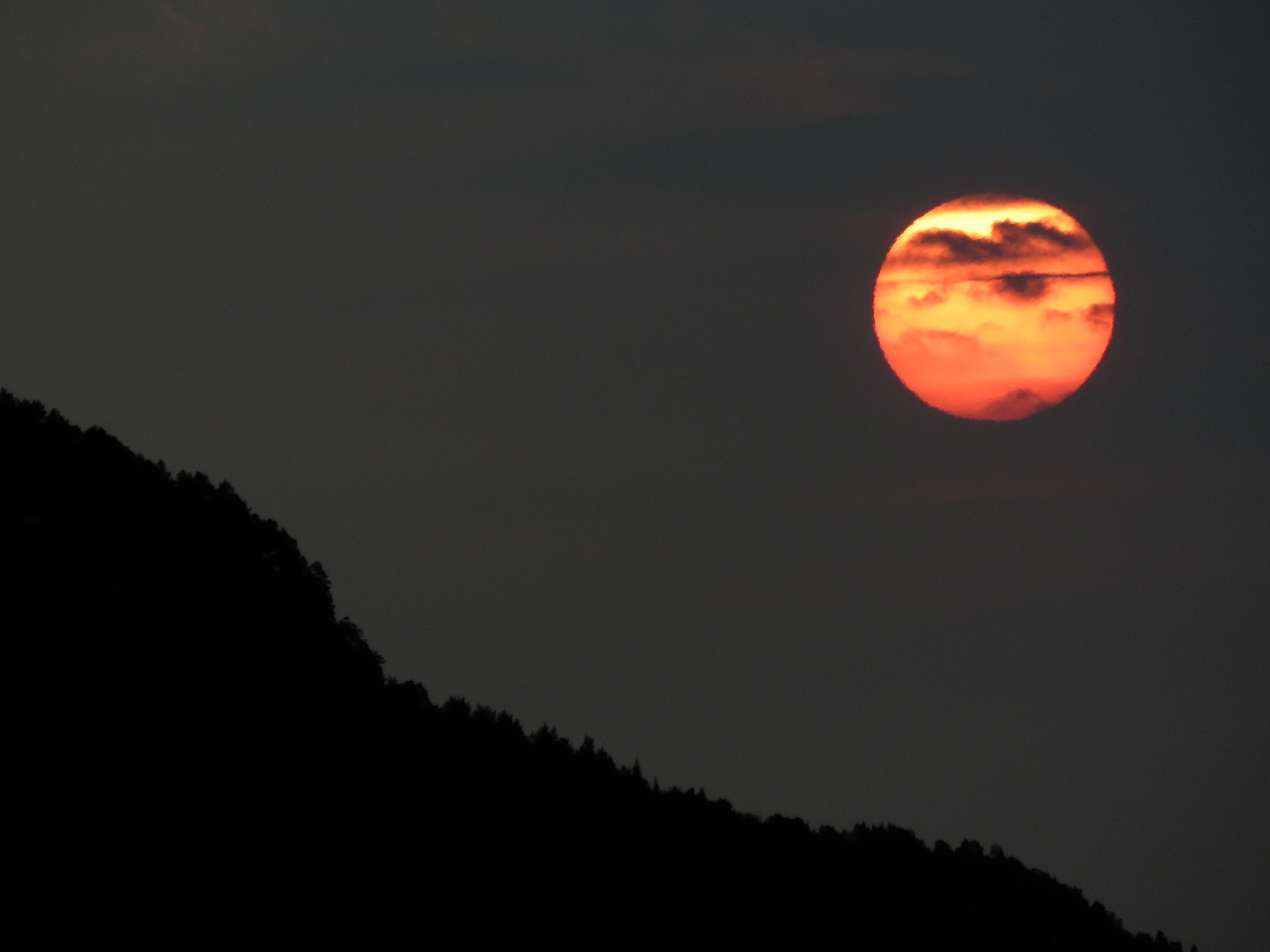 |
Red Sun
Position: 62°25.89’N, 6°20.15’E
A fabulous red sunrise as we head south from Alesund.
|
 |
Vegsundet
Position: 62°25.88’N, 6°20.59’E
We pulled off to the side to allow an oncoming fishing vessel to pass through Vegsundet before we proceeded. There was room to pass, but only just. And with several knots of current running in the channel, waiting was a safer option.
|
 |
Honningdalsvagen
Position: 62°27.79’N, 6°37.25’E
At anchor in Honningdalsvagen. The scenic cove had good protection from the forecast southwest winds and was a convenient base for a tender run to Geirangerfjord.
|
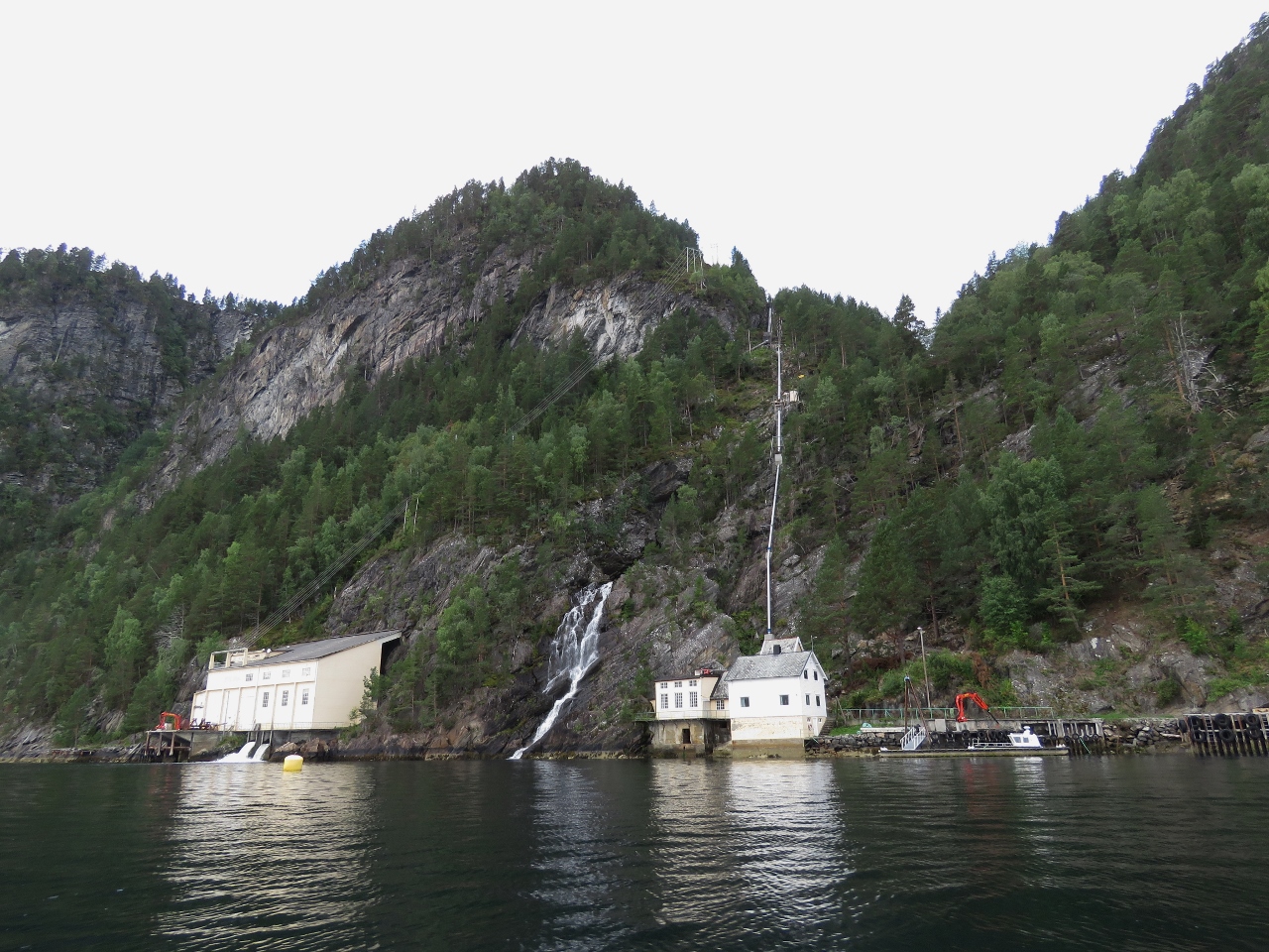 |
Hydroelectricity
Position: 62°21.45’N, 6°53.71’E
Workers were installing new pipe, on the right, at this hydroelectric station along Storfjorden.
|
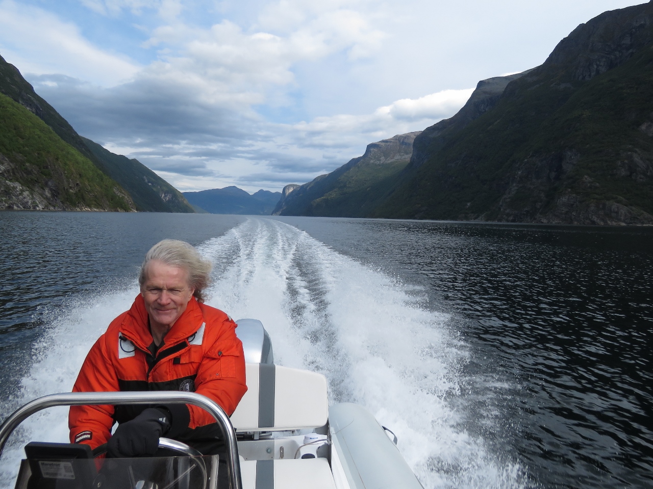 |
Underway
Position: 62°10.37’N, 7°0.71’E
We’re all bundled up for the tender run to Geirangerfjord in our flotation suits, among our favourite cold-weather boating gear. The suits are similar to ski jumpsuits, but with built-in flotation and extra insulation. We use Mustang 2175s, which are standard issue with the Coast Guard on both sides of the Canada-US border. We can toss these on over light clothing, add a pair of gloves and perhaps some ear warmers and be instantly warm in the coldest weather. This will be one of our longest tender trips ever, at nearly 90 miles return.
|
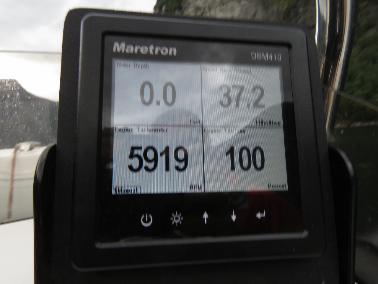 |
37.2 mph
Position: 62°10.37’N, 7°0.71’E
We’re loving the speed of the new tender. And with the larger actuators, it comes on plane with ease.
|
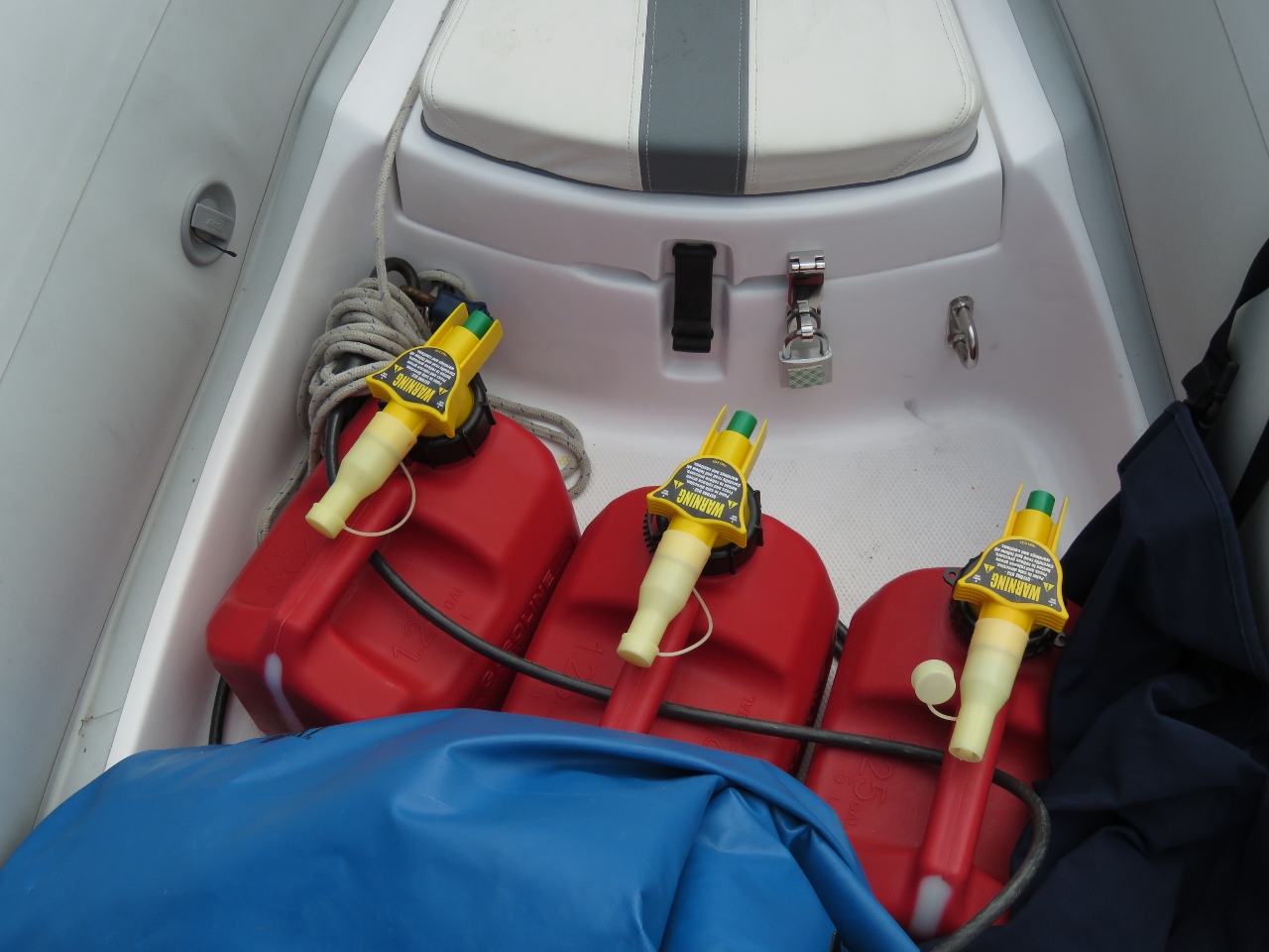 |
Extra Fuel
Position: 62°10.37’N, 7°0.71’E
The new tender has a listed fuel capacity of ten gallons (39 L), but until we calibrate the tank for the new Maretron TLM150, we don’t know the tank fuel tank capacity nor do we have an accurate understanding of the engine’s burn rate. So we’re bringing along an extra 3.75 gallons (14L). But, even with all the fuel we have on board, we still might learn we don’t have the fuel to do the whole trip. So it’s possible we might have to stop for fuel along the way.
|
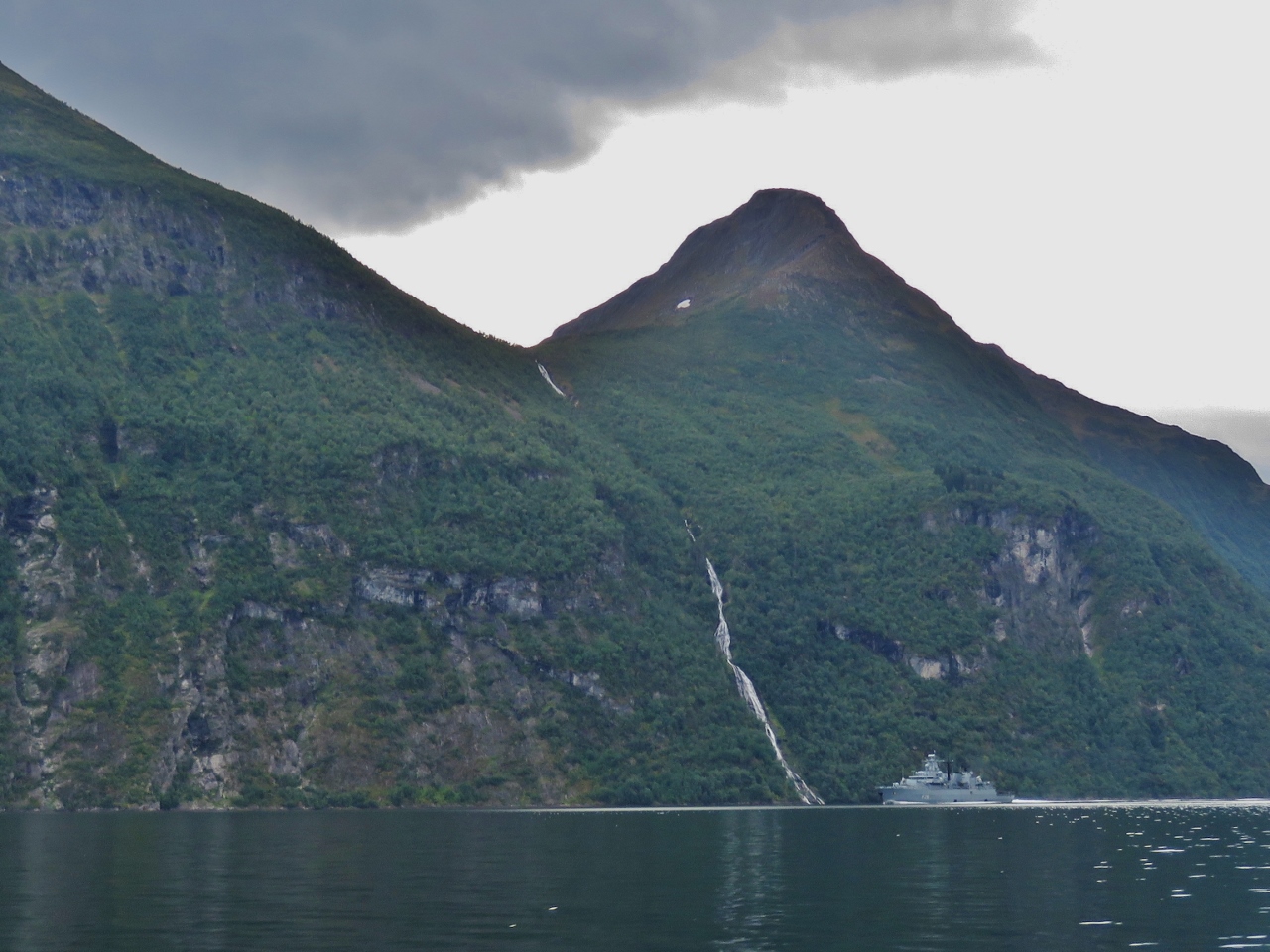 |
Schleswig-Holstein
Position: 62°9.31’N, 6°59.96’E
The German frigate Schleswig-Holstein passing a waterfall near the entrance to Geirangerfjord.
|
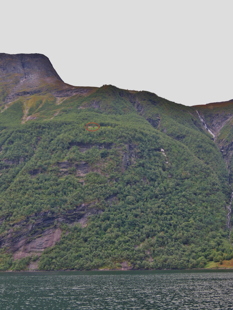 |
Mountain Cabin
Position: 62°5.57’N, 7°2.70’E
We saw several cabins such as this one, circled in red, way up in the hills with no obvious road or trail access (click image for a larger view). This one you might land a helicopter at, but many had little or no space. We surmise that people must hike in from some other access point.
Update 2018/09/01: Blog readers Trond Saetre and Benlogis tell us these likely are old farms dating from medieval times and most are now abandoned. |
 |
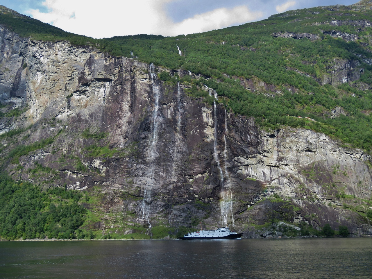
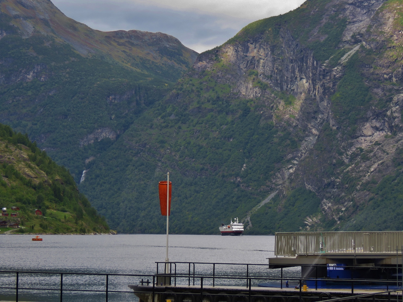
Scenery
Position: 62°5.61’N, 7°3.20’E
Geirangerfjord is famous for its dramatic scenery. This is the view looking up the fjord to Friaren waterfall.
|
 |
Friaren
Position: 62°6.16’N, 7°6.45’E
Jennifer standing at the base of spectacular Friaren waterfall.
|
 |
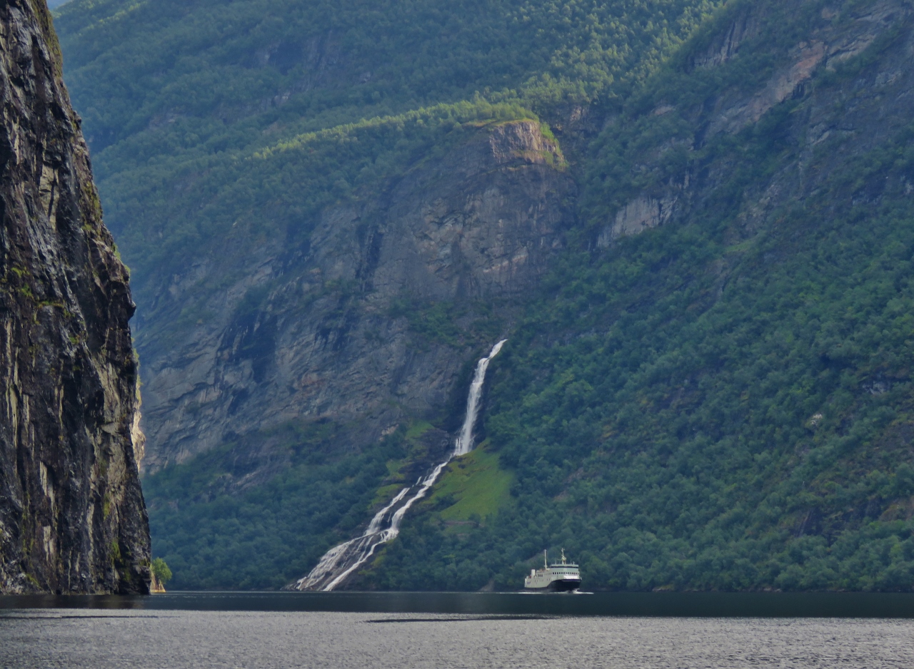
Seven Sisters
Position: 62°6.36’N, 7°6.61’E
Ferry passing beneath the Seven Sisters waterfall opposite Friaren.
|
 |
Waterfall
Position: 62°6.57’N, 7°6.97’E
Another beautiful Geirangerfjord waterfall.
|
 |
Cliffs
Position: 62°6.74’N, 7°7.19’E
Passing beneath steep cliffs along the south shore.
|
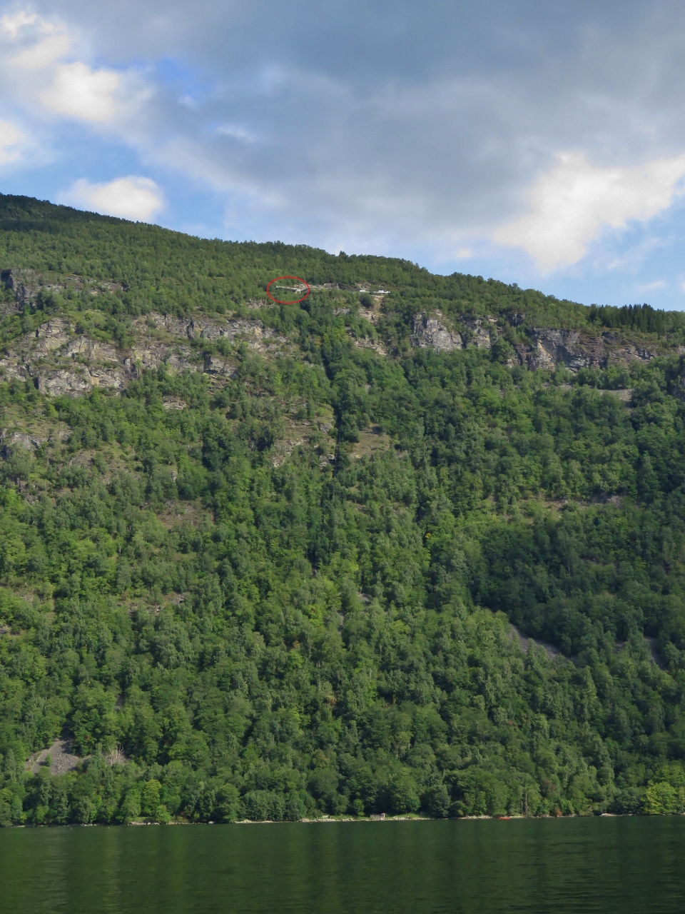 |
Lookout
Position: 62°6.79’N, 7°9.81’E
The lookout we visited by car from Åndalsnes is high up the mountain, circled in red (click image for a larger view).
|
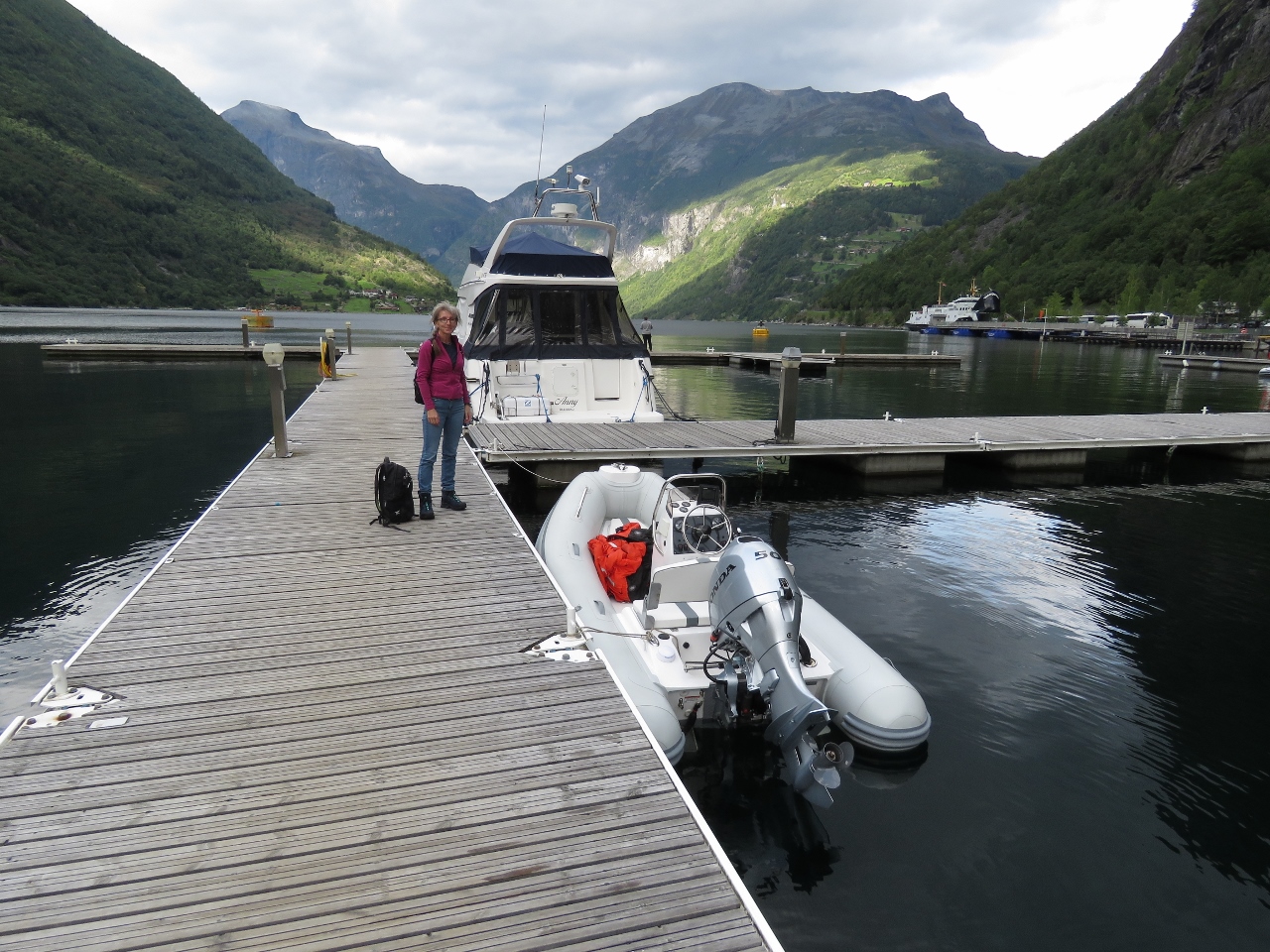 |
Geiranger Docks
Position: 62°6.08’N, 7°12.31’E
We shed our flotation suits at the Geiranger guest harbour for lunch and a walk through town. Without a cruise ship in port, the town is a lot less busy than when we visited by car from Åndalsnes.
|
 |
Naustkroa
Position: 62°6.12’N, 7°12.36’E
We had a delicious lunch overlooking the water on the back terrace at Naustkroa.
|
 |
Versteralen
Position: 62°6.12’N, 7°12.36’E
The Hurtigruten Versteralen arriving into Geiranger from Alesund.
|
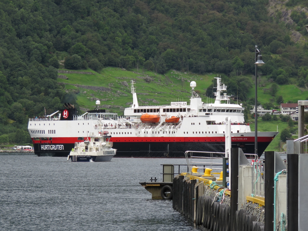 |
Disembarking
Position: 62°6.12’N, 7°12.36’E
We knew that the Hurtigruten ferries made a five-minute stop at Geiranger in the summer to disembark passengers, but we couldn’t see how—there’s not a fixed dock large enough to handle them. Cruise ships tie off in open water on bow-and-stern moorings, but that would take some time organize. We were curious how the Hurtigruten dropped off passengers on its daily stop. Here’s the trick: the Geirangerfjord headed out to meet the Versteralen, who slowed down while they did an underway passenger transfer.
|
 |
Mushroom
Position: 62°5.84’N, 7°12.43’E
Giant “fairytale” mushroom along the Geiranger Waterfall Walk.
|
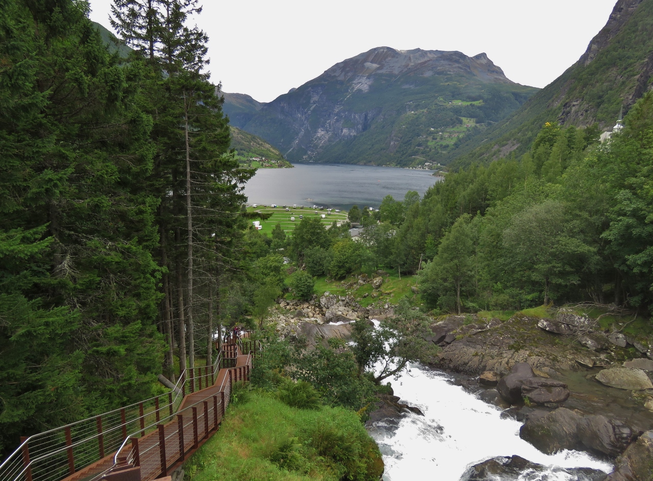 |
Waterfall Walk
Position: 62°5.82’N, 7°12.46’E
Looking down into Geirangerfjord from the Waterfall Walk, a beautifully-built staircase along the Storfossen waterfall.
|
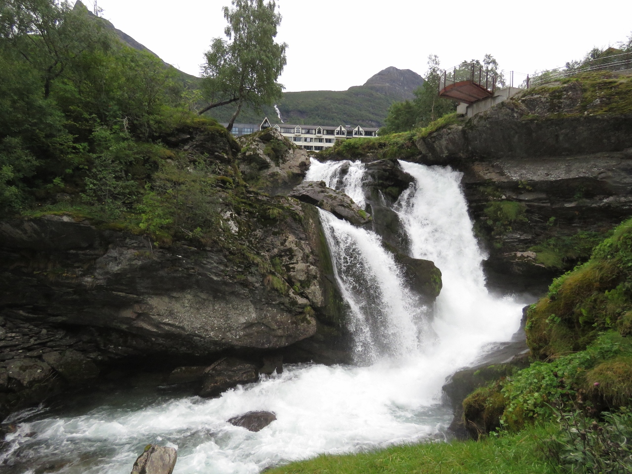 |
Storfossen
Position: 62°5.82’N, 7°12.46’E
Storfossen gushing and cascading beside the Waterfall Walk.
|
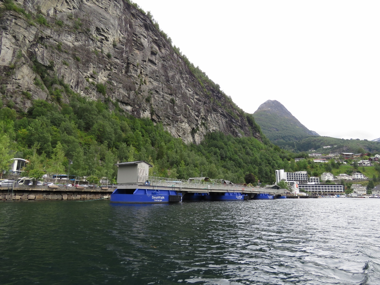 |
SeaWalk
Position: 62°6.62’N, 7°11.30’E
When we visited Geiranger by car, the cruise ship MSC Preziosa was moored on offshore buoys and the SeaWalk with its blue floating supports was extended alongisde to allow passengers to disembark. Today the SeaWalk is folded up against the shore.
|
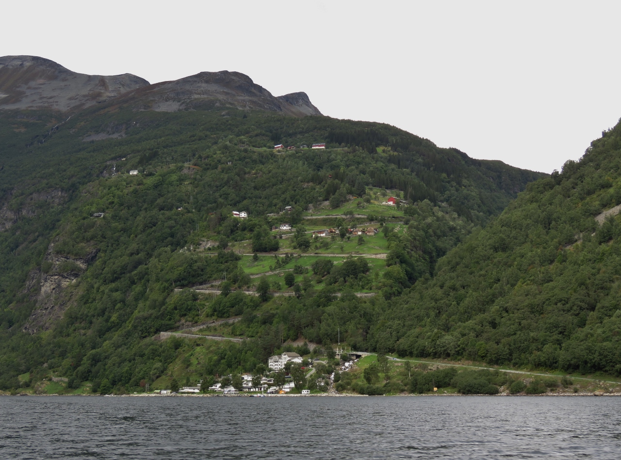 |
Switchbacks
Position: 62°7.03’N, 7°10.04’E
A view to the switchbacks we drove down to reach Geiranger from the lookout.
|

|
Click the travel log icon on the left to see these locations on a map, with the complete log of our cruise.
On the map page, clicking on a camera or text icon will display a picture and/or log entry for that location, and clicking on the smaller icons along the route will display latitude, longitude and other navigation data for that location. And a live map of our current route and most recent log entries always is available at mvdirona.com/maps. |
Wow, the Friaren Waterfall looks stunning — rare to see a layered, spreading fall like that. The photos of Geirangenfjord are spectacular. Great stuff.
Thanks John. We had two excellent trips to the Fjord and it’s a real winner.