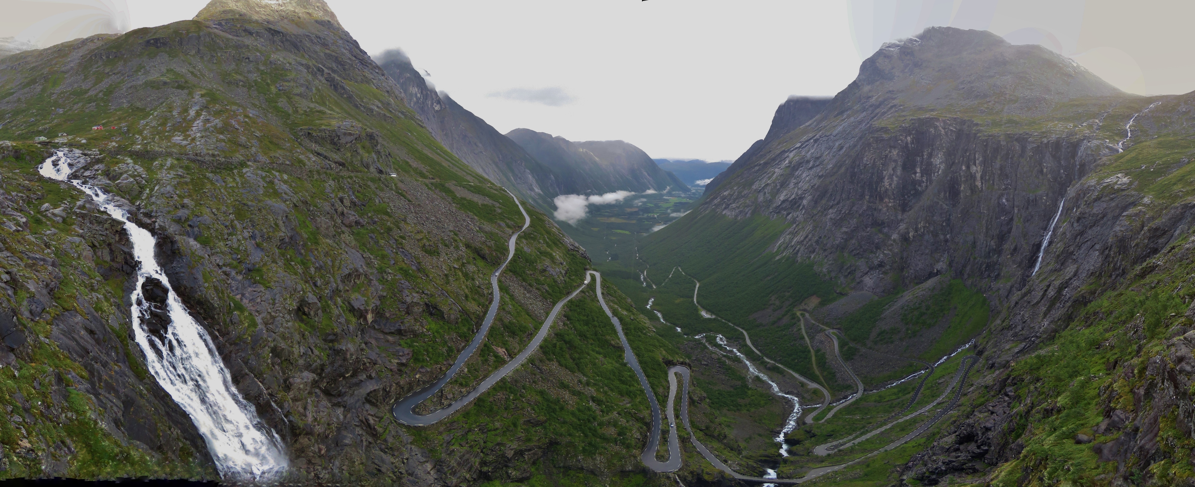
The dramatic Trollstigen route near Åndalsnes winds up a steep 1:12 gradient through 11 hairpin turns so tight that vehicles longer than 43 ft (13.1m) are prohibited. En route, a narrow bridge carries the road over and beside the spectacular 1,050 ft (320 m) Stigfossen falls. In 2012, Trollstigen was officially opened as a National Tourist Route and is so popular that during the busy season over 2,500 vehicles drive through daily.
Blog reader and Ålesund native Steinar Nerland offered to drive us up Trollstigen, but he was out of town while we were in the area. His suggestion got us interested in visiting Åndalsnes and we had a fabulous time. The day after hiking Nesakskla we rented a car and drove up Trollstigen, then down the other side to famed UNESCO Heritage Site Geirangerfjord with a side trip to 314-ft-high (96m) Zakarias Dam.
Below are trip highlights from August 21st, 2018. Click any image for a larger view, or click the position to view the location on a map. And a live map of our current route and most recent log entries always is available at mvdirona.com/maps
 |
Cow
Position: 62°29.81’N, 7°40.32’E
We picked up a rental car early this morning to drive up the famous National Tourist Route Trollstigen (“The Trolls Road”) from Andalsnes to Geiranger. This cow standing on the road had little concern for our car—we had to sqeeze beside it.
|
 |
Trolls
Position: 62°28.94’N, 7°40.14’E
Many of the geographical features in the area are named after trolls, a mystical creature from Norse Mythology. We’ve seen many troll statues and troll figurines for sale in gift shops. This campsite has no shortage.
|
 |
Istra
Position: 62°28.17’N, 7°40.30’E
The river Istra gushing alongside the road.
|
 |
Wheels
Position: 62°27.53’N, 7°40.54’E
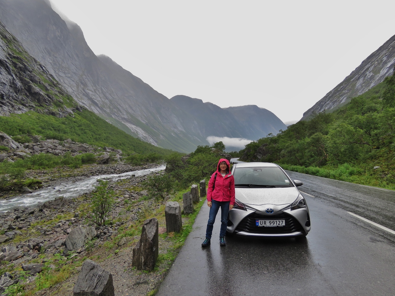
Jennifer with our ride, a hybrid Toyota Yaris. We were amazed at the excellent fuel economy it got. After driving 165 miles (265 km) with a total elevation gain of 19,700 ft (6,000 m), we’d only burned 10 liters of gasoline (assuming it was full when we picked it up).
|
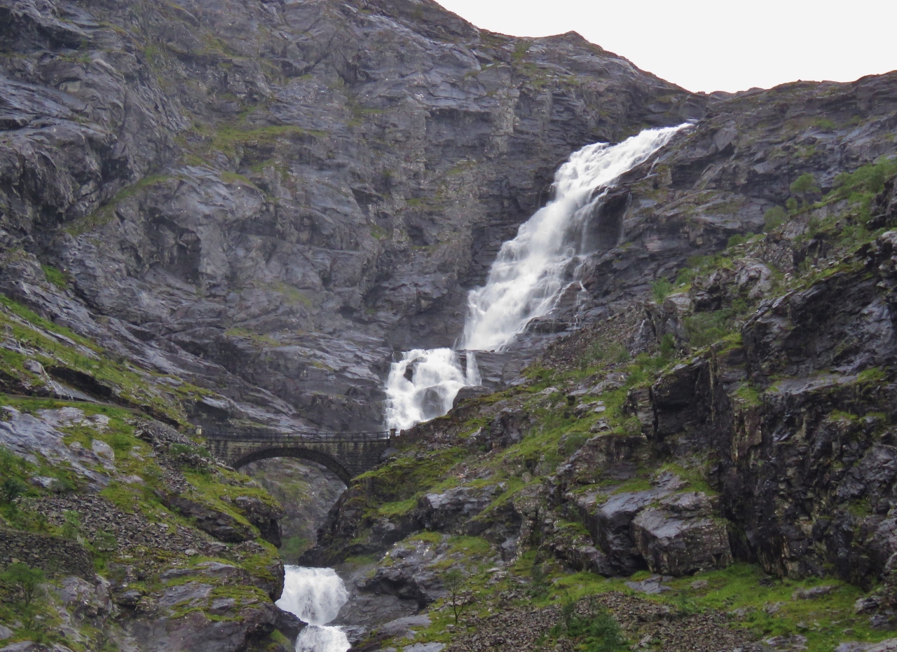 |
Stigfossen Waterfall
Position: 62°27.54’N, 7°40.75’E
Dramatic Stigfossen Waterfall plumetting from the top of Stigrora, 2,815 ft (858 m) above sea level, down and under Stigfoss Bridge. Trollstigen winds up and along the bridge.
|
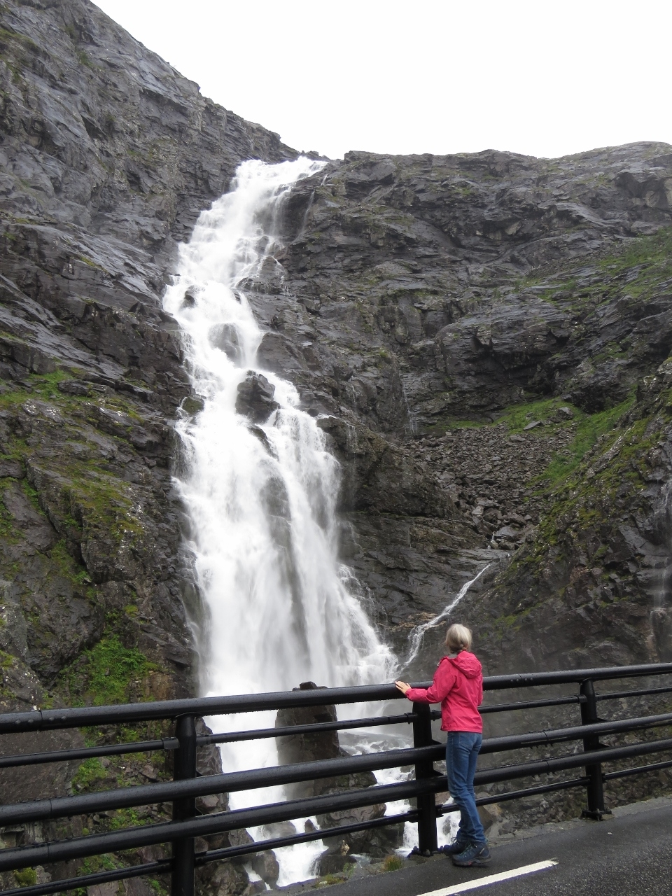 |
Stigfoss Bridge
Position: 62°27.56’N, 7°40.23’E
Through a series of switchbacks, climbing the steep slope, we arrived at Stifgoss bridge for with an excellent close-up view to Stigfossen Waterfall.
|
 |
Visitor Center
Position: 62°27.30’N, 7°40.03’E
The striking visitor center above Trollstigen.
|
 |
Upper Lookout
Position: 62°27.30’N, 7°40.04’E
At the upper lookout above Trollstigen.
|
 |
Lower Lookout
Position: 62°27.31’N, 7°40.34’E
Jennifer standing at the lower Trollstigen lookout.
|
 |
Trollstigen
Position: 62°27.29’N, 7°40.31’E
The view from the lower lookout to the spectacular switchbacks of Trollstigen with Stigfossen Waterfall on the left, Stigfoss Bridge at the bottom just right of center, and the Romsdal valley in the distance. It was a pretty wild road to drive up. (Click image for a larger view).
|
 |
Breakfast
Position: 62°27.30’N, 7°40.34’E
Steady rain had been falling all morning, but we found a little nook with some protection and had a picnic breakfast at the lower lookout overlooking Trollstigen.
|
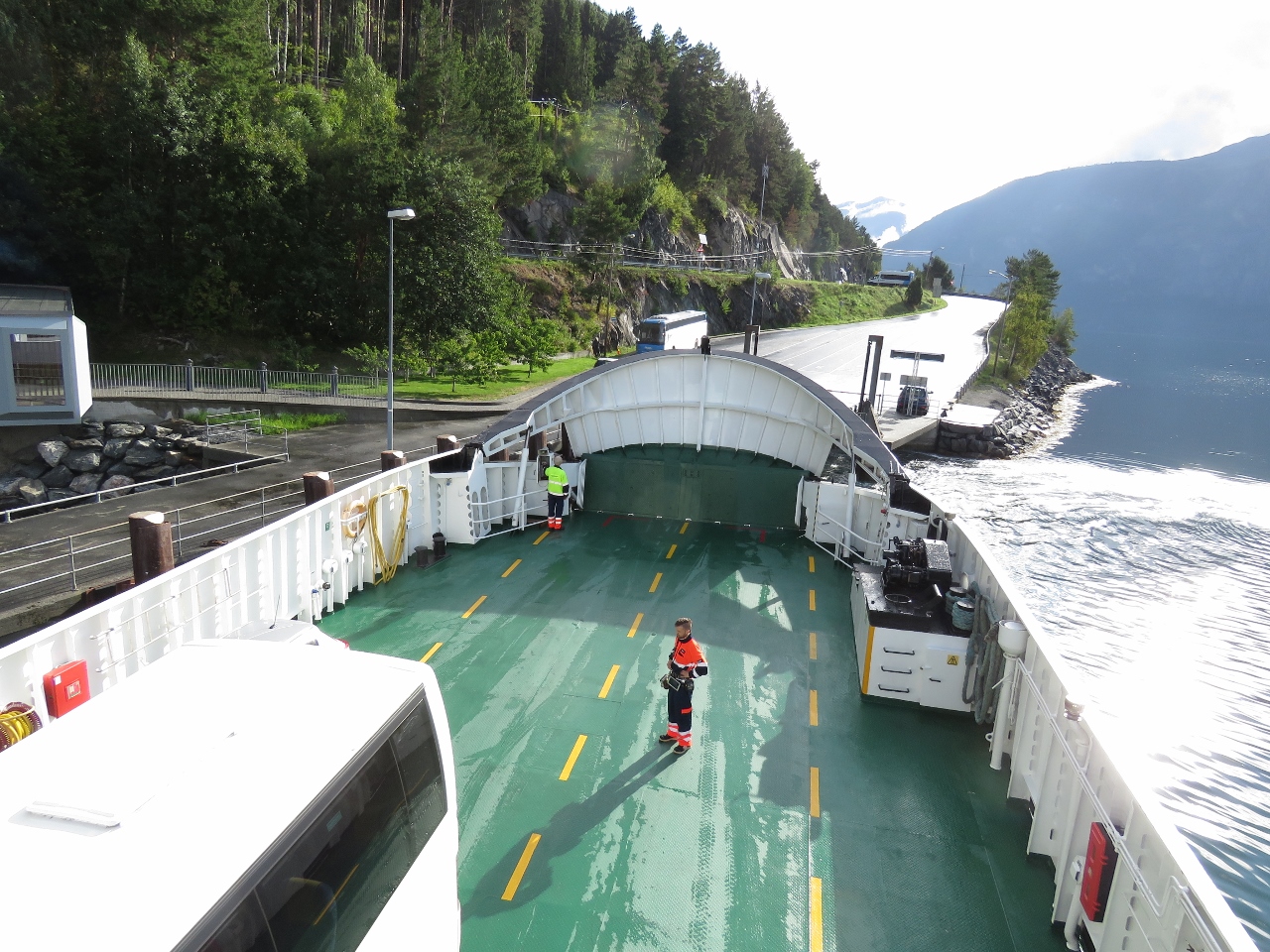 |
Ferry
Position: 62°16.95’N, 7°10.78’E
The next leg of our journey was a ferry ride across Stofjorden from Linge to Eidsdal.
|
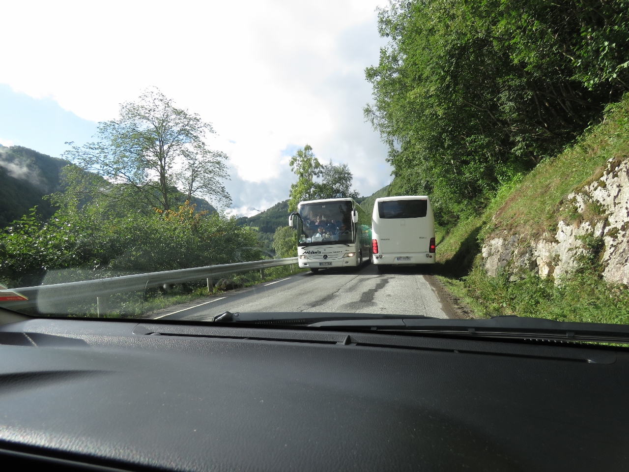 |
Passing
Position: 62°13.20’N, 7°8.61’E
Driving a bus on this road looks challenging—there’s not much room to pass.
|
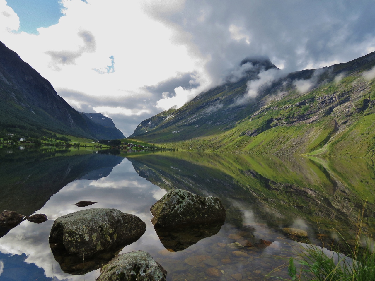 |
Eidsvatnet
Position: 62°10.92’N, 7°9.89’E
The rain has stopped and the skies are clearing, producing this beautiful scene at the lake Eidsvatnet.
|
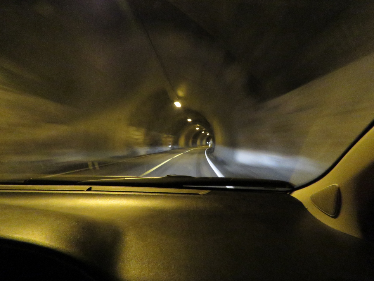 |
Tunnel
Position: 62°8.23’N, 7°11.08’E
In one of several tunnels we’ll pass through today.
|
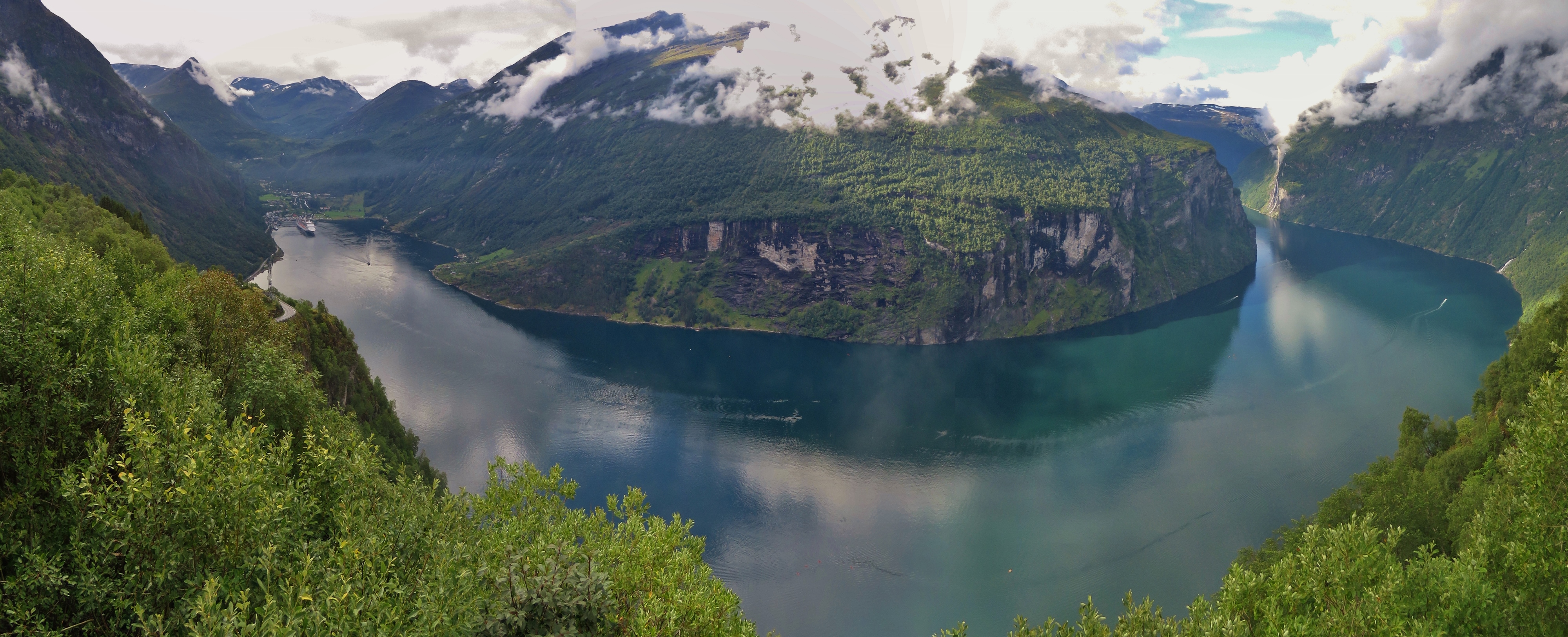 |
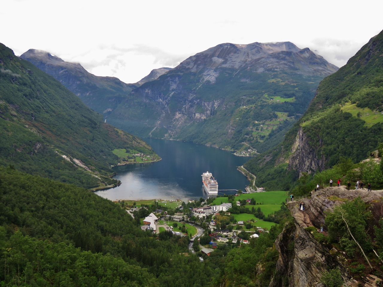
Geirangerfjord
Position: 62°7.57’N, 7°9.99’E
Geirangerfjord is one of the better known and popular fjords in Norway and is part of the West Norwegian Fjords UNESCO World Heritage Site. Full-sized cruise ships regularly visit, as do the Hurtigruten coastal ferries, local ferries and countless other craft. This lookout is perched above Geirangerfjord before the road plunges through a series of switchbacks to the town of Geiranger at the far left. The lookout was packed with cruise ship passengers who had been bussed up from the ship visible off the town.
|
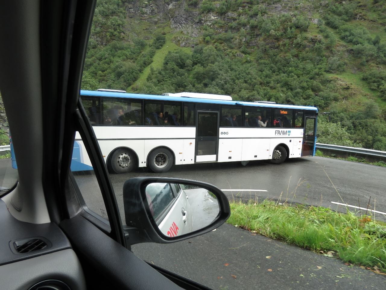 |
Switchback
Position: 62°7.25’N, 7°10.92’E
It’s a real struggle for the many full-sized buses to navigate the tight switchbacks. The driver of this bus had to stop and back up on order to complete the corner.
|
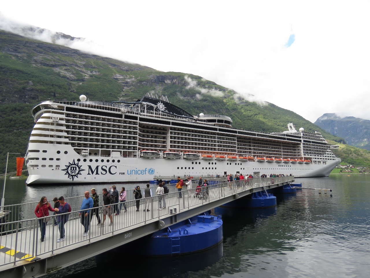 |
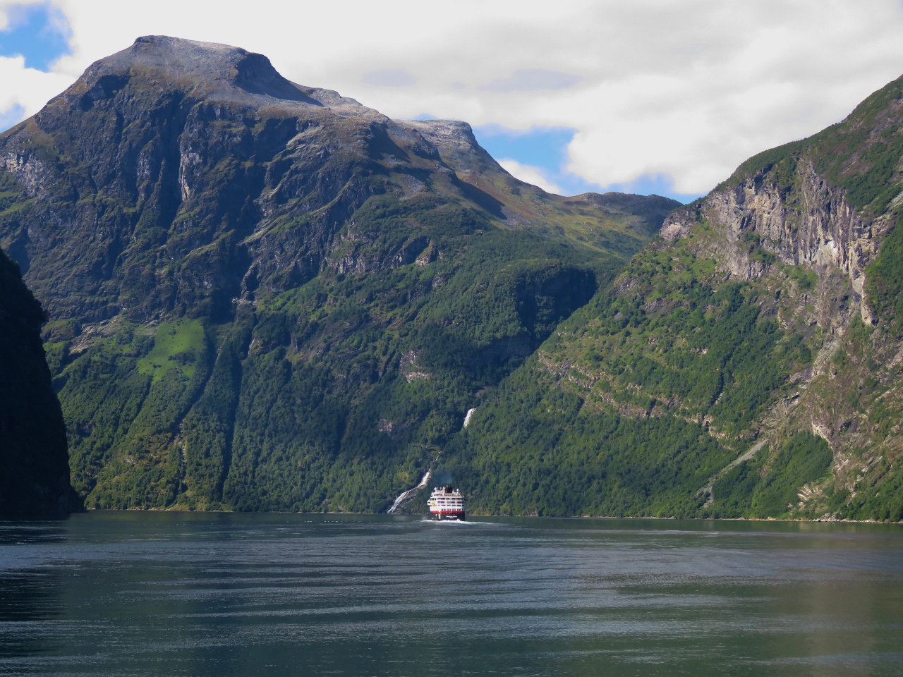
MSC Preziosa
Position: 62°6.10’N, 7°12.15’E
Passengers disembarking from the 1,092ft (332m) cruise ship MSC Preziosa at Geiranger. The town doesn’t have a dock suitable for a vessel of this size, so instead the ship is secured bow-and-stern to large moorings.
|
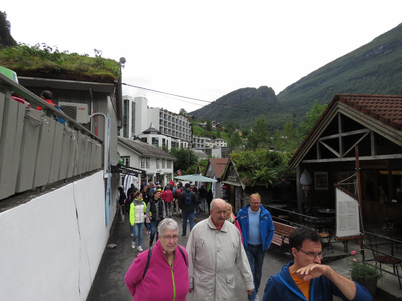 |
Crowds
Position: 62°6.18’N, 7°12.29’E
The MSC Preziosa has a capacity of 3,959 passengers and the small town of Geiranger was packed with tourists.
|
 |
Flydalsjuvet
Position: 62°5.40’N, 7°13.38’E
We continued on the road through Geiranger and up into the hills above. This is the fabulous view looking back down from the Flydalsjuvet viewpoint. A wedding party taking photographs is just visible at bottom right, partway down the cliff outside of the spectator fencing (click image for larger view).
|
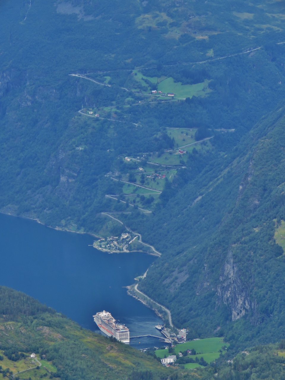 |
Switchbacks
Position: 62°2.96’N, 7°16.17’E
A close-up view to the switchbacks we negotiated down to Geiranger. The lookout above Geirangerfjord is at top left where the road makes the first turn.
|
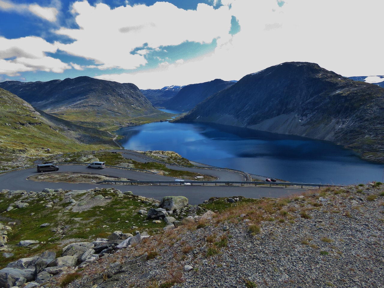 |
Djupvatnet
Position: 62°2.16’N, 7°16.73’E
Overlooking the lake Djupvatnet as we follow the switchback road up to Dalsnibba, Europe’s highest fjord view by road.
|
 |
Dalsnibba
Position: 62°2.96’N, 7°16.16’E
Jennifer taking in the spectacular view to Geirangerfjord from the Dalsnibba lookout 4,921ft (1500m) above sea level. The twisty road we followed up from Geiranger is visible below.
|
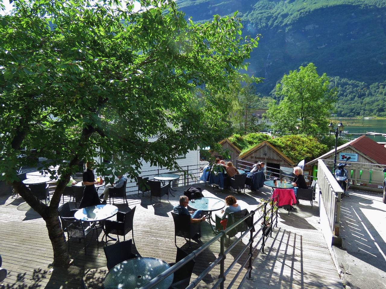 |
Olebuda
Position: 62°6.12’N, 7°12.39’E
We arrived back into Geiranger just before the lunch crowds and snagged a patio table with a view over town.
|
 |
Trollfjord
Position: 62°7.02’N, 7°11.01’E
The Hurtigruten Trollfjord returning to Alesund from Geiranger. The ships only stop in the town for five minutes to transfer passengers.
|
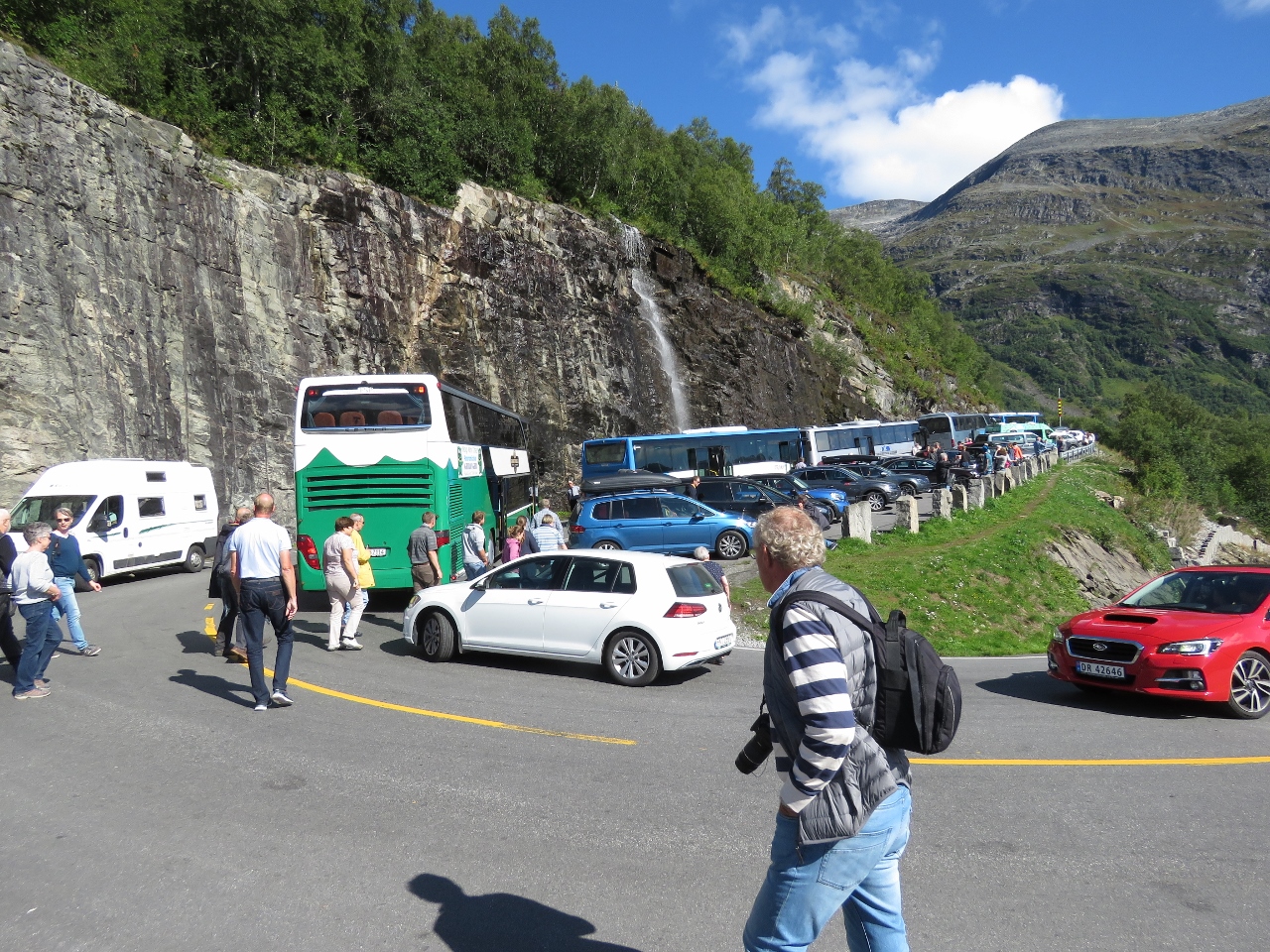 |
Buses
Position: 62°7.57’N, 7°10.04’E
We stopped off at the Geirangerfjord lookout again on our return trip. One lane of the road, and much of the car park, was completely blocked by a series of buses carrying Hurtigruten passengers who were visiting the lookout and would continue on by bus to meet the ship at Alesund.
|
 |
Return Ferry
Position: 62°16.18’N, 7°10.35’E
Taking the return ferry back across Stofjorden to Linge.
|
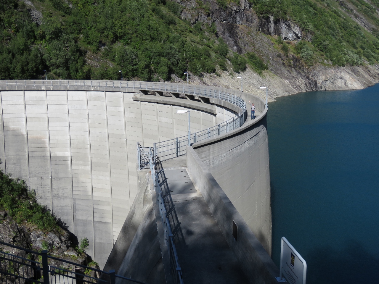 |
Zakarias Dam
Position: 62°12.10’N, 7°29.42’E
After the ferry ride, we continued east to Tajford and beyond to visit the Zakarias Dam. The 314-ft-high (96m) dam was highest dam in Northern Europe when completed in 1986. In the US, we’d never be able to get near the dam for “security reasons” but here in Norway we could walk all the way across the top from one side to the other.
|
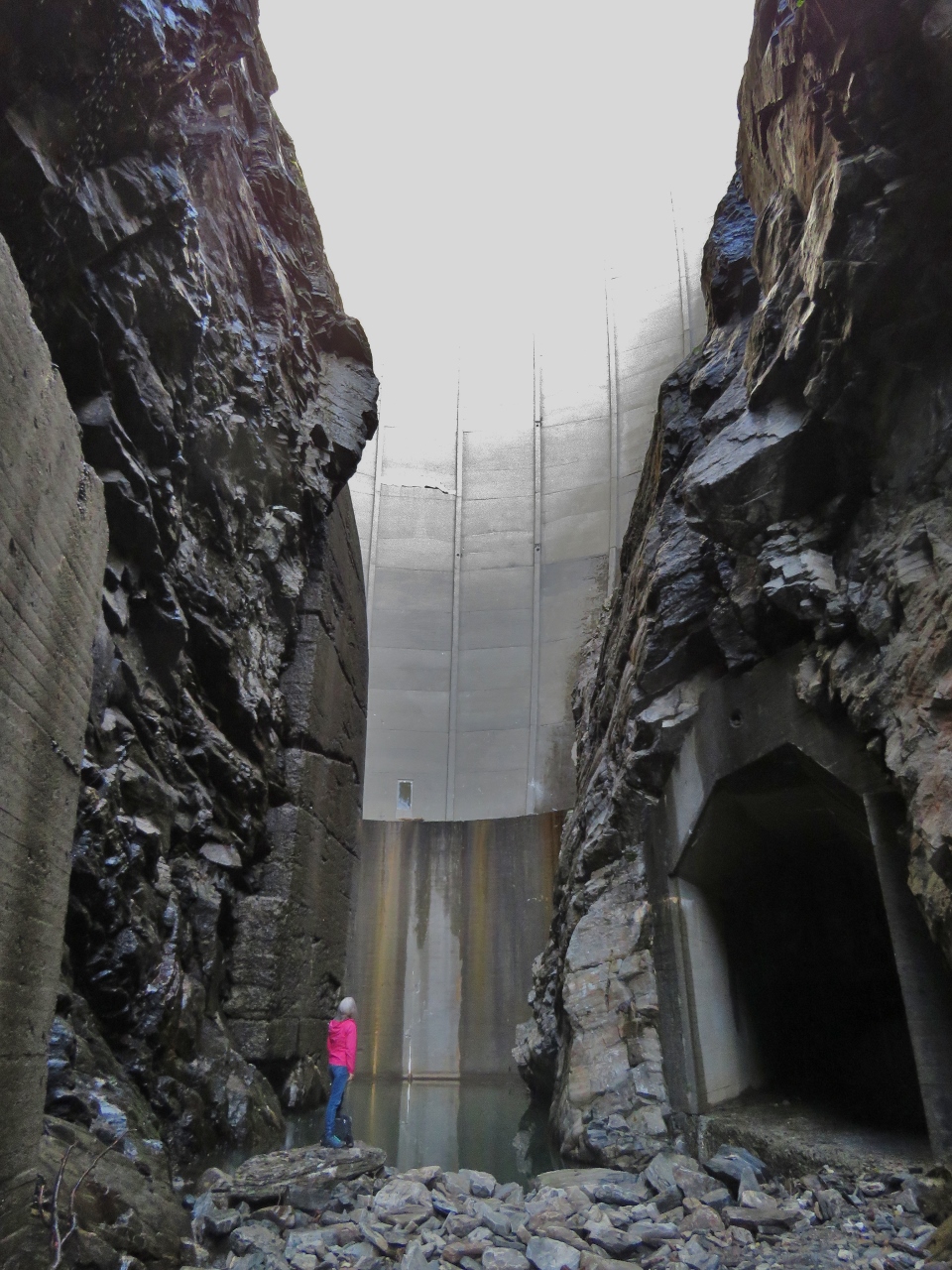 |
Below Dam
Position: 62°12.15’N, 7°29.35’E
From the top of the dam, we could see an old road running across a bridge toward the dam base. We found the road on the way back out and followed it a short distance to reach the base of the dam. It did feel a little crazy to be standing there with all that water held in behind. But the dam has stood for 30 years, so odds are it will last another 15 minutes. We just hoped they didn’t need to open the floodgates.
|
 |
Mountains
Position: 62°19.97’N, 7°22.25’E
The weather continued to clear up as the day progressed and we got some excellent mountain view on the return trip.
|
 |
Power House
Position: 62°20.62’N, 7°24.50’E
Old power house along the River Valldola.
|
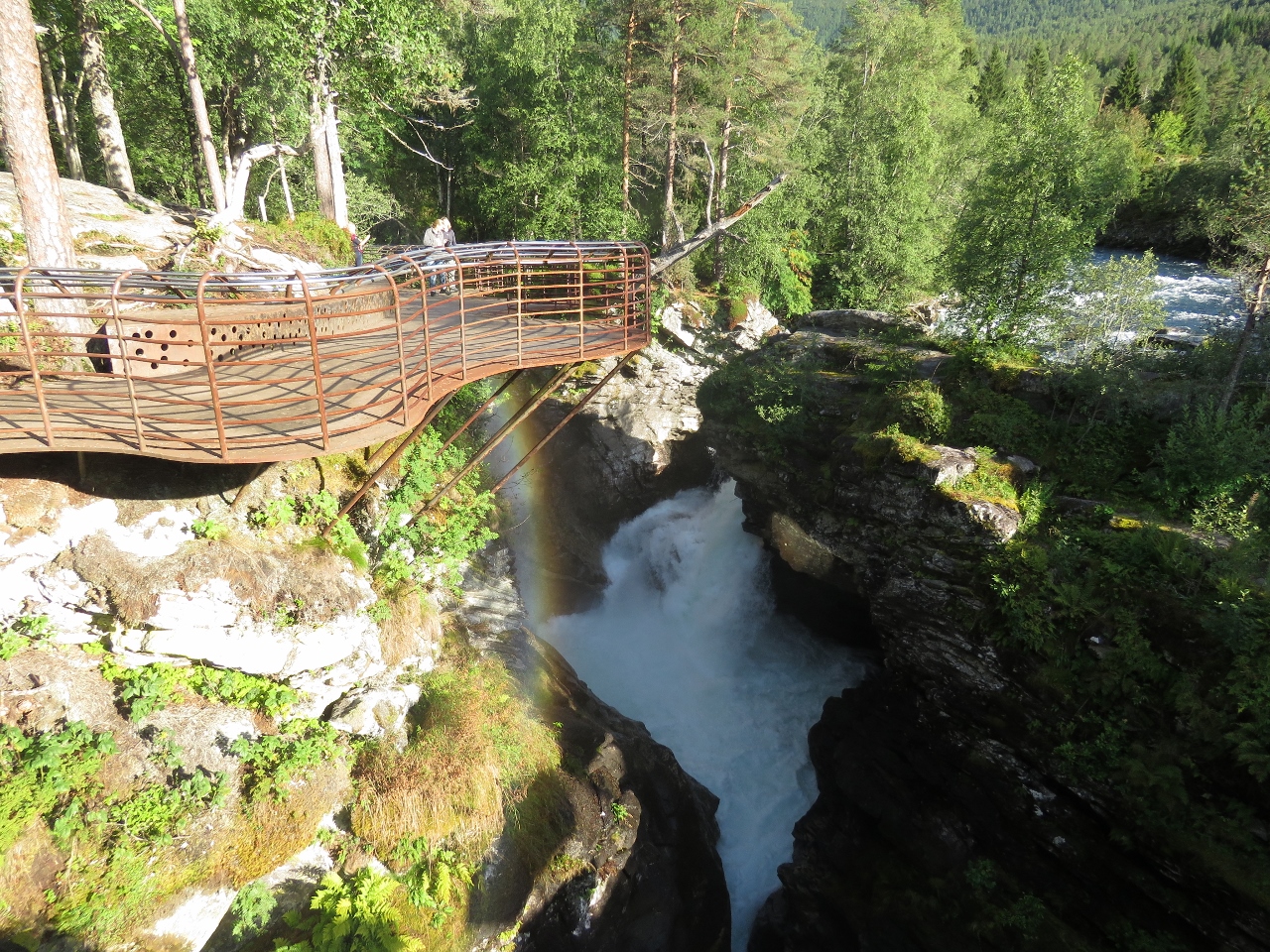 |
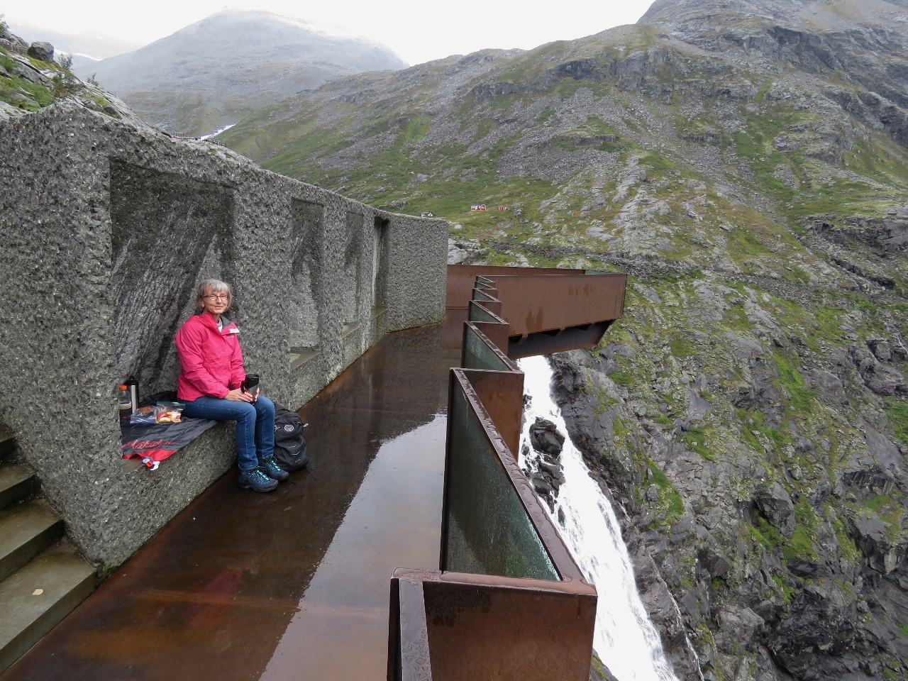
Gudbrandsjuvet
Position: 62°19.85’N, 7°28.29’E
Gudbrandsjuvet is a narrow ravine through which the Valldola River gushes. Walkways through the woods and over the river provide a birds-eye view to the rapids.
|
 |
Clear Skies
Position: 62°26.97’N, 7°39.55’E
The weather on the return trip through Trollstigen was clear and beautful—a big difference from this morning.
|

|
Click the travel log icon on the left to see these locations on a map, with the complete log of our cruise.
On the map page, clicking on a camera or text icon will display a picture and/or log entry for that location, and clicking on the smaller icons along the route will display latitude, longitude and other navigation data for that location. And a live map of our current route and most recent log entries always is available at mvdirona.com/maps. |
If your comment doesn't show up right away, send us email and we'll dredge it out of the spam filter.