Trollveggen (“The Troll Wall”) is the highest vertical mountain wall in Europe. The face is 3,600 ft (1,100 metres) from base to summit and scaling it is one of the ultimate mountaineering challenges. With several other difficult climbing peaks in the area, nearby Åndalsnes is considered the mountaineering capital of Norway. Their modern visitor center contains a mountaineering museum covering the history of climbing in the region, including more extreme sports such as BASE jumping.
Those who want to experience Trollveggen more sedately can take the Raumabanen, named by Lonely Planet as Europe’s most beautiful railway journey. From Åndalsnes, the train runs right underneath Trollveggen and along the River Rauma through the scenic Romsdalen valley.
On our third day in Åndalsnes, we rode the Raumabanen past Trollveggen to Dombas and back, then visited the excellent Mountaineering Museum right next to our berth. Below are trip highlights from August 22. Click any image for a larger view, or click the position to view the location on a map. And a live map of our current route and most recent log entries always is available at mvdirona.com/maps
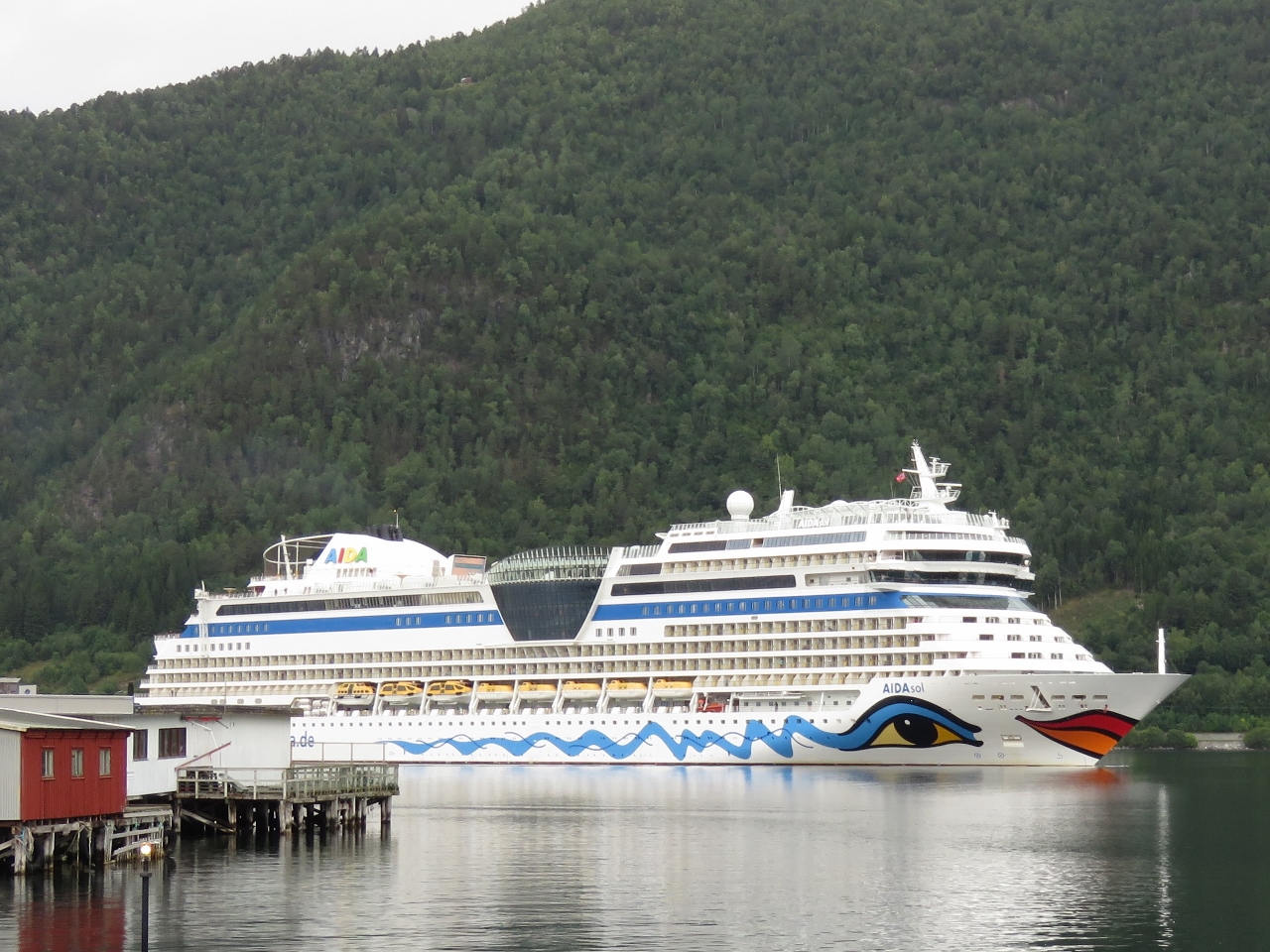 |
AIDAsol
Position: 62°34.11’N, 7°41.37’E
While we were having breakfast in the pilot house, the 831ft (253m) cruise ship AIDAsol suddenly dominated the view forward. This is the same ship we saw from the Hurtigruten at Hammerfest.
|
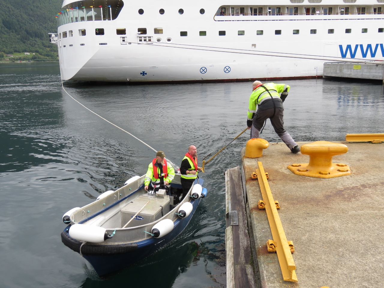 |
Line Handlers
Position: 62°34.11’N, 7°41.37’E
We’d been seeing workers arrive at the pier and were wondering what they were up to—they were line handlers for the AIDAsol. It was fun to have a close-up view of the work done to deploy and secure the various lines.
|
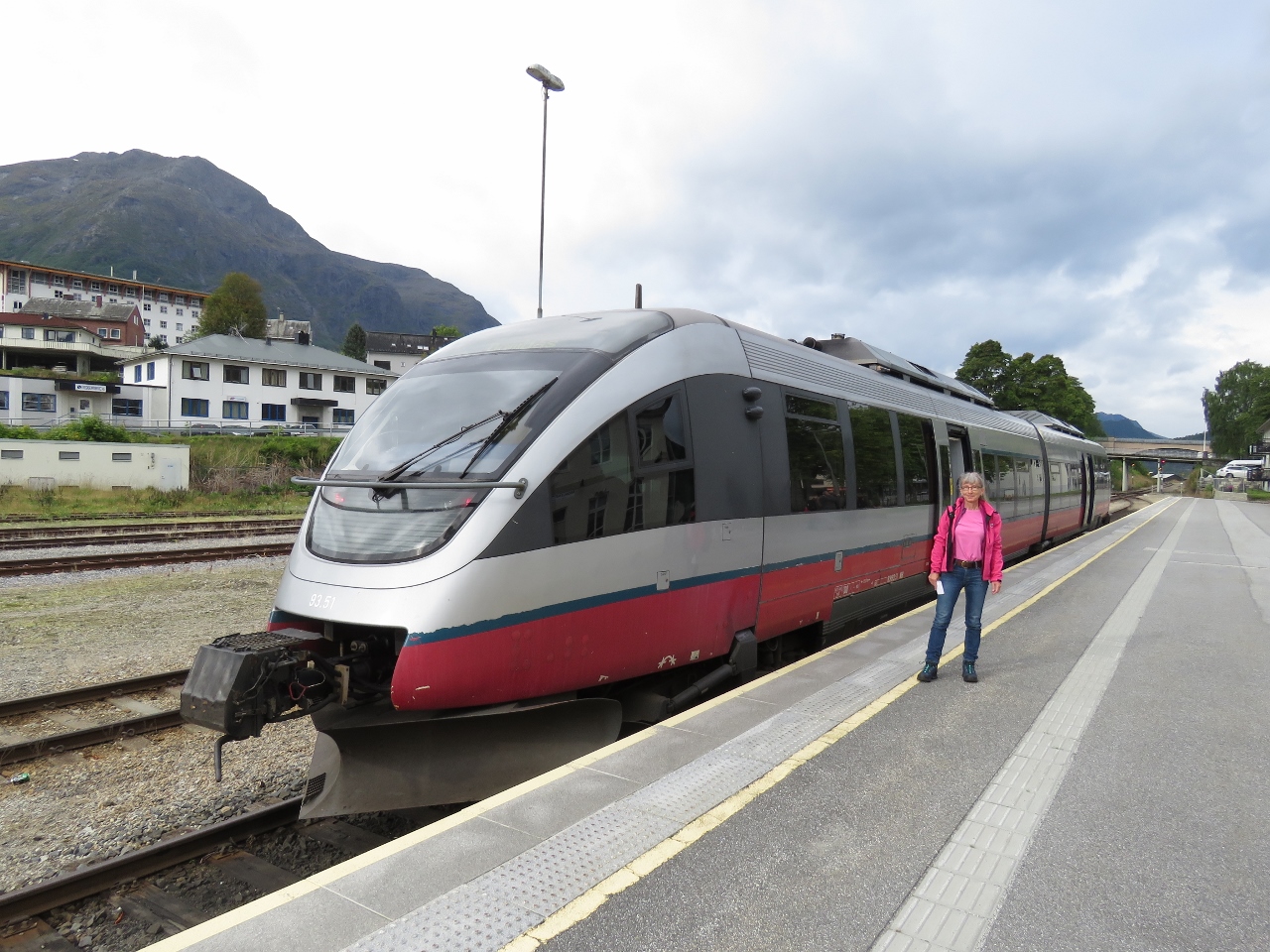 |
Raumabanen
Position: 62°34.04’N, 7°41.43’E
Ready to go on our trip on the Raumabanen that Lonely Planet named Europe’s most beautiful railway journey.
|
 |
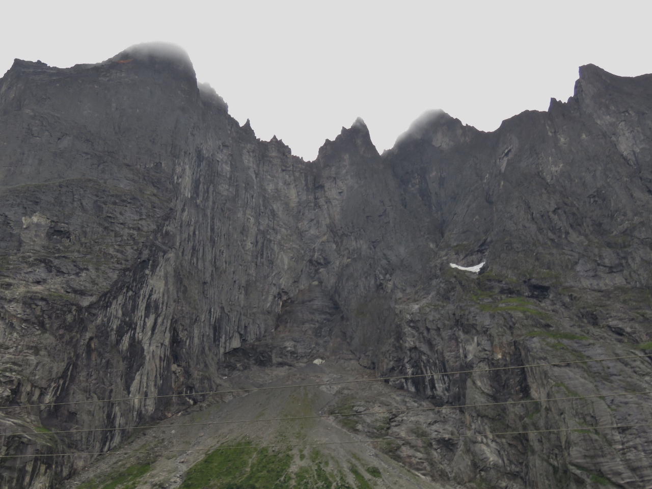
Trollveggen
Position: 62°30.03’N, 7°46.16’E
One of the highlights along the Raumabanen is spectacular Trollveggen (“The Troll Wall”), the highest vertical mountain wall in Europe. The face is 3,600 ft (1,100 metres) from base to summit and scaling it is one of the ultimate mountaineering challenges.
|
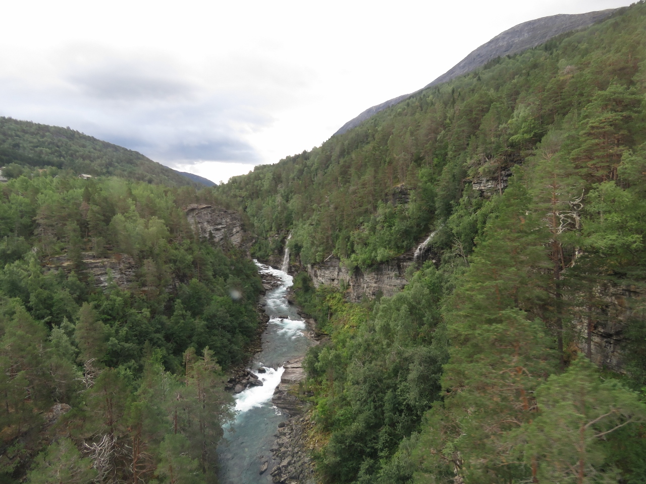 |
River Rauma
Position: 62°21.06’N, 8°3.23’E
The River Rauma spilling through a gorge as we cross the Kylling Bridge.
|
 |
Romsdalen Valley
Position: 62°22.00’N, 8°2.95’E
Looking back to the River Rauma winding through the Romsdalen Valley.
|
 |
Kylling Bridge
Position: 62°22.00’N, 8°2.95’E
A quick glimpse of the famous Kylling Bridge, one of the most photographed in Norway, before we enter a 180-degree tunnel.
|
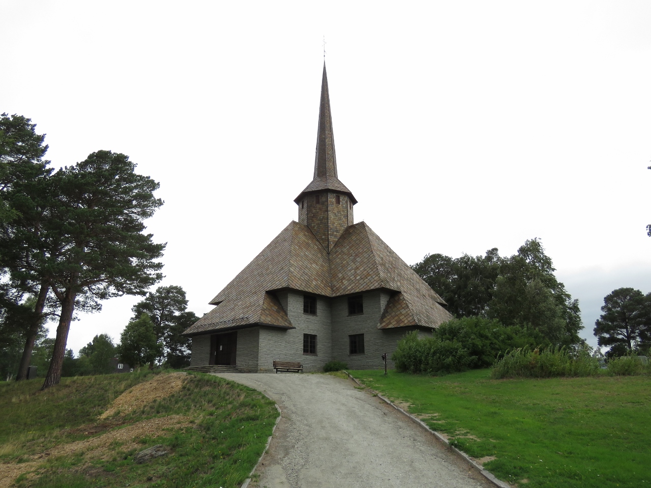 |
Dombas
Position: 62°4.47’N, 9°7.62’E
The Raumabanen line ends at the small village of Dombas, where the station there is a junction for trains to Trondheim and Oslo. We had an hour until our return train, so walked around a bit. The place is obviously popular with outdoor enthusiasts with only one hotel, a couple of restaurants, and a hardware store but at least four outdoor gear stores and several grocery stores. This is the Dombas Church, completed in 1939.
|
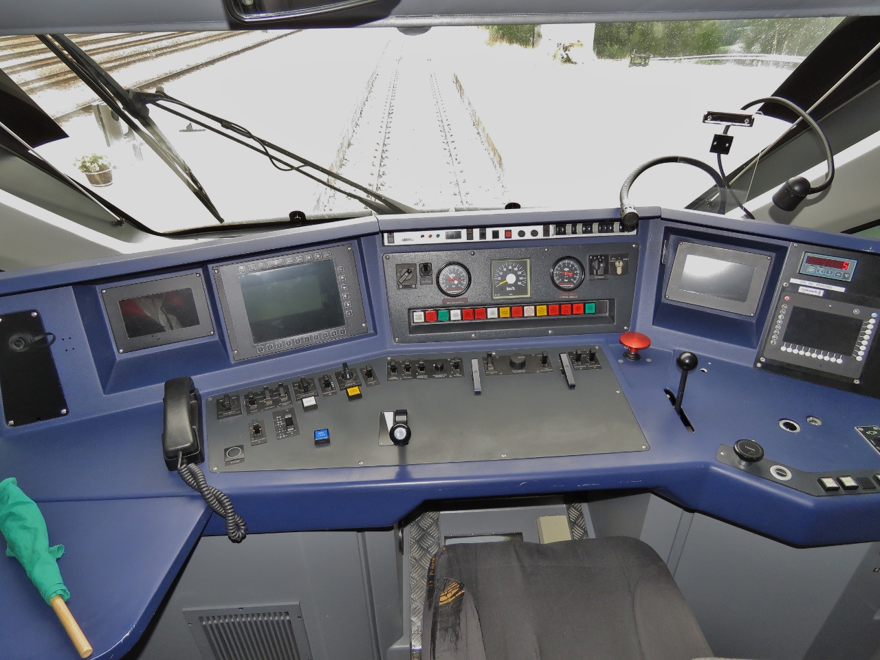 |
Cockpit
Position: 62°4.10’N, 9°7.53’E
The cockpit of our train.
|
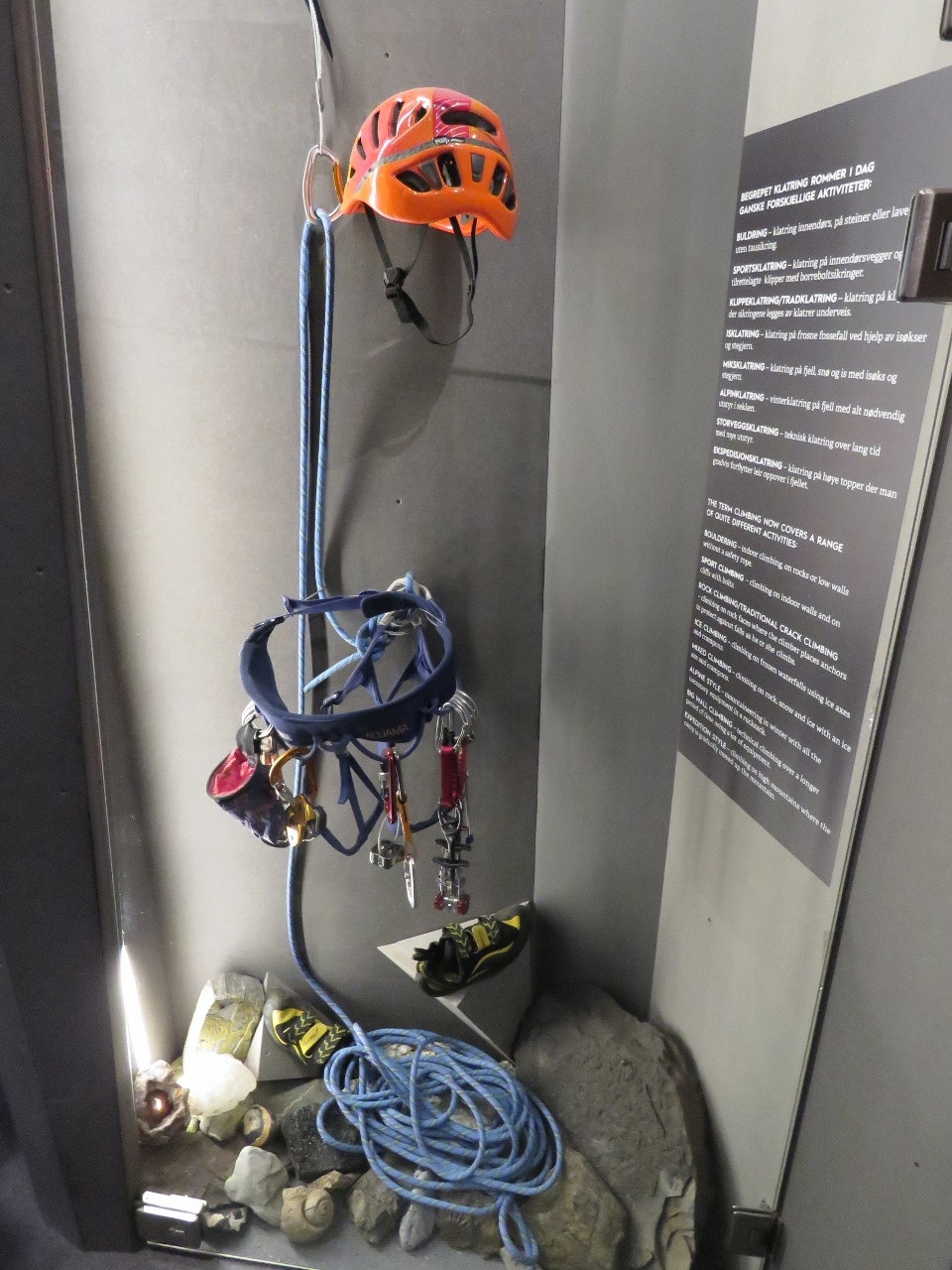 |
Mountaineering Museum
Position: 62°34.07’N, 7°41.41’E
Åndalsnes is considered the mountaineering capital of Norway and the visitor center adjacent to our berth has an excellent mountaineering museum covering the history and technology of the sport with some great video footage.
|
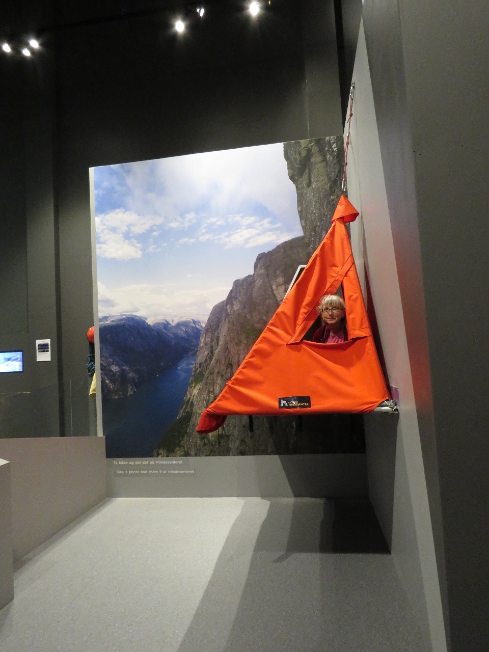 |
Cliff Tent
Position: 62°34.07’N, 7°41.41’E
Jennifer trying out a cliff tent at the Åndalsnes Mountaineering Museum. Rock climbers making multi-day climbs overnight in tents like these.
|
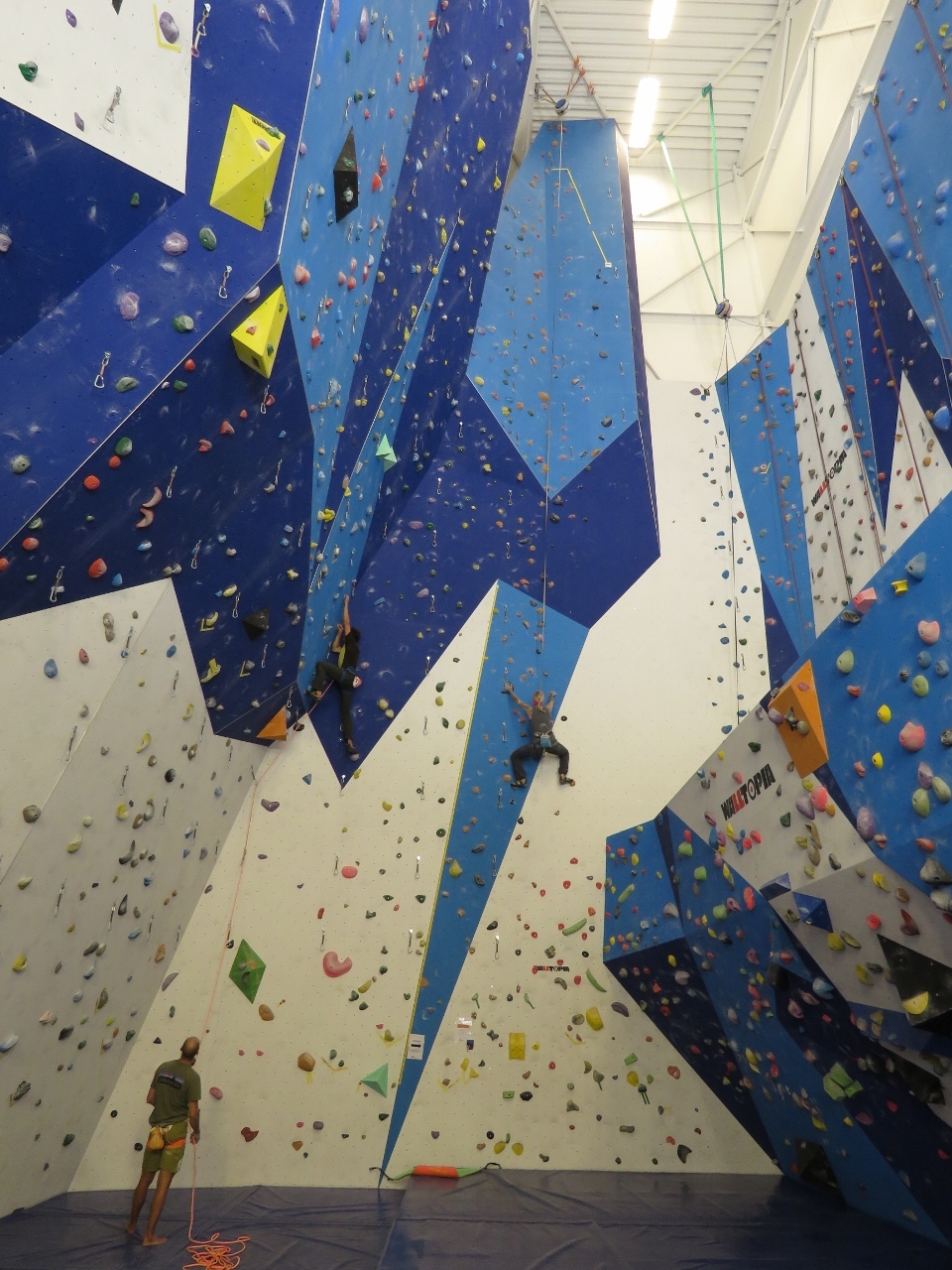 |
Climbing Wall
Position: 62°34.07’N, 7°41.41’E
Inside the Mountaineering Museum we discovered what the tall portion of the building was: a massive climbing wall. We spent some time watching several climbers working their way up the complex face.
|
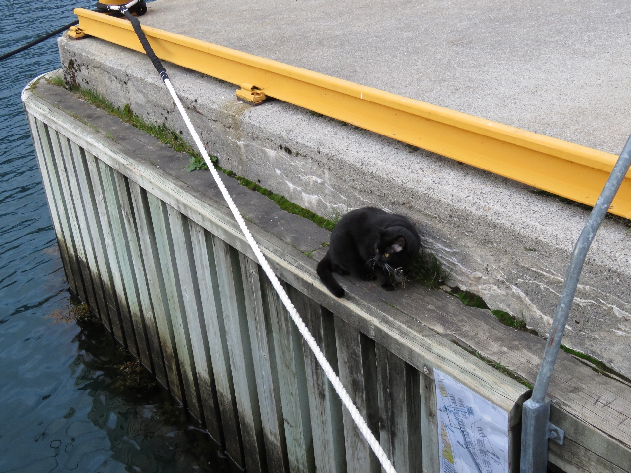 |
AWOL
Position: 62°34.11’N, 7°41.37’E
Spitfire knows he’s not allowed off the boat and generally follows the rules, but the grass on the pier at Åndalsnes was too much for him to resist. Normally he jumps right back on board when he knows he’s been spotted, but he just kept chomping away until we picked him up and carried him back aboard. He’s never been that stubborn.
|

|
Click the travel log icon on the left to see these locations on a map, with the complete log of our cruise.
On the map page, clicking on a camera or text icon will display a picture and/or log entry for that location, and clicking on the smaller icons along the route will display latitude, longitude and other navigation data for that location. And a live map of our current route and most recent log entries always is available at mvdirona.com/maps. |
If your comment doesn't show up right away, send us email and we'll dredge it out of the spam filter.