 |
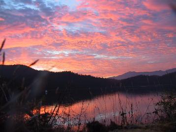
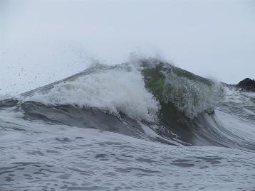
It wasn't until last summer that we even entertained the prospect of cruising
the west coast of Vancouver Island. It's completely exposed to the Pacific
Ocean and receives some really nasty weather. Even on very good days there
is a constant ocean swell, and on very bad days ships go down and lives are
lost. Places like Cape Scott at the northwest tip, and Brooks Peninsula,
just to the south, are renowned for big storms, huge seas, and shipwrecks.
The southwest shore is no better. It is nicknamed the "Graveyard of the
Pacific" for good reason. But many
pleasure craft have successfully circumnavigated in the relatively benign summer
months, and doing so is very rewarding. While the outer coast is rugged, there are numerous protected anchorages to tuck into. And
besides the adventure of being out on the wild west coast, there are an endless
number of things to see and do while you are there, such as hiking, hot springs,
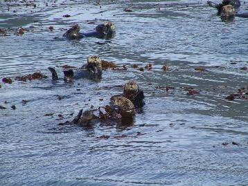
sea otters, fishing, sea caves, whales, and ruins. We needed a rest when we
were done.
|
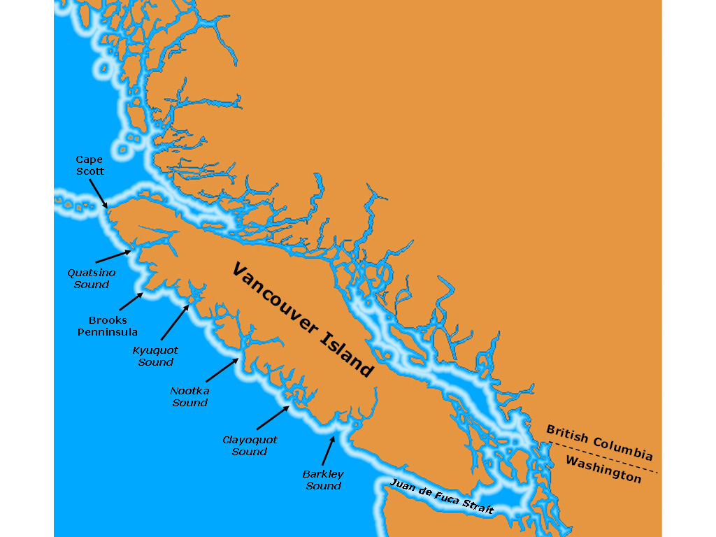
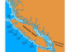
The west coast is divided into five large sounds that indent the island: Barkley, Clayoquot, Nootka, Kyuquot,
and Quatsino. The typical trip
consists of a series of exposed coast runs between them, with several days spent
within each one. Most people go around the island counter-clockwise -- up
the east coast and down the west. This puts the prevailing northwest wind
and swell behind, making for a smoother ride. Also, a large proportion of
these vessels are sailboats, so wind direction is important. We chose to
go around the other way. If we had any time left over, we wanted to spend
it on the northeast side of the island, where we rarely get to, rather than at
the southern end, which is easily accessible. Although working against the
swells was certainly rougher than going with them, we didn't regret the
decision, and would go around clockwise again.
On our Hakai trip last
summer we got some open ocean experience that inspired us to make the west coast
trip. We felt comfortable in the swells, and Dirona handled them easily. We
started planning in the spring, reading through Don Watmough's Cruising Guide
to the West Coast of Vancouver Island and the
Waggoner Cruising Guide's west
coast section (both highly recommended). We only had three weeks, so we
wanted to make the best of it, as we wouldn't be able to see and do everything.
We planned to spend about 2-3 days in each sound and expected to be delayed a
day or so by weather. We also brought along the Douglass' Exploring
Vancouver Island's West Coast, which is also a good reference,
particularly in its detailed anchorage information. And we carried the set of
Coastal Recreation Maps for the west coast. They are designed for
kayakers, but have lots of useful information for visitors in any sized vessel.
You can also read
about this trip in our
article in the July 2005 issue of
PassageMaker Magazine.
Day 1: Bamfield, Barkley Sound
Day 2: Tzartus Island, Barkley
Sound
Day 3: Pinkerton Group, Barkley
Sound
Day 4: Jarvis Island, Broken Group, Barkley
Sound
Day 5: Lemmens Inlet, Meares Island,
Clayoquot Sound
Day 6: Mosquito Harbour, Meares
Island, Clayoquot Sound
Day 7: Matilda Inlet, Flores Island,
Clayoquot Sound
Day 8: Young Bay, Sydney Inlet, Clayoquot
Sound
Day 9: Bodega Cove, Bodega Island, Nootka
Sound
Day 10: Hecate, McBride Bay, Nootka Sound
Day 11: Nuchatlitz Inlet, Nootka Sound
Day 12: Dixie Cove, Kyuquot Sound
Day 13: Bunsby Islands, Checleset Bay
Day 14: Nasparti Inlet, Checleset Bay
Day 15:
Klaskish
Basin, Brooks Bay
Day 16:
Varney Bay,
Quatsino Sound
Day 17:
Sea Otter
Cove, Cape Scott
Day 18: Port Hardy, Inside
Passage