Way back in March of this year, while still in London, we booked a berth for the winter at City Marina Amsterdam starting November 1st. We’d had an incredible summer cruising Norway, but were now looking forward to spending some time exploring the Netherlands capital. We arrived into Amsterdam on November 1st after a 26-mile run from Hoorn and through two more bridges and a lock before finally reaching our winter berth. As is typically our custom, we spent the afternoon walking through the city on foot. We only scratched the surface though—Amsterdam has a lot to see and we’ll enjoy exploring it.
Below are trip highlights from November 1, 2018 en route to and in Amsterdam. Click any image for a larger view, or click the position to view the location on a map. And a live map of our current route and most recent log entries always is available at mvdirona.com/maps
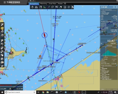 |
Traffic
Position: 52°29.45’N, 5°11.22’E
Heavy traffic in the shipping channel into Amsterdam as we approach at 7:30am on morning run from Hoorn.
|
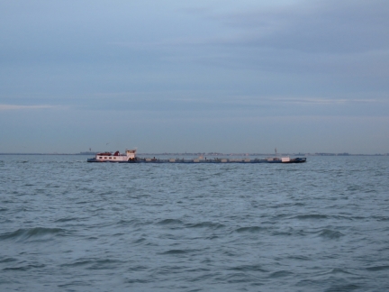 |
Typhoon
Position: 52°28.01’N, 5°11.48’E
The barge Typhoon passing us heading north. Since the barges operate only in sheltered, inland waters, they don’t need much freeboard.
|
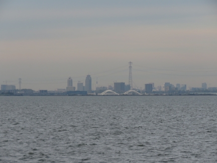 |
Amsterdam View
Position: 52°24.05’N, 5°5.85’E
Our first view of Amsterdam, about ten miles away.
|
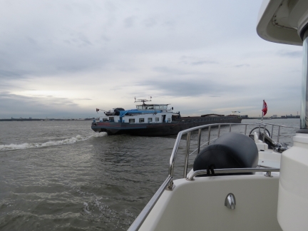 |
Overtaking
Position: 52°22.20’N, 5°0.65’E
The water outside the lanes was too shallow, so we tucked just inside. This overtaking barge gave us as much room as was available, but it was still pretty close.
|
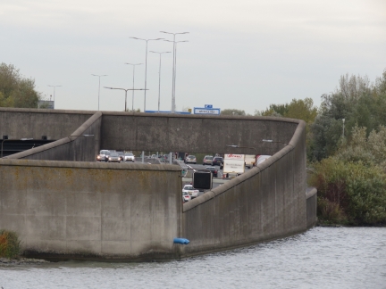 |
Rush Hour
Position: 52°22.56’N, 4°58.35’E
Rush-hour traffic heading in and out of a tunnel under the waterway just past 9am.
|
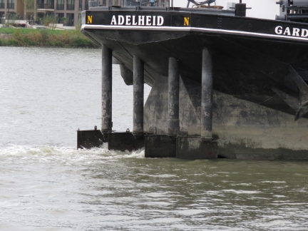 |
Four Rudders
Position: 52°22.65’N, 4°58.21’E
This canal barge has four rudders for more control in close-quarters.
|
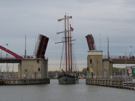 |
Schellingwoude Bridge
Position: 52°22.78’N, 4°57.95’E
A sailing canal barge passing through the Schellingwoude Bridge eastbound.
|
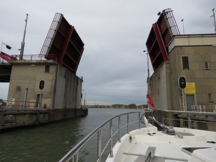 |
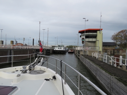
Green Light
Position: 52°22.81’N, 4°57.91’E
Once the sailing canal barge passed through, we got a green light to proceed through the open Schellingwoude Bridge.
|
 |
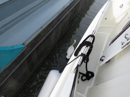
Oranjesluizen
Position: 52°22.91’N, 4°57.66’E
Entering Oranjesluizen, our final lock on the journey from Denmark to Amsterdam. A large commercial barge is on the left and we’ll tuck in behind the pleasure craft on the right.
|
 |
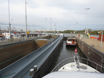
Swan
Position: 52°22.91’N, 4°57.66’E
Swan looking for handouts in Oranjesluizen. We’re right up against the lock wall on the starboard side and there’s not much space to port. We’re lucky we fit.
|
 |
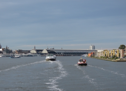
Locking Through
Position: 52°22.92’N, 4°57.63’E
Locking through westbound, with the lock chamber to the left filling with eastbound vessels.
|
 |
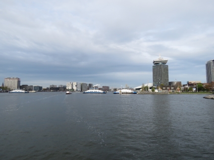
IJ River
Position: 52°22.86’N, 4°54.90’E
We’re now on the IJ River, Amsterdam’s waterfront, where Dirona will be for the next four months. The long buildings in the distance are Amsterdam Station. (IJ is a digraph pronounced roughly ‘ay’, like the first letter in the English alphabet.)
|
 |
Ferries
Position: 52°22.98’N, 4°53.93’E
There are lots and lots of ferries in the IJ River.
|
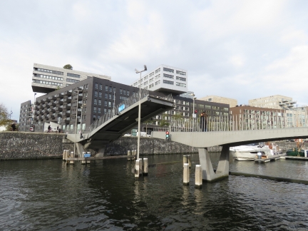 |
Pedestrian Bridge
Position: 52°23.02’N, 4°53.61’E
The Oranjesluizen was our final lock, but we still have one more bridge to pass under before we’re officially in our winter home.
|
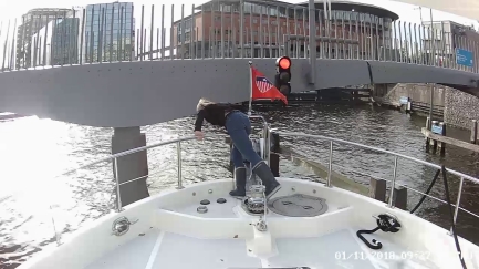 |
Tight Moorage
Position: 52°23.02’N, 4°53.62’E
Backing into our berth was challenging. We were inches off a boat to port, were nearly touching the bridge itself, and our bow pulpit completely overlapped the bridge channel pilings with only inches to spare there as well. Here Jennifer is checking the clearance off the second set of bridge pilings, not visible under our pulpit.
|
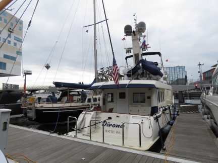 |
Moored
Position: 52°23.03’N, 4°53.61’E
Moored at City Marina IJDok in Amsterdam for the winter. Our dual shorepower system, that we designed specifically for spending the winter in this marina, is working like a champ.
|
 |
City Marina IJDok
Position: 52°23.00’N, 4°53.60’E
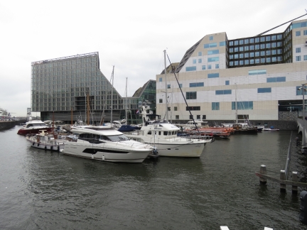
Looking across City Marina IJDok from the pedestrian bridge we just passed under. The marina is quite small—we were lucky to get a winter berth in such an awesome location right in downtown Amsterdam.
|
 |
Bicycle Storage
Position: 52°22.85’N, 4°53.94’E
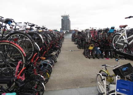
This double-layer bicycle storage rack outside Amsterdam Station contained thousands of bikes.
|
 |
Unloading
Position: 52°22.83’N, 4°53.94’E
When the passenger ferries unload, you don’t want to be in the way. When the gate opens, pedestrians, cyclists and scooters shoot off the ferry like the start of a horse race.
|
 |
More Bicycle Storage
Position: 52°22.72’N, 4°53.84’E
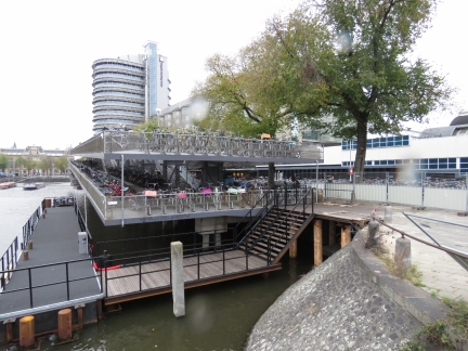
Another huge bicycle storage area on the other side of Amsterdam Station.
|
 |
Brew Pub
Position: 52°22.53’N, 4°53.96’E
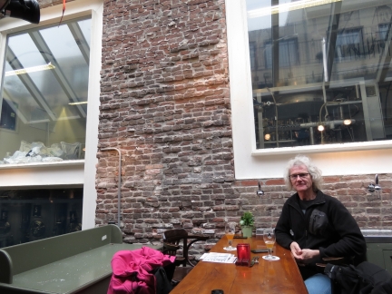
Our first meal in our new temporary home, Amsterdam, at the Brouwerij de Prael microbrewery.
|
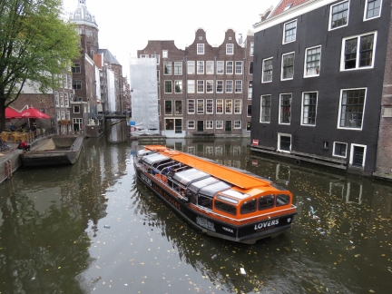 |
Canal Boat
Position: 52°22.53’N, 4°53.99’E
One of the dozens of tour boats that ply Amsterdam’s canals. Waterways run throughout the city, giving it a real Venice feel.
|
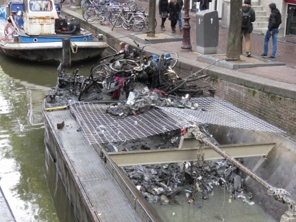 |
Garbage
Position: 52°22.46’N, 4°54.02’E
Garbage dredged up from the canals in this scow intrigued us. A lot of bicycles met their end in the water.
|
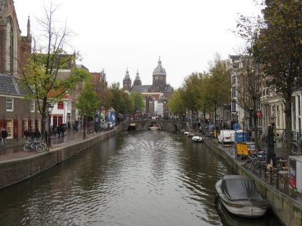 |
Basilica of Saint Nicholas
Position: 52°22.44’N, 4°53.91’E
Looking down another Amsterdam canal to the spires of the Basilica of St. Nicholas.
|
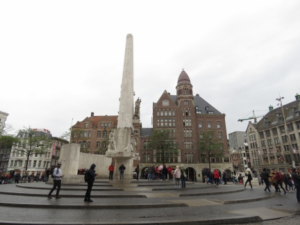 |
National Monument
Position: 52°22.38’N, 4°53.62’E
The National Monument, a World War II memorial erected in 1956 in Amsterdam’s Dam Square.
|
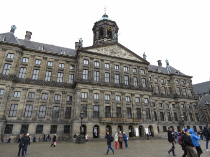 |
Royal Palace
Position: 52°22.39’N, 4°53.54’E
The 17th century Royal Palace on Dam Square in Amsterdam was initially built as a city hall and is one of three palaces at the disposal of the Dutch monarchy.
|
 |
Click the travel log icon on the left to see these locations on a map, with the complete log of our cruise.
On the map page, clicking on a camera or text icon will display a picture and/or log entry for that location, and clicking on the smaller icons along the route will display latitude, longitude and other navigation data for that location. And a live map of our current route and most recent log entries always is available at mvdirona.com/maps. |

Do you use some sort of radio communication between the two of you when docking in tight spaces like this? Wireless headsets or such…
No, we have generally found that communications works fairly well without radio communications equipment since it’s a fairly small boat. But there are occasional exceptions so we’ve been talking about adopting some form of intercom system. It’s only rarely a problem but it does happen so we’ll look into the options but we’re not currently using anything.
Sena SPH10 Bluetooth headsets are very popular with the Australian cruising yacht community, Often referred to as “marriage savers”. They are not cheap (the quoted price is typically for one unit) but they work very well. We love our pair. Sena is a major supplier of communication solutions for the motorcycle community and the SPH10 is the one product they sell that hasn’t been designed to fit into a helmet. See https://www.sena.com/product/sph10
ps: I saw Dirona when you were alongside the fuel dock at my yacht club in Hobart (RYCT).
Have followed and greatly enjoyed your blog ever since. Stay safe, Ian
Wow, that goes back quite a ways. We were in Hobart back in 2015. That was early on in the Australian leg of our trip but we ended up staying there for 19 months.
Thanks for the pointer to Sena. We’ll check them out.
I remain amazed at your ability to cope with and solve difficult repair issues. Very clever work to solve the problems with the TV lift system given the inaccessibility of the components.
I assume the slip you have for the winter has on-site pump out at the slip. If not, how do you deal with that issue? I would think roving pump out boats would be hauled for the winter soon.
Yes, it’s fun to see a $15 hobbiest remote control replace something that costs hundreds and wasn’t very reliable.
We’ve not faced the pump out problem yet. We carry 120 gallons so we can go a long time and we’ve not been on the boat much in Amsterdam so far with trips to Dhubai, Abu Dhabi, Las Vegas, and Seattle. In our entire stay in London last year we chose to be pumped out only twice and, with the new more reliable black water level sensors, we might not have needed to at all.
Amsterdam seems to continue to operate normally through the winter. I’ve not seen any evidence of any boats coming out of the water.