
Hoorn was the birthplace of Dutch explorer Willem Schoutens, who in 1616 named South America’s Cape Horn after his home town. Also born in Hoorn was Jan Pieterszoon Coen, an officer of the Dutch East India Company and a two-time Governor-General of the Dutch East Indies. Not surprisingly, Hoorn was a major Dutch East India Company port and a prosperous 17th-century trade center. The city has a large number of surviving buildings from that period, along with numerous excellent restaurants, several marinas and a river boat dock, making it a popular destination for visitors arriving by both land and water.
Below are trip highlights from October 30th in Hoorn, Netherlands. Click any image for a larger view, or click the position to view the location on a map. And a live map of our current route and most recent log entries always is available at mvdirona.com/maps
 |
Playmate
Position: 52°38.00’N, 5°11.92’E
|
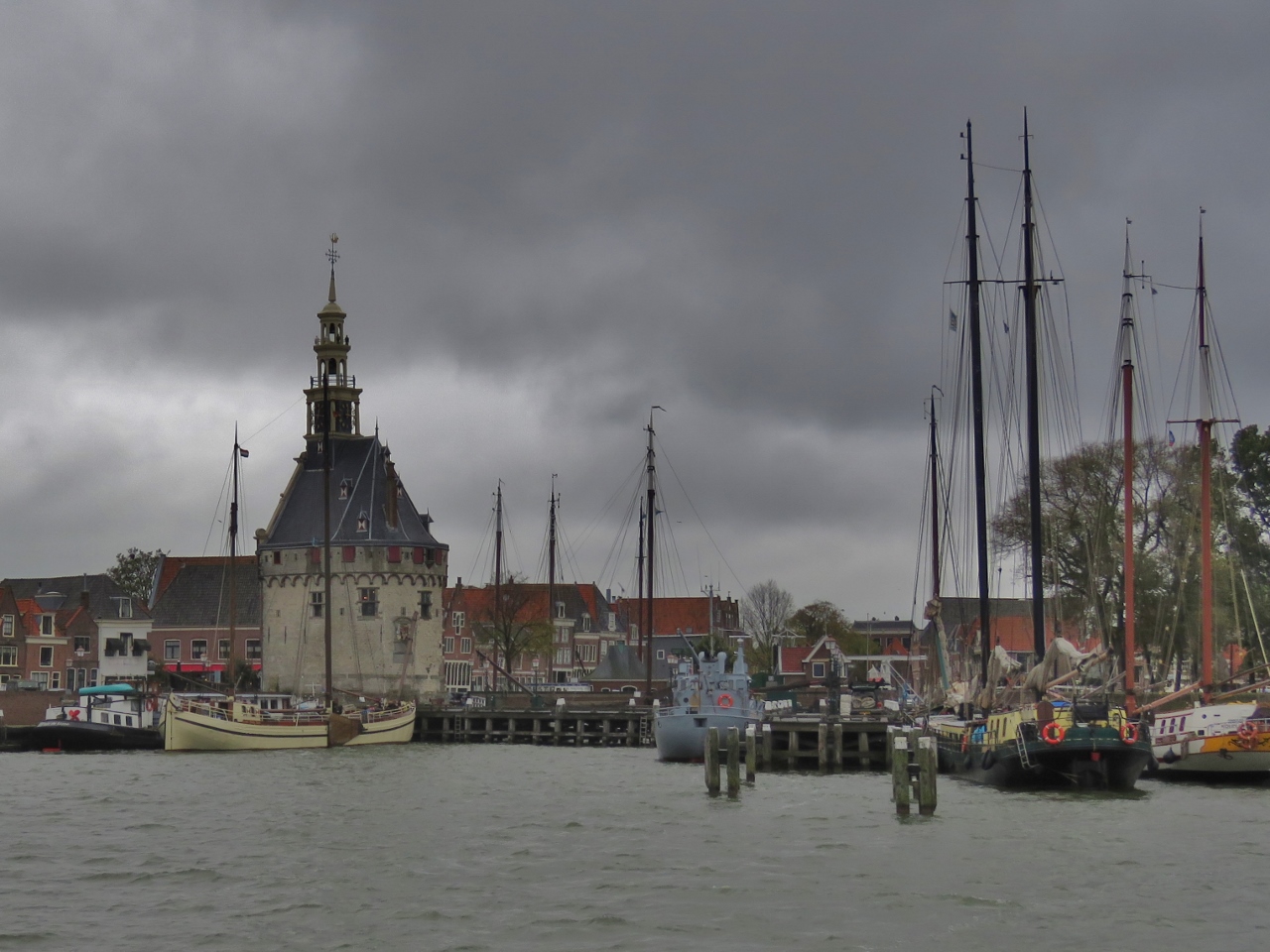 |
Approaching Hoorn
Position: 52°38.18’N, 5°3.86’E
Approaching the town of Hoorn, our final stop before Amsterdam. Prominent on the waterfront is the defensive tower Hoofdtoren.
|
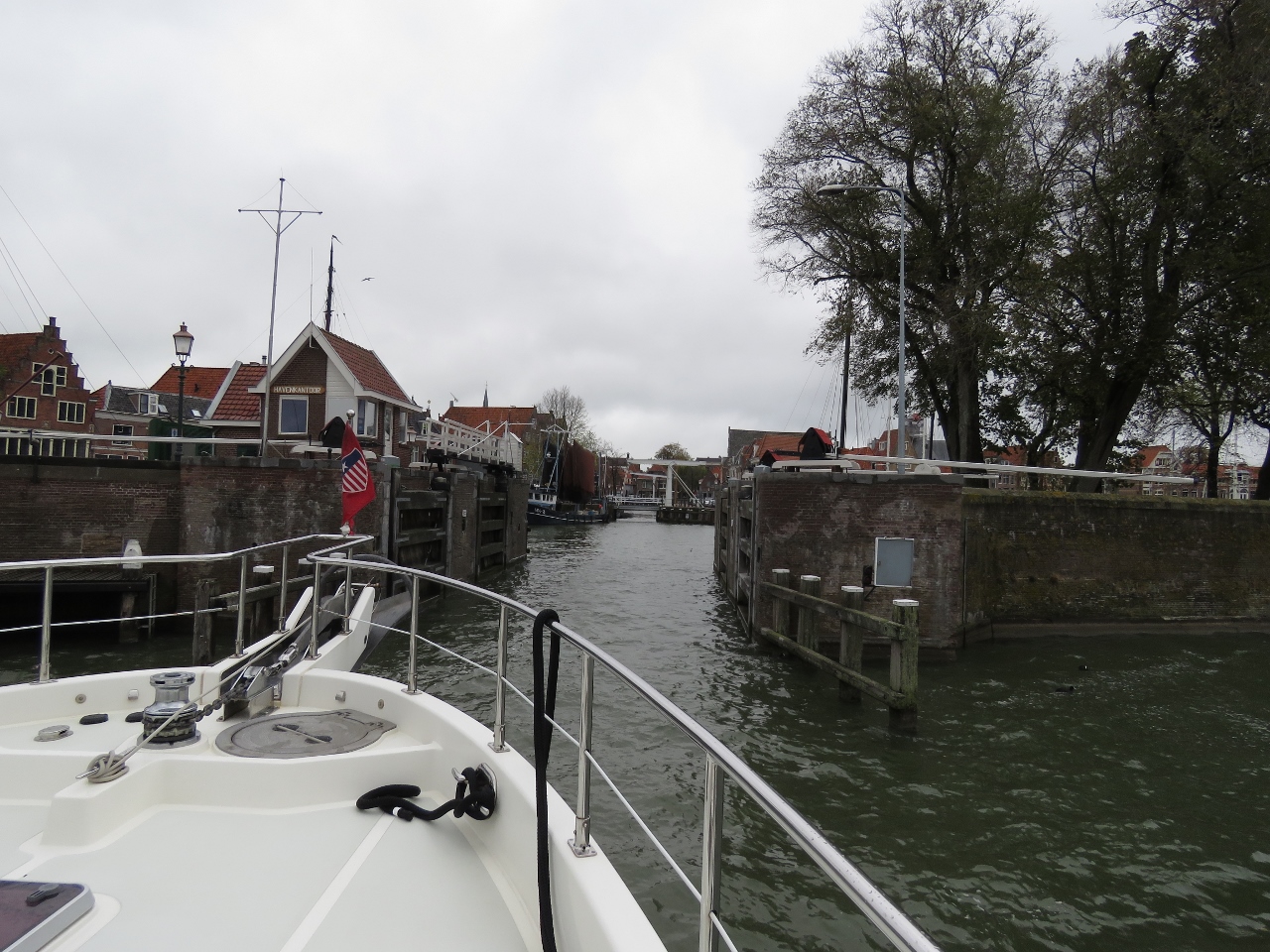 |
Entering Binnenhaven
Position: 52°38.23’N, 5°3.82’E
Entering Hoorn’s old harbour, Binnenhaven, through lock gates that now stand permanently open.
|
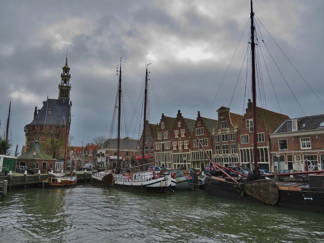 |
Binnenhaven
Position: 52°38.28’N, 5°3.82’E
Looking southwest across Binnenhaven to the tower Hoofdtoren with canal barges lining the walls.
|
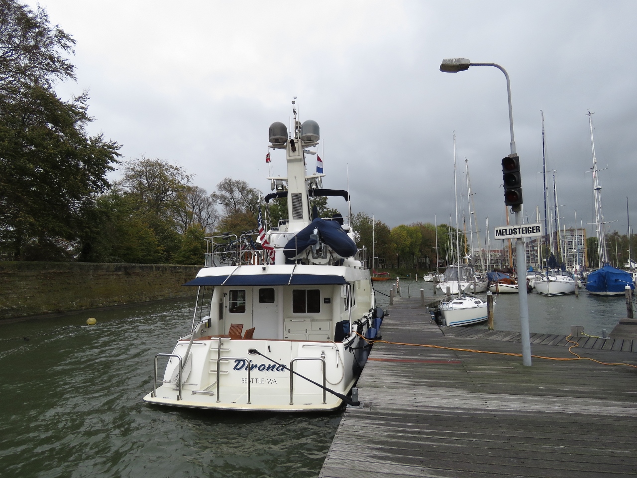 |
WSV Hoorn
Position: 52°38.26’N, 5°3.89’E
Hoorn has four areas where guest boats can moor and we had a little confusion as to where we were supposed to be. We thought it was Binnenhaven, which is why we went in, but our berth was outside at WSV Hoorn. This worked out super-well and was an easy walk into the town center.
The berth also gave us a chance to do another test of our new dual shorepower system. We’re currently plugged into two 10-amp supplies, giving us a total of 20 amps, which is fine. Before we added the second shore-power connection, we’d only be able to get a single 10-amp feed, a little lean for our power consumption. |
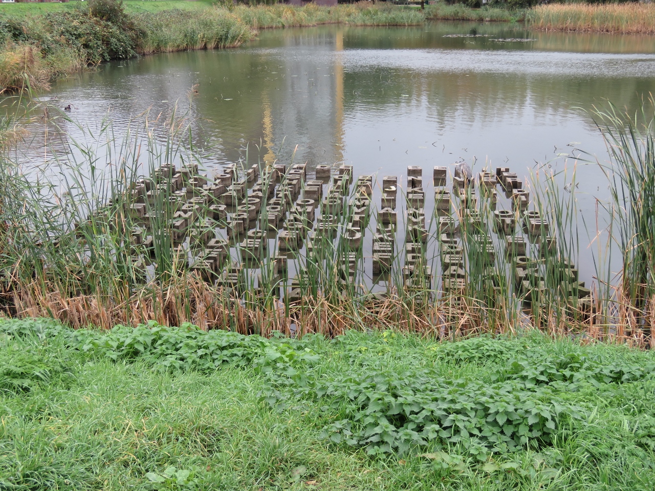 |
Letters
Position: 52°38.30’N, 5°4.02’E
We couldn’t quite make out the words, presumably in Dutch, of this intriguing artwork in a pond adjacent to WSV Hoorn.
|
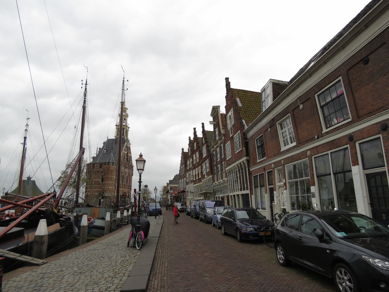 |
Veermanskade
Position: 52°38.26’N, 5°3.78’E
Historic buildings overlooking Binnenhaven along Veermanskade.
|
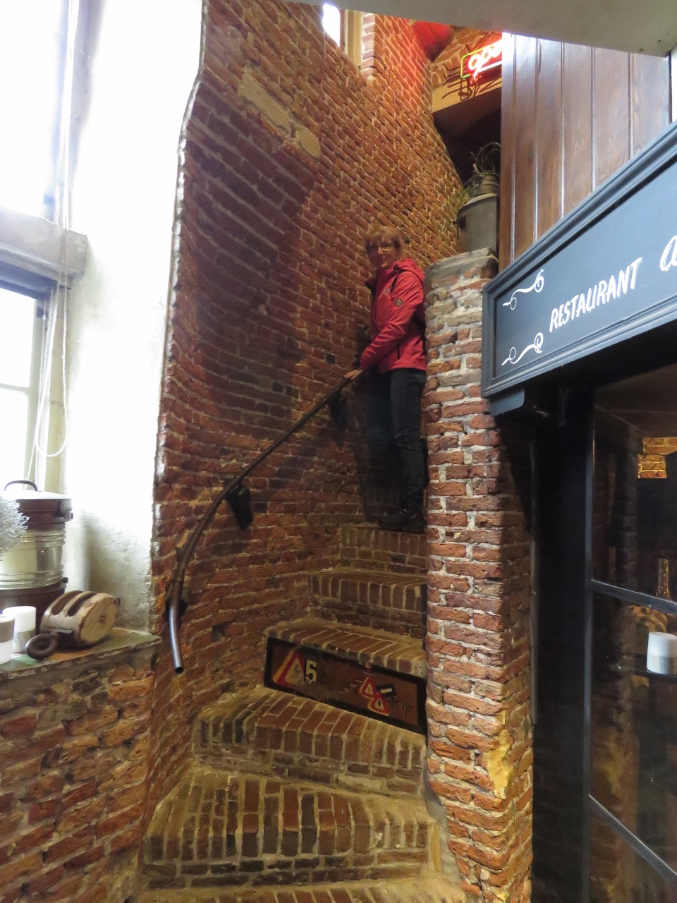 |
Stairs
Position: 52°38.22’N, 5°3.79’E
Climbing the well-worn stairs inside Hoofdtoren to the restaurant on the second floor. The tower has been standing since 1532.
|
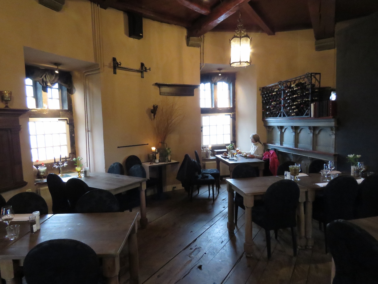 |
De Hoofdtoren
Position: 52°38.22’N, 5°3.79’E
We had an excellent late lunch with a harbour view at De Hoofdtoren inside the Hoofdtoren tower.
|
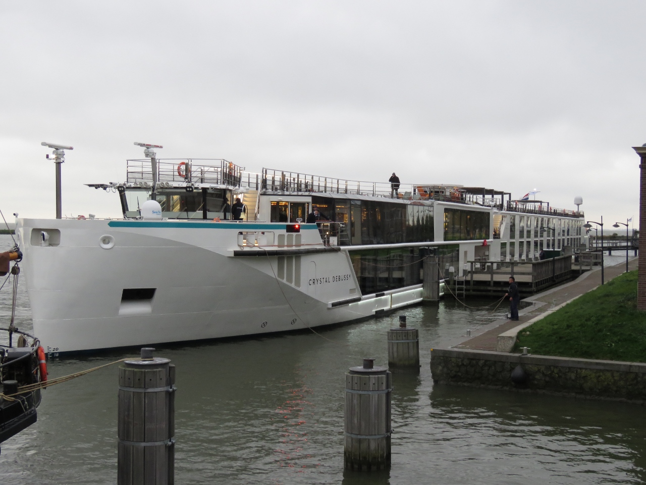 |
Crystal Debussy
Position: 52°38.17’N, 5°3.78’E
The river cruise ship Crystal Debussy arriving into Hoorn.
|
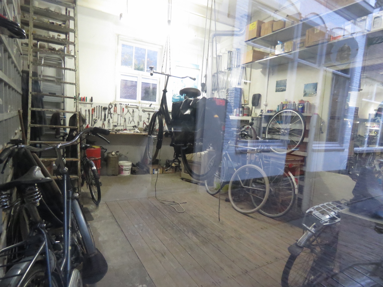 |
W. Wormsbecher
Position: 52°38.32’N, 5°3.59’E
Bicycles and tools at W. Wormsbecher bicycle repair. With the number of bicycles in The Netherlands, bicycle-repair must be a steady business.
|
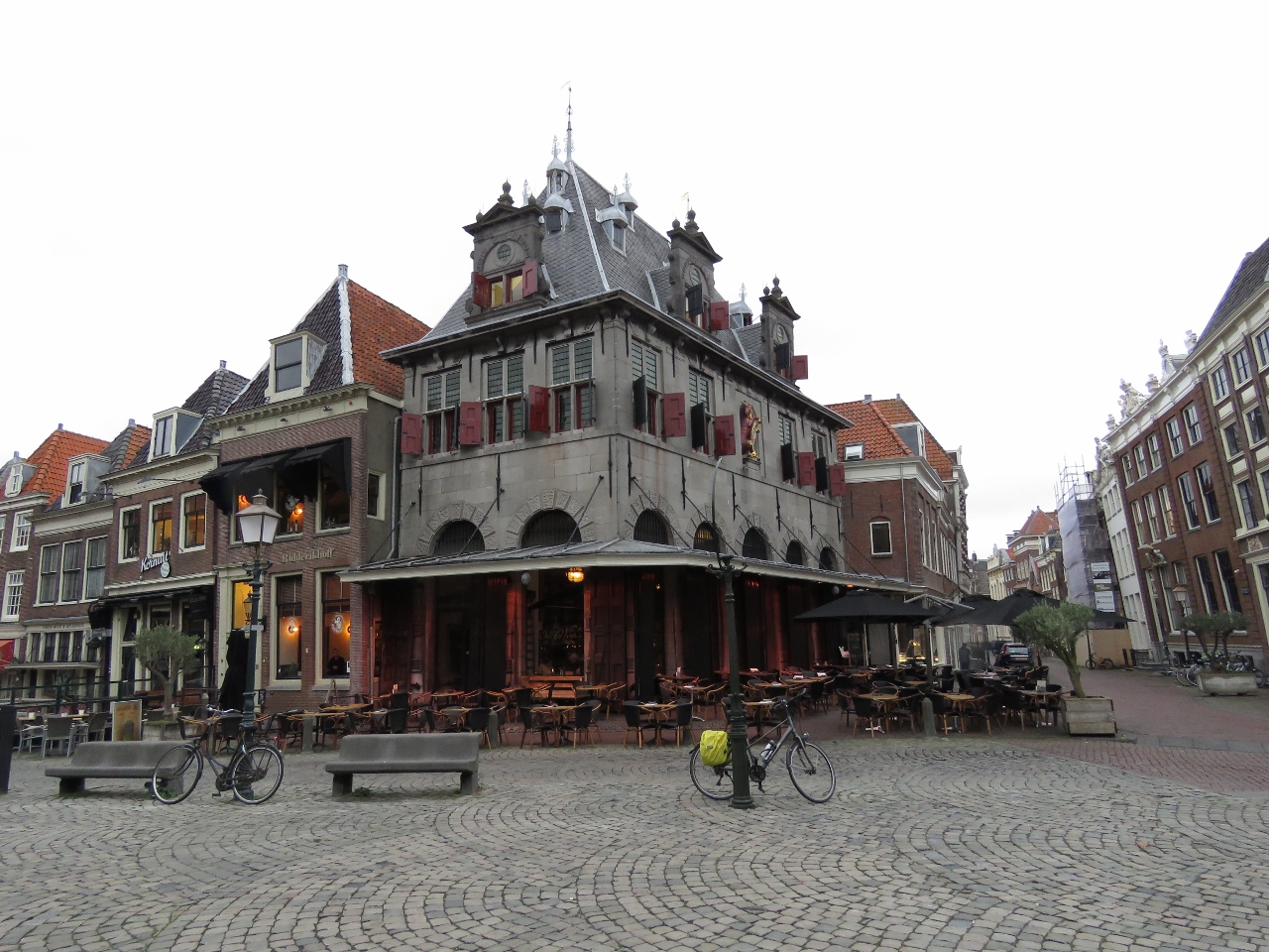 |
The Waag
Position: 52°38.36’N, 5°3.56’E
The 17th-century weigh house, the Waag, on Hoorn’s main square with Hoorn’s symbol of a unicorn on the upper right face. The building now contains a popular restaurant.
|
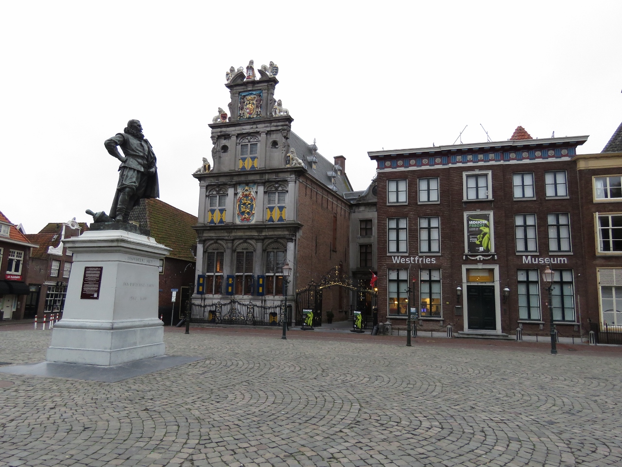 |
Jan Pieterszoon Coen
Position: 52°38.38’N, 5°3.57’E
Statue in Hoorn’s main square of Hoorn-born Jan Pieterszoon Coen, who was an officer of the Dutch East India Company and a two-time Governor-General of the Dutch East Indies. Immediately to the right of the statue, across the square, is the 16th-century State Council building that now houses a museum.
|
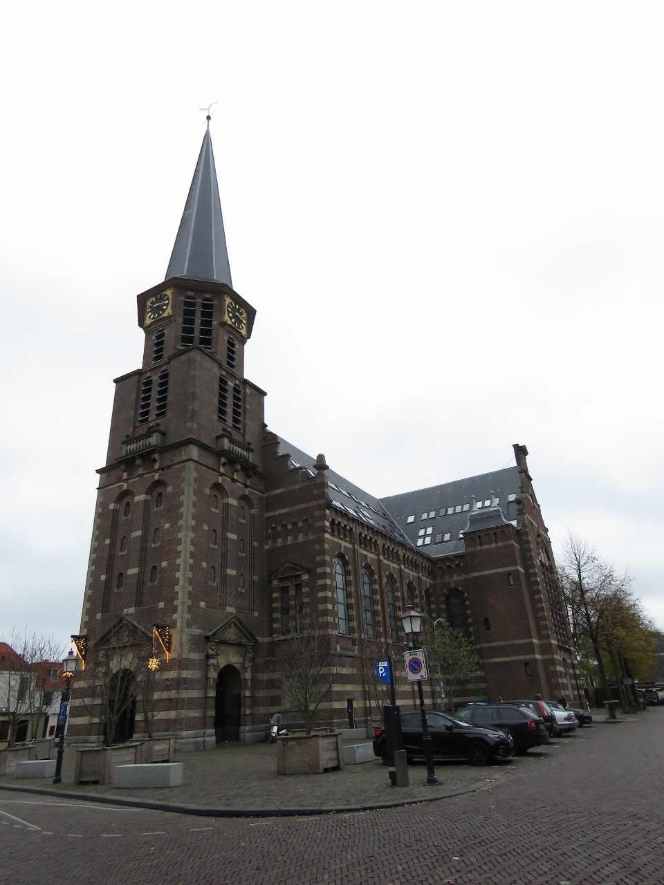 |
Grote Kerk
Position: 52°38.43’N, 5°3.58’E
The skylights in the roof of the Grote Kerk intrigued us as they were unusual for a church. Built in the last 1800s the church closed in 1968 and was converted to commercial function including thirty-six residential apartments. That explains the skylights.
|
 |
Town Hall
Position: 52°38.49’N, 5°3.61’E
Hoorn’s fabulous twin-gabled old town hall building dates from 1613.
|
 |
Leaning
Position: 52°38.41’N, 5°3.68’E
This house was built leaning forward, a building technique common in Europe through the middle ages when houses were made of wood. The major advantage is that rainwater is less likely the enter the floor below. It also allows the upper floor to be bigger without taking up as much street space. When brick came into use as a construction medium, the tradition continued. Many buildings included commercial space in the attic and the lean also reduced the risk of damaging windows or the building itself when goods were hoisted up.
|
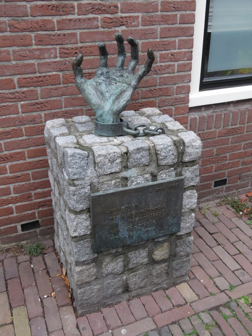 |
Despair
Position: 52°38.40’N, 5°3.43’E
“Despair”, one of several bronze chained hand sculptures in Hoorn that warn against injustice and war. The works are by Dutch artist Truus Menger-Oversteegen who, along with her sisters, was a member of the anti-Nazi Dutch armed resistance during World War II.
|
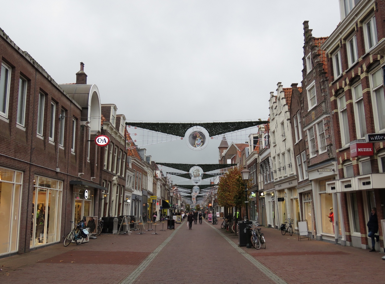 |
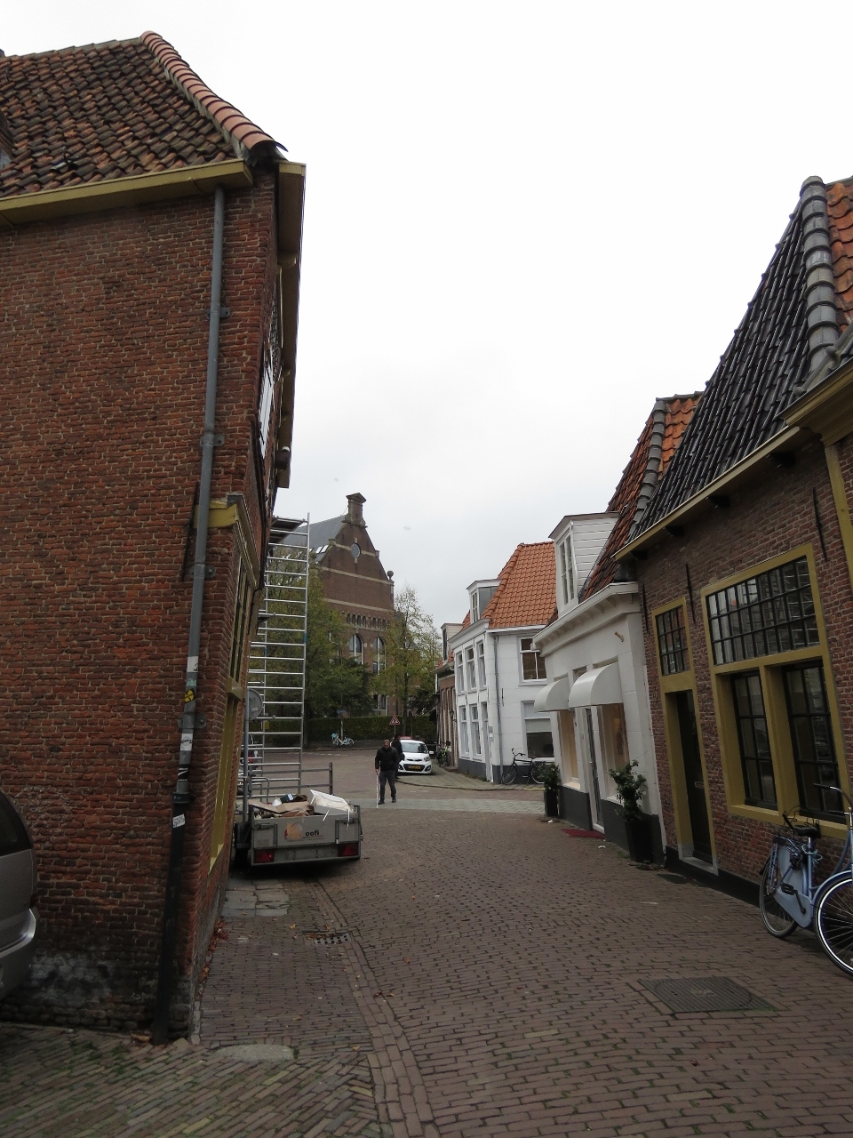
Grote Noord
Position: 52°38.42’N, 5°3.47’E
Looking along Grote Noord, a pedestrian mall and shopping district.
|
 |
Oude Waegh
Position: 52°38.36’N, 5°3.58’E
We capped off an excellent walking tour of Hoorn with a meal at Oude Waegh in the Waag building on Hoorn’s main square. Blog reader Rene Bornmann recommended we visit Hoorn (and Enkhuizen), and we very much enjoyed both towns.
|
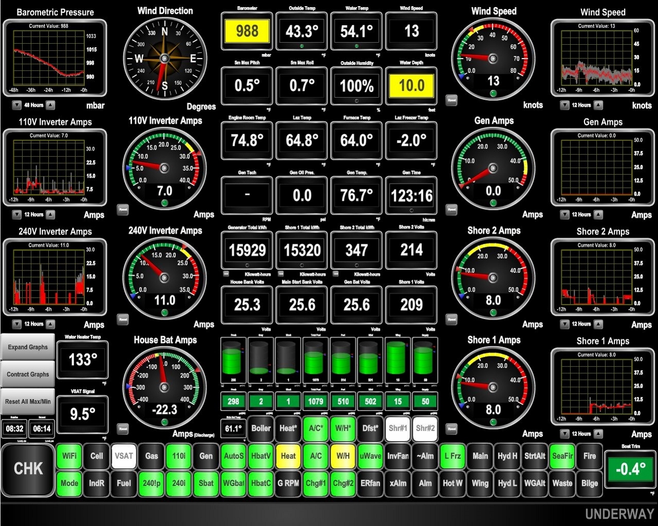 |
Barometer
Position: 52°38.26’N, 5°3.88’E
The barometer has fallen hard in the past couple of days and now is on the upswing. This likely will bring strong winds, so it’s nice to be in a protected inland waterway.
|

|
Click the travel log icon on the left to see these locations on a map, with the complete log of our cruise.
On the map page, clicking on a camera or text icon will display a picture and/or log entry for that location, and clicking on the smaller icons along the route will display latitude, longitude and other navigation data for that location. And a live map of our current route and most recent log entries always is available at mvdirona.com/maps. |
If your comment doesn't show up right away, send us email and we'll dredge it out of the spam filter.