Last summer was a busy one for traveling. We made two trips to Europe: one in early June to spectacular Iceland before a fabulous cruise along Greenland’s frozen east coast, and the second at the end of the summer to attend the action-packed Italian Grand Prix. In addition, we took weekend trips within Washington state to Bainbridge Island, Granite Falls, Enumclaw and to the Finger Lakes district in New York, and James made a week-long business trip to Asia. And in the Seattle area, we attended a Mariners major league baseball game and made several rucking excursions.
Below are highlights from June 1st to August 25th, 2024. Click any image for a larger view, or click the position to view the location on a map. And a map with our most recent log entries always is available at mvdirona.com/maps.
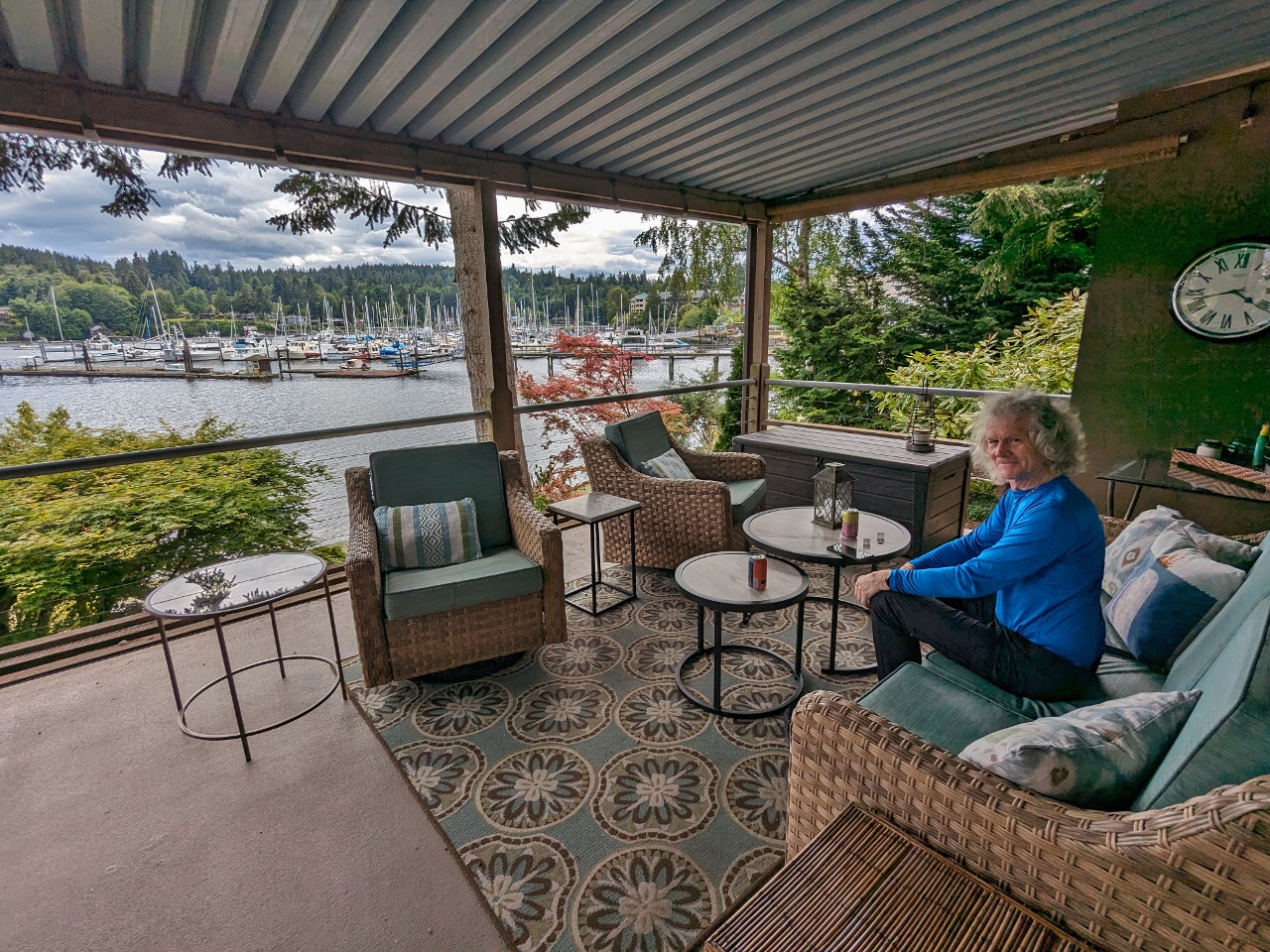 |
Bainbridge Island Revisited
Position: 47°37.35’N, -122°31.14’W
A couple of months after our first land-based weekend on Bainbridge Island, we made another trip, this time by car with our new rucking gear. In a busy overnight trip, we visited one of our longtime favorite pubs, tested our new gear with a ruck through Grand Forest park, enjoyed the views from the deck of our rented VRBO (pictured above), and shared an excellent pizza in town.
|
 |
Iceland: Land of Fire and Ice
Position: 64°19.57’N, -20°7.46’W
Iceland, “The Land of Fire and Ice”, is a geological wonder. The island nation lies atop the Mid-Atlantic Ridge between the North American and Eurasian tectonic plates and, as the plates move apart, magma from the earth’s core reaches the surface through thirty volcanic systems across the island. The magma also heats vast underground water reserves, producing dramatic geysers and geothermal energy. That’s the “fire” part of Iceland’s moniker. The “ice” refers to the country’s hundreds of glaciers, some atop live volcanoes. When these glacial volcanoes erupt, the resulting iceberg-filled floods can be devastating. On their own, the glaciers are a majestic sight as they flow through rugged mountain ranges, sometimes calving into the sea. And where they don’t reach the land’s edge, the glacial meltwater produces many spectacular waterfalls.
|
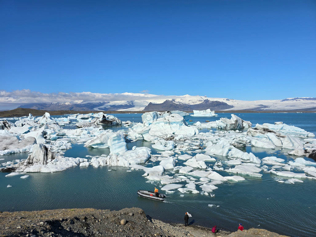 |
Vatnajokull National Park
Position: 64°2.95’N, -16°10.86’W
Vatnajokull National Park in southeastern Iceland is the largest of the country’s three national parks and a UNESCO World Heritage Site since 2019. The park is named after Vatnajokull glacier, the largest in Europe outside the Arctic, and contains many volcanoes, several beneath the glacier. At 5,778 sq miles (14,967 sq km) the massive park encompasses 14% of Iceland’s land mass and is the second largest in Europe after Yugyd Va in Russia. The park is popular to visit year-round, and supports a wide variety of recreational activities, including biking, hiking, and ice climbing.
|
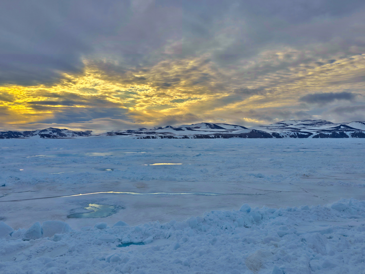 |
Northeast Greenland’s Unexplored Sea Ice
Position: 70°26.76’N, -21°8.03’W
We had a fabulous cruise aboard the icebreaker Le Commandant Charcot along Greenland’s still-frozen east coast. The sea ice typically doesn’t clear until mid-to-late summer, and one of the attractions of the cruise was the opportunity to view polar bears on the Arctic sea ice. We felt so lucky to sight one on our cruise to the North Pole and really hit the jackpot on the Greenland trip when we sighted dozens in one place, feeding on a whale carcass beached on the ice. The scene was so extraordinary that the ship just stopped there for a day and a half. Among the gathered bears were many mothers and their cubs, including several rare sets of triplets.
|
 |
Rucking at Discovery Park
Position: 47°39.74’N, -122°24.72’W
Another weekend ruck at Discovery Park.
|
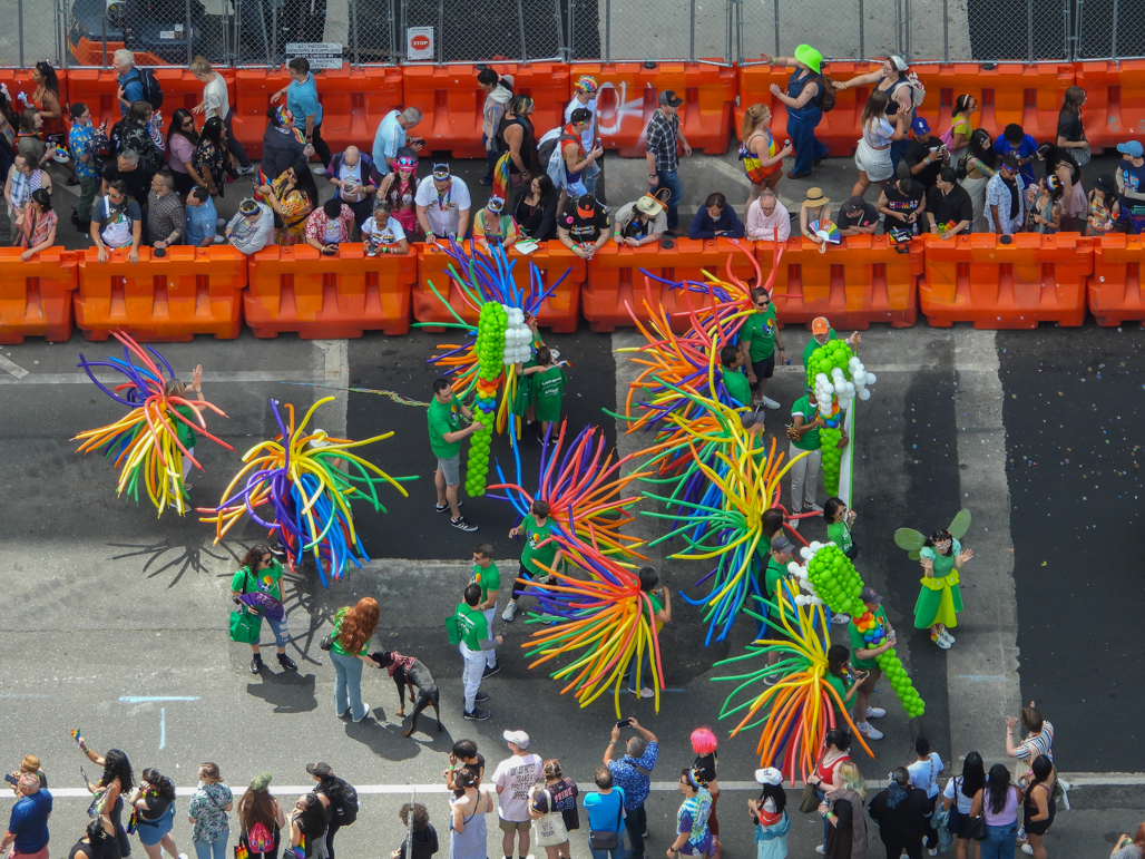 |
Seattle Pride Parade
Position: 47°36.99’N, -122°20.59’W
Participants in the 2024 Seattle Pride Parade wearing colorful balloon costumes, viewed from our apartment balcony. More than 250 groups marched in the parade that drew over 300,000 attendees.
|
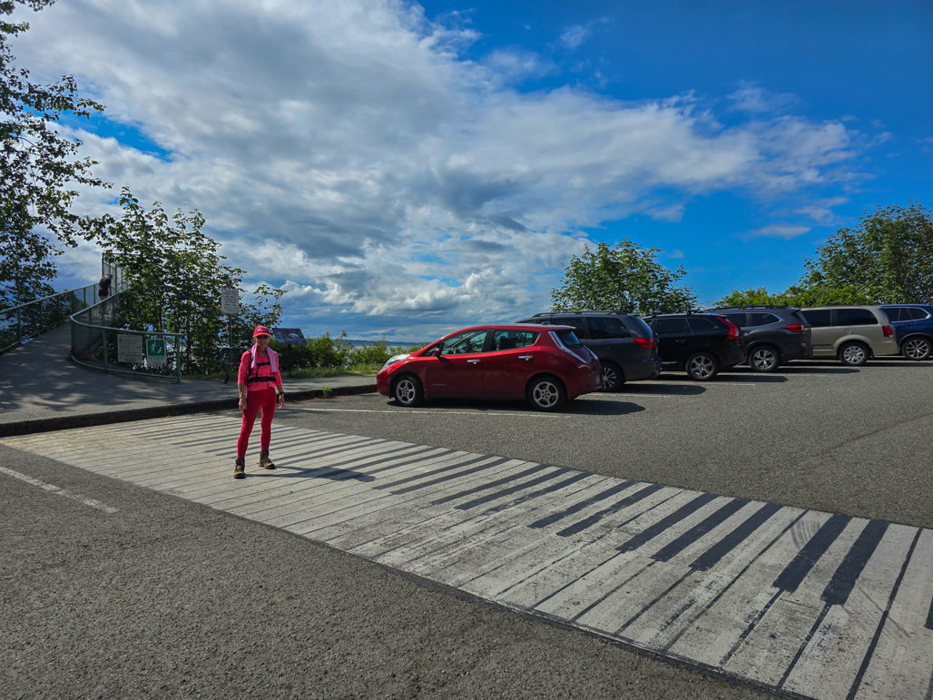 |
Play Attention
Position: 47°42.75’N, -122°22.72’W
Crossing the artwork Play Attention by local artist Garry Golightly during a ruck at Carkeek Park.
|
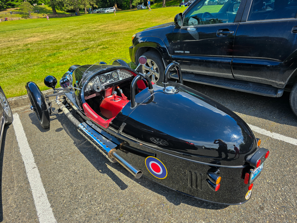 |
Morgan 3-Wheeler
Position: 47°42.75’N, -122°22.70’W
A Morgan 3-Wheeler at Carkeek Park. British manufacturer Morgan Motor Company produced the three-wheeled roadster from 2012 to 2021.
|
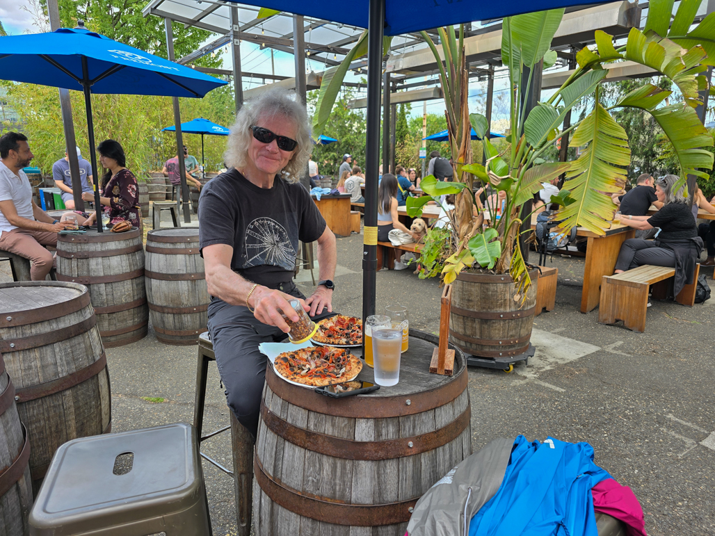 |
Fremont Brewing
Position: 47°38.94’N, -122°20.66’W
Working off those calories burned during our ruck at Carkeek Park with beer and pizza at Fremont Brewing’s Urban Beer Garden.
|
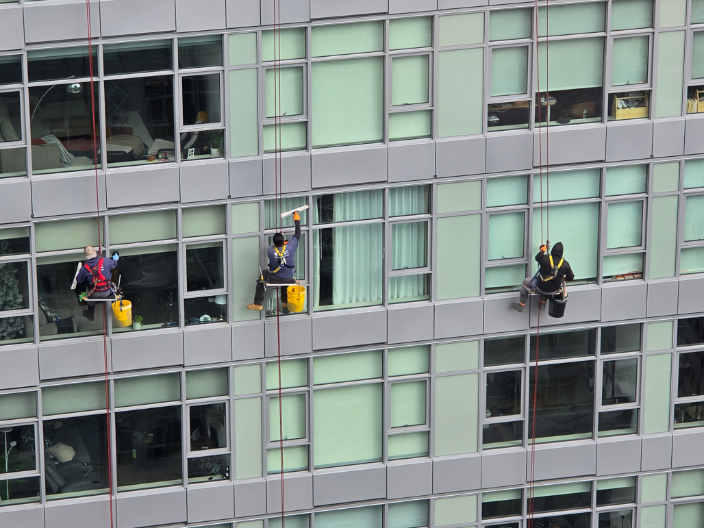 |
Window cleaning, Insignia
Position: 47°36.99’N, -122°20.58’W
Three window cleaners hanging high up on the north tower of our apartment complex.
|
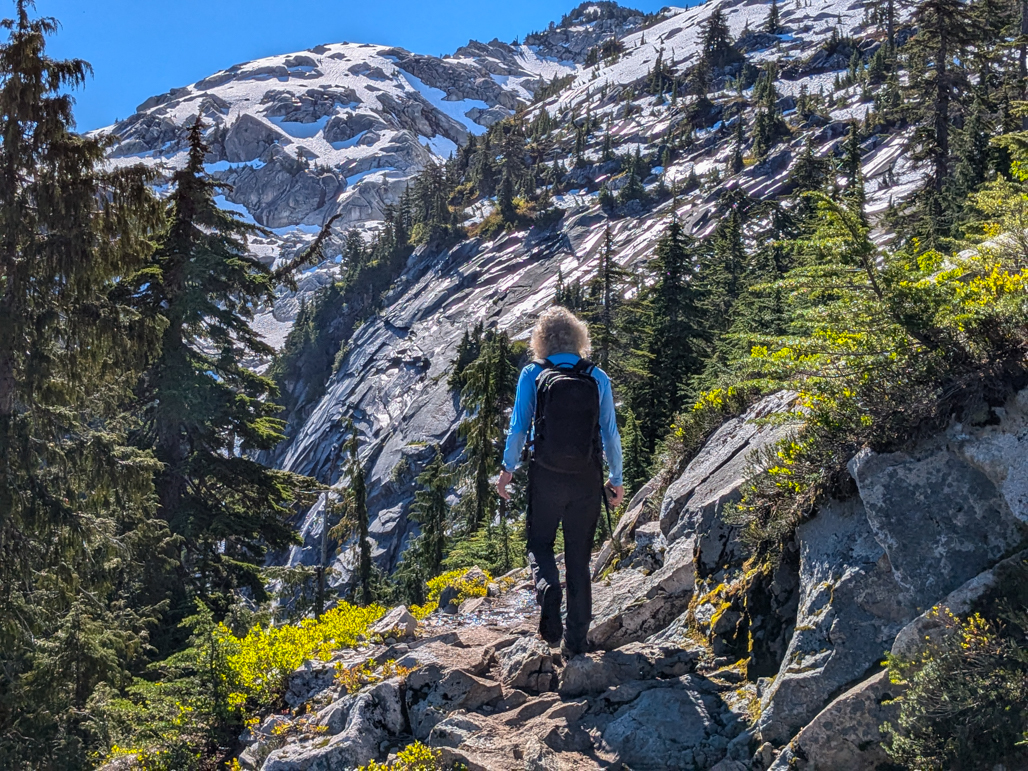 |
Granite Falls
Position: 48°3.78’N, -121°48.30’W
Hiking the Mt. Pilchuck Trial on a long weekend trip to Granite Falls, WA.
|
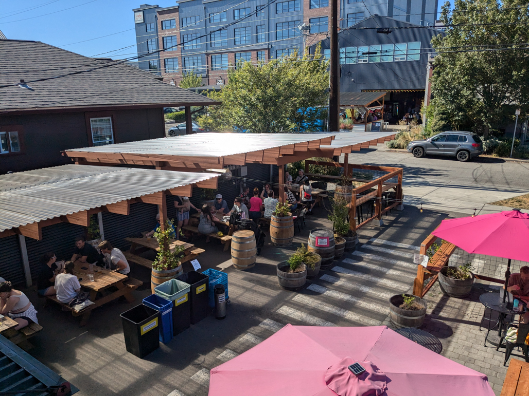 |
Urban Family Brewing Co
Position: 47°39.99’N, -122°22.25’W
Lunch and craft beer at Urban Family Brewing in Ballard after rucking at Discovery Park.
|
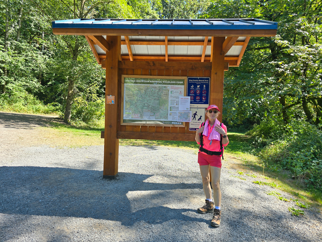 |
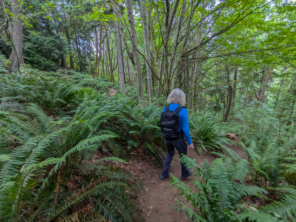
Rucking at Cougar Mountain
Position: 47°32.07’N, -122°7.72’W
Setting of for a ruck at Cougar Mountain in Bellevue, across Lake Washington from Seattle. Getting here is a bit more of a drive than our “home trail” of Discovery Park, but we enjoyed the change of scenery and the extensive trail system was excellent and lightly loaded.
|
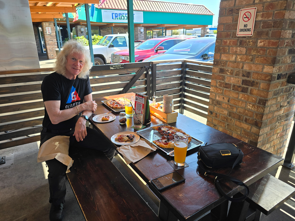 |
Resonate Brewery, Bellevue
Position: 47°33.12’N, -122°10.66’W
A delicious pizza and craft beer at Resonate Brewery in Bellevue after rucking on Cougar Mountain.
|
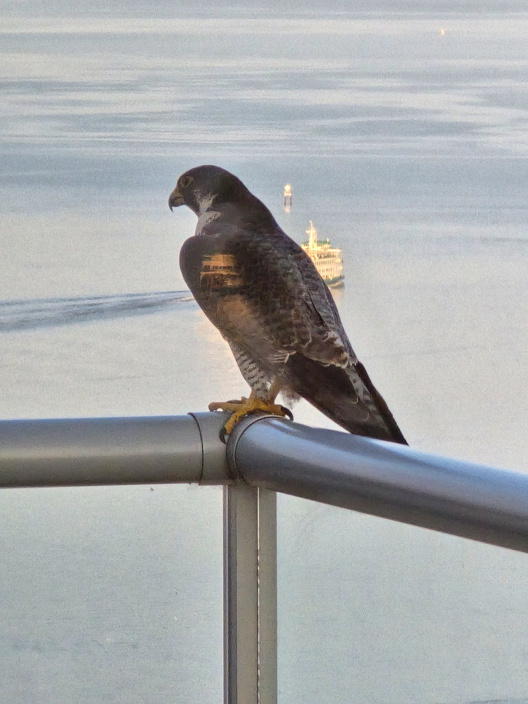 |
Peregrine falcon
Position: 47°36.99’N, -122°20.58’W
This striking peregrine falcon landed on the balcony of our apartment.
|
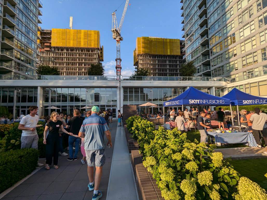 |
Insignia Picnic
Position: 47°37.01’N, -122°20.62’W
The summer picnic at our apartment complex, Insignia, drew over 200 people.
|
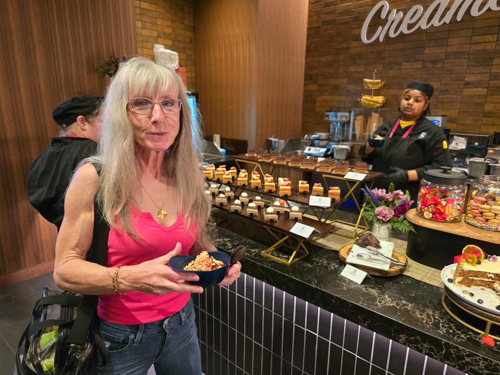 |
Mariners Sundae
Position: 47°35.46’N, -122°20.01’W
Jennifer enjoying an ice cream sundae treat in a baseball hat-shaped bowl before a Seattle Mariners baseball game.
|
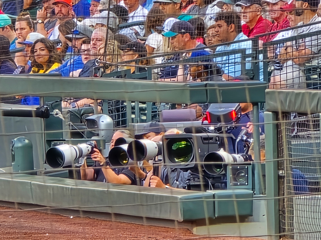 |
Lenses
Position: 47°35.47’N, -122°19.99’W
Major league sporting events, such as the Seattle Marines game we’re attending, always bring out the big lenses.
|
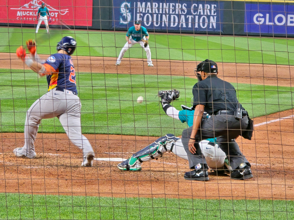 |
Strikeout
Position: 47°35.47’N, -122°19.99’W
The Seattle Mariners pitch a strike during a game against the Houston Astros. We would have needed a lot more of these to prevent a 4-2 loss, but we had a great evening at the game.
|
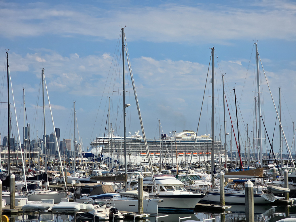 |
Love Boat
Position: 47°37.81’N, -122°23.47’W
While we were having lunch at Maggie Bluffs in Elliott Bay Marina, the Majestic Princess departed Pier 99, playing the theme from the Love Boat television series. The decade-running popular television show was filmed aboard a variety of Princess ships, starting with the series pilot on the line’s original Sun Princess in 1977 and Gavin MacLeod, who played Captain Stubing, was the Princess Cruise Lines spokesperson for 35 years.
|
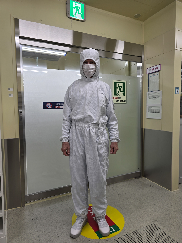 |
Bunny Suit
Position: 36°50.59’N, 127°6.89’E
James dressed in a bunny suit before entering the clean room at Samsung’s High Bandwidth Memory (HBM) fab in South Korea as part of a week-long business trip to Asia.
|
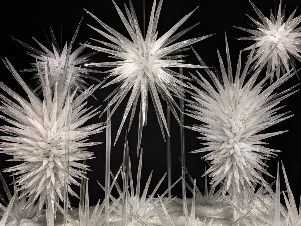 |
Chihuly Garden and Glass
Position: 47°37.23’N, -122°21.02’W
Winter Brilliance, originally commissioned for the 2015 Barneys New York holiday window, on display at the Chihuly Garden and Glass museum at the base of the Seattle Space Needle. Despite its proximity to our apartment, we’d never visited the museum before. The complexity and innovativeness of the glasswork on display is impressive.
|
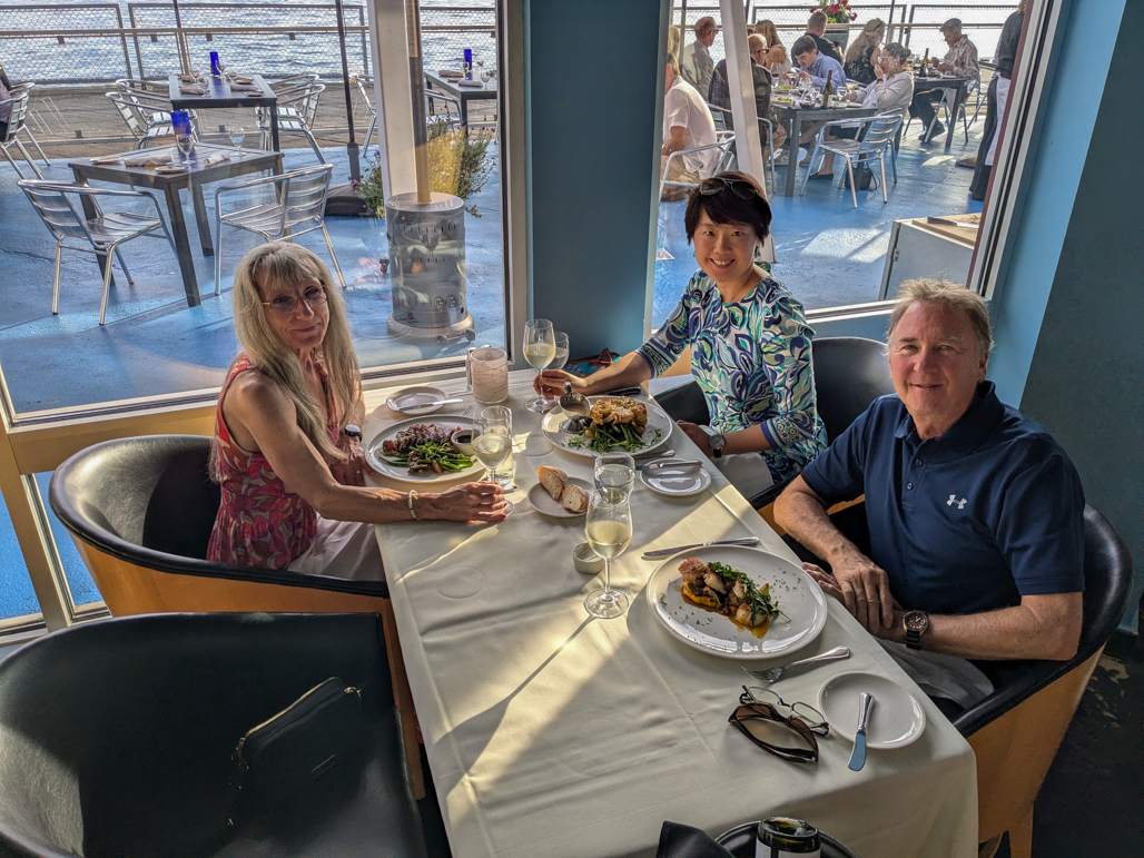 |
Mark & Christine
Position: 47°36.90’N, -122°21.31’W
Dinner with our friends Mark Mohler and Christine Guo of Nordhavn 62 Gray Matter, who were visiting Seattle for a couple of days. James should have been in the picture as well, but his return flight from a business trip to South Korea and Japan was delayed a day due to aircraft mechanical problems in Japan.
|
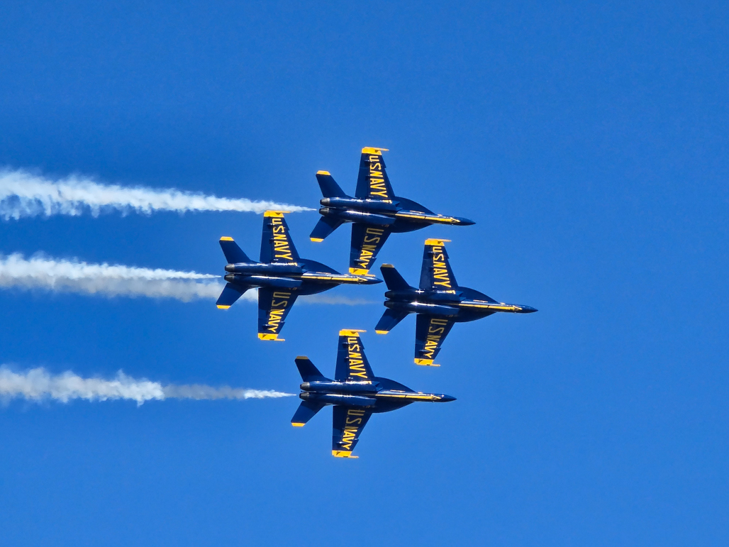 |
Blue Angels
Position: 47°36.99’N, -122°20.57’W
The US Navy Blue Angels flight demonstration squadron streaking by the rooftop of our apartment complex as part of the annual Seafair Weekend events.
|
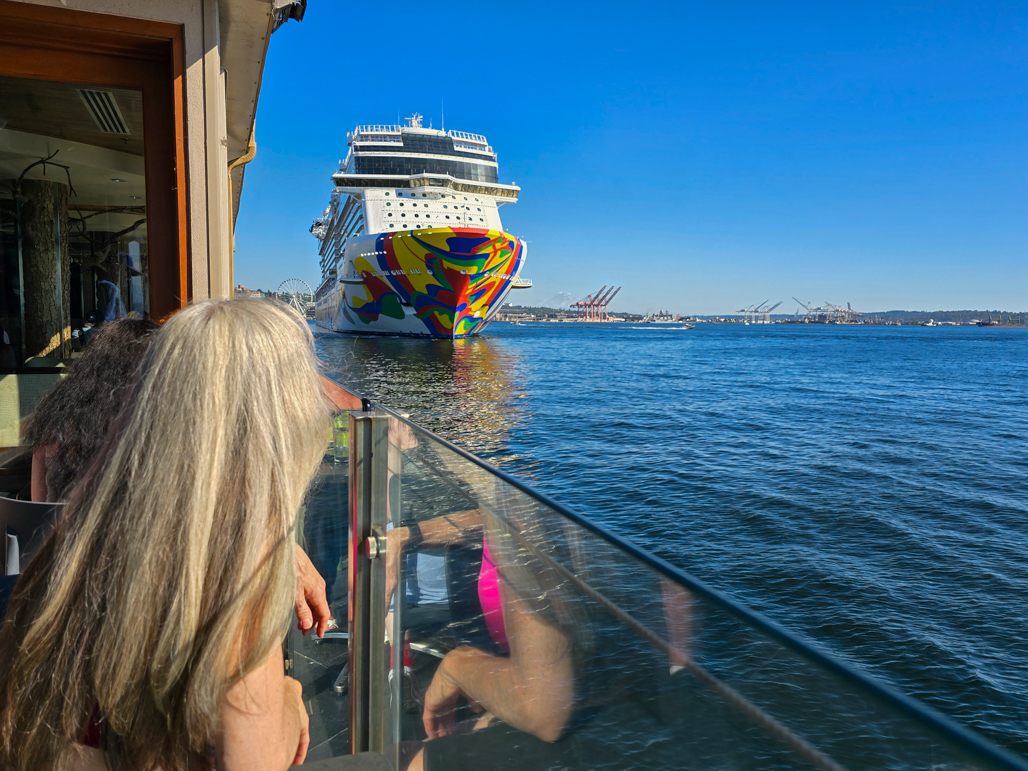 |
Norwegian Encore
Position: 47°36.75’N, -122°21.19’W
Enjoying a drink on the terrace at the Edgewater Hotel to watch the Norwegian Encore depart Pier 66.
|
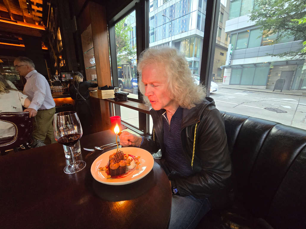 |
The Butcher’s Table
Position: 47°37.06’N, -122°20.34’W
Celebrating James’ birthday with a traditional dinner at one of our favorite Seattle restaurants, The Butcher’s Table.
|
|
|
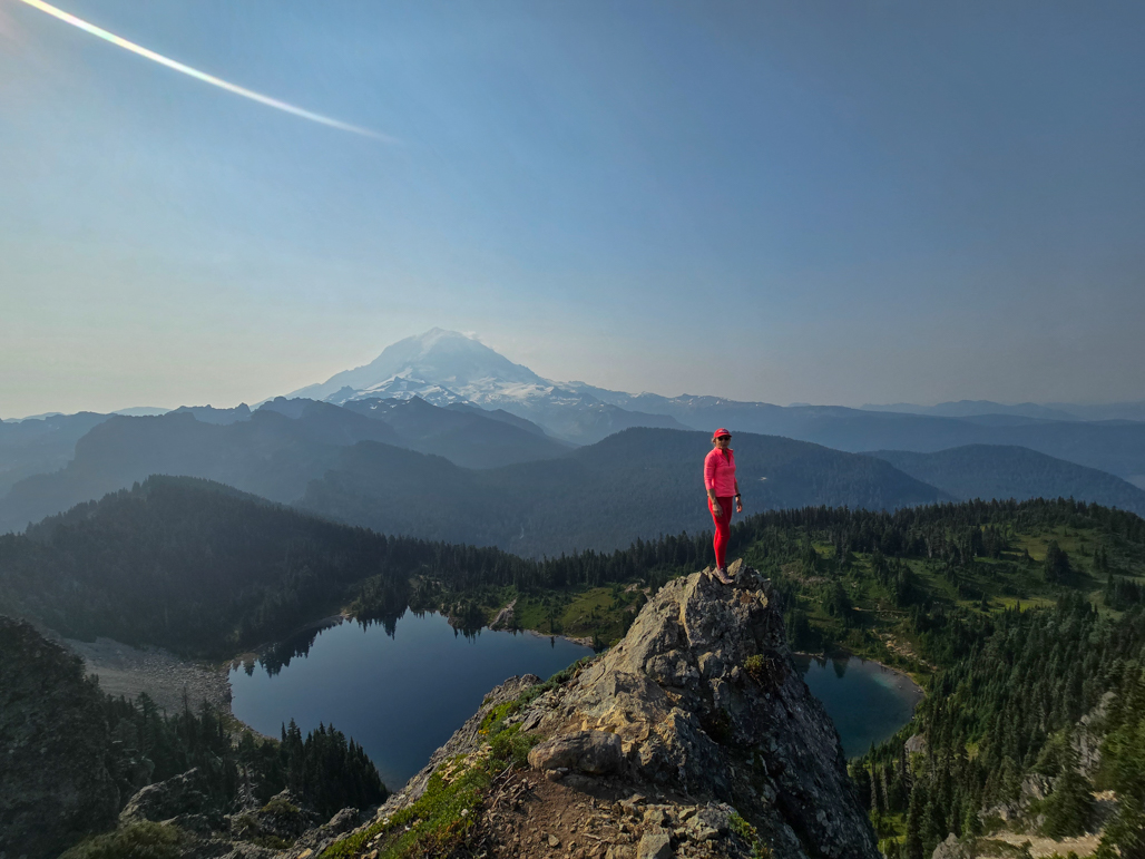
Tolmie Peak, WA
Position: 46°57.46’N, -121°52.79’W
Taking in the view to Mt. Rainier, in the background, from Tolmie Peak as part of a weekend hiking trip to Enumclaw.
|
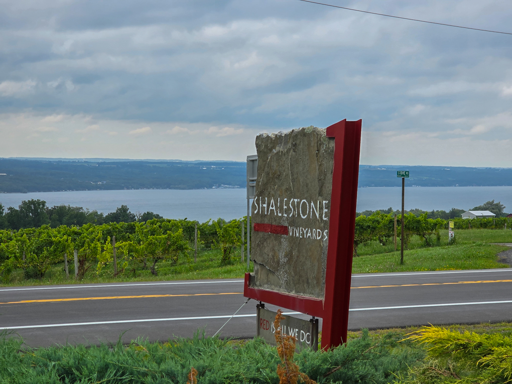 |
Shalestone Vineyards, Finger Lakes
Position: 42°33.32’N, -76°51.98’W
At Shalestone Vineyards in New York’s Finger Lakes district during a weekend visit with friends who have a vacation home nearby.
|
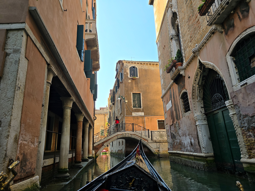 |
Venice
Position: 45°26.02’N, 12°19.98’E
Northern Italy has long been high on our list of places to visit. For the summer of 2020, we had booked moorage for Dirona in Genoa and planned to tour the area extensively. The COVID pandemic changed those plans, and we finally filled that gap on a last-minute trip to attend the Italian Grand Prix near Milan. We started our visit with two nights in Venice, the “City of Canals”.
|
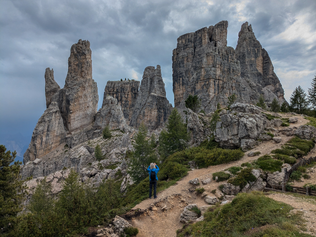 |
The Dolomites
Position: 46°30.67’N, 12°2.97’E
One of the reasons that we’ve long been wanting to visit Northern Italy is to hike the Dolomites in the Italian Alps. The pictures we’d seen, of dramatic formations rearing above diminutive hikers, really drew us in. The Dolomites are considered a world-class hiking destination and we finally were going to experience them.
|
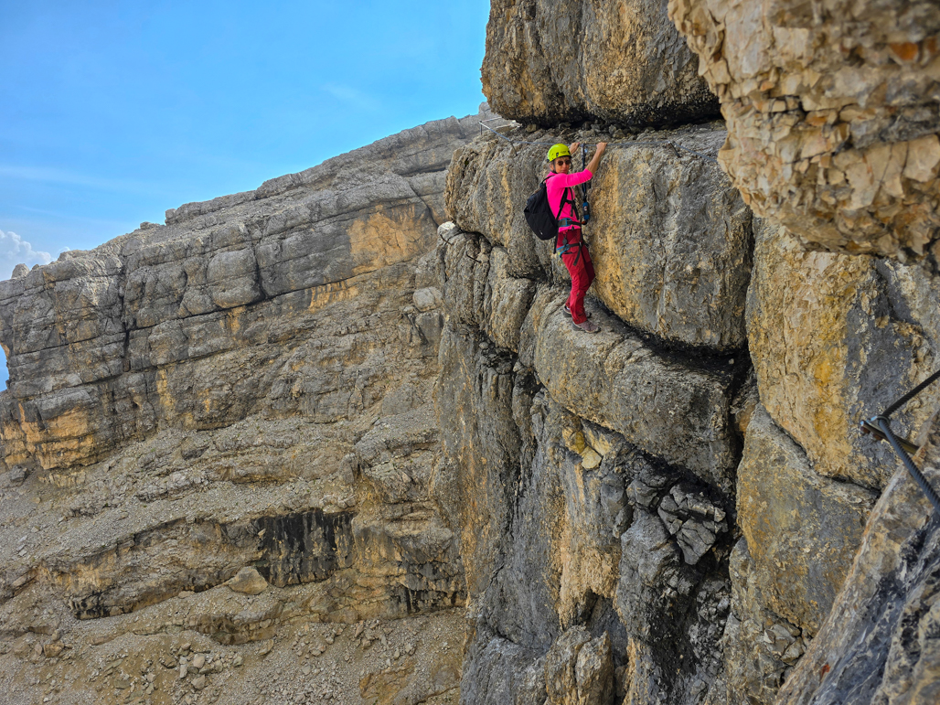 |
Via Ferrata Gianni Aglio
Position: 46°32.78’N, 12°4.19’E
In addition to the hiking and dramatic scenery, another draw of the Dolomites for us was the chance to do a via ferrata course where the sport originated. Via ferrata means “iron road” in Italian, and refers to a system of cables, ladders, bridges, handholds, and footholds used to aid ascension.
|
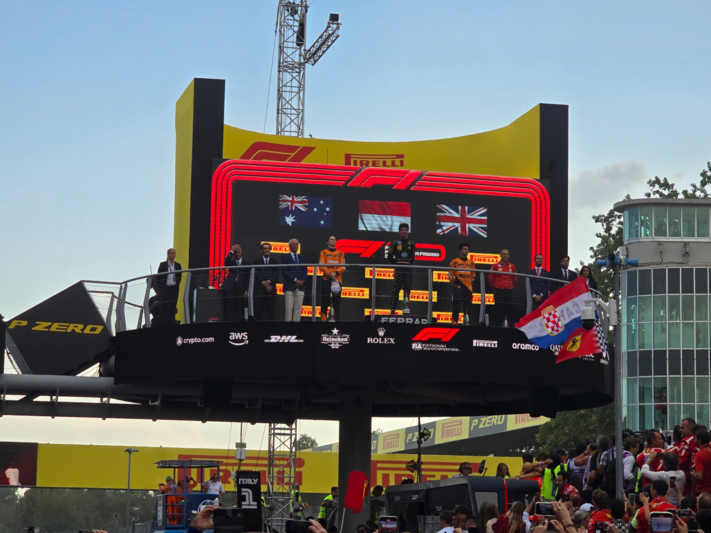 |
Ferrari Wins at Monza!
Position: 45°37.01’N, 9°16.87’E
Even if we weren’t Formula 1 fans, it would be hard not to be carried away by the excitement when Ferrari won the Italian Grand Prix at their home track of Monza Circuit last weekend. In a contest that played out to the final laps, Ferrari driver Charles LeClerc picked up the lead when McLaren driver Oscar Piastri pitted for fresh tires with 20 laps to go. The local fans, clad in Ferrari red and waving banners bearing the team’s prancing horse logo, cheered loudly every time LeClerc passed by in the lead.
|
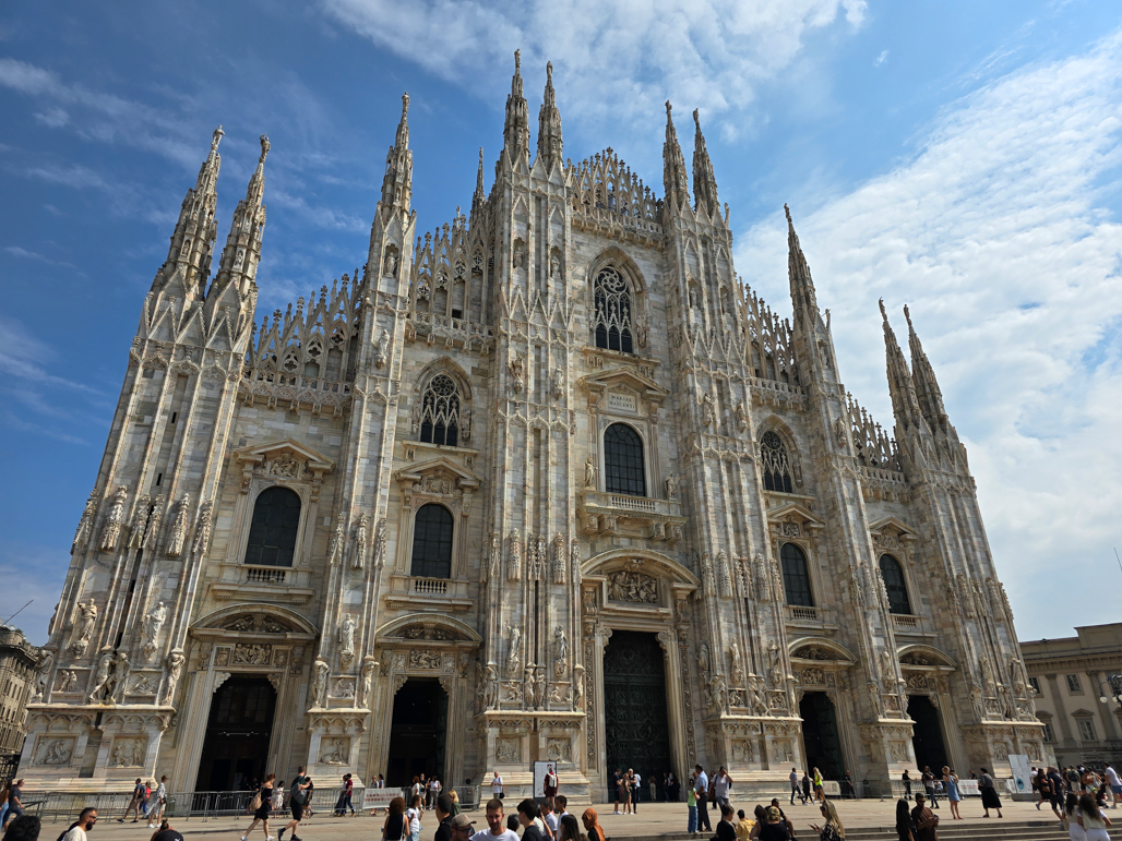 |
Milan
Position: 45°27.87’N, 9°11.41’E
Milan is a wonderful city full of striking architecture, public art, historical depth and countless excellent restaurants. The influence of Leonardo ca Vinci, the city’s most notable resident, is visible throughout. We got a small taste of the city’s offerings on a one-day exploration before returning home to Seattle.
|

|
Click the travel log icon on the left to see these locations on a map. And a map of our most recent log entries always is available at mvdirona.com/maps. |
If your comment doesn't show up right away, send us email and we'll dredge it out of the spam filter.