Marina del Rey, in Los Angeles County, California, contains the largest artificial pleasure boat harbor in North America. Construction began in the 1950s and today the basin has a capacity for 5,000 vessels, supports five different yacht clubs and is lined with restaurants, shops, condos, and hotels. The first hotel built was the historic Marina del Rey Hotel, where we stayed for a long weekend in early spring. Opened in 1964, the hotel underwent a $25 million renovation in 2015 and is a modern and comfortable facility with great views in the marina basin.
During our stay, we enjoyed the marina happenings, checked out several restaurants in the area, and spent an excellent day visiting famous Venice Beach and walking along the beach promenade all the way to Santa Monica.
Below are highlights from March 1st through 5th, 2024. Click any image for a larger view, or click the position to view the location on a map. And a map with our most recent log entries always is available at mvdirona.com/maps.
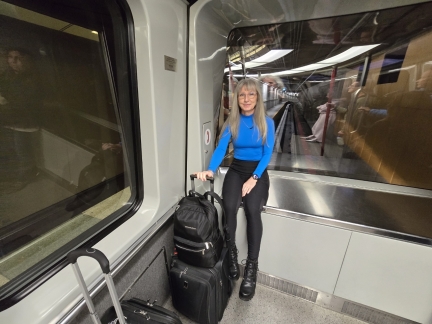 |
SeaTac Train
Position: 47°26.93’N, -122°18.40’W
Riding the underground train to SeaTac’s N Concourse for our flight to Los Angeles.
|
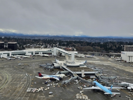 |
IAF Pedestrian Walkway
Position: 47°26.39’N, -122°18.49’W
View as our flight takes off from SeaTac to the International Arrivals Facility (IAF) Pedestrian Walkway connecting S Concourse with IAF in A Concourse. The 85-foot-high (26 m) walkway crosses an active taxiway, with room for planes to pass under. At 780-feet (237m m) long, it is the largest of the three existing taxiway bridges in the world.
Most international flights into SeaTac arrive into S Concourse, so we often walk that bridge when returning home from outside the country. The bridge is one-way, because passengers departing the US don’t pass through any immigration or customs formalities and simply take the underground train to S Concourse. |
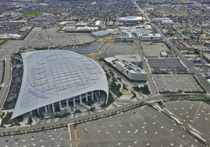 |
SoFi Stadium
Position: 33°57.50’N, -118°20.43’W
Flying over SoFi Stadium on Los Angeles, the home of the Los Angeles Chargers and Los Angeles Rams NFL teams. The stadium seats 70,240, and was completed in 2020 at an estimated cost of $5–6 billion. At upper right is The Intuit Dome, home of the Los Angeles Clippers NBA team.
|
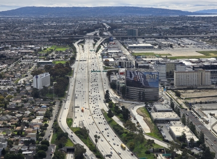 |
I-405
Position: 33°57.33’N, -118°22.08’W
Passing over I-405, a bypass freeway along the southern and western sections of greater Los Angeles. The freeway is famous for being the busiest and most congested in the US, day and night.
|
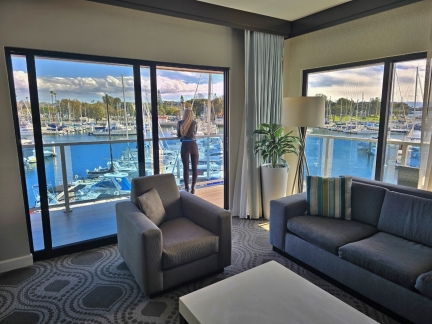 |
Marina del Rey Hotel
Position: 33°58.77’N, -118°26.77’W
Jennifer checking out the views to the boats from our room for the weekend at the Marina del Rey Hotel in Los Angeles.
|
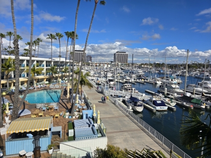 |
Marina del Rey
Position: 33°58.77’N, -118°26.77’W
A view to the pool area at our hotel, and some of the boats moored at Marina del Rey. The basin is the largest artificial pleasure boat harbor in North America, with a capacity for 5,000 vessels.
|
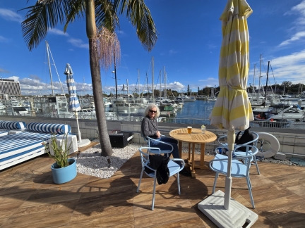 |
SALT
Position: 33°58.78’N, -118°26.76’W
Enjoying a drink on the patio at SALT Restaurant and Bar in our hotel.
|
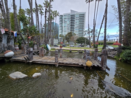 |
Pond
Position: 33°58.98’N, -118°26.67’W
A large koi pond outside The Warehouse restaurant in Marina del Rey.
|
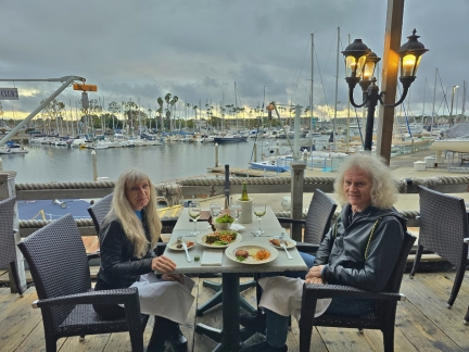 |
The Warehouse
Position: 33°58.97’N, -118°26.67’W
We had a great meal on the deck at The Warehouse in Marina del Rey. With temperatures just under 60F (15.5 C), wind, and light scattered rain, we were just able to make it work by sitting near a patio heater.
|
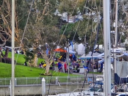 |
LA County Dragon Boat Festival
Position: 33°58.76’N, -118°26.77’W
The 3rd annual LA County Dragon Boat Festival is being held today at Chase Burton Park in Marina del Rey. The race was popular enough that registration was full a month in advance.
|
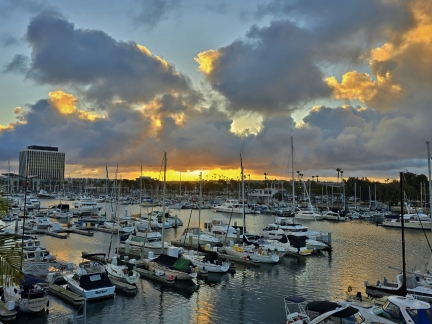 |
Sunrise, Marina del Rey
Position: 33°58.77’N, -118°26.77’W
Sunrise over the boats, viewed from the balcony of our room at Marina del Rey Hotel.
|
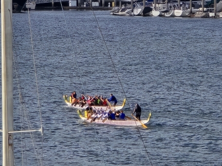 |
Dragon Boats
Position: 33°58.77’N, -118°26.77’W
Dragon boats racing in Marina del Rey as part of the 3rd annual LA County Dragon Boat Festival.
|
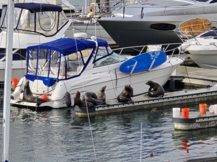 |
Sea Lions
Position: 33°58.77’N, -118°26.78’W
Marina del Rey has a boisterous sea lion population that loves to haul out on the docks. Many boats have fenders and buckets placed on their swim platform to keep the animals off. The fenders on this boat didn’t help much.
|
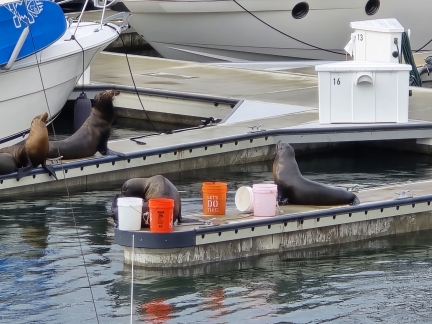 |
Buckets
Position: 33°58.77’N, -118°26.77’W
The buckets on the dock didn’t deter these sea lions. They just found a way to jump up between them.
|
 |
Sparrow
Position: 33°58.77’N, -118°26.77’W
A well-fed sparrow, what we refer to as a “pudjo”, at SALT restaurant in our hotel.
|
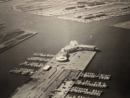 |
Marina del Rey Hotel, 1964
Position: 33°58.78’N, -118°26.76’W
An aerial photograph of the Marina del Rey Hotel from 1964. Although at least a thousand boats are moored here already, the area looks positively barren compared to today.
|
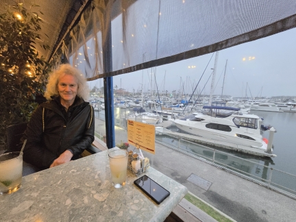 |
Tony P’s
Position: 33°59.01’N, -118°26.87’W
A good dinner at Tony P’s Dockside Grill overlooking the California Yacht Club, one of five yacht clubs in Marina del Rey.
|
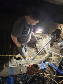 |
Water Leak
Position: 33°58.81’N, -118°26.76’W
While we were at dinner, we got a text from our hotel indicating that the water would be shut off until 10pm that night due to emergency water leak repairs. On returning to the hotel, we chatted briefly with this plumber who had dug a hole through the concrete sidewalk and was repairing a broken water pipe.
|
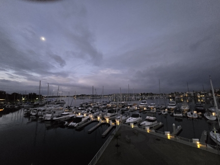 |
Dawn
Position: 33°58.77’N, -118°26.77’W
The moon reflecting into still waters, looking southwest across Marina del Rey from our hotel balcony.
|
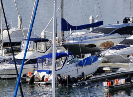 |
Spraying Water
Position: 33°58.77’N, -118°26.77’W
The sea lions don’t seem to like fresh water, or perhaps they don’t like being sprayed. They all jumped into the water when someone on the dock at Marina del Rey hosed them down (partly visible at right).
|
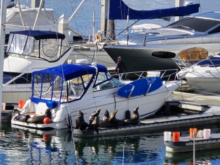 |
Sea Lions Back
Position: 33°58.77’N, -118°26.78’W
Spraying water on the sea lions did get them to move, but they were all right back in place within a half hour.
|
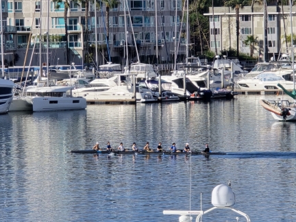 |
Rowers
Position: 33°58.77’N, -118°26.78’W
Rowing is popular in the wide fairway at Marina del Rey.
|
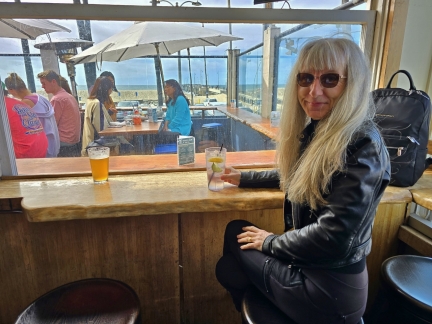 |
The Venice Whaler
Position: 33°58.74’N, -118°28.00’W
A delicious lunch overlooking the ocean at The Venice Whaler in Venice, CA.
|
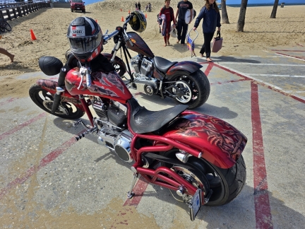 |
Motorcycles
Position: 33°58.73’N, -118°28.04’W
These two beautiful choppers reminded us of the great time we had at Bike Week in Daytona Beach back in 2017.
|
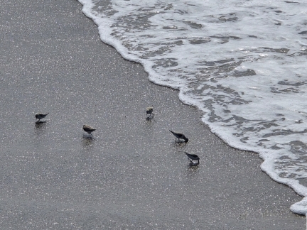 |
Sandpipers
Position: 33°58.70’N, -118°28.08’W
We had fun watching the sandpipers working the surf at Venice Beach. As the waves went out, they’d scurry to the edge of the exposed sand to probe for small invertebrates, then rush back just ahead of the water as the waves came back in.
|
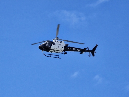 |
LAPD
Position: 33°58.70’N, -118°28.09’W
An LAPD helicopter was in the air surveying the beach area most of the afternoon.
|
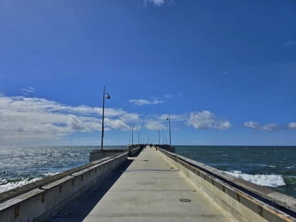 |
Venice Fishing Pier
Position: 33°58.66’N, -118°28.15’W
Looking out to sea along the Venice Fishing Pier. The pier was originally built in 1963, but fell into disrepair and by the 1980s was slated to be destroyed. Residents campaigned to save it, and the pier was retrofitted and re-opened in 1997. After suffering extensive storm damage in 2005, the pier was again closed, and re-opened the following year.
|
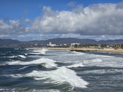 |
Surf
Position: 33°58.67’N, -118°28.15’W
View from the Venice Fishing Pier to the big waves rolling onto the beach in today’s high winds.
|
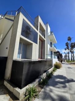 |
Modern Venice Beach House
Position: 33°58.97’N, -118°28.21’W
A modern home overlooking Venice Beach.
|
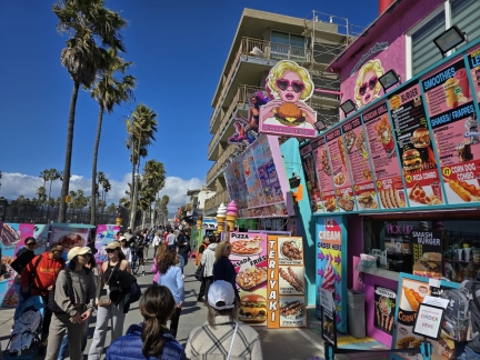 |
Ocean Front Kitchen
Position: 33°59.07’N, -118°28.29’W
The colorful signs of the Ocean Front Kitchen, one of the dozens of small establishments bordering Venice Beach.
|
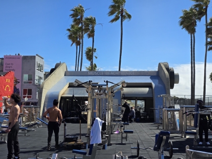 |
Muscle Beach Venice
Position: 33°59.14’N, -118°28.36’W
The Muscle Beach Venice outdoor bodybuilding gym opened in 1963, attracting famous weight lifters such as Arnold Schwarzenegger and Lou Ferigno.
|
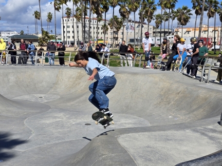 |
Venice Beach Skatepark
Position: 33°59.22’N, -118°28.52’W
Venice has long been a mecca for top skateboarders such as Jay Adams, whose innovate style in the 1970s helped popularize modern skateboarding, and Tony Hawk, who won the National Skateboard Association championship 12 years in a row. We spent ages watching the many talented riders at the Venice Beach Skatepark.
|
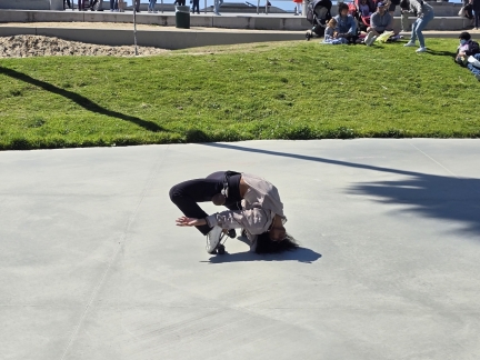 |
Roller Skate Dance Plaza
Position: 33°59.24’N, -118°28.50’W
Venice Beach was the center of the 1970s roller dancing phenomenon. The Roller Skate Dance Plaza was created in 1999 to give skate dancers an official place to practice, learn and perform within Venice Beach Park.
|
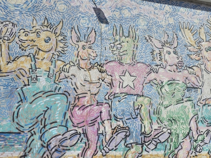 |
Venice Beach Chorus Line
Position: 33°59.34’N, -118°28.53’W
The “Venice Beach Chorus Line” mural created in 2004 by artist Rip Cronk
|
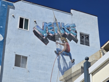 |
Venice Beach by Rip Cronk
Position: 33°59.36’N, -118°28.54’W
Another mural by artist Rip Conk, this one a self-portrait created in 1990 and titled “Venice Beach”.
|
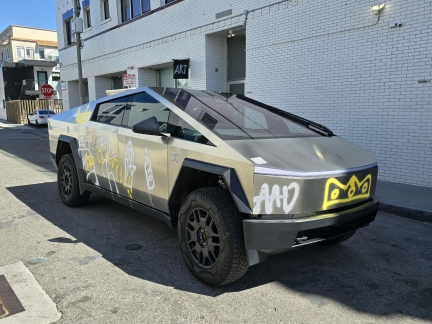 |
Tesla Cybertruck
Position: 33°59.44’N, -118°28.61’W
2024 Tesla Cybertruck painted in graffiti by 11-year-old artist “theminididi”.
|
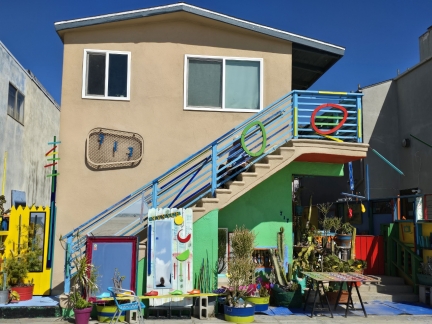 |
Art and Plants
Position: 33°59.49’N, -118°28.67’W
A colorful display of art and plants at a Venice Beach house.
|
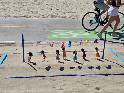 |
Dolls and Laundry
Position: 33°59.49’N, -118°28.67’W
An unusual display of dolls and laundry opposite the Venice Beach house we photographed earlier.
|
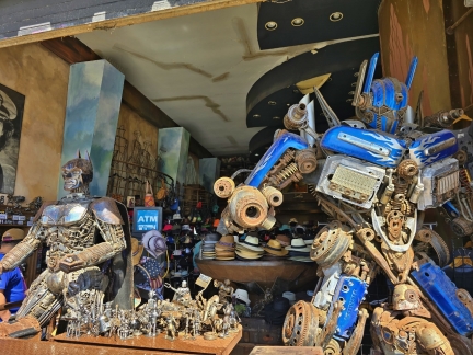 |
Titanic Boutique
Position: 33°59.64’N, -118°28.78’W
Large and small metal sculptures at the Titanic Boutique. The creativity and detail is quite impressive.
|
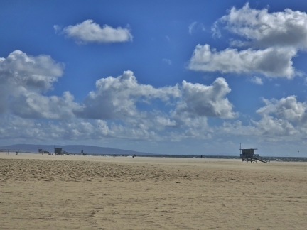 |
Santa Monica State Beach
Position: 33°59.85’N, -118°29.03’W
A mostly-empty Santa Monica State Beach. Today’s high winds and cool temperatures make beach-going unappealing.
|
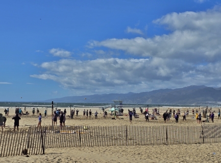 |
Volleyball
Position: 34°0.02’N, -118°29.19’W
The beach isn’t very busy, but the beach volleyball courts at Santa Monica State Beach are.
|
 |
Original Muscle Beach Santa Monica
Position: 34°0.48’N, -118°29.64’W
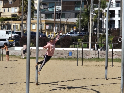
A gymnast swinging between rings at the original Muscle Beach in Santa Monica. The facility opened in the 1930s with outdoor exercise equipment installed as part of a New Deal agency Works Progress Administration, sparking the physical fitness movement in the US. Gymnastic and acrobatic demonstrations were held, and famous body-builders such as Joe Gold worked out with the weight-lifting equipment installed on a platform off the beach. Today the original Muscle Beach has an extensive gymnastics training area, and some weight-lifting equipment, but much of the latter activity has been transferred to Muscle Beach Venice.
|
 |
Tightrope
Position: 34°0.47’N, -118°29.64’W
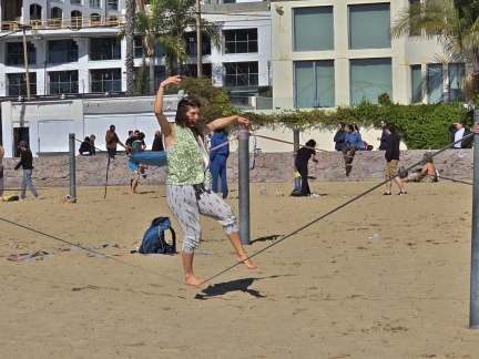
Tightrope walker balancing at the original Muscle Beach in Santa Monica.
|
 |
Santa Monica Pier
Position: 34°0.51’N, -118°29.72’W
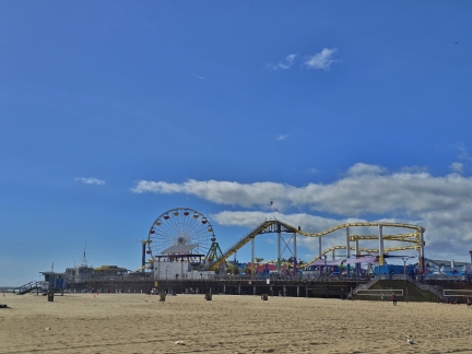
The famous Santa Monica Pier was the first concrete pier on the West Coast when completed in 1909. Today the pier supports an amusement park and several restaurants and other attractions.
|
 |
Pacific Park
Position: 34°0.53’N, -118°29.83’W
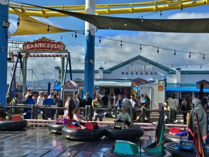
Bumper cars at Pacific Park, the compact amusement park on the Santa Monica pier.
|
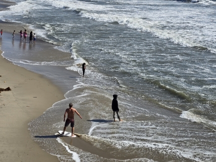 |
Skimboarder
Position: 34°0.50’N, -118°29.85’W
A skimboarder working the waves off the Santa Monica pier. Unlike surfing, a skimboarder waits on shore for a wave and rides out towards the surf. A skimboard resembles a small surf-board without fins.
|
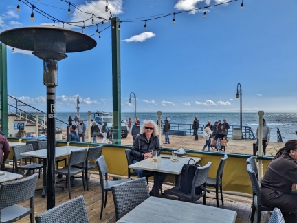 |
Maria Sol
Position: 34°0.46’N, -118°29.98’W
Enjoying a beer and the view at Maria Sol Mexican restaurant at the head of Santa Monica pier.
|
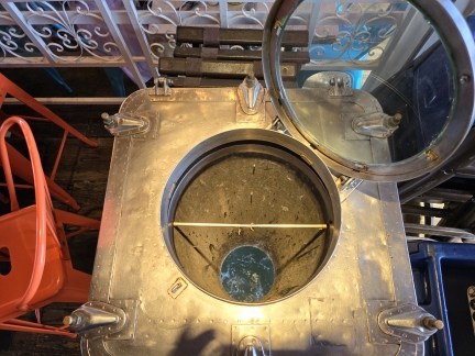 |
Ocean Chute
Position: 34°0.46’N, -118°29.99’W
A chute in the bar at Maria Sol Mexican restaurant opens to the ocean below.
|
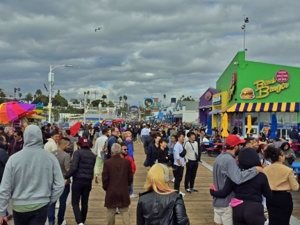 |
Crowds
Position: 34°0.52’N, -118°29.90’W
The high winds may have discouraged the beach-goers, but not visitors to the Santa Monica pier. It was positively packed.
|
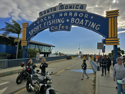 |
Santa Monica Yacht Harbor
Position: 34°0.68’N, -118°29.70’W
When this landmark sign was erected at the foot of the Santa Monica pier in 1941, a harbor for about 100 boats did exist off the pier. The harbor ceased to exist after the breakwater protecting it was destroyed in a 1982 storm.
|
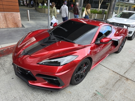 |
Corvette
Position: 34°0.79’N, -118°29.69’W
The late-model Corvettes sure are exotic-looking.
|
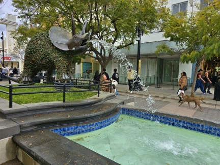 |
3rd Street Promenade
Position: 34°0.87’N, -118°29.68’W
One of several whimsical fountains along the 3rd Street pedestrian promenade in downtown Santa Barbara.
|
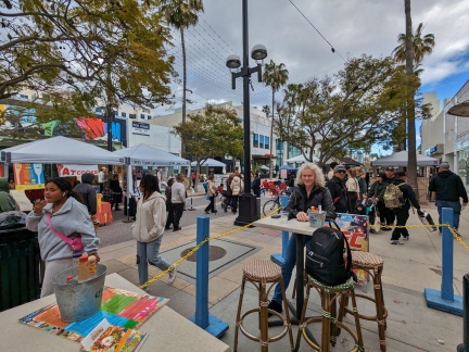 |
Cabo Cantina
Position: 34°1.04’N, -118°29.90’W
Taking in the street scene over a margarita at Cabo Cantina on the 3rd Street pedestrian promenade in downtown Santa Barbara.
|
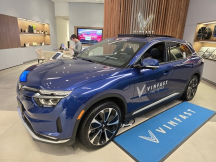 |
Vinfast
Position: 34°0.81’N, -118°29.67’W
Checking out a Vinfast all-electric car at dealership in Santa Monica Place mall.
|
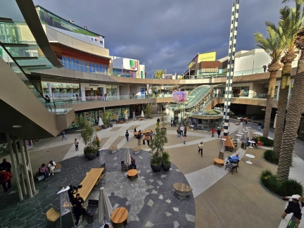 |
Santa Monica Place
Position: 34°0.81’N, -118°29.63’W
Looking down into the central atrium of Santa Monica Place at the southern end of the 3rd Street pedestrian promenade. Originally opened as an indoor mall in 1980, it was one of the first works of famed architect Frank Gehry. In 2010, the mall was redesigned to be all-outdoor.
|
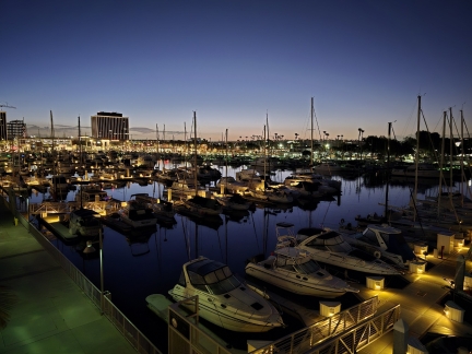 |
Dawn, Marine del Rey
Position: 33°58.77’N, -118°26.77’W
Dawn under a clear sky at Marine del Rey in Los Angeles. We’ve experienced uncharacteristically rainy weather for the past two days, but expect better conditions today.
|
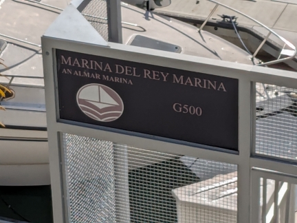 |
Marina Times Three
Position: 33°58.77’N, -118°26.76’W
The sign outside our Marina del Rey hotel managed to get the word “marina” in the name three times.
|
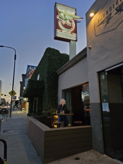 |
Thunderbird Bar, Los Angeles
Position: 34°2.60’N, -118°28.12’W
Enjoying a drink on the terrace of the Thunderbird Bar in Los Angeles after an appointment nearby.
|
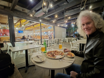 |
Pitfire Pizza, Los Angeles
Position: 33°59.69’N, -118°26.32’W
A delicious pizza on the terrace at Pitfire Pizza in Los Angeles. With the temperature at 57°F (14°C), it seemed too cold for the locals. We were the only ones outside, but were warm and comfortable under a heater.
|
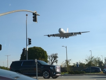 |
Plane Landing at LAX
Position: 33°57.13’N, -118°23.80’W
An airplane crossing over Lincoln Blvd shortly before landing at Los Angeles airport. A park nearby, aptly-named Airplane Landing View Point, is one of the best places in the country to watch planes land.
|
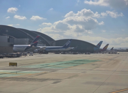 |
Airlines
Position: 33°56.82’N, -118°24.77’W
A diverse collection of airlines represented at Los Angeles Airport, from closet to fathest, Chilean LATAM, Japanese All Nippon Airways, Korean Air, South Korean Asiana Airlines, a Star Alliance airline, and United Airlines.
|
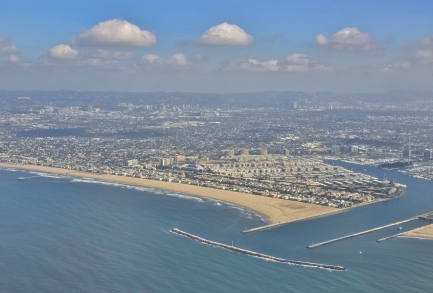 |
Marina del Rey
Position: 33°56.62’N, -118°28.13’W
View to Marine del Rey, where we stayed for the weekend, as our flight for Seattle takes off from Los Angeles airport.
|
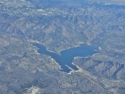 |
Lake Isabella
Position: 35°33.80’N, -118°41.05’W
The Lake Isabella reservoir in California, viewed from our flight back to Seattle from Los Angeles airport. The reservoir was created in 1953 with the damming of the Kern River.
|
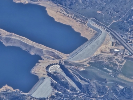 |
Labryinth Wier, CA
Position: 35°37.64’N, -118°40.55’W
View to the dam complex on Lake Isabella. In the center is the recently-constructed labryinth wier, completed in 2022 to mitigate the risk of flooding should the lake overflow. The unique shape of the wier allows it to handle much higher volumes of water than a straight wier, and increases the spillway discharge capacity tenfold, from 50,000 cfs (1,415 cms) to 506,000 cfs (14,328 cms).
|
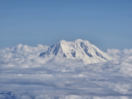 |
Mt. Rainier
Position: 46°44.98’N, -122°44.28’W
A wonderful view to Mt. Rainier as our flight from Los Angeles nears the Seattle area.
|

|
Click the travel log icon on the left to see these locations on a map. And a map of our most recent log entries always is available at mvdirona.com/maps. |

If your comment doesn't show up right away, send us email and we'll dredge it out of the spam filter.