On a whim, we made a last-minute decision to go to Honolulu for a long weekend earlier this year. We’d both visited Hawaii many times, but hadn’t been back since we departed for Palmyra in 2013 on our trip around the world in Dirona. We had a fabulous time, and left with more warm memories of the Aloha islands.
High on our list of things to do in Honolulu was to stop in at the Waikiki Yacht Club, where we are members and lived for several months in 2012-2013 on Dirona. Another important stop was sunset drinks at the Halekulani resort, a tradition for at least three generations of Hamiltons. We also enjoyed exploring the newly-renovated International Market Place. The last time we were in Hawaii the market was still in its original form consisting of dozens of small stalls selling jewelry, clothing, and souvenirs but it has since been replaced with a three-story complex including high-end stores and several good restaurants.
Below are highlights from January 12th through 16th, 2023. Click any image for a larger view, or click the position to view the location on a map. And a map with our most recent log entries always is available at mvdirona.com/maps.
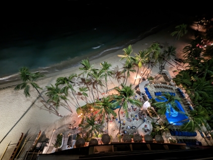 |
Waikiki Beach
Position: 21°16.61’N, -157°49.66’W
Looking down to Waikiki Beach from our room at the Outrigger Waikiki Beach Resort just past 11pm.
|
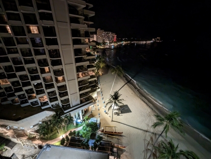 |
Diamond Head
Position: 21°16.61’N, -157°49.66’W
We just landed a couple of hours ago and this is the view south towards Diamond Head from our hotel room.
|
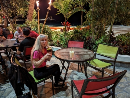 |
Mai Tai
Position: 21°16.60’N, -157°49.68’W
Enjoying our first Hawaiian Mai Tai in a decade overlooking the beach at Duke’s Waikiki Restaurant in our hotel.
|
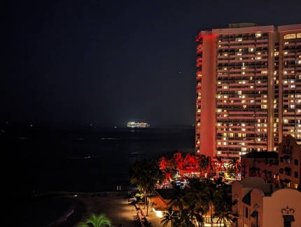 |
Cruise Ship
Position: 21°16.61’N, -157°49.67’W
A cruise ship arriving into Honolulu just past 6am.
|
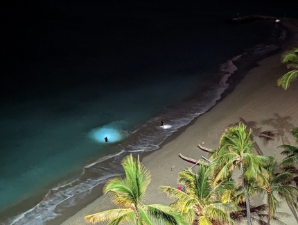 |
Treasure Hunters
Position: 21°16.60’N, -157°49.67’W
Treasure hunters working the beach before dawn looking for lost valuables.
|
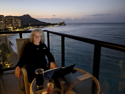 |
The Offic
Position: 21°16.60’N, -157°49.66’W
Getting some work done on the balcony of our hotel room, with Diamond Head visible beyond.
|
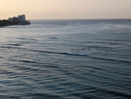 |
Surfers
Position: 21°16.60’N, -157°49.67’W
Early-morning surfers in the waters off Waikiki Beach.
|
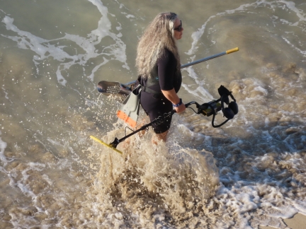 |
Metal Detectorist
Position: 21°16.61’N, -157°49.66’W
A metal detectorist heading home after searching the beach for lost valuables in the early morning before the crowds arrive.
|
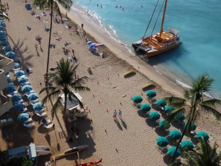 |
Cruise Boat
Position: 21°16.61’N, -157°49.66’W
One of several day cruise boats moored at Waikiki Beach. The boats run right up onto the beach for passengers to embark and disembark. They have permanently-installed anchors up the beach.
|
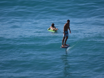 |
Foiling Surfboard
Position: 21°16.61’N, -157°49.66’W
A powered foiling surfboard.
|
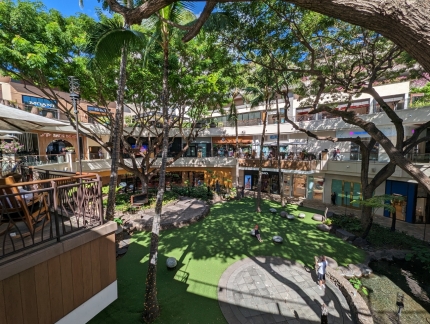 |
International Market Place
Position: 21°16.72’N, -157°49.58’W
The last time we were in Hawaii, in 2013, the International Market Place was still in its original form consisting of dozens of small stalls selling jewelery, clothing, and souvenirs. Later that year, the market was closed for a complete renovation and replaced with a three-story complex including restaurants and high-end stores.
|
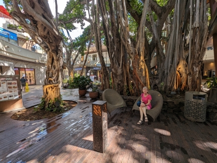 |
Banyan Tree
Position: 21°16.66’N, -157°49.62’W
The huge banyan tree is the only thing preserved from the original Honolulu International Market Place.
|
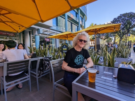 |
Aloha Beer
Position: 21°16.83’N, -157°49.81’W
Enjoying a pint on the terrace at the Aloha Beer brewpub in Honolulu.
|
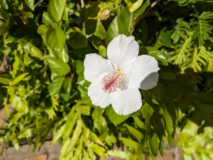 |
Hibiscus
Position: 21°16.62’N, -157°49.74’W
A lovely hibiscus growing on the well-tended and tranquil grounds of the Royal Hawaiian Resort.
|
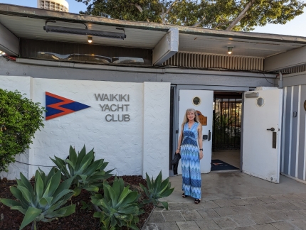 |
Waikiki Yacht Club
Position: 21°17.31’N, -157°50.52’W
High on our list of things to do in Honolulu was to stop in at the Waikiki Yacht Club, where we lived for several months in 2012-2013 on Dirona prior to setting off on our trip around the world.
|
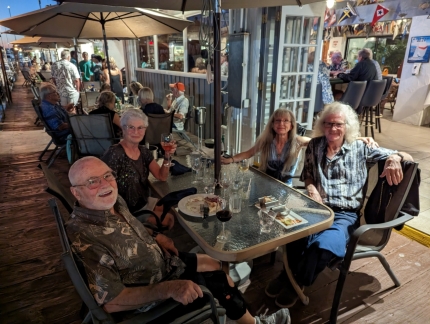 |
Don and Sharry
Position: 21°17.29’N, -157°50.49’W
A great evening at the Waikiki Yacht Club with Don and Sharry Stabbert of MV Starr. Prior to starting our trip around the world, Don and Sharry met with us to hear about our planned route and made suggestions on destinations. Their advice improved our trip greatly, and we really enjoyed our several-month stay at the Waikiki Yacht Club that they arranged. We’ve crossed paths with them many times since, most notably in Sweden during the Cruising Club of America Stockholm Archipelago Cruise. The Stabberts now live in Honolulu and it was wonderful to get together and catch up.
|
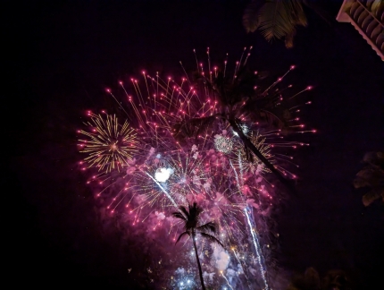 |
Fireworks
Position: 21°16.90’N, -157°50.29’W
Our walking route back to our hotel from the Waikiki Yacht Club took us past a great viewing point for the weekly Friday night fireworks. The show was spectacular.
|
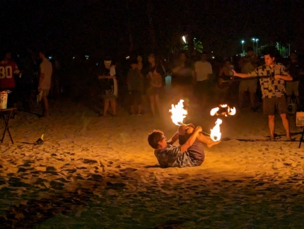 |
Fire Dancer
Position: 21°16.88’N, -157°50.23’W
A fire dancer on Waikiki Beach.
|
 |
Beer
Position: 21°16.67’N, -157°49.61’W
We got a giggle out of this Beer shirt on display at the Honolulu International Market Place.
|
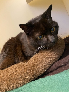 |
Spitfire
Position: 47°36.28’N, -122°7.96’W
Spitfire looking very interested in something at Wagly Pet Campus in Bellevue, his home-away-from-home while we are traveling.
|
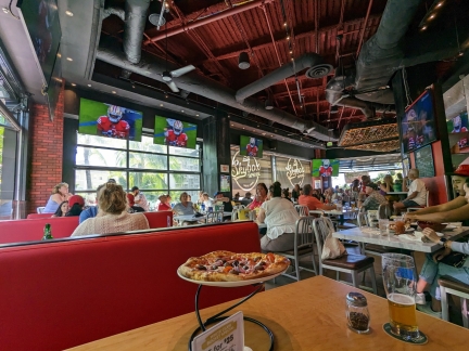 |
Skybox Taproom
Position: 21°16.55’N, -157°49.57’W
A delicious pizza lunch at Skybox Taproom in the Honolulu International Market Place while watching the Seattle Seahawks take on San Francicso 49ers in an NFC wildcard game. Sadly, we lost 23-41, ending our season. But just reaching the playoffs was impressive in what was a rebuilding year after longtime quarterback Russell Wilson was traded to Denver.
|
 |
StripSteak
Position: 21°16.69’N, -157°49.60’W
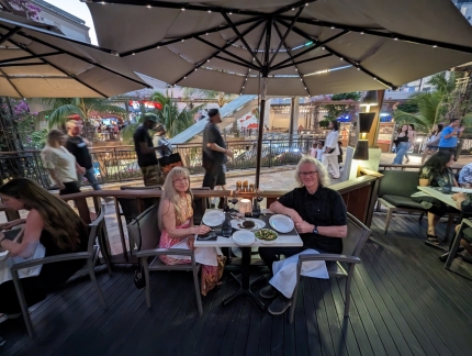
An excellent dinner on the terrace at StripSteak in the renovated Honolulu International Market Place.
|
 |
Surfers
Position: 21°16.61’N, -157°49.66’W
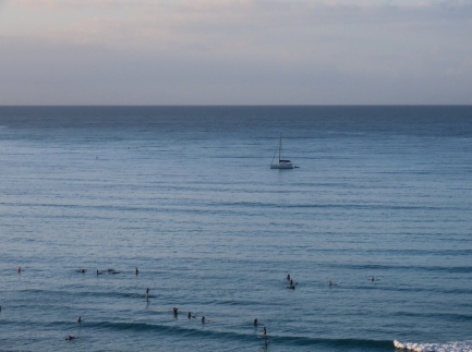
Early morning surfers, and an overnighting catamaran, off Waikiki Beach.
|
 |
Breakfast
Position: 21°16.61’N, -157°49.66’W
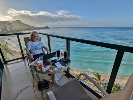
Enjoying breakfast on the lanai of our room at the Outrigger Waikiki Beach Resort, with Diamond Head visible in the background.
|
 |
Starr
Position: 21°16.61’N, -157°49.66’W
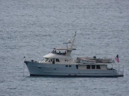
Don and Sharry Stabbert’s 77ft (23 m) Northern Marine Starr anchored for the afternoon off Waikiki Beach.
|
 |
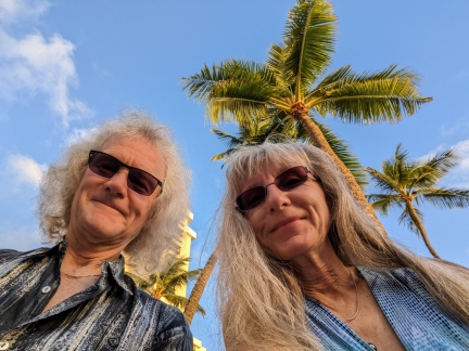
Sunset Drinks
Position: 21°16.65’N, -157°49.92’W
Another item high on our list of things to do in Honolulu was to have sunset drinks at the Halekulani resort, a tradition for at least three generations of Hamiltons.
|
 |
Halekulani
Position: 21°16.64’N, -157°49.92’W
It’s been a nearly a decade to the day since our last Halekulani visit, and we’re having a fabulous evening.
|
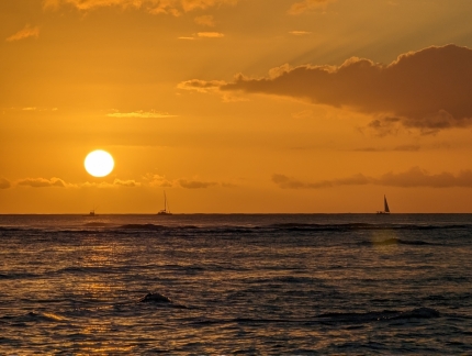 |
Sunset
Position: 21°16.64’N, -157°49.92’W
A spectacular sunset during our evening at the Halekulani resort in Waikiki.
|
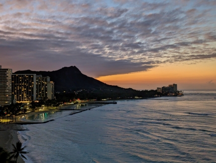 |
Dawn
Position: 21°16.60’N, -157°49.66’W
A final dawn view to Diamond Head from our Waikiki hotel room before we depart for Seattle later this morning.
|
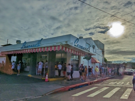 |
Leonard’s
Position: 21°17.09’N, -157°48.81’W
A long queue at Leonard’s Bakery, operating since 1952, as we head to the airport. Their incredibly popular specialty is malasadas, a delicious Portuguese fried donut that has become an island icon. We call them “sinkers” because we would load up on them before heading out to snorkel at Hanauma Bay, where we would run risk of sinking due to the all the donuts we ate. We absolutely love those donuts, but that line length exceeds our desire.
|
 |
Ke’ehi Boat Harbor
Position: 21°18.41’N, -157°54.75’W
Pleasure craft at anchor and on the docks at Ke’ehi Boat Harbor, viewed shortly after our plane took off from Honolulu.
|
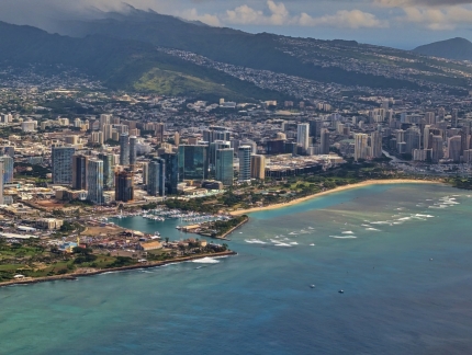 |
Kewalo Basin
Position: 21°17.35’N, -157°53.47’W
Kewalo Basin, left, with Ala Wai Harbor barely visible at far right. Ala Wai Harbor is home to the Waikiki Yacht Club, where we lived for several months aboard Dirona in 2012-2013 (click image for a larger view).
|
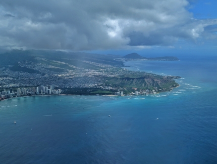 |
Oahu
Position: 21°16.45’N, -157°53.05’W
The southwest coast of Oahu, with Waikiki Beach at left and the volcanic craters of Diamond Head at lower right and Hanauma Bay at upper right.
|
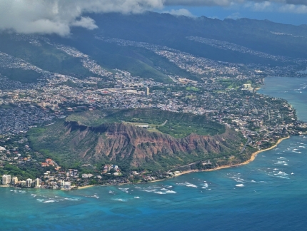 |
Diamond Head
Position: 21°16.45’N, -157°53.05’W
View into the inside of Diamond Head. The crater was home to the first military reservation in Hawaii, Fort Ruger, established in 1906. Over the years, seven tunnels were constructed through the sides of the mountain to reach the interior. Today most military activity has ceased at Diamond Head, except for a National Guard emergency operations center and a Hawaii State Civil Defense Headquarters.
|
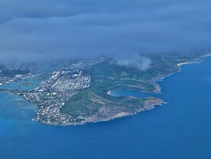 |
Hanauma Bay
Position: 21°11.83’N, -157°46.89’W
The Hanauma Bay Nature Preserve at right is one of the best snorkeling destination on Oahu, and is very popular.
|
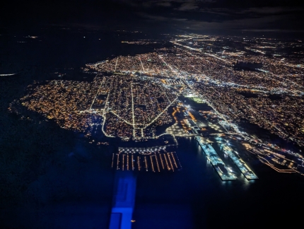 |
Elliott Bay Marina
Position: 47°35.37’N, -122°27.31’W
View to Elliott Bay Marina, bottom center, and across Magnolia towards Ballard at top as our flight from Honolulu arrives into the Seattle area.
|
 |
Click the travel log icon on the left to see these locations on a map. And a map of our most recent log entries always is available at mvdirona.com/maps. |

If your comment doesn't show up right away, send us email and we'll dredge it out of the spam filter.