Naval Base San Diego is the second largest surface ship base of the United States Navy and the main home port of the Pacific Fleet of over 50 ships. On a recent trip to the city, James got some great views to the naval base, San Diego Bay and the city skyline as his plane circled in for a landing. The early-morning flight also yielded striking dawn views over Mt. Rainier and the Columbia River.
Below are highlights from September 20th, 2022. Click any image for a larger view, or click the position to view the location on a map. And a map with our most recent log entries always is available at mvdirona.com/maps.
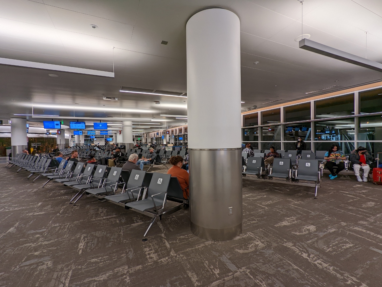 |
SeaTac
Position: 47°26.87’N, -122°18.14’W
Not many people are in the SeaTac waiting area at 04:55am. James was there for a 6:00am flight to San Diego.
|
 |
Port of Seattle
Position: 47°31.80’N, -122°18.55’W
View over the Port of Seattle, center, and Elliott Bay at right, as James’ flight to San Diego takes off.
|
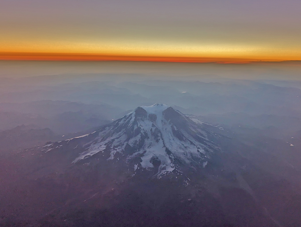 |
Mt. Rainier
Position: 47°26.63’N, -122°9.71’W
Mt. Rainier at dawn from the air.
|
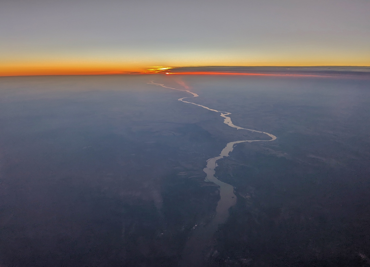 |
Columbia River
Position: 45°47.56’N, -121°43.36’W
The Columbia River winding away from an orange dawn sky.
|
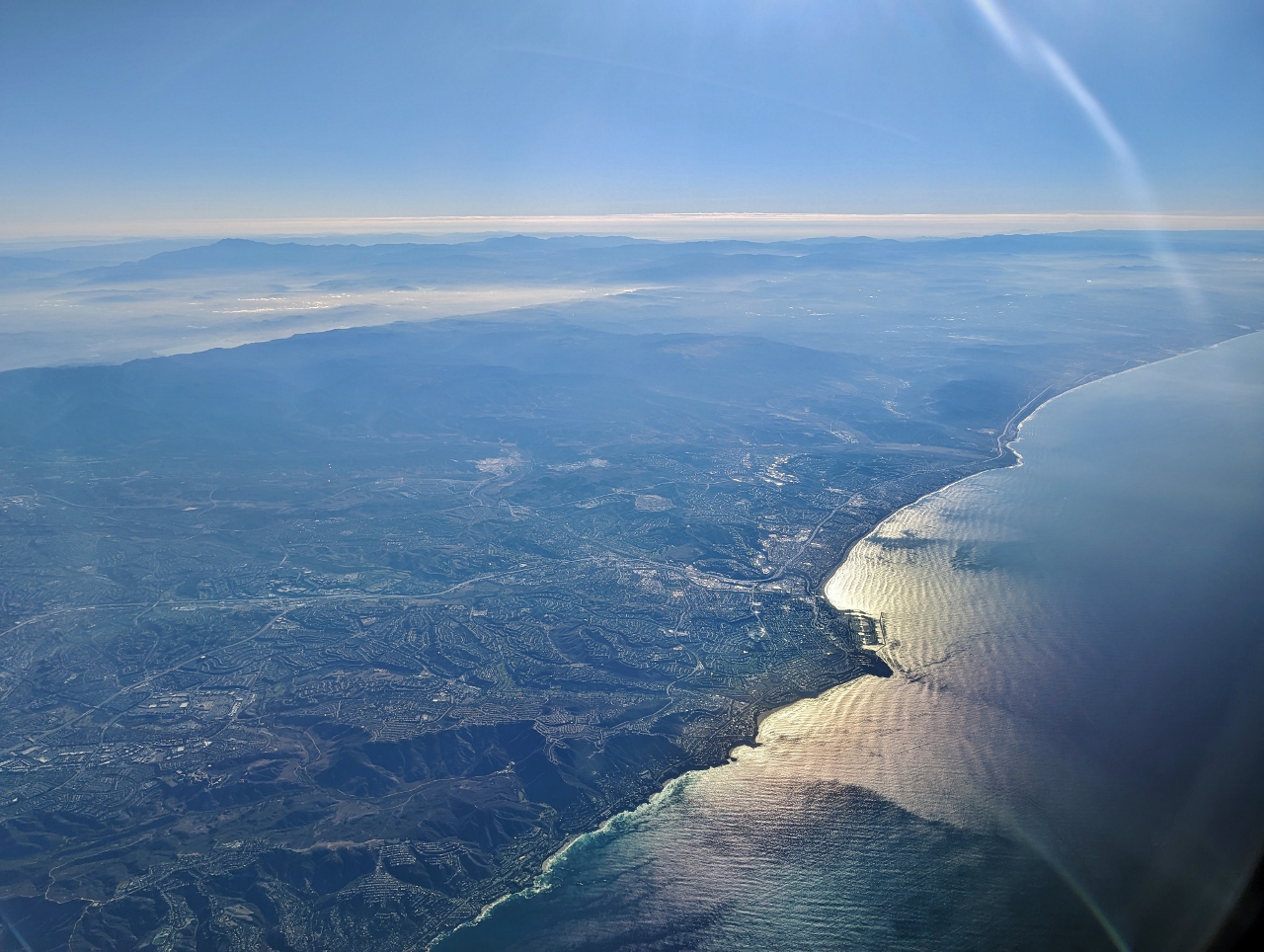 |
Point Castillo
Position: 34°23.45’N, -119°42.48’W
Looking south along the California coast to Point Castillo.
|
 |
Miramar
Position: 32°53.30’N, -117°10.61’W
Marine Corps Air Station Miramar, the former location of the United States Navy Fighter Weapons School (NFWS) whose TOPGUN training program was depicted in the movie of the same name. NFWS moved just outside Reno in 1996—we passed closed to it on our road trip across the US.
|
 |
San Diego Bay
Position: 32°42.28’N, -116°57.79’W
San Diego Bay, with the graceful Coronado Bridge at right. Directly left of the bridge is Naval Base San Diego.
|
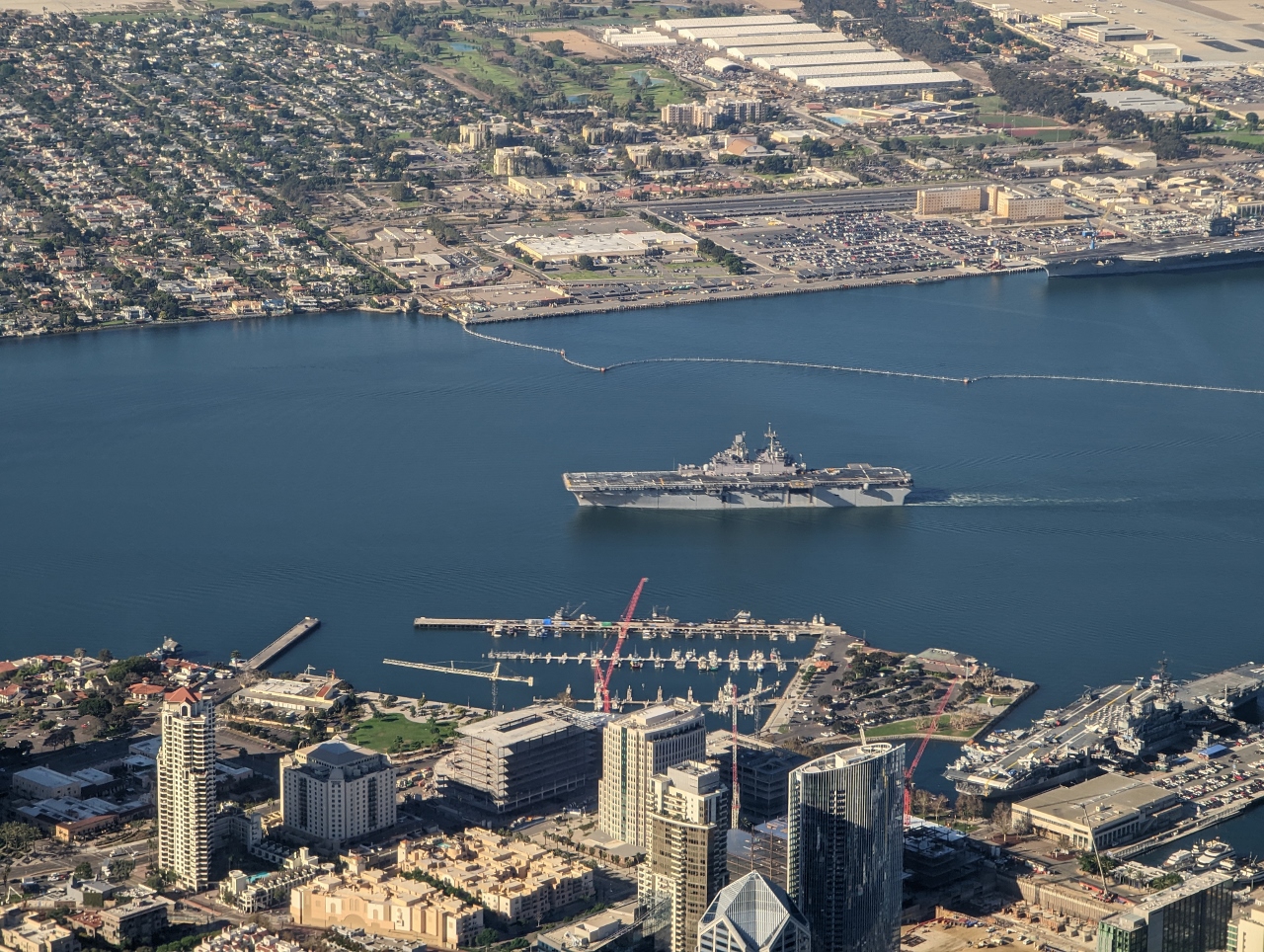 |
USS Makin Island
Position: 32°43.13’N, -117°9.41’W
The USS Makin Island, an 843-ft (257 m) amphibious assault ship, underway off Tuna Park in San Diego Bay for Naval Base San Diego.
|
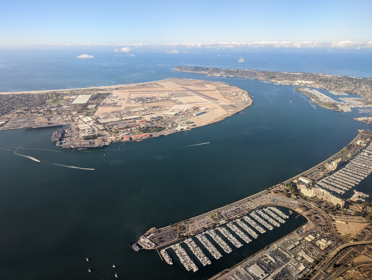 |
Harbor Island
Position: 32°43.94’N, -117°10.49’W
Two huge marinas in Harbor Island at the north end of San Diego Bay near the San Diego airport.
|
|
|
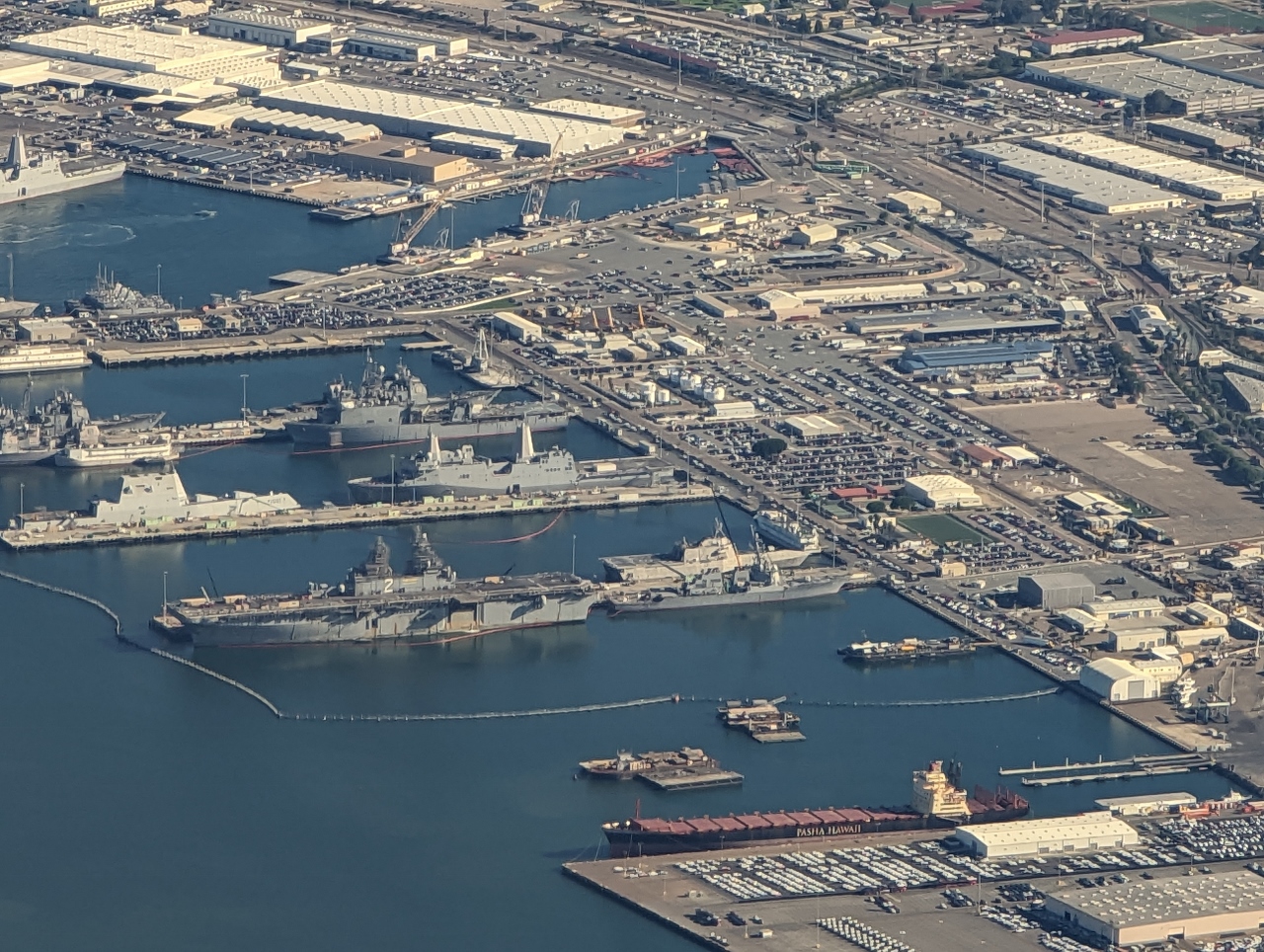
Position: 32°38.97’N, -117°7.16’W
Looking north across Naval Base San Diego as James’ flight descends towards the airport.
|
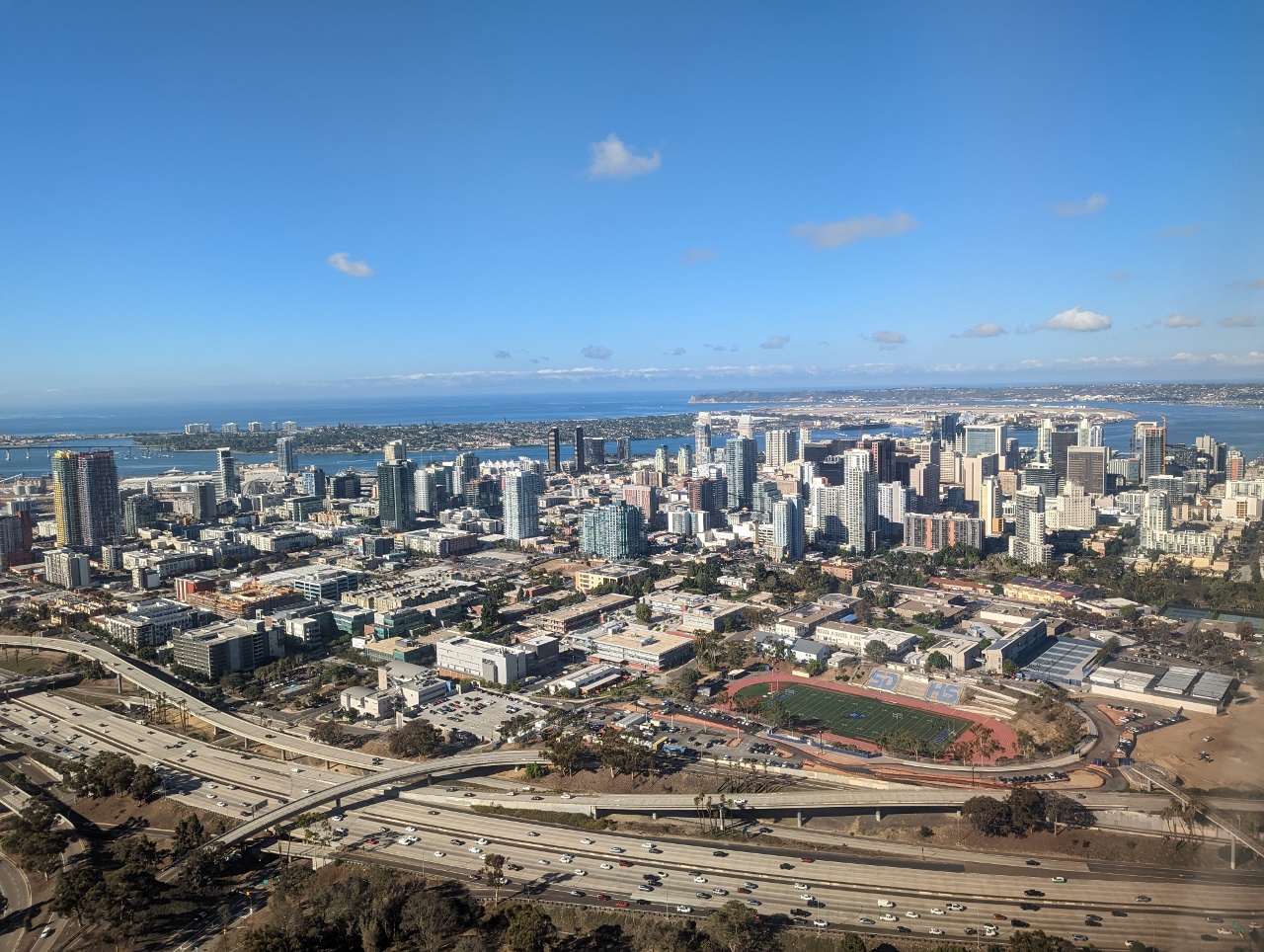 |
San Diego
Position: 32°42.55’N, -117°5.32’W
The San Diego skyline, with San Diego Bay beyond.
|
 |
Click the travel log icon on the left to see these locations on a map. And a map of our most recent log entries always is available at mvdirona.com/maps. |
If your comment doesn't show up right away, send us email and we'll dredge it out of the spam filter.