The Pilatus-Bahn, just outside Lucerne, is the world’s steepest cogwheel railway at 48% maximum and 35% average incline. The line opened in 1889 and ascends 5,279 ft (1,609 m) from Alpnachstad to the summit of Mount Pilatus in only 2.86 miles (4.6 km). Depending on snow conditions, the train generally operates from May to October. But year-round access to the summit is possible through a series of cableways from the other side of the mountain. The round-trip, connecting to Lucerne via train and bus, is known as the “Silver Round Trip”. The “Golden Round Trip” adds a ride across Lake Lucerne to connect with the Pilatus-Bahn.
Conventional cogwheel railways have set of teeth mounted vertically on an extra rail (rack) that a cog wheel underneath the train meshes with. Particularly steep railways, such as the 8.3% incline of the West Coast Wilderness Railway we took in Tasmania, use two sets of teeth and cog wheels to always have the train gear engaged in the rack. But even this dual-rack system has a limit of 25%, insufficient for the 48% grade at Mount Pilatus. The Piluatus-Bahn designers instead used a system where the gear teeth are cut into the sides of the rack and mesh with two horizontal wheels underneath the train, allowing for a gradient of up to 50%. This also solved another concern that the area’s high crosswinds would push the train off the track.
From Zurich, we took a one-hour train ride to Lucerne and embarked on the “Silver Round Trip” via train to Alpnachstad to connect with the Pilatus-Bahn. We really enjoyed the ride to the top on the historic train, but weren’t so lucky with the weather. The summit was in thick clouds much of the time we were there, but did clear briefly a few times for some wonderful views. And we loved seeing the amazingly nimble alpine ibex clinging to what appeared to be impossibly steep slopes.
On the cableway descent, we stopped off at Fraekmuntegg and had an exciting time riding the Fraekigaudi Rodelbahn, the longest summer toboggan run in the country at 4,429 ft (1,350 m) long. A panoramic gondola ride brought us to Kriens, and we took a bus back to Lucerne to complete the round trip. We capped of another big day in Switzerland with an excellent meal along the River Reusse and an evening view to Lucerne’s 13th-century city wall from the balcony of our hotel room.
Below are highlights from June 27th, 2022. Click any image for a larger view, or click the position to view the location on a map. And a map with our most recent log entries always is available at mvdirona.com/maps.
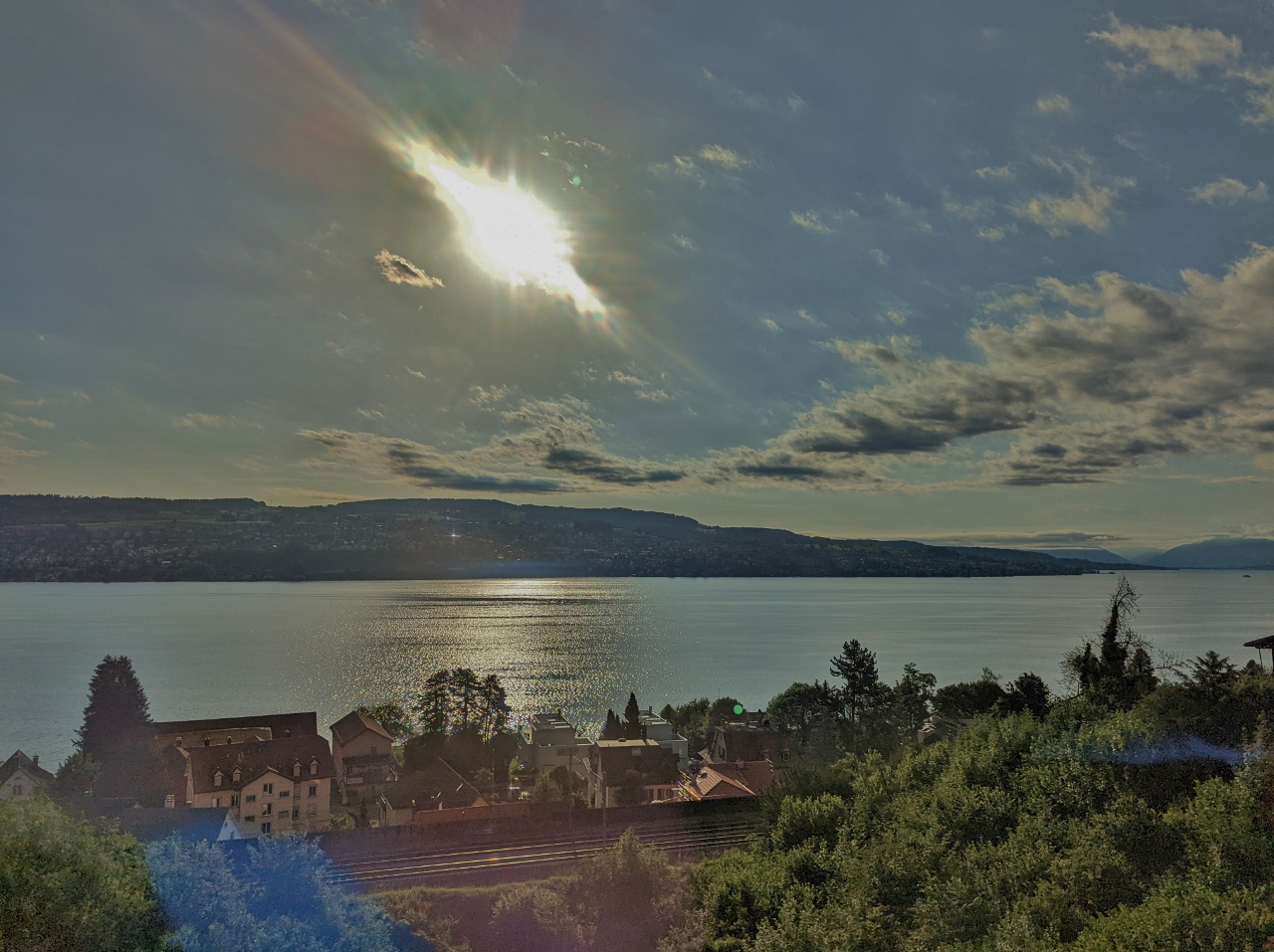 |
Lake Zurich
Position: 47°17.22’N, 8°34.40’E
Looking east across Lake Zurich as we take a train south from Zurich to Lucerne.
|
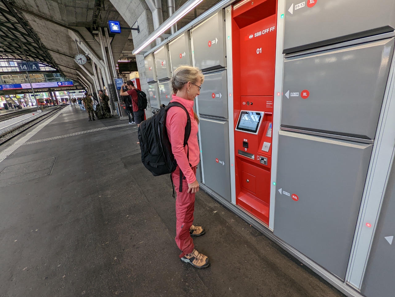 |
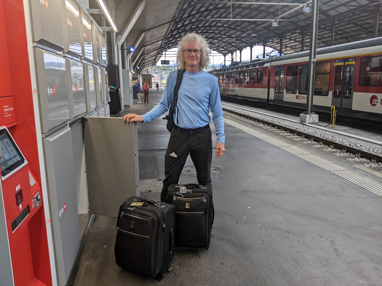
Luggage Locker
Position: 47°2.96’N, 8°18.65’E
Checking our bags into the automated locker system at the Lucerne train station. We’ll leave our luggage here while we make a day trip to Mount Pilatus, a twenty-minute train ride away. The lockers are reasonably large, but ensuring we can fit our luggage inside is another reason we wanted to have carry-on bags only for this trip to Switzerland.
|
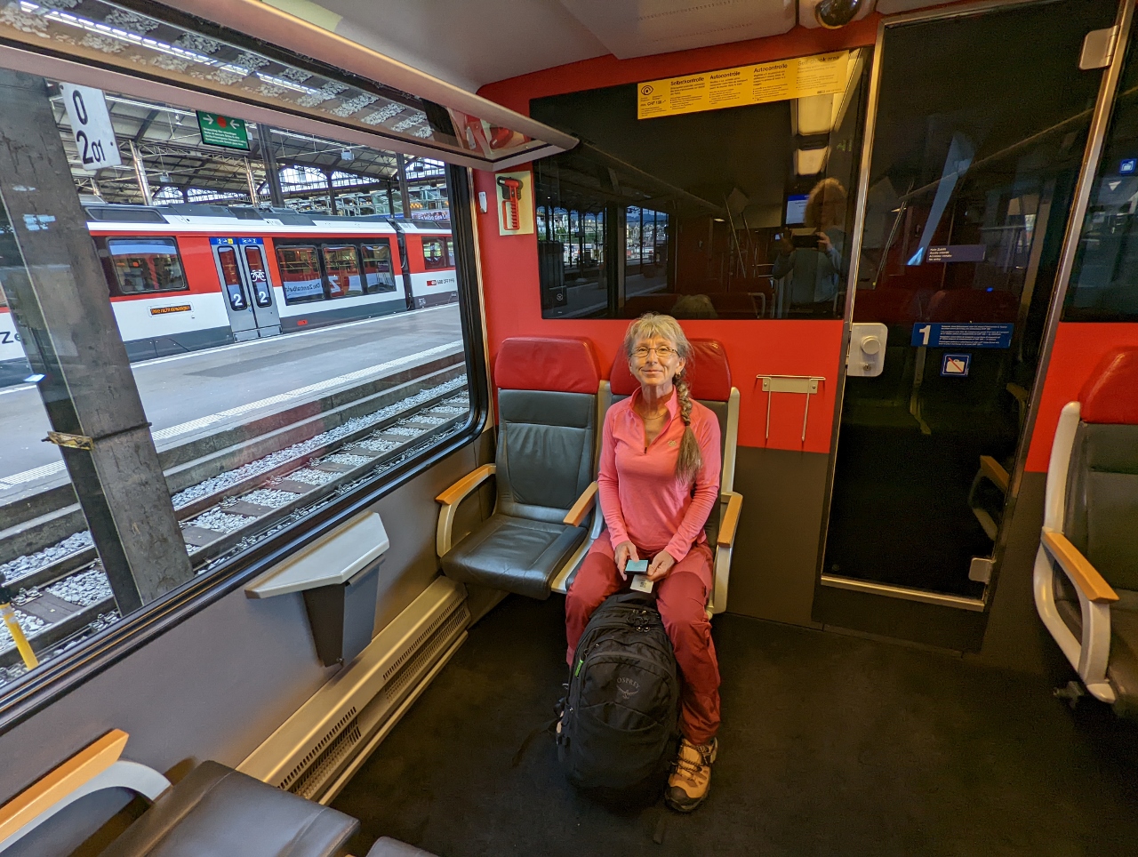 |
On Board
Position: 47°2.97’N, 8°18.65’E
On board the train from Lucerne to Alpnachstad, at the base of Mount Pilatus.
|
|
|
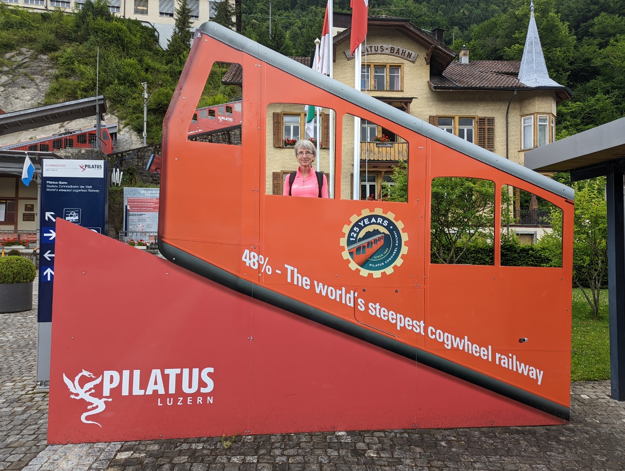
Pilatus-Bhan
Position: 46°57.33’N, 8°16.66’E
At Alpnachstad to take the cogwheel railway (bahn means railway in German) up to Mount Pilatus. The Pilatus-Bahn is the world’s steepest cogwheel railway at 48% maximum and 35% average incline.
|
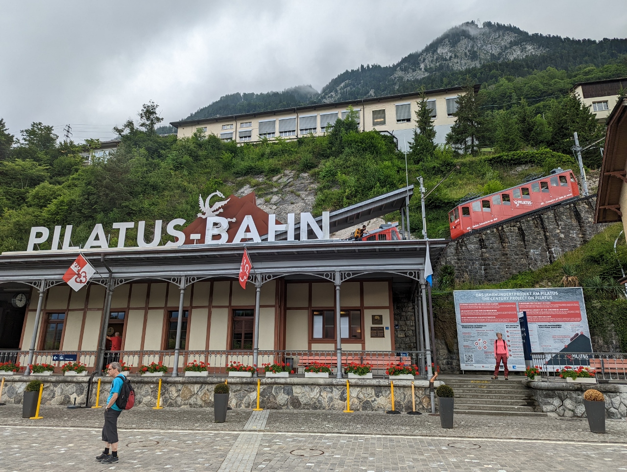 |
Station
Position: 46°57.33’N, 8°16.65’E
The Pilatus-Bahn station with a display car on the tracks at upper right showing the steepness of the route. The line opened in 1889 under steam power and was electrified in 1937. Depending on snow conditions, the train generally operates from May to October.
|
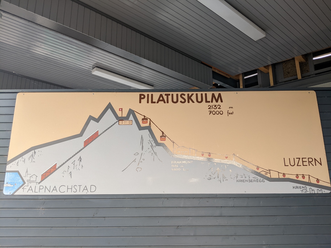 |
Pilatuskulm
Position: 46°57.32’N, 8°16.64’E
Map showing Mount Pilatus travel routes from Lucerne (kulm is German for mountain). We took the train from Lucerne to Alpnachstad, at lower left, to take the cogwheel railway to the top. We’ll descend via aerial cableway to Kriens, at lower right, and then take a bus back to Lucerne. This is known as the “Silver Round Trip“. The “Golden Round Trip” replaces the train from Lucerne with a ride across Lake Lucerne, seen at extreme lower left.
|
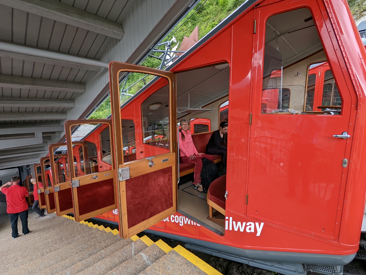 |
First Train
Position: 46°57.34’N, 8°16.64’E
At the front of the train for the first trip of the day from Alpnachstad to Mount Pilatus.
|
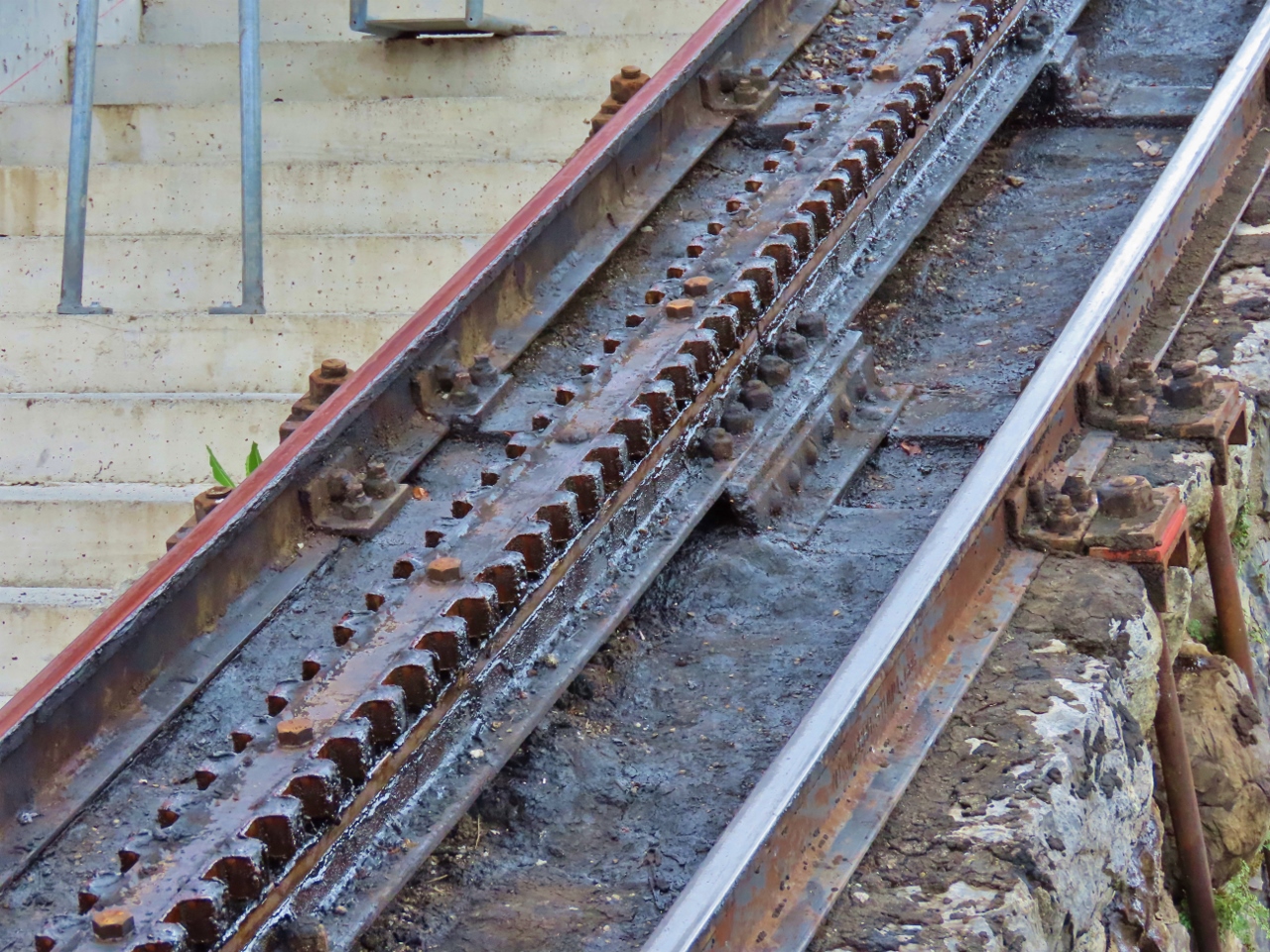 |
Double Cogs
Position: 46°57.32’N, 8°16.63’E
Conventional cogwheel railways have set of teeth mounted vertically on an extra rail (rack) that a cog wheel underneath the train meshes with. Particularly steep railways, such as the 8.3% incline of the West Coast Wilderness Railway we took in Tasmania, use two sets of teeth and cog wheels to always have the train gear engaged in the rack. But even this dual-rack system has a limit of 25%, insufficient for the 48% grade at Mount Pilatus.
The Piluatus-Bahn designers instead used a system where the gear teeth are cut into the sides of the rack and mesh with two horizontal wheels underneath the train, allowing for a gradient of up to 50%. This also solved another concern that the area’s high crosswinds would push the train off the track. |
 |
1,700 Volts
Position: 46°57.33’N, 8°16.63’E
The voltage reading 1,700 as we ascend in one of the original 1937 electric carriages.
|
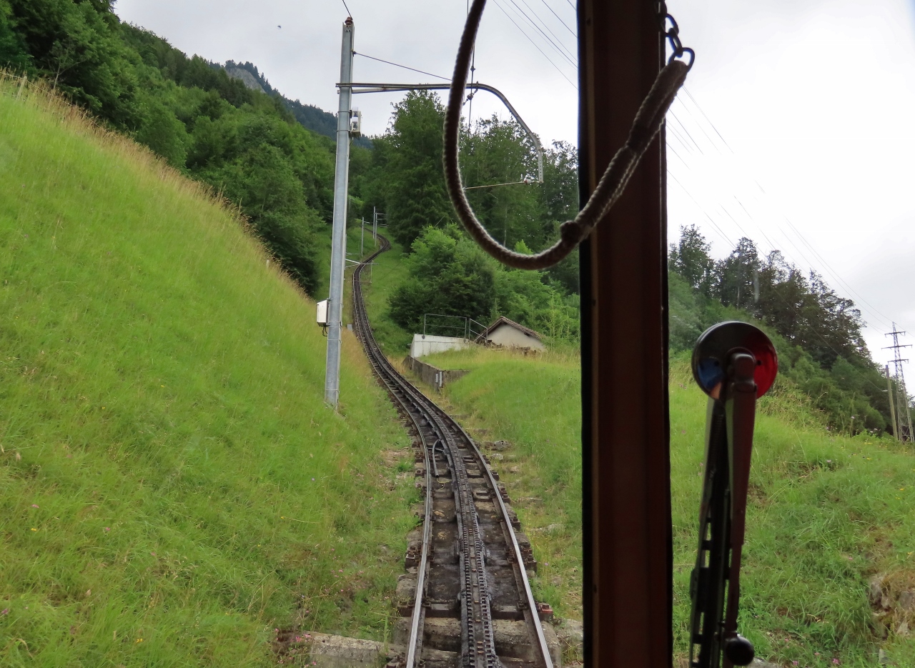 |
Ascending
Position: 46°57.40’N, 8°16.65’E
The double-racked track winding steeply ahead as we ascend on the Pilatus-Bahn.
|
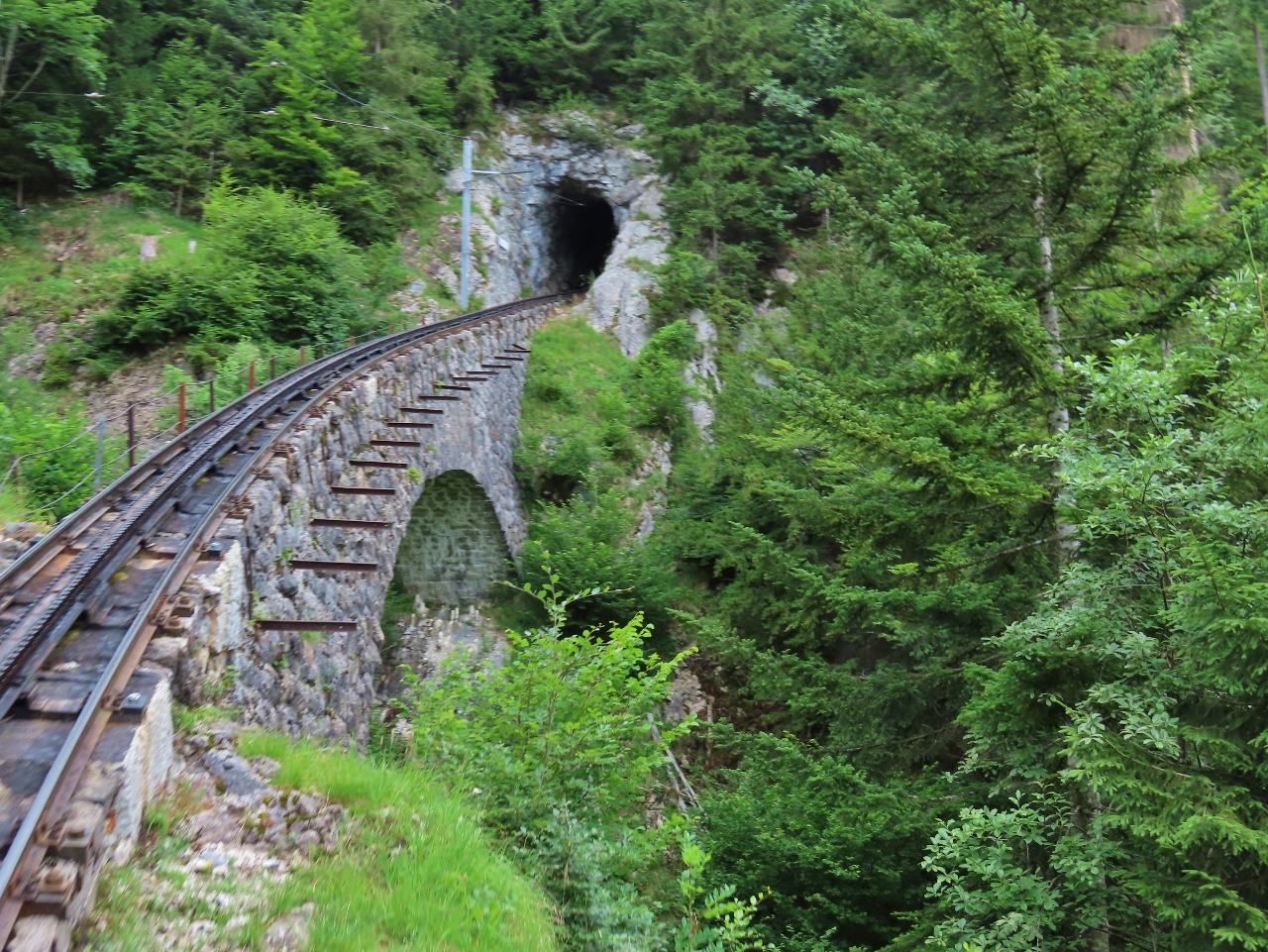 |
Wolfort Bridge
Position: 46°57.80’N, 8°16.63’E
The Pilatus-Bahn designers faced many challenges besides the steepness of the route. The Wolfort Bridge is a stone bridge with a single span of 75 ft (23m) across the Wolfert Ravine. The bridge slants steeply upwards and curves into a 144-ft (44m) tunnel.
|
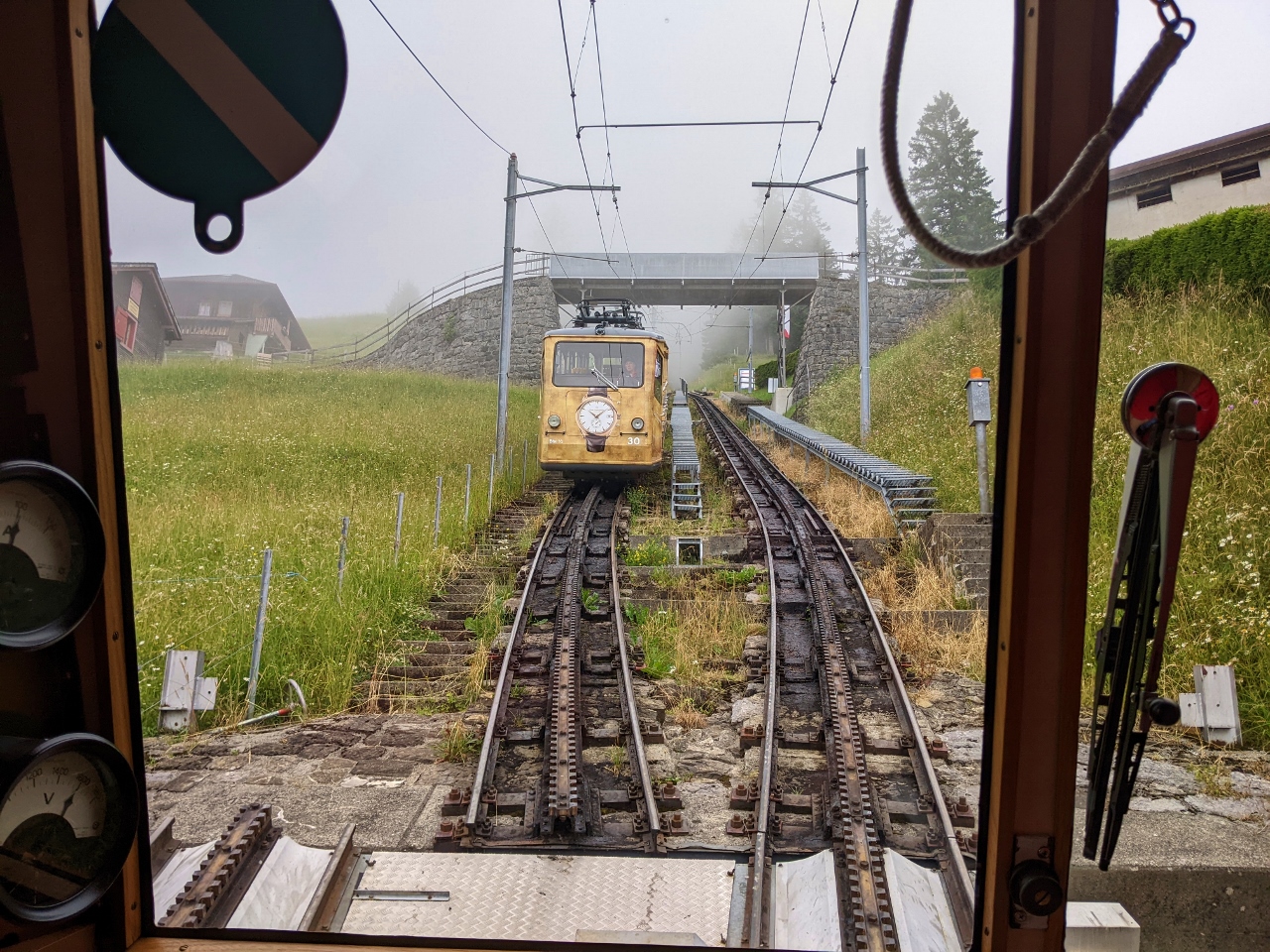 |
Sliding Switch
Position: 46°58.22’N, 8°16.31’E
A major downside of the horizontal cog system is that a standard railway switch cannot be used. The Pilatus-Bahn instead uses a custom sliding switch.
|
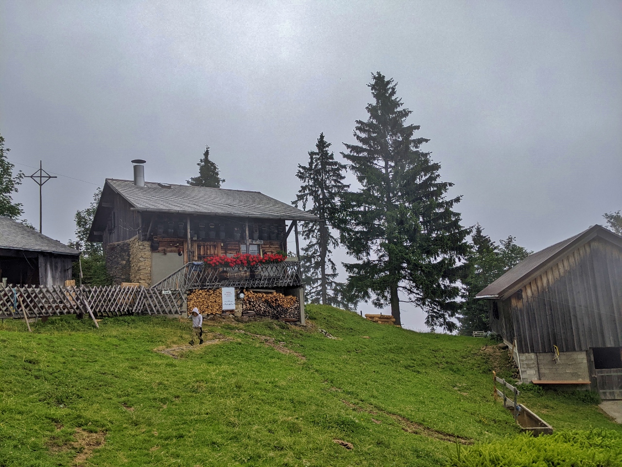 |
Aemsigen Station
Position: 46°58.22’N, 8°16.31’E
One of several mountain houses at Aemsigan Station along the Pilatus-Bahn.
|
 |
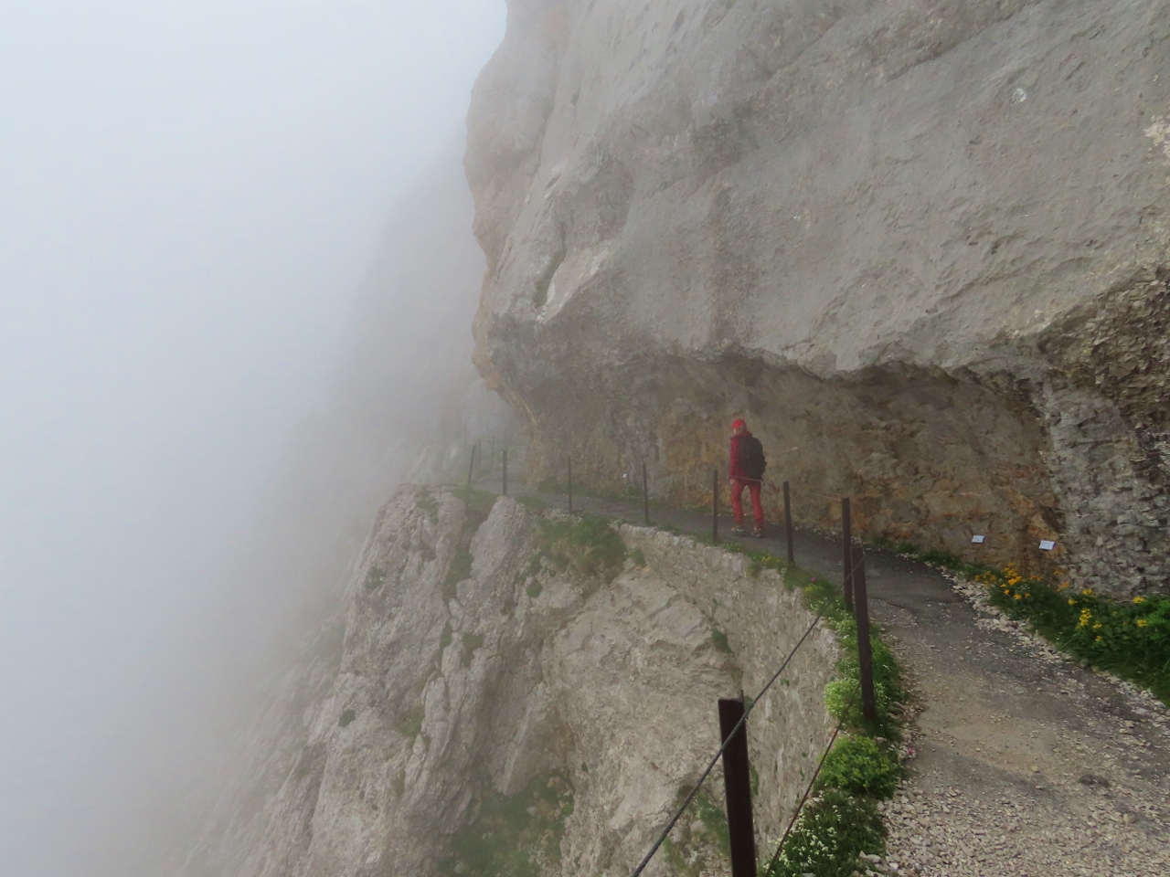
Eselwand Precipice
Position: 46°58.57’N, 8°15.58’E
Fog and light rain as we approach one of the four tunnels on the Eselwand Precipice along a ledge blasted out from the hillside. To drill holes and place the blasting charges, workers stood on planks hung on ropes over the edge of the precipice.
|
 |
7000 ft
Position: 46°58.77’N, 8°15.26’E
At the summit of Mount Pilatus, 7,000 ft (2,132 m) above sea level. The logo of the mountain, a red dragon, derives from the dragon legends that have long been associated with the mountain. In the Middle Ages, people believed healing dragons lived in caverns inside the mountain.
|
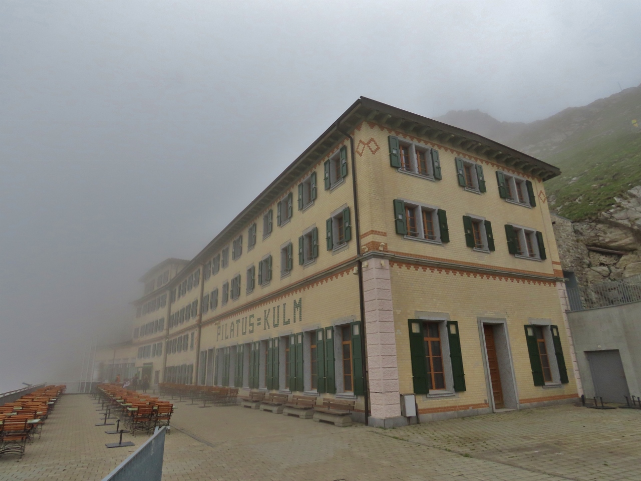 |
Hotel Pilatus Kulm
Position: 46°58.77’N, 8°15.26’E
The historic Hotel Pilatus Kulm has been accepting visitors since 1890. Each room has a spectacular view of the Swiss Alps, but not right now. The fog is so thick this morning that we can barely see the far end of the building. We had a great time riding the railway, so even if the fog doesn’t clear, we’ll be happy.
|
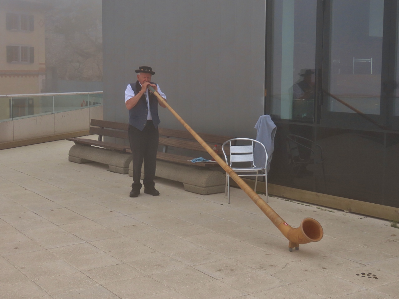 |
Alpenhorn
Position: 46°58.77’N, 8°15.26’E
A man playing a traditional Swiss alpenhorn atop Mount Pilatus.
|
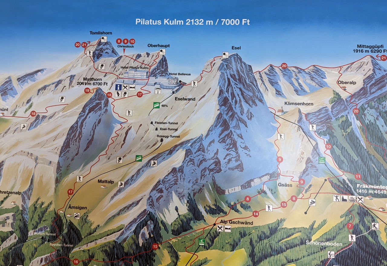 |
Trails
Position: 46°58.75’N, 8°15.34’E
Map at the summit of Mount Pilatus showing the many hiking trails in the area, with the railway shown at left using green icons. The hike from the cogwheel railway station at Alpnachstad to Mount Pilatus (labeled 17) is 5 miles (8km) and takes about 3.5 hours with an altitude gain of 5,300 ft (1,615m). We plan to make some of the shorter hikes to the three viewpoints at upper left: Tomlishorn, Oberhaupt and Esel. (Click image for a larger view.)
|
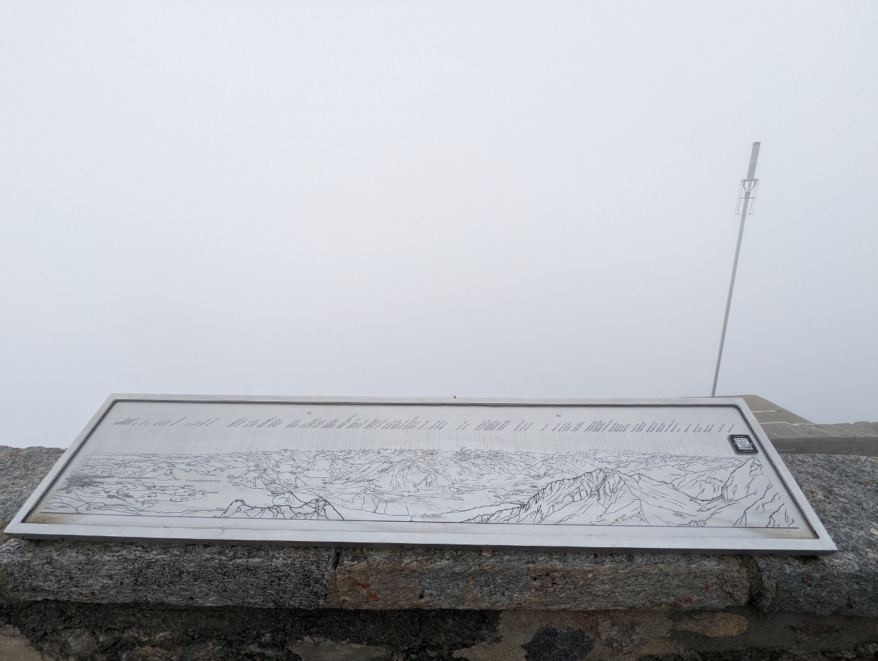 |
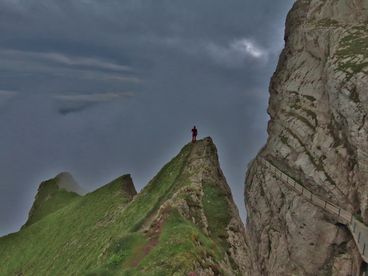
Esel
Position: 46°58.75’N, 8°15.37’E
A map atop the hill Esel showing what we could see if the fog cleared.
|
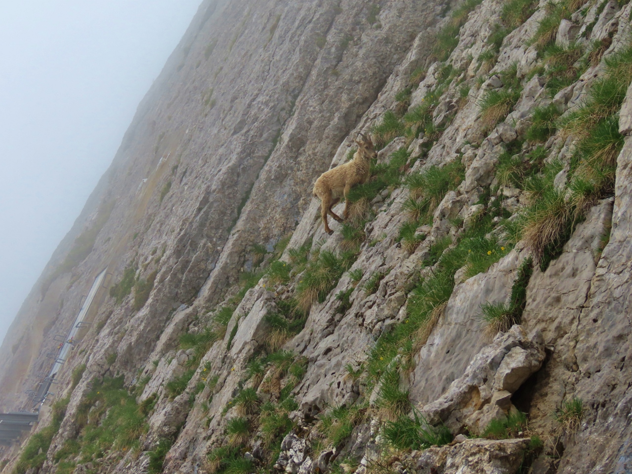 |
Alpine Ibex
Position: 46°58.75’N, 8°15.17’E
An alpine ibex clinging to what appears to be an impossibly steep slope. The Alpine ibex were nearly extinct by the 19th century, with fewer than 100 animals left. All herds today were reintroduced from the stock in Gran Paradiso National Park, created to protect the species from poachers.
|
 |
Tomlishorn Trail
Position: 46°58.66’N, 8°15.05’E
We enjoyed the cliffside trail to Tomlishorn peak. But alas, the view in the thick fog was the same as at Esel.
|
 |
Locking Horns
Position: 46°58.55’N, 8°14.86’E
Two young male ibex locking horns below Tomlishorn peak trail.
|
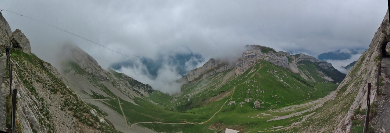 |
Clouds Lifted
Position: 46°58.64’N, 8°15.03’E
As we returned from Tomlishorn peak, the clouds suddenly lifted to reveal the valley below.
|
 |
Hanging On
Position: 46°58.65’N, 8°15.03’E
We have no idea how this Alpine ibex is holding on, but the lichen must be really delicious.
|
 |
Pilatus Kulm
Position: 46°58.65’N, 8°15.03’E
The buildings atop Mount Pilatus finally visible when the fog lifted. From left to right is the Hotel Pilatus Kulm, the visitor center, and the circular Hotel Bellevue. The peak Esel that we climbed earlier is at far right.
|
 |
Construction Supplies
Position: 46°58.71’N, 8°15.14’E
Supplies for a construction project at Mount Pilatus being brought across by a temporary cable line.
|
 |
View North
Position: 46°58.82’N, 8°15.16’E
Looking northeast from a pinnacle on the north side of the peak Oberhaupt. Not visible behind the clouds is the aerial cableway that we’ll take down to return to Lucerne.
|
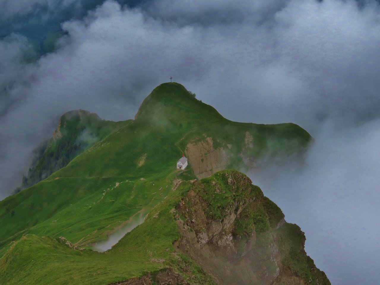 |
Klimsenkapelle
Position: 46°58.77’N, 8°15.18’E
The Klimsenkapelle (Klimsen Chapel) perched below the Oberhaupt peak. The church was inaugurated in 1861 as part of a hotel complex that burned down and was removed in 1967. Since the complex predated the cogwheel railway, early visitors must have arrived on foot or perhaps horseback.
|
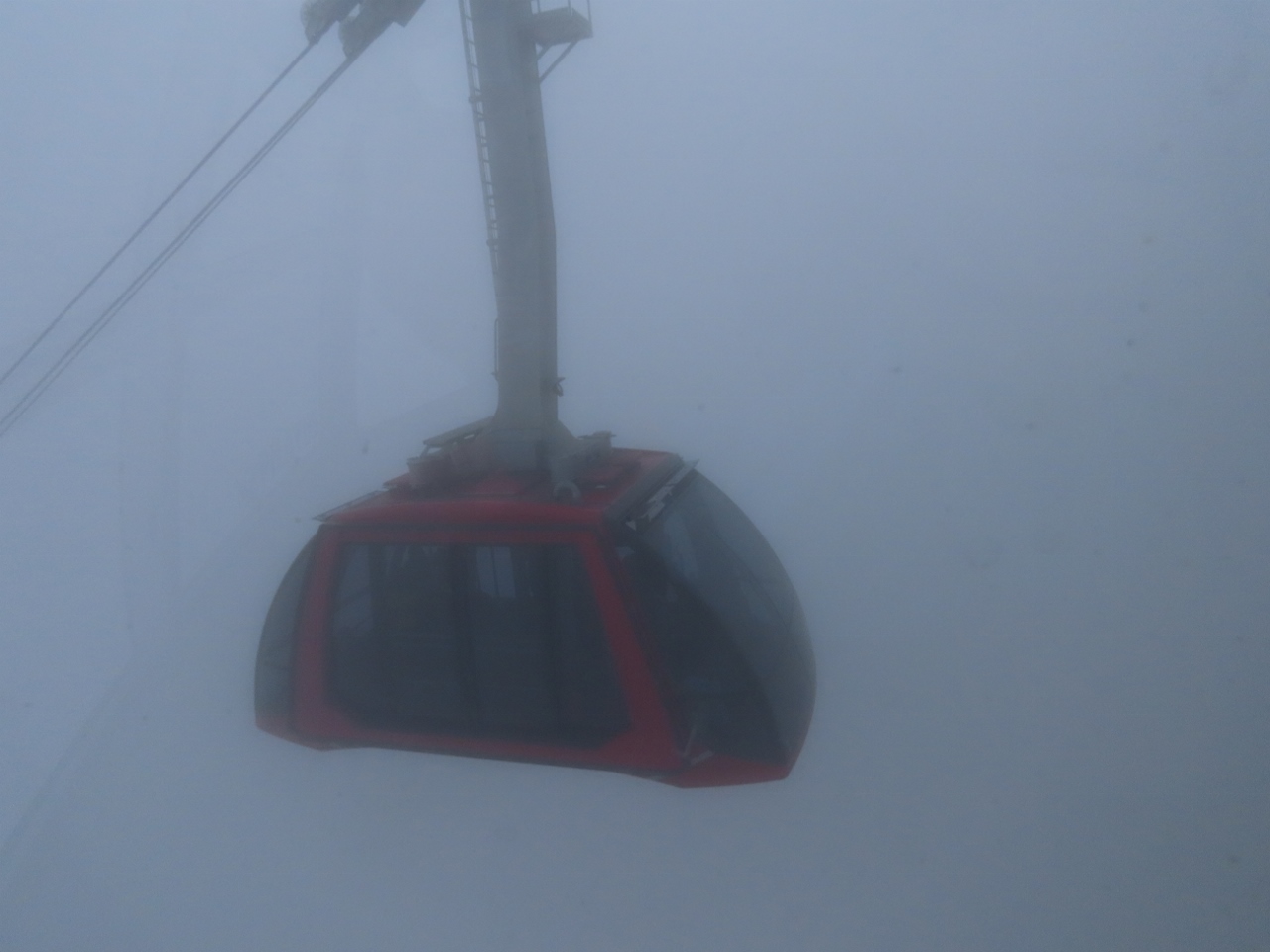 |
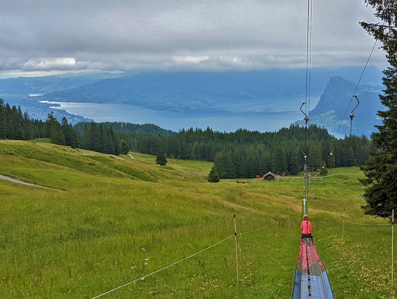
Dragon Ride
Position: 46°58.81’N, 8°15.33’E
Passing another car, just visible in the fog, as we descend on the “Dragon Ride” aerial cableway from Pilatus-Bahn to Frakmuntegg station.
|
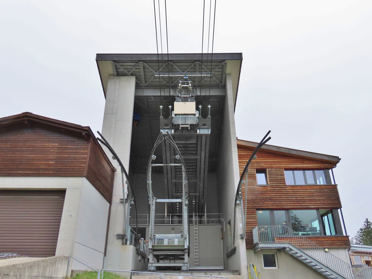 |
Fraekmuntegg Station
Position: 46°59.42’N, 8°15.09’E
Fraekmuntegg Station is midway to Kriens at 4,649 ft (1,416 m) above sea level. The station here supports parallel cableway lines with a central structure that slides left or right to accommodate an arriving car.
|
 |
Fraekmuntegg Adventure Park
Position: 46°59.41’N, 8°15.08’E
Fraekmuntegg, at the bottom of the dragon ride, has a number of outdoor adventure activities, including Seilpark Pilatus, Central Switzerland’s largest suspension rope park and Fraekigaudi Rodelbahn, the longest summer toboggan run in the country at 4,429 ft (1,350 m).
|
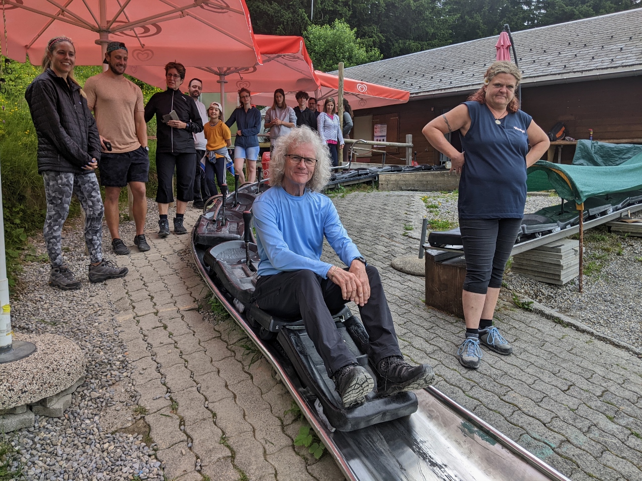 |
Fraekigaudi Rodelbahn
Position: 46°59.30’N, 8°14.93’E
The toboggan run, Fraekigaudi Rodelbahn, looked like fun, so we signed up. Here James is ready for launch.
|
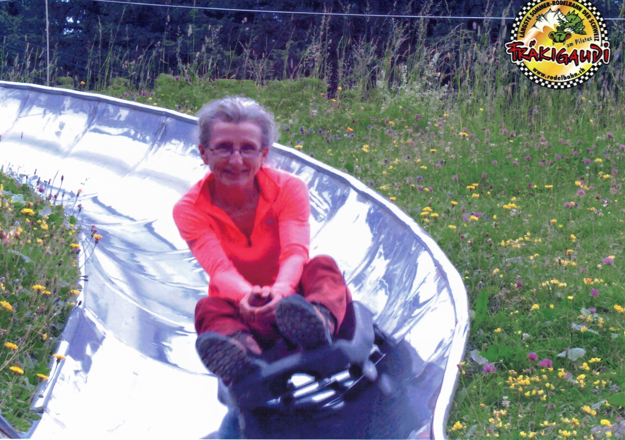 |
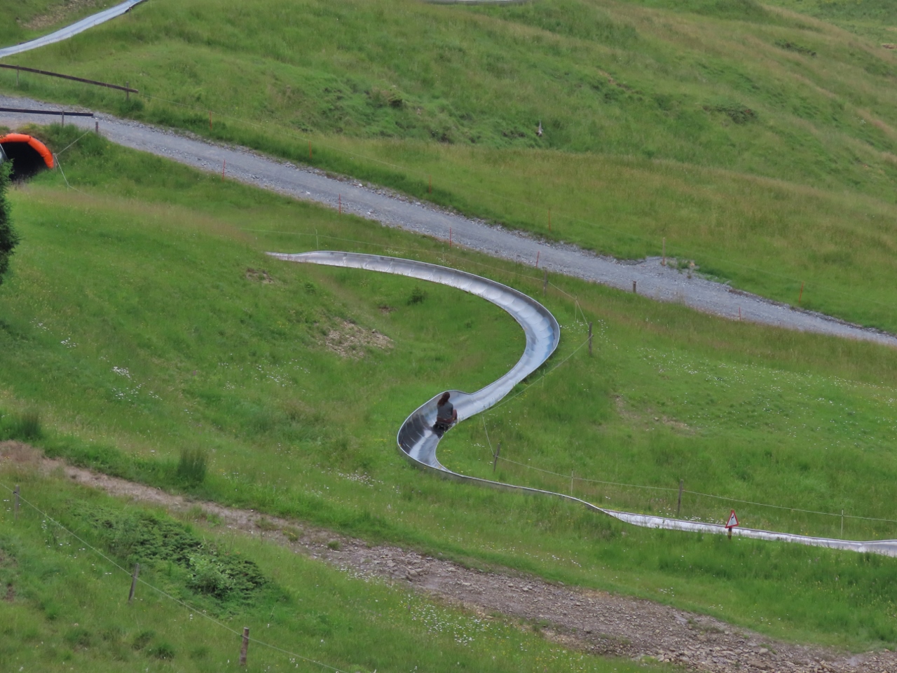
Cornering
Position: 46°59.30’N, 8°14.98’E
Jennifer rounding the first major corner on the Fraekigaudi Rodelbahn at speed. We had a great time.
|
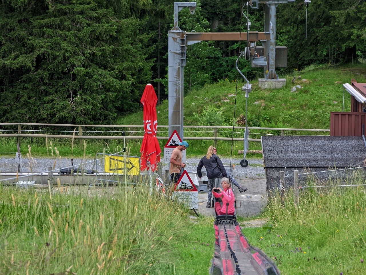 |
Reversing
Position: 46°59.37’N, 8°15.50’E
The Fraekigaudi Rodelbahn gets the rider back up to the top by hooking a line on the back of the toboggan and pulling it up in reverse.
|
 |
Lake Lucerne
Position: 46°59.34’N, 8°15.19’E
Being pulled up in reverse gave us an opportunity to take in the great views from the area. This is looking down to Lake Lucerne, with the city of Lucerne out of the picture on the left.
|
 |
Snack
Position: 46°59.32’N, 8°14.93’E
Enjoying a snack with a view at Fraekmuntegg after our toboggan ride.
|
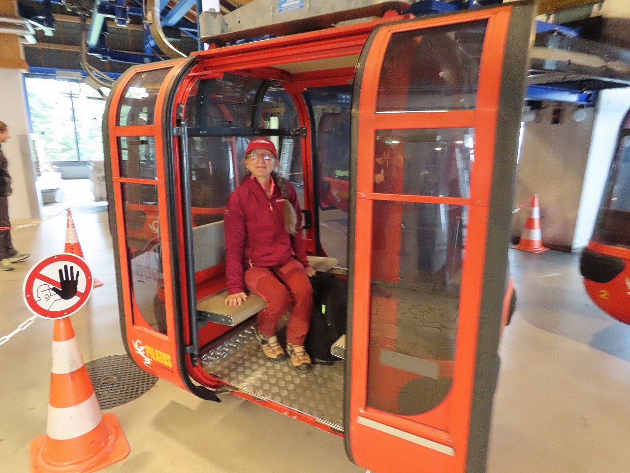 |
Gondola
Position: 46°59.44’N, 8°15.08’E
Taking a gondola down from Fraekmuntegg to Kriens.
|
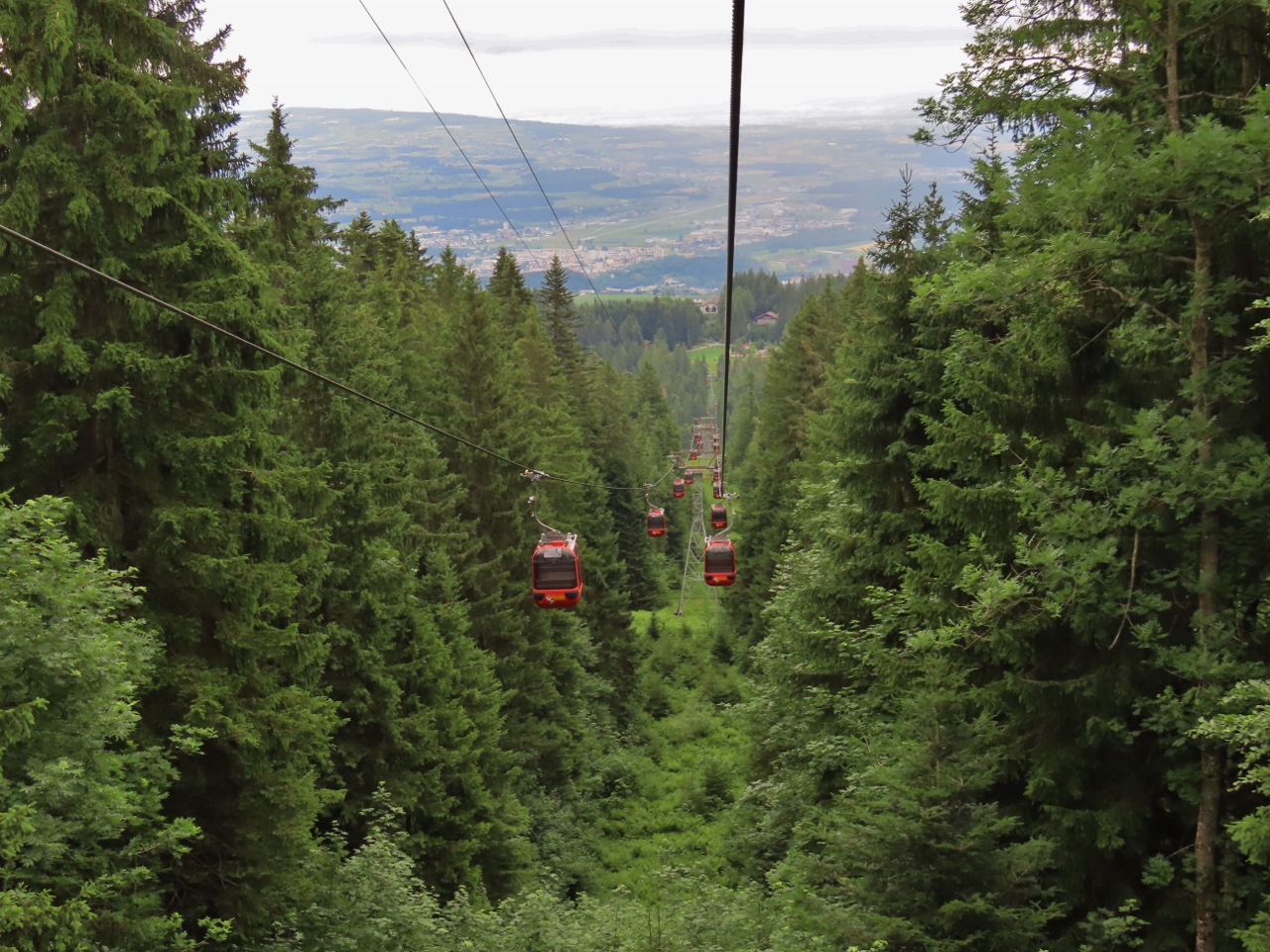 |
View from Gondola
Position: 46°59.94’N, 8°15.36’E
The panoramic gondola between Fraekmuntegg to Kriens has a total altitude gain of (899m) in two tower-less spans, one (2,118 m) long and the second (2,774 m), that connect at Kreinseregg. Here we are are descending towards the station Kreinseregg, visible in the distance, where we will switch to the second span.
|
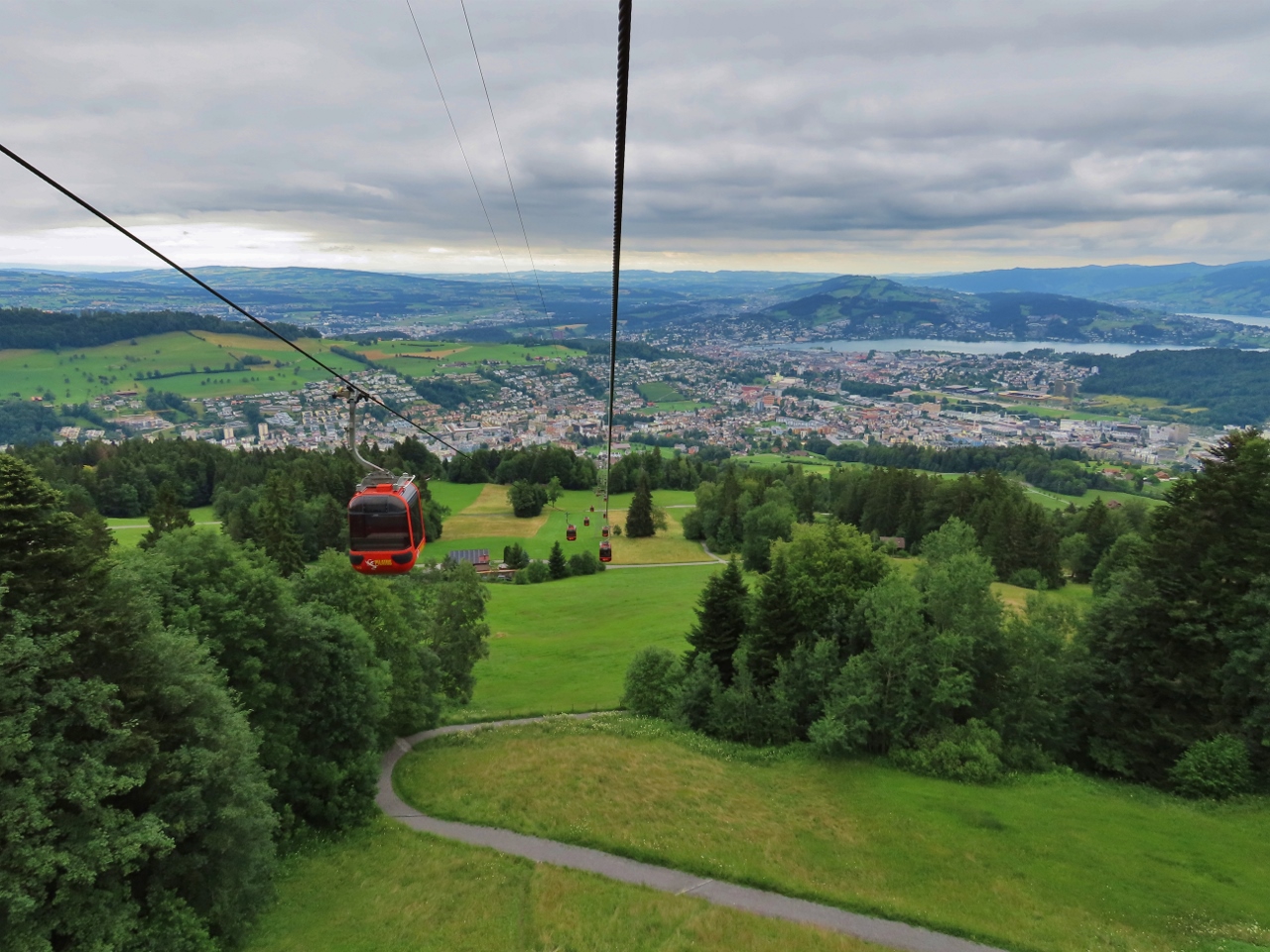 |
Kriens
Position: 47°0.84’N, 8°15.88’E
Riding the second span of the panoramic gondola, from Kreinseregg to Kriens, a suburb of Lucerne. Lake Lucerne and the city are visible in the background.
|
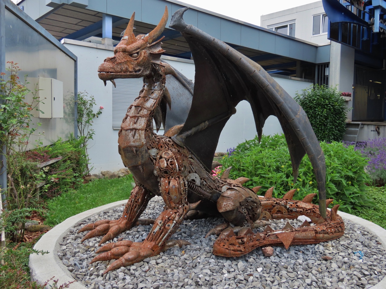 |
Dragon
Position: 47°1.82’N, 8°16.66’E
Wonderful statue of a dragon, the “mascot” of Mount Pilatus, at the Kriens gondola station.
|
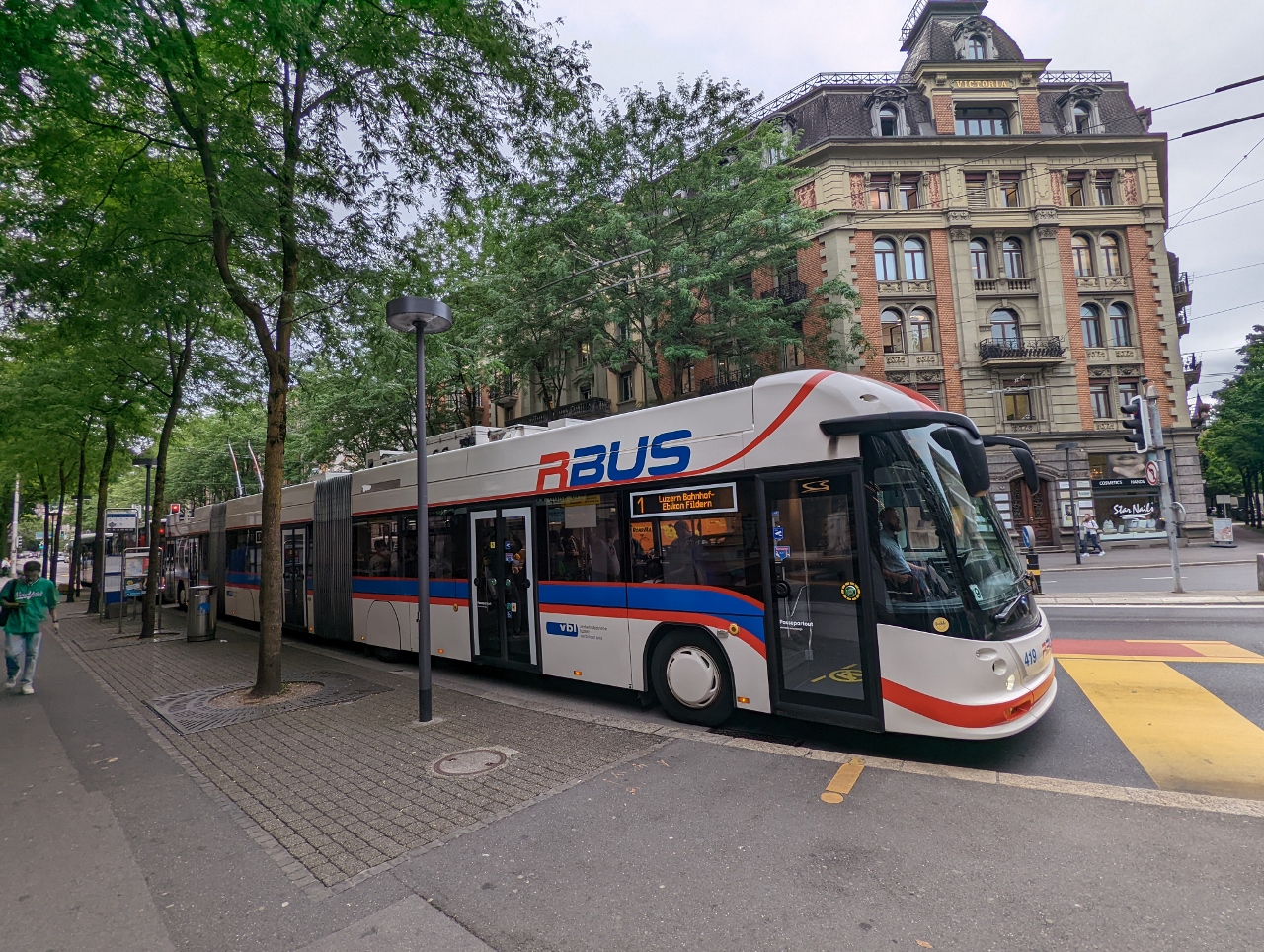 |
Double Articulation
Position: 47°2.92’N, 8°18.37’E
The 81-ft (24.7m) bi-articulated Hess lightTram 25 DC we took back to Lucerne from Kriens.
|
 |
Retrieving Luggage
Position: 47°2.95’N, 8°18.51’E
Retrieving our luggage at the Lucerne train station before heading to our hotel. Being able to store our bags at the train station worked out really well for our day trip to Mount Pilatus.
|
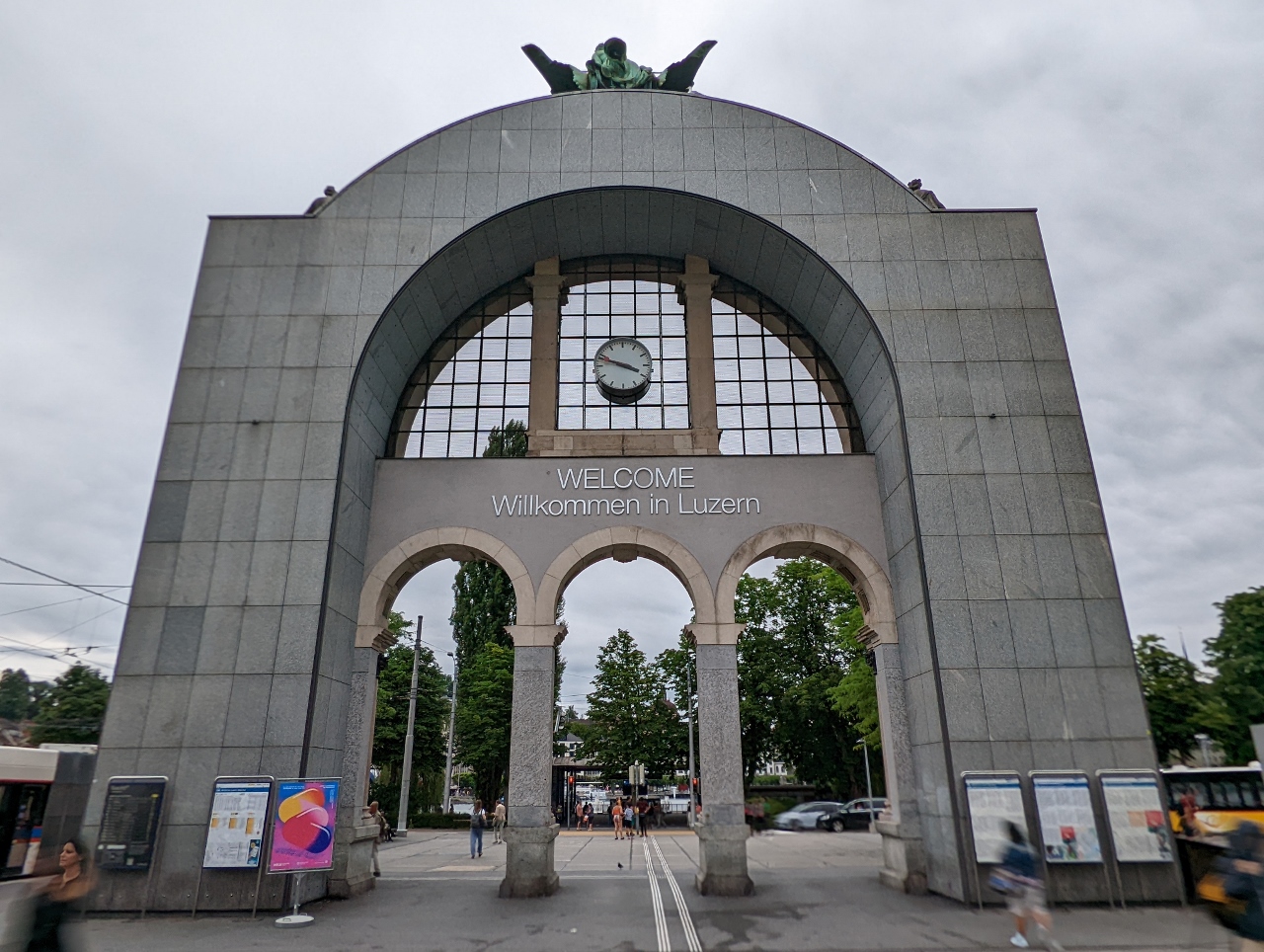 |
Luzern
Position: 47°3.04’N, 8°18.62’E
A welcome arch outside the Luzern (Lucerne) train station.
|
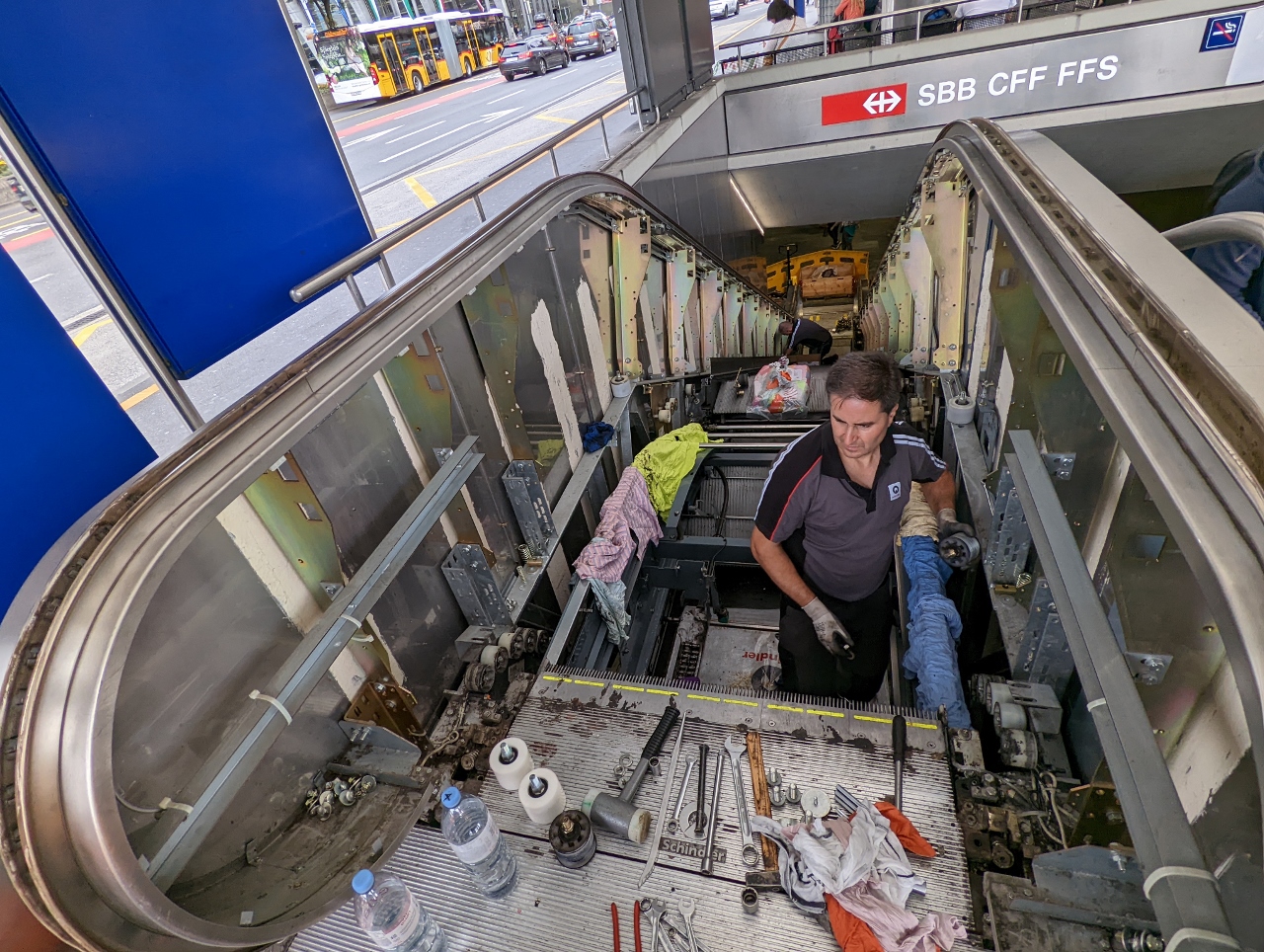 |
Escalator Repair
Position: 47°3.05’N, 8°18.54’E
Lots of tools and parts out as an escalator near the Lucerne train station is open for maintenance.
|
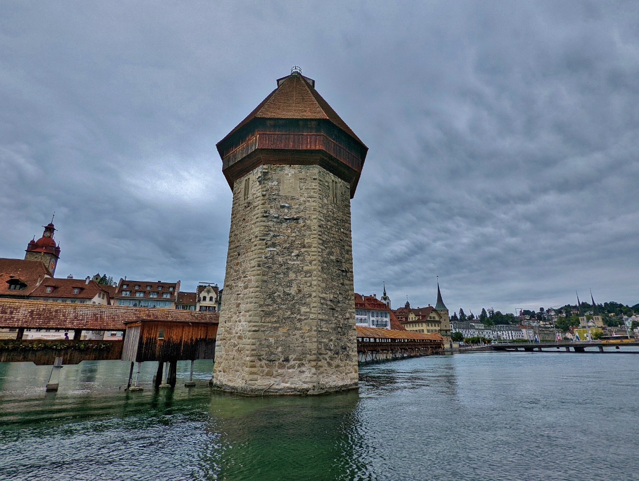 |
Kapellbrucke
Position: 47°3.06’N, 8°18.45’E
The Kapellbrucke (Chapel Bridge) in Lucerne, built in 1360, is the oldest covered bridge in Europe and the oldest truss bridge in the world. In the foreground is the Wasserturm (water tower, as in “tower standing in the water”) that was built about a century before the bridge and has been used variously as a prison, torture chamber, treasury and municipal archive.
|
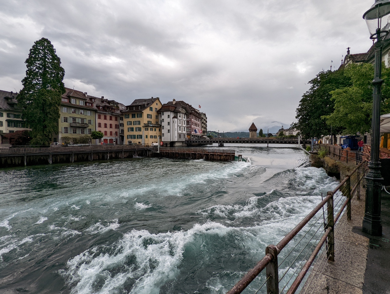 |
Nadelwehr
Position: 47°3.05’N, 8°18.14’E
The Nadelwehr (Needle Dam) along the River Reusse in Lucerne with the Wasserturm and Kapellbrucke in the background. Completed in 1861, the dam uses wood planks (needles) inserted vertically to obstruct the river flow and is still used today to manually control the water level in Lake Lucerne. Currently the dam is partially open, but the planks can extend all the way across the river to the righmost shore.
|
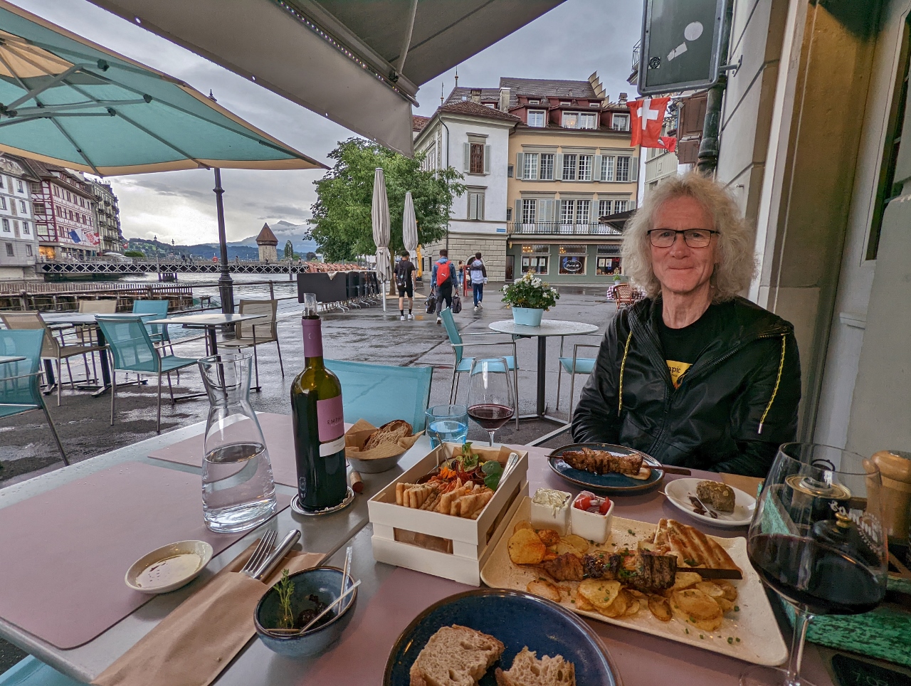 |
Restaurant Ammos
Position: 47°3.05’N, 8°18.14’E
A delicious meal along the River Reusse at Restaurant Ammos in Lucerne. The Nadelwehr is on the left and the Wasserturm and Kapellbrucke are just visible in the distance.
|
 |
Barolo
Position: 47°2.89’N, 8°18.25’E
We stopped off for a drink in the bar at Hotel Anker where we are staying in Lucenre. Jennifer loves Barolo so much that she ordered a magnum to take up to our room. Well, not really, but that was the bottle the bar tender poured Jennifer’s glass from and we just had to get a picture.
|
 |
Mussegmauer
Position: 47°2.89’N, 8°18.25’E
Two of the nine remaining towers in the Mussegmauer (Musseg Wall), Lucerne’s 13th-century city wall, viewed from our hotel room. At left is the undated Mannliturm (Little Man Tower), named after the small figure of a man atop one of the two turrets, and at right is the Luegislandturm (Luegisland Tower), built around 1370. With 2,854 ft (870m) still standing, the Mussegmauer is the longest contiguous preserved wall in Switzerland.
|
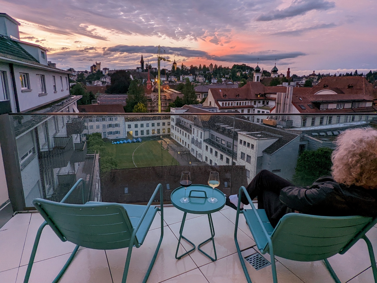 |
Sunset
Position: 47°2.90’N, 8°18.26’E
Enjoying the sunset from the patio of our room at the Hotel Anker in Lucerne. The 13th-century Mussegmauer (Musseg Wall) and four of its towers are visible in the distance (click image for a larger view).
|
 |
Click the travel log icon on the left to see these locations on a map. And a map of our most recent log entries always is available at mvdirona.com/maps. |
If your comment doesn't show up right away, send us email and we'll dredge it out of the spam filter.