We departed Geneva for Seattle early on our second morning in the city. The ascent from the Geneva airport gave us a few last glimpses to the Alps, and we got some really nice views into the Frankfurt area, pictured above, as we descended to transfer home.
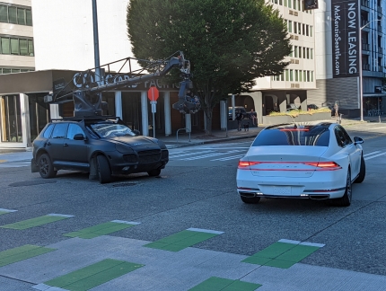
On the return flight, we continued our experiment of adapting to the timezone by again sleeping only for a few hours on the plane. Our hope was that we’d get enough sleep so we weren’t exhausted when we got in, but not so much that we wouldn’t be tired in the evening. As with our arrival into Zurich at the start of the trip, this worked well. We reached our apartment mid-afternoon, went out for dinner at one of our favorite restaurants, and later spent some time watching the shooting of a car commercial in our neighborhood. That night, we slept well and overall barely noticed the timezone change.
Below are highlights from July 10, 2022. Click any image for a larger view, or click the position to view the location on a map. And a map with our most recent log entries always is available at mvdirona.com/maps.
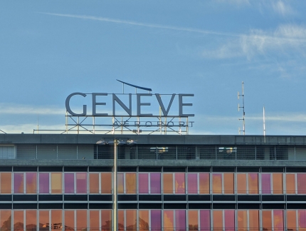 |
Geneve Aeroport
Position: 46°13.94’N, 6°6.41’E
At the Geneva airport for our flight home to Seattle via Frankfurt.
|
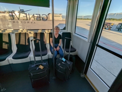 |
Shuttle
Position: 46°13.74’N, 6°6.13’E
Riding a shuttle bus from the terminal to our plane out on the tarmac. Our experiment of taking only carry-on luggage worked super-well. We really liked the convenience of having small, easily stowed and transported bags. And doing laundry at a few hotels along the way held us for the trip.
|
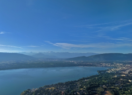 |
Lake Geneva
Position: 46°14.80’N, 6°7.31’E
The view south across Lake Geneva as we take off for Frankfurt. At center in the distance is Mont Blanc and at right is Geneva.
|
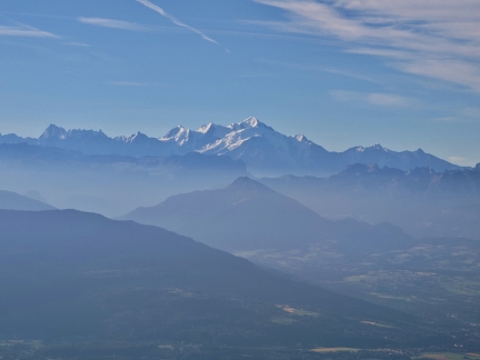 |
Mont Blanc
Position: 46°16.03’N, 6°9.13’E
One last view to Mont Blanc in France as we depart the Geneva area.
|
 |
Main
Position: 50°5.14’N, 8°35.47’E
View to the river Main, the largest tributary of the Rhine, on our approach into Frankfurt.
|
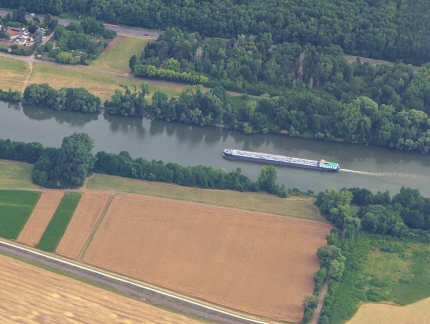 |
Barge
Position: 50°6.78’N, 8°48.92’E
A river barge running west along the river Main. The river barges were a constant during our time in the Netherlands, and we miss seeing them.
|
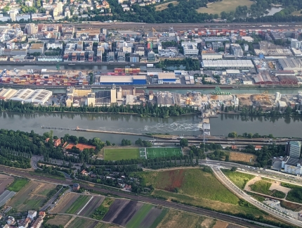 |
Schleuse Offenbach
Position: 50°5.90’N, 8°45.21’E
The Schleuse Offenbach along the river Main. Canals were built into the lower reaches of the river in the late 1800s, as was this lock, and the river currently has 34 barrages (a diversion dam used to control water levels) that maintain the water level at a minimum of 9.5ft (2.9m). The current Schleuse Offenbach was completed in 1953, has a drop height of 10.4ft (3.18m) and can accommodate ships up to 1,128 ft (344m) long with a 39-ft (12m) beam.
|
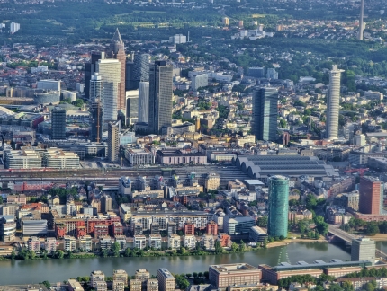 |
Westhafen
Position: 50°5.04’N, 8°41.65’E
Looking across the Westhafen district of Frankfurt as we descend to the airport. At bottom left, across the river, is the apartment-surrounded Marina Westhafen, with the Frankfurt train station beyond and at right is the 30-story, emerald-colored Westhafen Tower, completed in 2004.
|
 |
Frankfurt Airport
Position: 50°2.91’N, 8°35.24’E
The view from our shuttle to the terminal building at Frankfurt Airport.
|
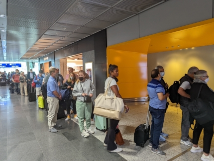 |
Lounge Line
Position: 50°2.87’N, 8°34.05’E
Airport lounges have been busy on this trip, but this line to enter the Lufthansa Lounge takes the record. It snakes way around the corner in the distance at left. We’ll pass on that one.
|
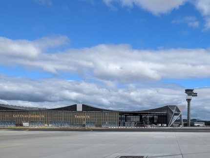 |
Lufthan Technik
Position: 50°2.55’N, 8°33.74’E
The Lufthan Technik service buildings at Frankfurt airport, viewed from the shuttle out to our plane to Seattle. Lufthan Technik is a subsidiary of Lufthansa and provides worldwide maintenance, repair, and overhaul services for aircraft, engines, and components.
|
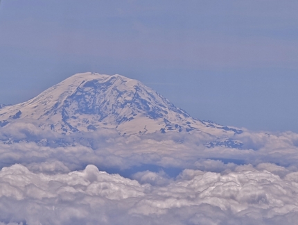 |
Mt Rainier
Position: 46°33.72’N, -121°59.48’W
“The Mountain”, Mt Rainier, as we arrive into the Seattle area from Switzerland. We’re nearly home. The scenery in Switzerland was truly spectacular, but it’s pretty special here as well.
|
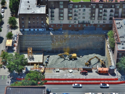 |
Crane Base
Position: 47°36.92’N, -122°20.66’W
In the time we’ve been away in Switzerland, an entire crane base has been built at the Fourth and Bell construction site.
|
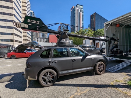 |
Pursuit Systems
Position: 47°36.99’N, -122°20.57’W
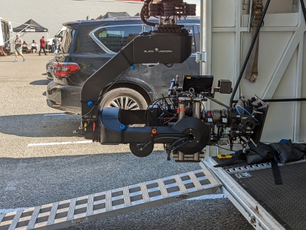
As we walked out for dinner, this Pursuit Systems chase vehicle was being unloaded across the road from our apartment building. Pursuit Systems specializes in stabilized cameras suspended from a crane mounted on a chase-vehicle rooftop.
|
 |
Black Unicorn
Position: 47°36.99’N, -122°20.57’W
The Black Unicorn remote stabilized camera mount on the Pursuit Systems chase vehicle.
|
 |
Tavolata
Position: 47°36.86’N, -122°20.80’W
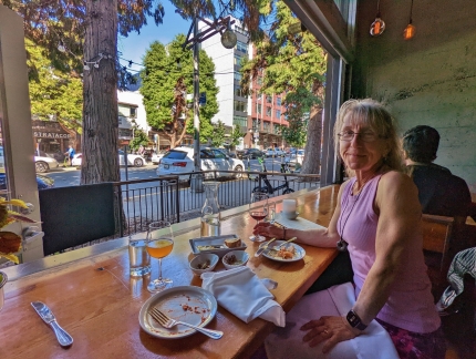
An excellent “welcome home” meal at our favorite table in Tavolata. The food is great and we love the street view, particularly in the summer with the glass wall opened up.
|
 |
Camera
Position: 47°37.04’N, -122°20.34’W
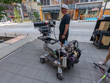
The Pursuit Systems vehicle we saw earlier was in town for the shooting of a Genesis car commercial, so we stopped by to have a look. This ultra-stabilized camera cart is sporting a capable-looking RED professional cinematography camera.
|
 |
Custom Drone
Position: 47°37.09’N, -122°20.44’W
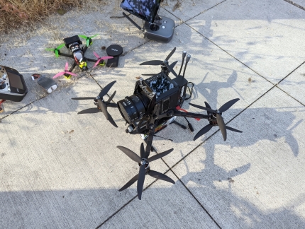
Another RED professional cinematography camera, this one mounted on a custom drone.
|
 |
Pursuit in Action
Position: 47°37.09’N, -122°20.52’W
The Pursuit Systems chase care in action: https://youtu.be/tgo_bn03lY4.
|
 |
Albert Khandzhayan
Position: 47°37.08’N, -122°20.44’W
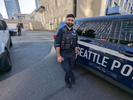
The Seattle Police were on hand to block off the streets for car commercial. Office Albert Khandzhayan noticed us checking out his police car and came over to say hello. He was super-friendly, and we quite enjoyed chatting with him.
|
 |
Seattle Police Car
Position: 47°37.09’N, -122°20.44’W
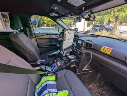
The Seattle Police department uses Ford Explorers with a lot of technology installed.
|
 |
Reflections
Position: 47°37.06’N, -122°20.38’W
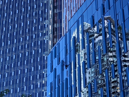
Downtown apartment tower reflected onto Amazon campus building along 8th Ave.
|
 |
Click the travel log icon on the left to see these locations on a map. And a map of our most recent log entries always is available at mvdirona.com/maps. |

If your comment doesn't show up right away, send us email and we'll dredge it out of the spam filter.