The Via Ferrata Murren-Gimmelwald is 1.4-mile (2.2 km) route strung along the cliffs between Murren and Gimmelwald. Unlike most via ferratas, this route descends rather than ascends, starting Murren at altitude 5,374 ft (1,638 m) and ending at Gimmelwald at 4,485 ft (1,367 m). But it shares many features of other via ferrata we’ve done (Loen, Tyssedal and Trolltunga), with steep cliffs, suspension bridges, tightropes, and spectacular scenery.
After enjoying the Birg Thrill Walk on our descent from the summit of Schilthorn, we returned back down to Murren for this much bigger thrill walk. We loved the experience, although the Cliff Walk crossing of a precipitous face 2,200 ft (670 m) above the valley floor, pictured above, definitely lifted our heartbeats a bit. After completing the course, we stopped in Gimmelwald for a delicious pizza lunch, then returned via cable car back up to Murren. We finished a big day with an excellent dinner at the Hotel Eiger, where we are staying in Murren, with more fabulous mountain views.
Below are more highlights from June 30th, 2022. Click any image for a larger view, or click the position to view the location on a map. And a map with our most recent log entries always is available at mvdirona.com/maps.
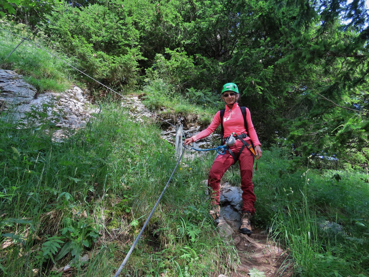 |
Murren Via Ferrata
Position: 46°33.56’N, 7°53.74’E
Ready to start the course with gear rented from Intersport in Murren.
|
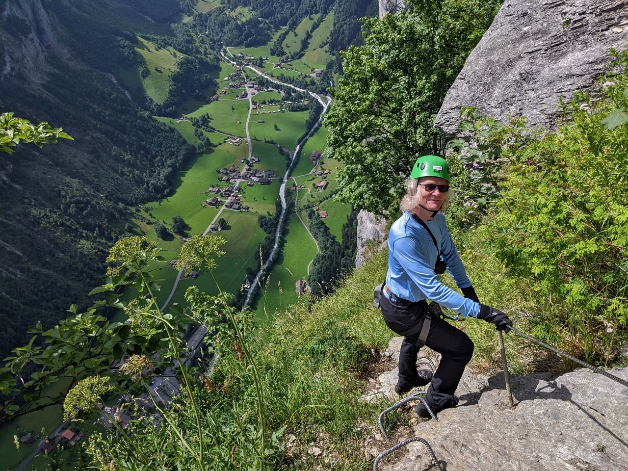 |
Descending
Position: 46°33.53’N, 7°53.78’E
Unlike most via ferratas, this route descends rather than ascends. We started at Murren at altitude 5,374 ft (1,638 m) and will climb down to Gimmelwald at 4,485 ft (1,367 m).
|
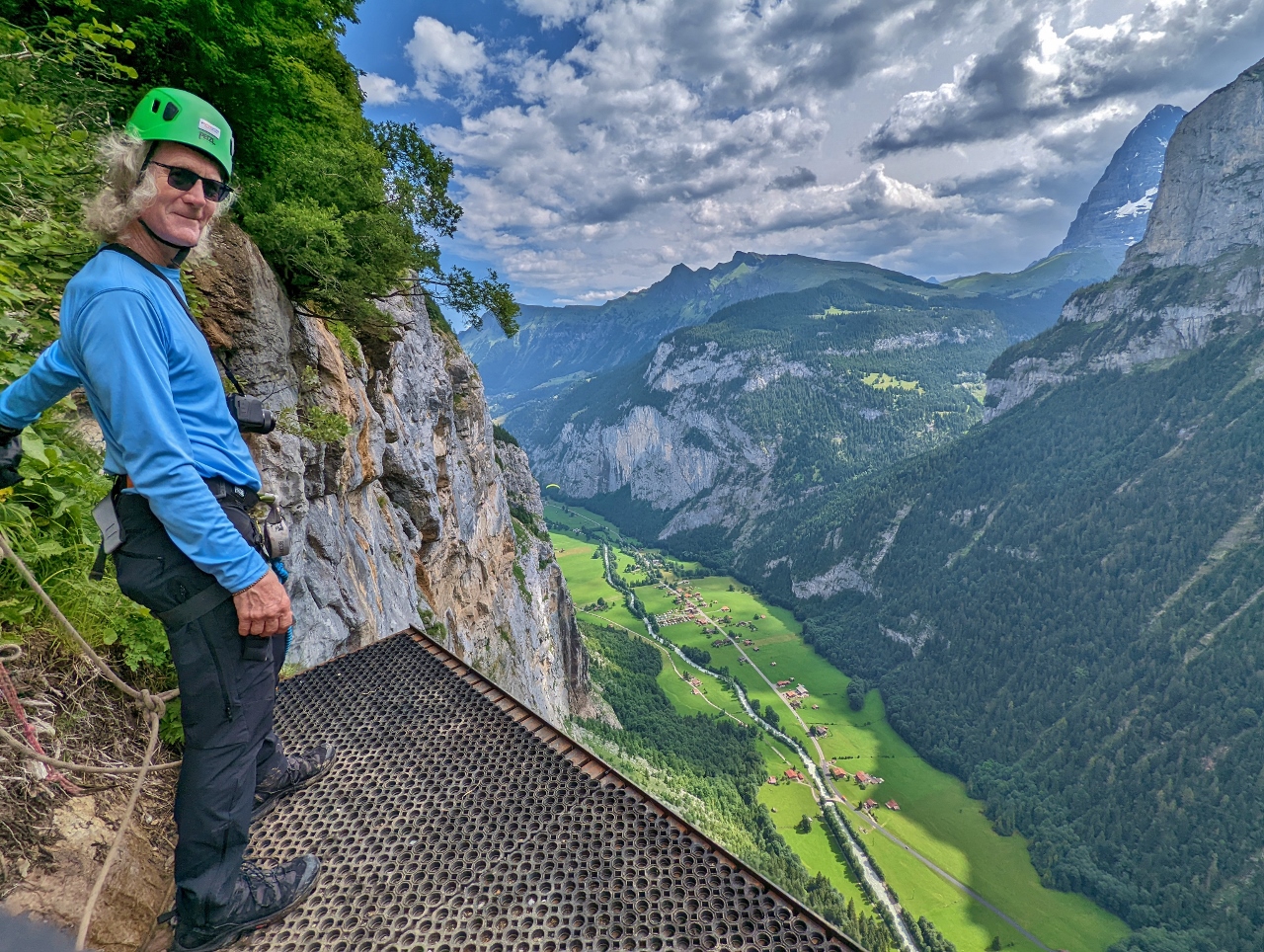 |
Squirrel Jump
Position: 46°33.46’N, 7°53.76’E
We stopped briefly for a snack and to enjoy the view from this BASE jumping platform hung off the cliff along the via ferrata route. We’re 2,200 ft (670 m) up and, even secured with two tethers, getting close to the edge was quite scary.
BASE jumping is an extreme sport where participants leap from fixed objects at great heights and free-fall, using a parachute to eventually land safely. “BASE” is an acronym for the four types of objects that are used: buildings, antenna (such as radio towers), spans (ie. bridges), and earth (such as cliffs). In one form of BASE jumping, that Jennifer calls “squirrel jumping”, participants wear winged suits and look somewhat like flying squirrels. BASE jumping is growing in popularity in the area, with several jump locations like this one. Over 20,000 jumps were made in 2016 and the village has three restaurants and bars with a BASE theme. This video shows several people “squirrel-jumping” from the cliffs here: https://www.youtube.com/watch?v=5icNJD7HOE0. Yikes! |
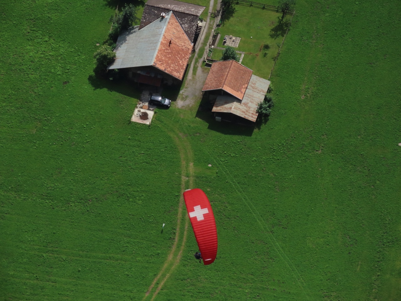 |
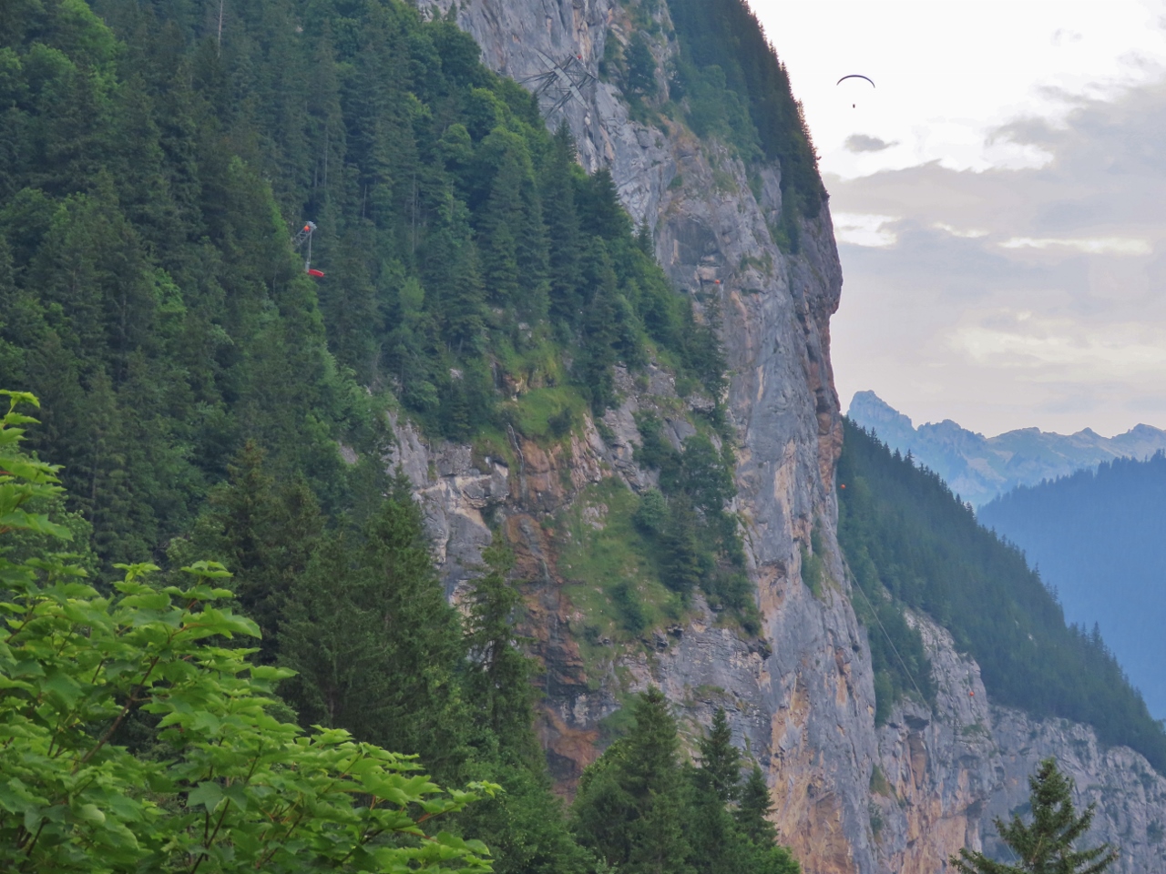
Paraglider
Position: 46°33.46’N, 7°53.75’E
You know you’re high up when you have to look down to see the paragliders. What’s even more amazing is that its almost straight down—they’re very close to underneath us.
|
|
|
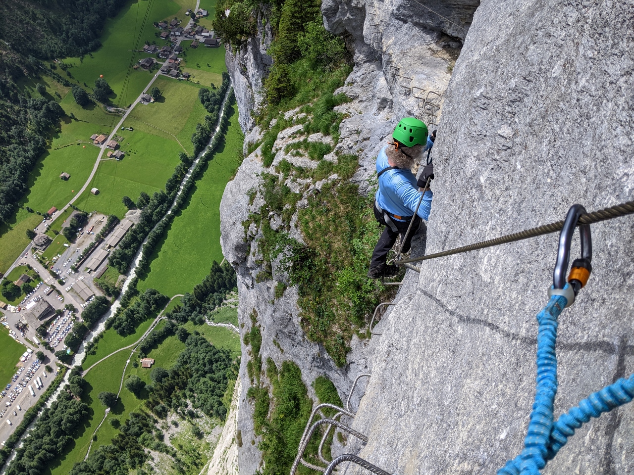
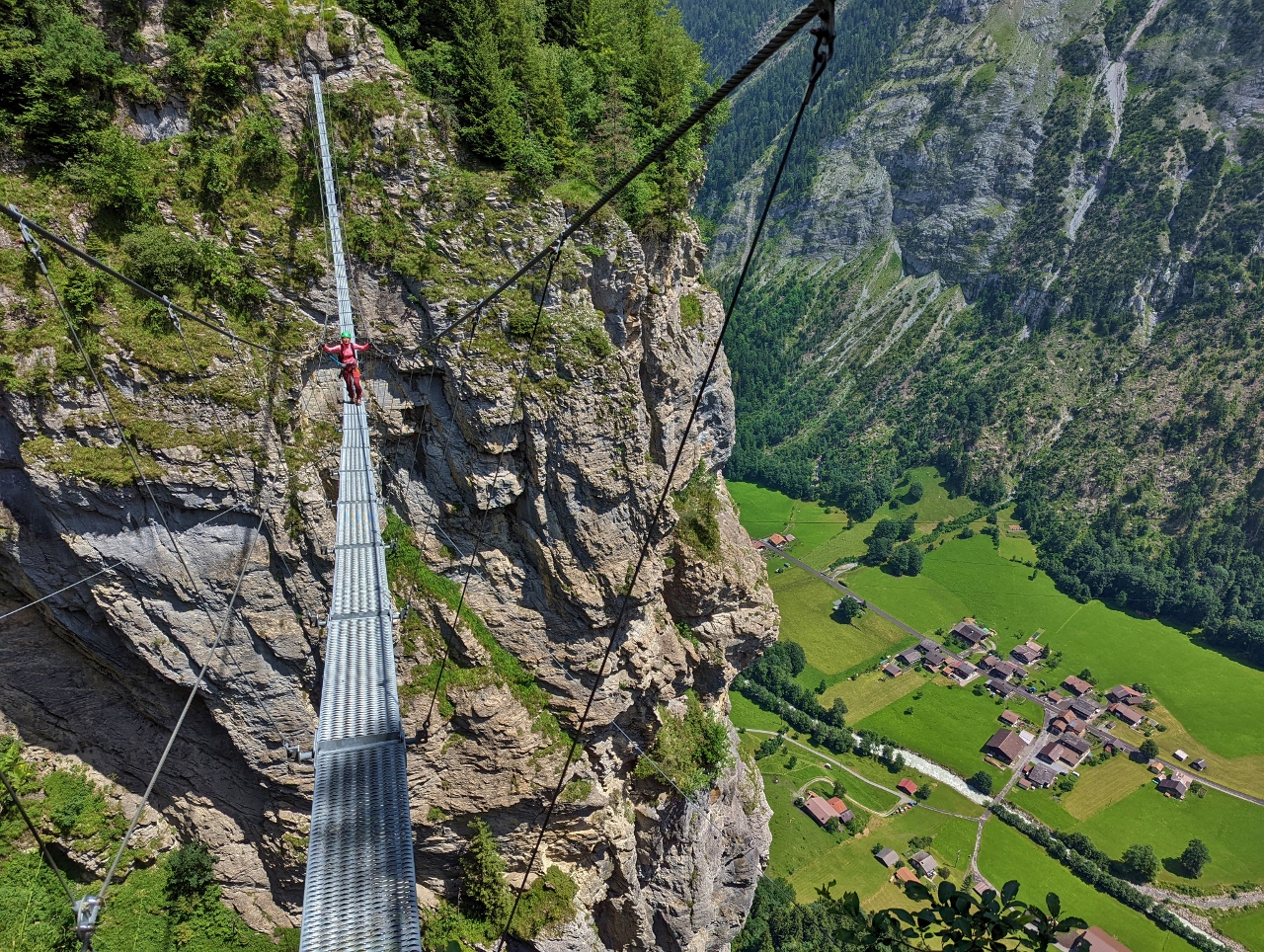
Cliffwalk
Position: 46°33.45’N, 7°53.76’E
Just past the jump platform, we started on the Cliff Walk, a series of metal rungs embedded in the cliff 2,200 ft (670 m) above the valley.
|
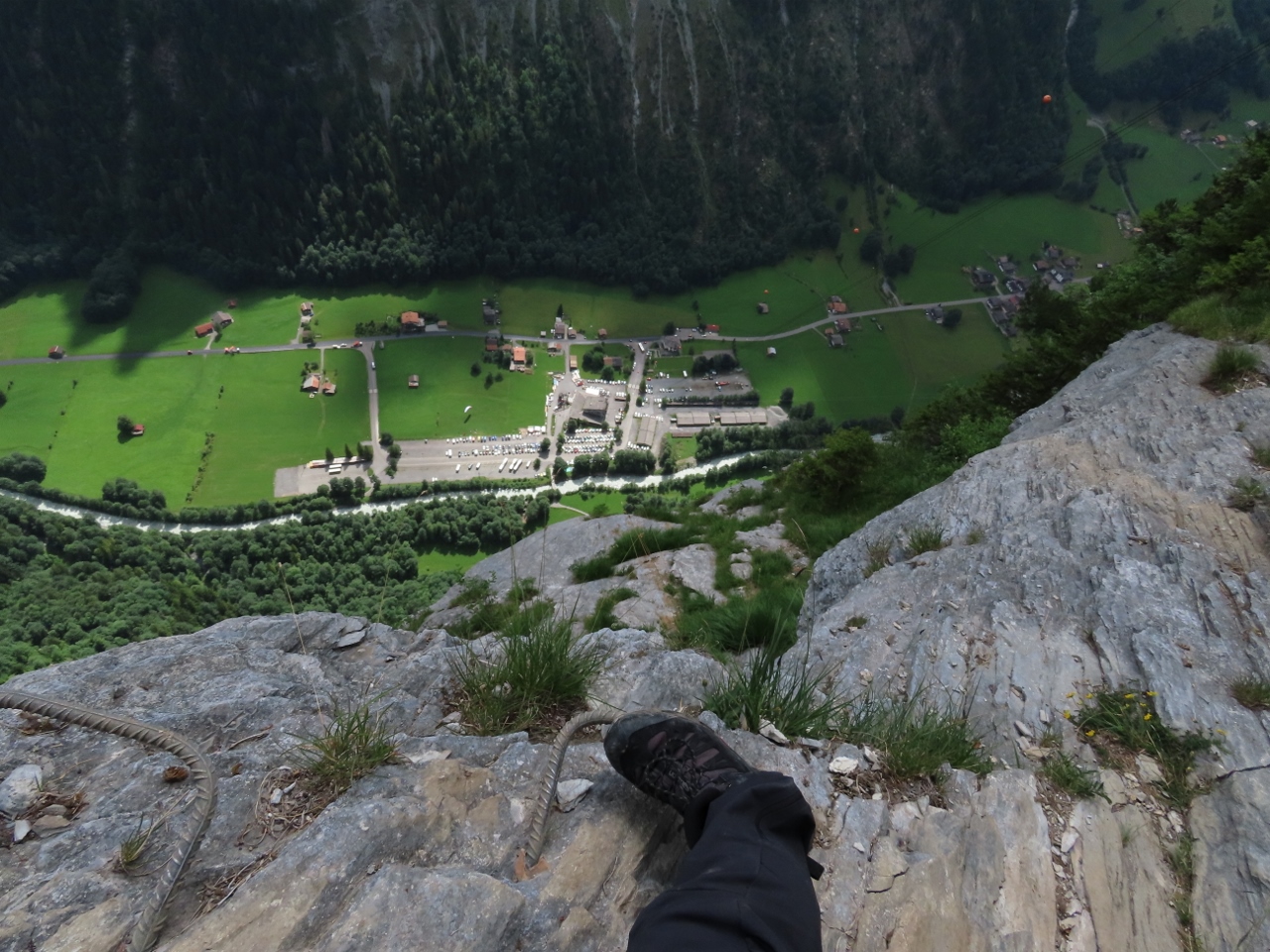 |
Footholds
Position: 46°33.45’N, 7°53.76’E
Looking down to Stechelberg as we gingerly make our way along the footholds of the Cliff Walk. The views from here were spectacular and we loved the experience, but we both were nearing our risk tolerance levels on this one.
|
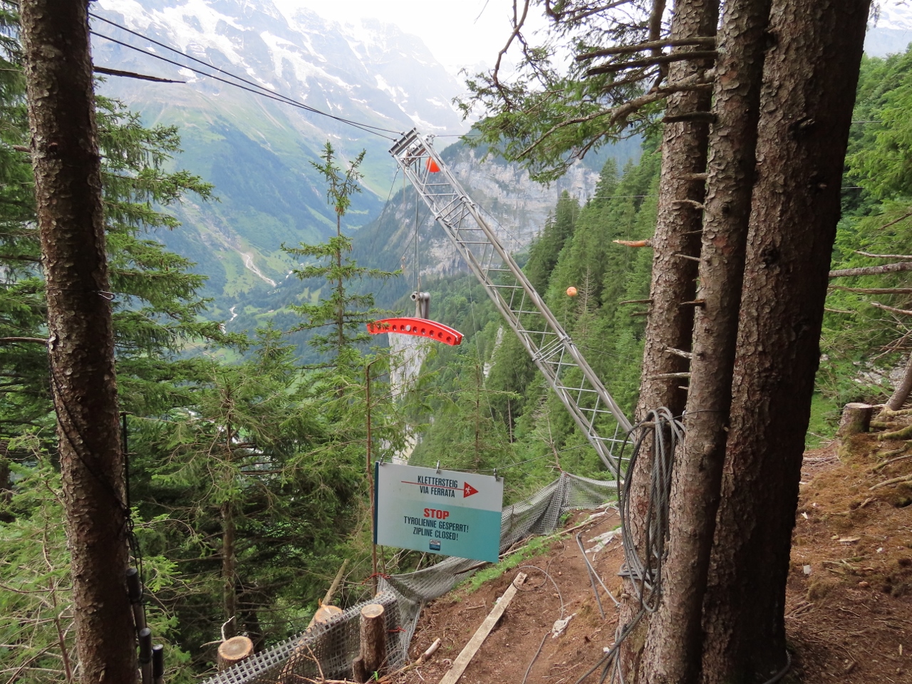 |
Zip Line
Position: 46°33.37’N, 7°53.74’E
If done as part of a guided group, the via ferrata course includes a zip line ride across a gorge. We’re on our own, so we’ll cross on a tightrope instead.
|
 |
Murrenbach
Position: 46°33.35’N, 7°53.66’E
James crossing a tightrope over Murrenbach (Murren Creek).
|
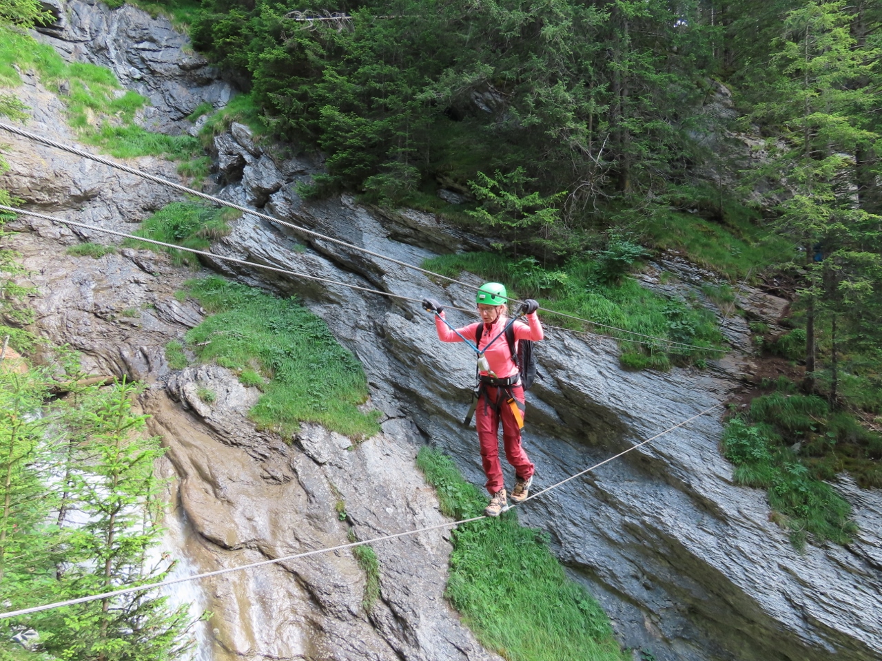 |
Tightrope
Position: 46°33.36’N, 7°53.67’E
Jennifer crossing the tightrope behind James.
|
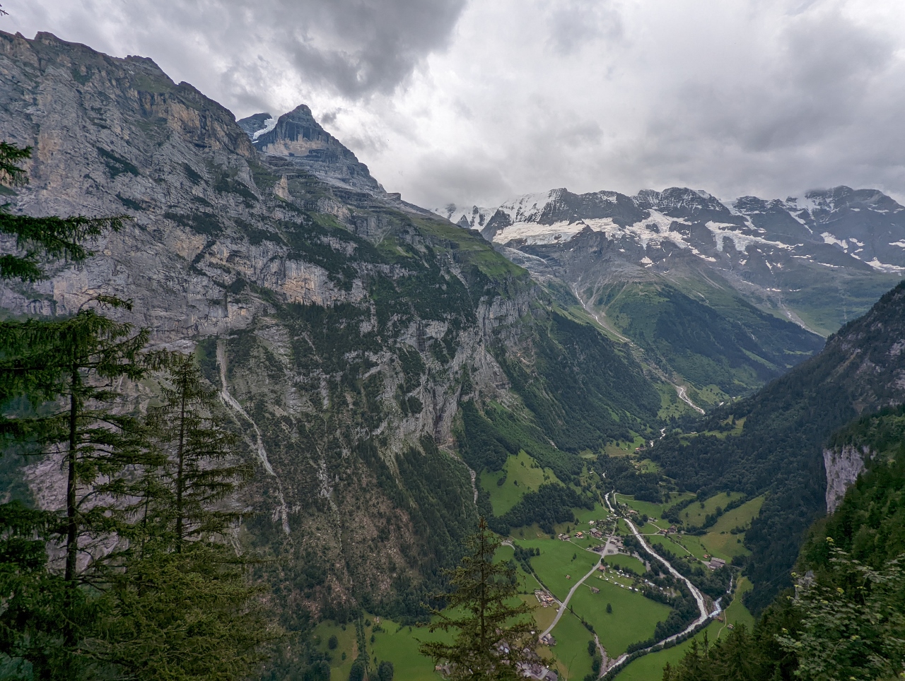 |
Lauterbrunnen Valley
Position: 46°33.27’N, 7°53.72’E
View across the Lauterbrunnen Valley just after crossing the tightrope over Murrenbach. The triangular-shaped peak left of center is 12,123 ft (3,695 m) Silberhorn.
|
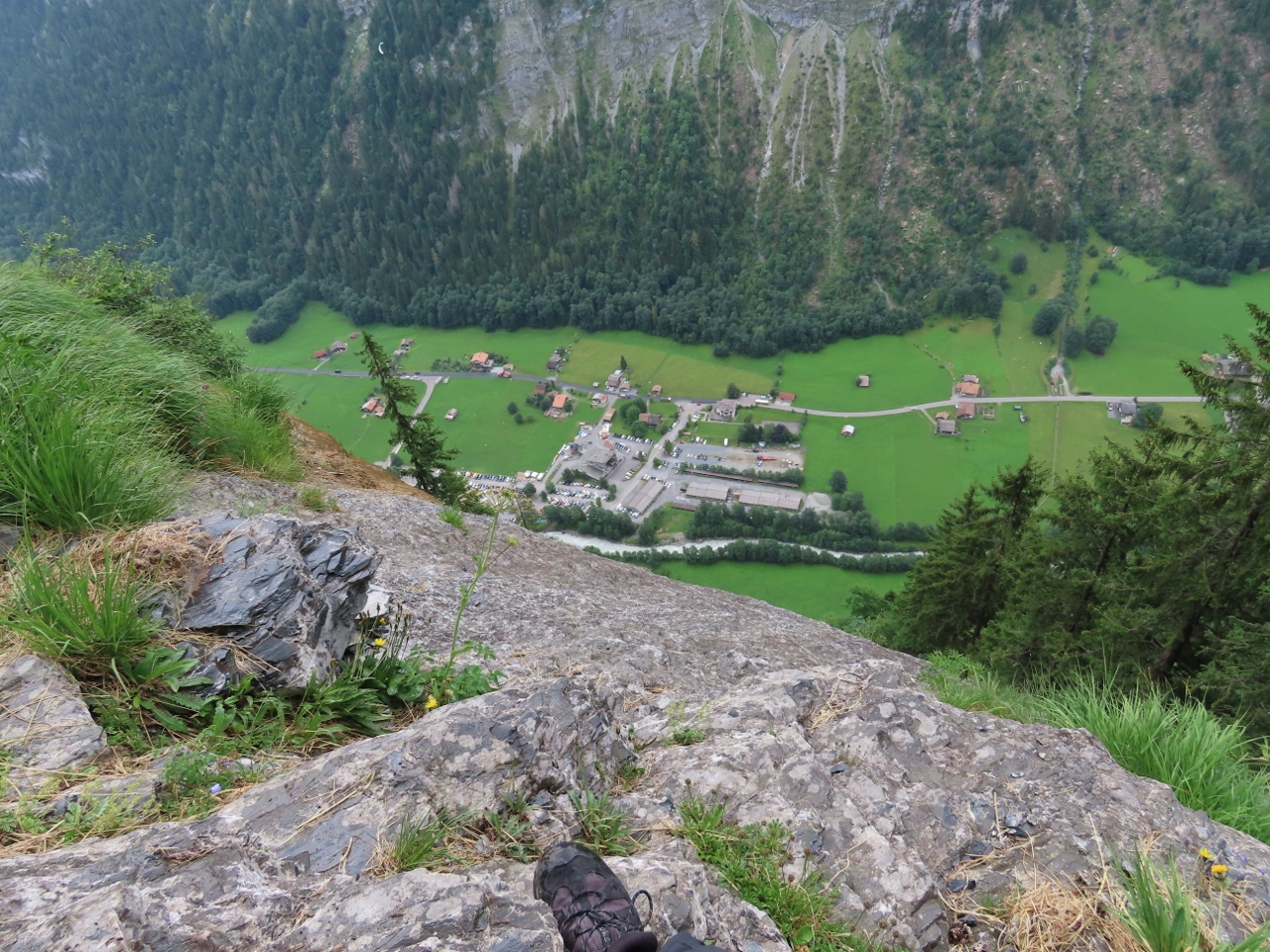 |
Stechelberg
Position: 46°33.26’N, 7°53.72’E
A final heart-thumping view to Stechelberg before we enter a slightly less exposed section of the course.
|
 |
Ladders
Position: 46°33.25’N, 7°53.72’E
Climbing down a series of ladders. The undercut face hides the next ladder, so it feels like you’ll be heading off the edge until reaching the bottom rung of the current ladder and finding the next one.
|
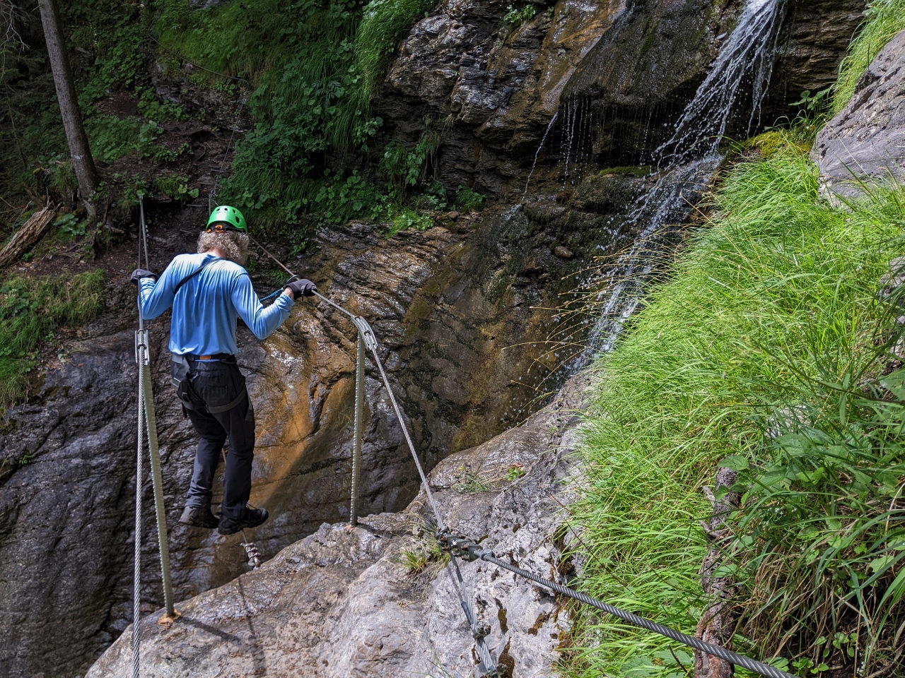 |
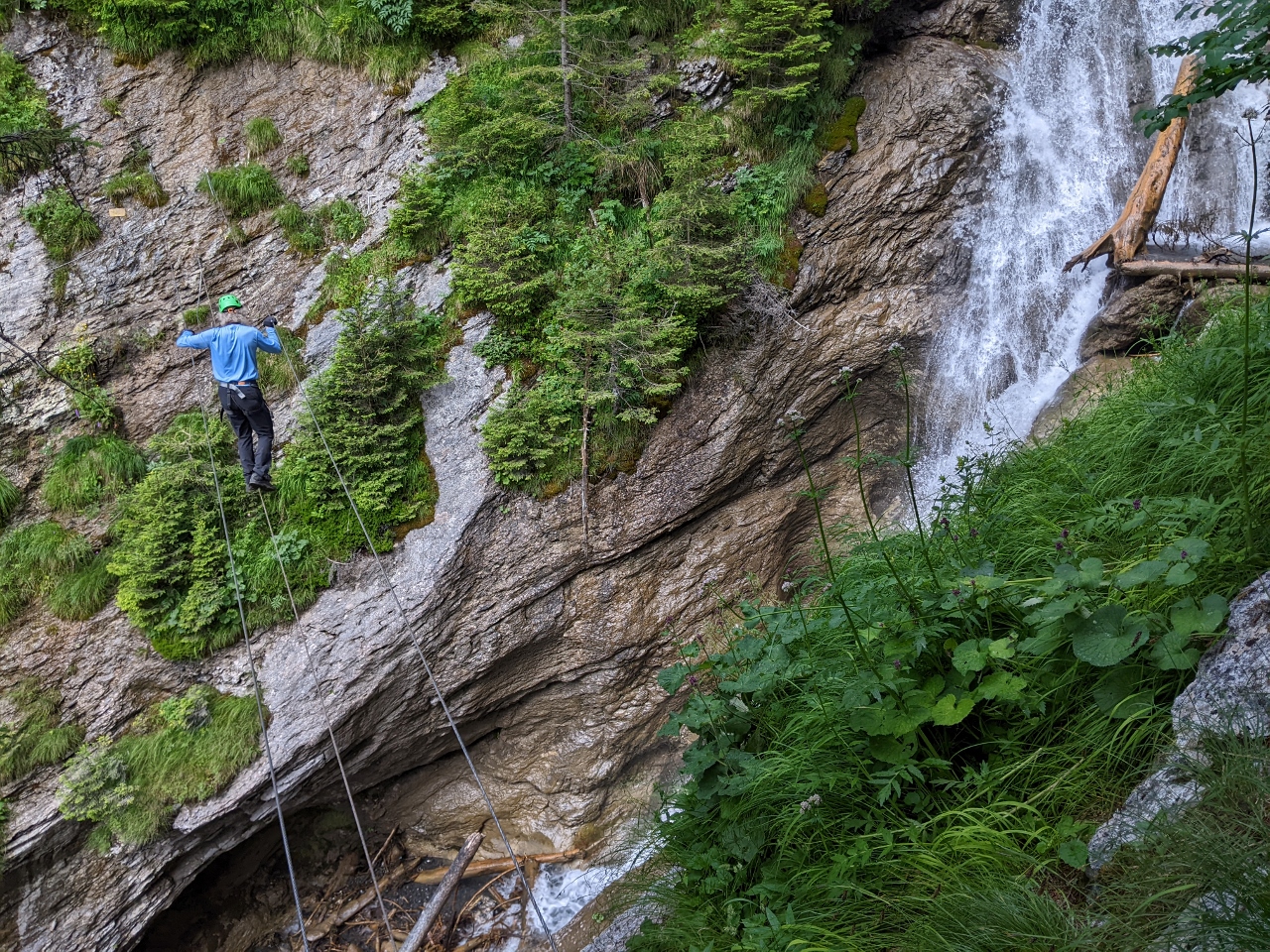
Wyenbach
Position: 46°33.03’N, 7°53.72’E
Crossing a second tightrope, this one over Wyenback (Wyen Creek).
|
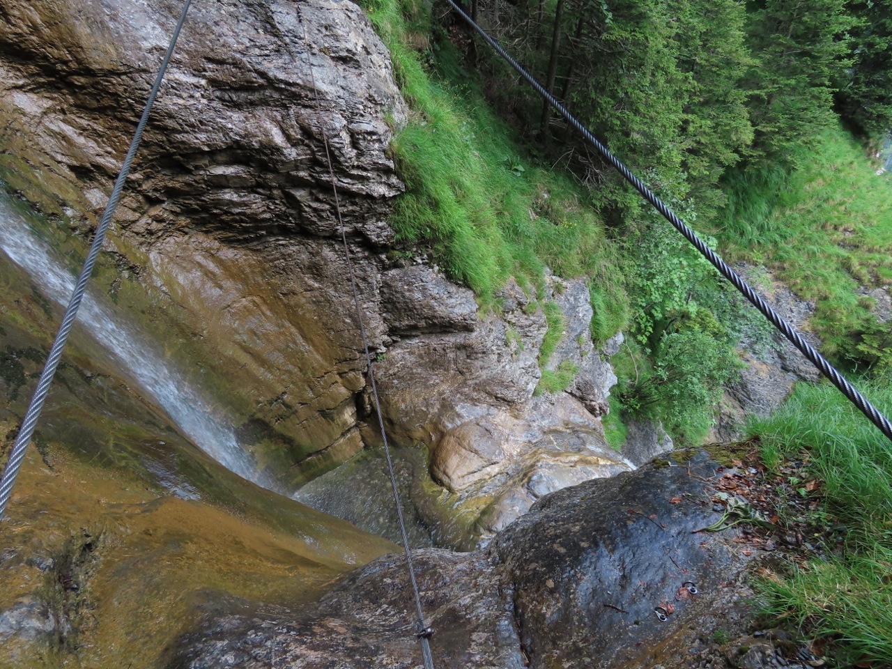 |
Waterfall
Position: 46°33.03’N, 7°53.71’E
Looking down through the tightrope to the waterfall from Wyenbach.
|
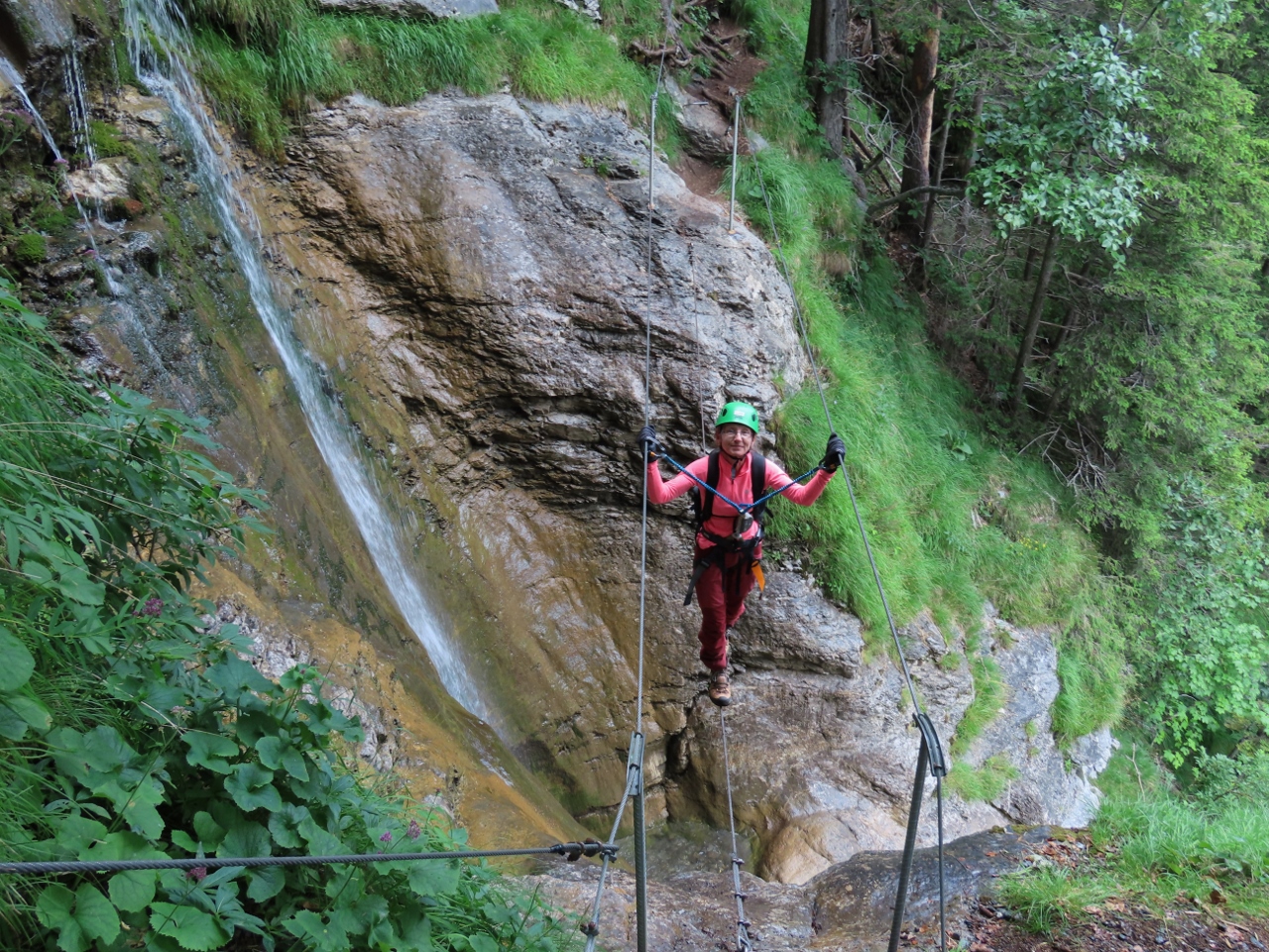 |
Second Tightrope
Position: 46°33.03’N, 7°53.71’E
Jennifer midway across the second tightrope.
|
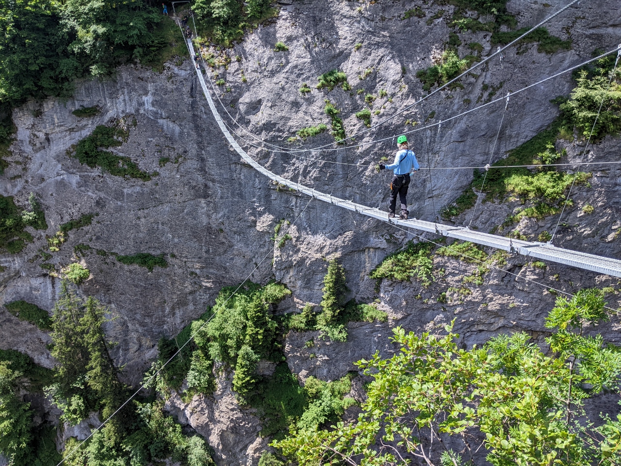 |
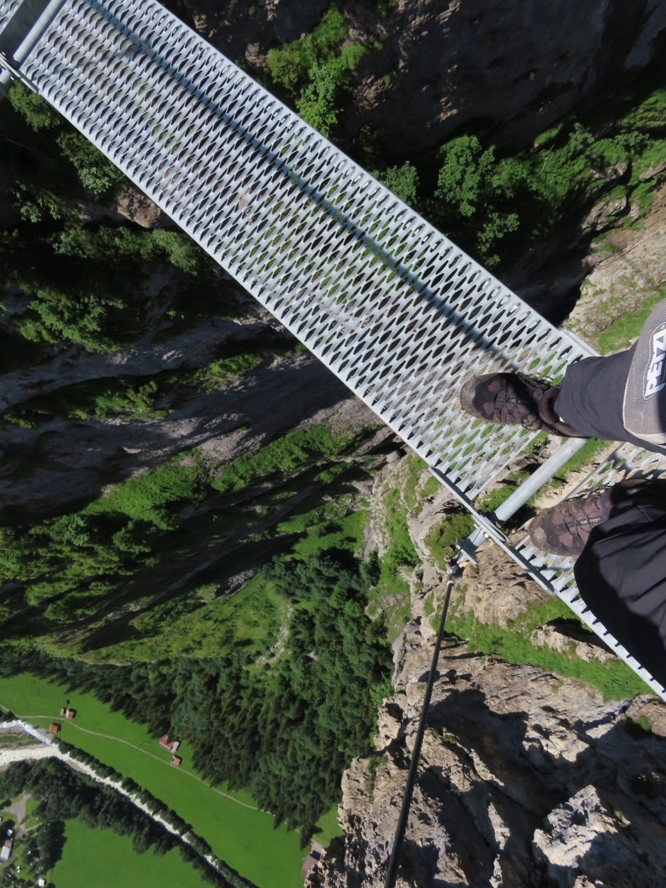
Nepalbrucke
Position: 46°32.93’N, 7°53.66’E
The Nepalbrucke (Nepal Bridge) is the final challenge of the Via Ferrata Murren-Gimmelwald. No matter how slowly and carefully you go, the 262-ft (80 m) suspension bridge swings and sways as you cross.
|
 |
View from Nepalbrucke
Position: 46°32.94’N, 7°53.65’E
Looking down to the Lauterbrunnen Valley 1,650 ft (500m) below the Nepalbrucke.
|
 |
Jennifer crossing Nepalbrucke
Position: 46°32.93’N, 7°53.65’E
Jennifer crossing the Nepalbrucke with Stechelberg and the Lauterbrunnen Valley visible in the background.
|
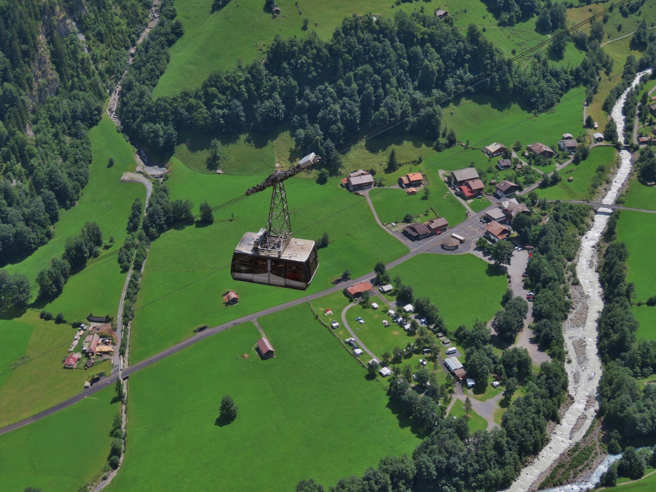 |
Cable Car
Position: 46°32.93’N, 7°53.65’E
The cable car from Stechelberg to Gimmelwald passing below us.
|
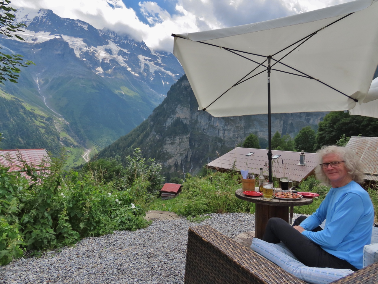 |
Lunch
Position: 46°32.80’N, 7°53.59’E
The via ferrata course ends at Gimmelwald shortly after crossing the Nepalbrucke. We stopped there at Mountain Hostel for a delicious pizza lunch with a mountain view.
|
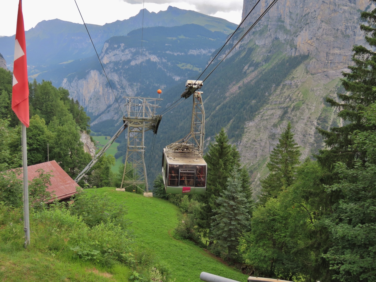 |
Gimmelwald Station
Position: 46°32.83’N, 7°53.62’E
At Gimmelwald Station to take a cable car back up to Murren. Here a car is arriving from Stechelberg.
|
 |
Cliff
Position: 46°32.83’N, 7°53.61’E
View to the cliff we just crossed from Gimmelwald Station. The red zip line support is just visible in the trees at upper left (click image for a larger view).
|
 |
Route
Position: 46°32.83’N, 7°53.62’E
Map of the area showing the via ferrata route at bottom right, labelled with ‘9’ (click image for a larger view). Murren is at far right and Gimmelwald is at center near the bottom. We had a fabulous time and are really glad we did the course.
|
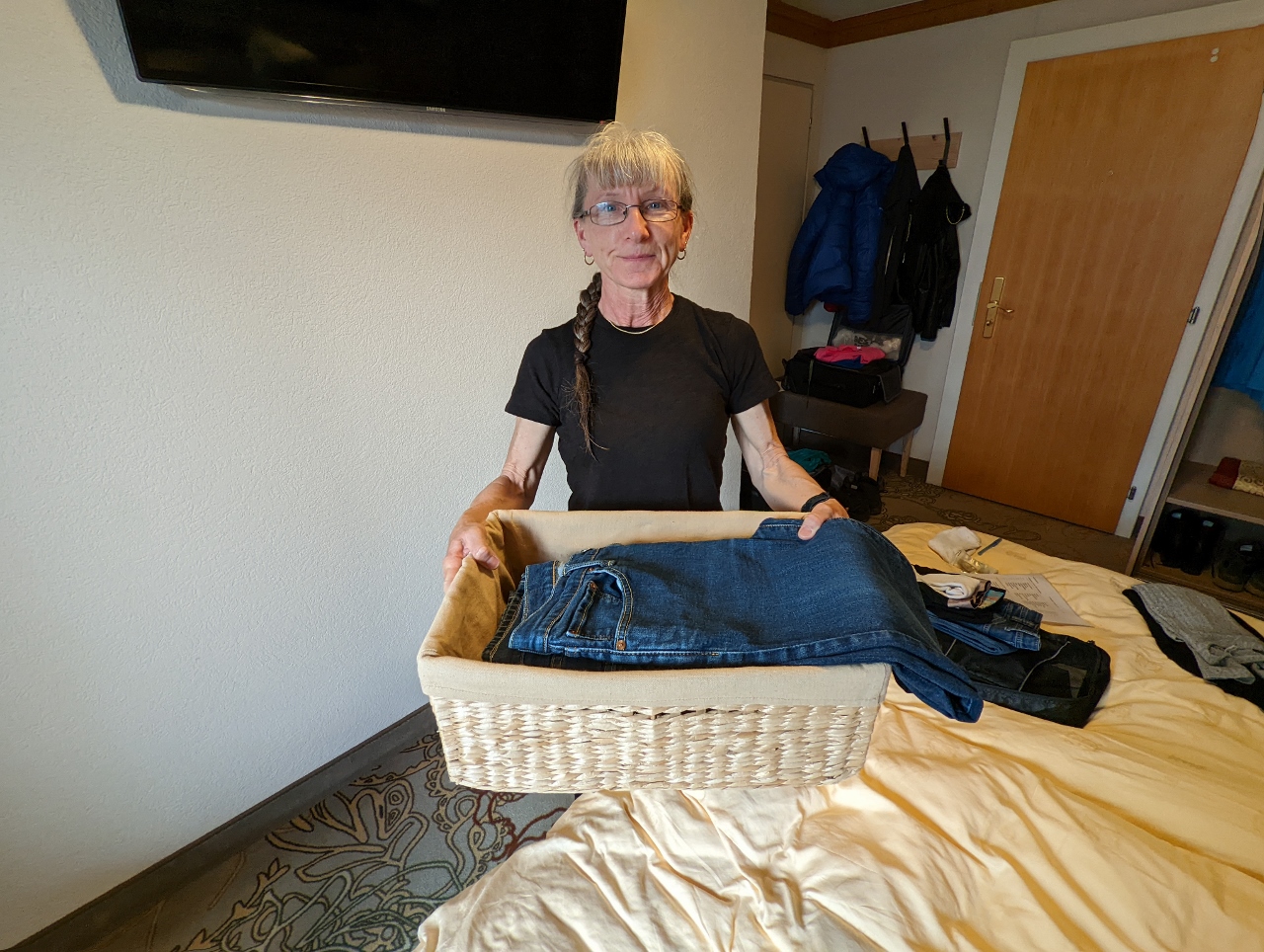 |
Laundry
Position: 46°33.83’N, 7°53.81’E
The Hotel Eiger laundered our clothes and returned them beautifully folded in a lined wicker basket.
|
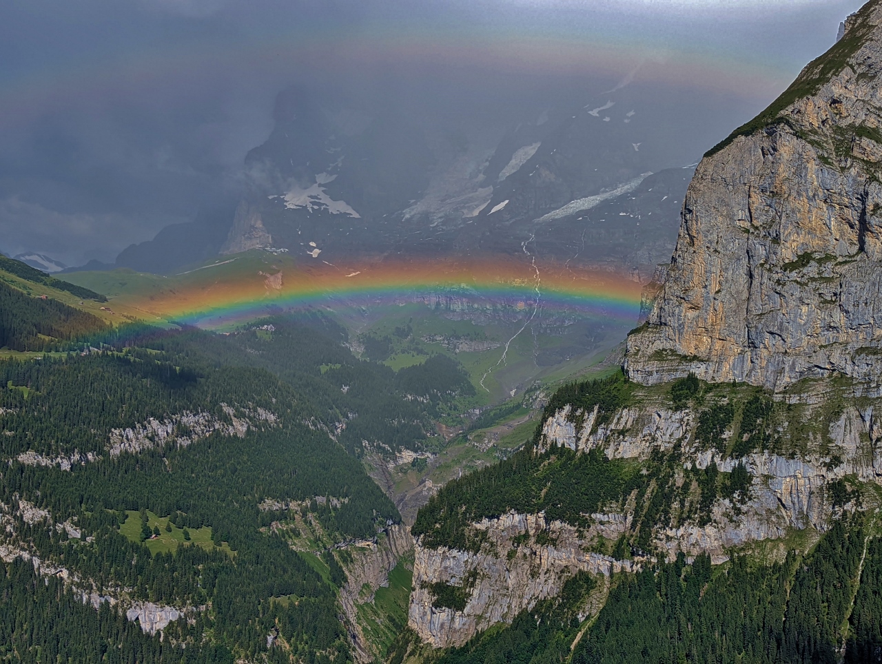 |
Double Rainbow
Position: 46°33.83’N, 7°53.80’E
A double rainbow viewed from our hotel room at the Hotel Eiger in Murren.
|
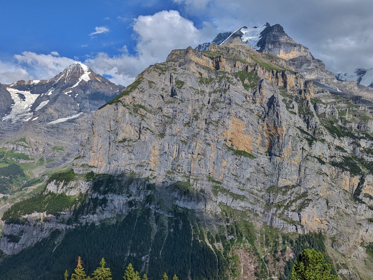 |
Schwarzmonch
Position: 46°33.82’N, 7°53.81’E
After the rainbow, the skies cleared and we got a fabulous view to 8690-ft (2,649 m) Schwarzmonch (German for “Black Monk”) rising up from the far side of the Lauterbrunnen Valley with the peak of 12,123 ft (3,695 m) Silberhorn visible behind at right. At left is 13,480 ft (4,110 m) Monch.
|
 |
Silberhorn
Position: 46°33.82’N, 7°53.81’E
The view from the Hotel Eiger in Murren to the glacier between 12,123-ft (3,695 m) Siberhorn (left) and 11,953 (3,643 m) Goldenhoren, with the peak of 8690-ft (2,649 m) Schwarzmonch partly visible in front.
|
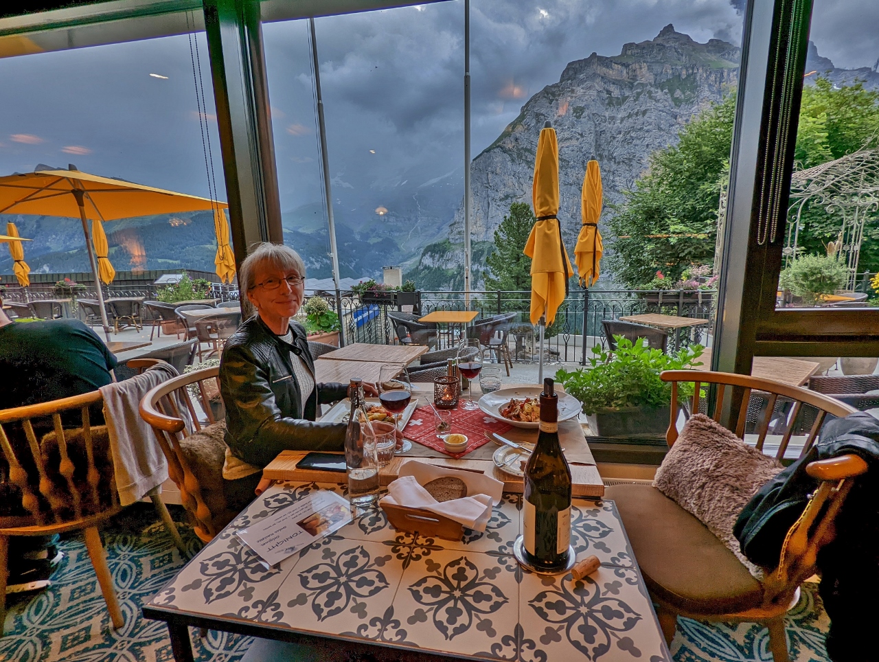 |
Hotel Eiger
Position: 46°33.82’N, 7°53.80’E
An excellent meal at the Hotel Eiger, where we are staying in Murren, with a view to 8690-ft (2,649 m) Schwarzmonch. The food in Murren, and all of Switzerland, has been top-quality.
|
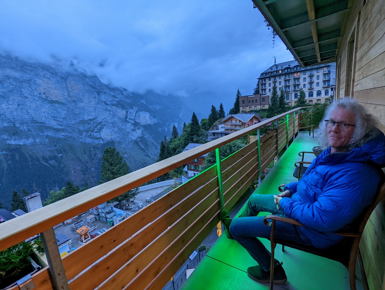 |
Evening View
Position: 46°33.82’N, 7°53.80’E
Enjoying the evening view from the deck of our room at the Hotel Eiger in Murren as clouds descend. The temperature has fallen, so we’re wearing our warmer coats outside tonight.
|
 |
Click the travel log icon on the left to see these locations on a map. And a map of our most recent log entries always is available at mvdirona.com/maps. |
If your comment doesn't show up right away, send us email and we'll dredge it out of the spam filter.