Eureka Peak, at elevation 5,521 ft (1,683 m), is the fourth highest in Joshua Tree National Park and the highest that is road accessible. From the end of the road, a short walk leads to the summit with sweeping views in all directions.
On our third and final day in Joshua Tree National Park, we drove up to Eureka Peak and had a picnic lunch with a view to Palm Springs and the San Jacinto Mountains. The drive up gave us another view to park’s diverse ecosystems—several mule deer were along the road, and the Joshua Trees were much larger than we’d seen elsewhere.
In the afternoon, we drove into Palm Springs to spend the first of three nights there before returning home to Seattle.
Below are highlights from May 29th, 2022. Click any image for a larger view, or click the position to view the location on a map. And a map with our most recent log entries always is available at mvdirona.com/maps.
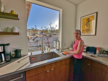 |
Kitchen
Position: 34°5.67’N, -116°17.30’W
Preparing fruit as part of breakfast on our final morning at Shelter: One. We really enjoyed the house and hope we can find more like it in other areas.
|
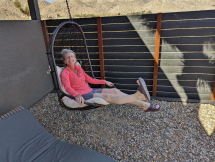 |
Swing
Position: 34°5.67’N, -116°17.30’W
We didn’t manage to try all the different outdoor seating options at Shelter: One, but did get to most of them.
|
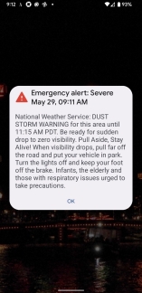 |
Dust Storm Warning
Position: 34°5.67’N, -116°17.30’W
Both our phones lit up with a dust storm warning while we were having breakfast. We don’t see a lot of those in Seattle :-).
|
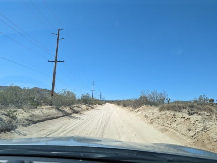 |
La Contenta Road
Position: 34°7.17’N, -116°22.22’W
Driving along sand-covered La Contenta Road en route to Eureka Peak, our last stop in Joshua Tree National Park.
|
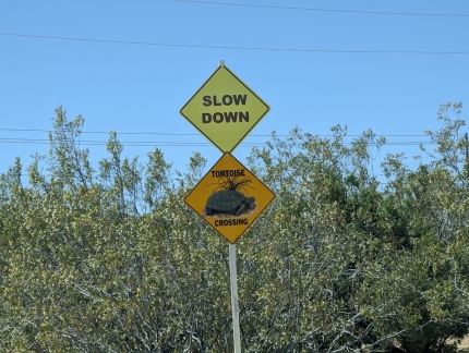 |
Tortoise Crossing
Position: 34°5.92’N, -116°22.22’W
A sign along La Contenta Road cautioning drivers to slow down and be alert for tortoises on the road. The destert tortoise is California’s state reptile and is considered a threatened species under the federal Endangered Species Act.
|
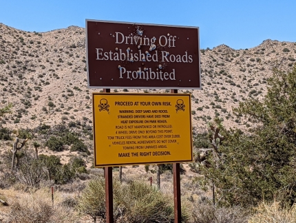 |
Warning
Position: 34°4.57’N, -116°21.16’W
Entering Joshua Tree National Park along Covingtion Flat Road. Although the sign warns of difficult road conditions, the road from here to Eureka Peak was in much better shape than the ones we traveled to reach this point. The hard part was already behind us.
|
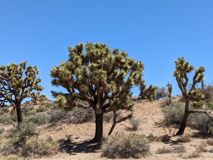 |
Joshua Trees
Position: 34°1.59’N, -116°20.02’W
Joshua Trees are prevalent along Eureka Peak Road, and much larger than we’d seen elsewhere in the park.
|
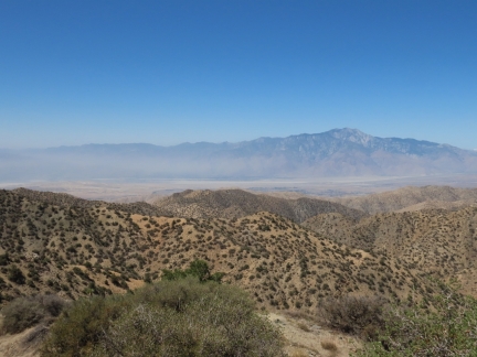 |
View to Palm Springs
Position: 34°1.83’N, -116°20.98’W
Fabulous view southwest to Palm Springs from the Eureka Peak parking lot. The mountain at right is 10,834 ft (3,302 m) San Jacinto Peak in Mount San Jacinto State Park. We’ll be taking the aerial tramway up to the park while we spend a few days in Palm Springs.
|
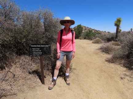 |
Trailhead
Position: 34°1.83’N, -116°20.98’W
Several trails lead from the Eureka Peak parking lot. We plan to walk a portion of the Eureka Peak trail to the Eureka Peak summit, visible in the background, and perhaps a little beyond.
|
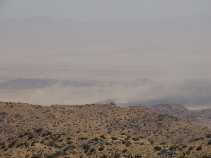 |
Dust Storm
Position: 34°1.87’N, -116°20.98’W
Looking east from the Eureka Peak trail, we could see the dust storm that we’d received warnings about this morning.
|
 |
Eureka Peak
Position: 34°1.93’N, -116°21.01’W
The views got better and better as we walked the Eureka Peak trail and reached the summit of Eureka Peak. This is the panoramic view from west to east, with north at center. San Jacinto Peak and Palm Springs are left (west), the Rodman Mountains Wilderness Area is at center (north) and the town of Yucca Valley, where we had dinner last night, is on the right.
|
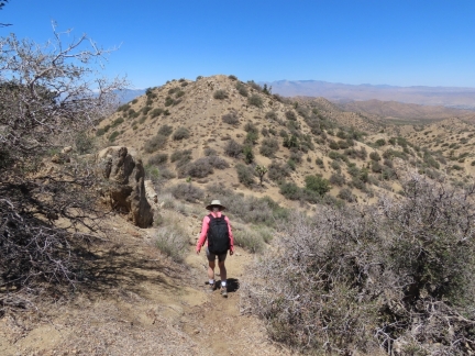 |
Descending
Position: 34°1.94’N, -116°21.05’W
Descending a dip in the Eureka Peak trail near the intersection with the Bigfoot Trail. We quite enjoyed the walk and the interesting terrain.
|
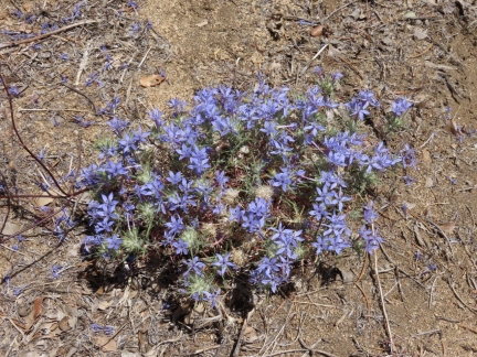 |
Woollystar
Position: 34°1.95’N, -116°21.06’W
Giant Woollystar, a member of the Phlox family, growing along the Eureka Peak trail.
|
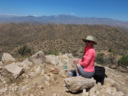 |
Lunch
Position: 34°1.96’N, -116°21.24’W
Lunch with a view along the Eureka Peak trail.
|
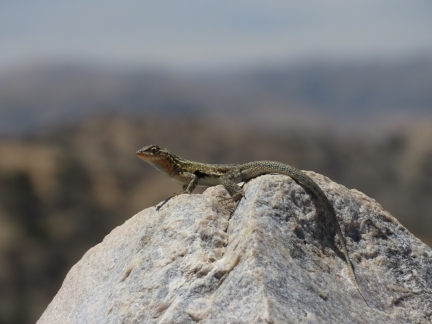 |
Side-Blotched Lizard
Position: 34°1.96’N, -116°21.24’W
A Desert Side-Blotched Lizard sunning on the rocks while we had lunch. The short-lived lizard has a lifespan of roughly a year.
|
 |
Mojave Mound Cactus
Position: 34°1.96’N, -116°21.24’W
Mojave Mound Cactus about ready to bloom along the Eureka Peak trail.
|
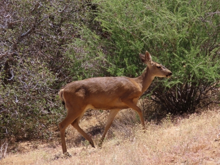 |
Mule Deer
Position: 34°1.83’N, -116°20.97’W
A mule deer, with it’s distinctive large mule-like ears and black tail tip, along the road as we descend by car from Eureka Peak.
|
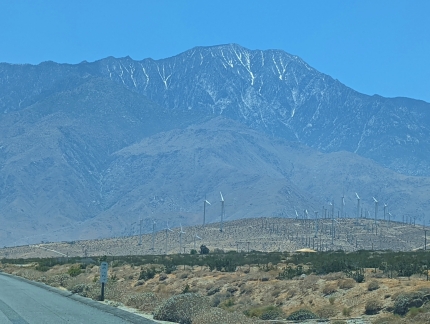 |
San Jacinto Peak
Position: 33°57.30’N, -116°35.57’W
Great view across the San Gorgonio Pass wind farm to 10,834 ft (3,302 m) San Jacinto Peak as we drive into Palm Springs along Salton View Road.
|
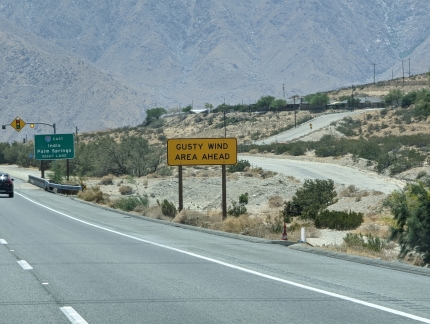 |
Gusty Wind Area
Position: 33°56.41’N, -116°35.80’W
It’s clear why San Gorgonio Pass is a good place for a wind farm. Strong gusts buffeted the car shortly after we passed these wind warning signs.
|
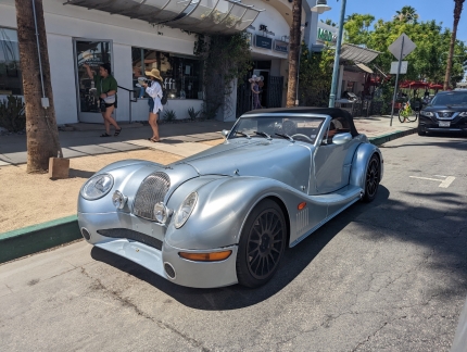 |
Morgan
Position: 33°49.87’N, -116°32.81’W
A Morgan Aero 8 parked along North Palm Canyon Drive as we approach our hotel in Palm Springs.
|
 |
Portraits
Position: 33°49.55’N, -116°32.84’W
Eye-catching celebrity portraits on the wall at the Hyatt Palm Springs.
|
 |
Il Corso
Position: 33°49.41’N, -116°32.84’W
A great meal on the terrace at Il Corso in Palm Springs.
|
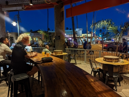 |
La Quinta Brewing Co
Position: 33°49.61’N, -116°32.82’W
Taking in the street action while enjoying the cooler evening temperatures at La Quinta Brewing Co in Palm Springs.
|
 |
Click the travel log icon on the left to see these locations on a map. And a map of our most recent log entries always is available at mvdirona.com/maps. |

This makes me a little homesick for California and its diverse geography. Way back when I played in a honky tonk band at Pappy and Harriet’s/Pioneer Town, near Joshua Tree. I remember loading out under a star filled sky. Good times.
Sounds wonderful. The clear desert sky is wonderful as night sets in and temperatures cool off.
Love the blog – FYI the car is a Morgan Aero 8, not a Bentley
Got the country right at least! :)
I’ve worked on Morgan’s in the past but never one that looked to be built in this century :-). The Aero looks great. Thanks for identifying the car.