Gripnesvagen is a beautiful, nearly land-locked anchorage at the north end of Tysnes with a great view to the islands’s highest point, 2467-ft (752m) Tysnessata. From the east side of Tysnes we cruised through the narrow and scenic channel Lukksund to spend two nights at Gripnesvagen, where we toured the area by tender, hiked up Tysnessata on a clear and sunny morning, and enjoyed the idyllic anchorage.
Below are highlights from Aug 18th to 20th, 2020. Click any image for a larger view, or click the position to view the location on a map. And a live map of our current route and most recent log entries always is available at mvdirona.com/maps.
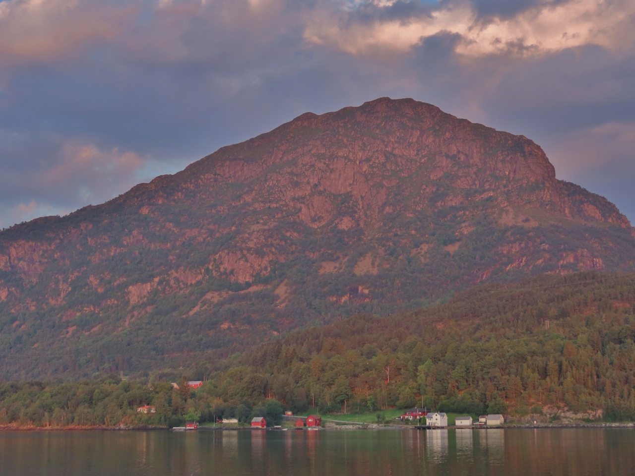 |
Hovlandsnuten
Position: 60°1.33’N, 5°42.92’E
A final view to 2,385ft (727m) Hovlandsnuten, the backdrop for our anchorage of the past three nights at the island Sandsoya off Tysnes.
|
 |
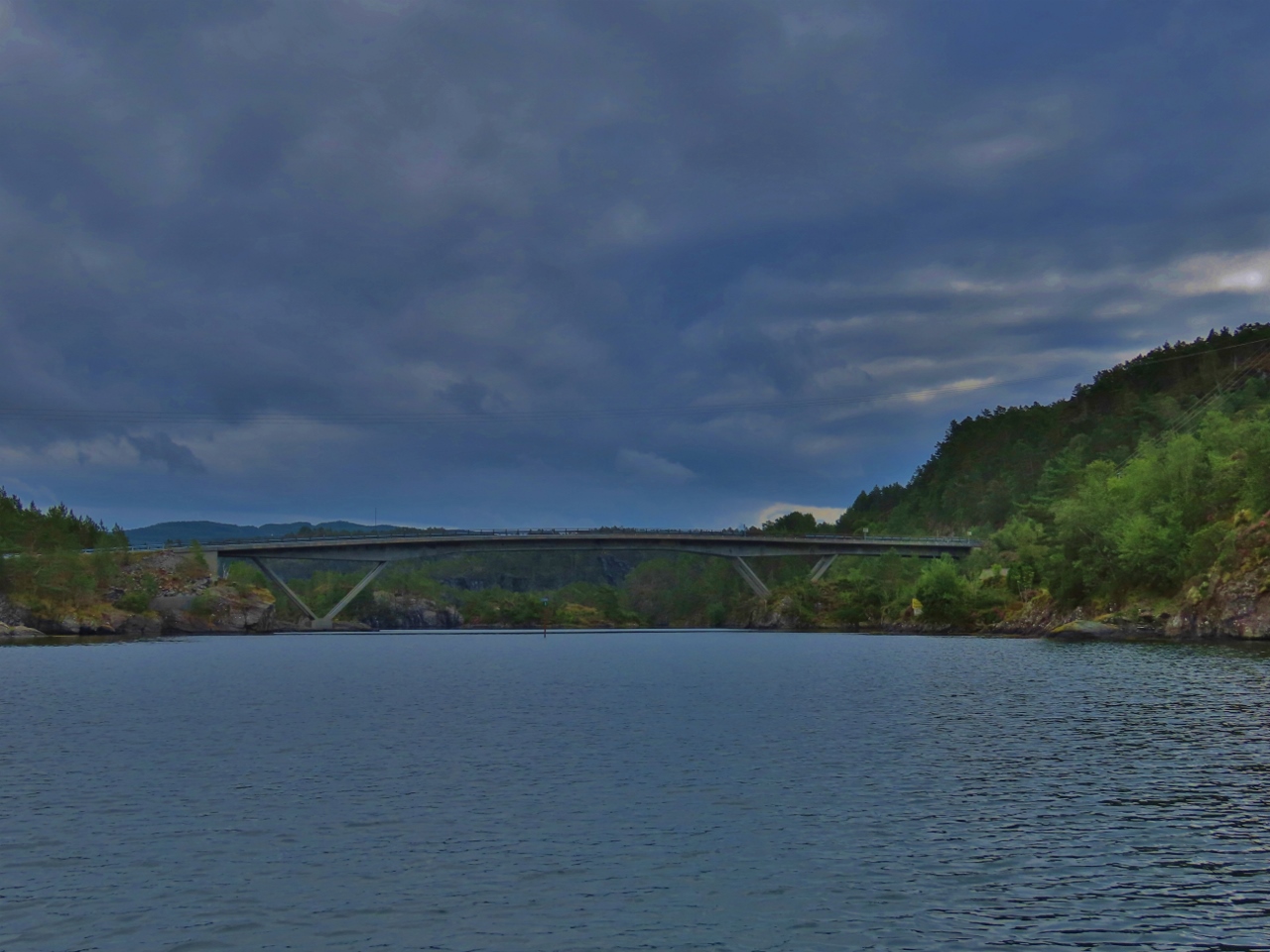
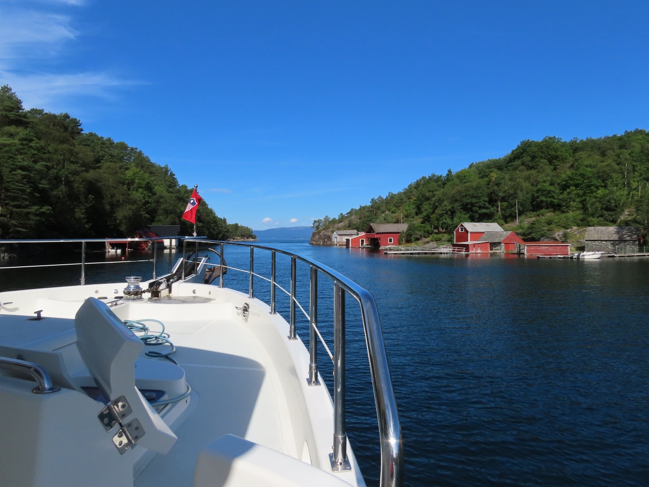
Lukksund
Position: 60°2.84’N, 5°42.35’E
Heading north under the bridge across the narrow and scenic channel Lukksund. We passed through here in 2018 on our way south from Bergen towards Stavanger.
|
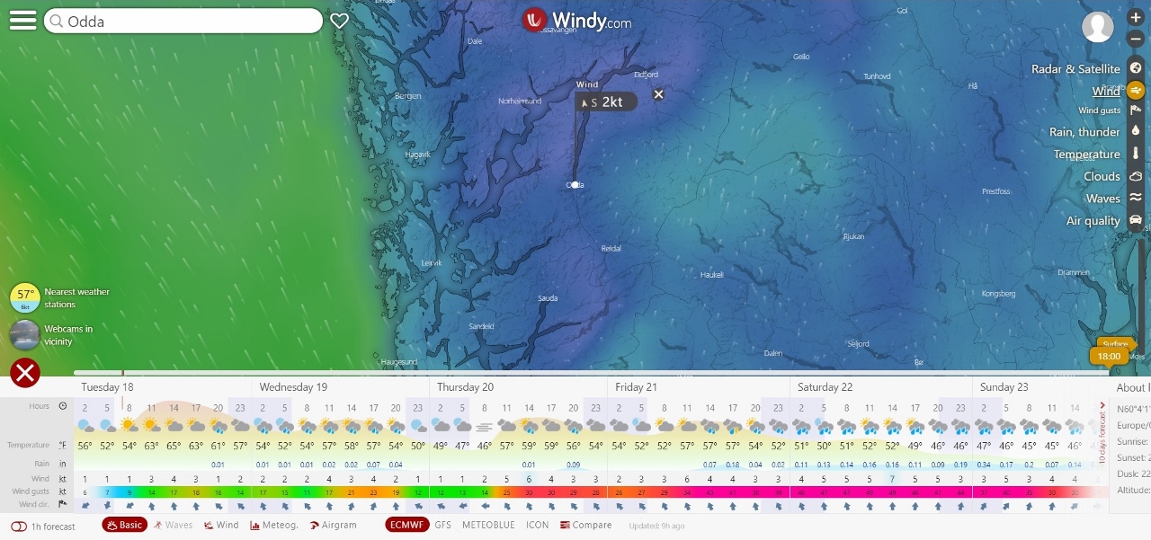 |
Odda Weather
Position: 60°3.75’N, 5°42.32’E
We eventually plan to spend some time in Odda at the end of Hardangerfjord to do several hikes, including to the famous Trolltunga. But the weather isn’t looking great for the next week, so we’ll spend some time nearer to the mouth of the fjord until the outlook improves.
|
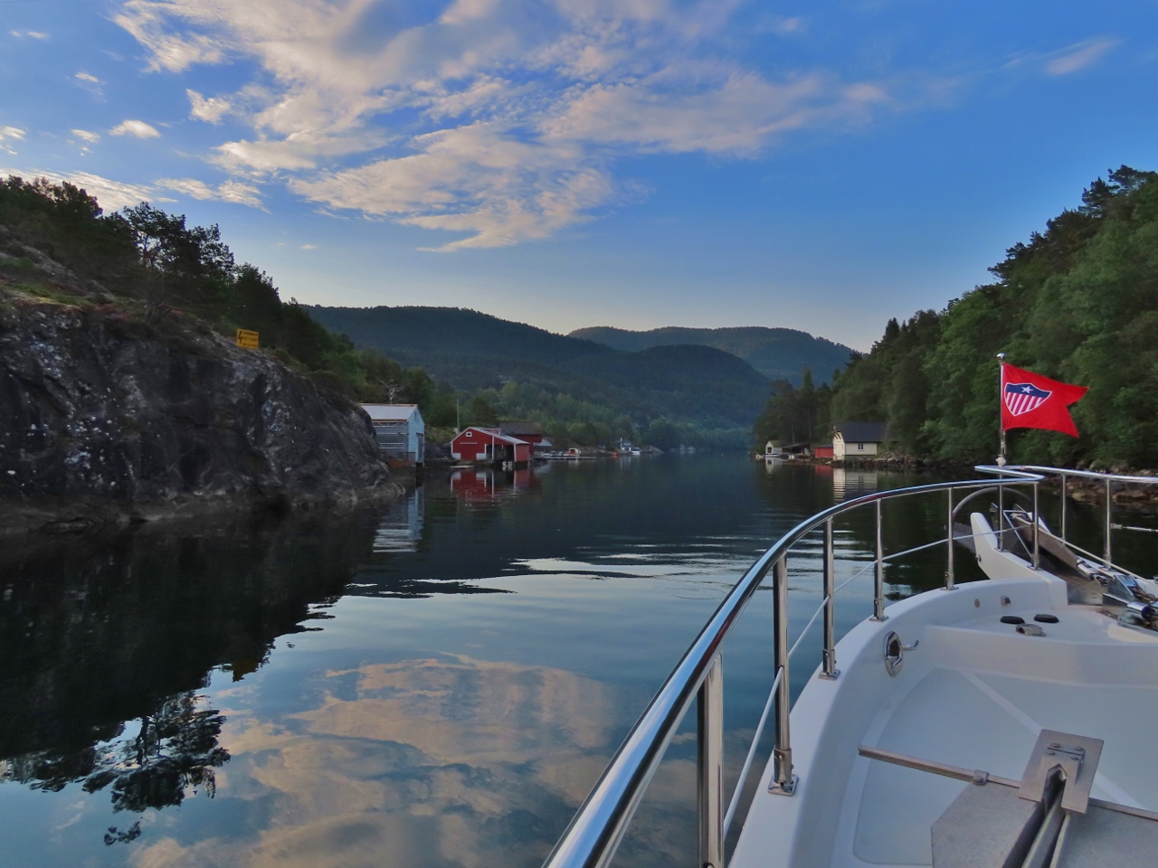 |
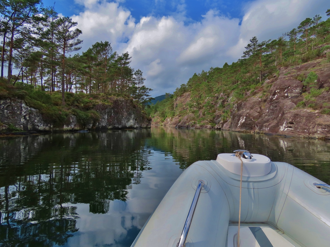
Synninga
Position: 60°4.39’N, 5°39.64’E
Running the intimate channel Synninga into our intended anchorage of Gripnesvagen at the north end of the island of Tysnes.
|
 |
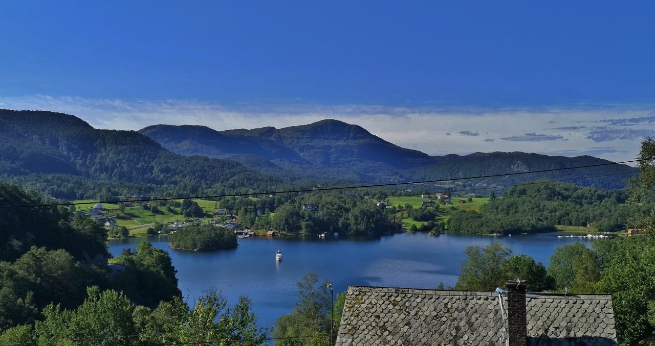
Gripnesvagen
Position: 60°4.09’N, 5°39.89’E
Looking west from the beautiful anchorage at sheltered Gripnesvagen on an ultra-calm morning.
|
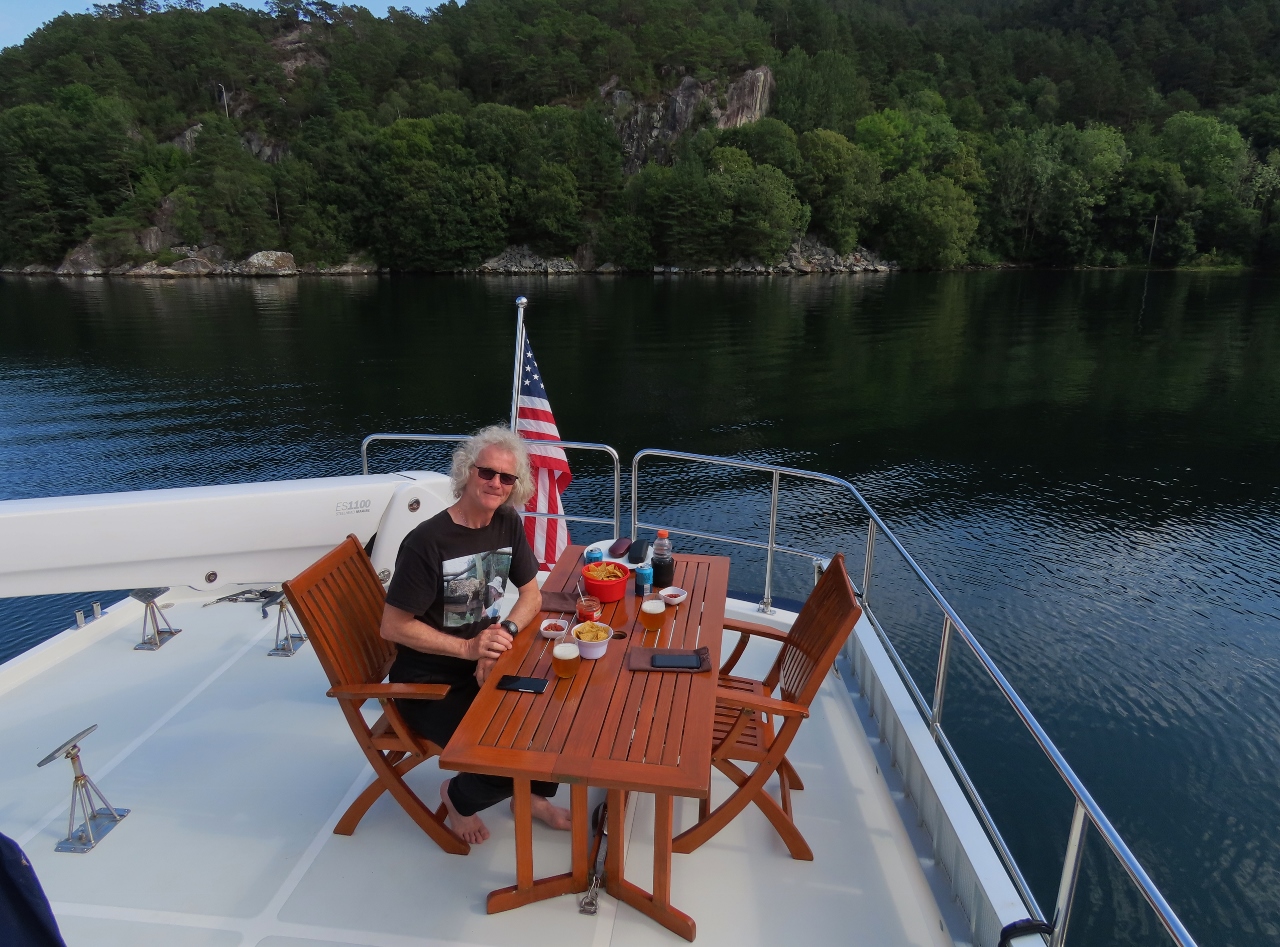 |
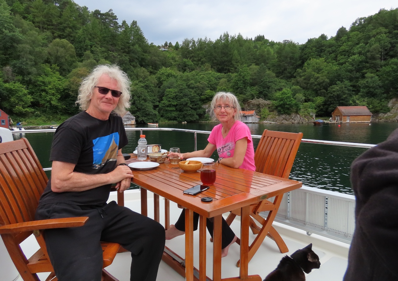
Boat Deck
Position: 60°4.04’N, 5°39.89’E
We’ve not used the boat deck table for ages, so decided to put it into use again to have lunch up top in the warm weather with a great all-around view to the anchorage.
|
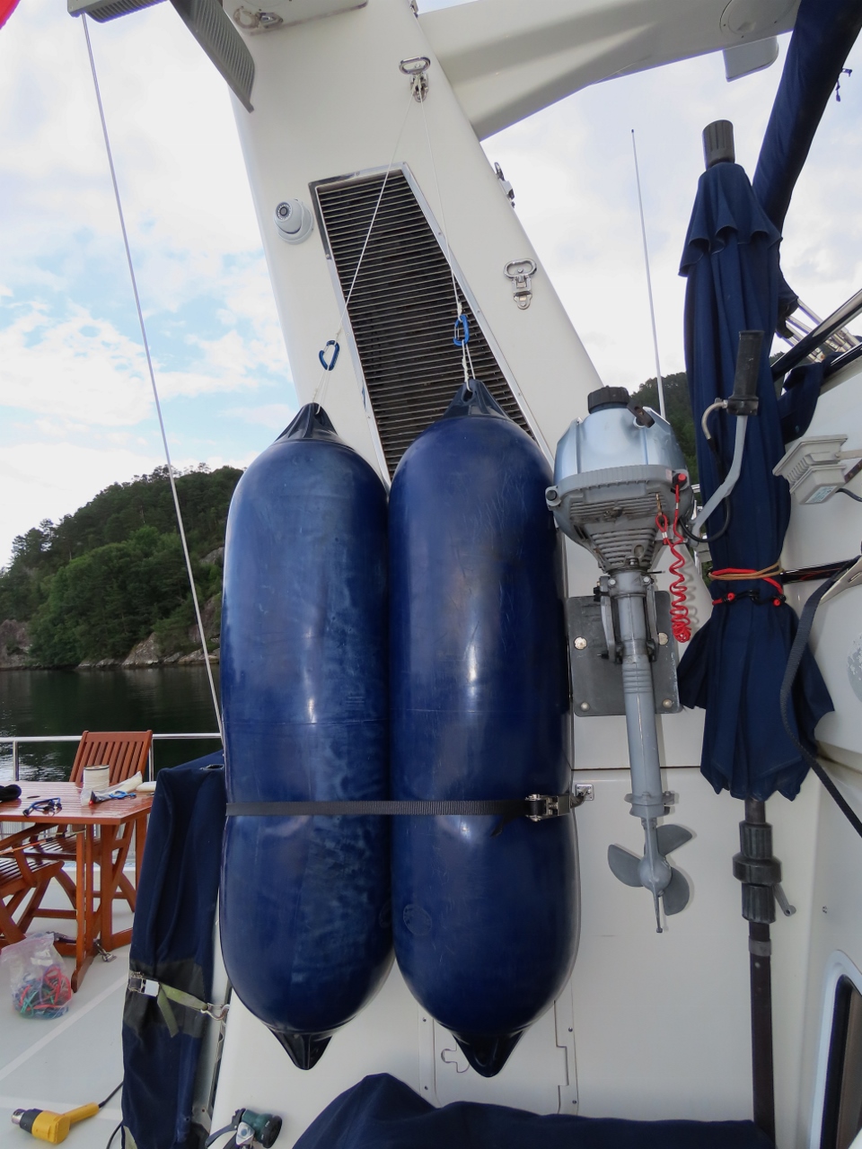 |
Hanging Fenders
Position: 60°4.04’N, 5°39.88’E
We like the stack-side storage location for our two large Polyform fenders, but find it a bit of a job to wrestle them into place and attach a ratchet strap. So we devised a hanging system for them where we clip each fender to a carabiner suspended from a fold-down stack step. This makes them much easier to manage, and lifting them gives a little more space for working around the tender.
|
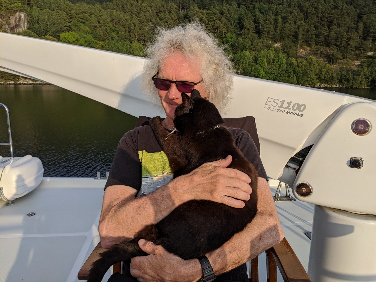 |
Spitfire
Position: 60°4.04’N, 5°39.87’E
Spitfire is a bit of a mimic and has learned to hug back with his paws around James’ neck.
|
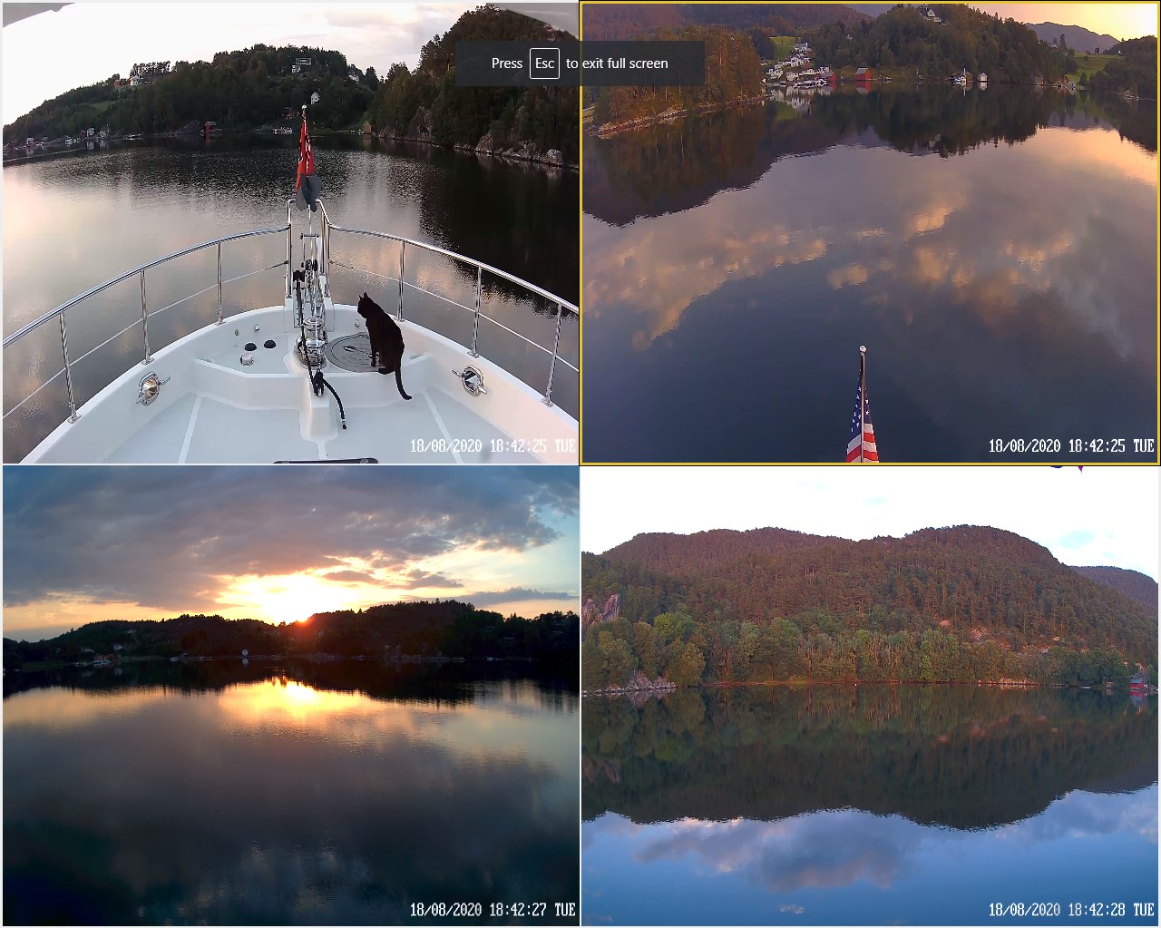 |
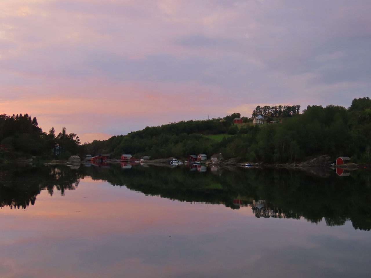
Evening Calm
Position: 60°4.04’N, 5°39.87’E
Evening calm in the anchorage at Gripnesvagen (clockwise from top left: forward, aft, starboard and port).
|
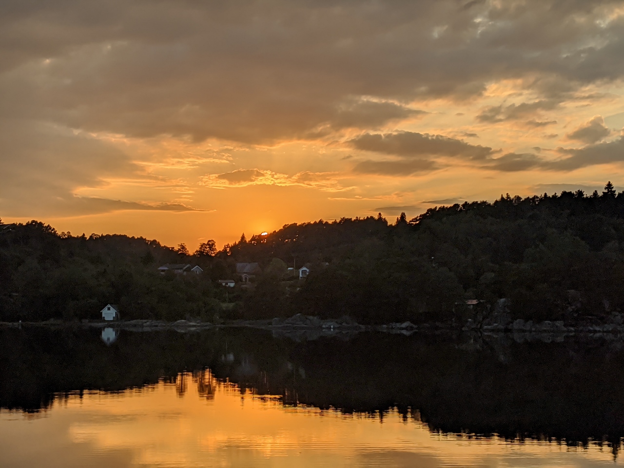 |
Sunset
Position: 60°4.04’N, 5°39.87’E
Spectacular orange sunset at Gripnesvagen.
|
 |
Grunnesund Bridge
Position: 60°4.22’N, 5°45.29’E
About to pass under the Grunnesund Bridge on a tender tour of Lygrespollen.
|
 |
Sundvor
Position: 60°4.13’N, 5°45.57’E
A few houses in the town of Sundvor on the north shore of Lygrespollen, reflected into still waters.
|
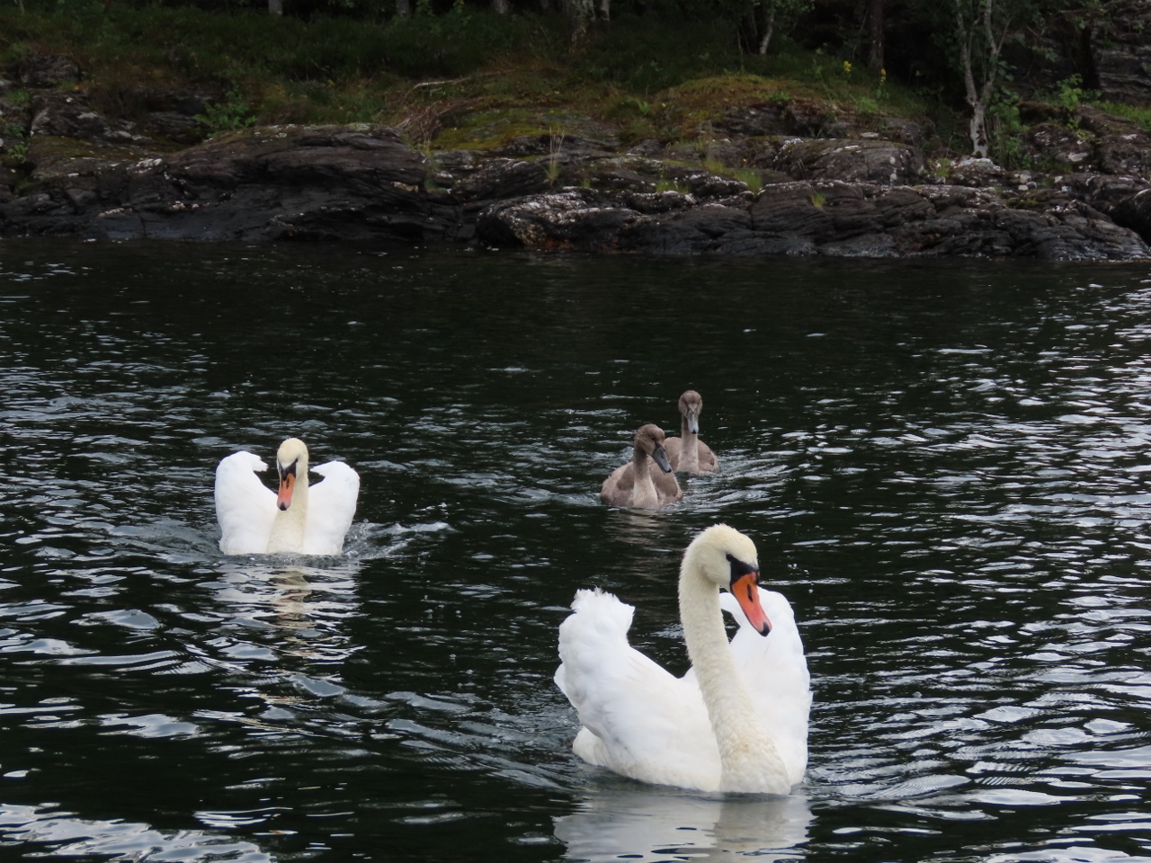 |
Swans
Position: 60°3.89’N, 5°48.65’E
As we passed these swans, they swam towards us with wings lifted threateningly and chased us surprisingly quickly. We suspect they don’t want us near their nest or perhaps young.
|
 |
Reflection
Position: 60°5.50’N, 5°50.00’E
Near-perfect reflections in the ultra-calm head of Lygrespollen.
|
 |
Munkholmen
Position: 60°4.69’N, 5°48.56’E
Running the tender through the narrow and shallow channel between the island of Munkholmen and the mainland.
|
 |
Sundvor Church
Position: 60°4.20’N, 5°45.39’E
Sundvor Church, at the mouth of Lygrespollen, was bult in 1927.
|
 |
Dusk
Position: 60°4.04’N, 5°39.89’E
Dusk in the calm and sheltered anchorage at Gripnesvagen. The winds have been unusually calm for the past few days.
|
 |
Humlevik
Position: 60°3.19’N, 5°37.61’E
The tender tied off at Humlevik for an early-morning hike up Tysnessata. We’re taking advantage of the clear weather forecast for the view hike, as we expect cloudy skies this afternoon.
|
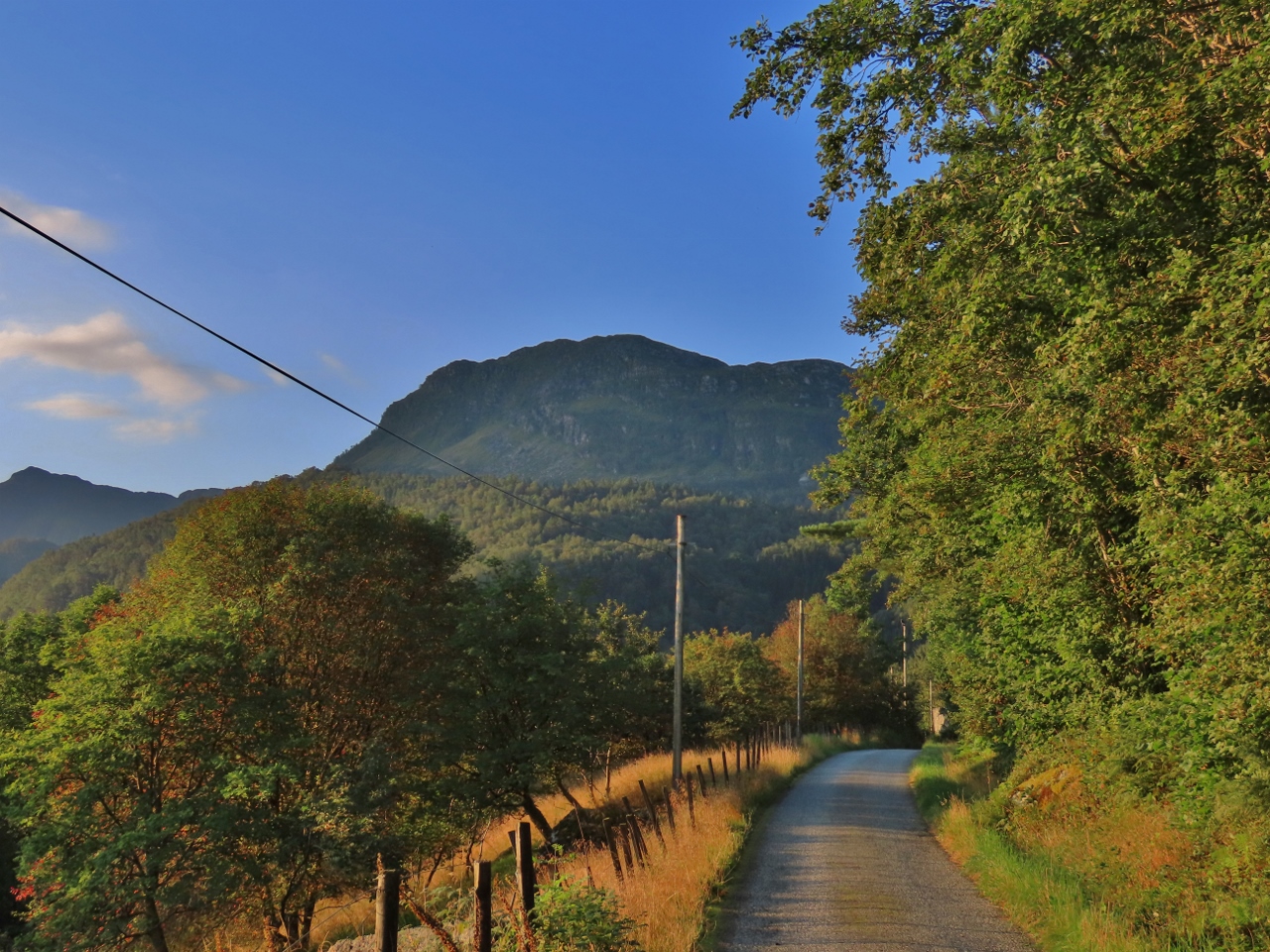 |
Destination
Position: 60°2.95’N, 5°37.30’E
Our destination, 2467-ft (752m) Tysnessata, from partway to the trailhead.
|
 |
Trailhead
Position: 60°1.96’N, 5°37.15’E
At the Tysnessata trailhead, about half-hour’s walk from the tender, with a 753 ft (229 m) altitude gain.
|
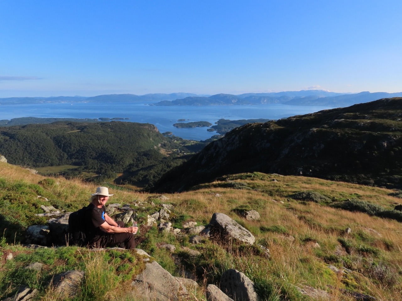 |
Break
Position: 60°1.62’N, 5°37.56’E
Taking a break and enjoying the view from 1732 ft (528 m), about halfway to the top of 2467-ft (752m) Tysnessata from the trailhead. The trail is short at only 1.1 miles (1.9km), but steep, with an average grade of 28%.
|
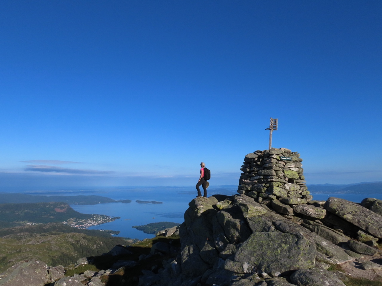 |
Tysnessata Summit
Position: 60°1.60’N, 5°36.89’E
Enjoying the spectacular view from the summit of 2467-ft (752m) Tysnessata. We reached the summit about an hour from the trailhead and 1.5 hours from the tender.
|
 |
Tysnessata View
Position: 60°1.60’N, 5°36.88’E
The sweeping panoramic view from the summit of 2467-ft (752m) Tysnessata (click image for a larger view). Longtime blog reader and Bergen resident Tronde Saetre, who has been giving us lots of excellent local travel advice, recommended the hike and we really enjoyed it.
|
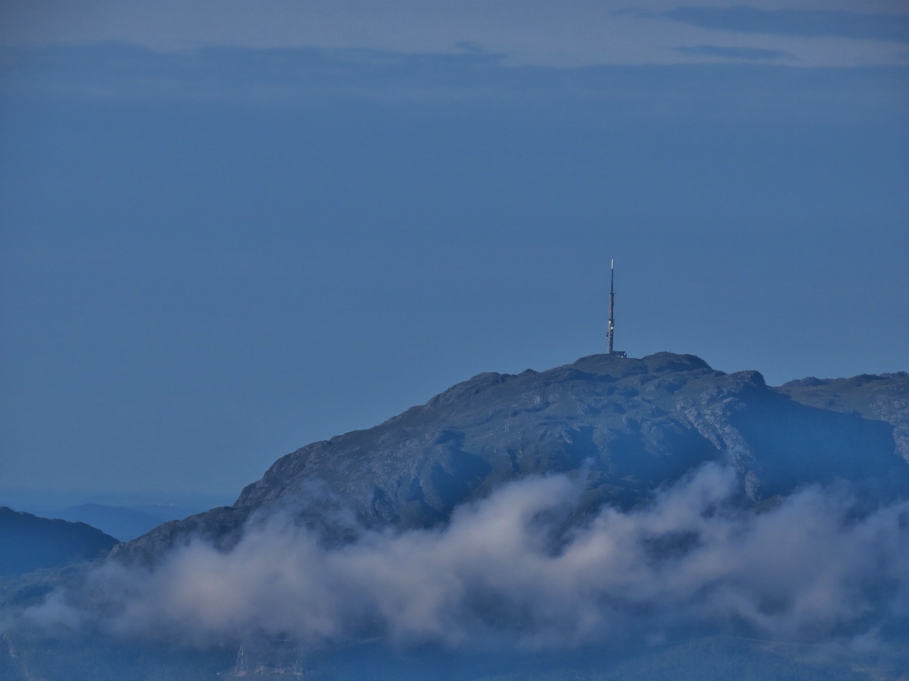 |
Kattnakken
Position: 60°1.60’N, 5°36.88’E
Looking west from the summit of Tysnessata to the TV tower on 2,375ft (724m) Kattnakken, that we hiked up ten days ago.
|
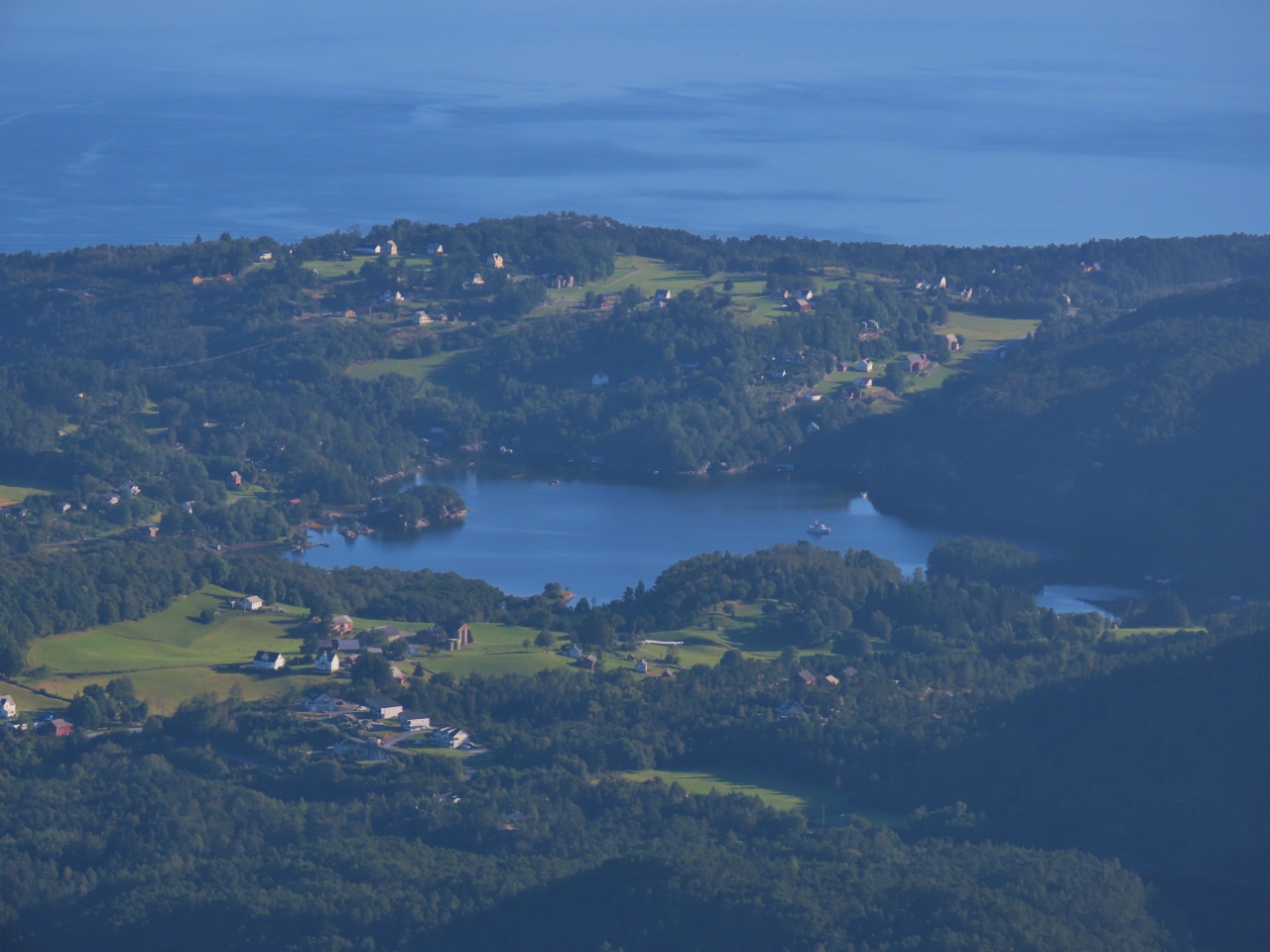 |
Gripnesvagen
Position: 60°1.60’N, 5°36.88’E
View from the summit of Tysnessata to Dirona anchored at Gripnesvagen.
|
 |
Bjornafjorden
Position: 60°1.61’N, 5°36.88’E
Bjornafjorden, north of Tysnes, viewed from the summit of Tysnessata.
|
 |
View Cabin
Position: 60°4.35’N, 5°38.45’E
Beautiful summer cabin with 270° views on Koloya as we pass through Koloysundet on the way back to Dirona.
|
 |
Dirona
Position: 60°1.10’N, 5°25.78’E
Irene Johansen sent us this picture taken from their porch of Dirona anchored in Gripnesvagen with Tysnessata visible in the distance.
|
 |
Synninga
Position: 60°4.23’N, 5°39.82’E
Returning back out through Synninga from the anchorage at Gripnesvagen. We’d really enjoyed our stay there, but other adventures beckon.
|
 |
Ersvaervagen
Position: 60°1.11’N, 5°25.76’E
Lunch on the “newly-reopened” boat deck in the anchorage at Ersvaervagen.
|
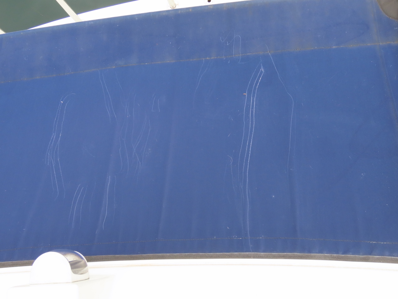 |
Boo-Boo
Position: 60°1.12’N, 5°25.76’E
While we were having lunch, Spitfire was roaming around on the boat deck. We heard him yowl and rushed over just as he pulled himself back up onto the boat deck from the eyebrow bimini. You can see the widely-spaced claw marks where he’d tried to stop his slide. We’re lucky he didn’t fall all the way.
|
 |
Click the travel log icon on the left to see these locations on a map, with the complete log of our cruise.
On the map page, clicking on a camera or text icon will display a picture and/or log entry for that location, and clicking on the smaller icons along the route will display latitude, longitude and other navigation data for that location. And a live map of our current route and most recent log entries always is available at mvdirona.com/maps. |
If your comment doesn't show up right away, send us email and we'll dredge it out of the spam filter.