Even in the Netherlands, a country of cyclists, the island of Terschelling is known for its extensive and diverse bicycle paths. It was a great landfall for us after the 160-mile run across the German Bight from Cuxhaven, Germany. After a fresh seafood lunch in town, we set of on an afternoon bicycle trip that took as past mudflats along the only natural bay in the Netherlands, through a cafe-filled town, to soft-sand beaches along the exposed north shore of the island, and along a wooded lane lined with fall leaves. We capped off the trip with a drink in a cozy locals’ pub back in West- Terschelling.
Below are trip highlights from October 28th on Terschelling in the Netherlands. Click any image for a larger view, or click the position to view the location on a map. And a live map of our current route and most recent log entries always is available at mvdirona.com/maps
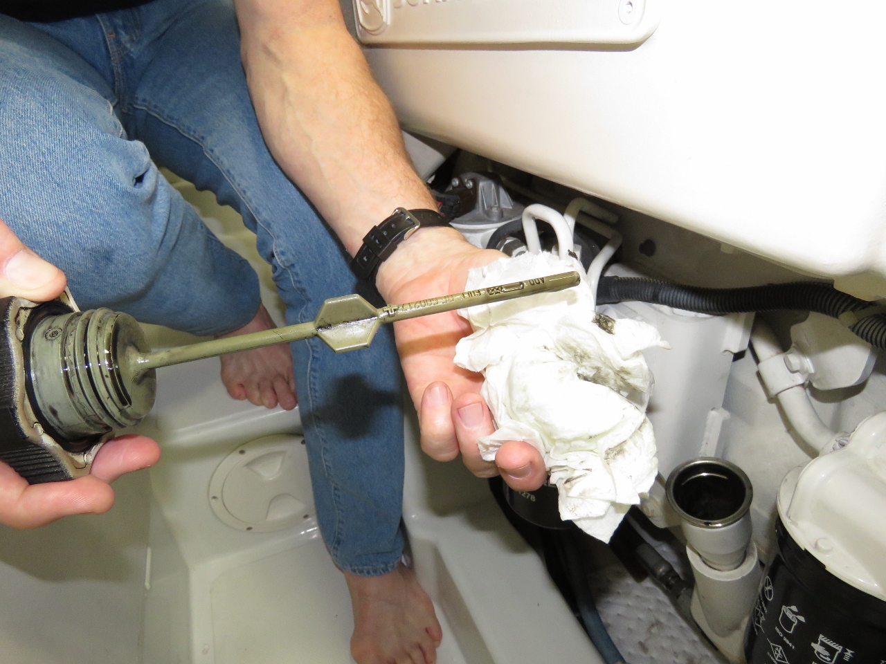 |
Clean Oil
Position: 53°21.90’N, 5°13.54’E
We are back on 10 ppm sulfur diesel and, as we were speculating might happen, the oil has again cleaned up. Some background: our Deere 6068AFM75 has always turned the oil black just about instantly. We went for a year on 10 ppm sulfur fuel and the oil seemed to be staying much cleaner. In this picture, we have 19 hours on the oil and it’s still quite clean. It’s highly unlikely that a 10,000 hour engine is going to suddenly improve and we’re using the same oil quality. The only factor we can think of is low sulfur fuel is much easier on the oil.
|
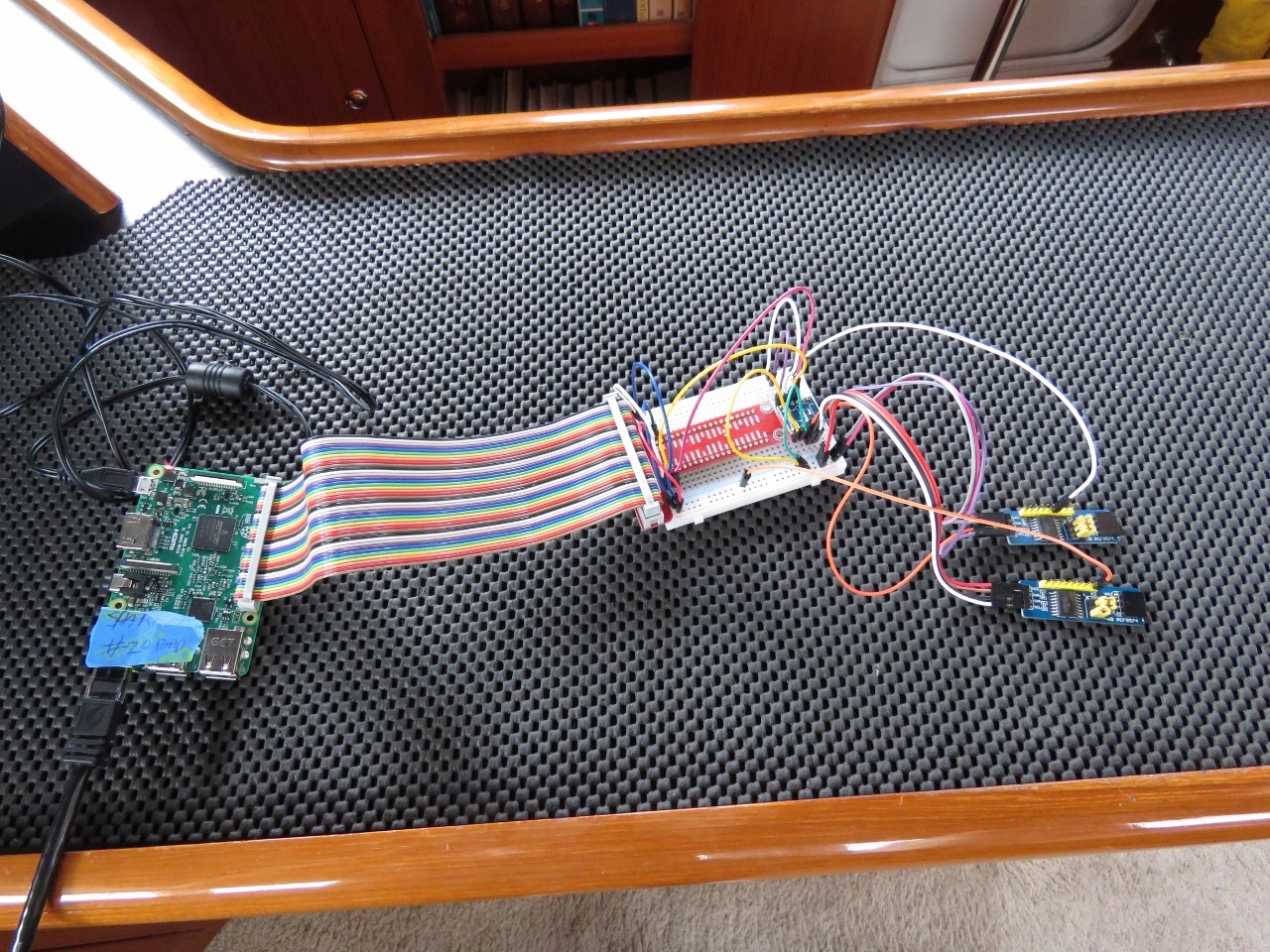 |
I2C
Position: 53°21.90’N, 5°13.54’E
We make such extensive use of the 5 Raspberry Pi’s we have in use on Dirona that we have run out of digital I/O pins on a couple. We have some work that will require another 16 pins of digital input (detecting off and on state of various switches and equipment on the boat). So the plan is to use two PCF8574 chips to get 16 more I/O pins. Each PCF8574 is controlled by a I2C bus and each chip provides 8 digital I/O pins. Using 2 PCF8574s we get 16 more pins controlled by a single 4 wire I2C bus. And up to 8 PCF8574s can be driven by the single I2C bus that provides 5v+, 5v-, SDA, and SCL signaling. It’s a nice, simple way to get a lot more dgital input and output.
|
 |
Buoys
Position: 53°21.88’N, 5°13.25’E
Navigation buoys of many shapes, sizes and colours ashore at West-Terschelling.
|
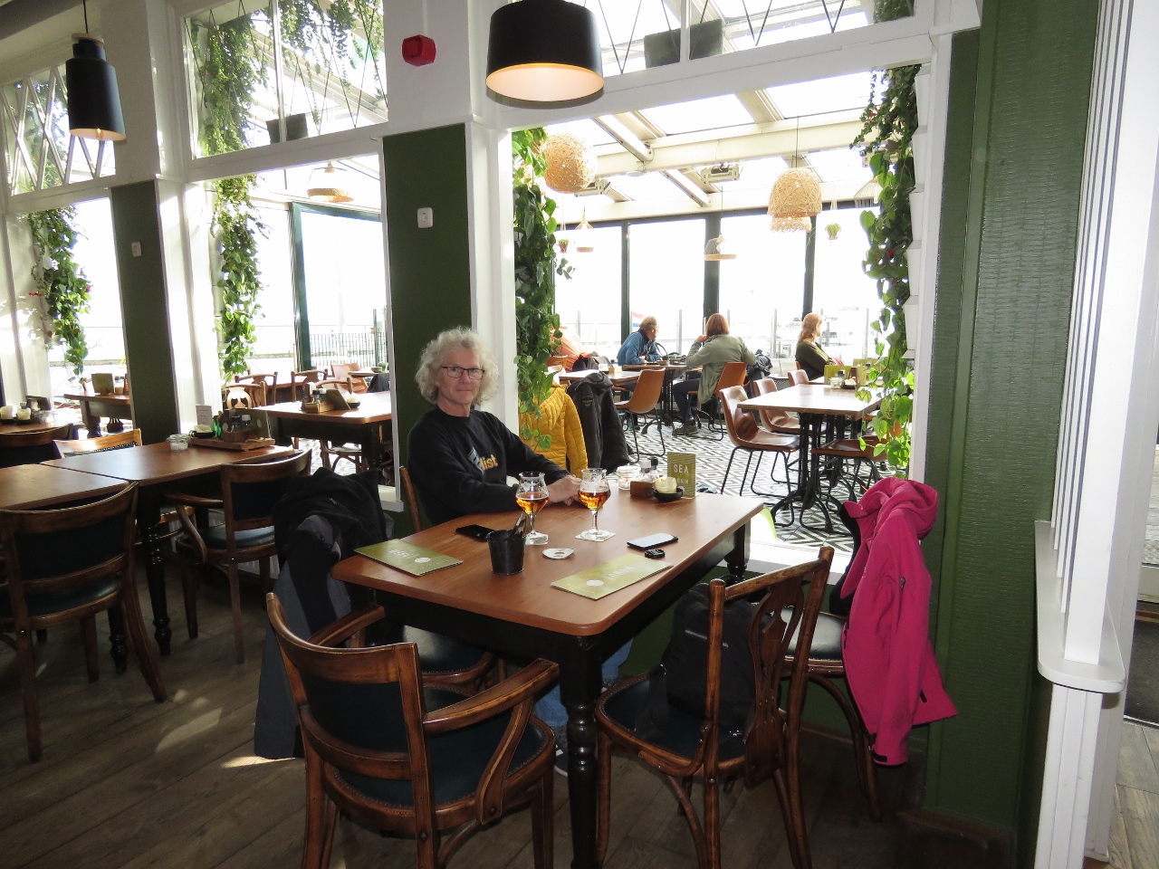 |
Grand Cafe Zeezicht
Position: 53°21.53’N, 5°12.97’E
Enjoying the light-filled Grand Cafe Zeezicht with a view to the harbour. We had a delicious fresh seafood lunch.
|
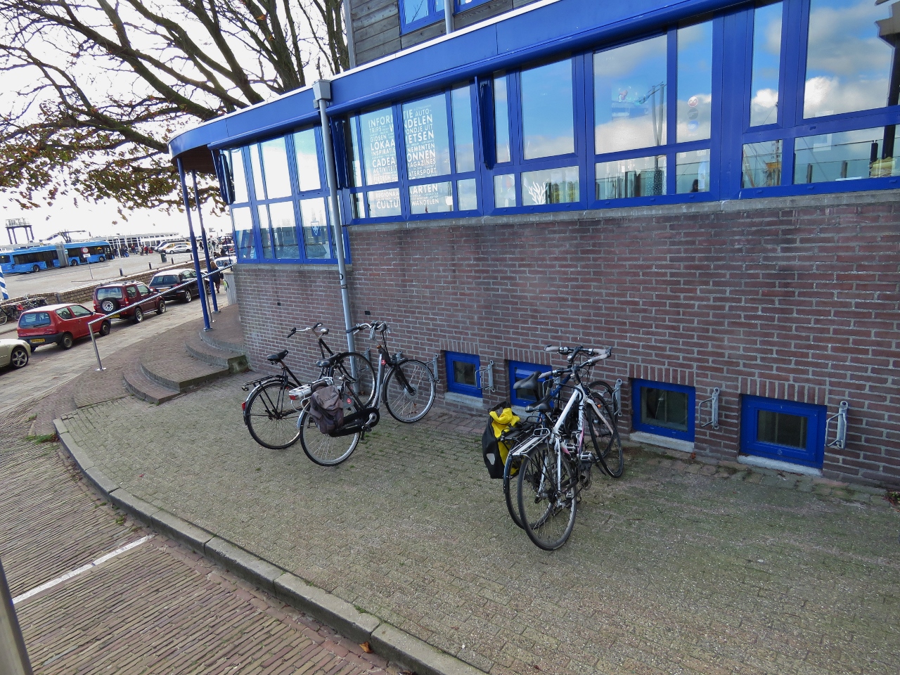 |
Bikes
Position: 53°21.88’N, 5°13.25’E
Our Giant FCR2 hybrid bikes locked outside Grand Cafe Zeezicht at right, with two traditional sturdy Dutch bikes on the left. We’ve not been used the bikes for a month or so—it was great to be out riding again.
|
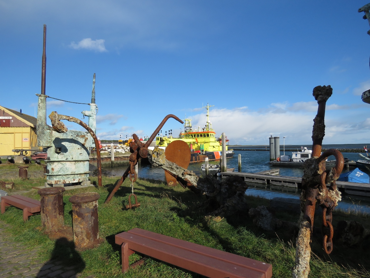 |
Salvaged
Position: 53°21.70’N, 5°13.07’E
Salvaged items along the West-Terschelling waterfront. Leftmost is a submarine conning tower.
|
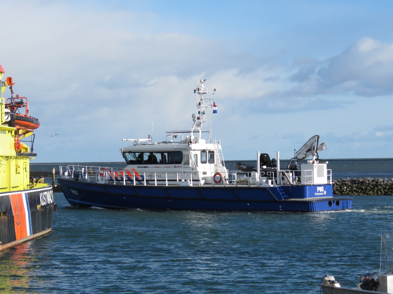 |
Politie
Position: 53°21.73’N, 5°13.07’E
The capable-looking Politie patrol vessel P85 underway at West-Terschelling. The boat has a shallow draft of only 4.7ft (1.45m) to reach almost anywhere in the IJsselmeer, its patrol area. And it can get there quickly, with a top speed of 47 kts, powered by two 875 HP main engines.
|
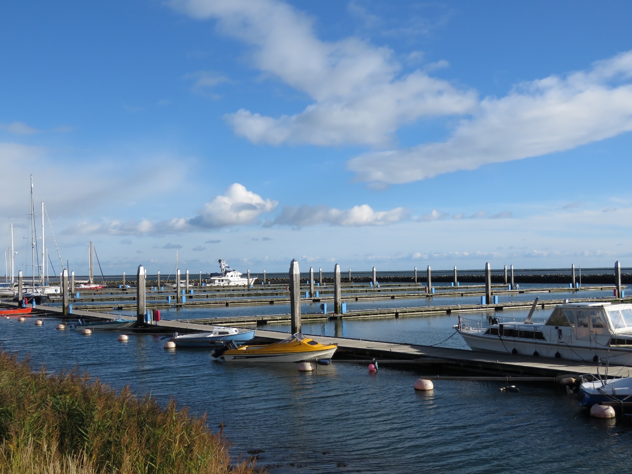 |
Empty Marina
Position: 53°21.95’N, 5°13.41’E
By the time we’d finished lunch and the regatta had departed and marina was almost empty again.
|
 |
Dellewal
Position: 53°21.99’N, 5°14.44’E
Looking across the flats at the edge of Dellewal, the only natural bay in The Netherlands.
|
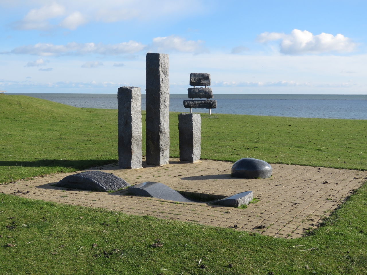 |
Images from the Sea
Position: 53°21.95’N, 5°14.60’E
A portion of the “Images from the Sea” sculpture park along the Dellewal. The sculptures, inspired by nautical elements such as a wave, sail and bollard, were carved from 22 Norwegian labrador granite stones salvaged from Swedish steamship Otto. The ship sunk off Terschelling in 1903 en route to Manchester, UK.
|
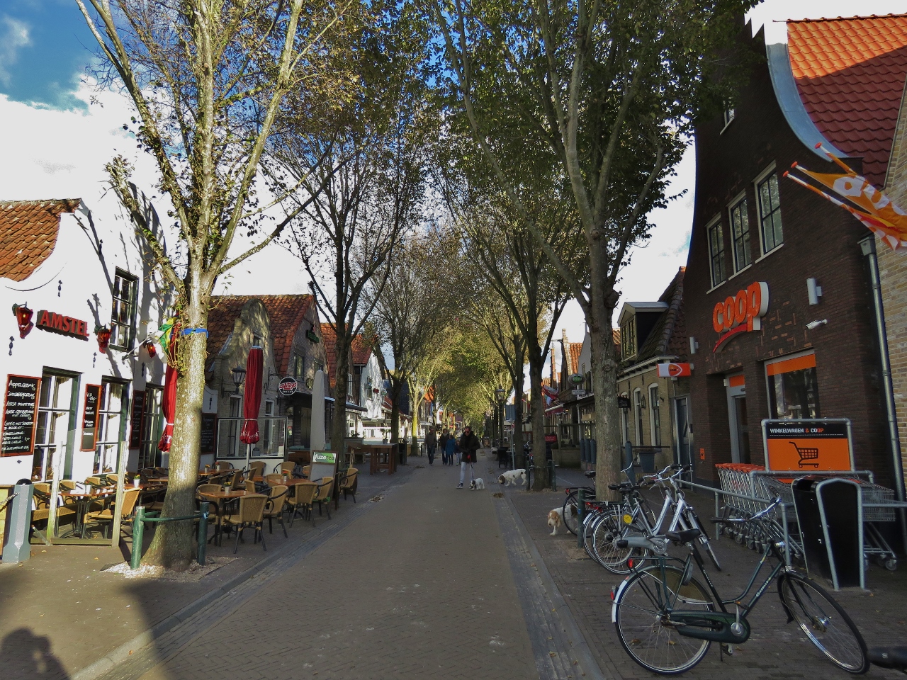 |
Midsland
Position: 53°23.01’N, 5°17.08’E
A cafe-lined street in Midsland, the second-largest town on Terschelling.
|
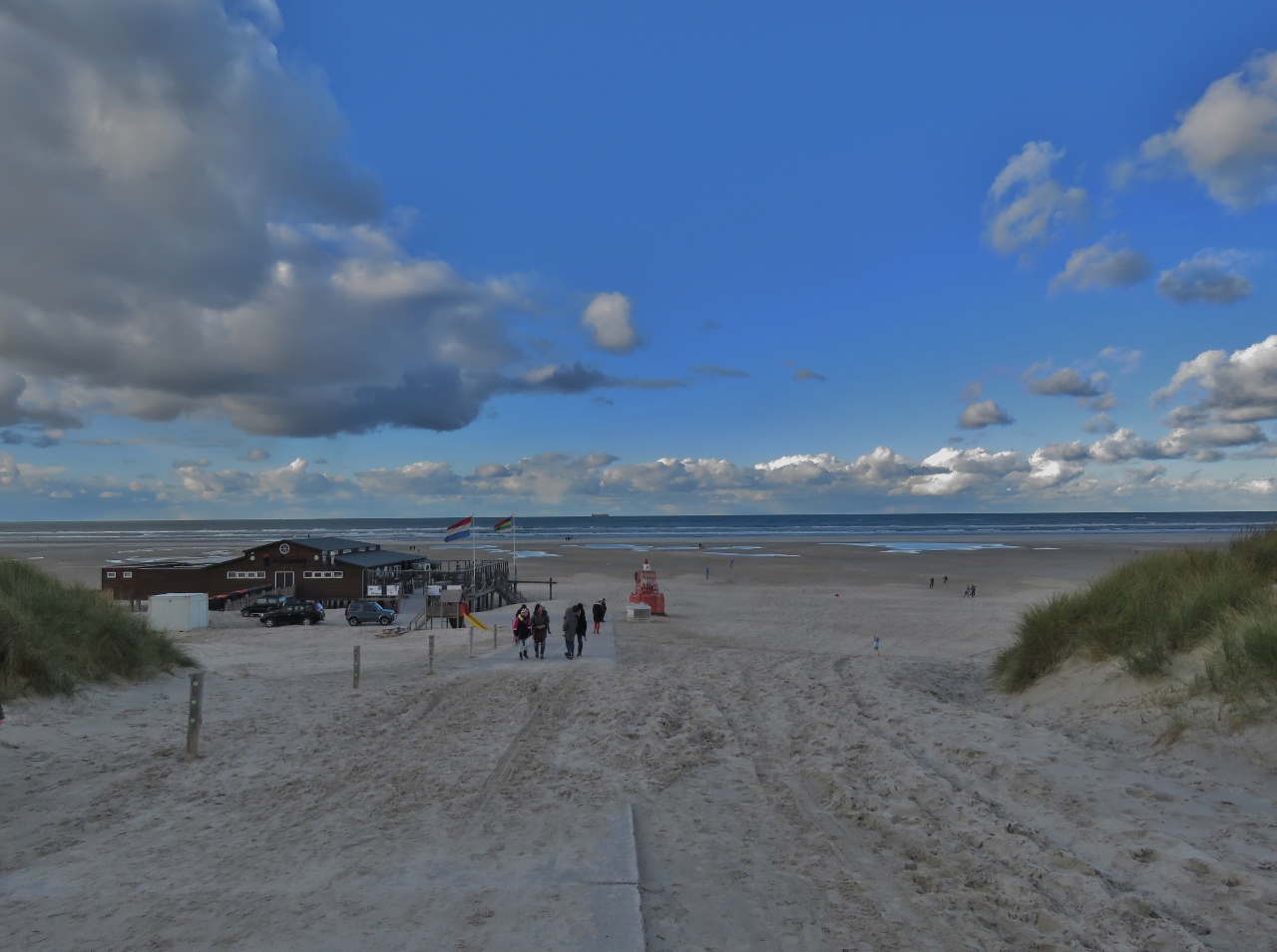 |
Beach
Position: 53°24.36’N, 5°17.21’E
Soft-sand beaches line the north shore of Terschelling. They’re certainly more popular in the summer, but many people were out taking in the scene on this sunny, but cold and windy, Sunday afternoon.
|
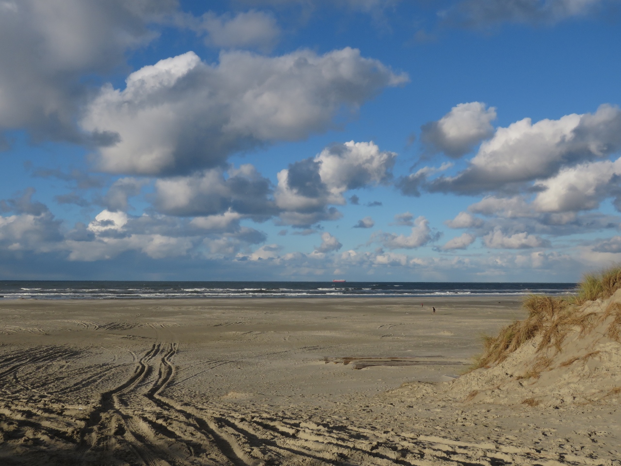 |
Shipping Lanes
Position: 53°24.06’N, 5°15.13’E
A bright red Wallenius Wilhelmsen RoRo working north in the traffic lanes off Terschelling. 14 hours ago we were running just inside those lanes, about 4.5 miles offshore from where this picture was taken.
|
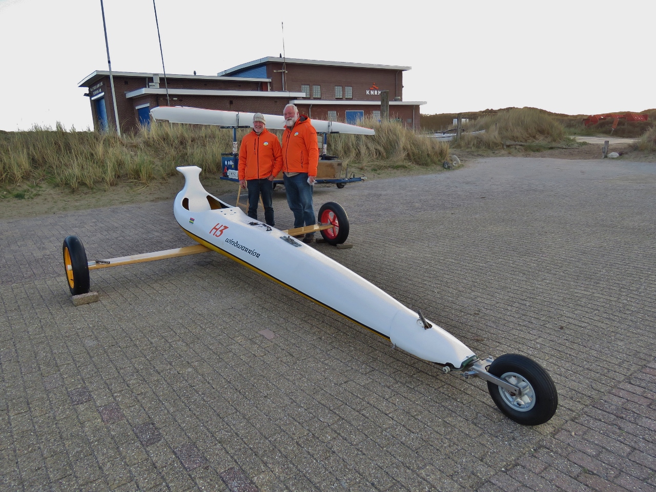 |
Land Yacht
Position: 53°23.96’N, 5°14.96’E
We spent ages talking to these two men from a local Land Yacht club about their sport. Land yachts are the land-based form of a racing sail boat. Just as in sailing, light weight is key as is minimizing drag. Race boats carry deep keels (sometimes to as much as 22′) to allow them to carry more sail power. With land yachts, its the width of the platform formed by the three wheels. The wider the spread, the more sail power they can carry. Speeds of up above 120 km/hr are possible so, like all things that race, this some risk.
|
 |
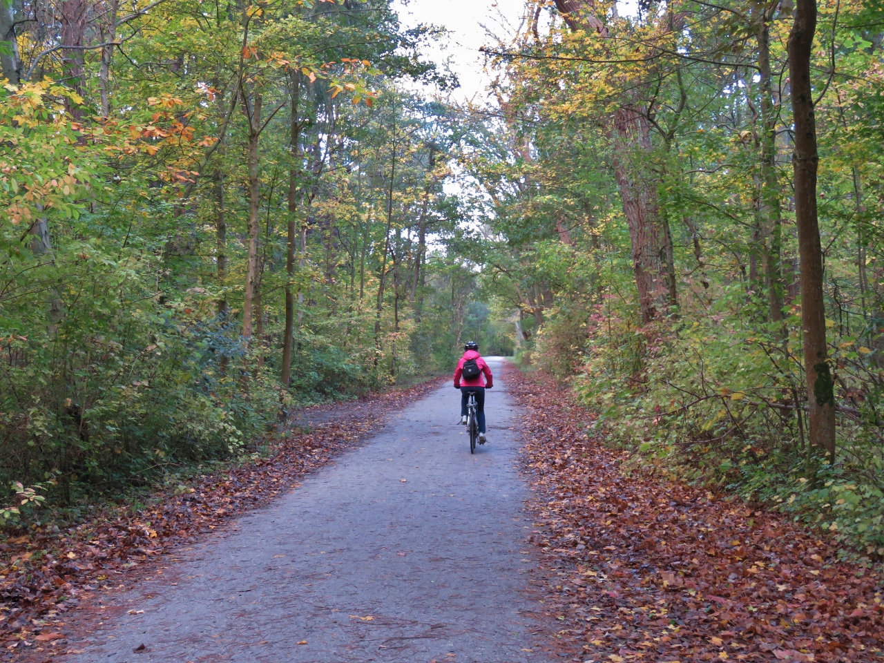
Woods
Position: 53°22.29’N, 5°13.05’E
Cycling through the woods back to West-Terschelling. We really enjoyed the ride with it’s diverse scenery, and this is only one of several rides you can take on Terschelling. Blog readers Andre and Annemarie Verhoek had recommended we make landfall in the Netherlands at Terschelling, particularly for the cycling.
|
 |
Paviljoen De Walvis
Position: 53°21.38’N, 5°12.73’E
The blustery and chilly day did not discourage the crowds enjoying the sunshine on the patio at Paviljoen De Walvis.
|
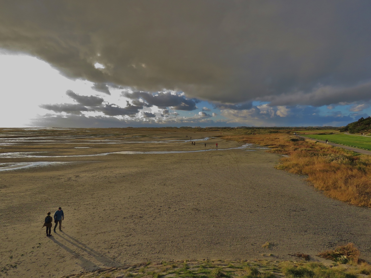 |
Shadows
Position: 53°21.36’N, 5°12.72’E
Long shadows cast in the late afternoon sun on the flats off West-Terschelling.
|
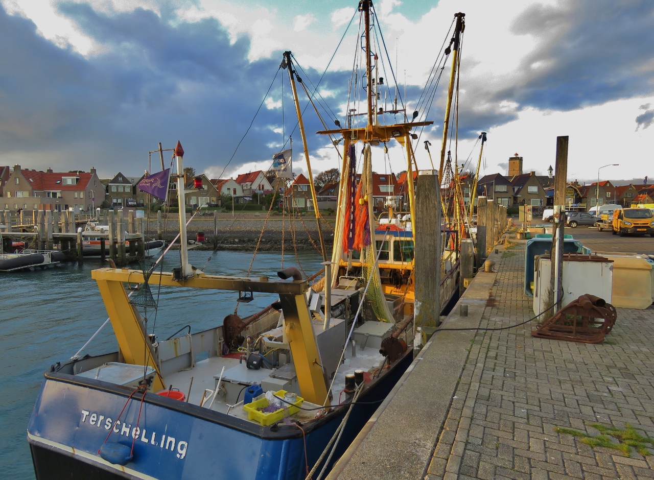 |
Fishboats
Position: 53°21.40’N, 5°12.93’E
Fishboats in the West-Terschelling commercial harbour.
|
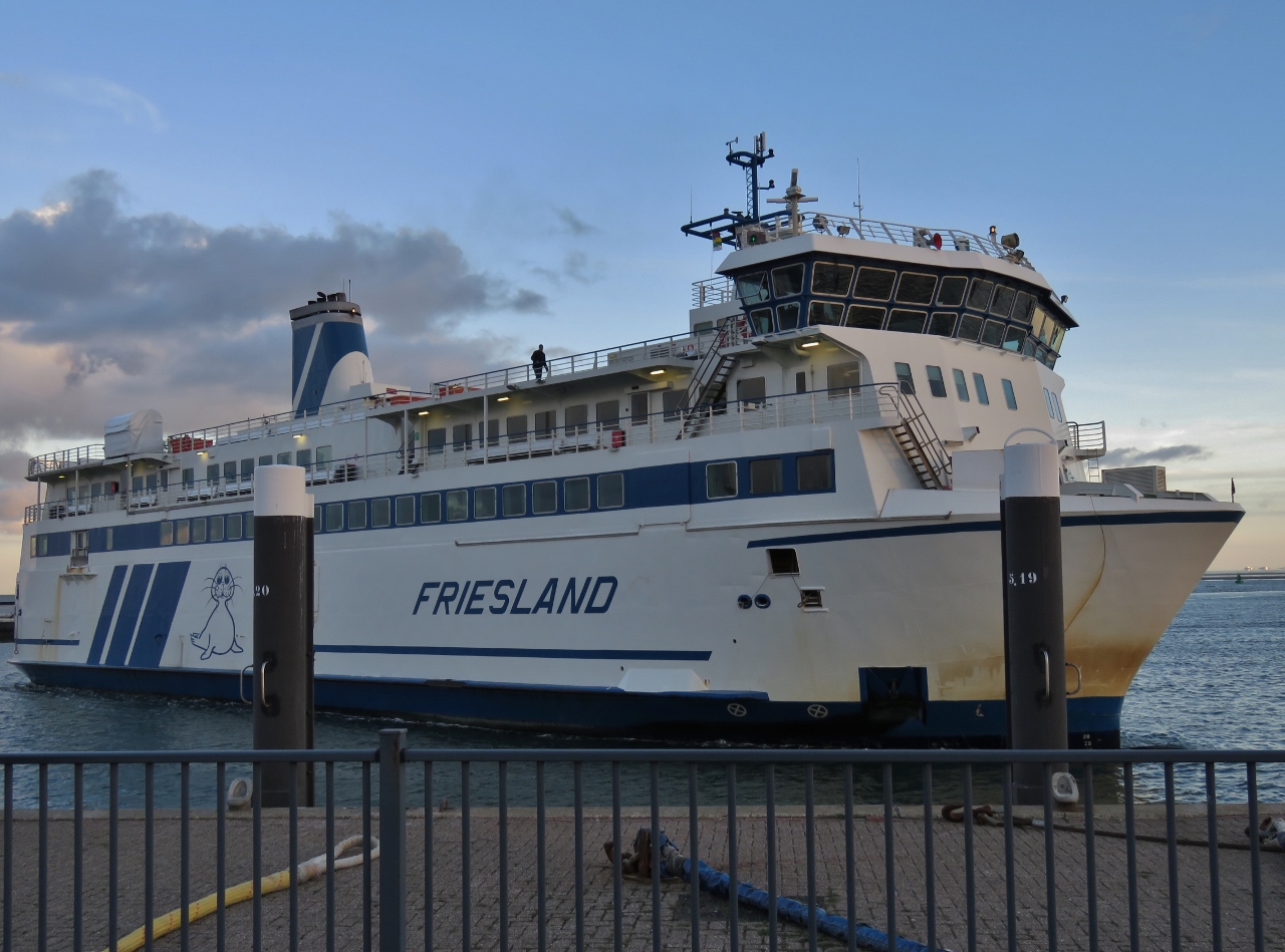 |
Friesland
Position: 53°21.38’N, 5°12.97’E
The 226ft (69m) vehicle ferry Friesland arriving into West-Terschelling from Harlingen. The skipper did a masterful job of docking in the strong winds, barely nudging the ship against the pier as the crew tied off.
|
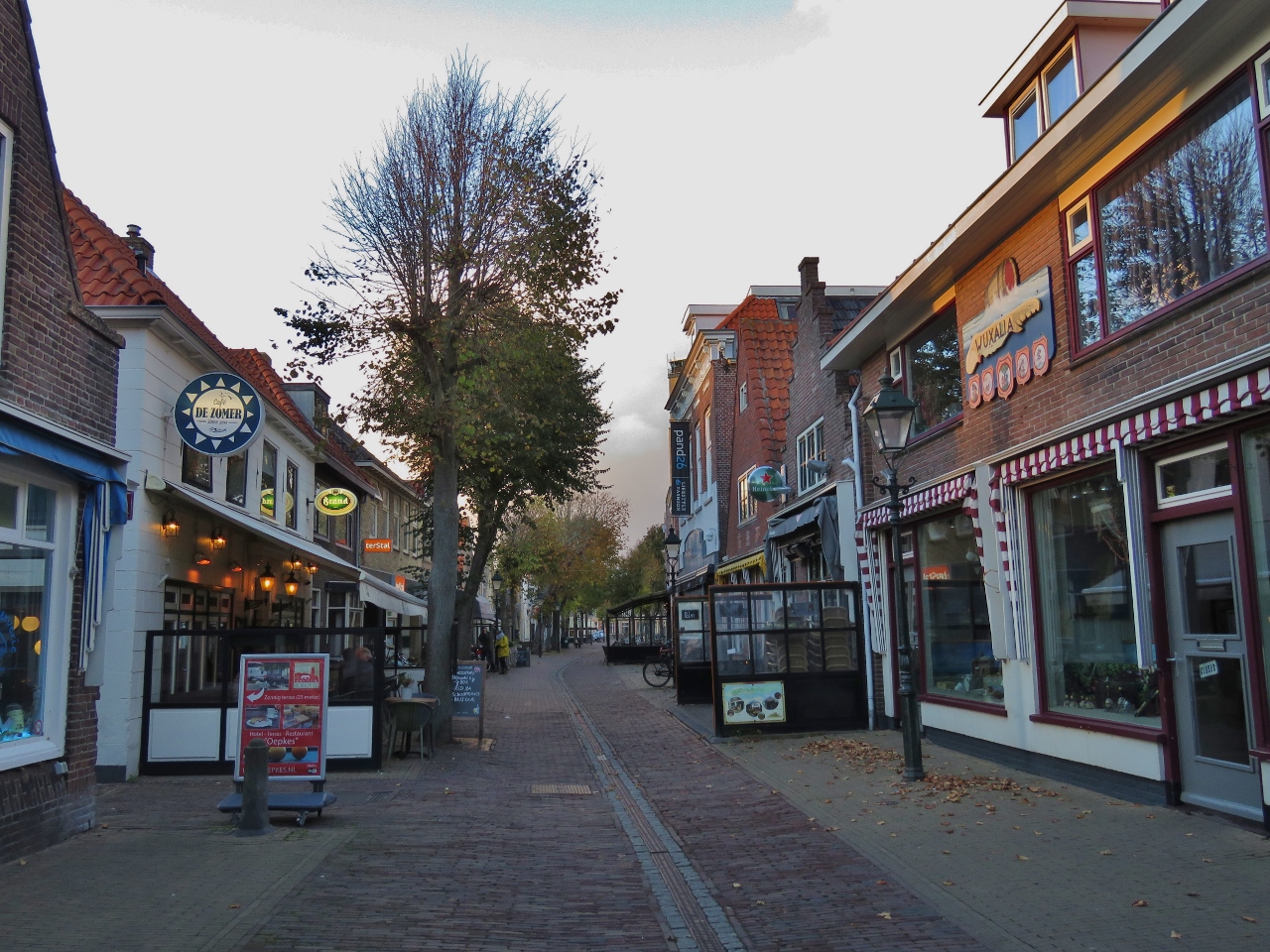 |
Torenstraat
Position: 53°21.57’N, 5°12.87’E
Restaurant-lined Torenstraat in West-Terschelling.
|
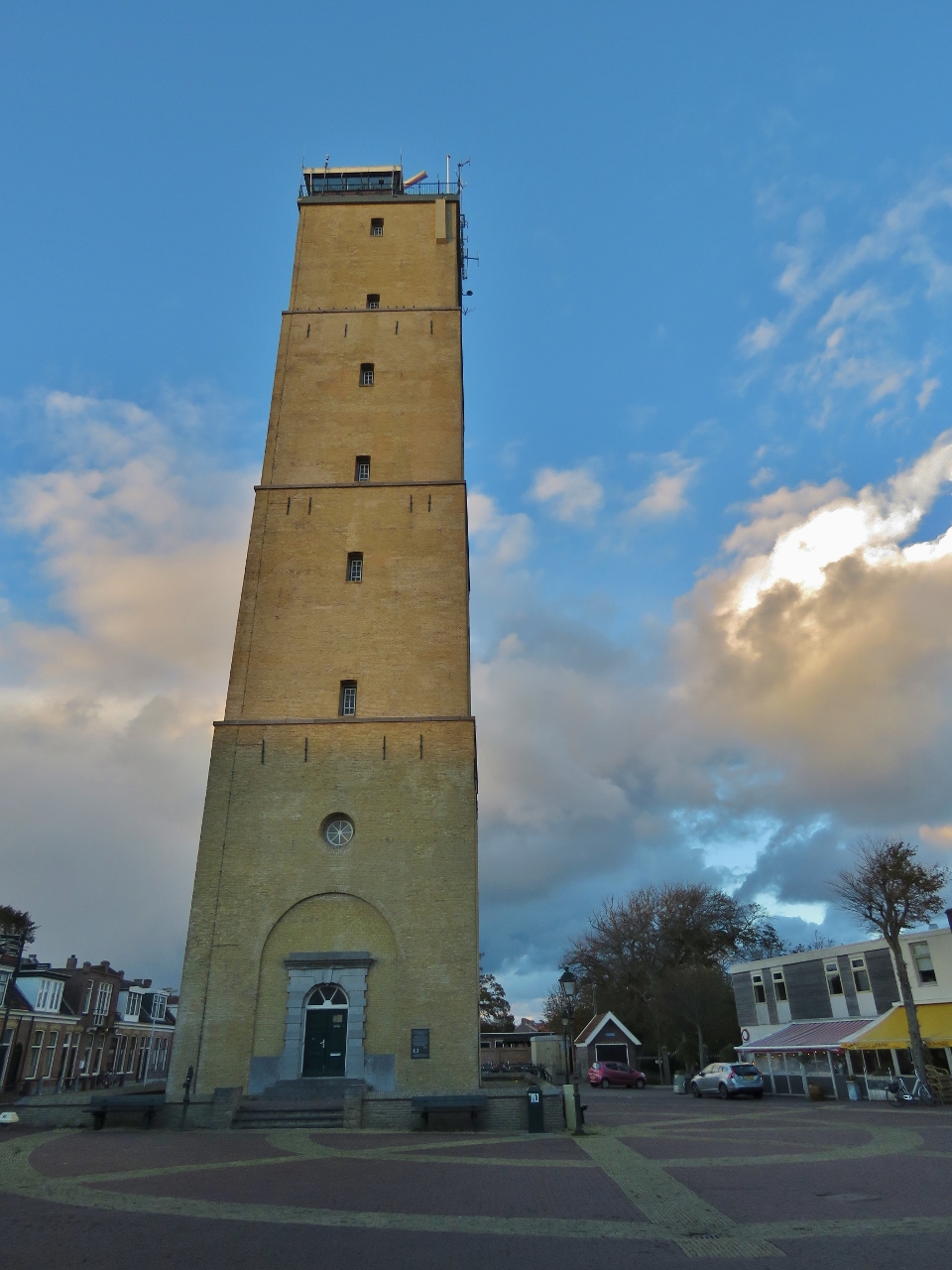 |
The Brandaris
Position: 53°21.61’N, 5°12.86’E
The Brandaris dominates the West-Terschelling skyline. Built in 1594, it’s the oldest lighthouse in the Netherlands. We could see the light from the 180ft (55m) tower for miles as we neared landfall.
|
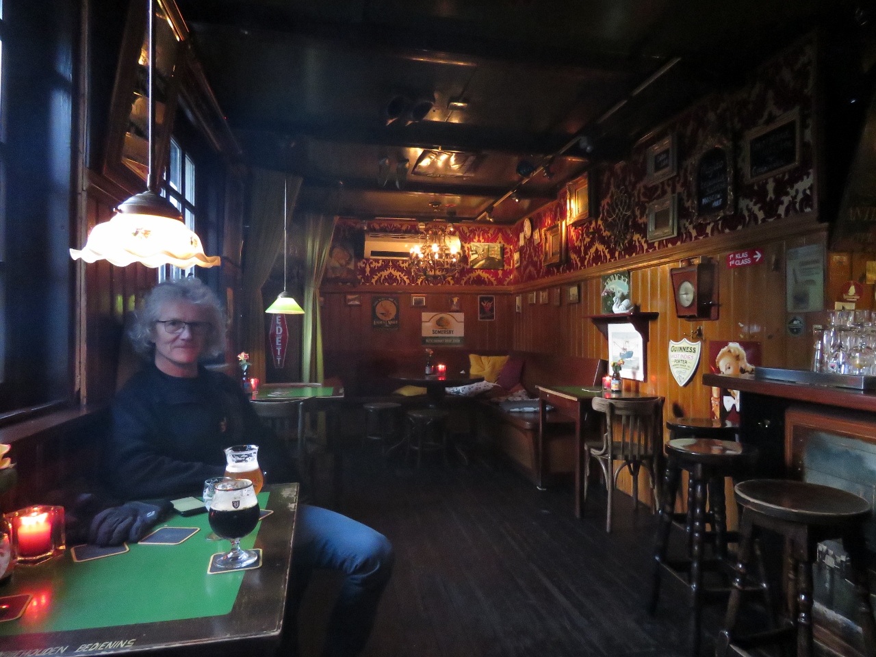 |
Warming Up
Position: 53°21.55’N, 5°12.96’E
Enjoying a local brew at the Cafe ‘t Zwaantje. It was a real locals’ bar—everyone knew each other.
|
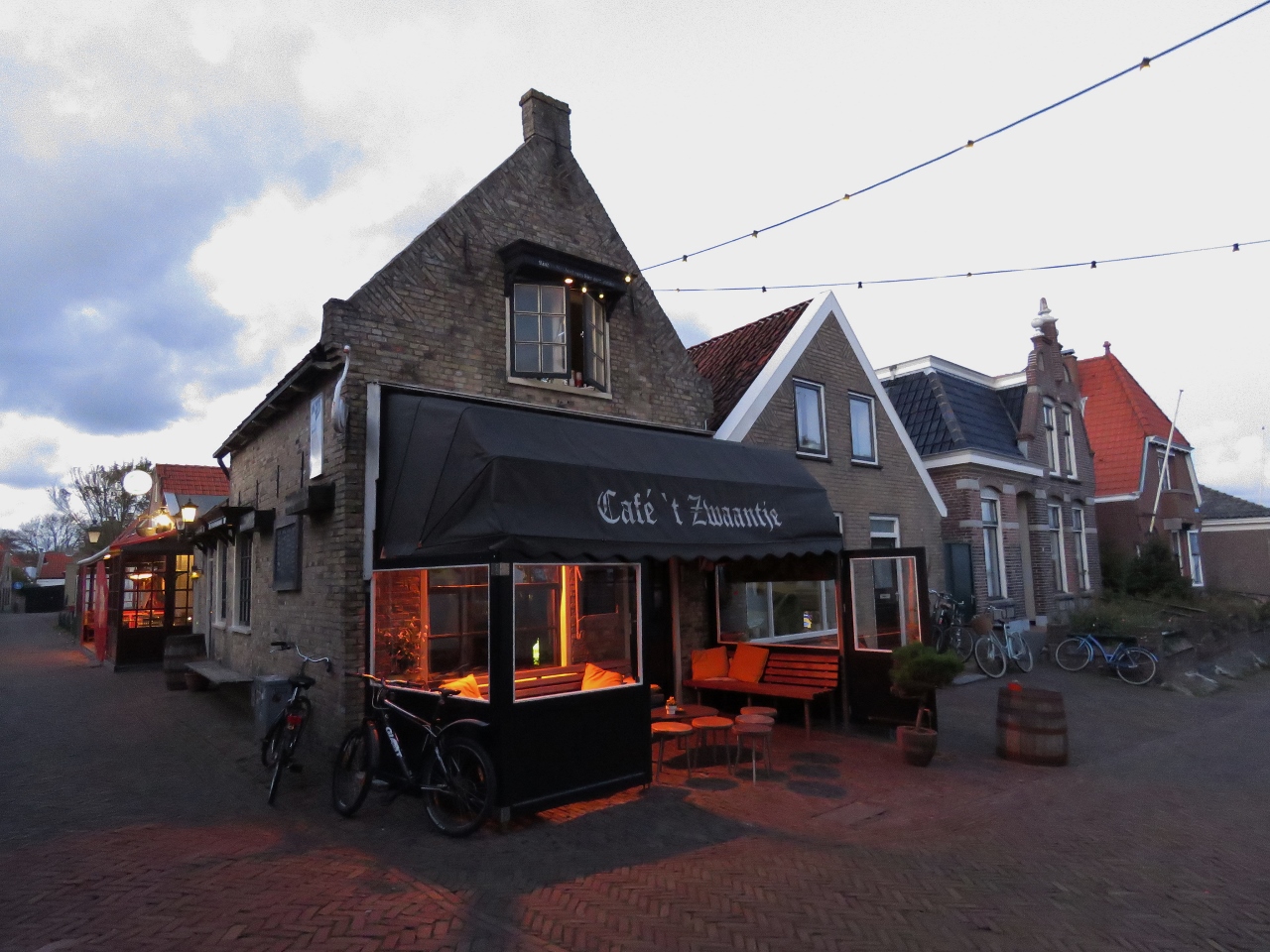 |
Cafe ‘t Zwaantje
Position: 53°21.55’N, 5°12.96’E
We were almost tempted to sit on the heated patio at Cafe ‘t Zwaantje, but the warm, cosy interior drew us in.
|

|
Click the travel log icon on the left to see these locations on a map, with the complete log of our cruise.
On the map page, clicking on a camera or text icon will display a picture and/or log entry for that location, and clicking on the smaller icons along the route will display latitude, longitude and other navigation data for that location. And a live map of our current route and most recent log entries always is available at mvdirona.com/maps. |
If your comment doesn't show up right away, send us email and we'll dredge it out of the spam filter.