We spent most of our final day in Stavanger at the exceptional Norwegian Oil Museum in Stavanger. The museum details the history and technology behind Norway’s growth as an oil nation through models, interactive displays and actual industry equipment.
Below are trip highlights from October 4th and 5th in Stavanger, Norway. Click any image for a larger view, or click the position to view the location on a map. And a live map of our current route and most recent log entries always is available at mvdirona.com/maps
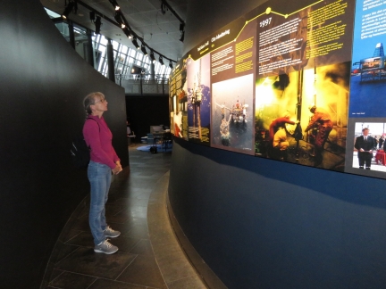 |
History
Position: 58°58.42’N, 5°44.08’E
These panels describe significant events in Norway’s growth as an oil nation, from 1969 discover to present.
|
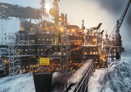 |
Heavy Weather
Position: 58°58.42’N, 5°44.09’E
We loved this picture of an oil rig in heavy weather.
|
 |
Lunch
Position: 58°58.42’N, 5°44.12’E
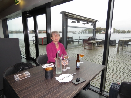
We’d arrived shortly after the Norwegian Oil Museum opened at 10am and expected to be there until it closed at 4pm, so stopped for a lunch break at the excellent restaurant Bolgen & Moi in the museum complex. We’d really enjoyed the couple of hours we’d spent so far, including viewing their two movies—the museum deserves its great reputation.
|
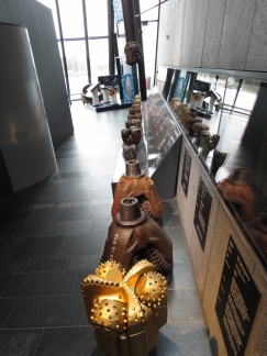 |
Drill Bits
Position: 58°58.42’N, 5°44.09’E
Drill bits on display at the Norwegian Oil Museum.
|
 |
Models
Position: 58°58.42’N, 5°44.09’E
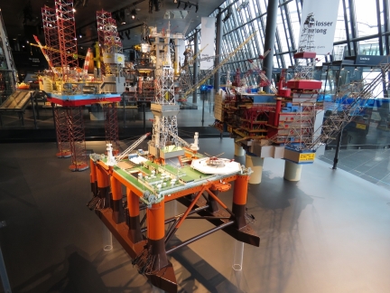
The Norwegian Oil Museum has some beautiful scale models, some built as part of the design process before computerized CAD/CAM systems were available.
|
 |
Goliat FPSO
Position: 58°58.42’N, 5°44.08’E
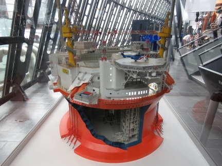
Scale model of Goliat FPSO, a massive floating production storage and offloading platform deployed in the Barents Sea north of Hammerfest.
|
 |
Check Mate
Position: 58°58.42’N, 5°44.08’E
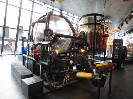
The Check Mate submersible could descend to 2,066ft (325m) and made about 400 dives between 1981 and 1986.
|
 |
Drill Cabin
Position: 58°58.44’N, 5°44.07’E
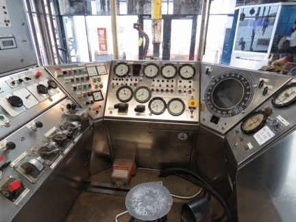
Drill control cabin from Norway’s first oil field, Ekofisk, at the Norwegian Oil Museum.
|
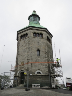 |
Valberg Tower
Position: 58°58.32’N, 5°43.91’E
The fire tower Valberg, perched on a hill above Stavanger, was built in 1853 and served as the city’s watchtower until 1922.
|
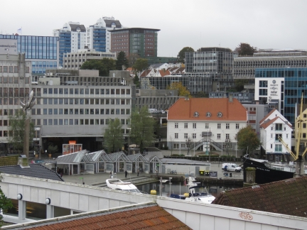 |
Harbour
Position: 58°58.31’N, 5°43.87’E
We could just see Dirona moored in Stavanger harbour from the hilltop beside Valberg Tower.
|
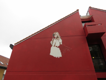 |
Street Art
Position: 58°58.35’N, 5°43.85’E
More Stavanger street art on Valbergjet.
|
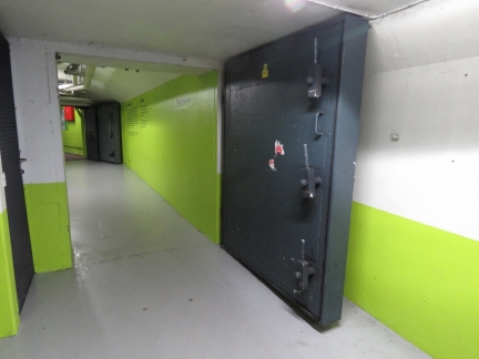 |
Bomb Shelter
Position: 58°58.31’N, 5°43.82’E
Huge doors at the opening to an old Stavanger bomb shelter, now an underground parking lot.
|
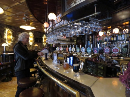 |
The Cardinal
Position: 58°58.28’N, 5°43.88’E
We stopped in for a pint chosen from the Cardinal’s 600-beer selection.
|
 |
Solhaugen
Position: 58°58.49’N, 5°42.54’E
Great views from the park Solhaugen west of the harbour.
|
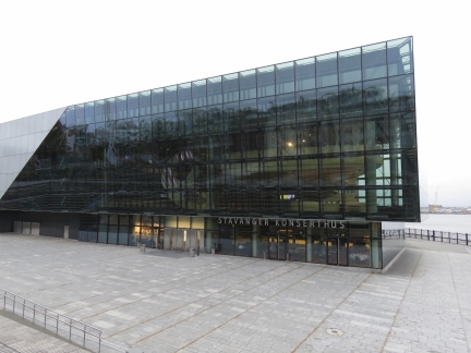 |
Stavanger Konserthus
Position: 58°58.49’N, 5°43.43’E
The striking waterside Stavanger Konserthus.
|
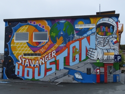 |
Houston
Position: 58°58.38’N, 5°43.58’E
Houston, Texas and Stavanger have been sister cities since 1980. Before oil prices fell in the past few years, there was enough traffic between the two oil giants that several airlines ran direct flights.
|
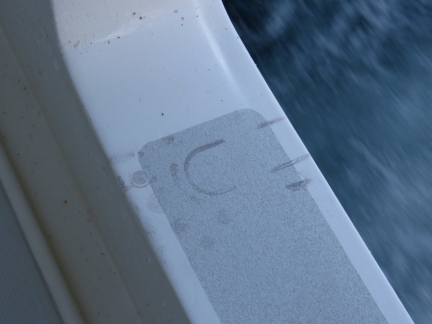 |
Intruder
Position: 58°58.26’N, 5°43.82’E
Late last night at around 1:30am we heard someone on the boat, but they were gone when James went up to check. All that was left is a footprint.
|
 |
Fender Failing
Position: 58°58.26’N, 5°43.82’E
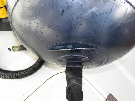
Our 46-month old set of Prostock marine fenders had two fail a year ago in Dublin and it looks like another one is on it’s way out. The winds at Stavanger Havn were only 30kts when a storm passed through, but the boat was moving a lot with 1.2° of pitch and 4.8° of roll.
|

|
Click the travel log icon on the left to see these locations on a map, with the complete log of our cruise.
On the map page, clicking on a camera or text icon will display a picture and/or log entry for that location, and clicking on the smaller icons along the route will display latitude, longitude and other navigation data for that location. And a live map of our current route and most recent log entries always is available at mvdirona.com/maps. |

If your comment doesn't show up right away, send us email and we'll dredge it out of the spam filter.