We only planned to make a quick pit stop outside Haugesund for gasoline before continuing south through the main channel. But as we left the fuel dock, we made a last-minute decision to take the waterway through town and another last-minute decision to stop for the night. We ended up staying for three. That kind of flexibility is one of the things we really enjoy about boating, particularly in the off-season.
Below are trip highlights from September 25th through 27th, 2018 at Haugesund, Norway. Click any image for a larger view, or click the position to view the location on a map. And a live map of our current route and most recent log entries always is available at mvdirona.com/maps
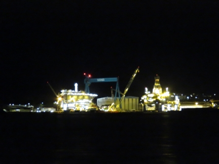 |
Kvaener Stord
Position: 59°44.21’N, 5°30.92’E
The massive Kvaener Stord yard to our north as we pass at 6:00am. The facility was a leading leading shipyard in the 1970s but now supports the oil and gas industry primarily in building, installing and decommissioning oil rigs.
|
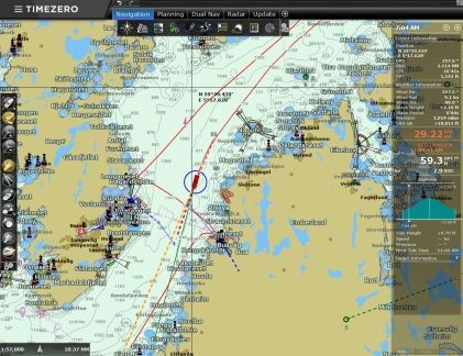 |
First Anchorage
Position: 59°37.52’N, 5°17.92’E
We’re just about to pass our very first Norwegian anchorage, Vorlandsvagen, where we stopped almost exactly five months ago on April 29th.
|
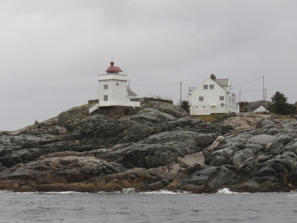 |
Ryvarden Lighthouse
Position: 59°31.53’N, 5°13.23’E
The Ryvarden Lighthouse, built in 1849, marks the southern entrance to Bomlafjorden, the outermost part of the Hardangerfjord where we recently made our road trip.
|
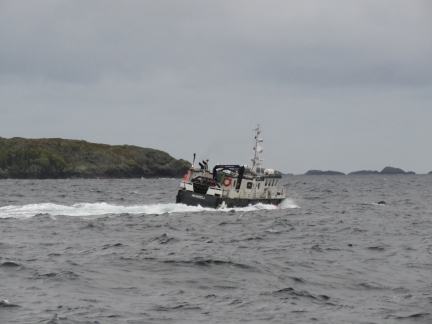 |
Akvarell
Position: 59°29.75’N, 5°12.99’E
We’d left the Romsa Islands around 4:30am this morning to round an exposed section, Sletta, before the winds came up later in the morning. We’re glad to have stabilizers watching the small cargo ship Akvarell rolling in the swell heading north.
|
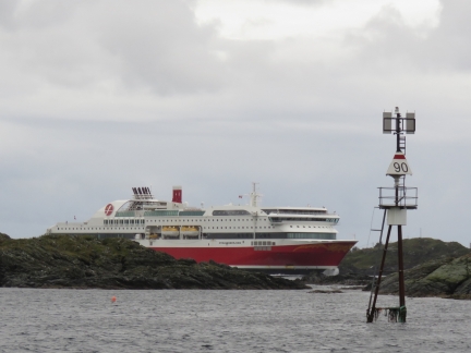 |
Stavangerfjord
Position: 59°25.65’N, 5°14.38’E
The Danish ferry Stavangerfjord heading north to Bergen from Stavanger on it’s run between Norway and Denmark. The ship is the first cruise ferry in the world powered entirely by natural gas.
|
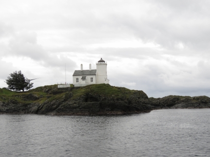 |
Tonjer Lighthouse
Position: 59°25.46’N, 5°14.57’E
The Tonjer Lighthouse at the norther entrance to Karmsundet.
|
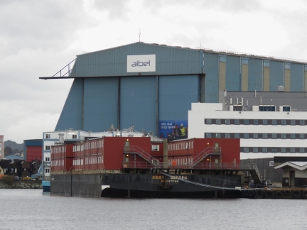 |
North Sea Hall
Position: 59°24.87’N, 5°15.19’E
The huge North Sea Hall in one of Aibel’s two major yards. Aibel, originally ABB Offshore Systems, operates in the offshore oil, gas and wind farm industries.
|
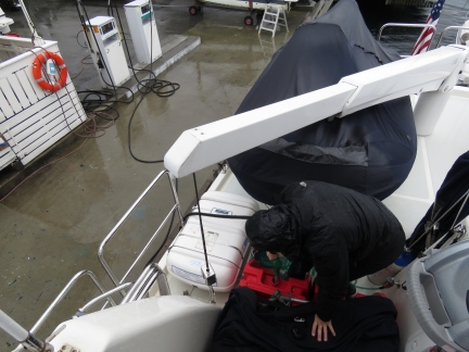 |
Gasoline
Position: 59°24.84’N, 5°15.40’E
We’re getting low on gasoline, so stopped in at Haugesund for a fill. Here James is filling one of our two 29-gallon deck tanks.
|
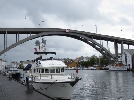 |
Haugesund
Position: 59°24.69’N, 5°16.13’E
Moored for the night at Haugesund. We initially were planning to continue south after we’d picked up the gasoline, but decided to make a pass along the waterway through town. The guest moorage had plenty of space, and since we already had the fenders and lines out, we changed plans and decided to stop for the night to explore Haugesund.
|
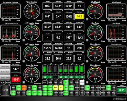 |
Shore 2
Position: 59°24.67’N, 5°16.14’E
The second shorepower connection is in use and working great. Reading the new data off our “Moored” N2KView display, you can see that “Shore 2” is active at 50hz (white indicator light—green is 60hz), the voltage is 230V, we are currently are drawing 7A, and have consumed 15kWhrs so far on that connection. Over the winter in Amsterdam we’ll be running with both “Shore 1” and “Shore 2” active for a combined 32A from a marina that doesn’t have greater than 16A connections.
|
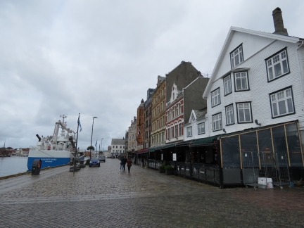 |
Smedasundet
Position: 59°24.74’N, 5°16.06’E
Nearly a dozen restaurants with heated, enclosed patios line Smedasundet just up from where we are moored. We had a great lunch on the patio at MM Cafe overlooking the harbor.
|
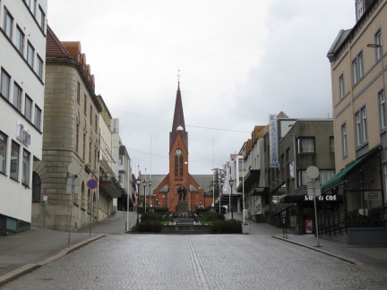 |
Var Frelsers Church
Position: 59°24.79’N, 5°16.00’E
Looking up to Torgatta to the 1,050-seat Var Frelsers Church, built in 1901.
|
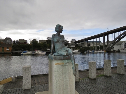 |
Marilyn Monroe
Position: 59°24.60’N, 5°16.24’E
Marilyn Monroe’s father, Edward Mortenson, was from Haugesund. This statue commemorates the 30th anniversary of her death.
|
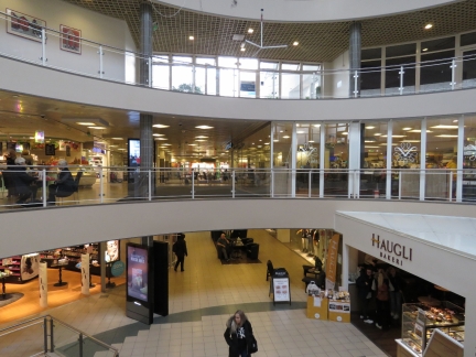 |
Mall
Position: 59°24.66’N, 5°16.41’E
Inside one of Haugesund’s several shopping malls.
|
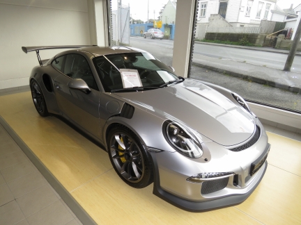 |
Porsche 911 GT3 RS
Position: 59°24.83’N, 5°16.44’E
Now we’re shopping :). We went into the local Mazda dealership for a closer look at a Porsche 911 GT3 RS in their used car display. I wonder which Mazda they traded for?
|
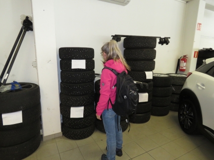 |
Studs
Position: 59°24.83’N, 5°16.46’E
The Mazda dealer had piles of studded tires ready to install. Winter is coming—time to get south.
|
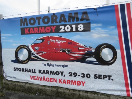 |
Motorama
Position: 59°24.82’N, 5°16.48’E
We’ll just miss a big car event that will be held on the nearby island of Karmoy in a few days.
|
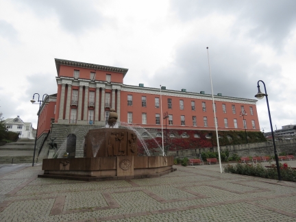 |
Town Hall
Position: 59°24.60’N, 5°16.47’E
Haugesund’s neo-classical, pink-colored Town Hall, opened in 1931, was a gift from shipbuilder Knut Knutsen. It was voted Norway’s most beautiful town hall in 2010.
|
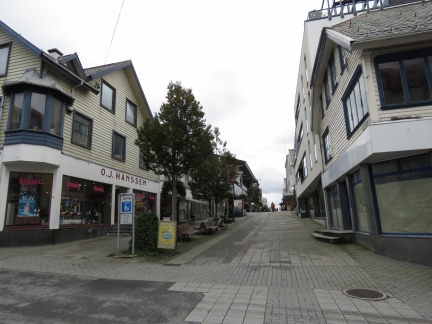 |
Sorhauggata
Position: 59°24.80’N, 5°16.11’E
Much of the length of Sorhauggata is a pedestrian mall with shops along both sides.
|
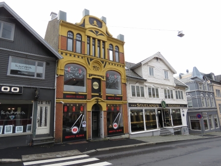 |
Strandgata
Position: 59°24.79’N, 5°16.07’E
Shops and restaurants along Strandgata. Stueland’s Abothek, in white building at right, looks like an appealing pub.
|
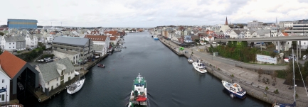 |
Smedasundet
Position: 59°24.63’N, 5°16.15’E
The view north along Smedasundet from the Risoy Bridge. Dirona is moored at right along the quay (click image for a larger view).
|
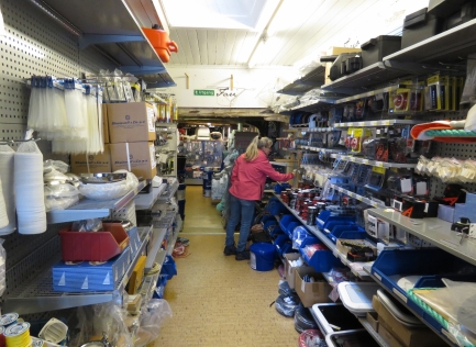 |
Chandlery
Position: 59°24.81’N, 5°15.97’E
Checking out the local marine chandlery, Chr Baardsen & Son. Like the chandlery in Alesund, the store was much bigger than it appeared from the street and we kept finding more sections as we walked around. We purchased a replacement boat hook for the one that slipped overboard while untangling the anchor in Norangsfjorden.
|
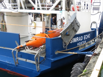 |
Simrad Echo
Position: 59°24.84’N, 5°15.90’E
Simrad is a subsidiary of Norwegian company Kongsberg Maritime. Their vessel Simrad Echo is used for product development, testing, demonstrations and training courses.
|
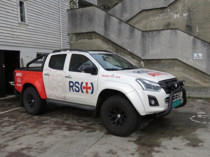 |
RS Truck
Position: 59°24.86’N, 5°15.88’E
We’ve seen plenty of Norwegian Society for Sea Rescue vessels, but this is the first truck.
|
 |
Bergen Kreds
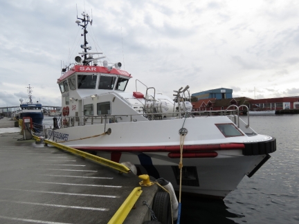
Position: 59°24.88’N, 5°15.85’E
The Haugesund Norwegian Society for Sea Rescue vessel Bergen Kreds looks very capable.
|
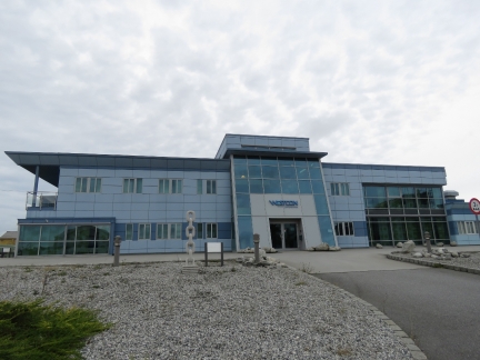 |
Westcon
Position: 59°25.09’N, 5°15.20’E
Westcon offices in Haugesund. They did the engineering behind the all-electric propulsion for the Future of the Fjords tour boat in Sognefjord.
|
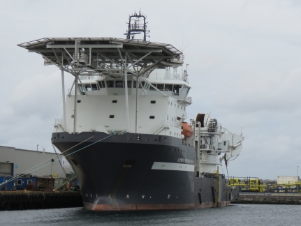 |
Olympic Intervention IV
Position: 59°25.20’N, 5°15.08’E
Olympic Subsea’s 311ft (94m) multifunctional vessel Olympic Intervention IV docked at Karmsund Port.
|
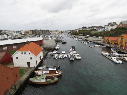 |
Haugesjoen
Position: 59°24.99’N, 5°15.68’E
Lots of boats moored in Haugesjoen, viewed from the bridge across Nordre Smedasundet.
|
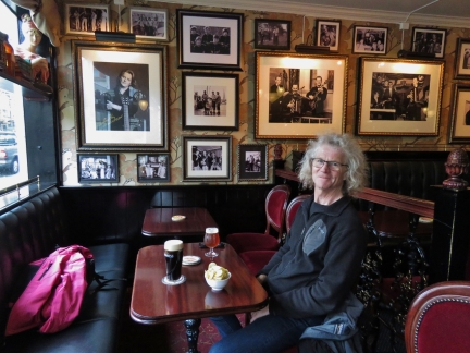 |
Stueland’s Abothek
Position: 59°24.79’N, 5°16.06’E
We stopped for a drink at Stueland’s Abothek later in the day. The place had a real Irish pub feel to it.
|
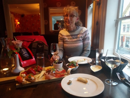 |
To Glass
Position: 59°24.84’N, 5°16.00’E
An exceptional meal of the tapas platter at To Glass overlooking Strandgata in Haugesund.
|
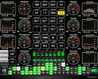 |
Wind
Position: 59°24.67’N, 5°16.14’E
The barometer is falling and the winds picked up into the 30s last night. We’re enjoying our stay in Haugesund, and the weather isn’t great, so we decided to extend a day.
|
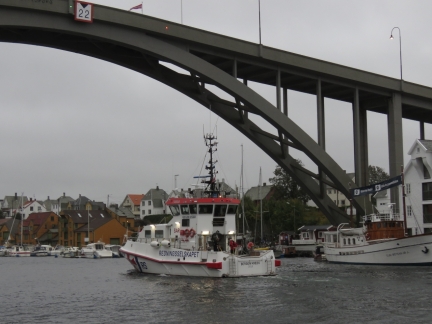 |
Bergen Kreds
Position: 59°24.67’N, 5°16.14’E
The Norwegian Society for Sea Rescue vessel Bergen Kreds heading south behind us under Risoy Bridge.
|
 |
Dual Shorepower
Position: 59°24.67’N, 5°16.14’E
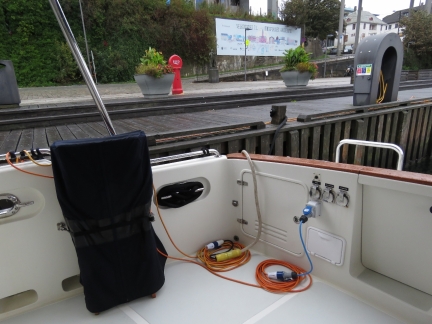
The Bergen shorepower system allocated only one shorepower outlet per vessel, so we couldn’t test both shorepower connections working together. In Haugesund, the power is charged at a fix rate per day based on boat size without fixed plug assignment. So we finally can test the ultimate goal of the dual shorepower project: to draw power from two separate outlets at marinas with only low-amperage connections and double our shorepower draw.
|
 |
Dual Shorepower Display
Position: 59°24.67’N, 5°16.14’E
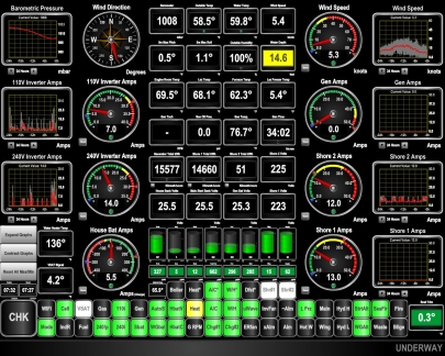
The dual shorepower system ran flawlessly on the first test. Our new N2KView “Moored” display shows both “Shore 1” and “Shore 2” active at 50hz (white indicator light—green is 60hz), the voltage is 223 on Shore 1 and 225 on Shore 2, the amperage draw is 13 on Shore 1 and 12 on Shore 2 and we are drawing 14A on the 240V inverter and 7A on the 120V inverter with the batteries charging at a positive 5.5A. Normally with this kind of draw and only a single 16A connection, the batteries would be discharging in a big way.
|
 |
Smedasundet
Position: 59°24.67’N, 5°16.14’E
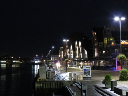
An early morning view along Smedasundet from our moorage at Haugesund.
|
 |
Rasoy Bridge
Position: 59°24.67’N, 5°16.14’E
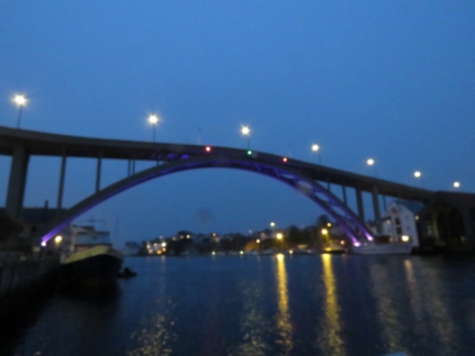
Looking behind us through the mist from our moorage at Haugesund to the Rasoy Bridge.
|
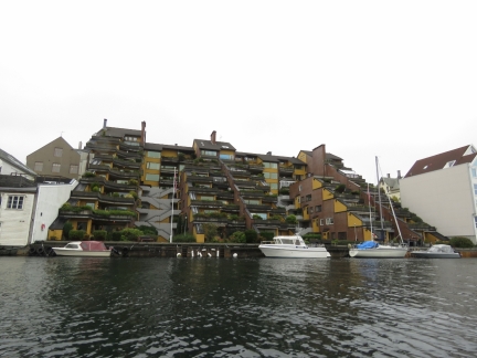 |
Apartments
Position: 59°24.53’N, 5°16.30’E
The steady rain abated for a bit, so we took the tender our for a tour of the area. These apartments overlook Smedasundet.
|
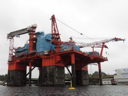 |
Safe Bristolia
Position: 59°23.05’N, 5°17.31’E
The oil rig Safe Bristolia was converted in 2006 to an 588-bed moored semi-submersible accommodation platform that meets regulations for UK North Sea operation.
|
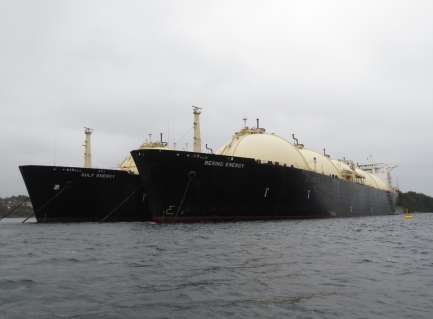 |
Bering Energy
Position: 59°21.71’N, 5°17.82’E
The LNG carriers Gulf Energy and Bering Energy that we photographed when running north on our first day in Norway. The ships have been here long enough to be visible on the satellite imagery.
|
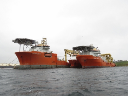 |
Normand Seven
Position: 59°21.60’N, 5°17.15’E
Normand Corona moored between Normand Seven and Normand Progress just south of Haugesund.
|
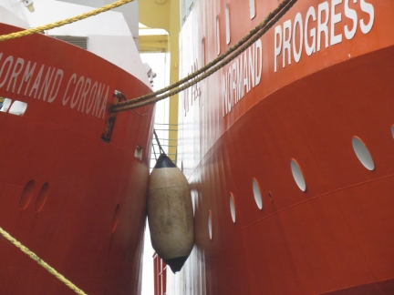 |
Polyform Fender
Position: 59°21.60’N, 5°17.21’E
A Polyform fender, similar to our new ones, between Normand Corona and Normand Progress. If they can hold these ships apart, they should be able to keep Dirona off the dock.
|
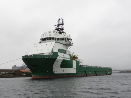 |
Bourbon Sapphire
Position: 59°21.65’N, 5°16.89’E
Bourbon Sapphire, another beautiful Norwegian offshore supply vessel.
|
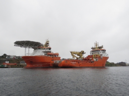 |
Normand Ivan
Position: 59°23.81’N, 5°16.28’E
Normand Ivan moored against Normand Fortress on the island of Karmoy. We’re seeing a lot of Normand boats in the area. They are owned by Solstad Farstad, an offshore service and supply ship shipping company based at Karmoy, that has a fleet of 50 ships. Last year they merged with Farstad Shipping and Deep Sea Supply to become Solstad Farstad with a fleet of 150 ships.
|
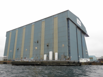 |
North Sea Hall
Position: 59°24.56’N, 5°15.60’E
Another view to Aibel’s huge North Sea Hall, a landmark in the area.
|
 |
Nordstjernen
Position: 59°24.67’N, 5°15.35’E
The Hurtigruten Nordstjernen, built in 1956, arriving into Haugesund. The Nordstjernen was used in the coastal service until 2012 and now exclusively cruises around Svalbard.
|
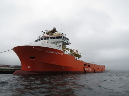 |
Normand Skipper
Position: 59°24.72’N, 5°15.27’E
Another “Normand”-named vessel owned by Karmoy-based Solstad Farstad.
|
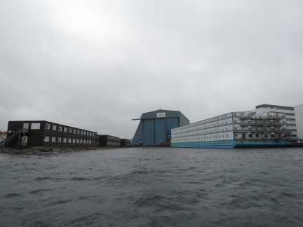 |
Bunk Houses
Position: 59°24.77’N, 5°15.53’E
Bunk houses .outside the Aibel facility, many of which are on a barge, likely for the oil and gas industry.
|
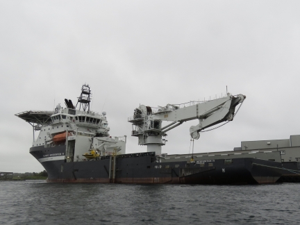 |
Olympic Intervention IV
Position: 59°25.34’N, 5°15.04’E
Another look at Olympic Subsea’s 311ft (94m) multifunctional vessel Olympic Intervention IV docked at Karmsund Port.
|
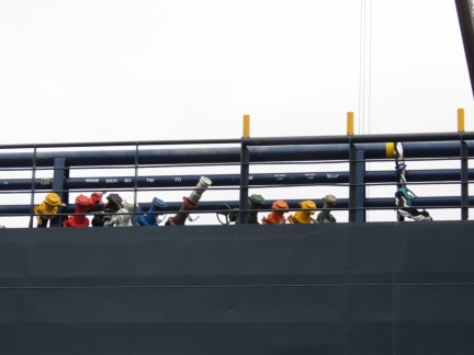 |
Outlets
Position: 59°25.30’N, 5°15.04’E
Color-coded and labelled hose outlets on offshore tug/supply ship Troms Capella at Karmsund Port. Some of the labels are brine, mud, slop, BO, FW, and FO.
|
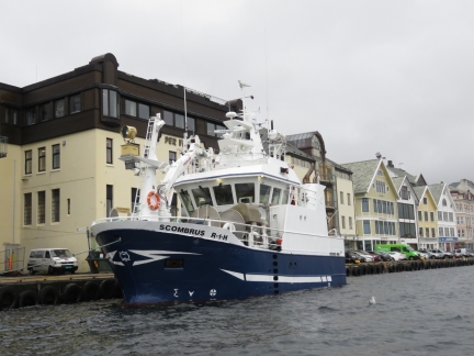 |
Scrombrus
Position: 59°24.87’N, 5°15.85’E
Scrombrus, on the quay at Haugesund, is unusually high and beamy. Blog reader Trond Saetre tells us this widespread design is due to licensing restrictions. An under-15m license is easier to get and far more common, so many boats are built just under 15m and then as tall and as wide as they can possibly make them.
|
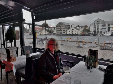 |
Lunch
Position: 59°24.72’N, 5°16.11’E
We had a great lunch harbour-side at SamSon Tapas. The red glow is from their patio heaters.
|
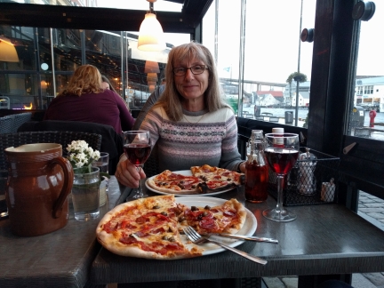 |
Il Forno
Position: 59°24.77’N, 5°16.02’E
A delicious pizza dinner with a bottle of Barbaresco overlooking the water at Il Forno in Haugesund.
|

|
Click the travel log icon on the left to see these locations on a map, with the complete log of our cruise.
On the map page, clicking on a camera or text icon will display a picture and/or log entry for that location, and clicking on the smaller icons along the route will display latitude, longitude and other navigation data for that location. And a live map of our current route and most recent log entries always is available at mvdirona.com/maps. |

If your comment doesn't show up right away, send us email and we'll dredge it out of the spam filter.