Lysefjord, in southwest Norway, is one of the country’s major tourist draws. Waterfalls plunge down cliffs that extend over a thousand feet above and below the water surface. The walls are so sheer in both directions that you can bring a boat within touching distance of shore without getting a depth sounder reading, and in most places all 500 feet of our anchor rode wouldn’t even touch bottom.
Below are trip highlights from September 28th and 29th in Lysefjord, Norway. Click any image for a larger view, or click the position to view the location on a map. And a live map of our current route and most recent log entries always is available at mvdirona.com/maps
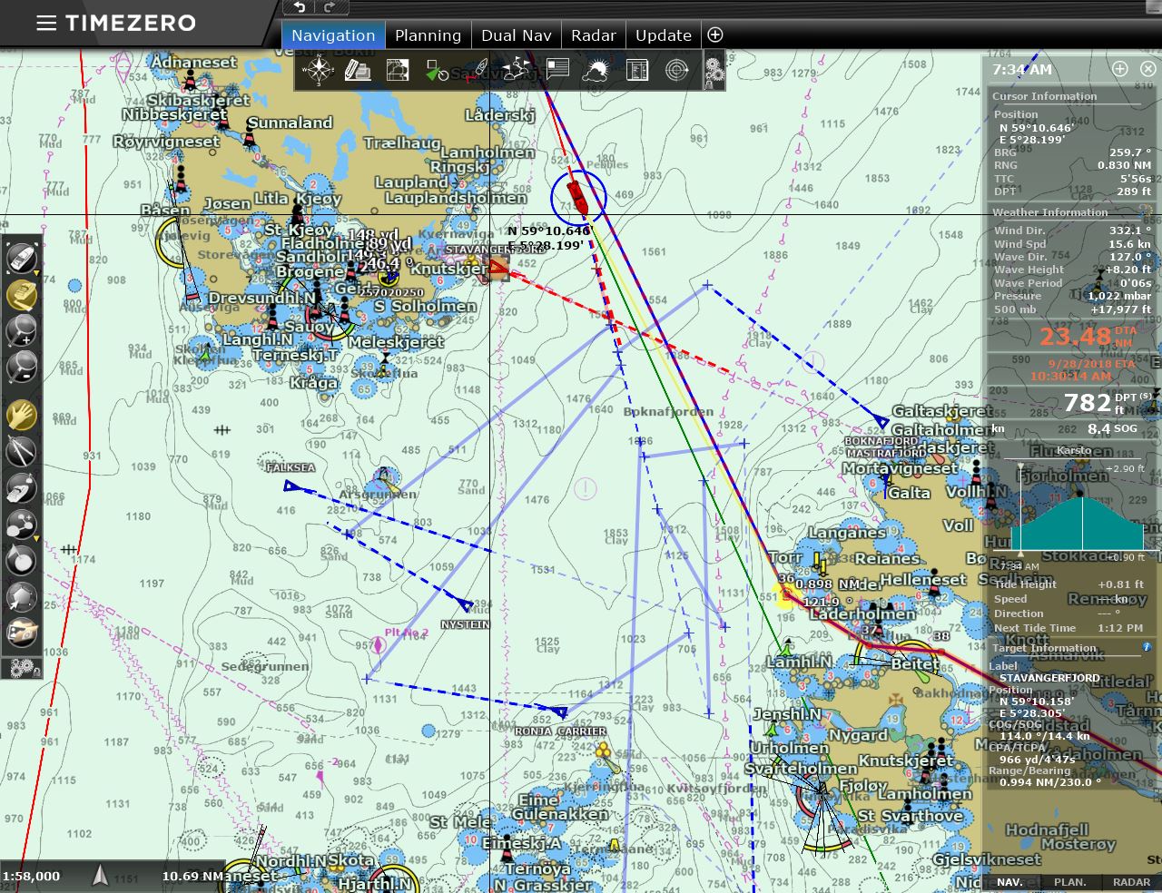 |
Traffic
Position: 59°10.93’N, 5°29.70’E
Heavy traffic as we cross the mouth of Boknafjorden at 7:30 this morning, en route south from Haugesund to Lysefjord. Several vessels are well to our south and closer by the ferry Stavanger (red triangle) has just departed the dock to our southwest and will cross in front of us, while the ferry running the same route from the other side, Boknafjord, will cross behind.
|
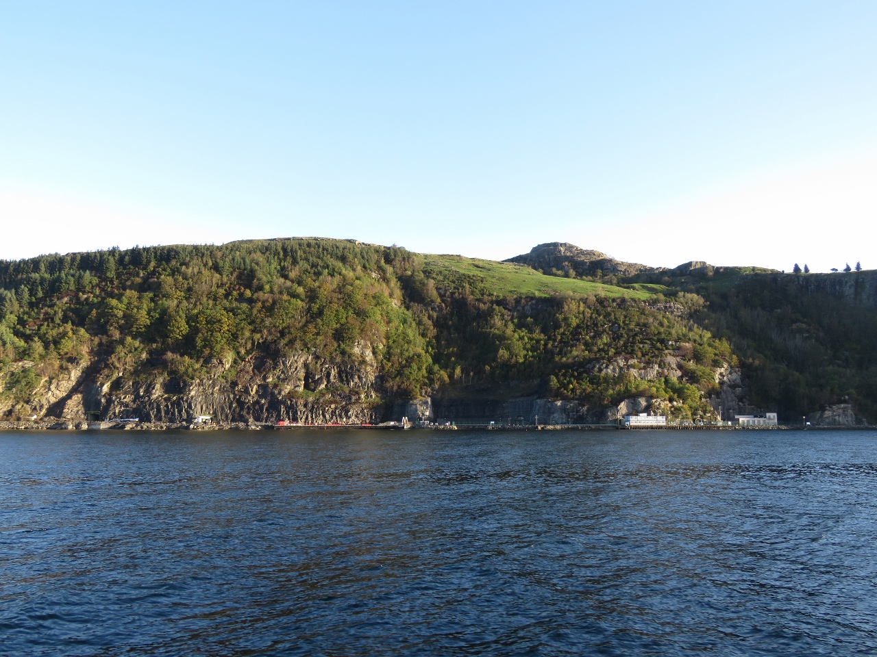 |
Data Center
Position: 59°3.83’N, 5°44.99’E
The Green Mountain Data Center on the island of Rennesoy, built in a former NATO ammunition storage facility.
|
 |
Hogsfjorden
Position: 58°54.65’N, 6°2.83’E
Looking southeast to the head of Hogsfjorden with a ferry crossing from the west. The weather is overcast now, but should clear up as the day progresses. Conditions are the best we can see for a few days, so we’re going to make a pass up famed Lysefjord.
|
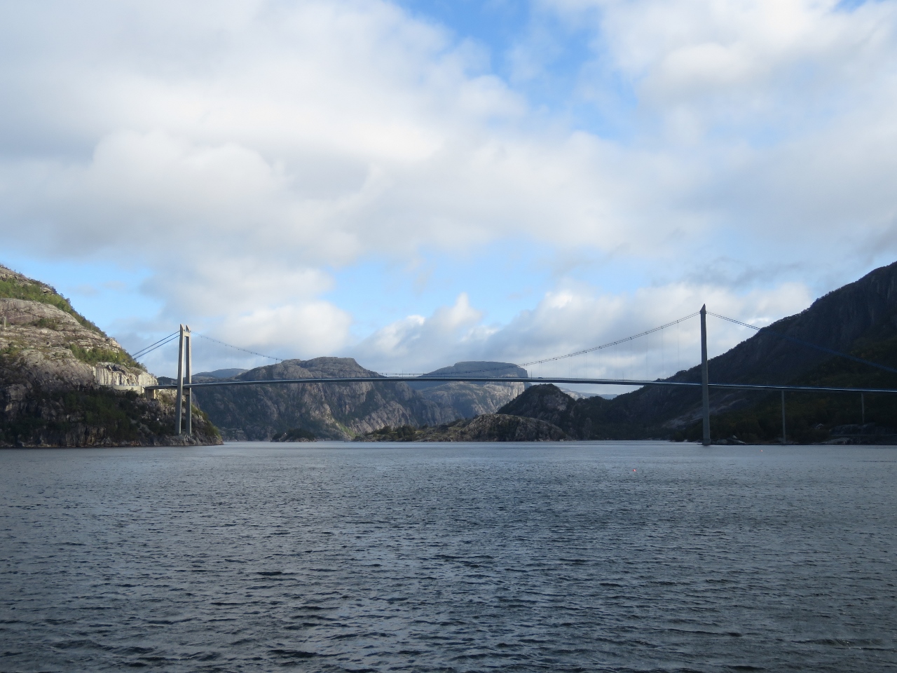 |
Lysefjord Bridge
Position: 58°55.24’N, 6°5.63’E
The 2,096 ft (639-metre) Lysefjord Bridge, one of Norway’s many, many suspension bridges, was completed in 1997.
|
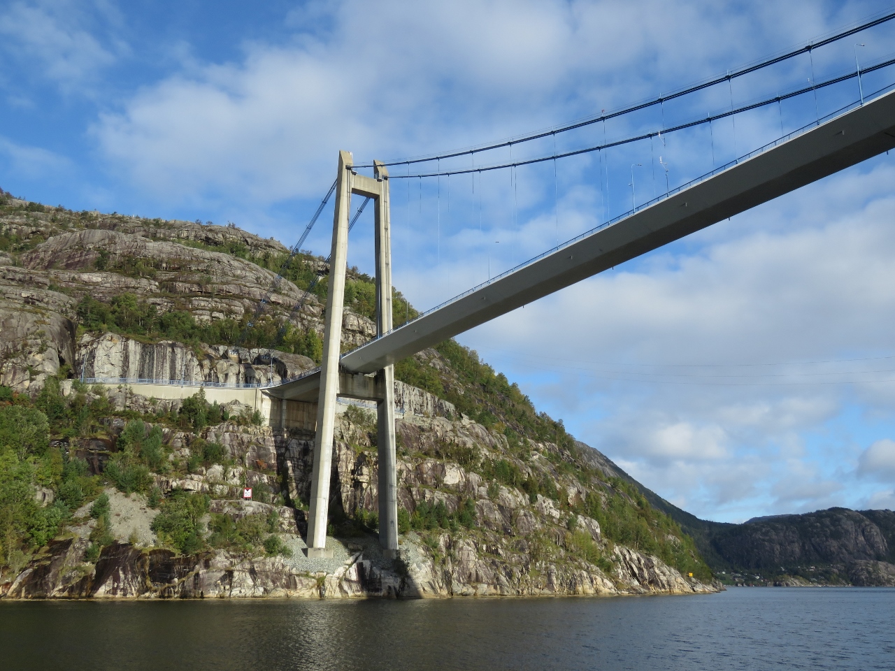 |
Tower
Position: 58°55.60’N, 6°5.96’E
Passing under one of the 335 ft (102 metres ) towers of the Lysefjord Bridge. We’re starting to get some sunny patches now.
|
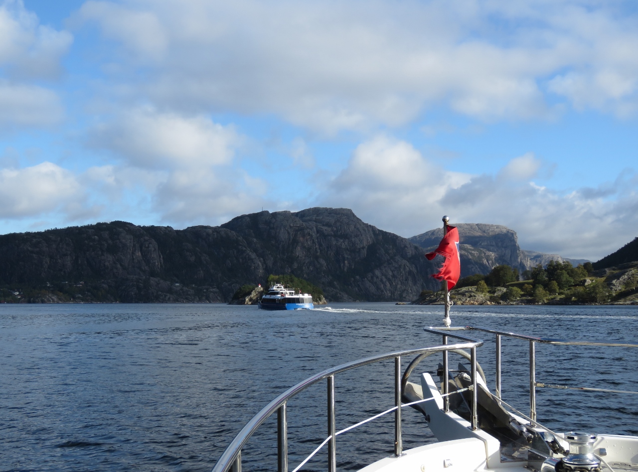 |
Rygerdronningen
Position: 58°55.87’N, 6°6.08’E
The modern catamaran Rygerdronningen, delivered this year to Rodne Fjord Cruises, passing us on a Lysefjord cruise.
|
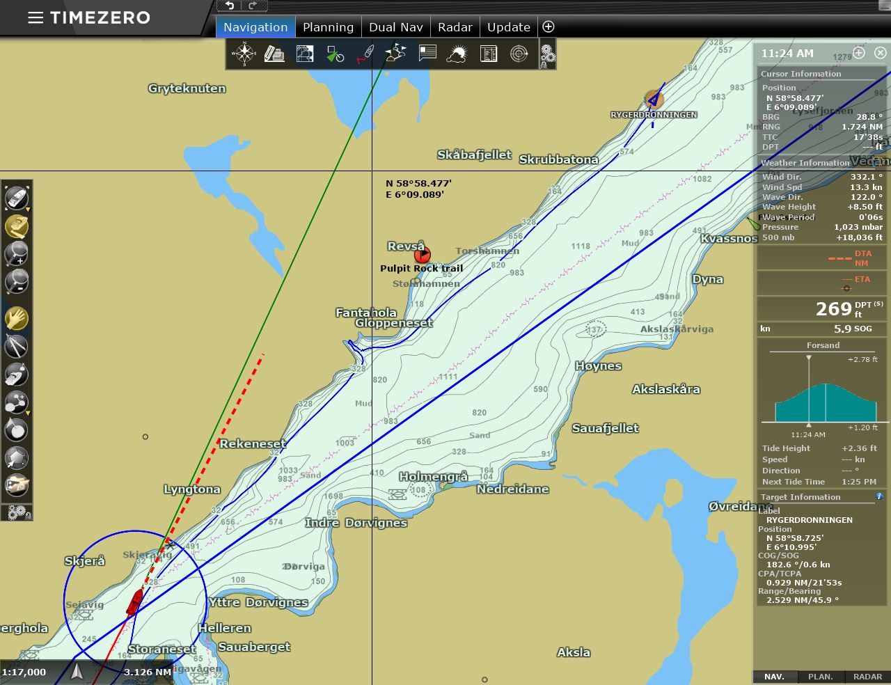 |
Local Knowledge
Position: 58°56.90’N, 6°7.42’E
We enabled tracking on the Rygerdronningen to record where it went and gain some local knowledge on the more interesting places along the fjord. Here you can see where Rygerdronningen stops and moves up closer to the shoreline.
|
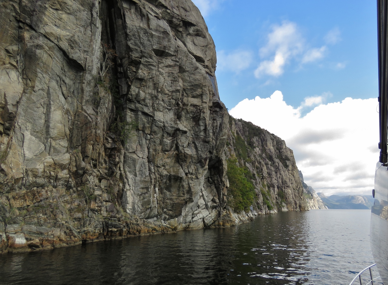 |
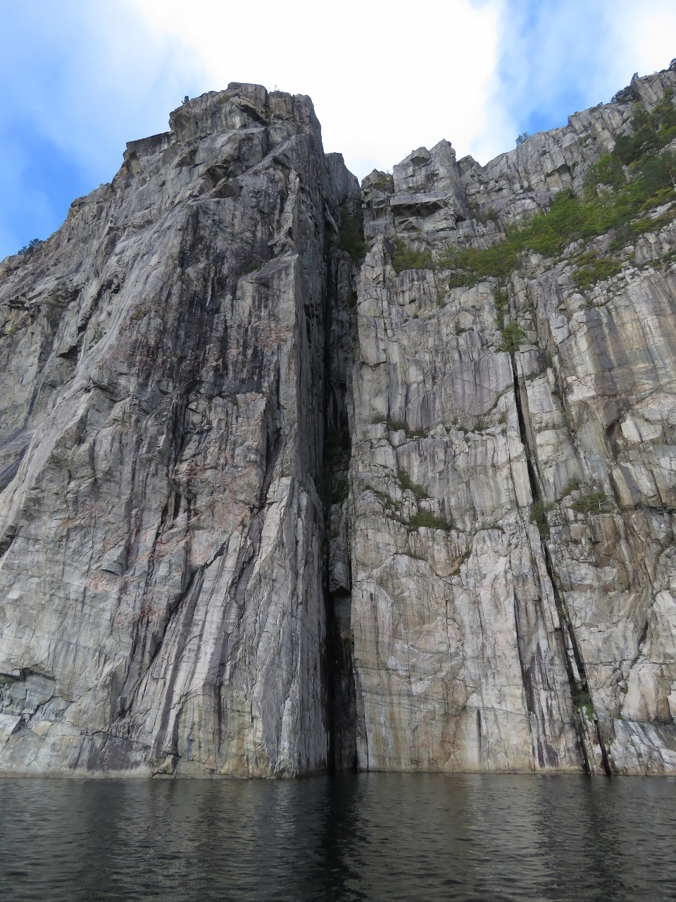
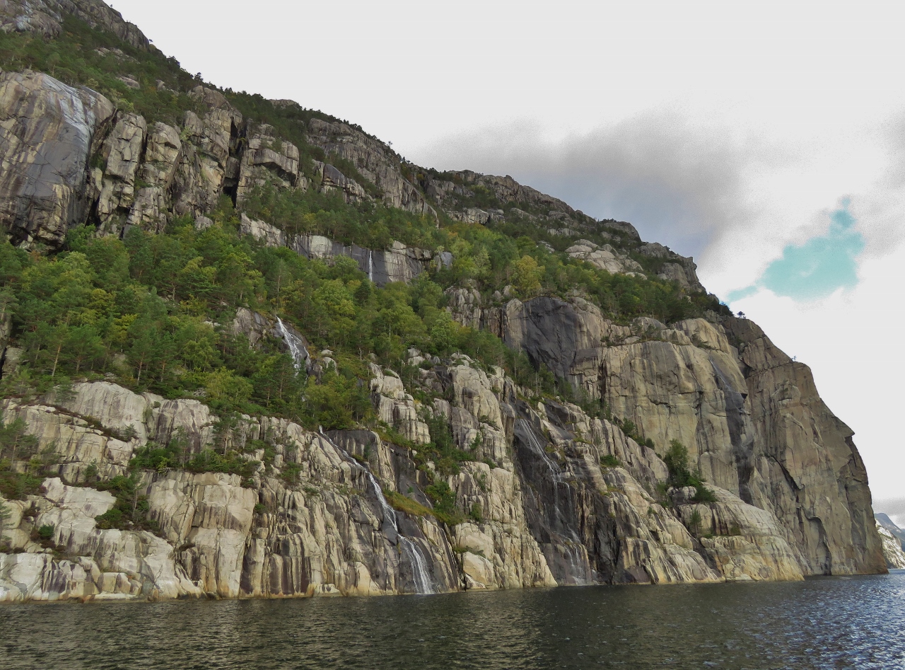
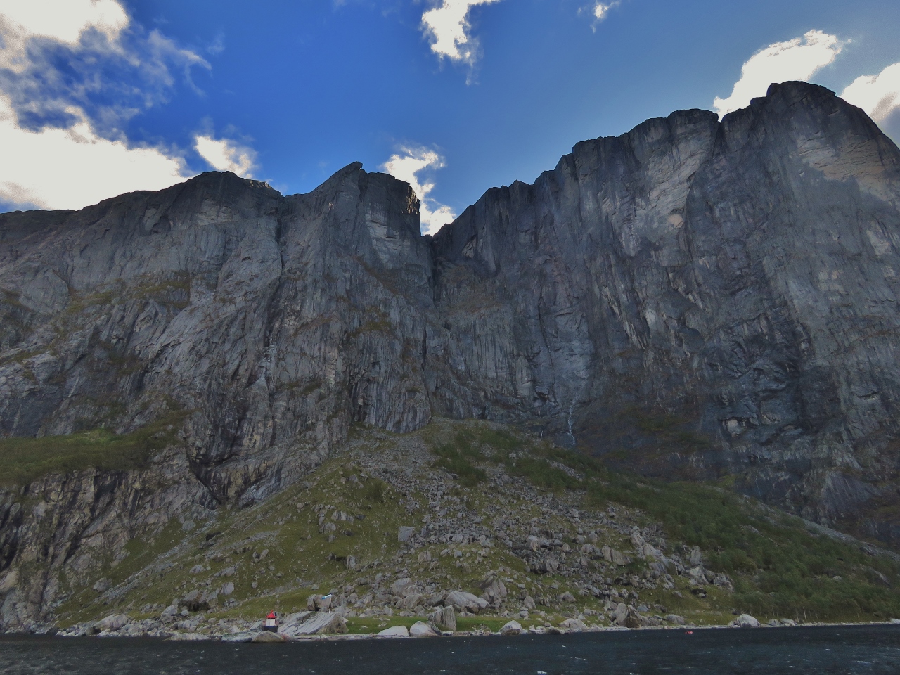
Sheer
Position: 58°57.31’N, 6°8.10’E
Sheer cliffs rising 1,300ft (400m) directly above Dirona.
|
 |
Crevice
Position: 58°57.78’N, 6°8.96’E
A crevice extending from the water right up the cliff.
|
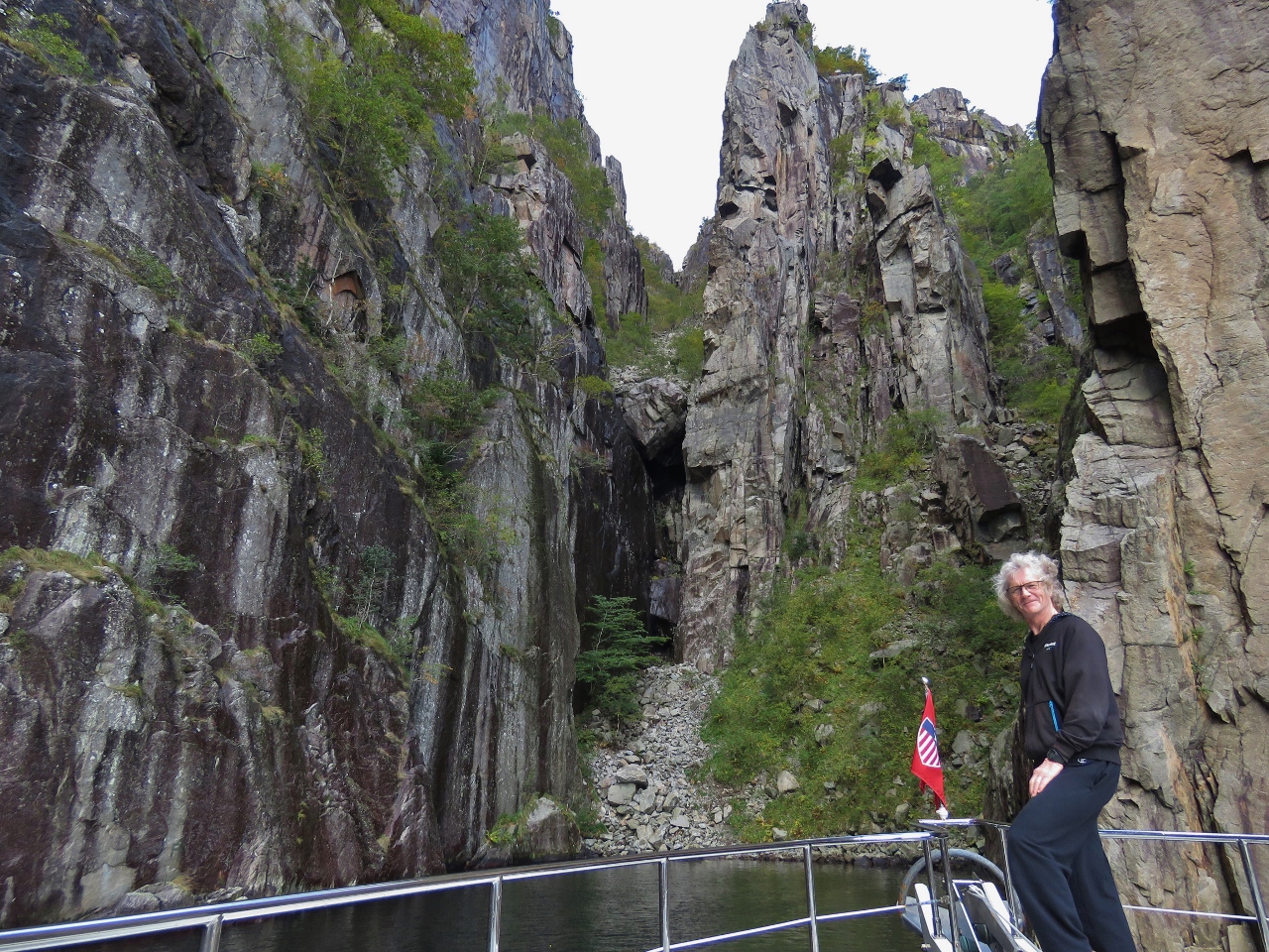 |
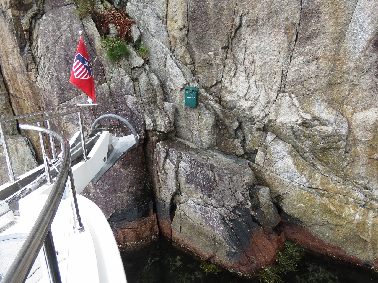
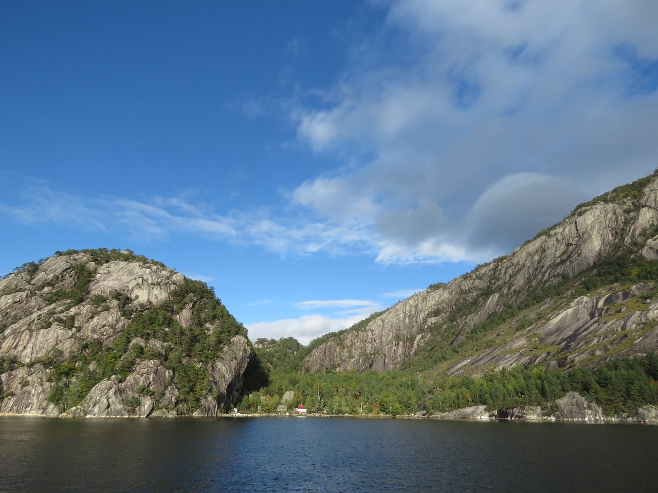
Fantahola
Position: 58°57.87’N, 6°8.92’E
The narrow and dramatic inlet Fantahola, on the north side of Lysefjord, is so steep on all sides that we could bring the boat right inside and be within feet of the walls on both sides.
|
 |
Visitor Box
Position: 58°57.84’N, 6°9.04’E
Visitor’s sign-in box on the sheer wall at Fantahola. We could easily have stepped off to sign it.
|
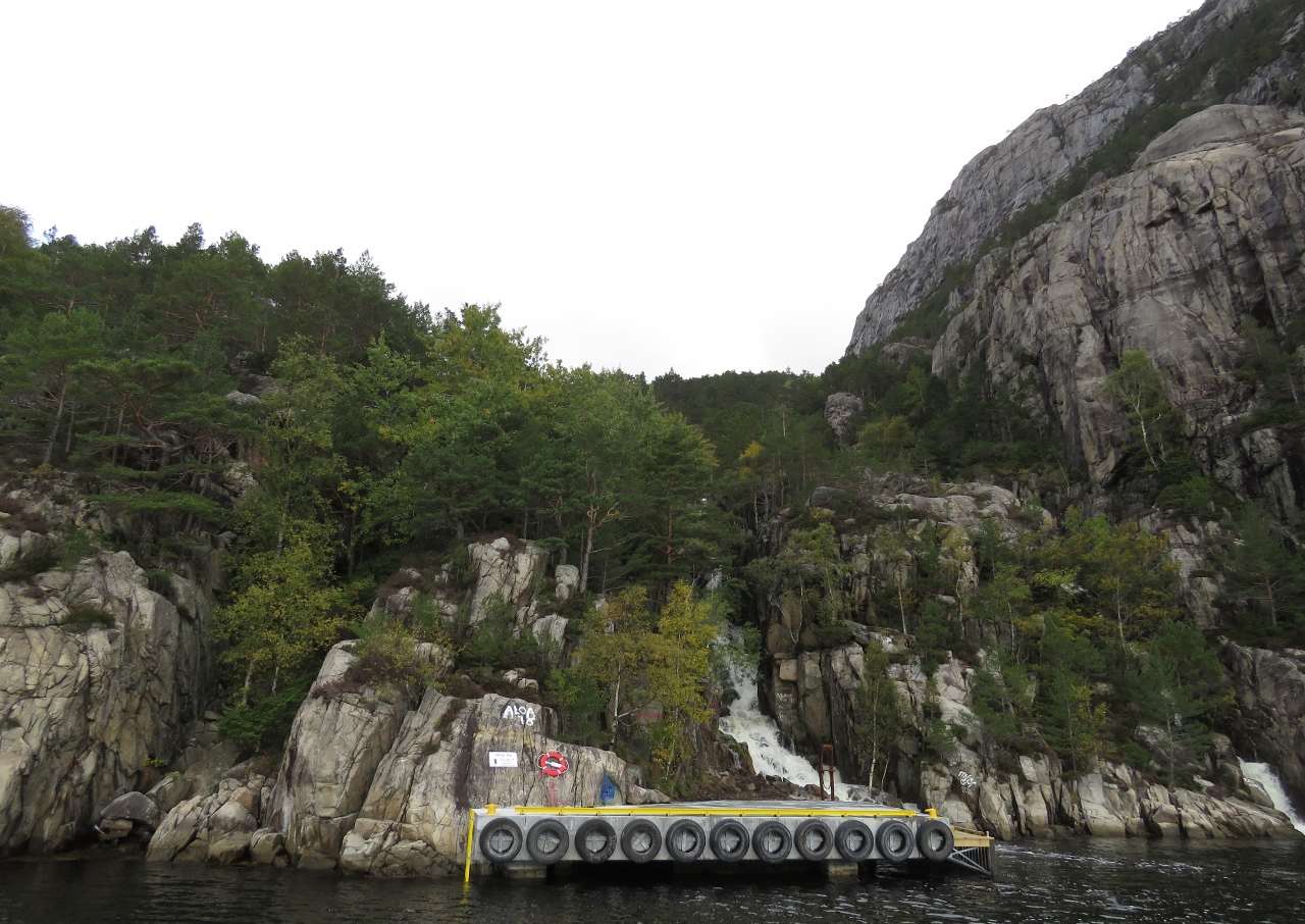 |
Trailhead
Position: 58°58.14’N, 6°9.47’E
The water-level trailhead for the 3-4-hour hike to the 1,981ft (604m) Pulpit Rock, one of Norway’s most famous and popular landmarks. The easier and more common route is a 1-2 hike from a road-accessible trailhead.
|
 |
Revsana
Position: 58°58.13’N, 6°9.52’E
The river Revsana emptying into Lysefjord adjacent to the Pulpit Rock trailhead.
|
 |
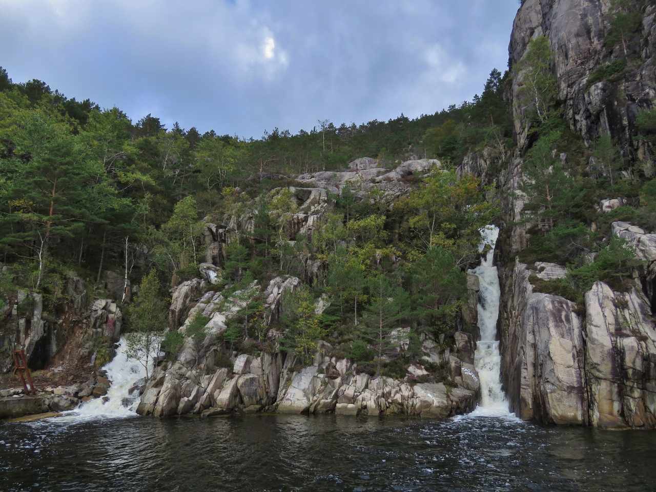
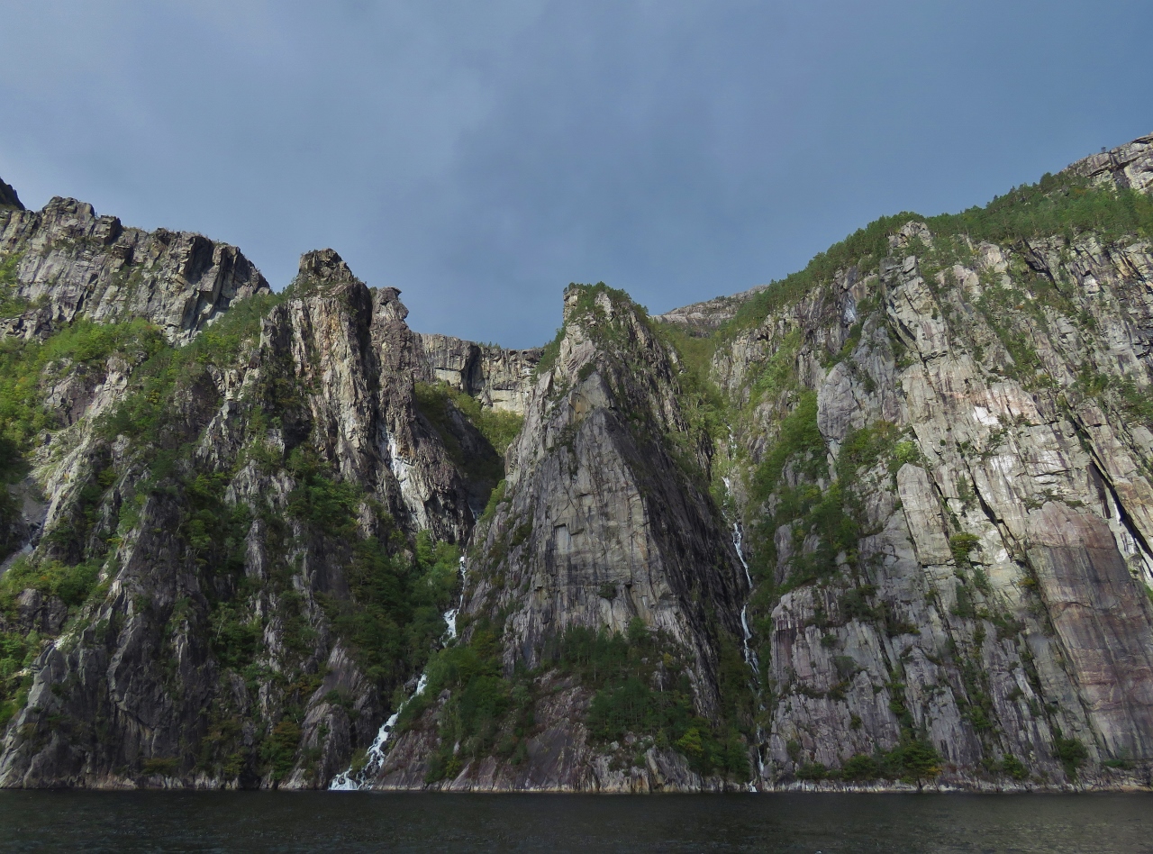
Skrubbatona
Position: 58°58.26’N, 6°10.17’E
Several waterfalls spilling down the cliffs at Tors.
|
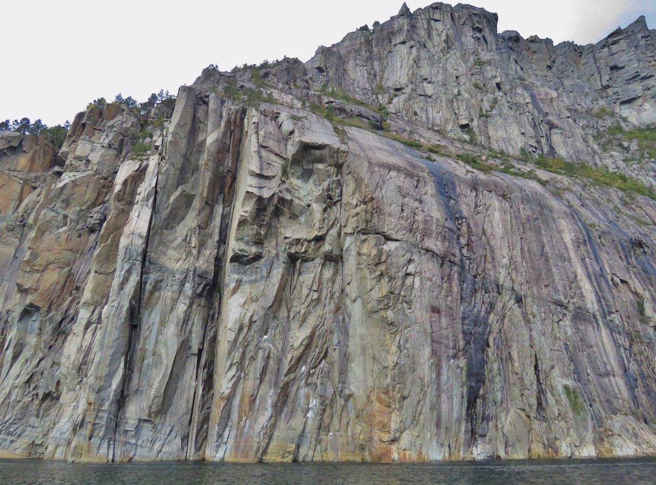 |
Naeverdalsgjuvet
Position: 58°58.44’N, 6°10.58’E
Sheer 1,981ft (600m) cliffs at Naeverdalsgjuvet. Lysefjord is definitely living up to its reputation for spectacular scenery.
|
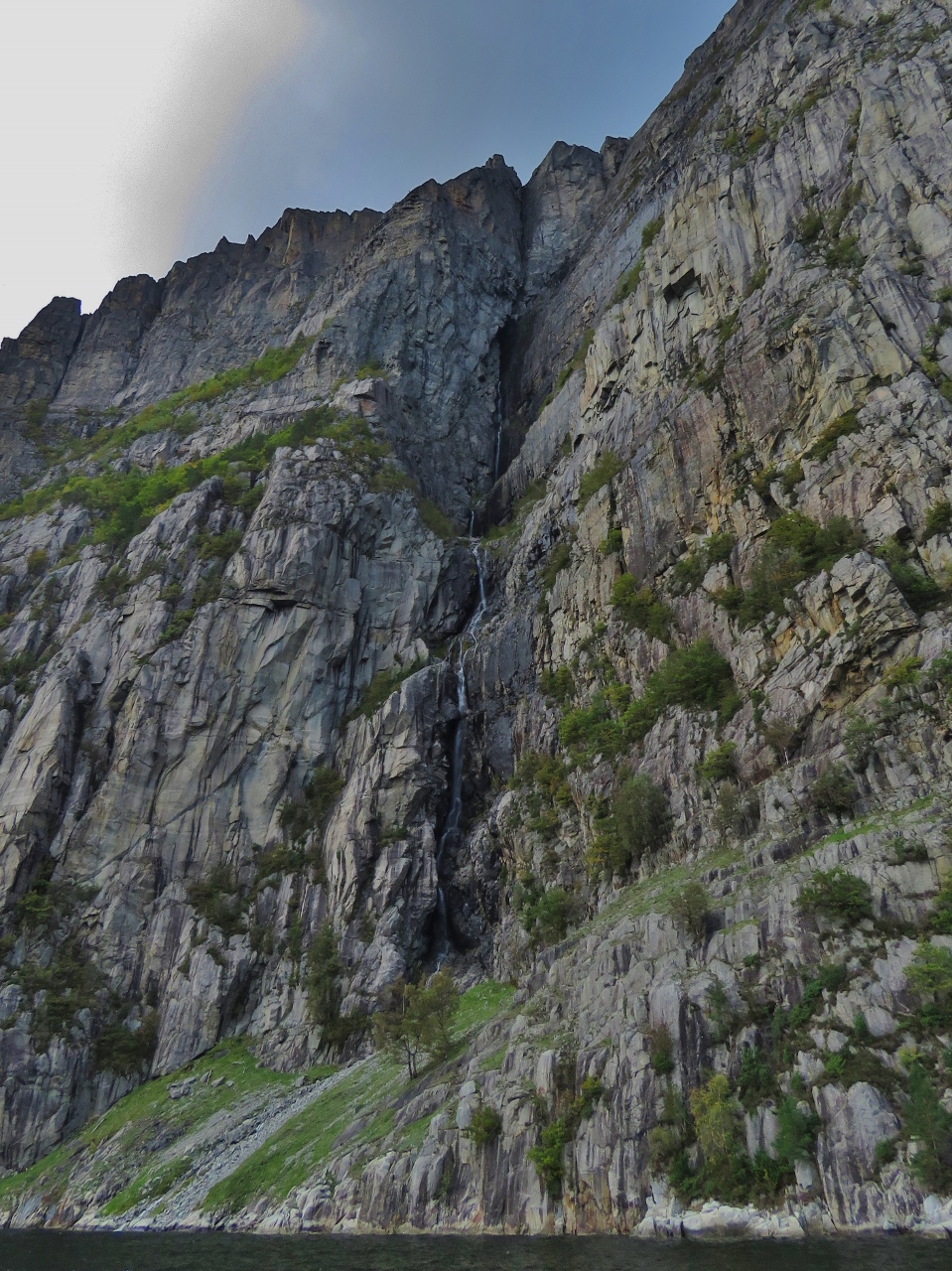 |
Waterfall III
Position: 58°58.78’N, 6°11.16’E
Waterfall falling down through a crevice from far above.
|
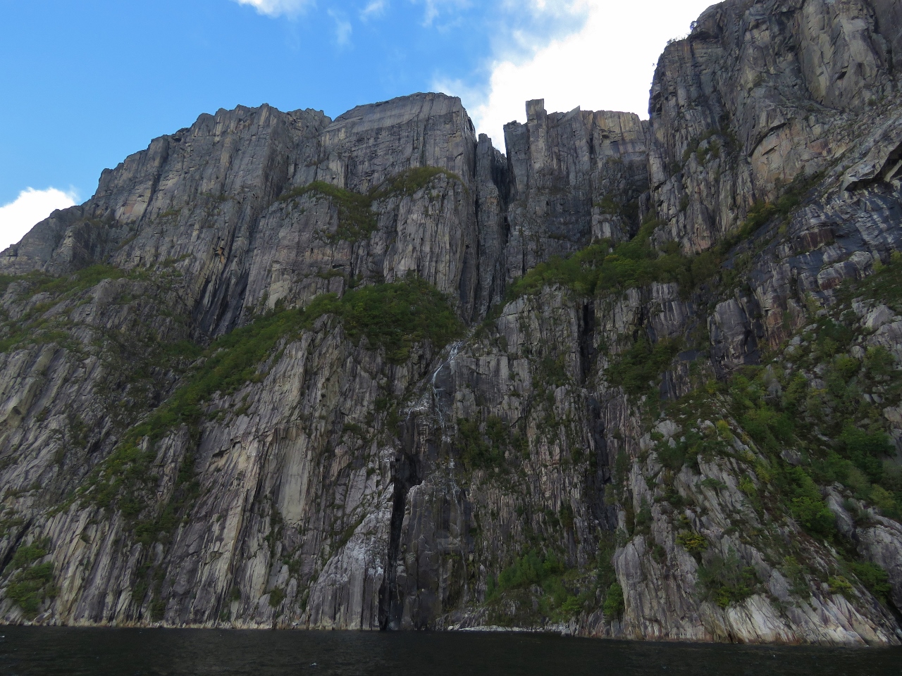 |
Pulpit Rock
Position: 58°59.11’N, 6°12.00’E
Looking way up to the Pulpit Rock, the square-shaped projection slightly to the right of center at the top of the picture.
|
 |
Angjuvet
Position: 58°59.46’N, 6°12.89’E
Waterfalls on either side of the headland at Angjuvet.
|
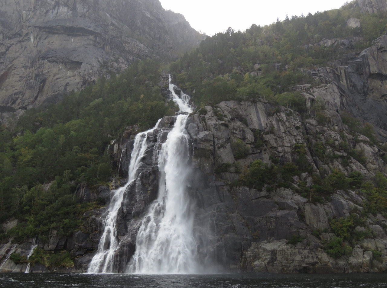 |
Hengjanefossen
Position: 58°59.90’N, 6°13.95’E
Hengjanefossen gushing into Lysefjord.
|
 |
Blue Skies
Position: 58°59.78’N, 6°14.02’E
Rain had started falling as we neared Hengjanefossen, so we decided to drift there over lunch to see if conditions improved. And they did.
|
 |
Florli
Position: 59°1.56’N, 6°25.76’E
Power station at Florli. A 4,444 public staircase, one of the longest in the world, runs beside the pipes to the dam.
|
 |
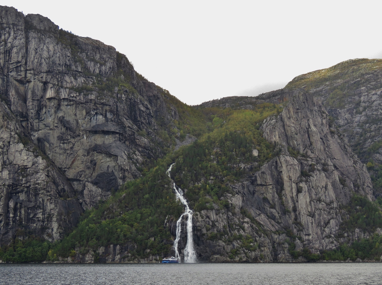
Linhamnen
Position: 59°2.58’N, 6°33.15’E
Another beautiful waterfall draining into Lysefjord at Linhamnen.
|
 |
Geitaneset
Position: 59°2.55’N, 6°34.52’E
Looking up to the cliffs above Geitaneset. Lysefjord is so deep and steep to that in most places all 500 feet of our rode would not even reach the bottom. We considered anchoring at at Geitaneset where depths are about 50ft, but it felt a little too exposed, especially with the winds predicted to increase this afternoon and evening.
|
 |
Lysebotn
Position: 59°2.47’N, 6°34.05’E
The village of Lysebotn nestled beneath cliffs at the head of Lysefjord.
|
 |
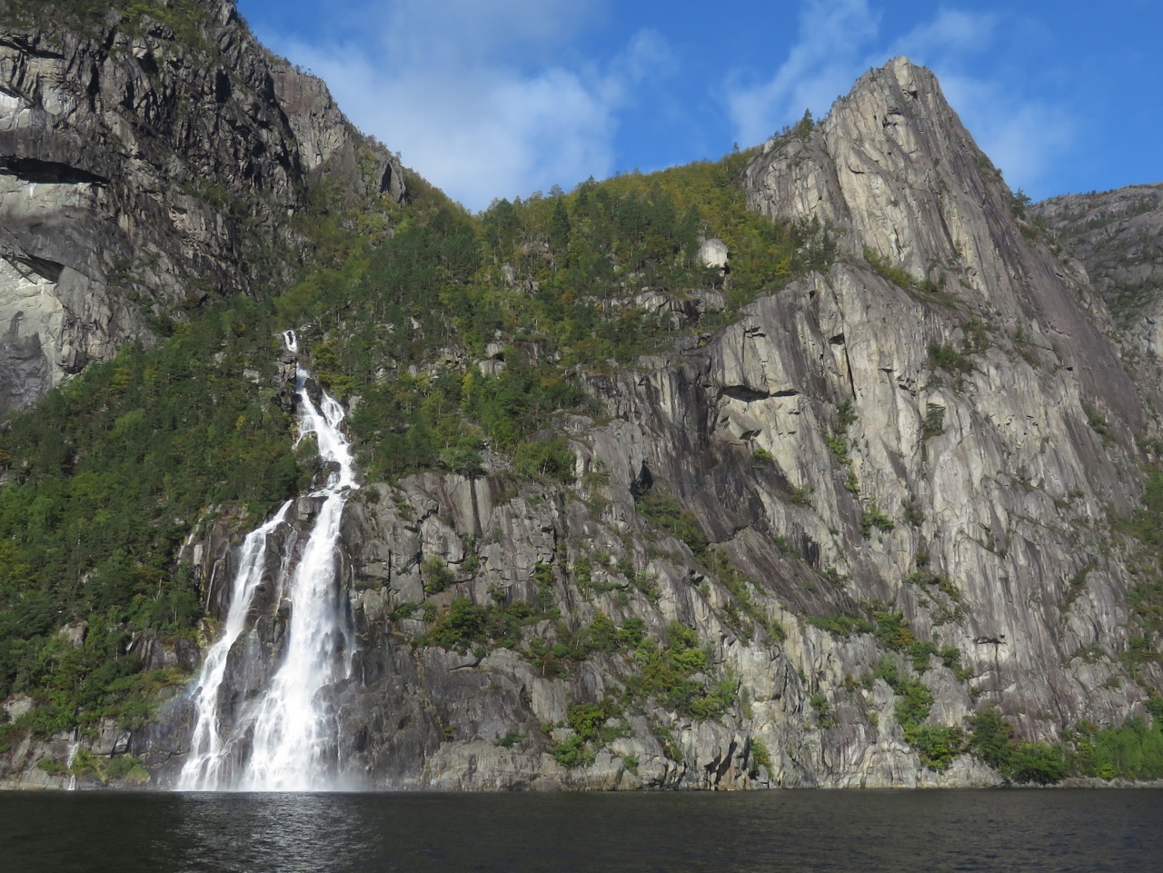
Second Trip
Position: 58°59.26’N, 6°13.94’E
The tour boat Rygerdronningen at Hengjanefossen on their second trip of the day.
|
 |
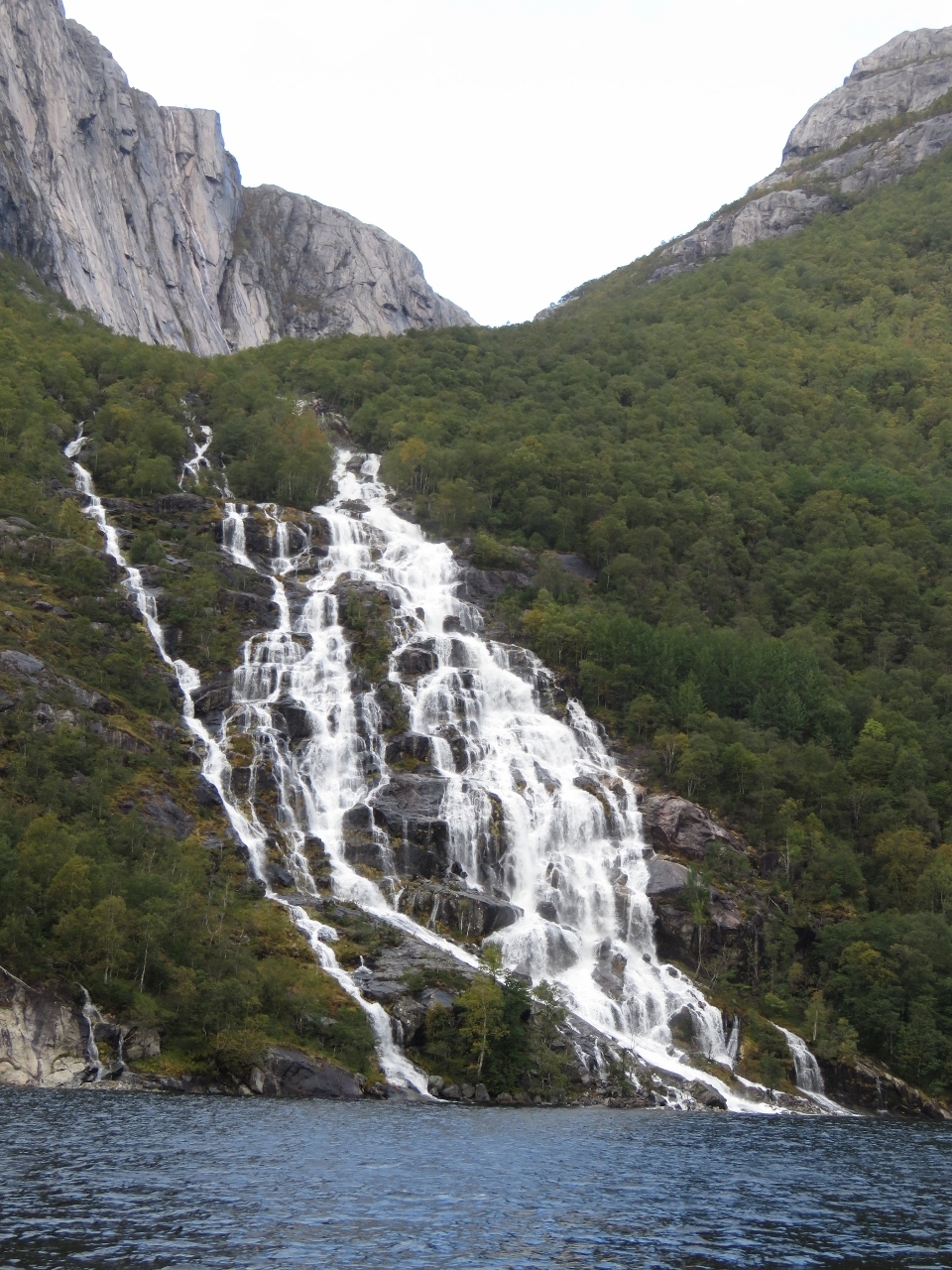
Fossana
Position: 58°58.98’N, 6°13.05’E
The river Fossana cascading down the south shore of Lysefjord. This certainly has been a record day for spectacular waterfalls.
|
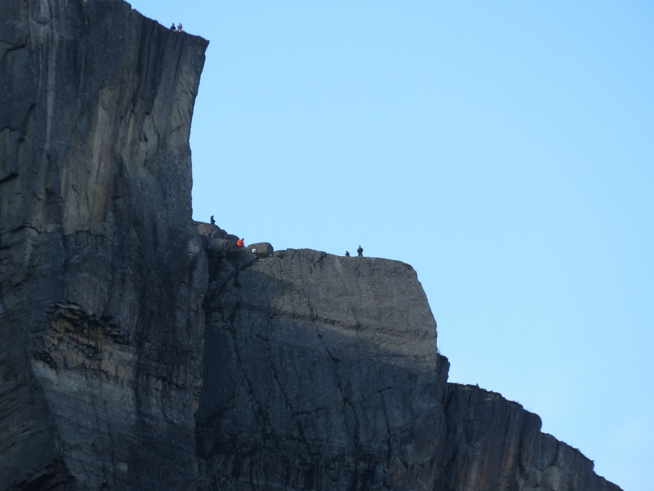 |
Hikers
Position: 58°58.40’N, 6°11.36’E
Hikers on the Pulpit Rock way above.
|
 |
Bergsholmen
Position: 58°55.95’N, 6°6.99’E
The view north from our sheltered anchorage off the island of Bergsholmen near the mouth of Lysefjord.
|
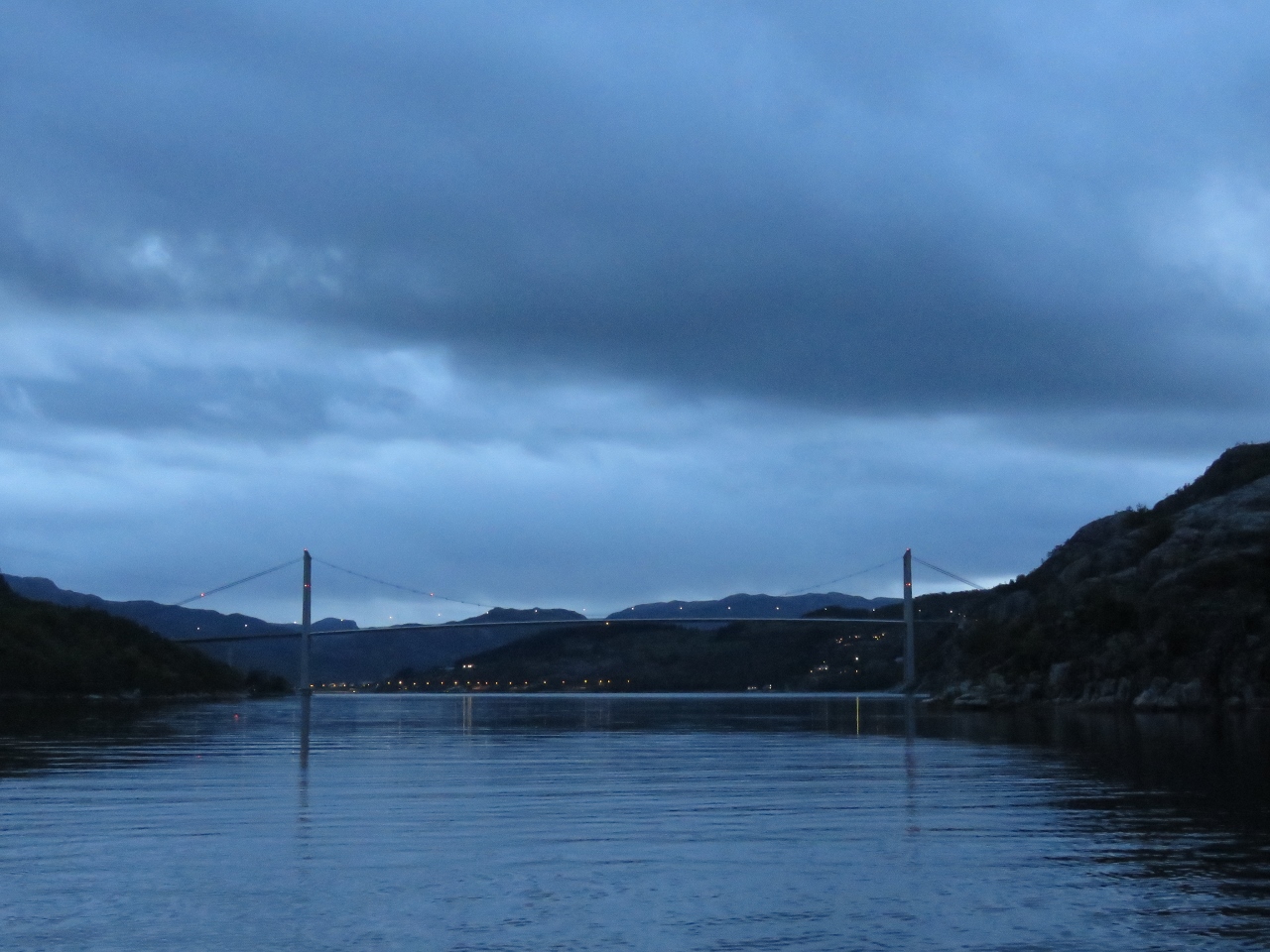 |
Dusk
Position: 58°55.93’N, 6°7.00’E
One of the appeals of the anchorage at Bergsholmen was a view to the Lysefjord Bridge.
|
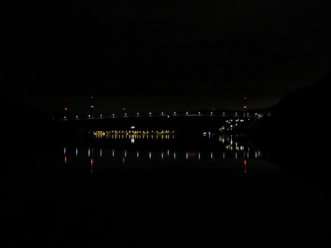 |
Reflections
Position: 58°55.93’N, 6°7.00’E
The lights of the Lysefjord Bridge and the village of Oanes beyond reflecting in still waters.
|
 |
Rygerdronningen
Position: 58°55.96’N, 6°7.01’E
The tour boat Rygerdronningen making a pass through our anchorage before heading up Lysefjord.
|

|
Click the travel log icon on the left to see these locations on a map, with the complete log of our cruise.
On the map page, clicking on a camera or text icon will display a picture and/or log entry for that location, and clicking on the smaller icons along the route will display latitude, longitude and other navigation data for that location. And a live map of our current route and most recent log entries always is available at mvdirona.com/maps. |
Love the pictures :)