Langfossen gushes into the Akrafjorden from 2,008ft (612m) above, with a vertical drop of 400ft (122m). The waterfall was rated the best in Norway in the World Waterfall Database (and the best in the world using an earlier rating system). After a 60-mile run from Bergen to the Romsa Islands, the following day we made a 57-mile tender trip up Akrafjorden to view the spectacular Langfossen.
Trip highlights from September 23rd and 24th, 2018 follow. Click any image for a larger view, or click the position to view the location on a map. And a live map of our current route and most recent log entries always is available at mvdirona.com/maps
 |
Viking Star
Position: 60°23.99’N, 5°18.78’E
Passing the Bergin-registered cruise ship Viking Star on an early-morning departure from Bergen. We’re typically up at 5am most days and generally will get underway immediately so that we can get in earlier to the next place and enjoy lunch or at least dinner there.
For most of our time in Norway, we had light no matter what time we got up, but now with the shorter days we’re usually departing in the dark. So long as we don’t have a difficult channel to pass through, running in the dark generally isn’t a problem. We always pre-plot our course for the day, so we just need to follow it while watching for other traffic and ensuring the navigation markers and other clues all match up with our chartplotter. |
 |
Nordkapp
Position: 60°6.77’N, 5°27.84’E
The 344.7 ft (105.05 m) Norwegian Coast Guard offshore patrol vessel Nordkapp crossing Bjornafjorden.
|
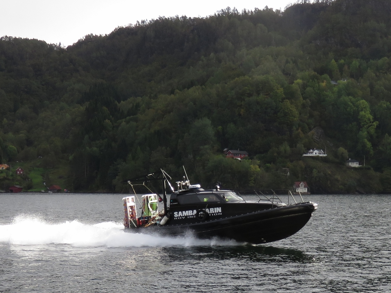 |
Fox Hunter
Position: 60°3.20’N, 5°42.38’E
Samba Marin‘s Fox Hunter dive boat passing us at nearly 40 knots. The company specializes in support for fish farms and other marine industries. This boat is well-equipped for commercial diving.
|
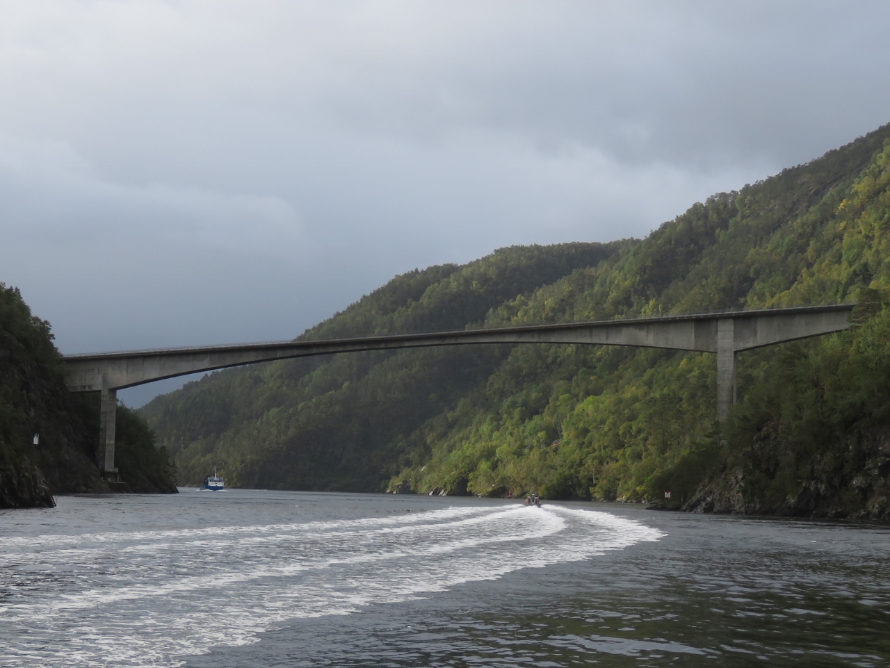 |
Lukksundet
Position: 60°3.05’N, 5°42.32’E
Approaching the bridge across the narrows in Lukksundet. Fox Hunter is passing under ahead of us and the workboat Katla is nearing in the other direction
|
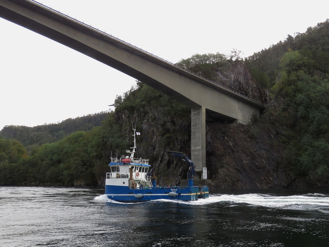 |
Katla
Position: 60°2.74’N, 5°42.29’E
The work boat Katla passing under bridge across Lukksundet. We’ve seen a lot of these almost-square-shaped work boats in Norway.
|
 |
Anchorage
Position: 59°40.31’N, 5°44.44’E
The view east from our anchorage at the Romsa Islands. After a few days in town, we like to spend some time at anchor to catch up and enjoy some solitude.
|
 |
Romsa Islands
Position: 59°40.30’N, 5°44.44’E
At anchor in the sheltered Romsa Islands.
|
 |
Akrafjorden
Position: 59°45.15’N, 6°1.76’E
Looking up Akrafjorden on a 57-mile tender trip from the Romsa Islands to Langfossen waterfall. Conditions were a little rough to reach the mouth, but the tender did fine and now we’re in relatively sheltered and smooth waters.
|
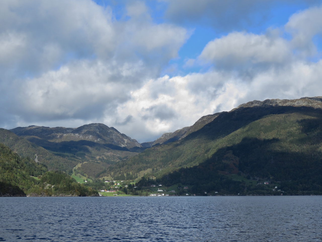 |
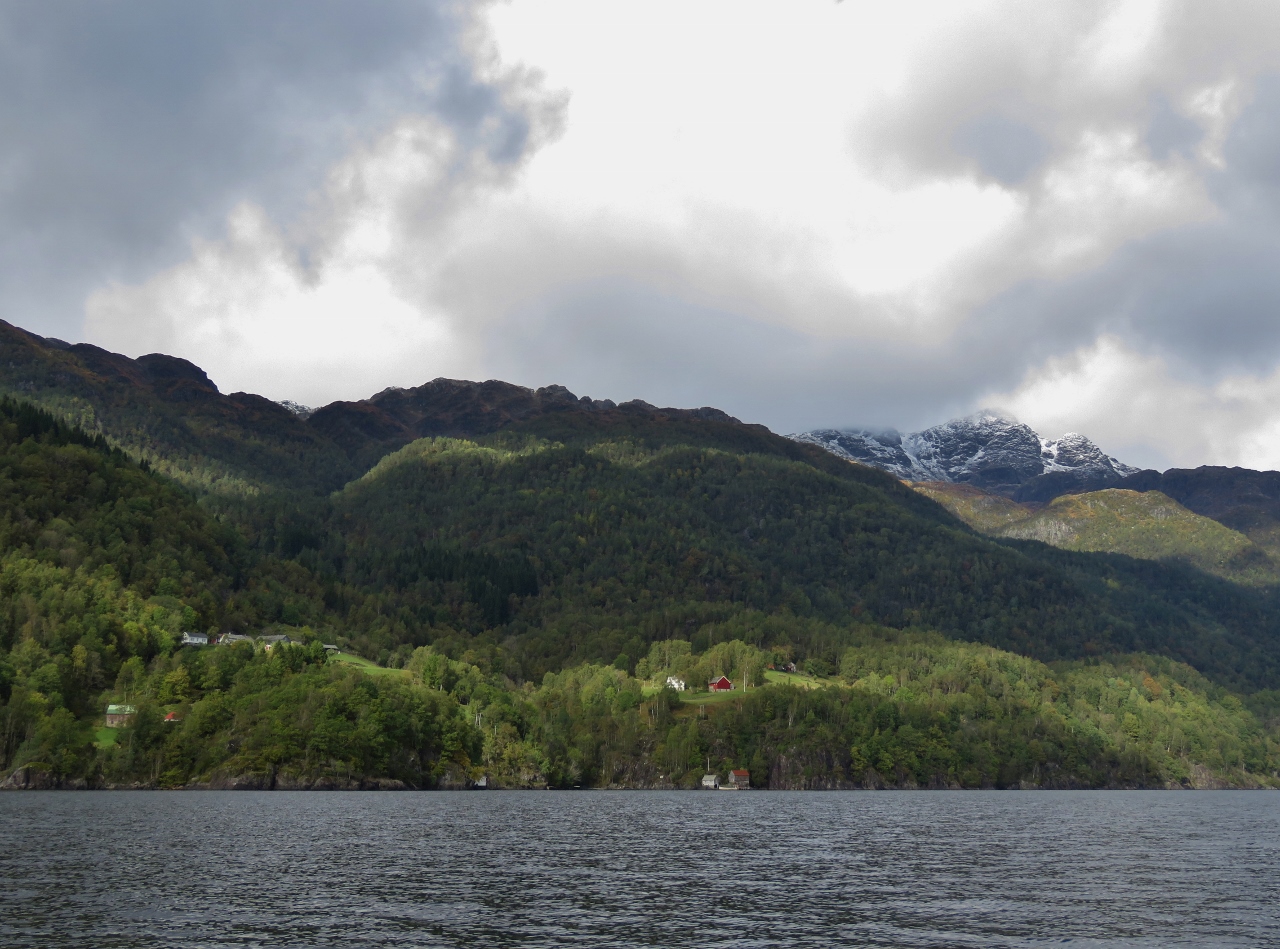
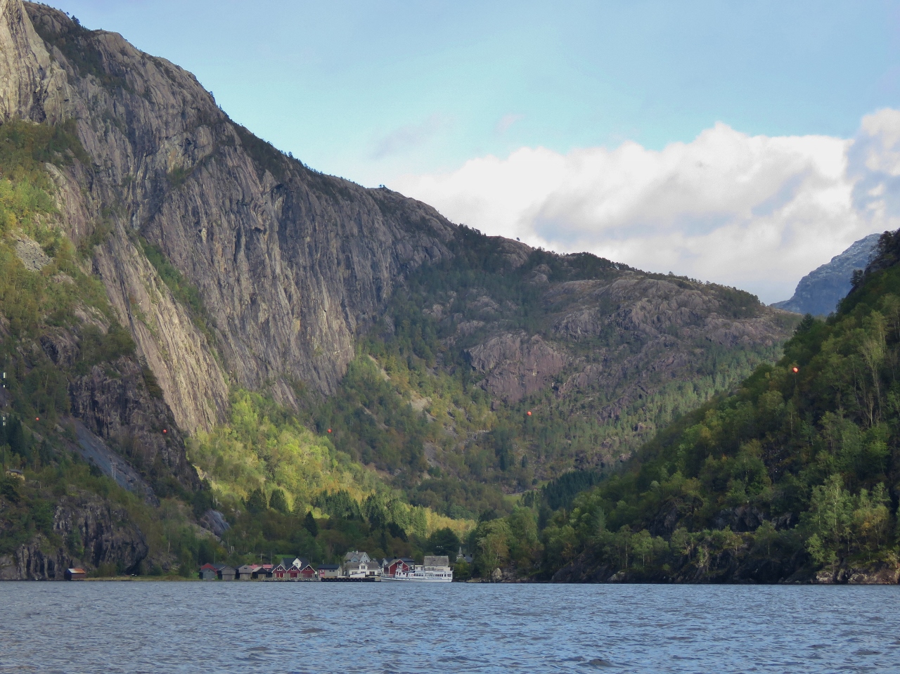
Akra
Position: 59°45.84’N, 6°5.52’E
The village of Akra nestled beneath steep mountains on the north side of Akrafjorden.
|
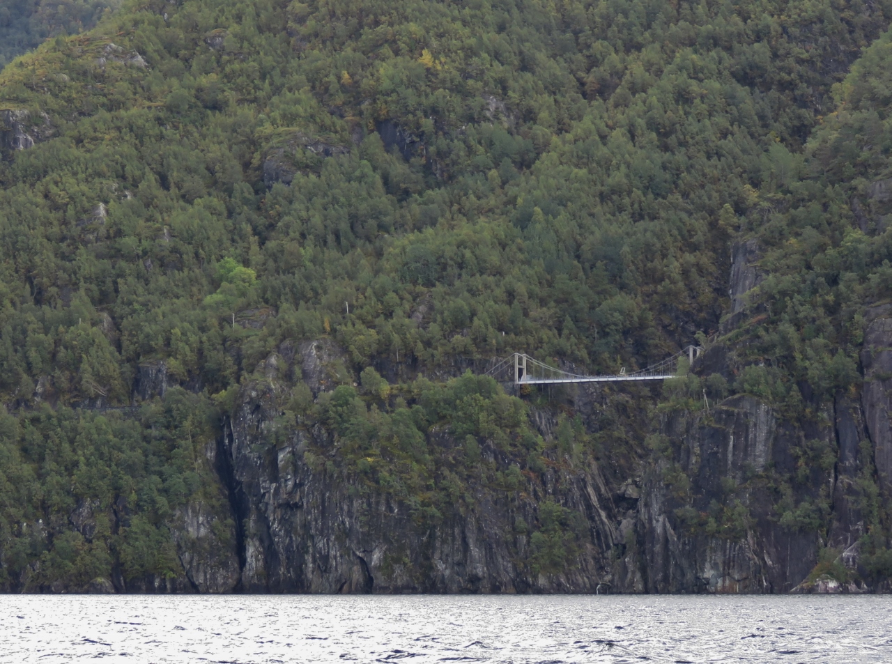 |
Trolljuv Bridge
Position: 59°47.51’N, 6°8.65’E
Trolljuv bridge, strung 377ft (115m) above the water, is another tunnel-to-tunnel suspension bridge. Thrill-seekers can bungee jump from it with Strikkhopp og Sant AS.
|
 |
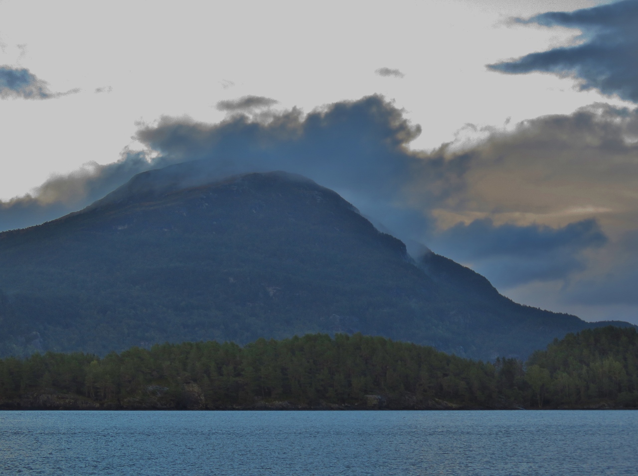
Fresh Snow
Position: 59°48.98’N, 6°12.59’E
Fresh snow on the mountains tops to our north. Winter is coming.
|
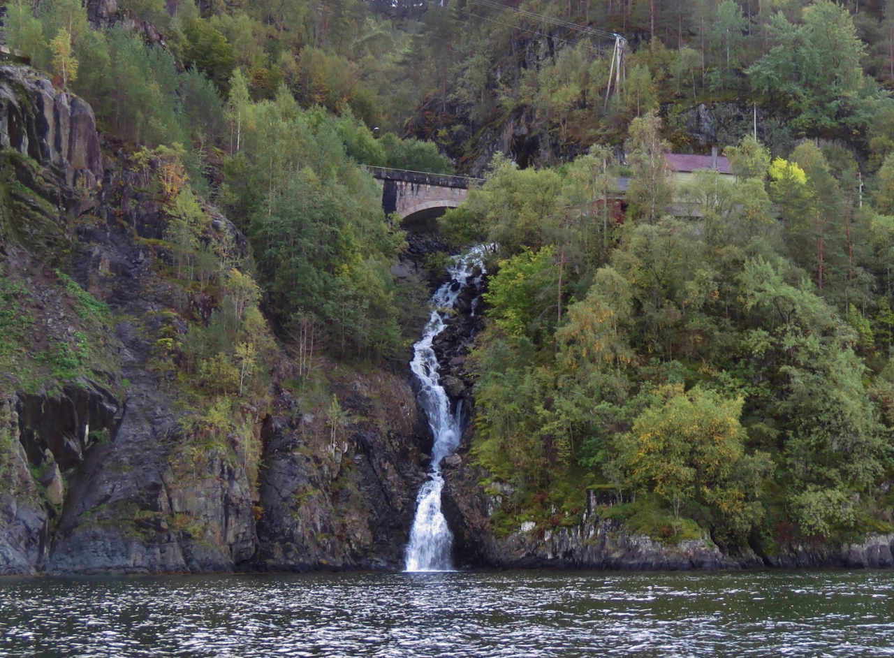 |
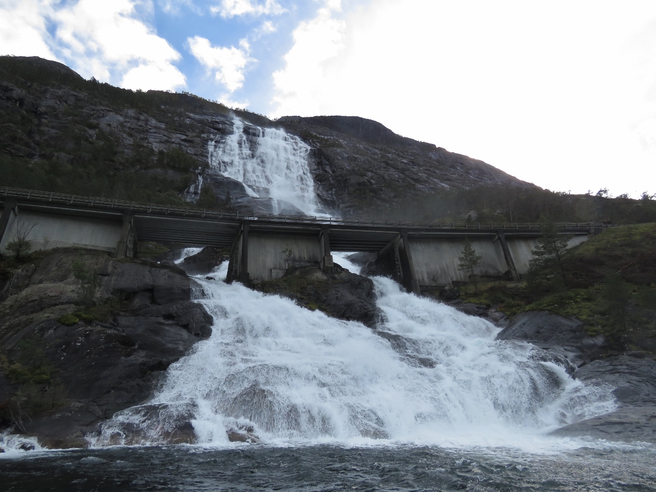
Waterfall
Position: 59°49.77’N, 6°14.69’E
Waterfall passing under a bridge along the old Akrafjorden coastal road. The new road passes through the 1.5 mile (2.4km) Markhus tunnel behind.
|
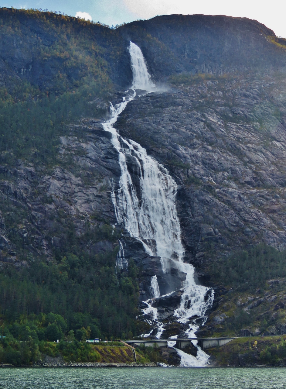 |
Langfossen
Position: 59°51.21’N, 6°20.40’E
Our goal for the tender trip: spectacular Langfossen, rated the best waterfall in Norway in the World Waterfall Database (and the best in the world using an earlier rating system). The waterfall gushes into the Akrafjorden from 2,008ft (612m) above, with a vertical drop of 400ft (122m), dwarfing the tour bus parked below on the left.
|
 |
Base of Falls
Position: 59°50.80’N, 6°20.37’E
Two of the three shutes that Langfoss splits into before reaching Akrafjorden. The World Waterfall Database reports that “When surveyed in June of 2011, so much spray was being ejected from the base of the falls that attempting to cross the bridge below the falls on foot would have been tantamount to taking a stroll during a hurricane.”
|
 |
Exploding
Position: 59°50.81’N, 6°20.37’E
Water exploding in a sea of spray high up Langfossen.
|
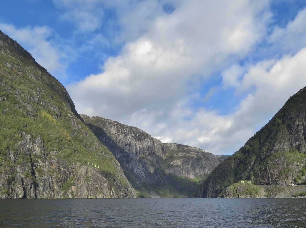 |
Akrafjorden Head
Position: 59°51.60’N, 6°21.07’E
Looking towards the head of Akrafjorden from Langfossen.
|
 |
Fjaera
Position: 59°52.23’N, 6°21.71’E
The village of Fjaera beneath steep cliffs at the head of Akrafjorden.
|

|
Click the travel log icon on the left to see these locations on a map, with the complete log of our cruise.
On the map page, clicking on a camera or text icon will display a picture and/or log entry for that location, and clicking on the smaller icons along the route will display latitude, longitude and other navigation data for that location. And a live map of our current route and most recent log entries always is available at mvdirona.com/maps. |
If your comment doesn't show up right away, send us email and we'll dredge it out of the spam filter.