Hardangerfjord is the second longest fjord in Norway after Sognefjord, and the fourth longest in the world. Besides dramatic scenery, attractions there include the Norwegian Museum of Hydropower and Industry, with the Tyssedal Hydroelectric Power Station fully open to visitors, and the Voringfossen, a group of spectacular waterfalls that include the 600-ft (182m) Voringfoss Waterfall with a 475ft (145m) free fall.
Below are trip highlights from September 21st, 2018 at Hardangerfjord, Norway. Click any image for a larger view, or click the position to view the location on a map. And a live map of our current route and most recent log entries always is available at mvdirona.com/maps
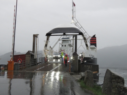 |
Gloppen
Position: 60°18.05’N, 6°10.29’E
At Torvikbygd to catch the ferry Gloppen to Jondal for a road trip around Hardangerfjord. We’d picked up a rental car in Bergen the moment the agency opened at 7am and just made the 8:40am ferry. This was fortunate, as the next one wasn’t for 90 minutes.
|
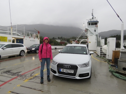 |
Our Ride
Position: 60°18.03’N, 6°10.39’E
Jennifer on the ferry Gloppen with our ride, an Audi A1 Sportback. Heavy rain has been falling all morning, but should clear this afternoon.
|
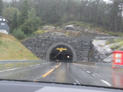 |
Jondal Tunnel
Position: 60°14.64’N, 6°12.45’E
Entering the 6.5 mi (10.4km) Jondal Tunnel, the 6th longest tunnel in Norway.
|
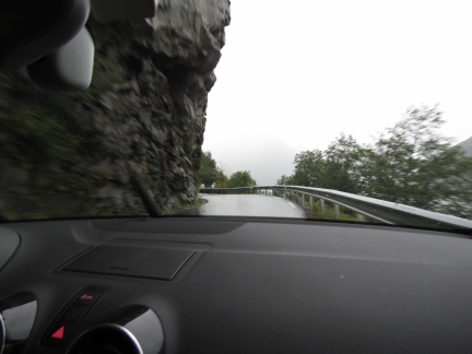 |
Narrow Road
Position: 60°9.13’N, 6°17.07’E
Norway has been gradually replacing all the old, narrow shore-hugging roads with wider ones, or tunnels. This old section along Nodrepollen is quite narrow, with the cliff-side overhanging the road. Fortunately we didn’t have much oncoming traffic to contend with.
|
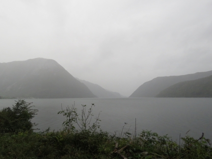 |
Nodrepollen
Position: 60°8.12’N, 6°16.95’E
The view down Nodrepollen through the mist.
|
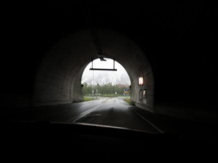 |
Folgefonn Tunnel
Position: 60°8.05’N, 6°20.83’E
We’ll be passing through a lot of tunnels today. This is exiting the 6.9-mi (11.15km) Folgefonn Tunnel, the fifth longest in Norway.
|
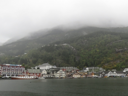 |
Odda
Position: 60°4.25’N, 6°32.83’E
The town of Odda at the head of Sorfjorden, a 20 nm branch off Hardangerfjord.
|
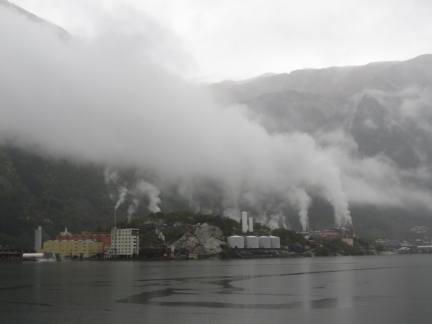 |
Norzink
Position: 60°5.02’N, 6°33.06’E
The Norzink Odda zinc smelter, founded in the 1920s. The raw materials are imported and the final product exported. What attracted the smelter to the Odda was the low-cost hydroelectric power in the area.
|
 |
Wilson Mersin
Position: 60°7.17’N, 6°33.34’E
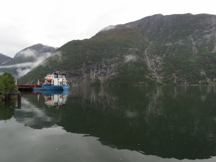
Wilson Mersin taking on cargo at Odda, with the spectacular backdrop of Sorfjorden.
|
 |
Norwegian Museum of Hydropower and Industry
Position: 60°7.17’N, 6°33.36’E
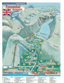
Our first stop for the day is the Norwegian Museum of Hydropower and Industry, built around the Tyssedal reservoir power station (#1 at bottom left of the map— click image for a larger view). The dam for the power station reservoir, Ringedals Dam, (#31) is at the upper right, feeding via pipes to Lippetopp (#22 midway on the left) and down the slope via pipes to the power station.
|
 |
Tyssedal Power Station
Position: 60°7.17’N, 6°33.36’E
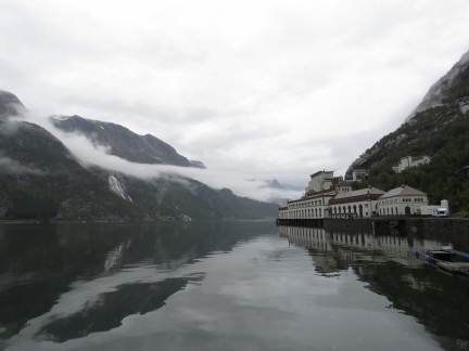
The Tyssedal power station was built between 1906 and 1918 and operated until 1989. It was one of the largest pressure power plants in the world when it first came online in 1918 with a production capacity of 100MW. The building is considered one of the best of Norway’s 20th-century architecture.
|
 |
Museum Exhibits
Position: 60°7.16’N, 6°33.39’E
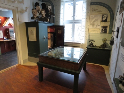
Exhibits in the museum detail the history of the area, with particular focus on hydroelectricity, the construction of Tyssedal Hydroelectric Power Station, and the industry it attracted to Odda.
|
 |
Power Plant
Position: 60°7.25’N, 6°33.38’E
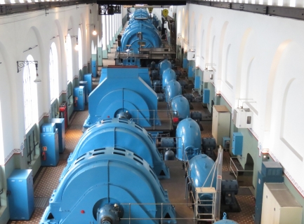
Looking across the generators and turbines in the power plant. The building was designed for a cathedral effect, with high ceilings and light-flooded floorspace. We’re effectively looking forward in time, where newer generator generations are extending out into the distance.
|
 |
Reservoir Power Plant
Position: 60°7.29’N, 6°33.36’E
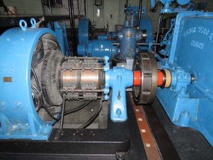
A reservoir poower plant Turbine (right), generator (left) and governer (behind) that make up a reservoir power plant.
|
 |
The Snobs
Position: 60°7.29’N, 6°33.36’E
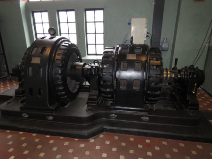
The plant initially produced 25 hertz power, used by most Odda houses and the manufacturing plants. Two small machines converted 25hz to 50hz for some gear in the power plant. The machines were known as “the snobs” because the leaders of the company also had this “better” 50hz power delivered to their homes.
|
 |
Open Generator
Position: 60°7.30’N, 6°33.33’E
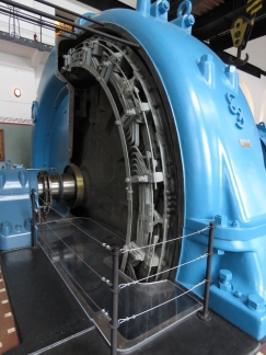
The power plant has been well-preserved, with most of the original machinery intact and accessible. This is a cut-away of one of the generators, showing the stator and the rotor with an explanation of how it works.
|
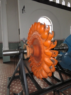 |
Pelton Turbine
Position: 60°7.29’N, 6°33.34’E
A Pelton turbine used in the power plant.
|
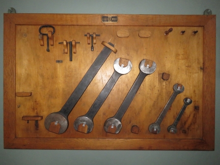 |
Tools
Position: 60°7.33’N, 6°33.32’E
Tools supplied by the generator manufacturer mounted on the wall.
|
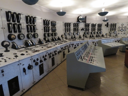 |
Control Room
Position: 60°7.27’N, 6°33.34’E
The jewel of the power plant is the control room, the best-preserved first-generation control panel in the world. The instruments are mounted on 1.7-inch (44mm) marble plates for aesthetic and practical reasons. We expected it to be sealed away behind glass windows and were delighted that we could walk through it.
|
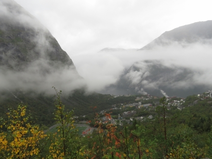 |
Tyssedal
Position: 60°7.21’N, 6°34.51’E
Looking across Tyssedal to Sorfjorden from the road to the Ringedals Dam.
|
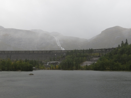 |
Ringedals Dam
Position: 60°7.90’N, 6°37.99’E
The Ringedals Dam, made from hand-carved granite, provides the reservoir for the Tyssedal Power Station and is the largest stone dam in Norway. With a reservoir capacity of 586 trillion gallons (222 million cubic meters), it was one of the largest gravity dams in Europe when completed in 1918.
|
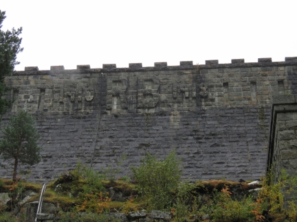 |
RB
Position: 60°7.73’N, 6°38.22’E
Ringedals Dam was topped with medieval-style battlements and contain the initials of managing director Ragnvald Blakstad and the construction date.
|
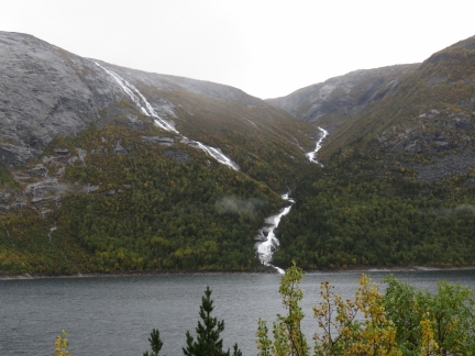 |
Mosdalsbekken
Position: 60°7.63’N, 6°38.90’E
The river Mosdalsbekken flowing into Ringedal Lake.
|
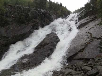 |
Mogelielvi
Position: 60°8.04’N, 6°37.58’E
The river Mogelielvi gushing down the hill near the trailhead to famous Trolltunga. We were interested in making the hike, but we’d need to set off before 8am to make the 10-12-hour return trip.
|
 |
Vetlevatn
Position: 60°7.96’N, 6°36.85’E
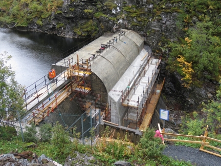
The dam on Vetlevatn lake was built between 1921 and 1924 to create an overflow reservoir for Ringedal Lake. The reinforced concrete dam was being renovated when we were there.
|
 |
Bridge
Position: 60°7.72’N, 6°36.12’E
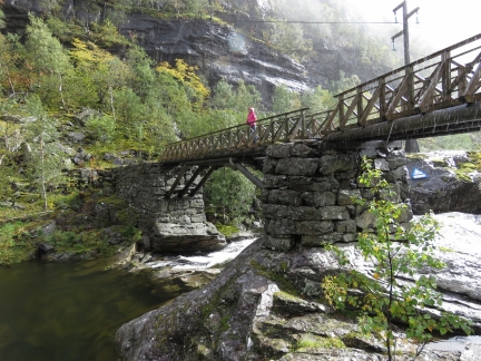
Jennifer taking in the view from a bridge over the river below Vetlevatn lake. Rain still is falling lightly, but we’re starting to get a little sun now too.
|
 |
Sorfjorden
Position: 60°8.33’N, 6°34.03’E
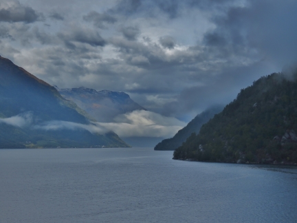
Great view down Sorfjorden just north of the power station.
|
 |
Folgefonna
Position: 60°8.33’N, 6°34.03’E
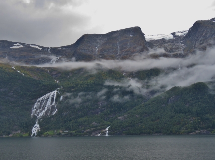
A glimpse to the Folgefonna glacier at upper right as we continued north along the shore of Sorfjorden.
|
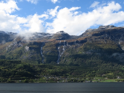 |
Waterfalls
Position: 60°17.11’N, 6°37.40’E
Waterfalls ribboning the cliffs along the west shore of Sorfjorden with blue skies above. The day is getting nicer.
|
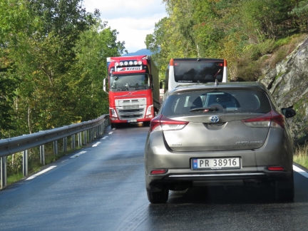 |
Traffic Jam
Position: 60°23.22’N, 6°43.06’E
Traffic ground to a halt just north of the village of Kinsarvik. It appeared to be mostly due to the narrowness of the road and the difficulty for vehicles to pass. The truck on the left is as far over as it can get, as is the bus on the right. The truck driver had to fold in his mirrors to allow the bus to pass.
|
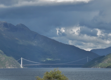 |
Hardanger Bridge
Position: 60°26.02’N, 6°45.42’E
The 4,530 ft (1,380 m) Hardanger Bridge, completed in 2013, is the longest suspension bridge in Norway and the longest tunnel-to-tunnel bridge in the world. The main span also is one of the longest suspension bridge spans in the world. We’ll be taking it on our way back to Bergen. The maximum deck height of 180 ft (55 m) prevents large cruise ships from reaching the inner Hardangerfjord anymore.
|
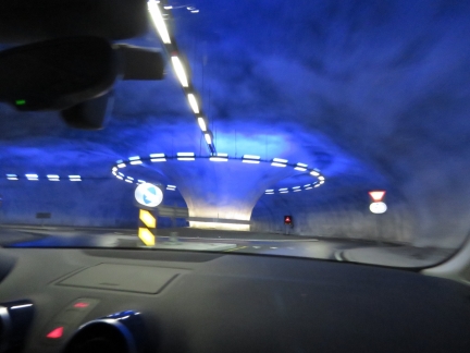 |
Tunnel Roundabout
Position: 60°27.94’N, 6°49.71’E
In addition to some pretty impressive tunnels, Norway also has the first tunnel roundabouts we’ve been in. We’ll pass through this roundabout again on our return.
|
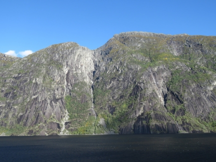 |
Eidfjorden
Position: 60°26.75’N, 7°6.18’E
Dramatic cliffs and waterfalls along the north shore of Eidfjorden.
|
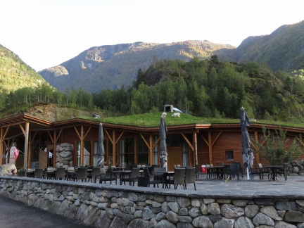 |
Goats
Position: 60°25.39’N, 7°8.04’E
We stopped in at the Hardangervidda Natursenter to watch their Lonely-Plant-recommended movie about the nature in the area, but the next showing was an hour away and we decided we’d rather see the Voringfossen waterfalls in good light. We were amused to see goats feeding on the roof of the nearby cafe.
|
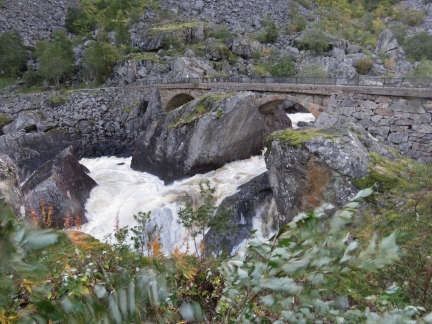 |
Bjoreio River
Position: 60°25.34’N, 7°12.35’E
A bridge on the old road across the active river Bjoreio River in the valley Mabodalen.
|
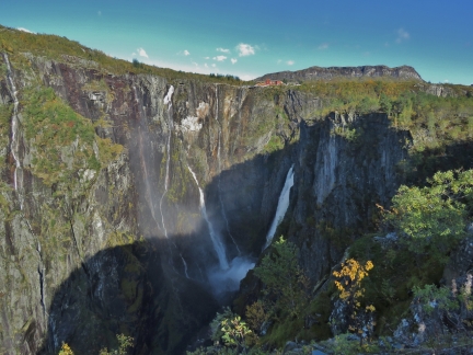 |
Voringfossen
Position: 60°25.61’N, 7°14.65’E
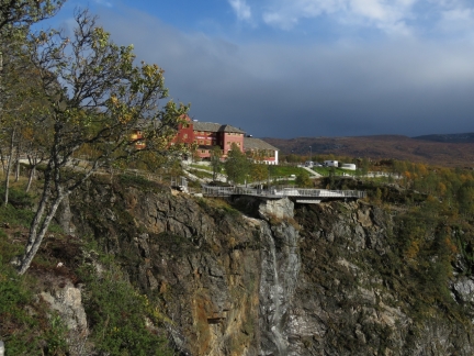
The last stop on our road trip was Voringfossen, a group of spectacular waterfalls that plunge from the Hardangervida Plateau. The most dramatic is 600-ft (182m) Voringfoss Waterfall on the right, with a 475ft (145m) free fall. The Fossli Hotel is perched above the falls, along with a public viewing platform.
|
 |
Hotel
Position: 60°25.71’N, 7°15.15’E
We continued up the hill to the extensive viewing platforms built above Voringfossen. The Fossli Hotel behind has a exceptional setting.
|
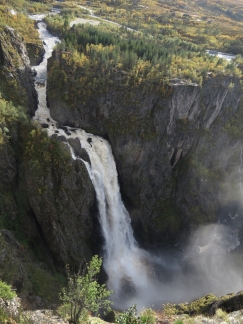 |
Voringfoss Waterfall
Position: 60°25.71’N, 7°15.17’E
Overlooking the Voringfoss Waterfall from the viewing platform above the falls.
|
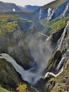 |
Mabodalen Valley
Position: 60°25.68’N, 7°15.20’E
The spectacular view to the west through the Mabodalen Valley from above the Voringfossen waterfalls with Voringfoss Waterfall on the left.
|
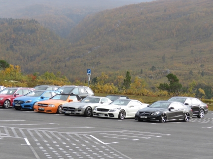 |
Mercedes
Position: 60°25.63’N, 7°15.27’E
The Voringfossen were pretty much empty when we arrived, but a large groups was walking in, many wearing matching jackets, as we departed. This was surprising as we couldn’t see a tour busy anywhere. It turned out to be a Mercedes owners group had just arrived in a dozen or so vehicles.
|
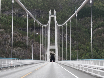 |
Crossing Hardanger Bridge
Position: 60°28.69’N, 6°49.85’E
Crossing Eidfjorden on the Hardanger Bridge, the longest tunnel-to-tunnel bridge in the world, on our way home. We’re about to pass into a branch that connects to the 4.6-mile (7.5km) Vallavik Tunnel via another tunnel roundabout. The bridge is unusual where a tunnel opens onto the bridge at one end and then the bridge passes into a tunnel at the other end.
|
 |
Click the travel log icon on the left to see these locations on a map, with the complete log of our cruise.
On the map page, clicking on a camera or text icon will display a picture and/or log entry for that location, and clicking on the smaller icons along the route will display latitude, longitude and other navigation data for that location. And a live map of our current route and most recent log entries always is available at mvdirona.com/maps. |

If your comment doesn't show up right away, send us email and we'll dredge it out of the spam filter.