A popular outing for Bergen residents is the 8-mile (13km) hike between Mt. Floyen and Mt. Ulriken. With a funicular railway at one end and a cable car at the other, you don’t have to climb up or down to take in the sweeping city views at each summit. The cable car at Mt. Ulriken was closed due to high winds when we arrived at the end of our hike, so we had to do little more work for our views. But the beautiful Ulriken stone steps, installed recently by Nepalese sherpas, ended up being part of the adventure.
Below are trip highlights from September 18th-20th, 2018 in Bergen, Norway. Click any image for a larger view, or click the position to view the location on a map. And a live map of our current route and most recent log entries always is available at mvdirona.com/maps
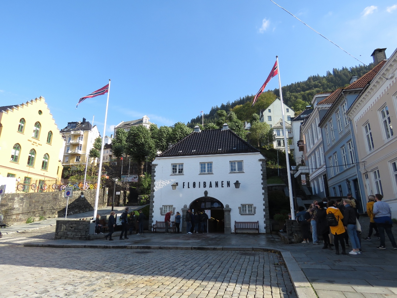 |
Floibanen
Position: 60°23.77’N, 5°19.68’E
At the Floibanen station to ride the funicular to the top of Mt. Floyen.
|
 |
26 Degrees
Position: 60°23.72’N, 5°20.37’E
The funicular climbs at a steep 26 degrees from downtown Bergen to 320m Mt. Floyen.
|
 |
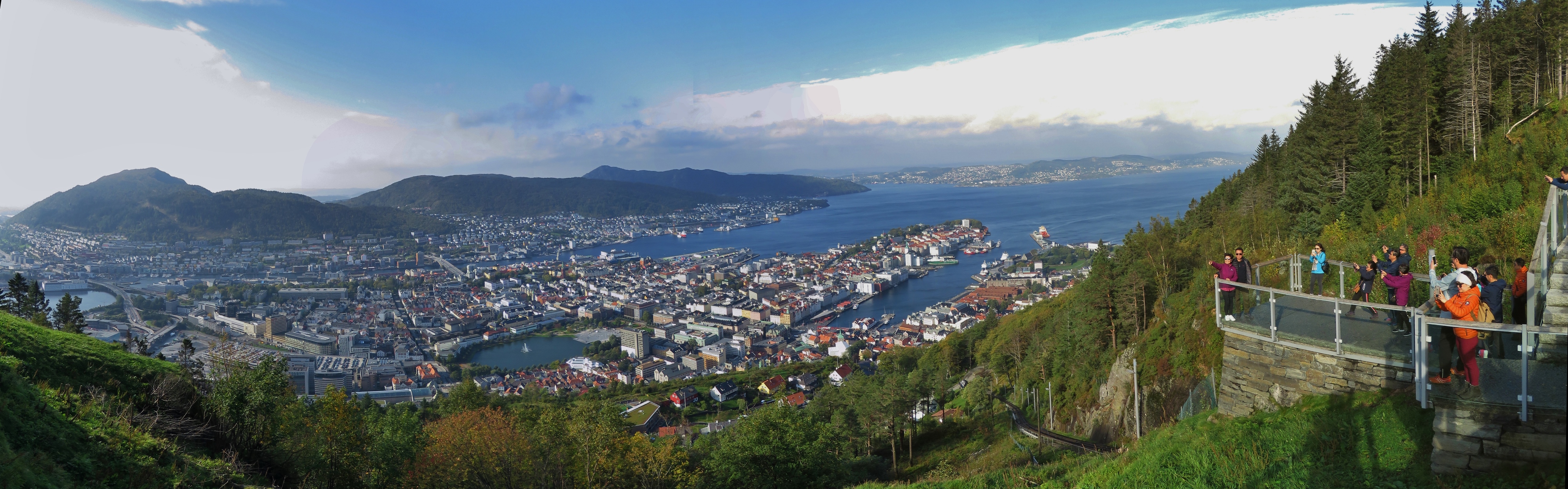
Mt. Floyen
Position: 60°23.69’N, 5°20.56’E
The spectacular view to Bergen from the top of Mt. Floyen.
|
 |
Storediket
Position: 60°24.43’N, 5°21.62’E
Looking west across the lake Storediket on the 8-mile (13km) hike from Mt. Floyen to Ulriken. The dam on the lake is just visible at the right of the photo.
|
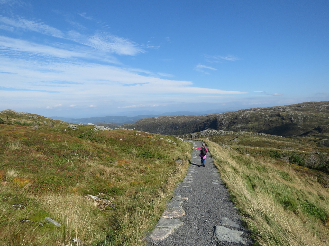 |
Trail
Position: 60°24.72’N, 5°22.06’E
The trail we’re taking is very popular and beautifully built.
|
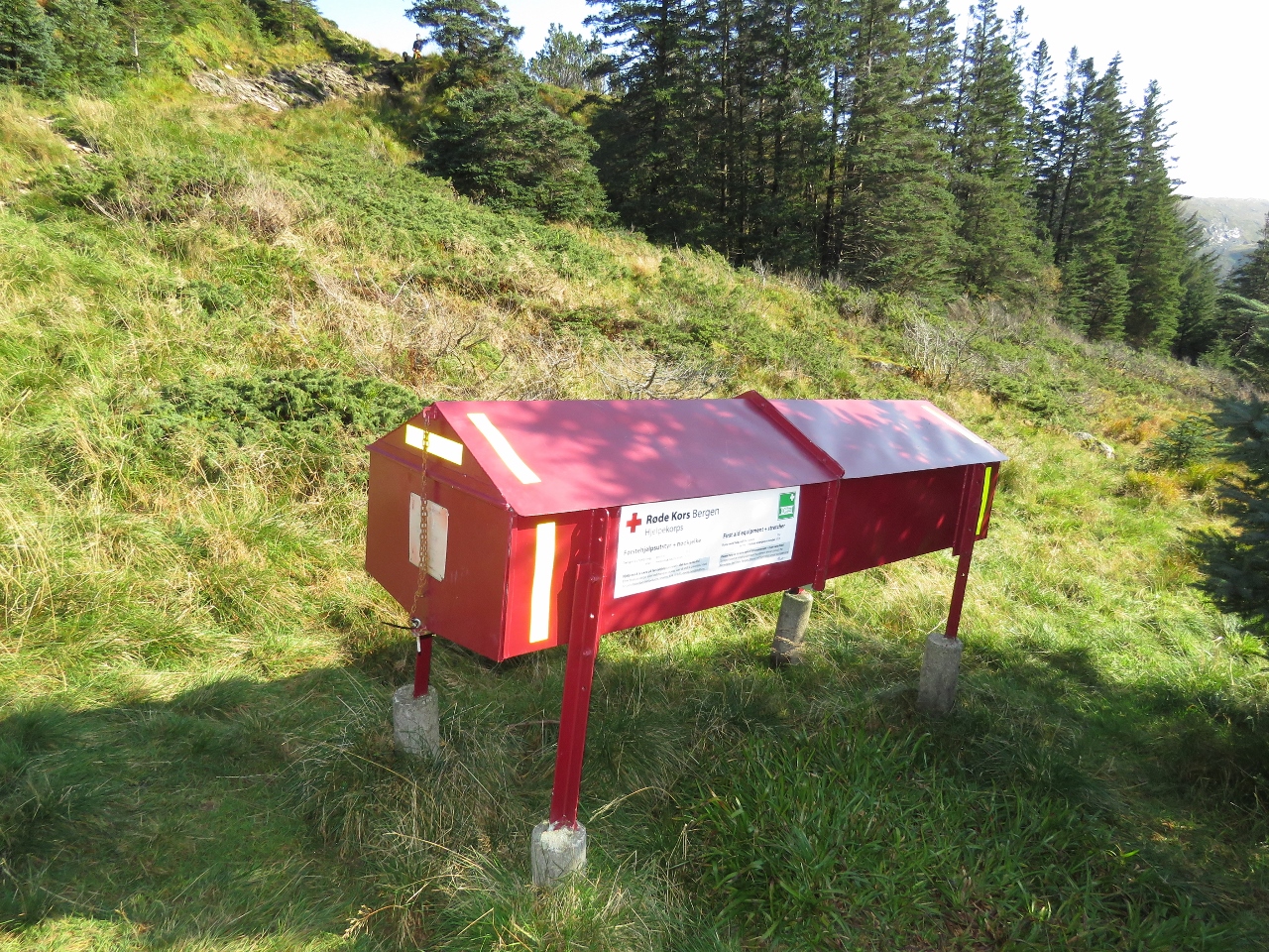 |
Emergency Station
Position: 60°24.88’N, 5°22.53’E
One of several emergency stations, complete with stretcher, that we saw on our hike.
|
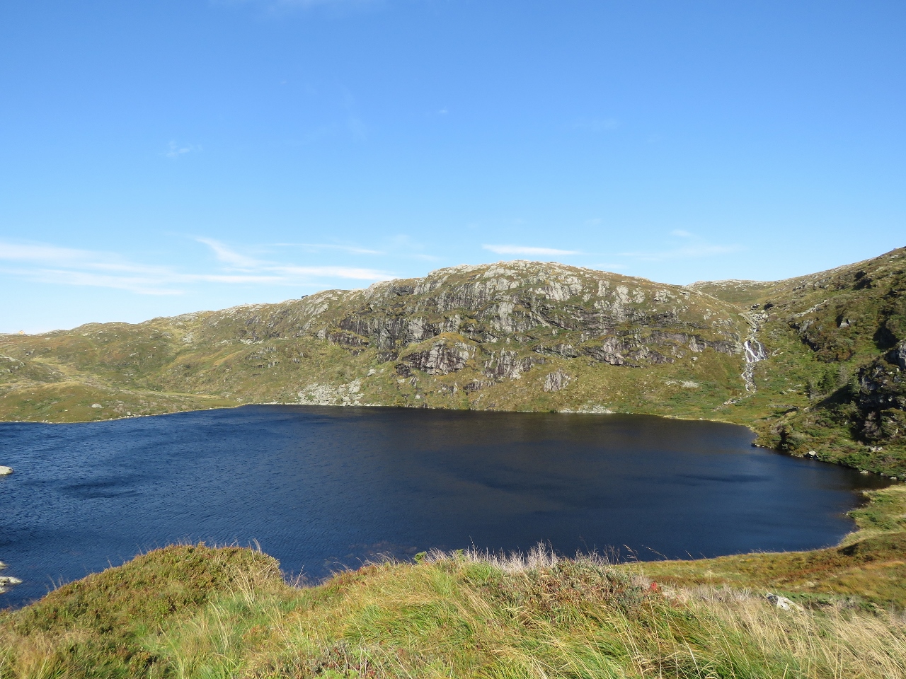 |
Tarlebovatnet
Position: 60°24.84’N, 5°23.71’E
The lake Tarlebovatnet with a nice waterfall feeding it at the right of the picture. A dam on this lake is just outside the photo on the left.
|
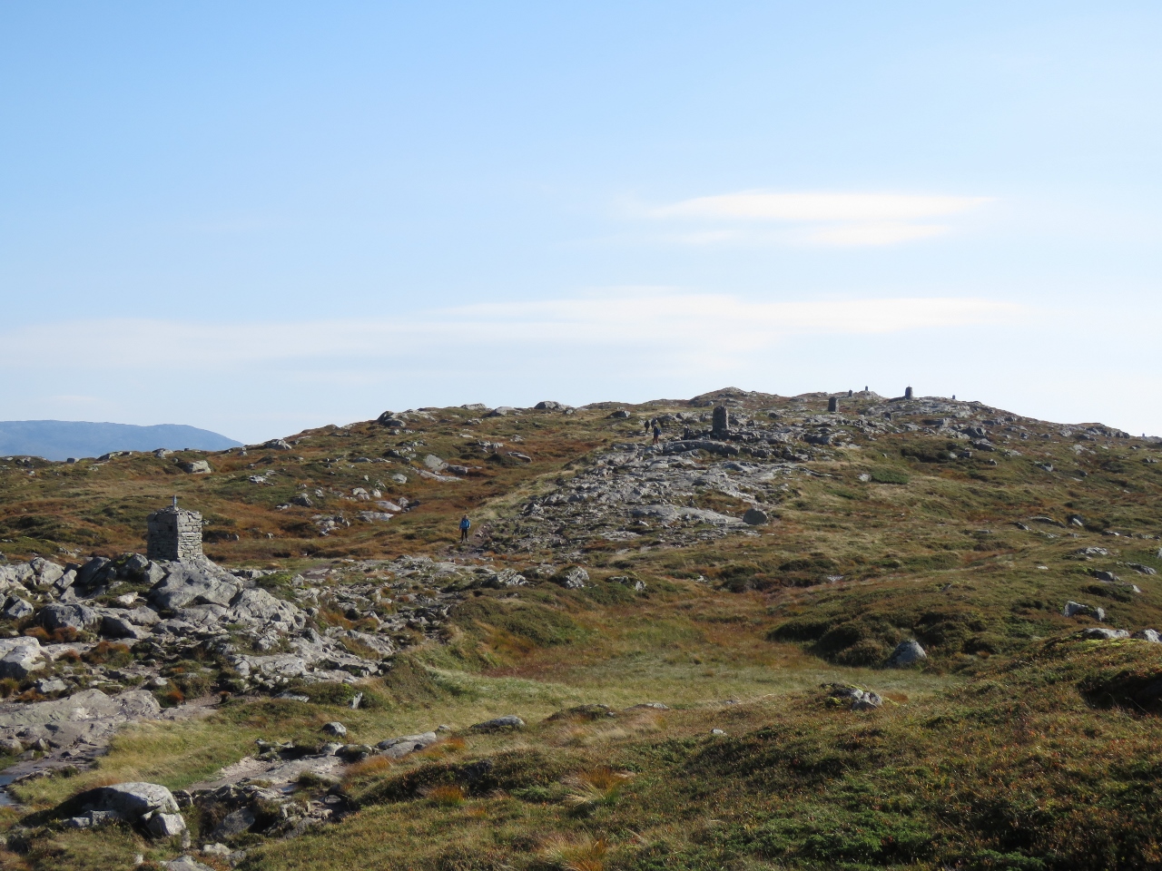 |
Cairns
Position: 60°24.60’N, 5°23.97’E
A series of cairns stretching away in the distance. They are built tall enough to be visible during the winter when snow covers the ground.
|
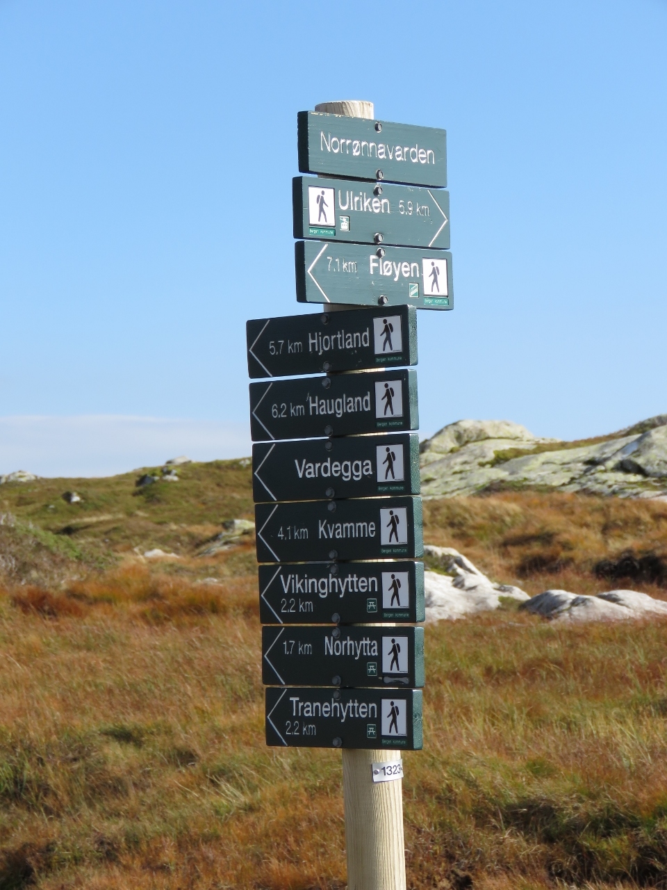 |
Fingerpost
Position: 60°24.37’N, 5°24.47’E
There are a lot of trails up here.
|
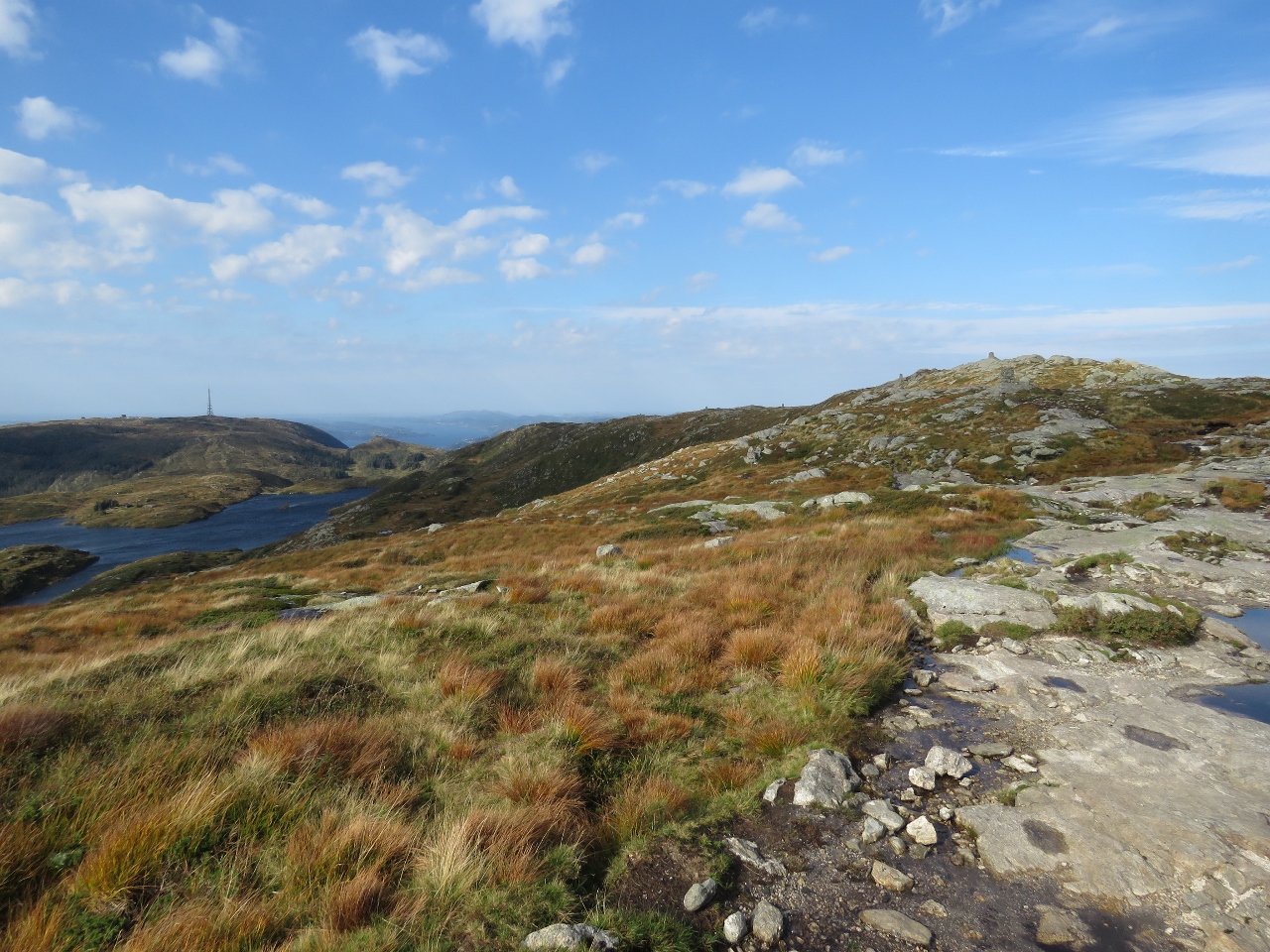 |
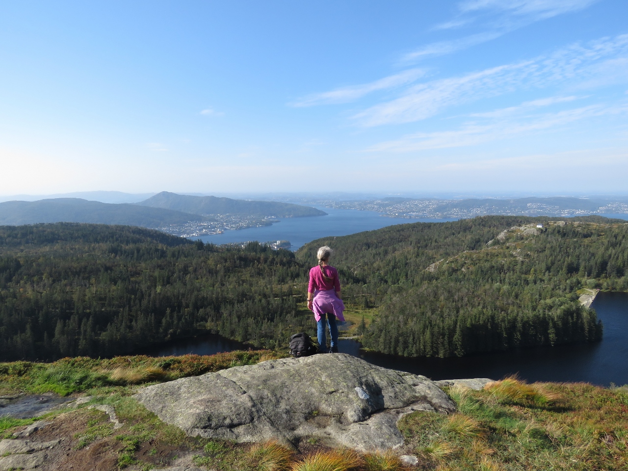
Looking Back
Position: 60°24.01’N, 5°24.91’E
We’re about six miles (9.5km) into our 8-mile (13km) hike from Mt. Floyen to Ulriken. The section of trail we photographed was beside the radio tower visible in the distance on the left.
|
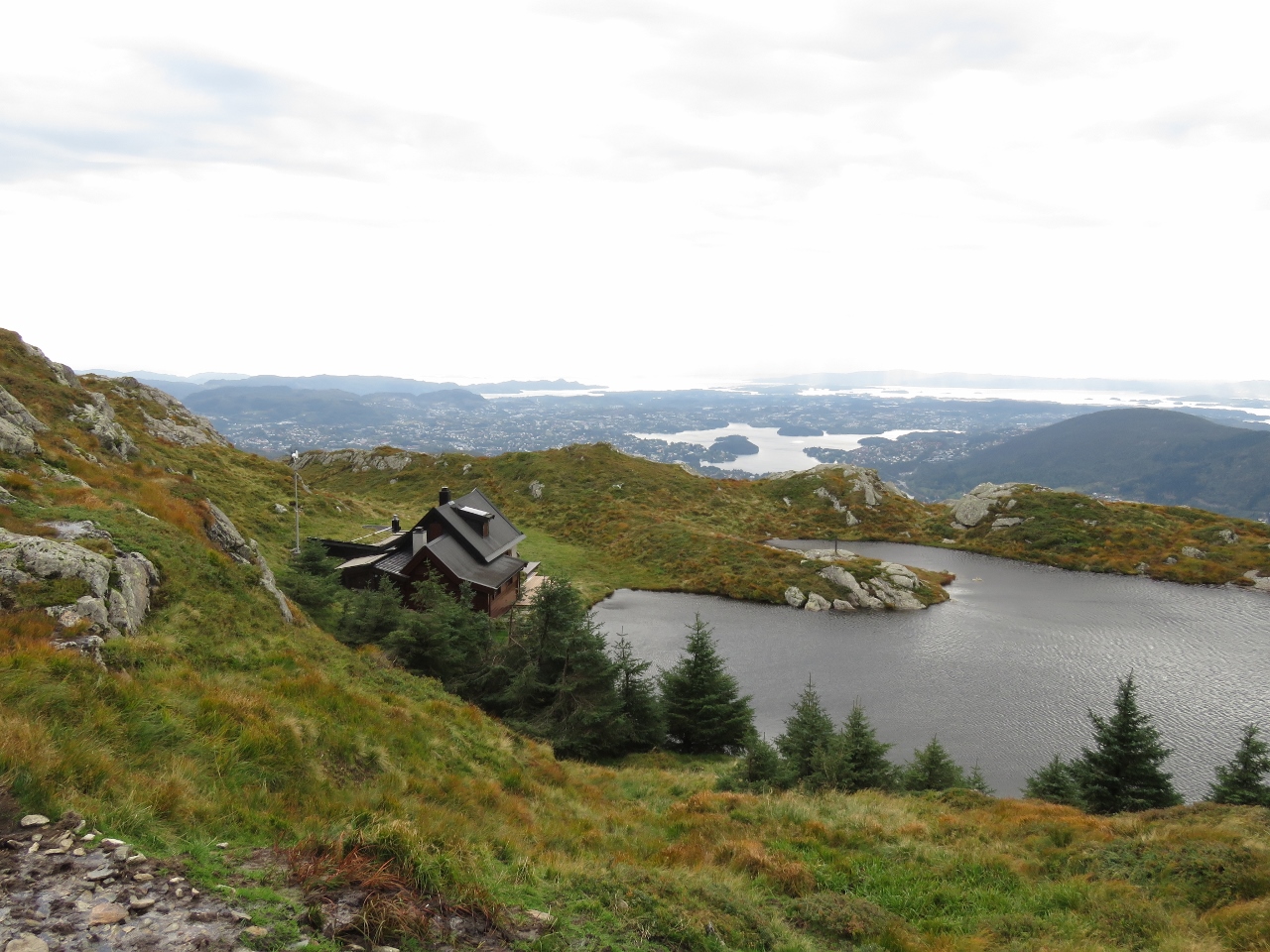 |
Cabin
Position: 60°22.52’N, 5°23.22’E
Beautiful mountain cabin with a private lake along the trail. It’s more of a house than a cabin.
|
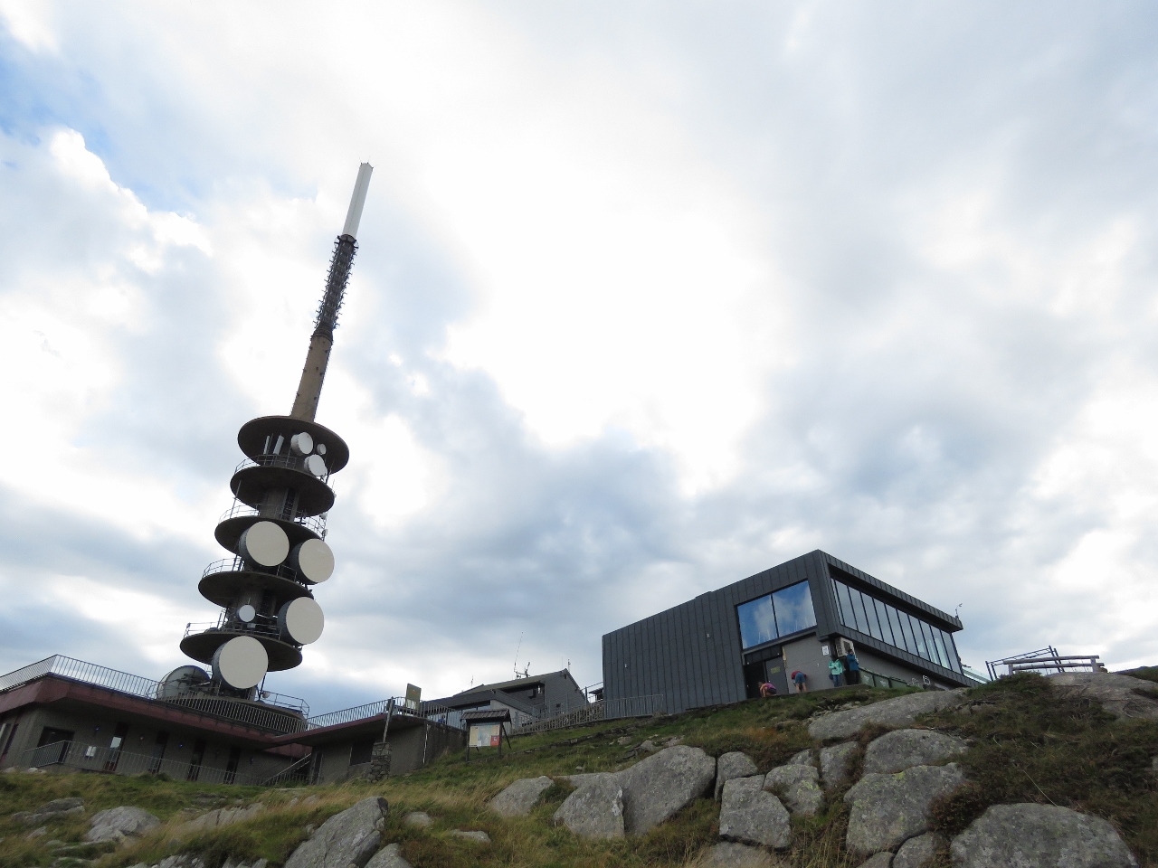 |
Tower
Position: 60°22.67’N, 5°22.91’E
The huge communications tower at the summit of 642m Ulriken is visible for miles. We could see it coming into Bergen.
|
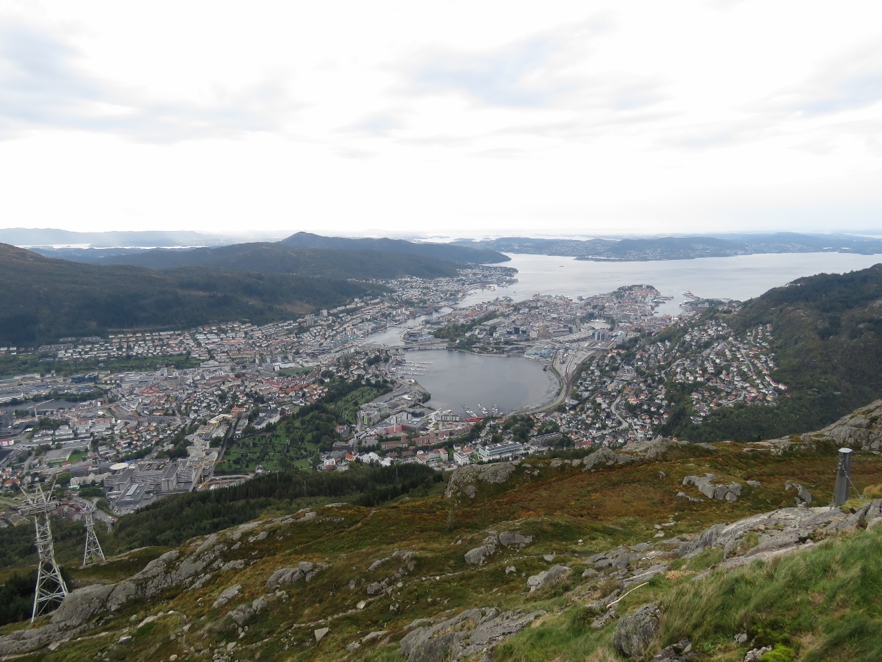 |
Ulriken
Position: 60°22.64’N, 5°22.85’E
Another great view to Bergen from 642m Ulriken.
|
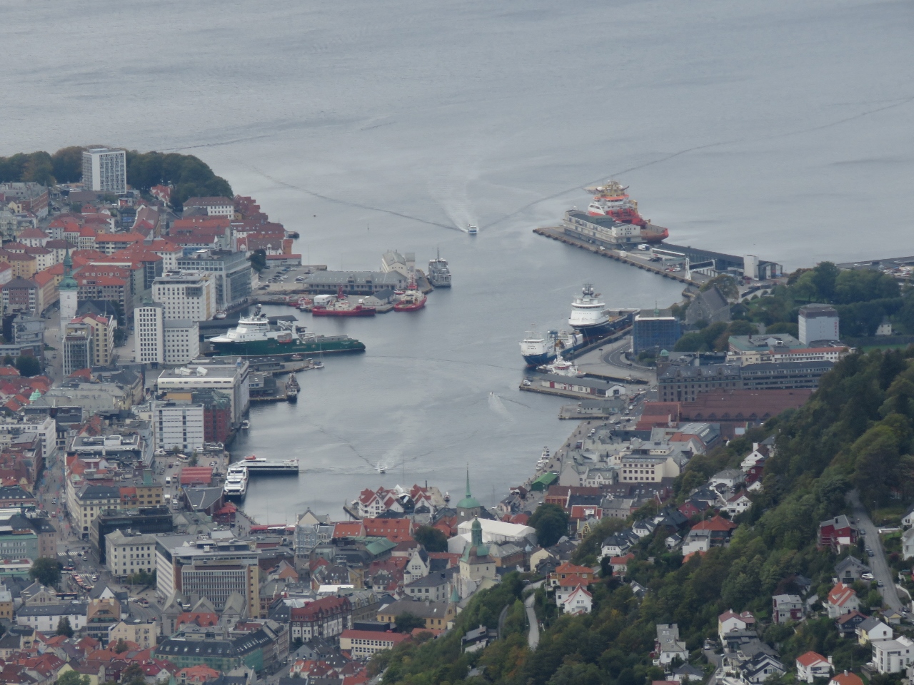 |
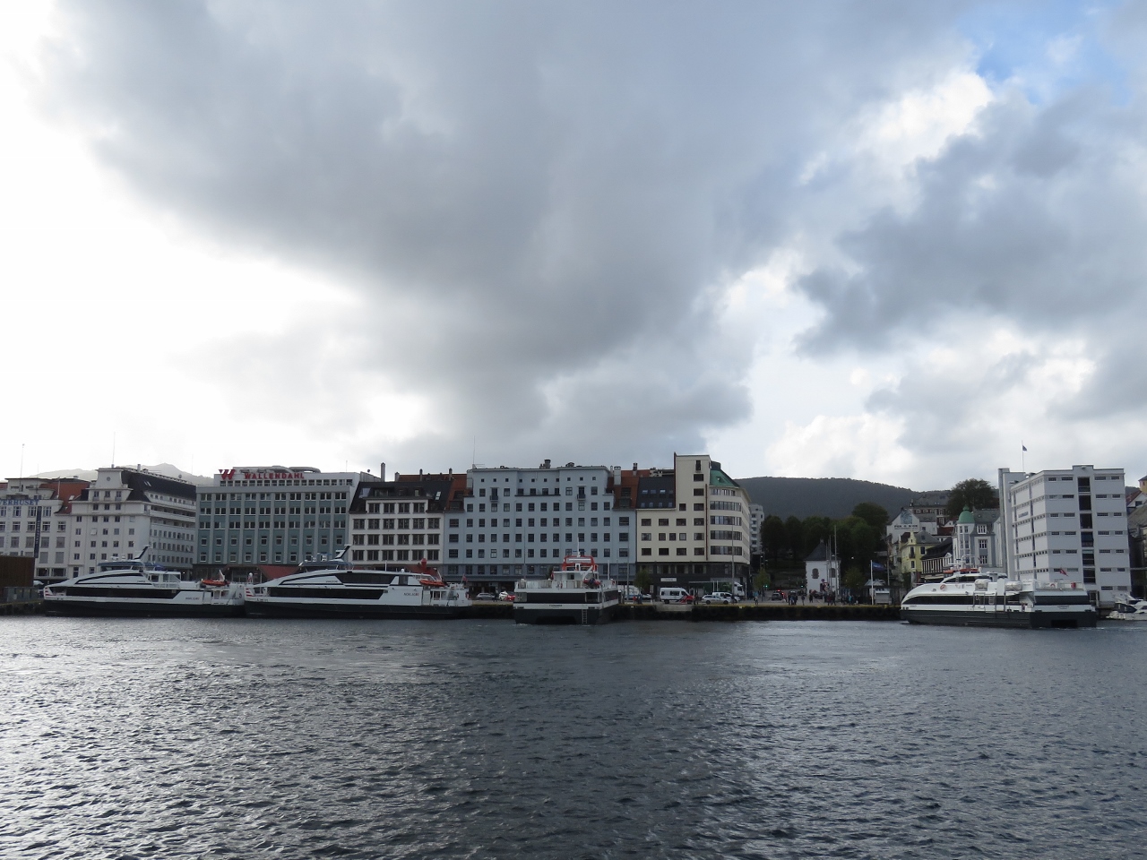
Bergen Havn
Position: 60°22.64’N, 5°22.85’E
Bergen Haven from Ulriken. Dirona is visible moored along the wall slightly right of center (click image for a larger view).
|
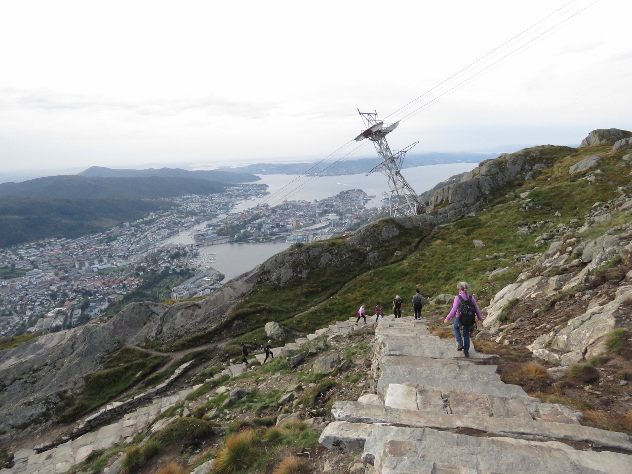 |
Steps
Position: 60°22.60’N, 5°22.83’E
We were planning to take the cable car back down from Ulriken, but it was closed due to high winds. We instead took the a beautifully-built stone staircase down.
|
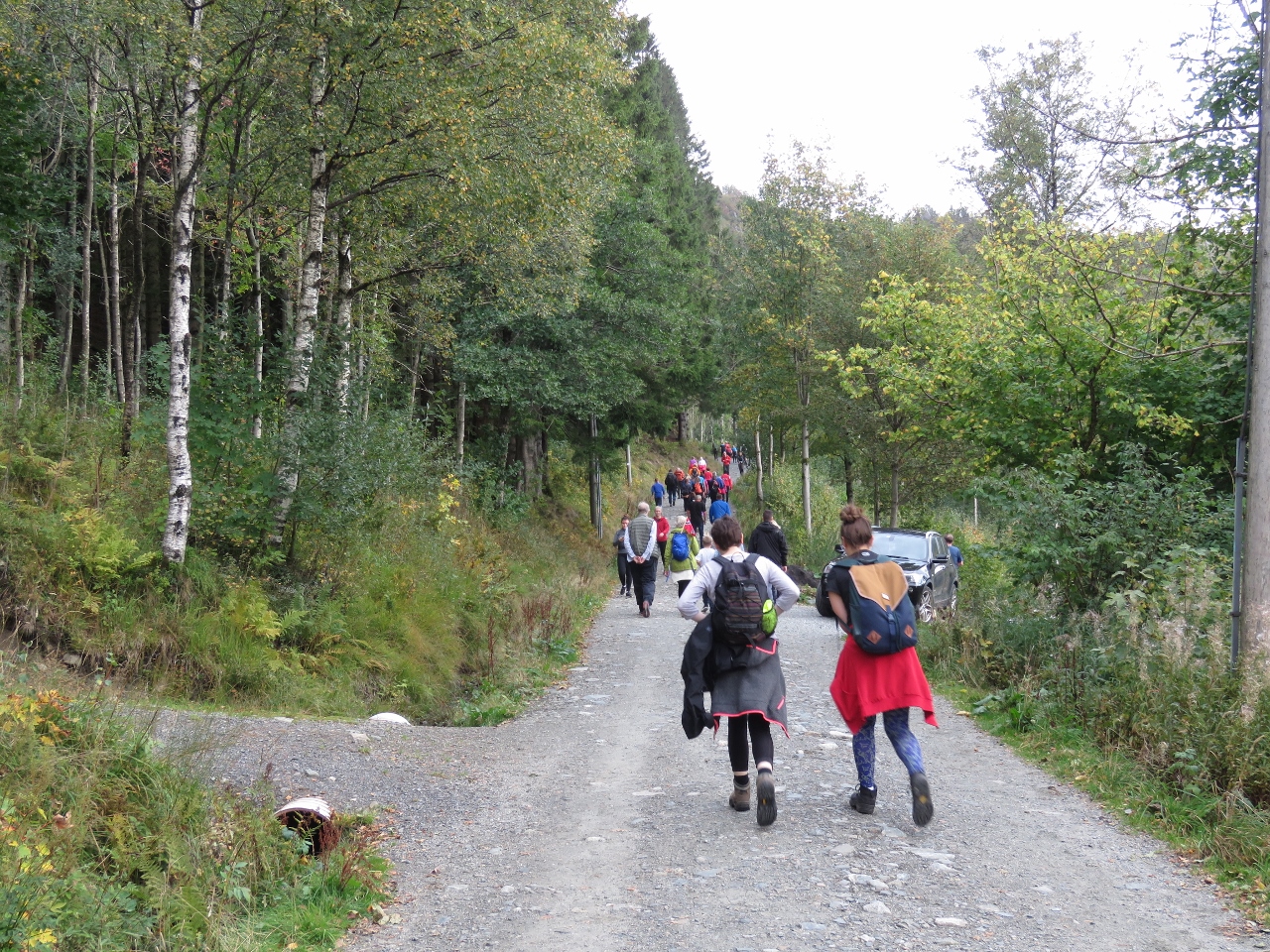 |
Crowds
Position: 60°22.21’N, 5°22.54’E
The walk up 642m Ulriken is steep, but huge crowds were heading up as we descended. We passed at least 100 people of all ages heading up.
|
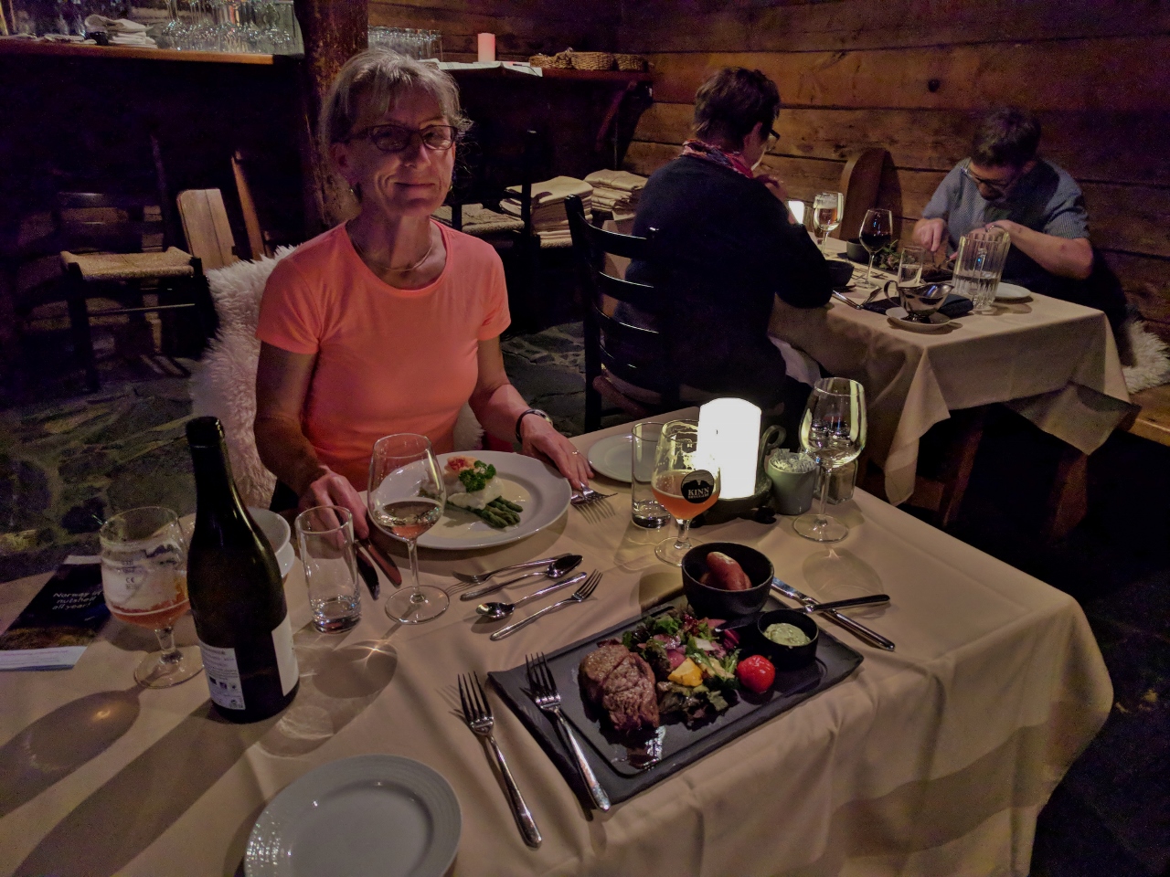 |
Bryggen Tracteursted
Position: 60°23.85’N, 5°19.47’E
We had an excellent dinner at Bryggen Tracteursted in historic Bryggen. The restaurant is in a building dating back to 1708, with a sloped stone floor and hand-hewn wooden beams.
|
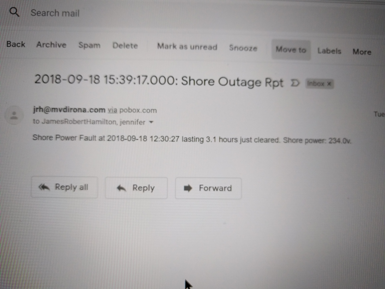 |
Shore Power Outage
Position: 60°23.80’N, 5°19.38’E
The shore power went out at 2:30pm (12:30 UTC) while we hiking between Floyen and Ulriken. We returned to the boat and found a new boat was plugged into the same shore pedestal and the breaker had tripped. We reset it and were up and running again. It’s hard to even speculate as to the cause, but we we’ve gone almost two decades with very few shorepower failures and then, in the last couple of years, we’ve come across several marinas with very sensitive residual current devices. An RCD is designed to reduce the risk of electrical shock from plugged-in boats and seem to work without problem in many marinas, but seem to be constantly tripping in others.
|
 |
Fast Ferries
Position: 60°23.80’N, 5°19.38’E
From our berth we have a great view to the busy fast ferry terminal on the opposite side of the harbour.
|
 |
AIDAsol
Position: 60°23.80’N, 5°19.38’E
The cruise ship AIDAsol departing with tug assist. The cruise ships usually don’t require tugs, so perhaps they needed assistance due to the high winds we’re seeing or possibly the maneuvering space is too tight.
|
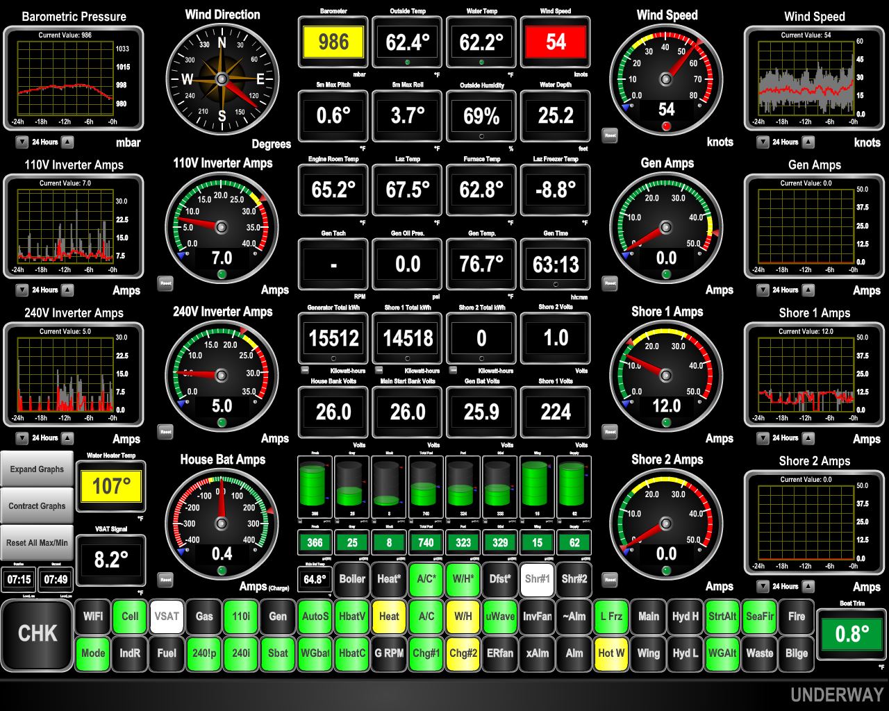 |
54 knots
Position: 60°23.81’N, 5°19.38’E
That forecast storm has arrived and the winds are gusting to 50 knots.
|
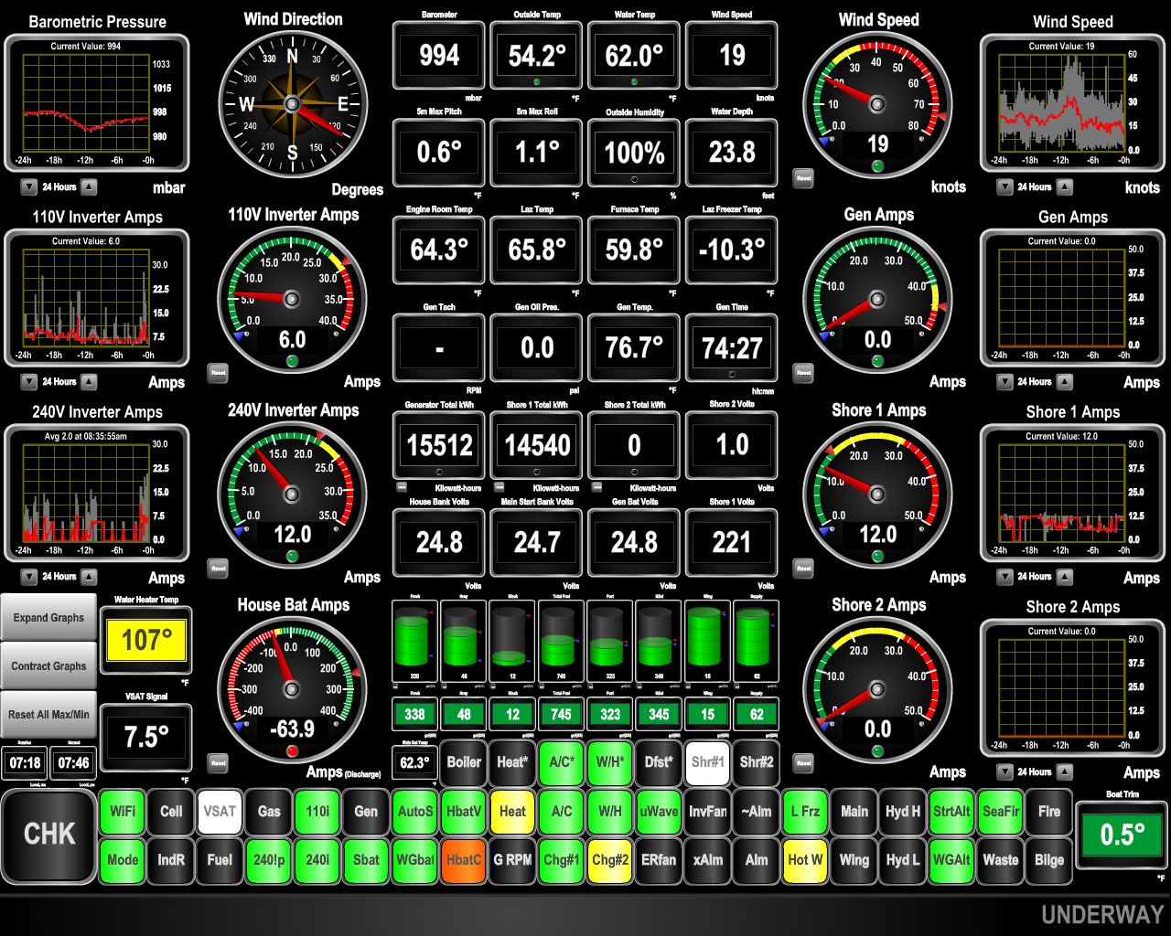 |
74 knots
Position: 60°23.81’N, 5°19.38’E
We recorded gusts to 74 knots last night in the storm. That’s the second strongest we can recall experiencing on Dirona—the highest being 110 knots in Fiordland, New Zealand. The cruise ship Albatros, that was scheduled to depart at 3pm yesterday, was still here this morning. Likely passenger comfort and safety won over schedule integrity.
|
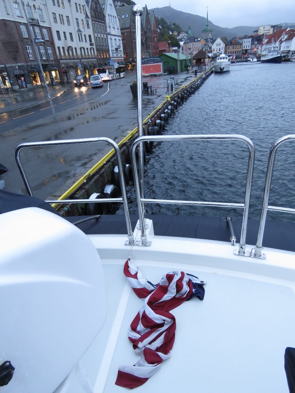 |
Ensign
Position: 60°23.81’N, 5°19.38’E
The boat rattled a lot during the big gusts to 74 knots last night, but the only casualty was our US ensign, which parted from the flagstaff. The flag itself was undamaged, we just needed to re-attach the snap-clip holding it to the flagstaff.
|
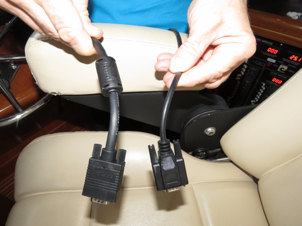 |
Monitor Cable
Position: 60°23.81’N, 5°19.38’E
The new Lenovo P320 Tiny navigation computer is working well, and the only issue is the screen fluctuates or flashes when the gen starts and stops. It’s not really much of a problem but we were pretty sure that the problem was caused by us using a low quality monitor cable (right). Trond Saetre, from Bergen, picked us up a new one (left) and the flicker is resolved. There are now no known issues with the new computer, and it hasn’t had any issues since installed.
|
 |
Shore Power 2
Position: 60°23.81’N, 5°19.38’E
The dual 16A shore power project is finally complete. Dirona can now accept two power connections with the primary connection allowing up to 50 amps and the secondary connection up to 16 amps. The primary usage model for the dual power connection is when in marinas with only low-amperage connections so we can now run two 8As, two 10As or even 2 16As to get a combined 16A 20, or 32A service. Both connections works equally well on 50 or 60 hertz.
|
 |
Groceries
Position: 60°24.00’N, 5°19.55’E
Buying a load of groceries at the local Meny grocery store. The Meny produce and bread selection is particularly good.
|
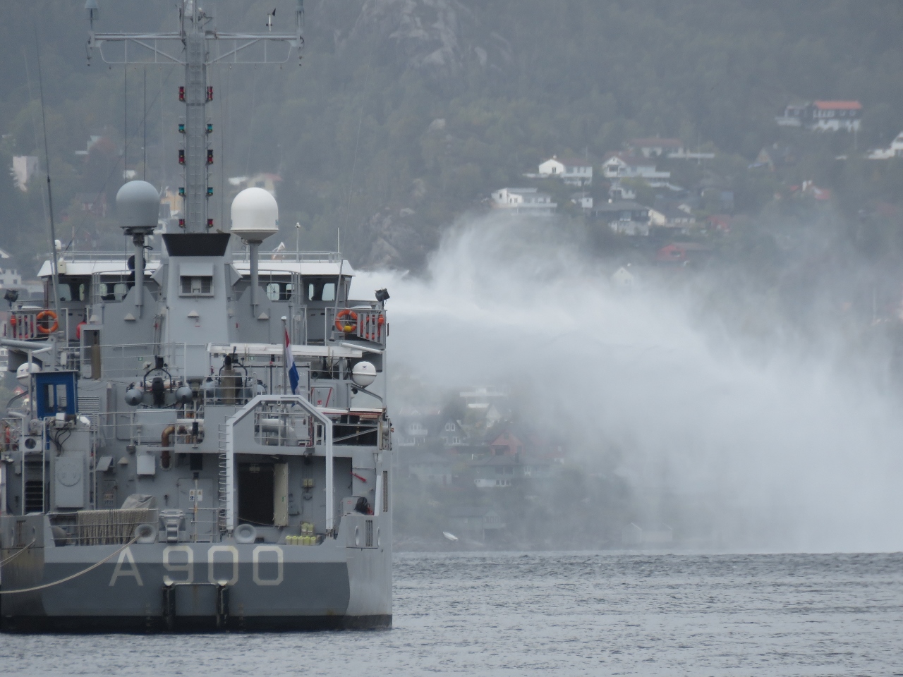 |
Mercuur
Position: 60°23.81’N, 5°19.38’E
The submarine support ship HNLMS Mercuur testing their fire-fighting equipment while moored at the entrance to Bergen Havn.
|
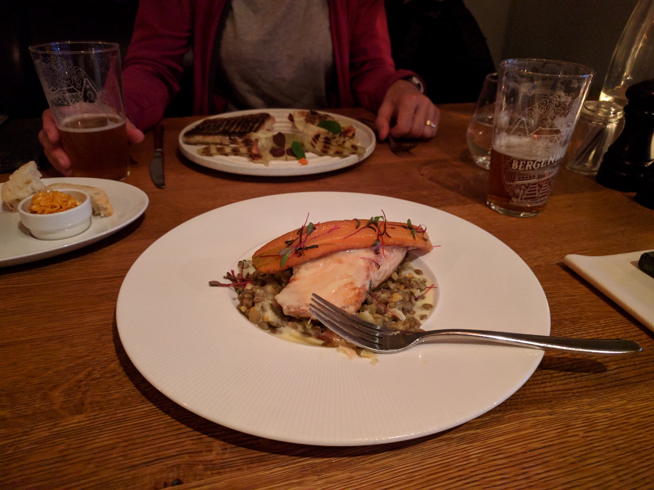 |
Bergenhus Bryggeri
Position: 60°23.72’N, 5°19.49’E
A delicious and well-presented dinner, with in-house microbrews, at the Bergenhus Bryggeri (brewpub) on the Bergen waterfront. You can’t beat dinner with a great view out over the entire Bergen harbor.
|

|
Click the travel log icon on the left to see these locations on a map, with the complete log of our cruise.
On the map page, clicking on a camera or text icon will display a picture and/or log entry for that location, and clicking on the smaller icons along the route will display latitude, longitude and other navigation data for that location. And a live map of our current route and most recent log entries always is available at mvdirona.com/maps. |
Hello to you guys from the south coast of England. Only just discovered you and am really looking forward to following your adventures!
Thank you for sharing them.
We’ve have absolutely been to the south coast of England but we originally sailed from the west coast of North America and still call Seattle home. Glad you are enjoying the blog Mick.
I really am thanks. DIRONA is a beautiful craft and it’s good to see a boat being used and not sat in a marina.
mtay50@hotmail.com