Ålesund is considered one of the most beautiful cities in Norway. After a devastating 1904 fire destroyed much of downtown, the city was rebuilt in an art nouveau style with many of the buildings overlooking a canal that runs through downtown.
From Åndalsnes we travelled 55 miles south to Ålesund, stopping for a few nights to relax and catch up a bit before the next adventure. In Ålesund we visited their museum and aquarium and climbed the 481 steps up to the Kniven Viewpoint for a great view across the city.
Below are trip highlights from August 23rd through 29th en route to and in Ålesund, Norway. Click any image for a larger view, or click the position to view the location on a map. And a live map of our current route and most recent log entries always is available at mvdirona.com/maps
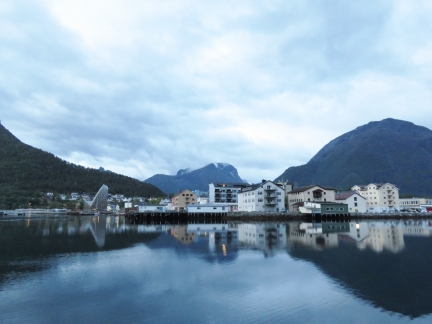 |
Åndalsnes
Position: 62°34.17’N, 7°40.63’E
A final view to Åndalsnes as we depart.
|
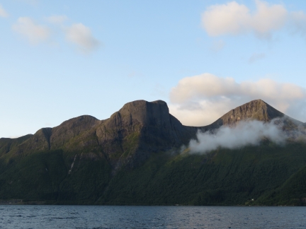 |
Romsdalsfjorden
Position: 62°35.91’N, 7°23.56’E
The mountains aglow in the morning sun as we pass through Romsdalsfjorden.
|
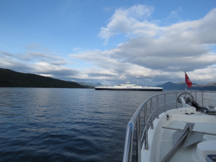 |
Fannefjord
Position: 62°39.73’N, 7°4.89’E
The ferry Fannefjord crossing in front as we turn west into Midfjorden.
|
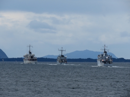 |
NATO Warships
Position: 62°36.91’N, 6°18.82’E
Three NATO warships (Lithunian M54, Latvian M 08, and Belgian A960) were underway in the area as we neared. They made several passes and turns before all continuing south ahead of us.
|
 |
Lofoten
Position: 62°33.98’N, 6°16.11’E
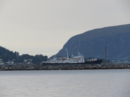
Anchored just north of Ålesund before continuing into town in a few days. We love anchorages like this, with plenty of swing room, good protection and a view to the passing traffic. This is the Hurtigruten Lofoten heading north from Ålesund after a day in Geirangerfjord.
|
 |
Nordhavn
Position: 62°33.99’N, 6°16.11’E
We noticed that one of the local AIS targets was named Nordhavn.
|
 |
Wire Pull
Position: 62°33.99’N, 6°16.15’E
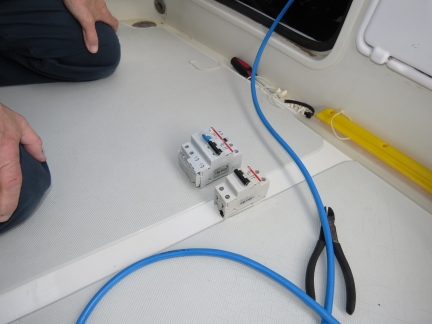
We’ll be staying in Amsterdam City Marina this winter. The great news is it’s right downtown but the bad news is that they don’t have larger than 16A connections. There are other marina choices in the area with 32A shore power connections but we really want to be right downtown. Dirona actually will run fine on 16A and the majority of the marinas we go to only have 16A power so it’s really not a problem. When running on 16A, we just need to give the batteries time to recover after the dryer or oven is used, and we would need to use diesel heat rather than electric.
However, the combination of having seen several docks in Norway that only have 10A connections or even less, we decided to implement a solution where we can run the boat on two shore power connections. This will allow us to run run all the way down to dual 8A connections. We love the flexibility that we’ll get from being able to use two shore power connections and it’ll allow us to have access to 32A rather than only 16A while we are in Amsterdam City Marina for 4 months this winter. Here James is installing the 16A breaker for the new shore power connection. |
 |
Breaker
Position: 62°33.98’N, 6°16.16’E
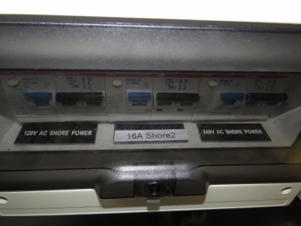
The left breaker is the 30A breaker for the 120V AC shore power connection, the middle breaker is the new 16A breaker for the second shore power connection. The breaker on the right is the 50A breaker for the primary 50A 240V shore power service. The new 16A breaker replaces one no longer in use that was for directly connecting the AC to shorepower.
|
 |
New Socket
Position: 62°33.98’N, 6°16.15’E
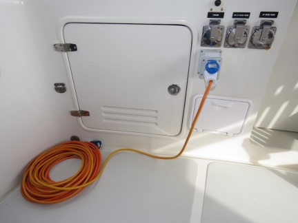
Here is the second shore power service installed and being tested. The wires run to a breaker behind the hatch door and then below but the below deck wire pulls haven’t yet been done.
|
 |
Steering Pump
Position: 62°33.98’N, 6°16.15’E
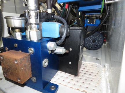
Here’s our #1 Accu-Steer HPU212-200 steering pump. It’s currently valved out of the system to minimize the amount it leaks. It has 4,900 hours on it and the bearings have failed causing it to both leak badly and to run slow due to high friction at the bearings. The Accu-Steer HPU212-200 has developed a poor reputation for reliability and is no longer made. Apparently we’re lucky to have got nearly 5,000 hours from these pumps. Given it’s a $4,000 pump, we don’t view 5,000 hours as an acceptable wear period. This pump is a real mess, but it’s still ready to go if we need to go to the backup.
To the right and behind the old pump, you can see the bright and shiny Accu-Steer HPU200. Both the HPU200 and the HPU300 have a great reputation industry wide, the pumps look like real beasts, and we expect these new pumps will last considerably longer the the original HPU212-200s did. |
 |
Rain … and Sun
Position: 62°33.99’N, 6°16.12’E
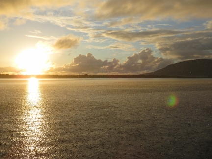
An unusual combination of pouring rain and bright sunlight in the evening.
|
 |
Le Champlain
Position: 62°33.99’N, 6°16.10’E
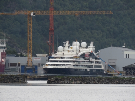
The luxury cruise ship Le Champlain nearing completion at VARD Sovkvines shipyard just south of our anchorage. The vessel is expected to be delivered later this year.
|
 |
Switch
Position: 62°33.99’N, 6°16.14’E
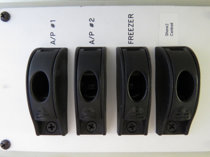
Switch and circuit breaker sending power to the Aft and Laz Raspberry Pis. The Aft Pi manages 12 temperature sensors, warns when main bilge pump or hydraulic bilge pump turns on, and warns if power to the main bilge pump is interrupted. It also controls the entertainment system cooling fan. The Laz Pi senses the availability of power at each charger and the second shore power connection. It’s responsible for shedding charger load when the overall boat power draw nears the capacity of the power source. It’s also responsible for switching on and selecting the second shore power connection when power is available on the second.
|
 |
Wire Pull
Position: 62°33.99’N, 6°16.11’E
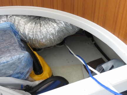
Today James pulled power and Ethernet connections down from the salon to the Laz Raspberry Pi.
|
 |
Broken Door
Position: 62°33.98’N, 6°16.15’E
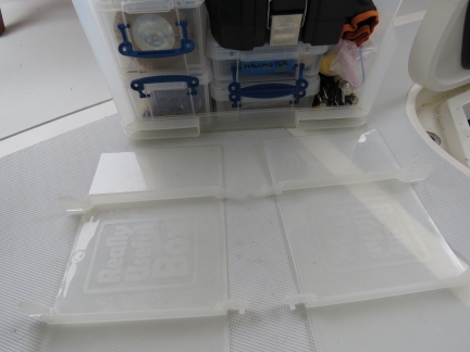
While transferring gear out of the lazarette and into the cockpit to work on the second shore power connection, the fold-down doors on a 64L Really Useful Boxes came open and broke while moving the box. Fortunately we have a few spares and this was an easy fix. (The damaged door is on the left. It’s hard to see in the photo, but the the topmost pin on which the door swivels down is broken off.)
|
 |
Wiring Up
Position: 62°33.97’N, 6°16.16’E
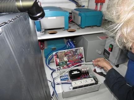
James connecting 24V power, ethernet, and NMEA2000 to the control box for the second shore power connection. This control box will be responsible for many operations overtime so it’s considerably more complex than needed for simply controlling the second shore power connection. The control box was designed to do the following: 1) support load shedding on both chargers, 2) control the 2nd shore power and enable it when power is available, 3) provide electrical interlock so the charger will be fed by the ship or the second shore power connection but never both, 4) control a 4×20 LCD in the engine room, 5) control a 4×4 matrix keyboard in the engine room, measure all voltage, current, and KWhrs consumed via the second shore power connection, and 6) provide 8 channels of digital output.
|
 |
Testing
Position: 62°33.97’N, 6°16.14’E
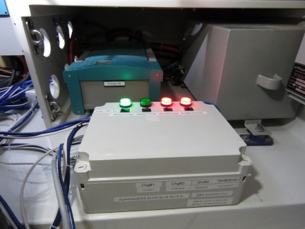
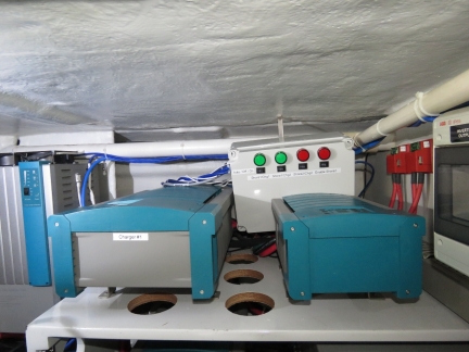
The laz power control box for the second shore power connection in test. The 4 lights signal: 1) charger #1 enabled via ship primary power, 2) charger #2 enabled via ship primary power, 3) second shore power enabled, and 4) second shore power selected. In the configuration shown, the first chargers is on and powered by the ship’s primary power, the second charger is on and powered by the second shore power connection.
|
 |
Control Box
Position: 62°33.99’N, 6°16.13’E
The control box for the second shore power (and various other control functions) at its eventual install location. A large service loop on the wires allows the control box to be lifted out and put on the laz floor in front of the chargers for ease of service.
|
 |
Finnmarken
Position: 62°28.45’N, 6°9.20’E
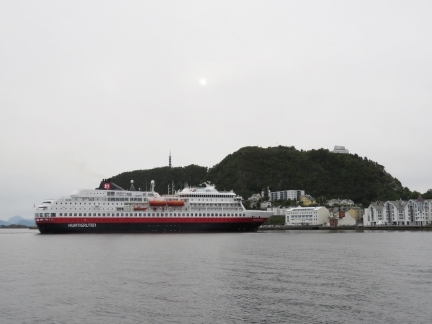
The Hurtigruten Finnmarken arriving into Ålesund on a northbound run. In the summer, the northbound ships stop here for 45 minutes, then cruise Geirangerfjord and return back to Ålesund for another 45 minutes before continuing north.
|
 |
Map
Position: 62°28.32’N, 6°9.22’E
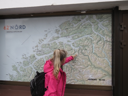
Jennifer tracing the route of our road trip from Åndalsnes to Geiranger on a large wall map.
|
 |
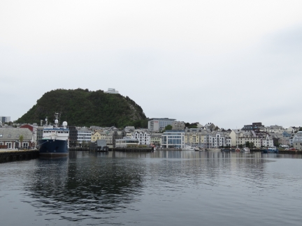
Brosundet
Position: 62°28.33’N, 6°9.11’E
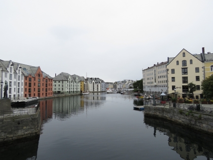
Looking northeast along Brosundet, the canal that runs through downtown Ålesund. Much of the town was rebuilt in Art Nouveau style following a devastating 1904 fire that destroyed much of the town center.
|
 |
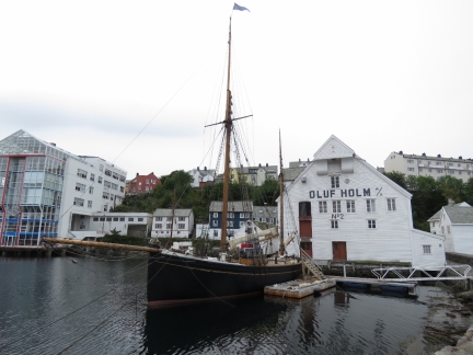
Inner Harbor
Position: 62°28.45’N, 6°8.96’E
Looking across the inner harbor from the breakwater. Ferry and commercial docks are on the left and Dirona is moored on the guest docks at right (click image for a larger view).
|
 |
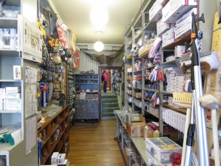
Fiskerimuseet
Position: 62°28.41’N, 6°8.98’E
Ålesund is a major cod-fishing town with the largest fleet in Norway. The Fiskerimuseet, housed in an 1861 warehouse that was one of the few buildings to survive the 1904 fire, describes the technology of fishing through the ages, along with salt-cod and cod-liver oil production.
|
 |
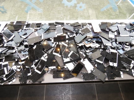
Chandlery
Position: 62°28.32’N, 6°9.08’E
Jennifer checking out the wares in the local marine chandlery. The places looked smallish from the street, but is vast with a huge inventory. We kept thinking we were at the end and found another room.
|
 |
Broken Screens
Position: 62°28.32’N, 6°9.71’E
An eye-catching advertisement for a store fixing mobile devices containing broken screens they’ve replaced. This is only a portion of the pile of broken screens that makes up their window display.
|
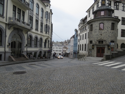 |
Lovenvoldgata
Position: 62°28.38’N, 6°9.40’E
Looking west down Lovenvoldgata. The building on the right is the local movie theater, Lovenvold Kino.
|
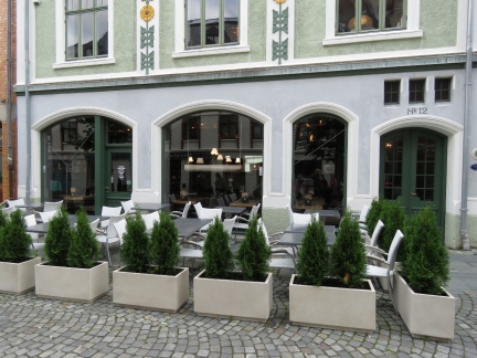 |
Lyst
Position: 62°28.48’N, 6°9.31’E
We had a great lunch at Lyst Cafe and Bar.
|
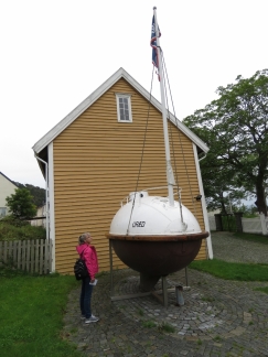 |
Uraedd
Position: 62°28.31’N, 6°9.41’E
At the Ålesund Museum next to the lifeboat Uraedd. To show that covered lifeboats were safer, the designer Ole Brude and three others piloted the 18-ft vessel across the Atlantic, landing in Gloucester, Massachusetts in January of 1905 after five months at sea.
|
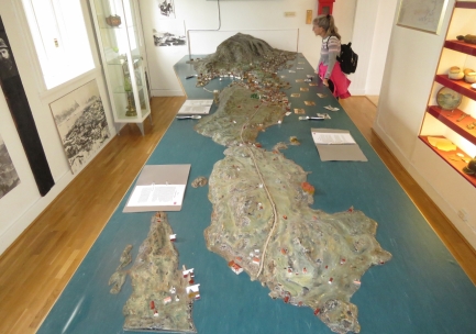 |
Town Model
Position: 62°28.31’N, 6°9.41’E
A model of the city at the Ålesund Museum just prior to the 1904 fire that destroyed most of the buildings in the city center.
|
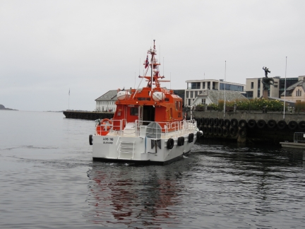 |
Pilot Boat
Position: 62°28.43’N, 6°9.33’E
The Ålesund pilot boat is moored near us and is constantly coming and going. It’s a busy port.
|
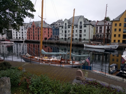 |
Stars and Stripes
Position: 62°28.32’N, 6°9.22’E
This is only second US-flagged vessel we’ve seen since leaving the UK. The first was Nordhavn 57 Summer Star in Bodo.
|
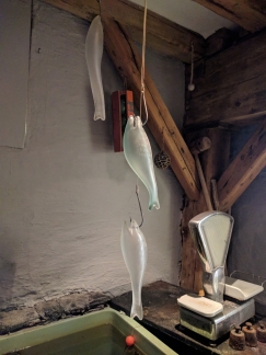 |
Frozen Fish
Position: 62°28.39’N, 6°9.24’E
These are the only frozen fish you’ll find at Sjobua. We had a delicious dinner there.
|
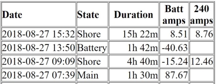 |
Power Outage
Position: 62°28.43’N, 6°9.33’E
The shore power went out yesterday at 1:50pm while we were at the Ålesund Museum. When we returned to the boat we plugged into a different socket and were up and running again. The failure happened at around the same time another boat using the same pedestal departed. It’s hard to even speculate as to the cause, but we we’ve gone almost two decades with very few shorepower failures and then, in the last couple of years, we’ve come across several marinas with very sensitive residual current devices. An RCD is designed to reduce the risk of electrical shock from plugged-in boats and seem to work without problem in many marinas, but seem to be constantly tripping in others.
|
 |
Ferry
Position: 62°28.43’N, 6°9.33’E
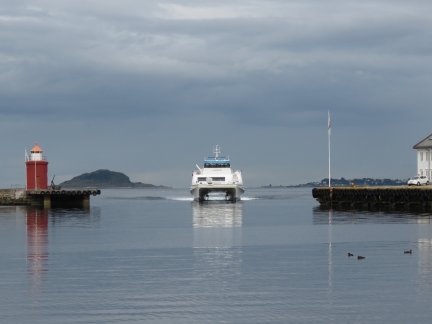
Fast ferry just pulling off speed before entering the inner harbor.
|
 |
Francois Karm
Position: 62°28.43’N, 6°9.34’E
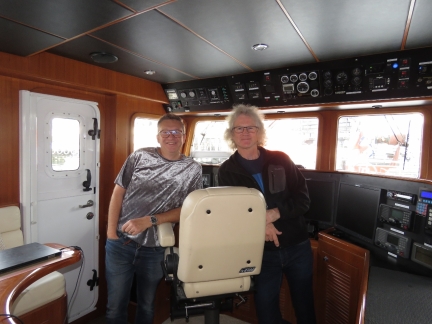
Pilot Francois Karm was following our boat construction years ago and happened to flying through Ålesund while we were here. He came down for a visit, and gave us a package of cat toys that has proved most popular with Spitfire.
|
 |
Rollo
Position: 62°28.42’N, 6°9.72’E
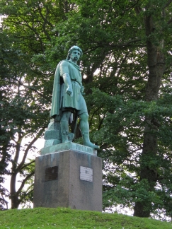
Statue of Rollo in the Ålesund Town Park. Rollo reportedly was from the islands near Ålesund and fled to France in 911 where he founded Normandy. He also was the forefather of William the Conquerer.
|
 |
Kniven Viewpoint
Position: 62°28.45’N, 6°9.85’E
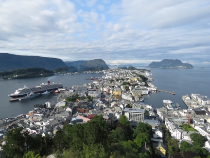
The famous view over Ålesund from the Kniven Viewpoint. We’ve seen loads of pictures taken from here—the night shots are particularly dramatic.
|
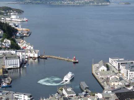 |
Inner Harbour
Position: 62°28.45’N, 6°9.85’E
Ferry make a tight turn in the Ålesund inner harbor before departing. Dirona is moored just out of sight behind the white building at bottom left.
|
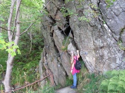 |
Secure
Position: 62°28.38’N, 6°10.22’E
Rocks heavily secured to prevent them from falling on the path.
|
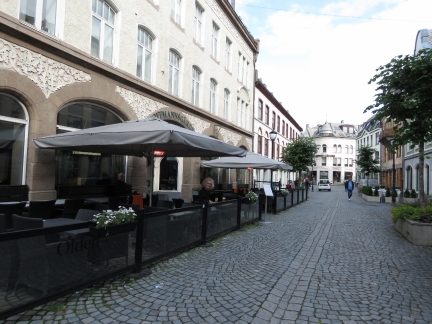 |
Hoffmann Cafe
Position: 62°28.41’N, 6°9.40’E
We had a nice lunch street-side at Hoffmann Cafe and Bar.
|
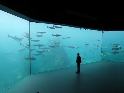 |
Atlanterhavsparken
Position: 62°27.92’N, 6°5.67’E
The 1.1-millon gallon (4-million liter) Great Atlantic tank at the Atlanterhavsparken (Atlantic Sea-Park) on the western shore of Hessa, one of the main islands in the island-cut of Ålesund.
|
 |
Ray
Position: 62°27.93’N, 6°5.77’E
We love rays and enjoyed seeing them at Ålesund’s aquarium.
|
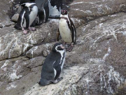 |
Humboldt Penguins
Position: 62°27.92’N, 6°5.71’E
The South American Humboldt Penguin is not natural to this area, but are housed at Atlanterhavsparken as part of a European breeding program for endangered species.
|
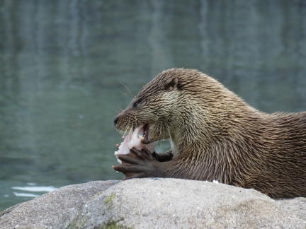 |
Otter
Position: 62°27.89’N, 6°5.65’E
Feeding time at Atlanterhavsparken outdoor otter park. The three otters here are incredibly cute.
|
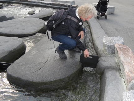 |
Dam
Position: 62°27.92’N, 6°5.71’E
James placing a dam at Atlanterhavsparken. The display is intended for curious children where they can add and remove dams throughout the maze of islands and watch the impact on the flow. James spent a while there too. :)
|
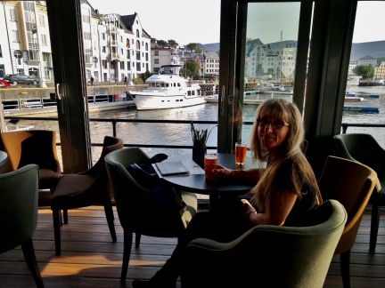 |
Milk Bar
Position: 62°28.45’N, 6°9.33’E
We couldn’t resist a pre-dinner drink overlooking the guest docks at Milk Bar.
|
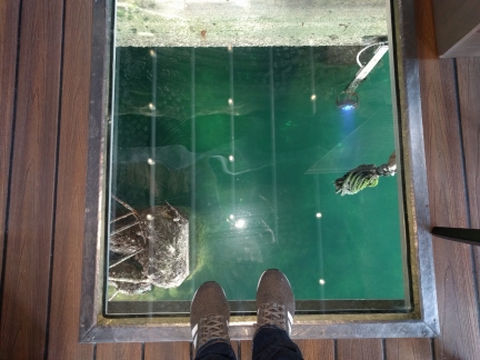 |
Glass Floor
Position: 62°28.45’N, 6°9.33’E
Besides the great view across the harbor, Milk also has views into the harbor through several glass panels in the floor. This is the view straight down through the floor from near our table.
|
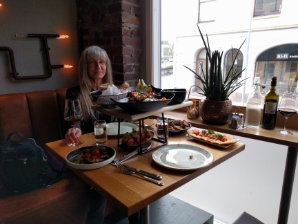 |
Kabb
Position: 62°28.47’N, 6°9.40’E
An exceptional meal of the tapas sharing platter at Kabb restaurant.
|
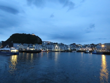 |
Dawn
Position: 62°28.50’N, 6°8.50’E
Ålesund inner harbor at dawn as we depart.
|
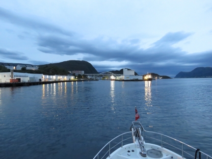 |
Bridge
Position: 62°28.26’N, 6°7.41’E
Approaching the 17m bridge between the islands of Heissa and Aspoya.
|
 |
World Pearl
Position: 62°28.00’N, 6°7.20’E
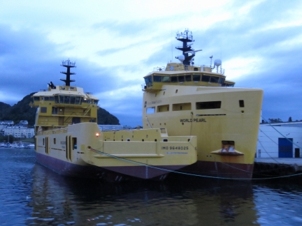
The World Pearl and World Diamond, mid-sized platform supply vessels, moored at Ålesund. They may be “mid-sized”, but a 263ft (80m) long, they’re pretty big boats.
|
 |
Ålesund From South
Position: 62°27.79’N, 6°10.65’E
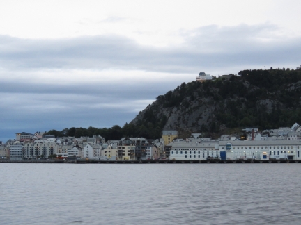
The view to Ålesund as we pass to the south.
|
 |
Click the travel log icon on the left to see these locations on a map, with the complete log of our cruise.
On the map page, clicking on a camera or text icon will display a picture and/or log entry for that location, and clicking on the smaller icons along the route will display latitude, longitude and other navigation data for that location. And a live map of our current route and most recent log entries always is available at mvdirona.com/maps. |

If your comment doesn't show up right away, send us email and we'll dredge it out of the spam filter.