
The natural beauty of Norway’s remote Lofoten islands attract over a million visitors a year. Many come to make the islands’ often-challenging hikes for the spectacular views. We made our first Lofoten hike at Værøy, about 15 miles north of Røst. From an anchorage off the once-abandoned fishing village of Måstad, we climbed 1,480 ft (450 m) to the summit of Måstadheia for sweeping 360° views.
Below are trip highlights from May 23rd on the island of Værøy in Lofoten, Norway. Click any image for a larger view, or click the position to view the location on a map. And a live map of our current route and most recent log entries always is available at mvdirona.com/maps
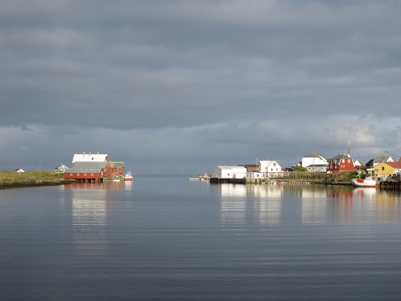 |
Røst
Position: 12 5.30, 67 30.40
Final view to Røst as we depart on a calm morning.
|
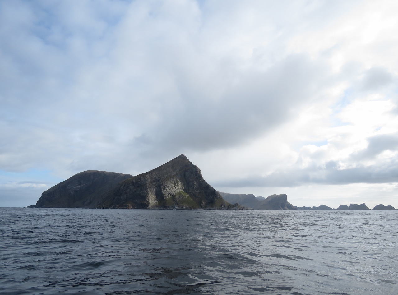 |
Værøy
Position: 12 34.29, 67 36.98
A first view to the soaring cliffs along the south end of the island of Værøy.
|
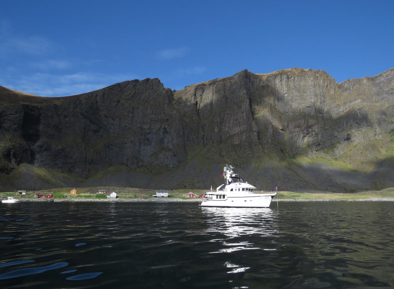 |
Måstad
Position: 12 36.13, 67 38.61
At anchor off the once-abandoned fishing village of Måstad. Several new houses have been built in the past few years, with more under construction while we visited.
|
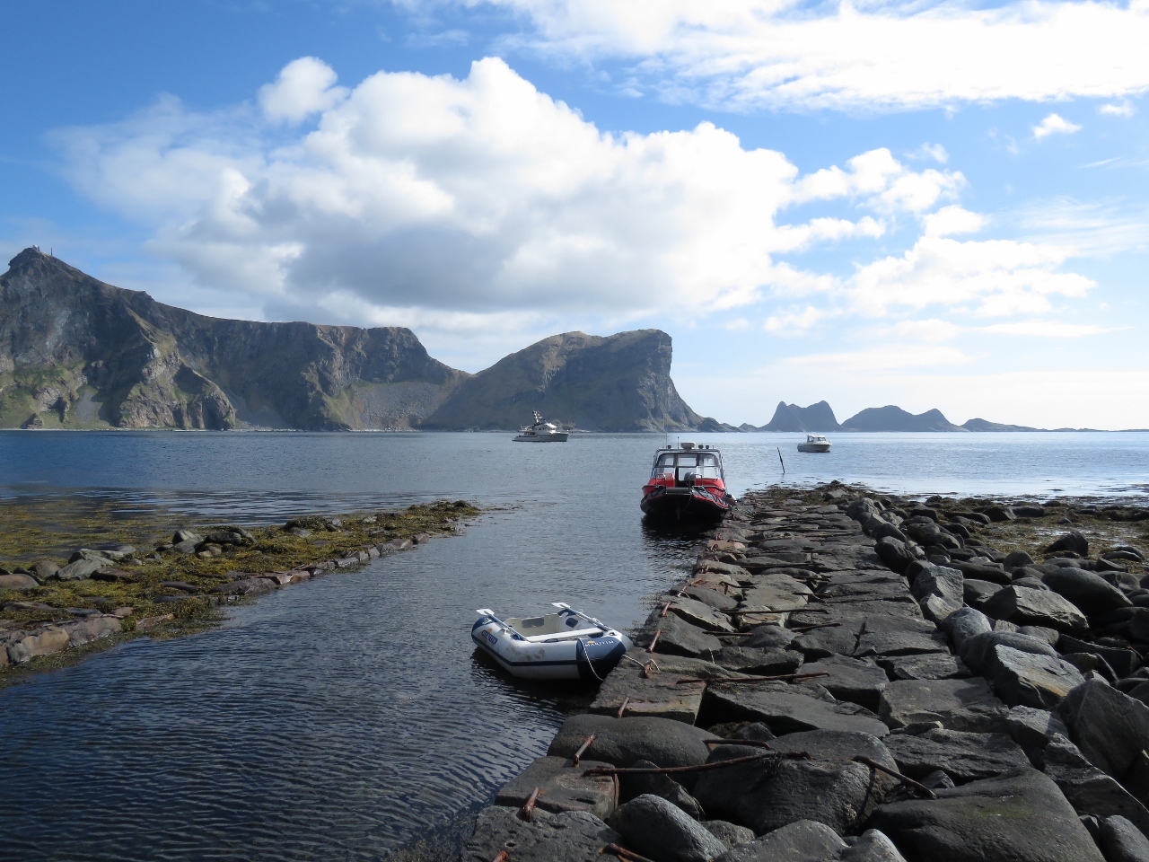 |
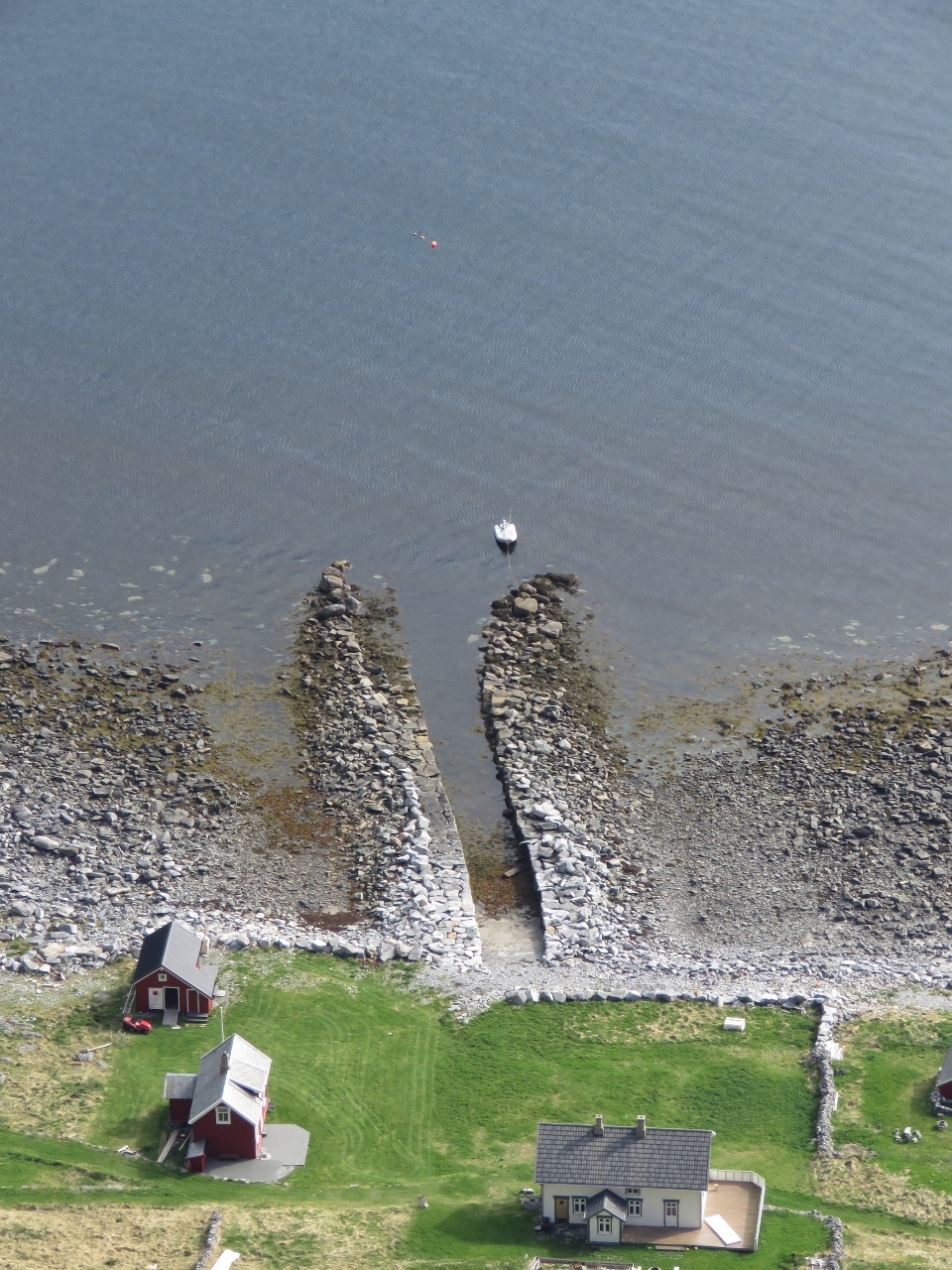
Channel
Position: 12 35.76, 67 38.56
Locals have built fairly extensive landing channels along shore. With two boats already moored in this one, we opted for one a little further along the beach so as not to get in their way.
|
 |
Måstadfjellet
Position: 12 35.21, 67 38.40
A well-trod trail, with a marked trailhead, leads through the nature reserve Måstadfjellet and up into the cliffs above Måstad. This is the already impressive view partway up at 440ft (134m). Dirona is the farther of the two white specks in the bay.
|
 |
Sørlandsvag
Position: 12 34.95, 67 38.51
The village of Sørlandsvag at the southeast side of Væroy.
|
 |
Måstadbukta
Position: 12 34.95, 67 38.53
The bay Måstadbukta viewed from an altitude of 1,215ft (370m).
|
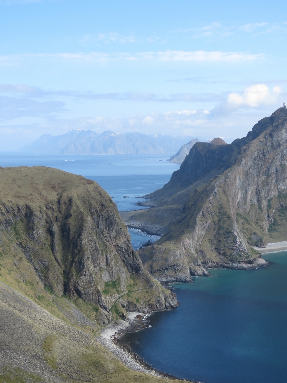 |
Moskensoy
Position: 12 34.96, 67 38.54
Looking north across the top of the Væroy to the channel Moskenstraum with the steep cliffs of the island of Moskensøy beyond. Moskenstraum is one of the strongest system of tidal eddies in the world and is the inspriation for Jules Verne’s Mælstrom at the end of his book Twenty Thousand Leagues Under the Sea.
|
 |
Tender
Position: 12 34.96, 67 38.54
Our tender moored at the entrance to one of the man-made channels at Måstad.
|
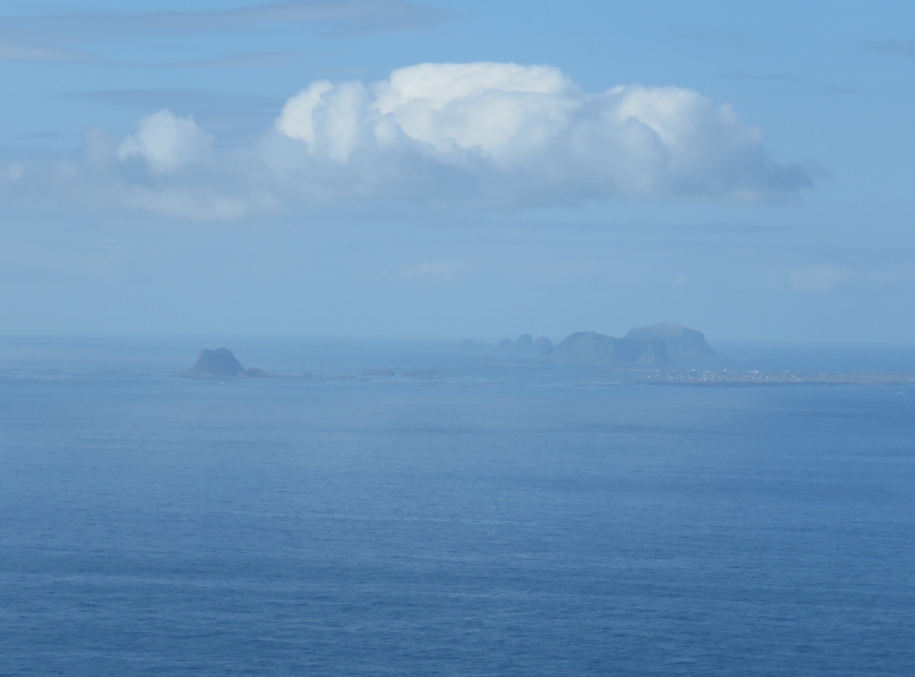 |
Røst Archipelago
Position: 12 34.61, 67 38.80
View south to the Røst Archipelago.
|
 |
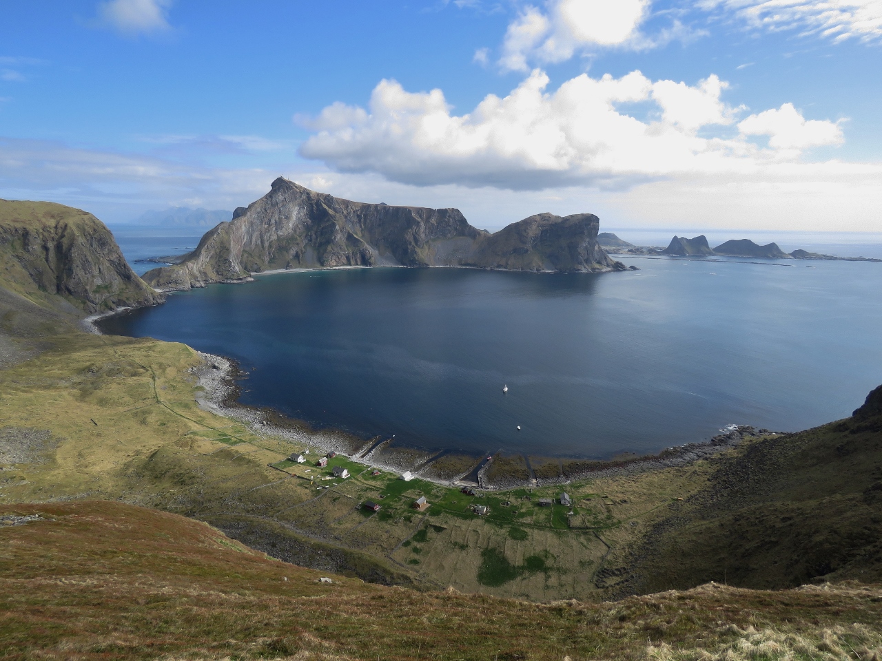
Måstadheia
Position: 12 34.89, 67 38.82
The fabulous view from the summit of Måstadheia at 1,480 ft (450 m) (click image to enlarge).
|
 |
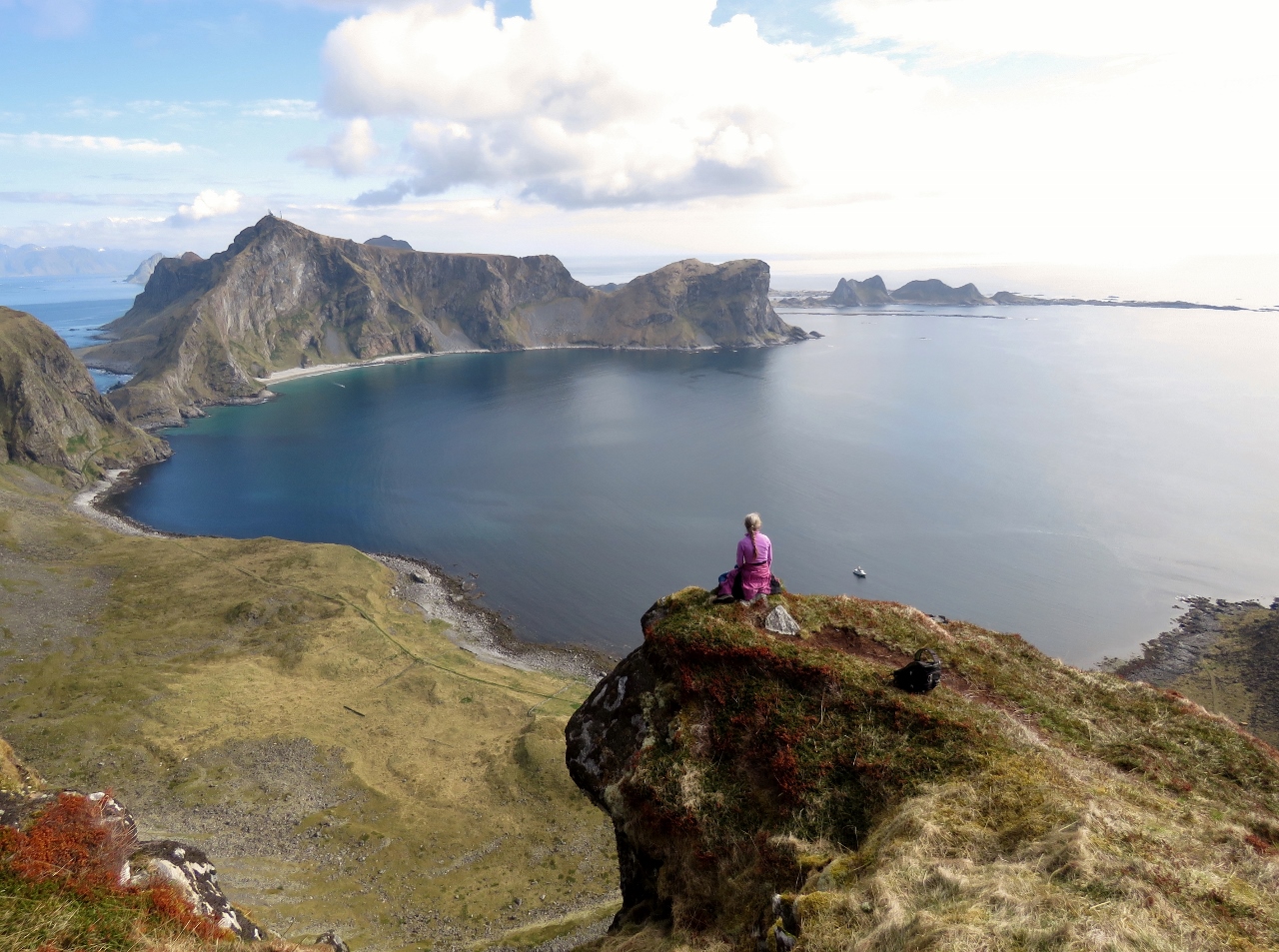
Lunch
Position: 12 34.88, 67 38.82
A picnic lunch with a view at Måstadheia.
|
 |
Radar Station
Position: 12 34.88, 67 38.82
A radar station, similar-looking to the one at Sanna, across the bay at Håen.
|
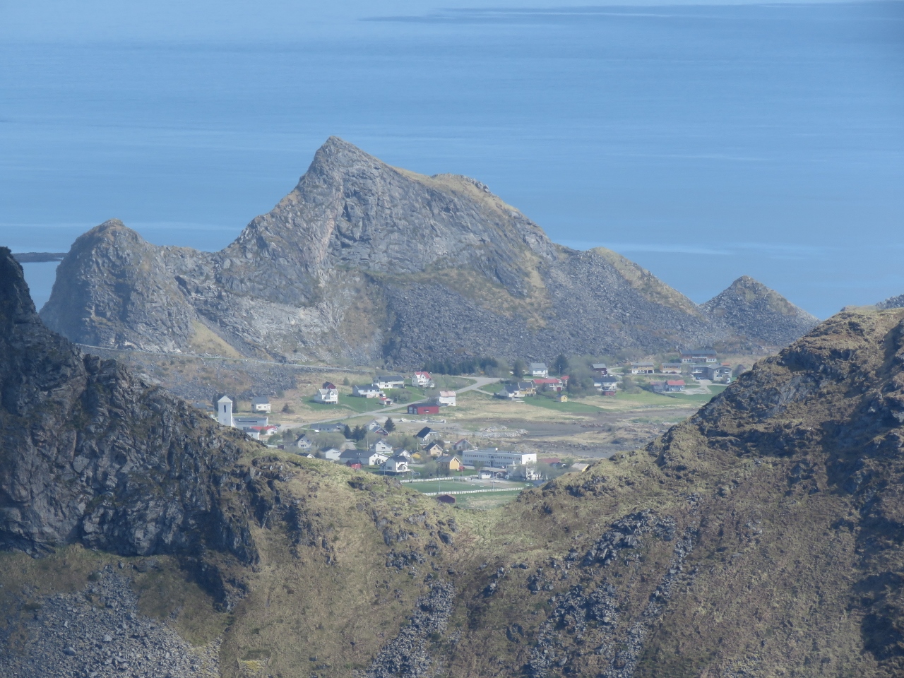 |
Sørlandsvag North
Position: 12 34.89, 67 38.82
The northern portion of the village of Sørlandsvag viewed from Måstadheia.
|
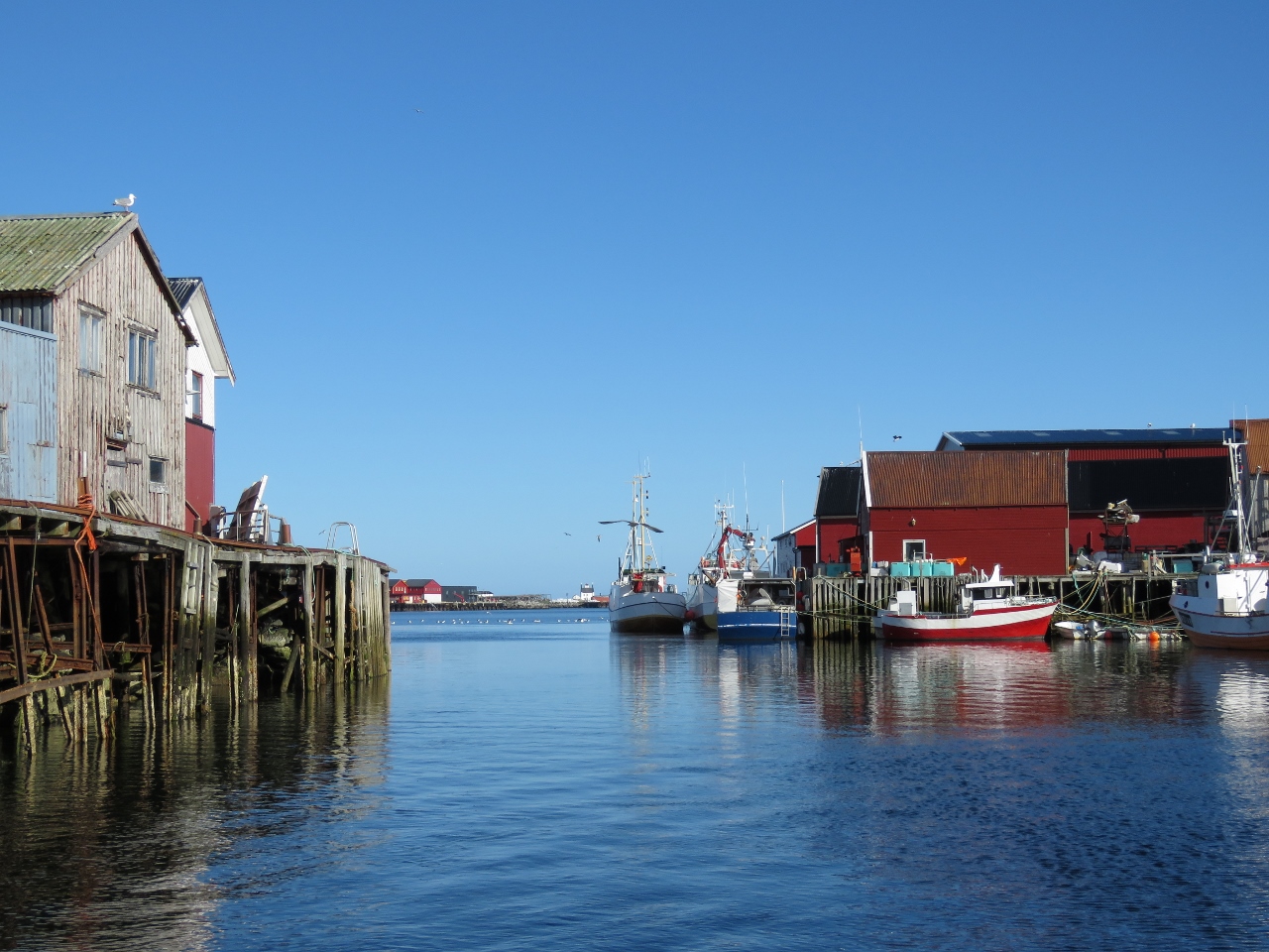 |
Sørlandsvag Harbour
Position: 12 41.80, 67 39.62
After our hike we ran the tender over to the village of Sørlandsvag. The harbour there is quite large, with plenty of swing room to anchor inside. This is looking back south from the head.
|

|
Click the travel log icon on the left to see these locations on a map, with the complete log of our cruise.
On the map page, clicking on a camera or text icon will display a picture and/or log entry for that location, and clicking on the smaller icons along the route will display latitude, longitude and other navigation data for that location. And a live map of our current route and most recent log entries always is available at mvdirona.com/maps. |
Well, I’ve finally caught up. A thank you both for introducing me to your wonderful seaborne adventures. Very envious of the Norwegian island scenery.
Norway is incredible. Whether you boat or not, it’s high on my list of recommended places to visit.