
The continental shelf runs within five miles of the Norwegian coast off the island of Andøya, 25 miles north of Stø. As we crossed, the sea bottom plummeted from 350 feet to 1034 feet in a short distance and continued down to over 3,000 ft (900 m). The deep cold water at the continental shelf attracts squid, that in turn attracts whales, and that in turn attracts tourists. Whale-watching is a big business in the area.
From Stø we ran north to look for whales off Andøya, cruised the dramatic west coast of Senja, then returned to mainland Norway at Hamn and continued north to the Tromsø area.
Below are trip highlights from June 8th through 10th in the Artic Circle, Norway. Click any image for a larger view, or click the position to view the location on a map. And a live map of our current route and most recent log entries always is available at mvdirona.com/maps
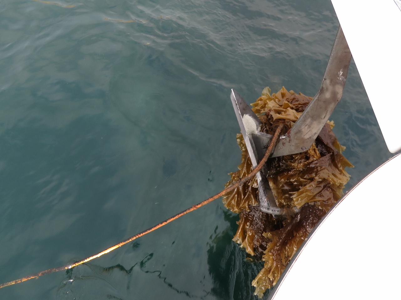 |
Anchor Fouled
Position: 15°7.00’E, 69°1.26’N
The anchor came up with a heavy rope, possibly the remains of an old mooring. Fortunately it was easy to release with a boat hook. We also carry an Ultra trip hook that is useful for freeing heavier items such as a steel cable that we pulled up while anchored in British Columbia. Another notable case was on our previous boat, where we had to slip an anchor fouled on logging debris. In a more recent situation, we had to dive to free the anchor in the Orkney Islands in northern Scotland. Given how much we’ve anchored, and all over the world, we’ve had surprisingly few situations where the anchor has been fouled.
|
 |
Anda Lighthouse
Position: 15°10.94’E, 69°3.52’N
The Anda Lighthouse, constructed in 1932, was the last lighthouse built in Norway and the last manned station in Norway until it was automated in 1987.
|
 |
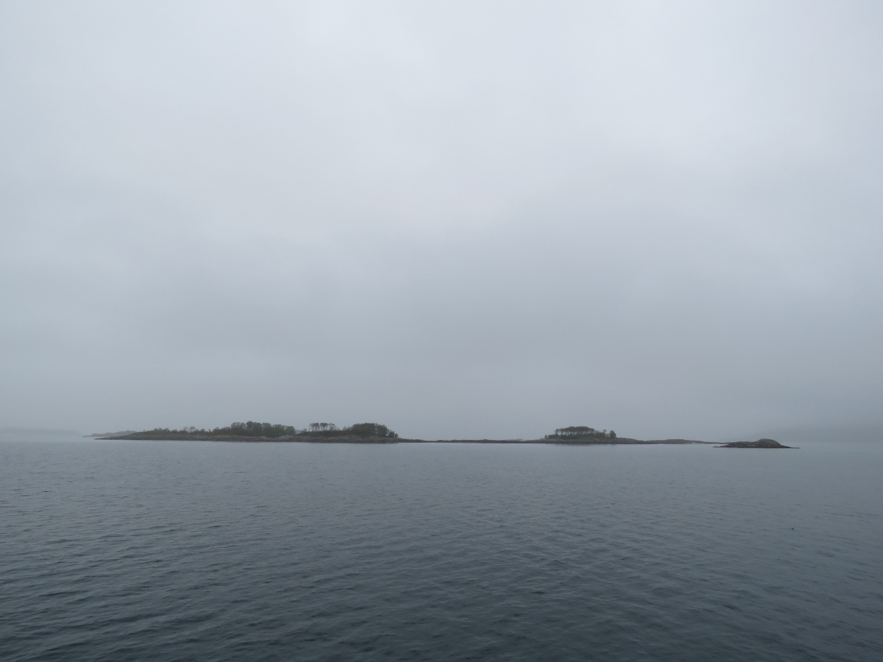
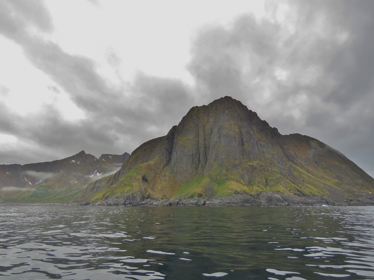
Continental Shelf
Position: 15°43.72’E, 69°19.66’N
The continental shelf runs within five miles of the Norwegian coast off the island of Andøya. We’re crossing over it now, and the sea bottom has plummeted from 350 feet to 1034 feet in a short distance and continues down to over 3,000 ft (900 m).
|
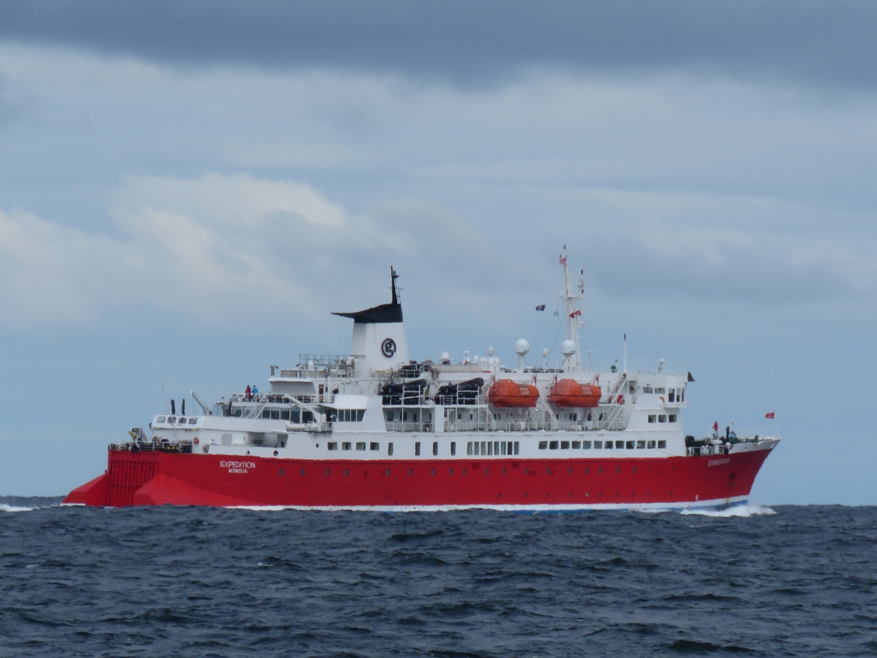 |
Expedition
Position: 15°45.50’E, 69°23.11’N
The 344-ft (105-m) pocket cruise ship Expedition carries 140 passengers on high-latitude adventures. The fare includes a free bright red expedition parka—everyone on deck seemed to wearing theirs.
|
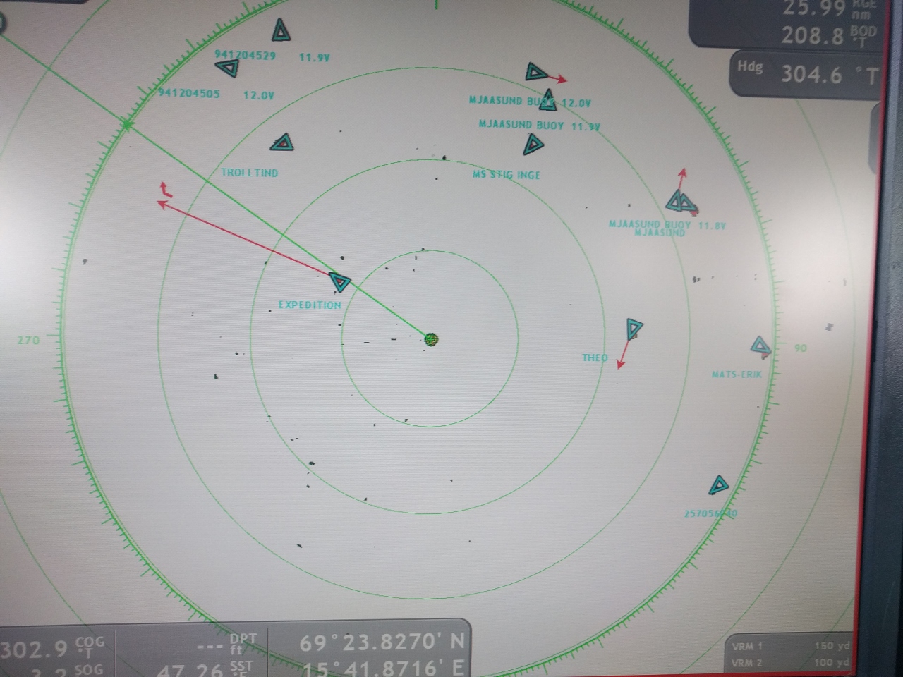 |
Fish Boats
Position: 15°41.95’E, 69°23.81’N
The continental shelf is a favorite place for the commercial fishery since fish tend to feed in this area. Nearly a dozen fishing boats are nearby.
|
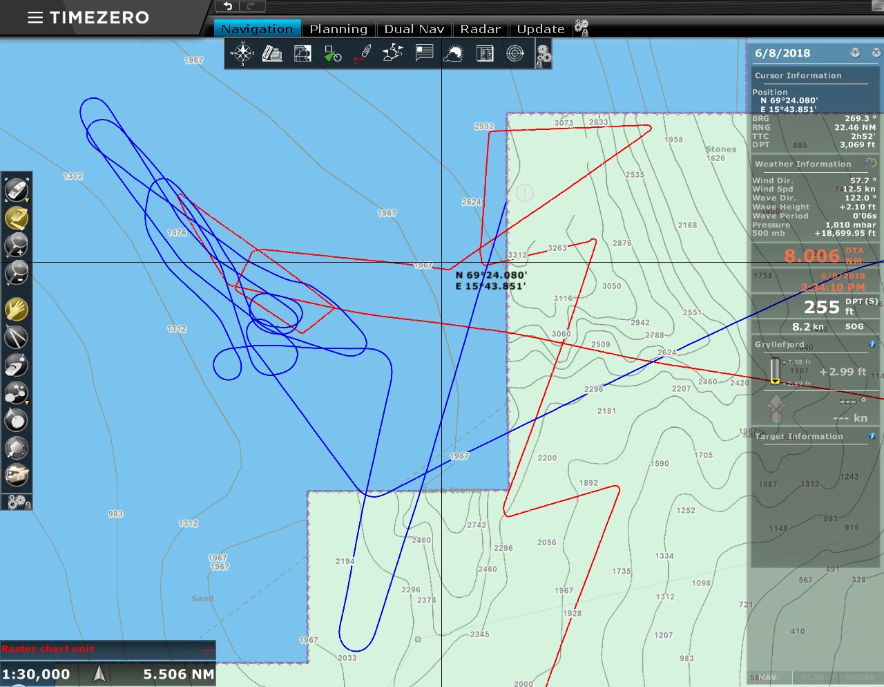 |
Whale Hunting
Position: 15°41.15’E, 69°24.02’N
The blue line is Expedition‘s course and the red line is ours as we weave about the sharp ledge of the continental shelf looking for whales. The deep cold water at the continental shelf attracts squid, that in turn attracts whales, and that in turn attracts tourists. Whale-watching is a big business in the area.
The whales aren’t easy to spot though. We did see a few, but they seem to be fairly busy feeding and only came up for a quick breath before returning to work. Perhaps they were diving deep for food but, whatever the reason, there was no frolicking at the surface, just a quick blow with the whale barely visible and then back under with no tails to be seen. Since there wasn’t all that much to see, we didn’t end up with any interesting pictures from this expedition. |
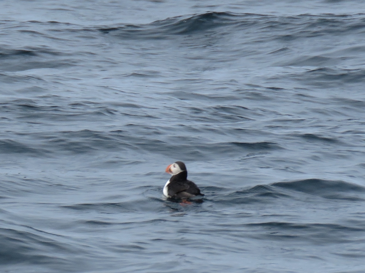 |
Puffin
Position: 16°0.61’E, 69°23.17’N
We didn’t get a good photo of a whale, but we got a nice shot of a puffin, one of our favourite birds.
|
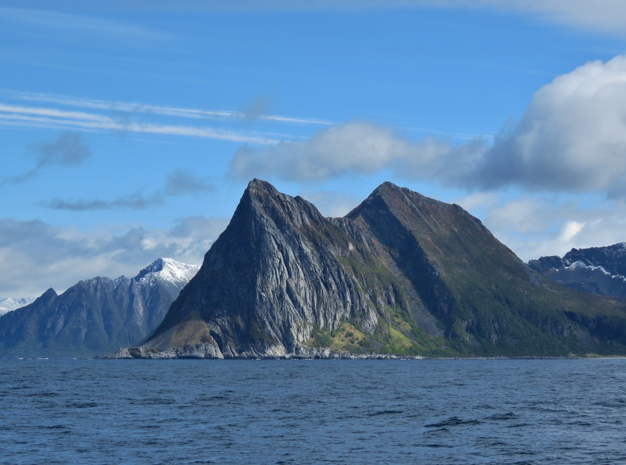 |
Ytre Teisten
Position: 16°49.38’E, 69°24.41’N
1,470 ft (448m) Ytre Teisten forms a dramatic headland on the island of Senja.
|
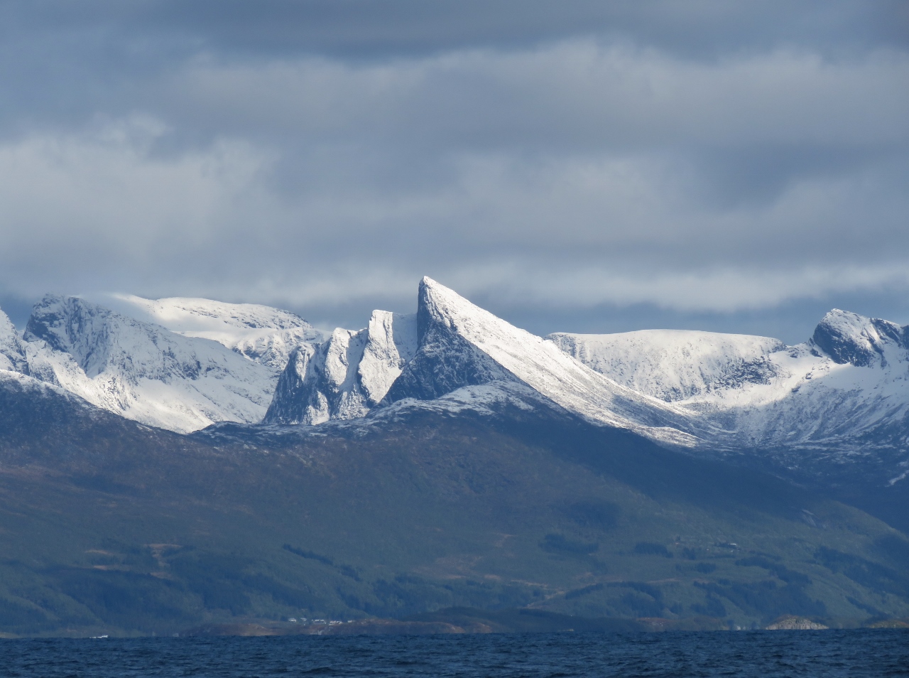 |
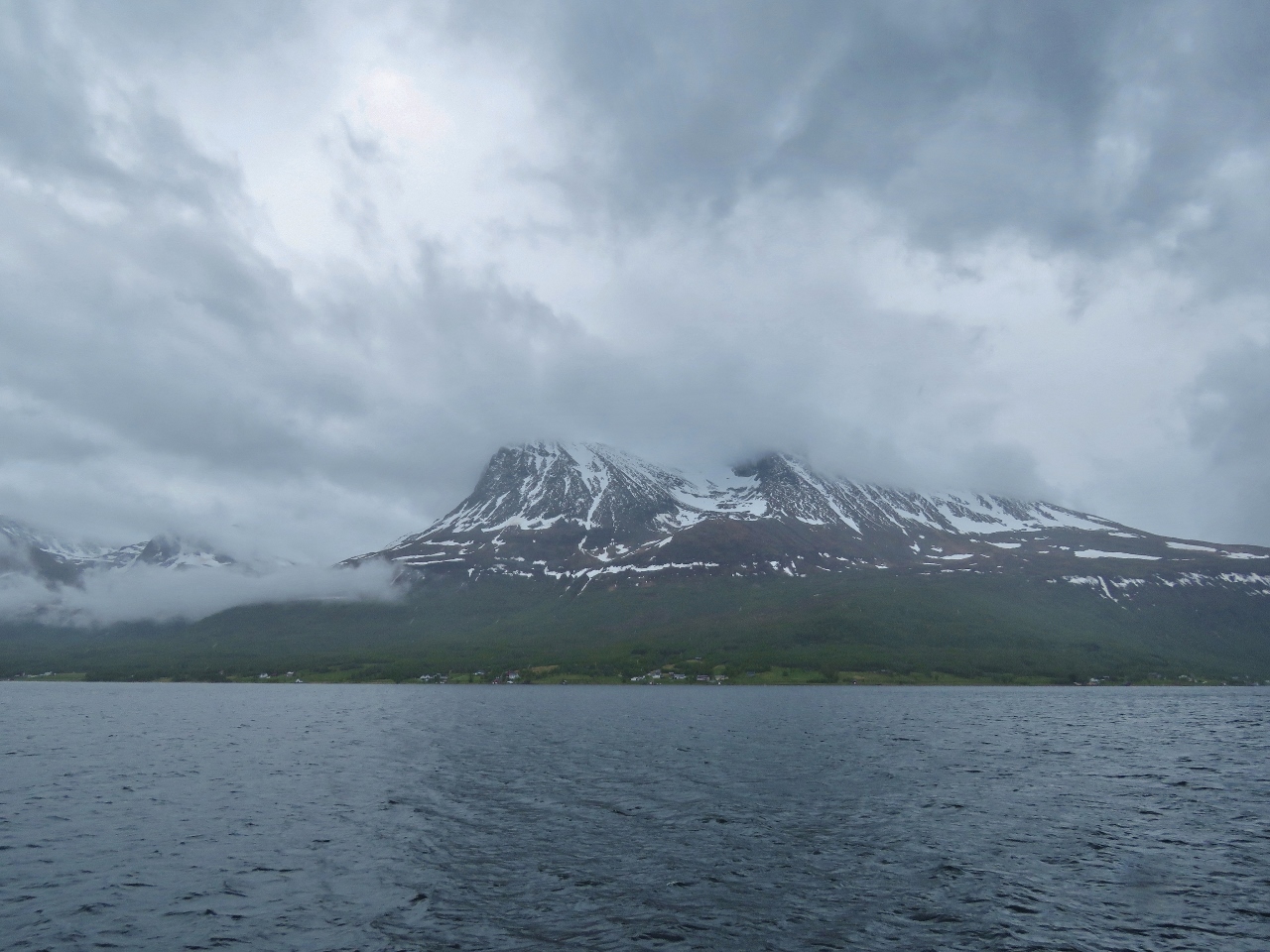
Mountains
Position: 16°52.82’E, 69°24.47’N
Striking snow-covered mountains on the north side of Bergsfjorden.
|
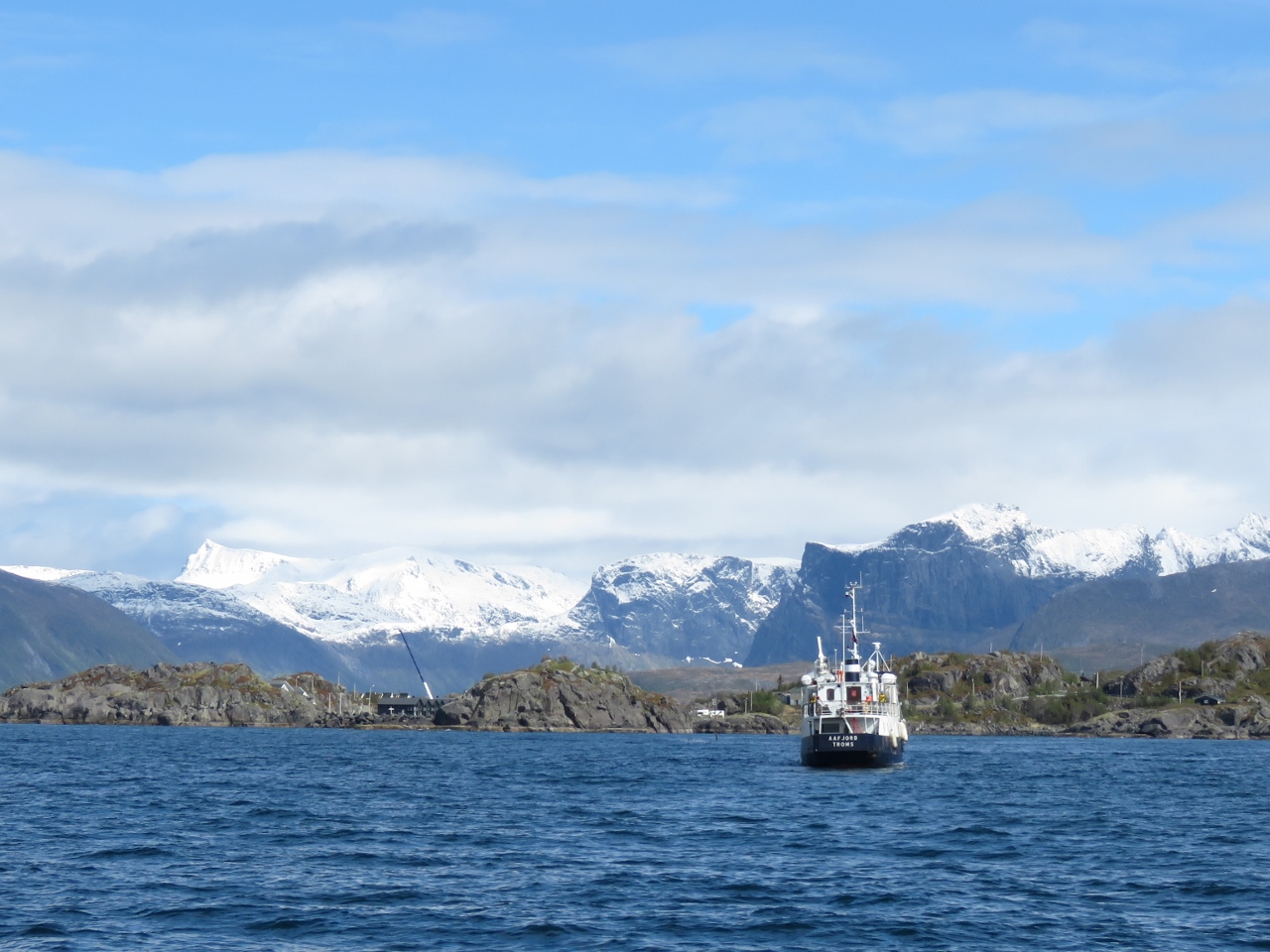 |
Aafjord
Position: 17°8.08’E, 69°24.90’N
Following the tour boat Aafjord toward Hamn. We were planning to anchor for the night in the small cove there, but holding was poor over weed, the swing room was restricted and with a resort ringing the shore we felt a bit like we were in someone’s backyard. What’s not to love?
|
 |
Laukvika
Position: 17°13.48’E, 69°24.97’N
We continued east from Hamn a short distance to an excellent anchorage at Laukvika. This is our view northeast to the mountains across Bergsfjorden (click image for a larger view).
|
 |
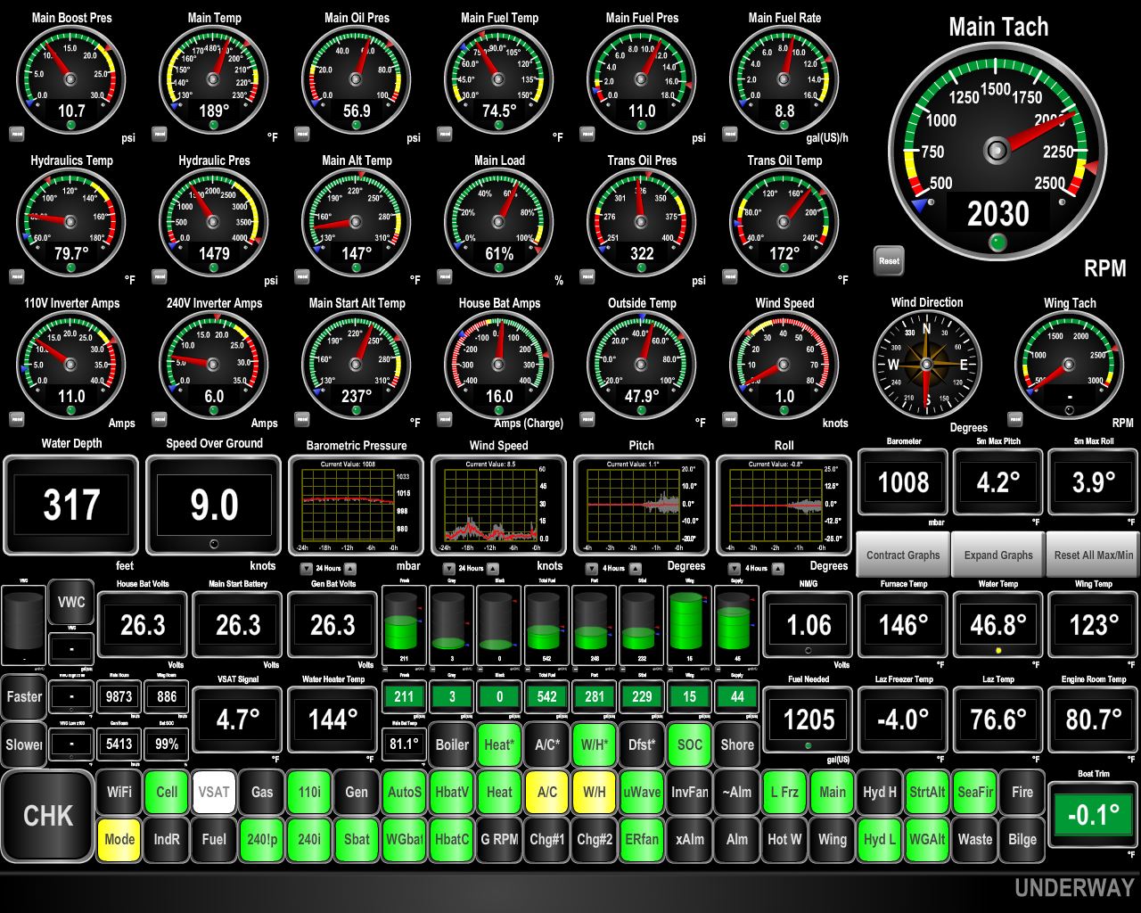
NMEA Cable
Position: 17°13.57’E, 69°24.96’N
James was looking at the NMEA 2000 network with Maretron N2kAnalyzer and found a failed device showing with no information about what it was. We correctly guessed that one of our first-generation fuel sensors that are no longer in use had failed.
We originally used Maretron TLM200s to measure fuel levels and they worked fairly poorly. We subsequently moved to the combination of Maretron FPM100 and Setra 0-3PSI pressure sensors and got excellent results. That’s what we have used for the last 5 years but the old TLM200s were still on the NMEA2000 network. Having been reminded of their presence by one failing, we decided to remove them both from our NMEA200 network. We took them off the network, and removed the tees and drop cables that ran to them. |
 |
Overcast
Position: 17°13.56’E, 69°24.96’N
We were planning to walk up to the small dam above Hamn, built in 1882 and said to be the world’s first hyrdo-electric plant. But rain has been falling all day, so we’ve not been very motivated to get out there. Good thing we took pictures of the mountain view yesterday as this is all we can see today.
|
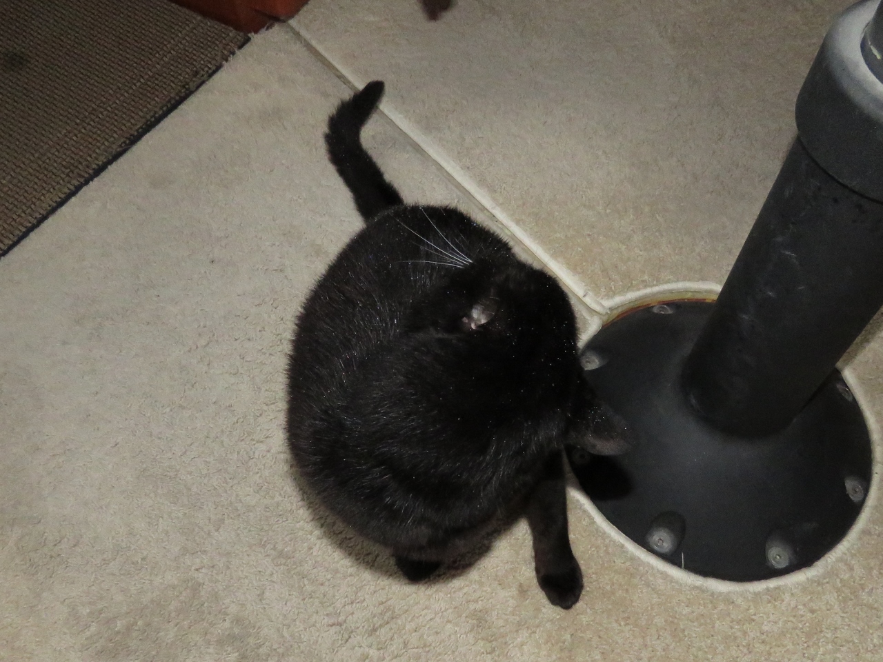 |
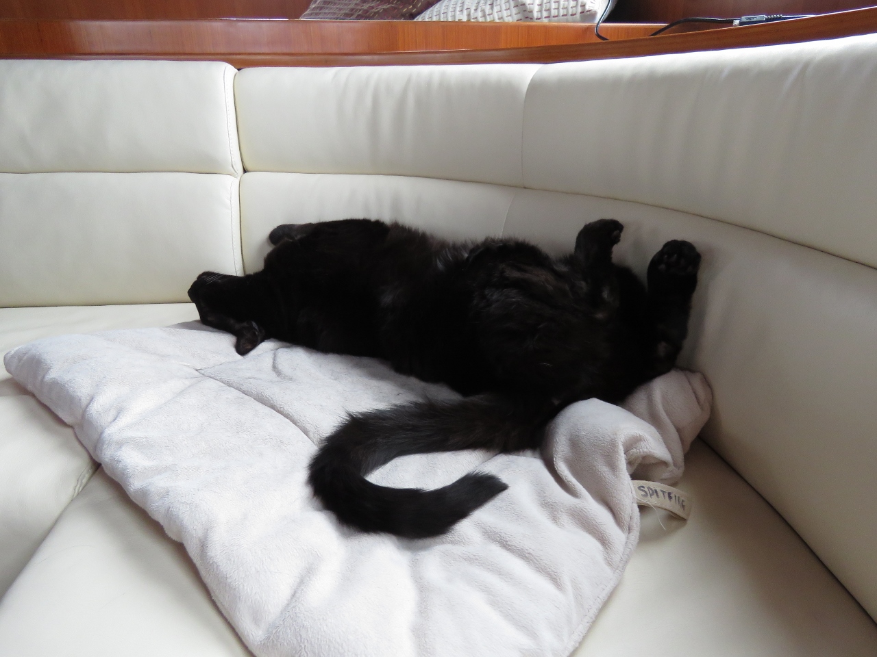
Spitfire Don’t Care
Position: 17°13.53’E, 69°24.97’N
Those white dots all over Spitfire’s fur are drops of rain. He’s been hunting out on the bow in the pouring rain for ages, doing his best Honey Badger imitation, and is now inside cleaning up.
|
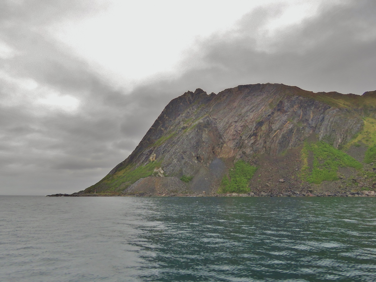 |
Trælen
Position: 17°11.51’E, 69°29.57’N
1,712ft (522m) Trælen, one of several dramatic headlands on the west coast of Senja.
|
 |
Ersfjorden
Position: 17°17.78’E, 69°32.52’N
Looking southeast along the north shore of Ersfjorden.
|
 |
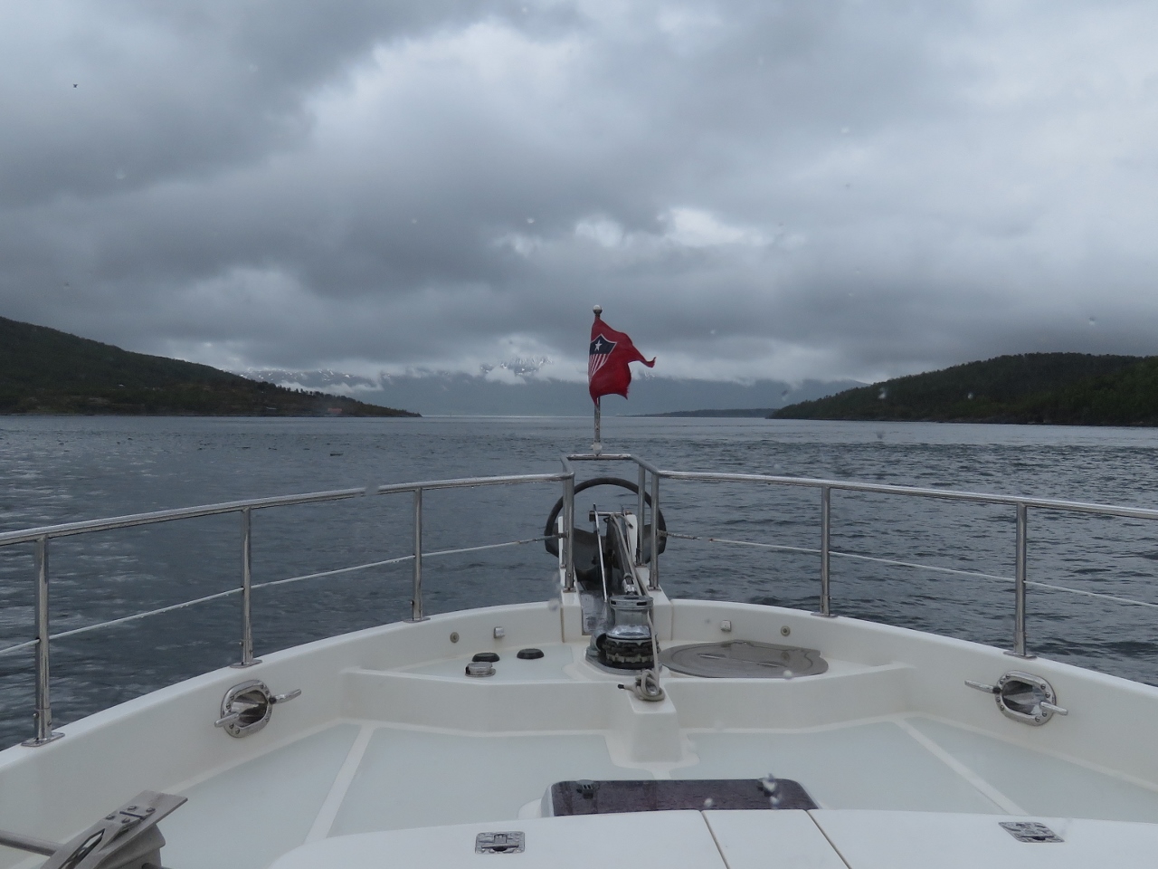
Calm
Position: 17°21.72’E, 69°33.87’N
We have wonderfully calm conditions on our final open ocean run for a few weeks. The wind is so light it’s barely registering and the ocean swell is hardly perceptible.
|
 |
Kjølva
Position: 17°30.59’E, 69°36.26’N
1,358ft (414m) Kjølva with Øyfjorden extending to the left.
|
 |
Coastal Cruising
Position: 17°53.93’E, 69°34.78’N
We’ve rounded the north side of Senja and are now in even calmer water along the east coast. Spitfire is enjoying the relaxed coastal cruising.
|
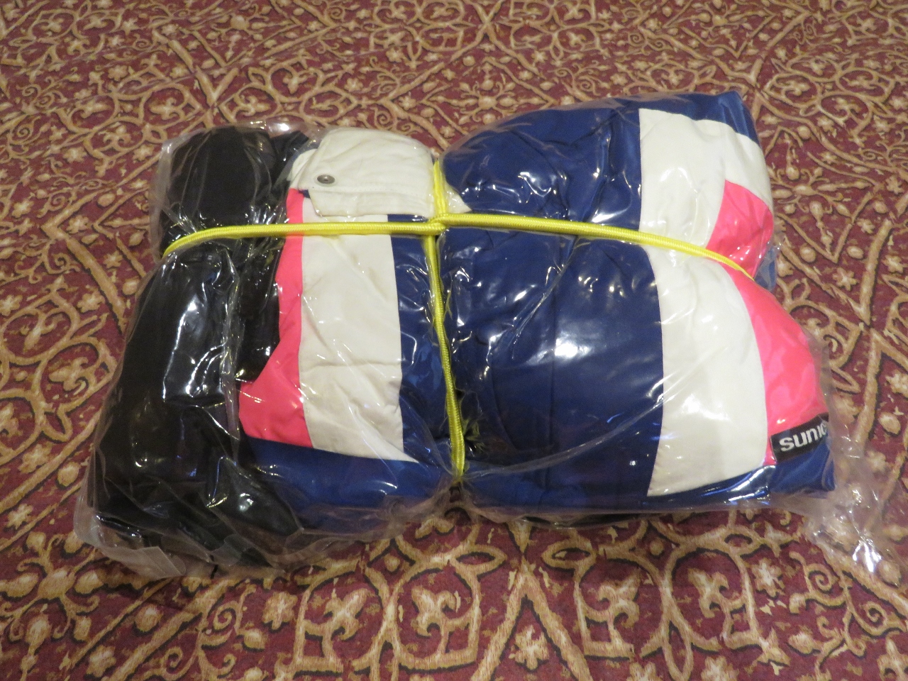 |
Ski Jackets
Position: 17°58.09’E, 69°33.71’N
We’re going to fly to Svalbard in a few days and are digging out our warmest clothes in preparation. Our ski jackets haven’t been used since we left Seattle in 2012. We stow them and and other out-of-season clothes in space-saving Space Bags. We put a bungee around them to keep the package small even if air does get in.
|
 |
2011 Tickets
Position: 18°3.43’E, 69°32.35’N
We found these tickets from the Seattle Seahawks 2011 season in our ski jacket pockets. This was the last time they were worn.
|
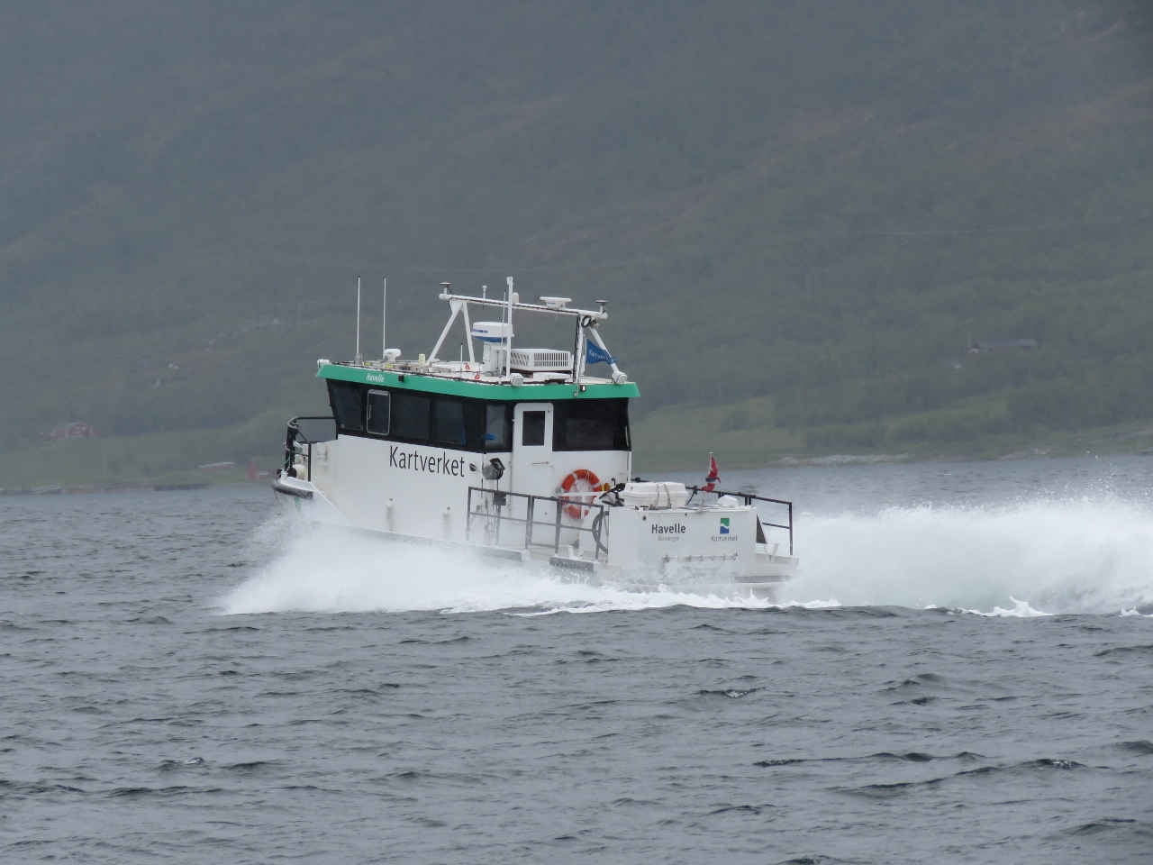 |
Havelle
Position: 18°36.28’E, 69°32.63’N
Kartverket is Norway’s national mapping agency—we’ve been heavy users of their online hydrographic charts and topographic maps. The chart data they produce is excellent. Havelle is one of Kartverket’s coastal survey vessels.
|
 |
Rystraumen
Position: 18°37.14’E, 69°32.71’N
Mountain view to the south as we pass through Rystraumen.
|
 |
Rystraumen Narrows
Position: 18°41.84’E, 69°33.15’N
Heading through the narrows at Rystraumen. On spring tides currents can reach 7 knots here, with upwelling and whirlpools. We’re passing through close to slack, so conditions are calm.
|
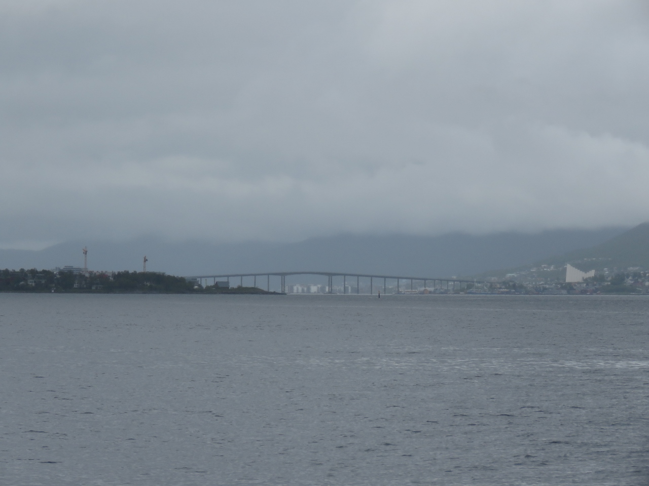 |
Tromsø
Position: 18°50.98’E, 69°35.98’N
Our first view to Tromsø in the distance, with the Arctic Cathedral the prominent white building on the right. We’ll anchor off for the night, then pick up a load of fuel first thing tomorrow morning before proceeding to the guest dock for a few days.
|
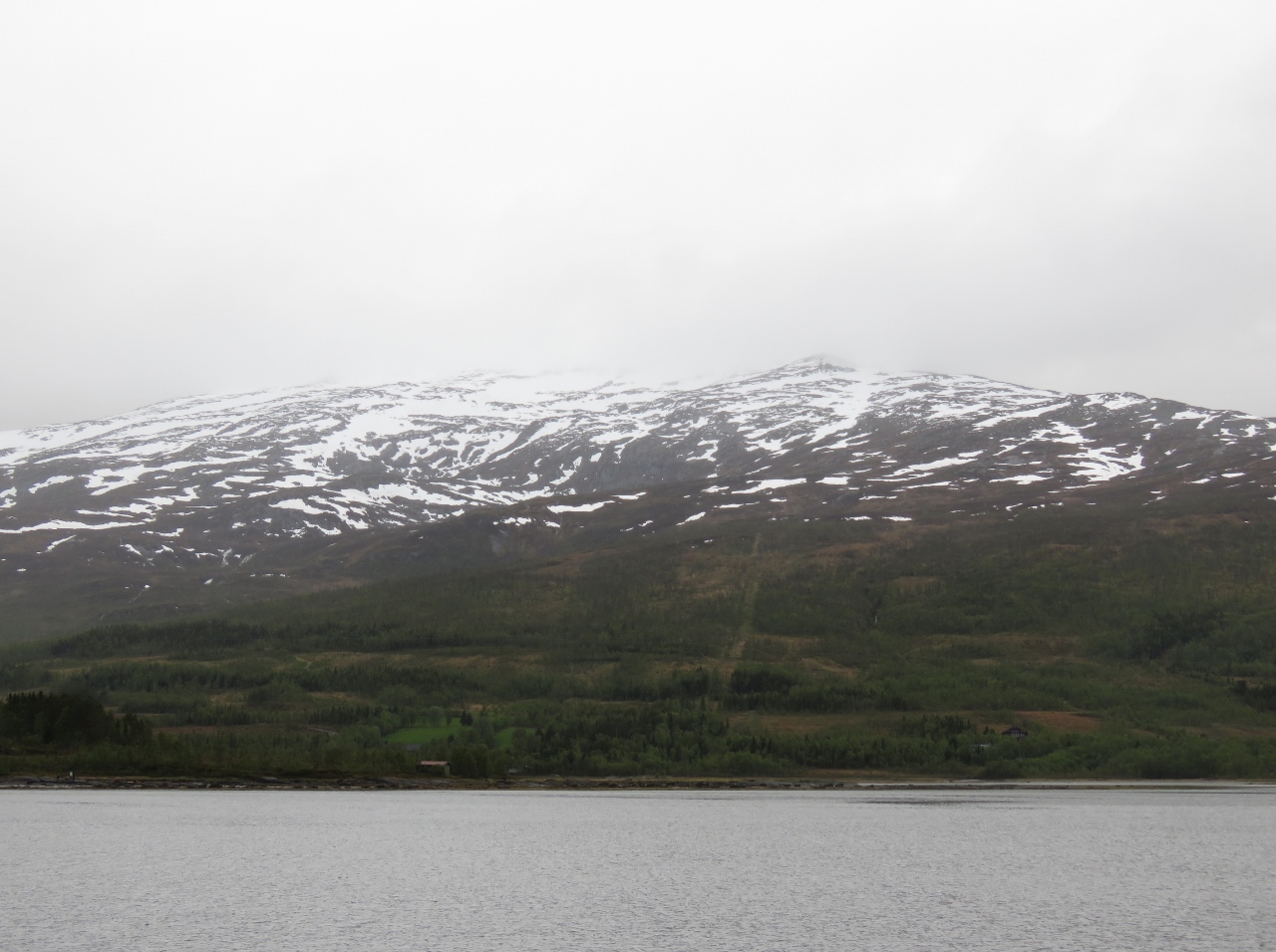 |
Sørbotn
Position: 18°45.46’E, 69°38.03’N
Mountain view from the anchorage at Sørbotn just south of Tromsø. This was a great stop.
|

|
Click the travel log icon on the left to see these locations on a map, with the complete log of our cruise.
On the map page, clicking on a camera or text icon will display a picture and/or log entry for that location, and clicking on the smaller icons along the route will display latitude, longitude and other navigation data for that location. And a live map of our current route and most recent log entries always is available at mvdirona.com/maps. |
Hello James,
We have Maretron TLM100 tank monitors on 3 freshwater and 2 diesel tanks. One of the diesel tank TLMs has been intermittent for well over a year and one of the water tank TLMs has now become intermittent. When I say intermittent, I do not mean varying in sensing of depth in the tank but the gauge is blank. I have run N2K analyzer and tested with my N2K meter and everything checks out. I have cleaned the NMEA connections with contact cleaner to no effect. I have contacted Maretron in the past and, to put it very politely, found their responses less than satisfactory. In our brief history with Maretron we have found not just the TLM sensors unreliable but also the WSO100, DST100 (the temperature sensor) and GPS200 (that would drift up to 15 nautical miles from actual position). Regarding the GPS200 they would not replace it and took over 6 months to fix the “software bug”. By this time we purchased a Furuno unit with different connectivity rendering the GPS200 redundant piece of junk.
I am aware that you prefer the FPM100 over the TLM. I am considering replacing the ultrasonic pressure monitor with fluid pressure monitors. But before I make any decisions, would you oblige me with answers to 2 questions:
1. Have you experienced problems with TLM200 totally going blank then after some period start responding?
2. Have you experienced any problems with your Setra 0-3PSI sensors
When I originally installed our system, I used the TLM200 and they really aren’t satisfactory and they have been discontinued. I replaced them with pressure sensors coupled with the FPM100 and that combination has been faultless. I’ve had excellent results with the TLM100 on fresh and and grey water tanks. The TLM100 would only rarely work on the black water tank. I’ve sized the Setra pressure sensors to the depth of the tank always fitting the minimum range sensor. I’ve never expereinced a fault or failure with any of the FPM100 and Setra pressure sensor combination.
On your problems with weather sensors, I do see a fault every 2 years and replace it. From my perspective it’s better than the alternatives so I just change it when it faults. Maretron has a new design in development that should be more reliable.